|
The
bordermarkers of the Pyrenees : all my trips
 |
|
| -
5 may
2009 - Reassembling bm093 |
 |
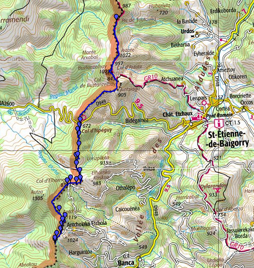 |
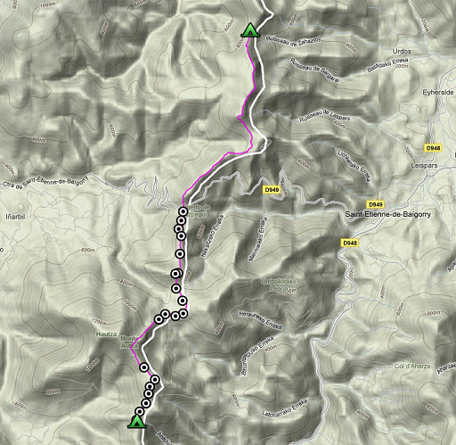
esfr-trip-track-20090505.kml (click to open in Google Earth or copy link to Google Maps; click right on this link to download gpx-version) Today I walked from Col d'Harrieta until a camping spot, just beyond bm110. Nice day, beautiful weather but fresh wind. Silent on the the hills. Able to find all bordermarkers. |
 |
For explanation of
the gps-coordinates and other cartographic backgrounds: see my cartography page According to my watch: - duration: ± 9 - 17.45, break ± ½ hour; 8.49 hour in total - up: 1234 m - down: 1067 m - total elevation: 2301 m |
 |
According
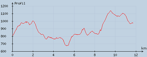
to visugpx - distance : 11.9 km - cum. elevation gain : 902 m - cum. elevation loss : 739 m - total elevation: 1641 - altitude maxi : 1138 m - altitude mini : 672 m - altitude average : 867 m |
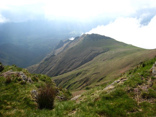 |
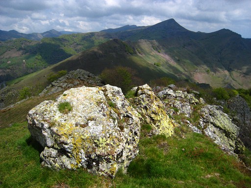
After
a windy, chilly night I continue on the GR10-track for a few kilometers
until the point where it bends down on the Col de Buztanzelhuy into the
valley towards Saint-Etienne-de-Baïgorry I'm not sure where or towards this picture was taken. Probably further on, looking back on the border ridge and the Col de Buztanzelhuy on the far right. |
|
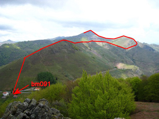
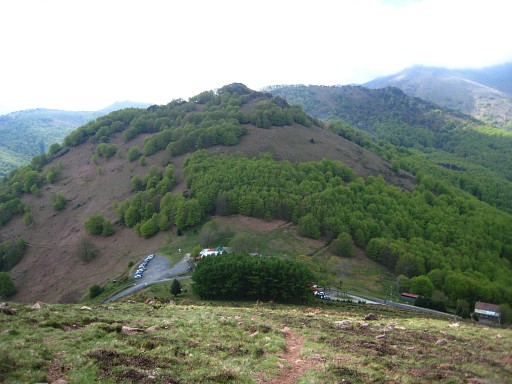
I do not descend but continue on a distinct - but not waymarked - path which is a shortcut from the border-ridge. Getting back for a short while on the south-side of the ridge, the path switches back to the other side (north) and continues in south-western direction along the ridge, staying approx. 20 meters underneath the top of the ridge. Finally it descends to Col d'Ispeguy with bm091. Move the cursor over the picture to see the border. |
 |
Bm091 down below in front of the garbage container. |
 |
Bm091 |
|
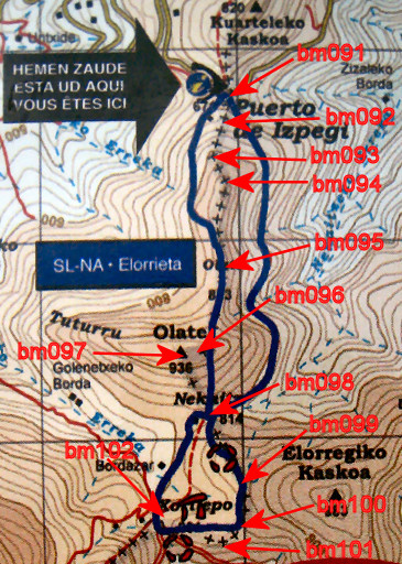
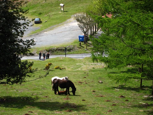
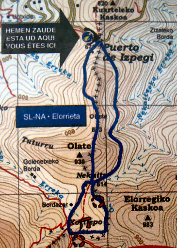
After a coffee in the venta, I studied this plan - on a board along the road - indicating a walking trail. There's a green-white-waymarked trail in a 8-shape. Part of this trail could be well incorporated into the GRPdesBF -> follow from the parking the western route, it converges with the borderline before bm095, passes that bm, leaves the forest east of bm096 and bm097, passes directly along bm098 and bm099, passes bm100 and 102 at 20-30 meters and arrives at bm102 before looping back. Move the cursor over the map to see the bordermarkers mentioned above. |
 |
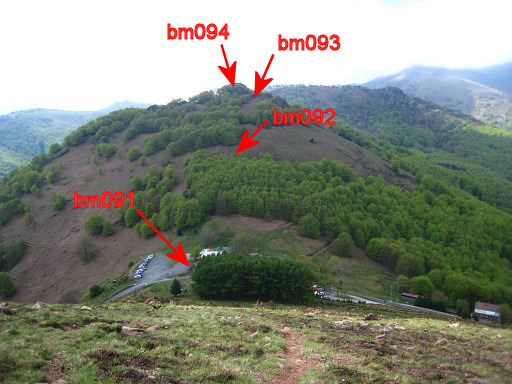
But I climb directly from bm091 through a forest in the direction of the supposed borderline on a narrow trail. If I leave the forest, I see a bordermarker lying in the grass. That must be bm092, although a don't see a number and the stone being to heavy to turn. There's a hole in the gr0und a few meters to the west, perhaps that's where it stood. |
 |
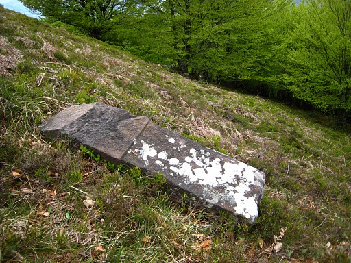
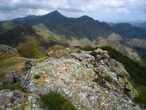
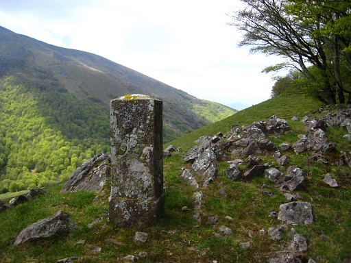
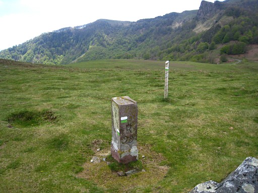
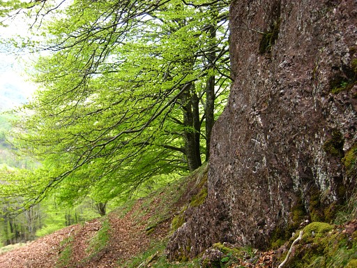
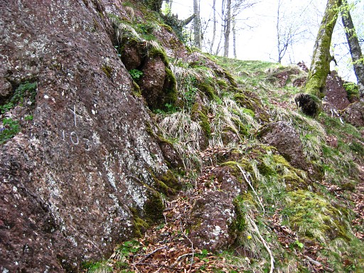
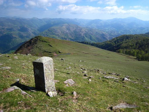
Climbing on, I reach a sort of saddle between two rockeries with bm093, shattered in pieces. |
 |
But I do a bit of reconstruction and this is bm093 more as it should be. |
|
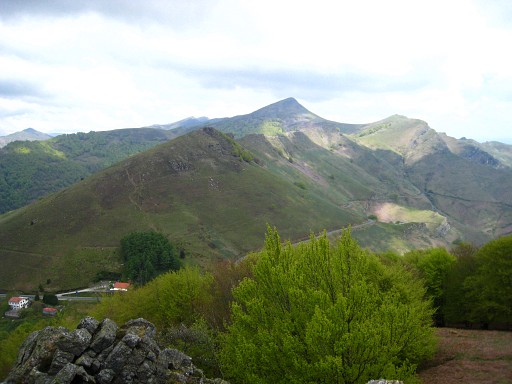
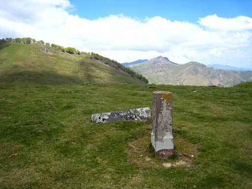
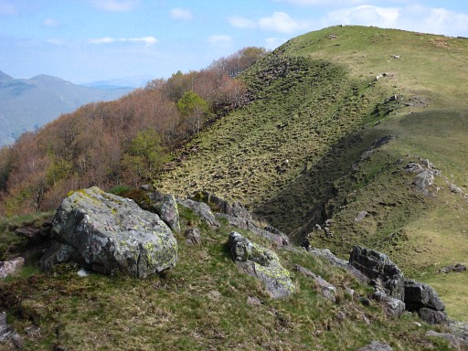
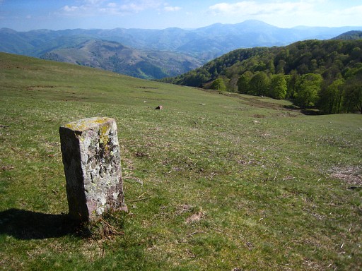
We're looking back at Col d'Ispeguy and can recognize the borderline. Move the cursor over the picture to see the border. |
 |
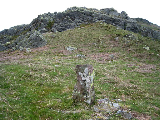
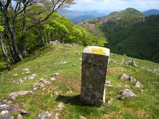
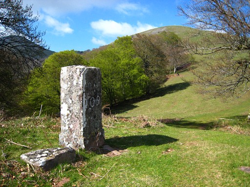
It took a while, looking around, but on the summit of the second rocky outcrop from bm093, there's bm094 |
 |
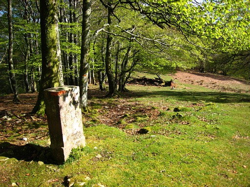
Close-up of bm094 |
 |
Following
the borderline is easy, the green-white trail unites with the
borderline and when entering the forest, I see to the left: bm095 |
 |
Te green-white trail climbs until the edge of the forest, looking down at a vally. At this point to the right (west) over a rocky ridge where (after ± 50m?) I find bm096 |
 |
Further on (60 meters according to the Procès-Verbal), there's bm097 |
 |
Bm097, looking back along the edge of the forest where bm96 is located. |
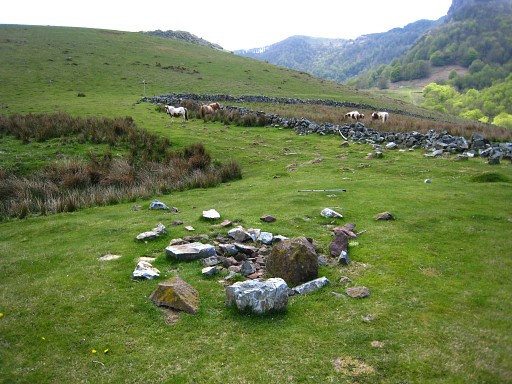 |
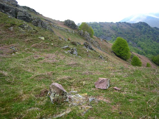
Descending to the valley to a square stone enclosure in the bottom (in the background of this picture). North-east of that enclosure, I find these shattered pieces of rock. I'm convinced that this must be the vandalized bm098. |
 |
But I can't find a definite piece of evidence, that's is (a piece of) the original number. So - with the help of chalk - a recreation. By the way, you're looking back at the hill-top with bm097. |
 |
I'm back at the green-white trail and continue it along Bm099 Note the green-white waymarks on the stone. |
 |
Bm099 with its predecessor (?) besides it. |
|
I have to leave the trail for a bit to the south for bm100 Move the cursor over the picture to see the approximate borderline. |
 |
Also south of the trail: bm101 |
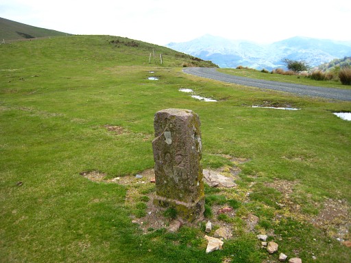 |
And then I arrive at bm102, besides a tarmac-road |
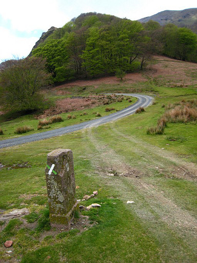 |
Further on, to the right of the tarmac road (where it bends to the left), there's a distinct trail leading uphill. |
 |
And the trail here more in detail, it is not waymarked. |
 |
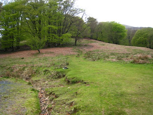
But
first I search for bm103. After the first forest-strip, there are
rocks and by going underneath them to the left, you will find (after
30m?) easily bm103 |
 |
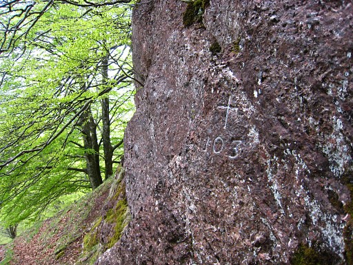
Bm103 |
 |
Bm103, from the other side |
 |
From bm103 (at the right of it) , you can climb directly to the trail above. That's a shortcut. Alternatively, you could return to the trail, following it uphill (a fence to the right, the ridge to the left above). The trail climbs and follows in the forest the ridge which is to the left above. The trail ends more of less when you notice to the left a sort of pass. See the picture. You have to go this pass, the trail continues on the other side of the ridge and switches back again to the spanish side of the ridge. |
 |
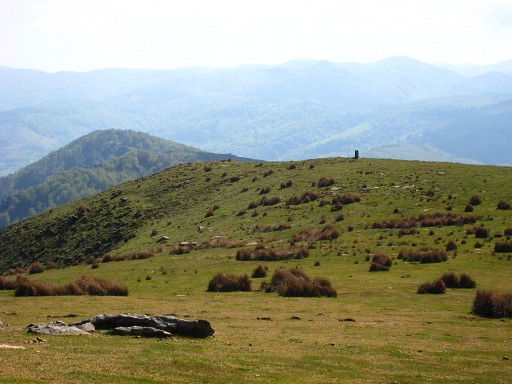
There's no clear path anymore but you can easily follow the ridge in s-e-direction. After some searching I find: bm104 |
 |
A
little help in finding bm104: half way along the ridge, there's a sort
of pass - very recognizable -to the French forest below. Bm104 is about
50m to the nw on the ridge it self. You can see that 'pass' clearly on this picture. |
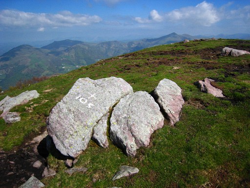 |
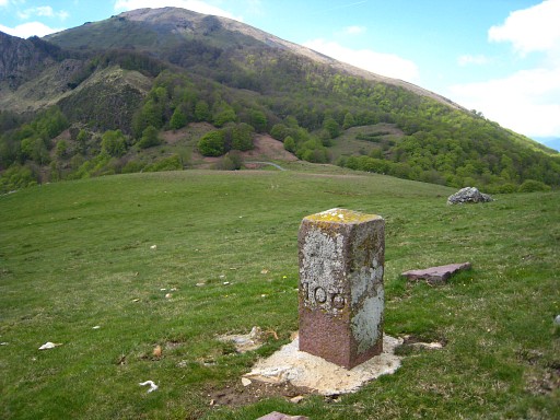
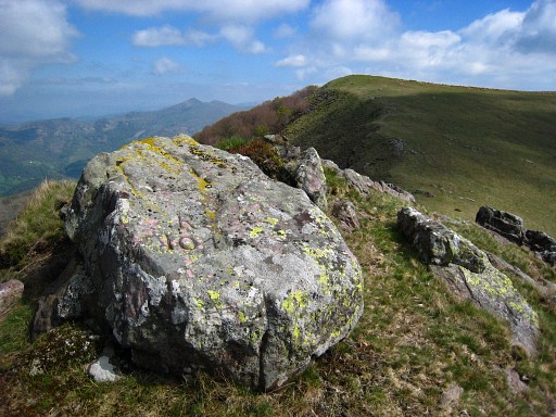
The rest is easy: climbing to the top of the ridge with bm105 (number was painted white) |
 |
And descending to bm106 |
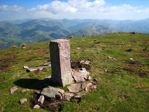 |
bm106 |
 |
bm107 Note that we've left the ridge, the borderline is descending now along the slope to a pass below. |
 |
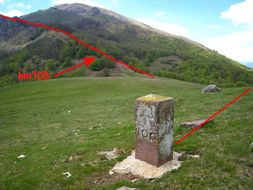
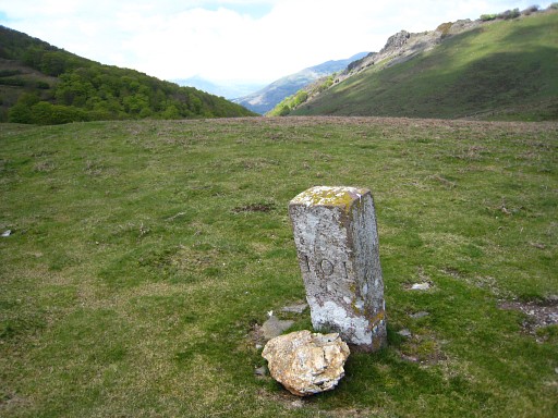
Bm108 |
 |
Bm109, situated at that (kind of) pass. Here I went down here to collect water from a stream. |
 |
Bm110 I have picked up another border- ridge. |
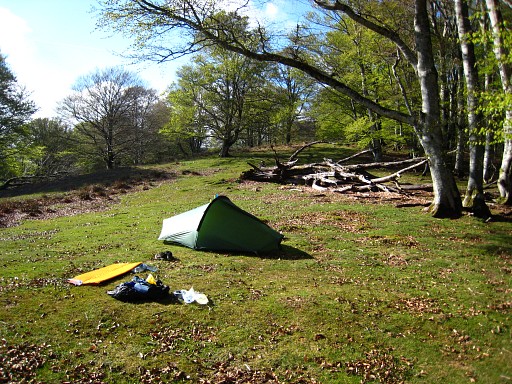 |
A wonderful camping spot, just beyond bm110. (N43 08 04.4 W1 24 53.0 H976m) |