|
The
bordermarkers of the Pyrenees : all my trips
 |
|
| -
1 june
2009 - No marker on the Pic d'Orhy |
 |
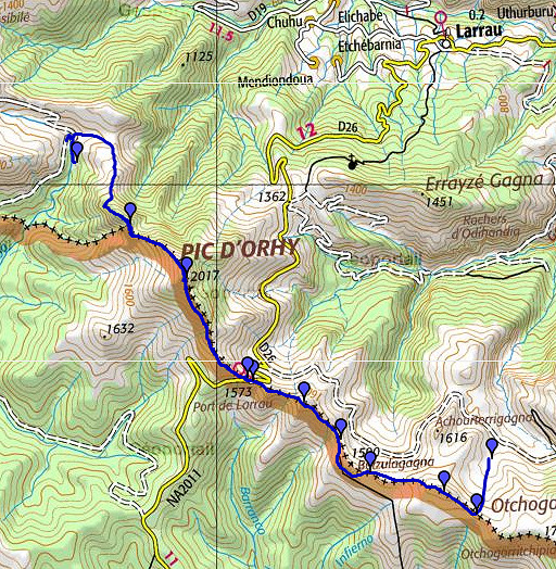 |
esfr-trip-track-20090601.kml (click to open in Google Earth or copy link to Google Maps; click right on this link to download gpx-version) Part of a 16-days trip, using day 1-10 to cover bm154 to 264 in the eastern Pyrenees and day 11-16 for bm416 to 365 near Bagnères-de-Luchon. Day 8: continuing along the border from approximately bm234bis, over the Pic d'Orhy and finishing near bm242. |
 |
For explanation of
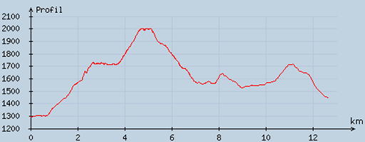
the gps-coordinates and other cartographic backgrounds: see my cartography page En route: 10-18.15, 8.17h, no break. According to my watch: up 1409m down 1265m = 2674m in total. Hmax 2013m Lmin 1297m |
 |
According
to visugpx - distance : 12.91 km - cum. elevation gain : 986 m - cum. elevation loss : 829 m - total elevation: 1815 - altitude maxi : 2002 m - altitude mini : 1292 m - altitude average : 1685 m |
 |
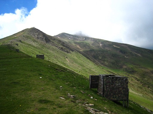
A
late start, 10am. I return to the tarmac road and climb SEE along a
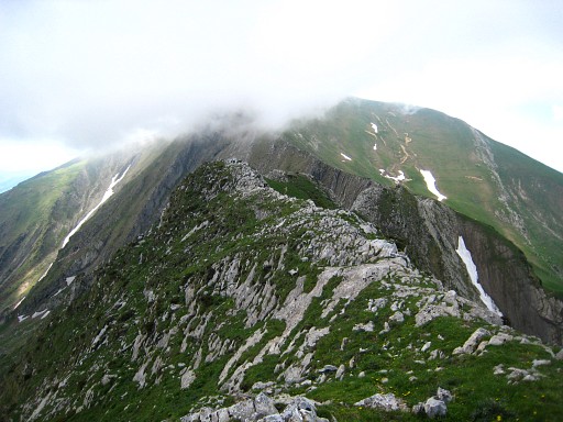
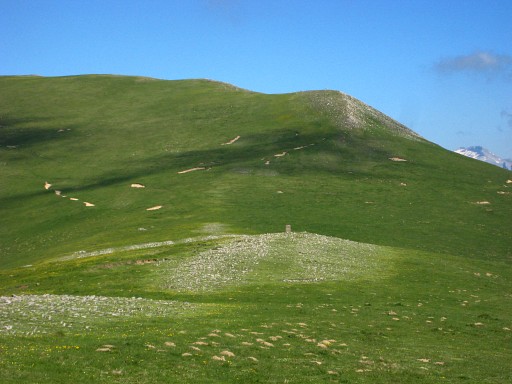
sort of stream-bed or cleft- keep that at the right - to the hillridge. At the hillridge, go to the right. You will pass many hunter's shelters. This picture: I've left the shelters behind me. The Pic d'Orhy is visible in the far distance. |
 |
The
hill-ridge becomes a rock-ridge and it's not obvious where the summit
(the Zazpigain) is. On - what I think is the summit - I make a
gps-waypoint and ± 150m further (Procès-Verbal) I start searching for
bm235. That location fits with the description of the borderline: where
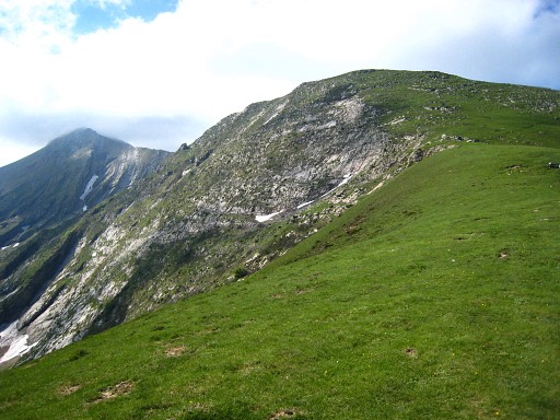
a ravine coming from bm234bis ends at the ridge. It's a rocky terrain, requiring some rock scramble, with some trails underneath. But no matter how I search, there's no trace of a a bordercross. This picture: looking from approximately the summit of Zazpigain along the borderridge towards Pic d'Orhy (in the clouds). |
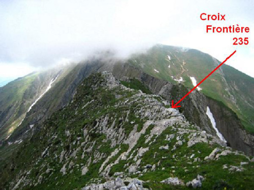 |
In 2010 Robert Darrieumerlou reported that he had found this cross.
And showed me - embarrassing - that the location is visible on my
own picture. It's somewhere between the Zazpigain and the spot where I searched. I couldn't believe that I missed it but learned later that this bordercross is ± 150m off the borderline. I didn't expect it there and didn't search there. See Robert's pictures on this page |
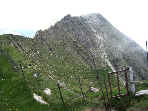 |
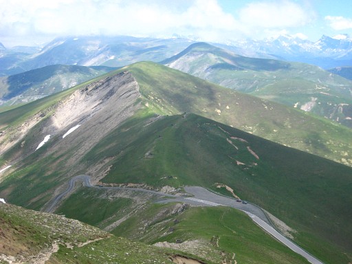
I continue on the ridge, that means
first a short but steep & slippery descent on the E-side and
climbing back on a decent path to the ridge, passing this gate. This picture: looking back. One can see the slippery (whitish) descent and the more gentle climb to this gate. I search a bit along the steep rockridge from this side but no bm235 here either. |
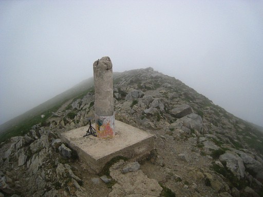 |
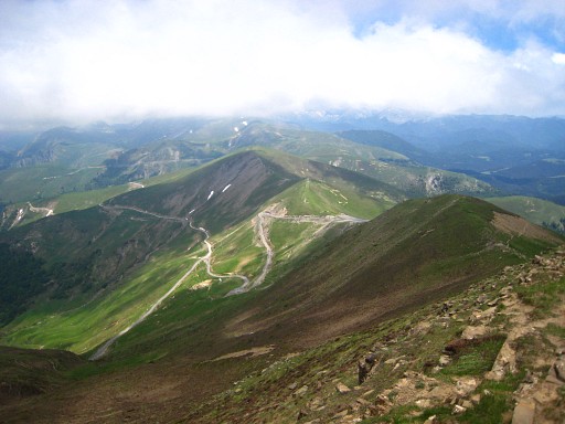
There's a distinct worn-out trail along the ridge to Pic d'Orhy which is shrouded in clouds. The Pic is in fact a horizontal ridge of ± 150m with a geodetic pillar at the N-side. |
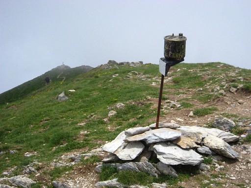 |
At the S-side there's this metal pole with a sign "Pic d'Ory"
etcetera. Not looking very official. I can't find a bm236 on the ridge. Is it vandalized? |
 |
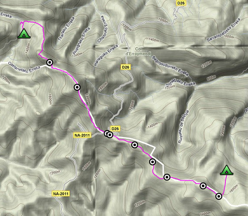
I descend on worn paths to Port de Larreau. |
 |
Zoom-in of Port de Larreau. |
 |
Hunter's shelters along the borderridge. |
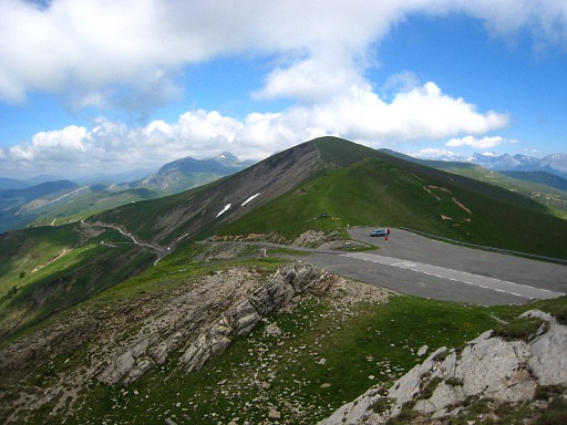 |
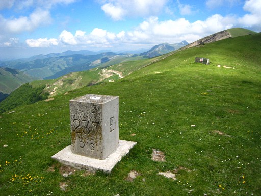
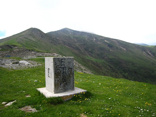
Port de Larreau, both bm237 and bm237bis are visible, |
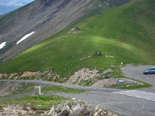 |
as you can see better at this zoom-in. |
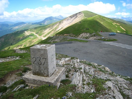 |
Bm237 |
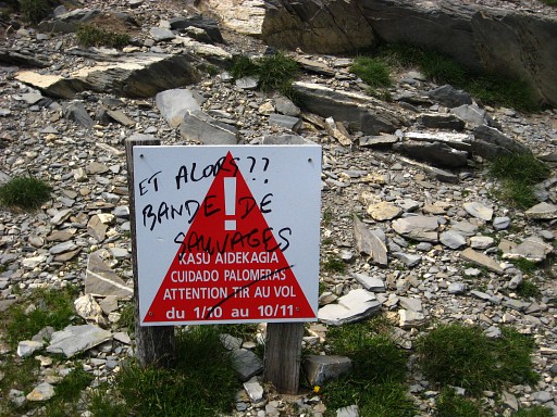 |
A sign warning against the danger of
hunters shooting the migratory birds and a hand-written outcry of a
protester: "So what?? Gang of savages". |
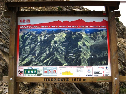 |
This is interesting: there's a long-distance path in the basque country, partly covering the esfr-border. |
 |
Bm237bis |
 |
Bm237bis |
 |
And then - after all that searching -
I can now speed up. There's a strong wind, it's sunny, only the Pic
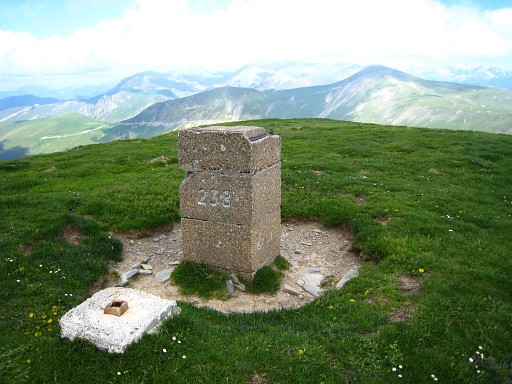
d'Orhy covered in clouds. I continue on the borderridge and find bm238 and |
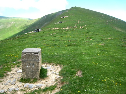 |
bm239. Then it's easier to traverse underneath the next hill-summit (S of it) to |
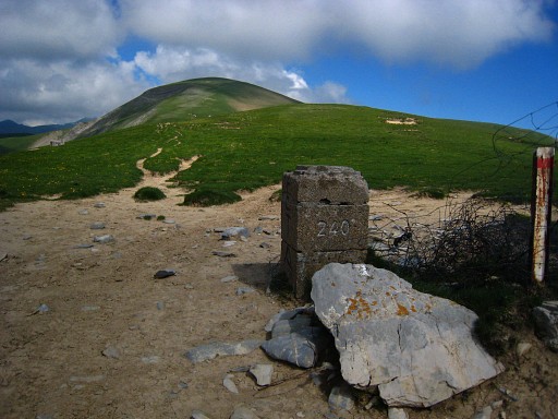 |
bm240. |
 |
Bm240, backside |
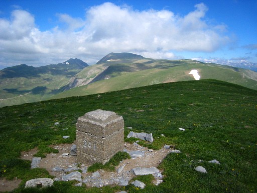 |
Then it's quite a climb to bm241 and then |
 |
descending to bm242. |
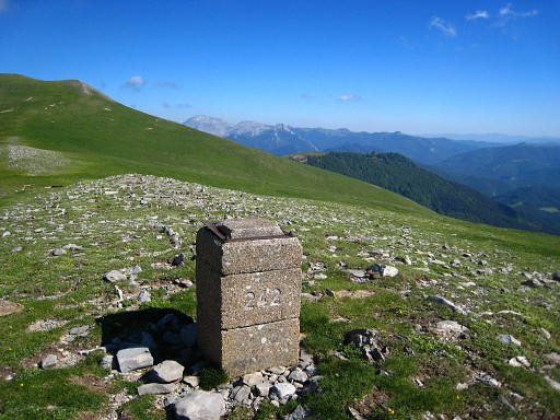 |
Bm242 |
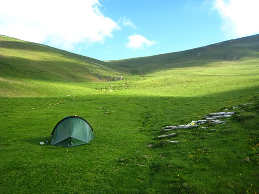 |
I can collect water from the melting
snow, still lying underneath bm242, and descend to the N to this valley
to bivouac. The wind has become cold. |