|
The
bordermarkers of the Pyrenees : all my trips
|
|
| -
10 may
2010 - Connecting two bordermarkers  previous
trip next
trip previous
trip next
trip 
|
 |
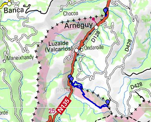 |
esfr-trip-track-20100510.kml (click to open in Google Earth or copy link to Google Maps; click right on this link to download gpx-version) Another return-trip with Jan-Willem from the Gîte d Etappe in St-Étienne-de-Baïgorry. We explore a possible direct route from the hamlet of Gainekoleta near bm197 to bm198 high up the mountain. And look again for bm196 at the venta near Arneguy. |
 |
For explanation of
the gps-coordinates and other cartographic backgrounds: see my cartography page |
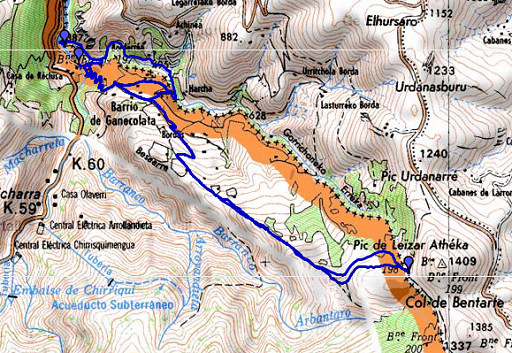 |
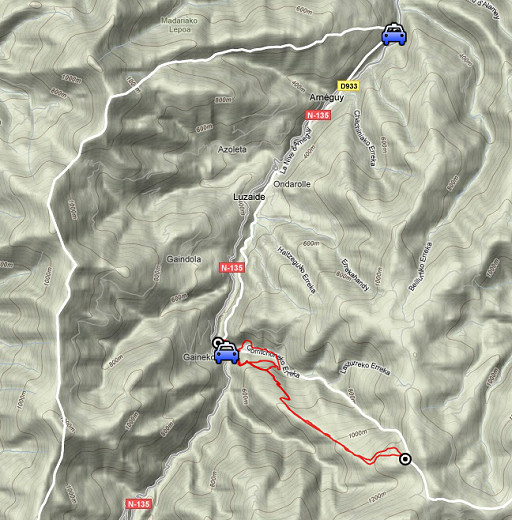
esfr-trip-track-20100510-trip1.kml (click to open in Google Earth or copy link to Google Maps; click right on this link to download gpx-version) TRip 1: we drive to Gainekoleta, a very tranquil hamlet where nowadays pilgrims to Santiago de Compostella pass through on an alternative route to Roncevalles. Main target: exploring the hiking possibility from Gainekoleta directly to bm198 |
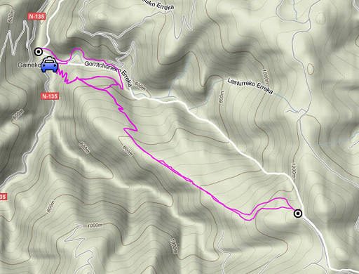 |
For explanation of
the gps-coordinates and other cartographic backgrounds: see my cartography page |
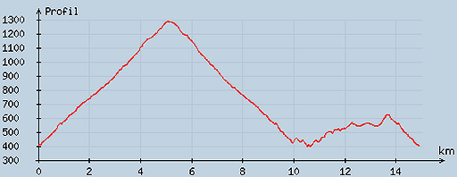 |
According
to visugpx - distance : 15.2 km - cum. elevation gain : 1197 m - cum. elevation loss : 1194 m - total elevation: 2391 m - altitude maxi : 1287 m - altitude mini : 398 m - altitude average : 699 m |
|
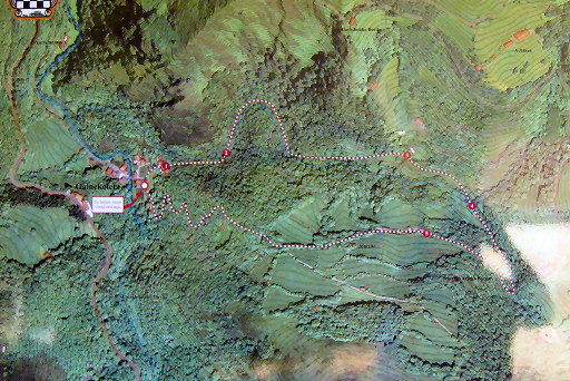
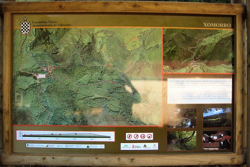
Since last year a
hiking-trail of 2,5 km has been waymarked starting and ending at the
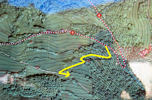
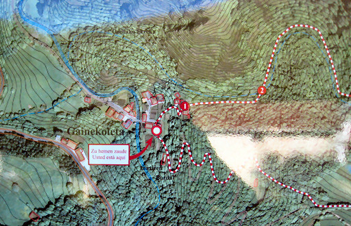
hamlet. This plan shows a trail dat crosses the borderstream Gorritchoneka Erreka twice and returns south of it to the hamlet. Move the mouse over the picture to see the trail more in detail. See further on for for some outlines |
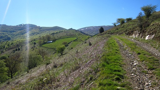 |
We follow the
country road which climbs zigzag through a forest to a sort of plateau
with meadows and barns. Continuing on the country road which goes on
and climbs gradually. Navigating is straightforward: following that
road as long as it climbs. |
|
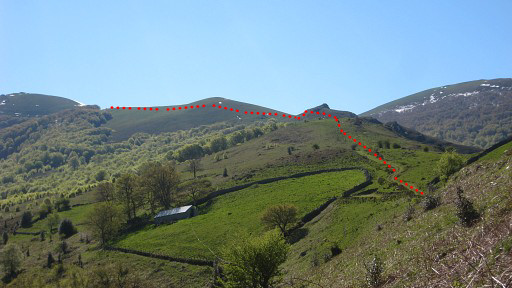
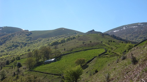
When the meadows
and barns are getting sparse and a long grassy hill-ridge comes in
sight, the road (having become a grassy road) starts to descend. At
that point leave the road and continue on the hill-ridge, remaining
left under the ridge itself. It’s tough walking on the grass but
navigating is easy. Move the mouse over the picture to see how you should walk towards bm098 |
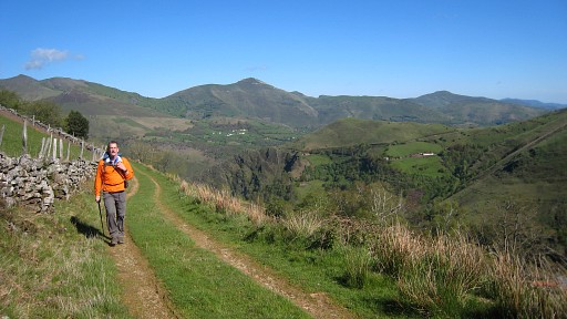 |
It's splendid
weather, Jan-Willem is enjoying the landscape. |
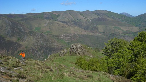 |
Still climbing. Later on a forest appears down to the left hillside, stay half way down between ridge and forest. |
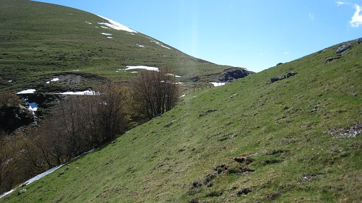
|
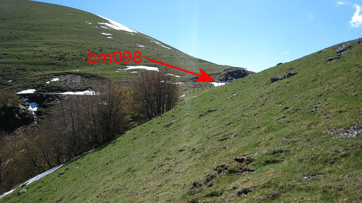
Don’t
follow an obvious trail into the forest as we did, you’ll end
op too low and will need to climb in the final part. Eventually (about 2 hours and a quarter since the start) you’ll reach a fence with on the other side: bm198, a mountain road and the beginning of the borderstream Gorritchoneka Erreka which connects bm198 and 197. Move the mouse over the picture to see where bm098 is. |
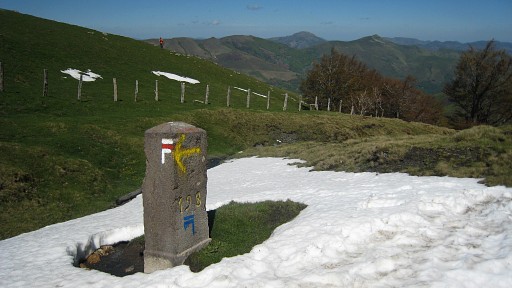 |
Bm198 was surrounded by snow caused by late snowfall last week. |
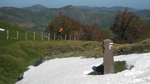 |
A footstep helps
you to get over the fence as Jan-Willem shows in the background. |
 |
We return to the
hamlet and try a different approach to bm197. Last year I simply
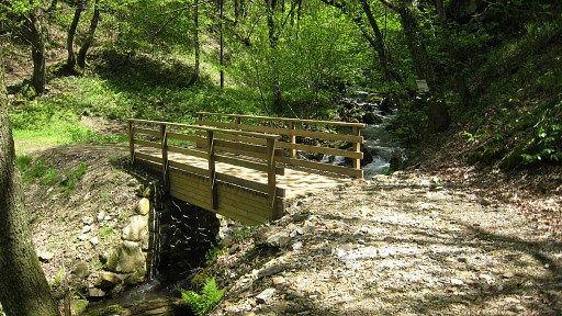
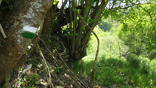
crossed the river la Nive d’Arneguy in front of the bm. The new (green-white waymarked) trail leads you to the highest house of the hamlet and beyond it the trail crosses the borderstream on a brand new footbridge. |
|
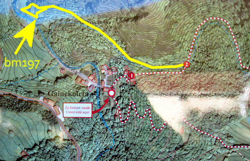
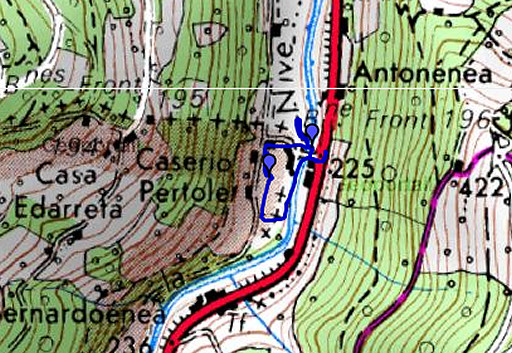
On the French side
of the stream we walk back along the stream on a trail which goes
underneath the steep rocky hillside and ends at a meadow besides the
river. An outline of the map mentioned above. The wooden bridge is at nr. 2. Move the mouse over the picture to see our access to bm197. |
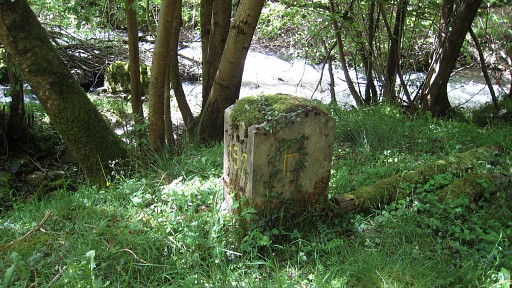 | Once arrived at the meadow, go a bit to the left and there is the confluence of the borderstream Gorritchoneka Erreka with the river la Nive d’Arneguy and bm197. |
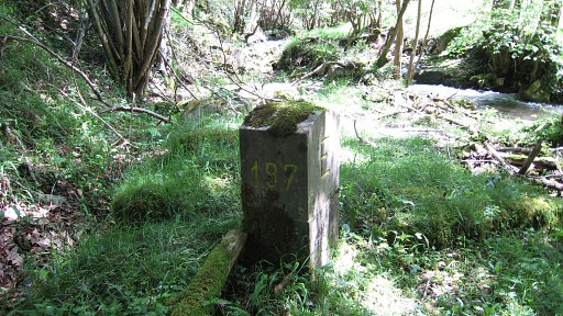 |
Bm197 |
 |
Back at the
footbridge I continue on the green-white trail to explore it. It is a
nice path on old trails. Further on it crosses the borderstream again,
makes a u-turn
and climbs back to the plateau and meets the road we walked before. |
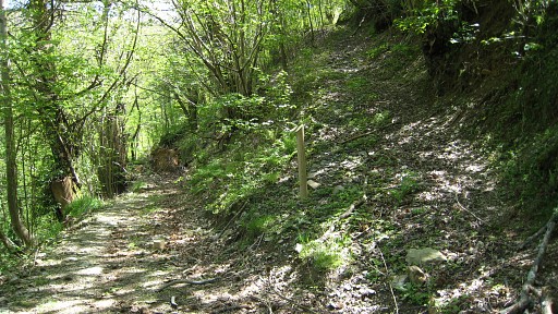 |
But I go back and
explore halfway between stream and that meeting point an old neglected
track
- visisble on this picture on the right - which climbs to that
same road but more to the south-east. It's a shortcut in the
direction of bm198. Via the road I return to the hamlet where Jan-Willem is waiting. |
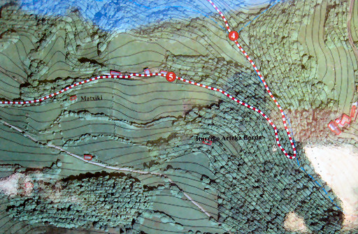
|
Another outline of
the above mentioned map. Move the mouse over the picture to see the shortcut I explored. |
 |
esfr-trip-track-20100510-trip2.kml (click to open in Google Earth or copy link to Google Maps; click right on this link to download gpx-version) Trip 2: looking for bm196 We drive to the venta's near Arneguy. |
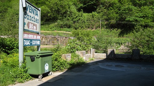 |
More accurate maps
(on cadaster-level, found on the
internet) show that bm196 should have been approximately at the spot
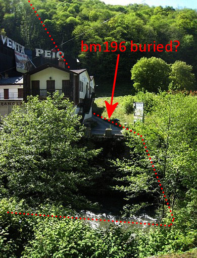
where the balustrade overlooking the river has its corner. But that's not true, I will learn later: see esfr-html-markers-184-196.html |
|
Last year I have
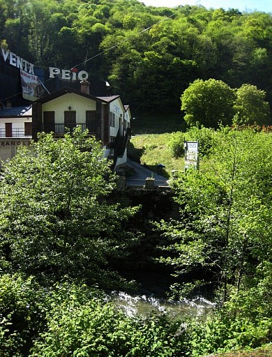
searched the site thoroughly, including the overgrown shore. This picture is taken from the other side of the river. Move the mouse over the picture se see the supposed place of bm196 and the approximate borderline. |
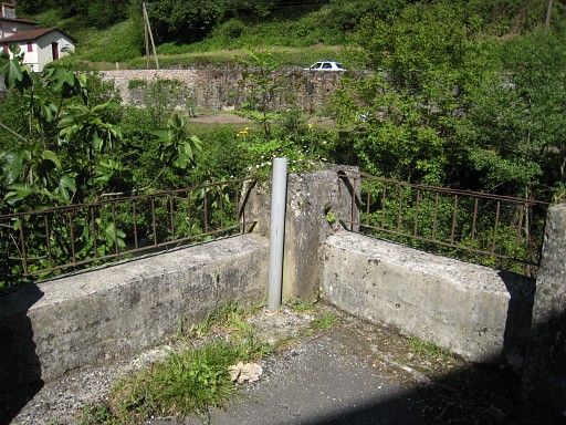 |
Now I just make
some pictures of the supposed place of. |
 previous
trip next
trip previous
trip next
trip 
|
|

