|
The
bordermarkers of the Pyrenees : all my trips
 |
|
| - 24
march
2011 - Sleeping at the castle |
 |
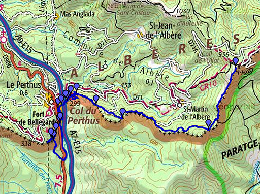 |
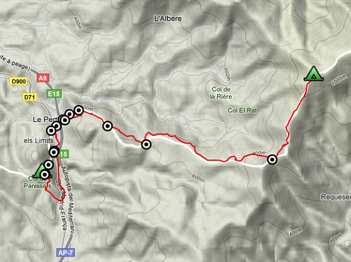
esfr-trip-track-20110324.kml (click to open this trip in Google Earth or copy link to Google Maps; click right on this link to download gpx-version) Summary: part of a 5-days trip from Portbou to a bit beyond Le Perthus (bm600-bm560). A remake of a trip in april 2006, now with a gps. Day 4: descending to Le Perthus and finishing at the castle of Fort de Bellegarde (bm583 to bm571) Weather: clear sky, full sun, strong wind |
 |
For explanation of
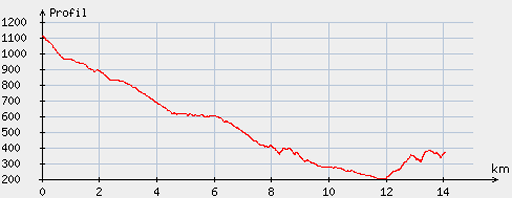
the gps-coordinates and other cartographic backgrounds: see my cartography page Start: 8.45, break: 13.45-15.00, finish: 17.30, net walking time: 7.30h According to the gp-tripteller: Distance: 15,3km Time en route: 8.41h Total ascent: 519m Maximum height: 1112m Final height: 380m |
 |
According
to visugpx - distance : 14.23 km - cum. elevation gain : 279 m - cum. elevation loss : 1029 m - total elevation: 1308 - altitude maxi : 1112 m - altitude mini : 200 m - altitude average : 467 m |
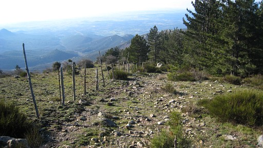 |
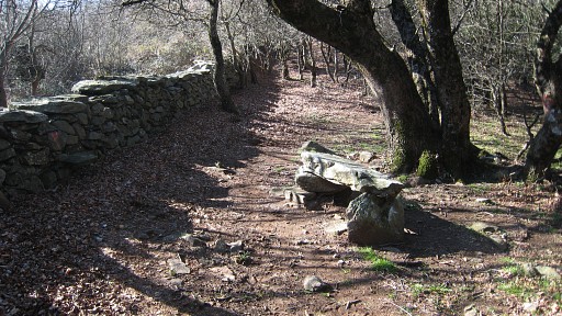
It was a
cold night again. I start with descending along / parallel to the
borderfence on a track where I remember a distinct dirt-road in 2006. |
 |
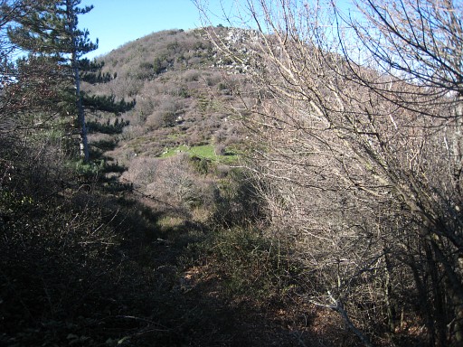
There are scarce yellow waymarks but increasing when it enters - a lovely part - |
 |
a beech forest underneath Puig Pinyer. |
 |
The track ends directly at the Col Forcat with bm582. This picture: looking forward to the pass, that grassy spot. |
| At the pass. If you go the other way, the start of
that trail is inconspicuous between the broom. The arrow might help you. As soon as you enter the broom, a path appears and after a while you'll see the yellow waymarks. |
|
 |
Bm582, about 10-15 meters NWW from the gate & signpost, somewhat hidden in the bush. |
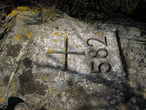 |
Bm582 |
 |
Bm582, looking east to Puig Pinyer. |
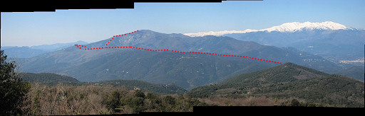 |
Twenty minutes later, I made this panorama, looking ahead. We see clearly the Mount Canigou, covered in snow. In red: the borderline from Le Pethus going SW. |
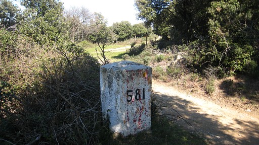 |
Then, along the forest road to bm581 (when going the other way, remember to take the sideroad to Col Forcat). |
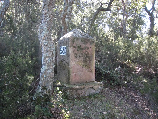 |
Then to bm580 |
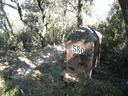 |
Bm580, looking down at the trail |
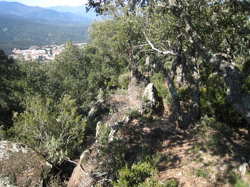 |
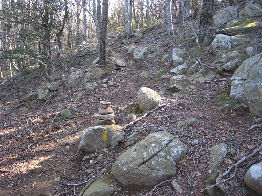
and from there, over/along the
border-ridge. In general an easy trail - there's one rocky outcrop
which can be passed underneath at the southern side - |
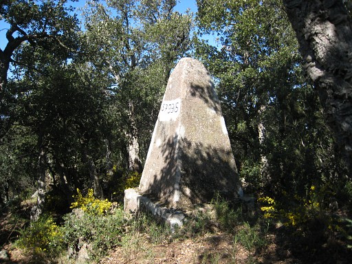 |
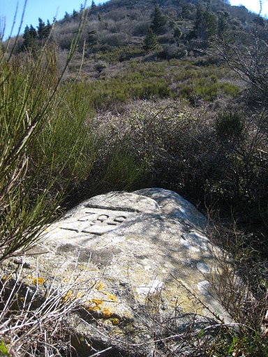
untill bm579bis. |
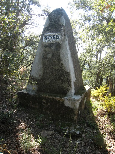 |
Bm597bis |
 |
From bm579bis, I try with my compass
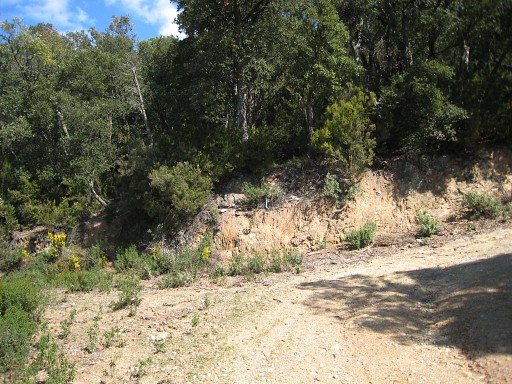
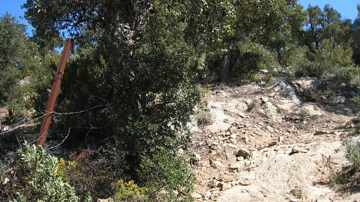
to go directly to bm579. That is a tiring trial-and-error wrestling through the bush, crossing a forest road (GR10) at a bend (this picture), |
 |
crossing an overgrown forest road further on and ending up at the northern slope underneath |
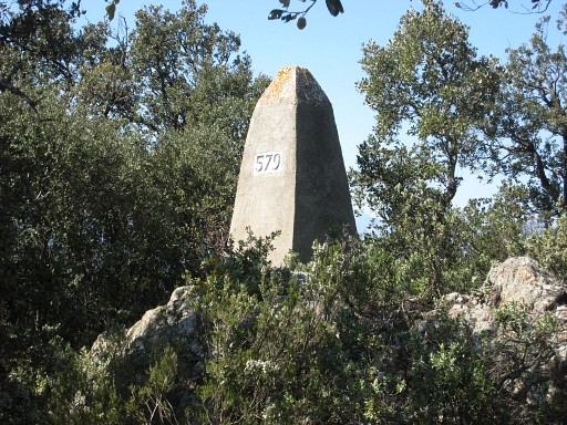 |
bm579. |
 |
From bm579, I walk back in the
direction of bm579bis, now easier on a sort of ridge - crossing again
the overgrown forest road - untill that distinct forest road, say
50-100 meters from that bend to the left higher up. I proceed but give
up soon: it is wrestling for anyone who wants to go in a straight line
to bm579bis. And the last part was anyway an useless attempt because
that forest road bends back. I would have reached the same road a bit
higher up. |
 | It's better to go from bm579 to bm579bis this way: from bm579 follow
the ridge NE, cross that overgrown forest road, proceed untill the forest road. Go to the left untill the bend in
the road. From the bend, enter the bush/forest on the hillside and go
NE untill you reach the ridge. You should be close to bm579bis,
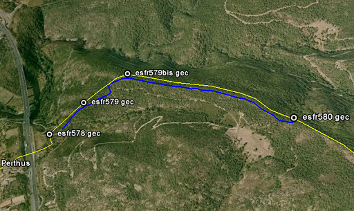
either to the left or right. This picture gives an overview of the direct route from approximately bm578 to 579 to 579bis to bm580. |
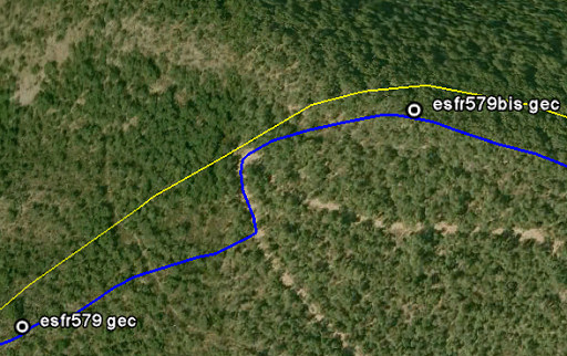 | And this is a closeup of the crucial part from bm579 to bm580, described above. |
| But there's an alternative route proposed to me in 2013 by Jacques Koleck from bm578 via bm579 and bm579bis to bm580: "To go from the 580 pyramid (Col de la Comtesse) to the 579bis pyramid (not mentioned in the Treaty) I followed your advice in taking the trail NW along the ridge. Having arrived at bm579bis I decided to go full S, Spanish side and I was pleasantly surprised to find the dirtroad 50 to 100m (in distance) below! (this track is the one that goes from the Col de la Comtesse to bm578) Therefore if you go from bm578 via bm579 and bm579bis to bm580, I suggest: - follow the GR10 and track until you see a small cairn on the left - go N uphill to find bm579 on the ridge - return downhill and continue on the track uphill - look for the following information painted on trees: - Left: GV (framed) 2x - Right: 7 (framed) - 25m further N, go N (40-50m in a straight line) to reach the pyramid 579bis - then from bm579bis, follow the (blue waymarked) trail SE to bm580 on the ridge. - It's easy and nice!" |
|
 |
I descend a bit on the forest road,
climb up to bm579 again and then descend through the forest on a sort of
ridge in the direction of bm578. If you go the other way: from the
'pass' where the GR10 trail crosses the borderfence into Spain, climb
along that fence uphill to bm579. |
 |
Then: -bm578 (my gec-waypoint is wrong) |
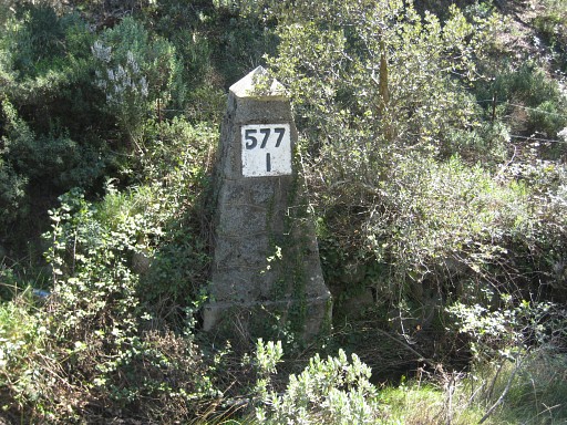 |
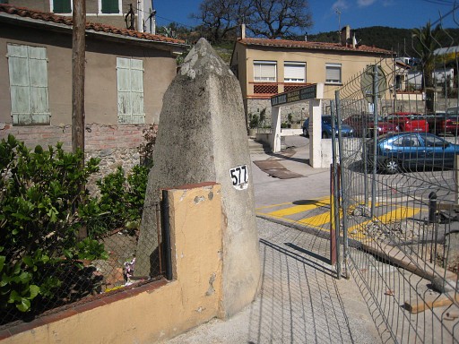
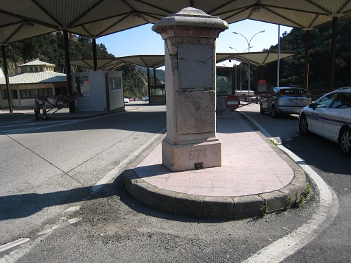
Bm577-I |
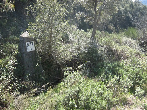 |
Bm577-I |
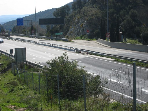 |
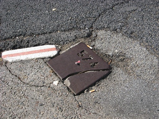
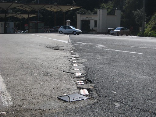
I pass underneath the highway through a tunnel. That tunnel is also the bed of a stream which forms the border. This picture: the striped borderline visible on the tarmac. |
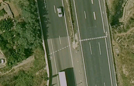 | And seen from above in Google Earth. |
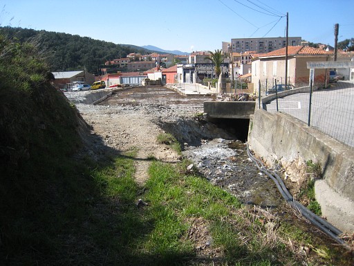 |
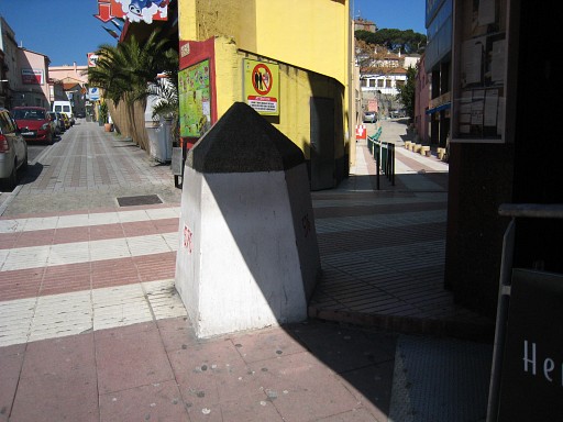
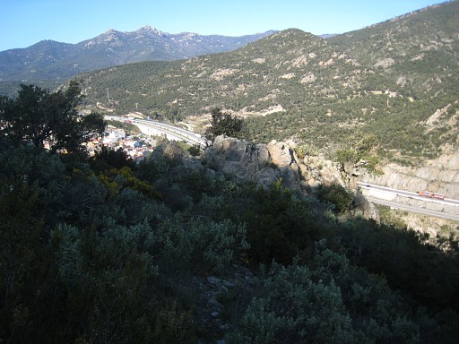
When leaving the tunnel and entering
Le Perthus, I spot bm577 in the distance. The buildings alongside are
demolished and they're building a new one. |
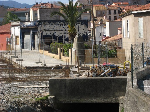 |
Bm577, zoom-in |
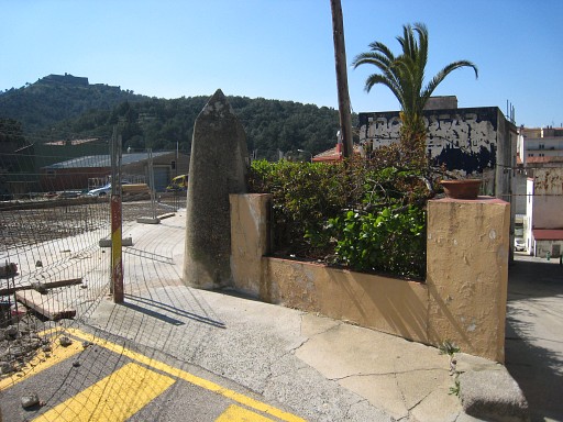 |
Bm577 |
 |
Bm577 |
 |
Bm576 |
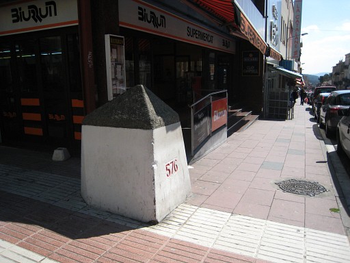 |
Bm576 Then lunch at a restaurant. |
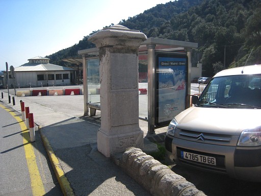 |
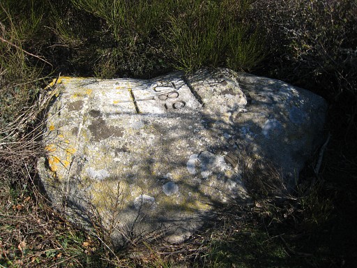
After lunch doing - once again - the three bordermarkers at the entrance of Le Perthus. Bm575, looking to the Spanish customs offices. |
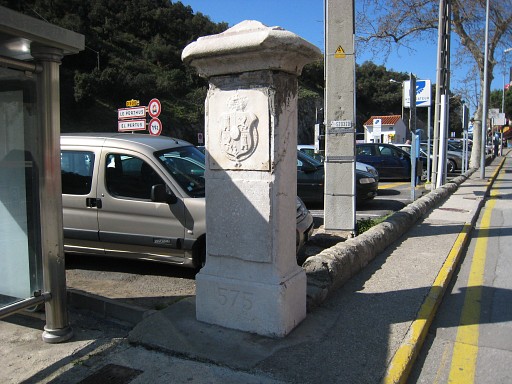 |
Bm575, the other side |
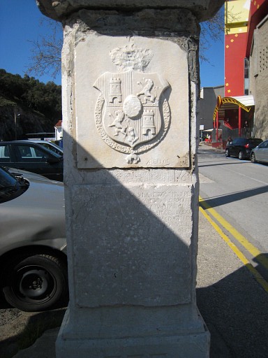 |
Bm575, close-up |
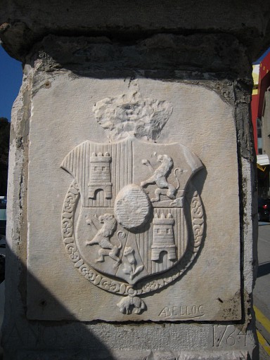 |
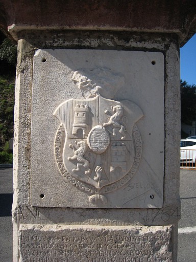
Bm575, closeup of the arms |
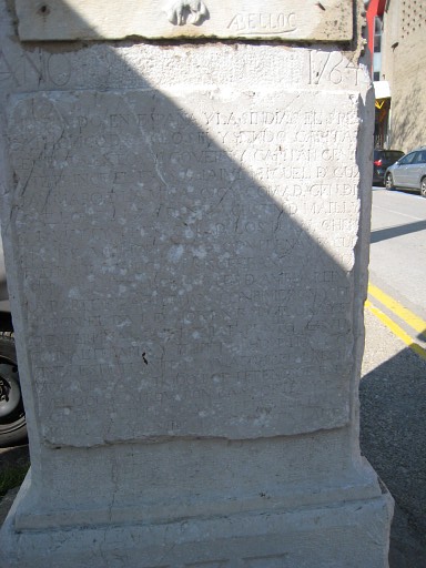 |
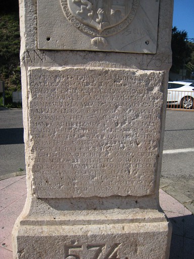
Bm575, closeup of the latin text. Click here to see an enlargement. |
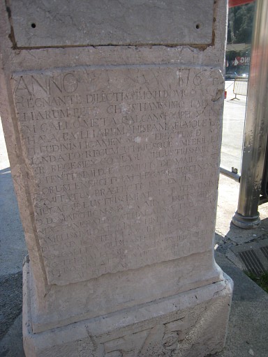 |
Bm575, closeup of the latin text on the other side. Click here to see an enlargement. |
 |
Bm575, looking to bm574bis. |
 |
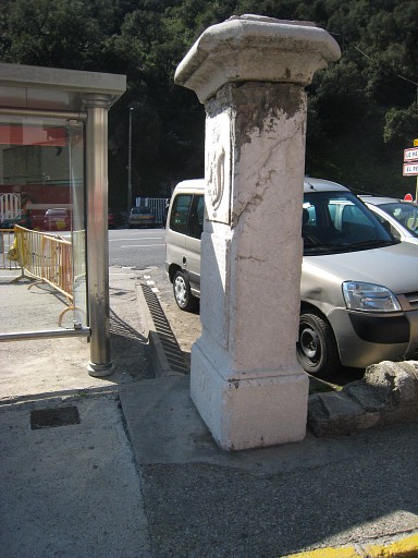
Bm574bis |
 |
Bm574bis, looking to bm574. This is the old place of bm574. It was removed to its current location to broaden the road. |
 |
Bm574, looking to Spain |
 |
bm574, the other side |
 |
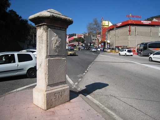
Bm574, closeup |
 |
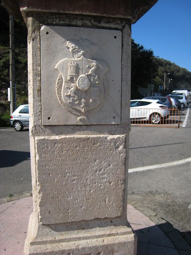
Bm574, closeup of the arms |
 |
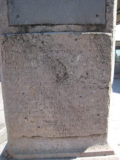
Bm574, closeup of the latin text, the same as on bm575. Click here to see an enlargement. |
 |
Bm574, closeup of the latin text on the other side, the same as on bm575. Click here to see an enlargement. |
 |
I try a alternative route via Spain to
bm571. You need to walk about 1 km southwards along the busy road, a
part of it can be done on the safe side of the guard rail. Then to the rigt on a forest road |
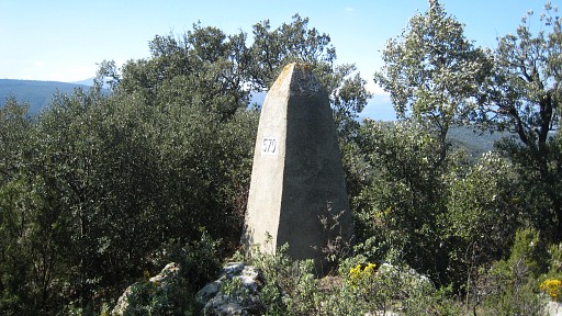
| up to a bifork with at the righthand a monument. At the corner starts an indistinct and not waymarked trail - in fact various trails - NE to the hillridge. | |
 |
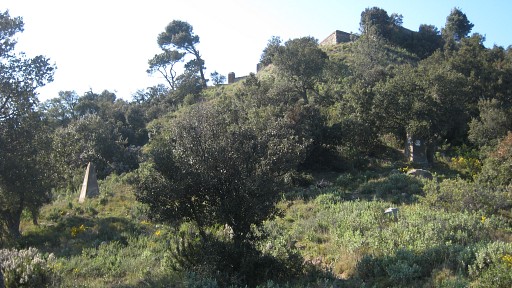
From this bifork we can see the Fort de Bellegarde, my destination. There's also a bordermarker visible, |
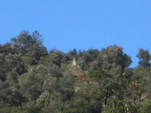 |
better visible on this zoom-in, that must be bm571 |
 |
So: from the bifork I climb to the the hillridge and from there - more gentle - to bm571 and bm572, both visible on this picture, standing ± 15 meters from each other. |
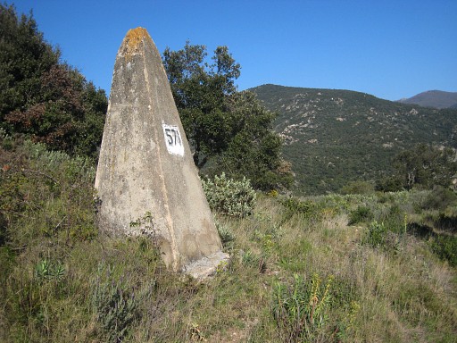 |
Bm571 |
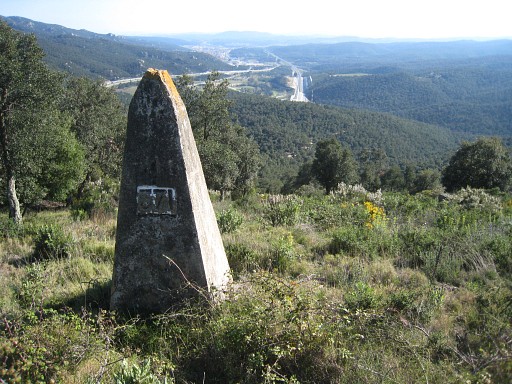 |
Bm571 |
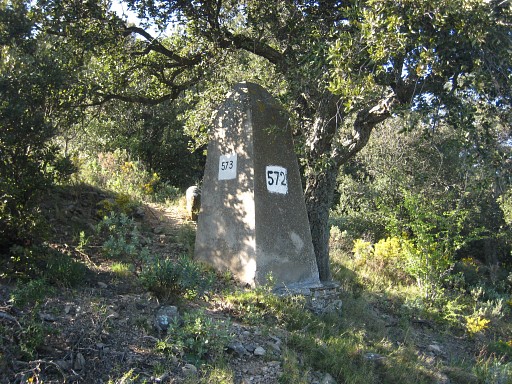 |
Bm572 (someone made a misstake: they painted 573 on it while the old and correct number 572 is still in place) |
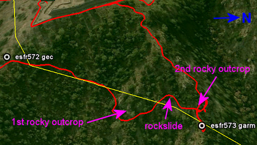 | Then through the bush in more or less a straight line to bm573. Some hints: - while descending northwards, you'll reach a rocky outcrop - go underneath it and cross a rockslide (be careful) - and reach further on a second distinctive rocky outcrop/ridge - descend on that rocky ridge |
 | This is (probably) the second rocky outcrop. |
 |
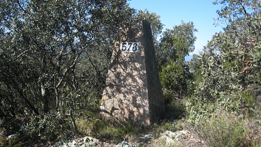
And then you'll reach bm573. |
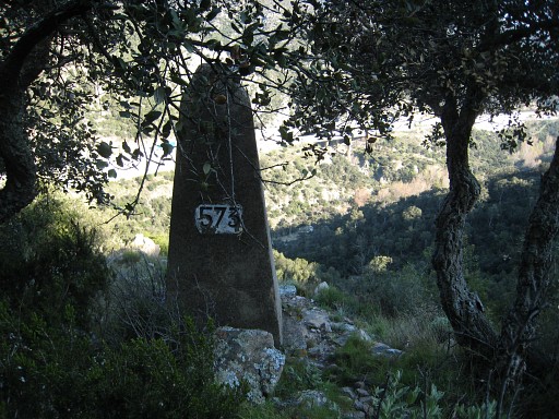 |
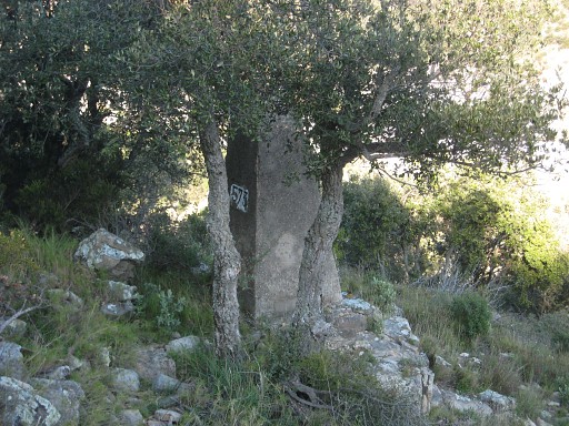
Bm573 |
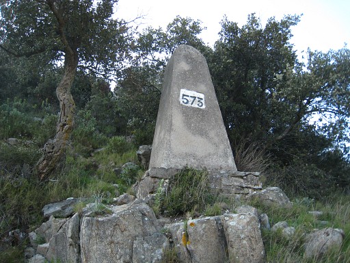 |
Bm573 |
 |
Going back, it might be easier to climb up along that rocky ridge untill the wall of the castle and return along that wall, inside or outside. |
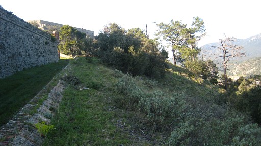 |
The castle premises here are public and
you might leave the area via its exit and continue to Le Perthus.
Conclusion: the GR10 entrance of Le Perthus is nicer than the Spanish alternative I explored earlier. |
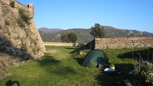 |
I try - with little zeal - to get to
bm570 but I can't find a decent trail and decide to camp on a perfect
spot just within the castle ramparts. There's no water nearby but I collected enough water earlier this day close to bm577-I. |