|
The
bordermarkers of the Pyrenees : all my trips
 |
|
| -
16 august
2011 - Oral history |
 |
 |
Summary:
part of a 3-weeks trip to the Pyrénées to 'do' the ± 60
remaining bordermarkers. All done as daytrips from campings. Day 2: three short trips with bm196 and bm157 as primary targets. Basecamp is St-Étienne-de-Baïgorry Weather: cloudy and drizzle in the morning, fine summer weather and clear skies in the afternoon |
 |
esfr-trip-track-20110816-trip1.kml (click to open this trip in Google Earth or copy link to Google Maps; click right on this link to download gpx-version) Trip1: investigating the location of bm196, reported to be buried. |
 |
For
explanation of
the gps-coordinates and other cartographic backgrounds: see my cartography page |
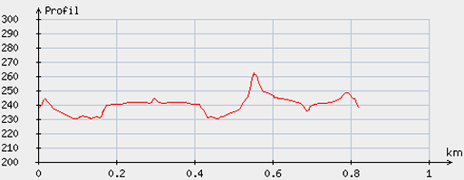 |
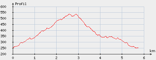
According
to visugpx - distance : 0,9km - cum. elevation gain : 16m - cum. elevation loss : 11m - total elevation: 27m - altitude maxi : 262m - altitude mini : 230m - altitude average : 239m |
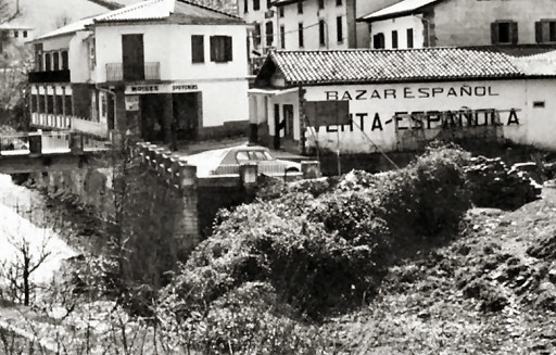 |
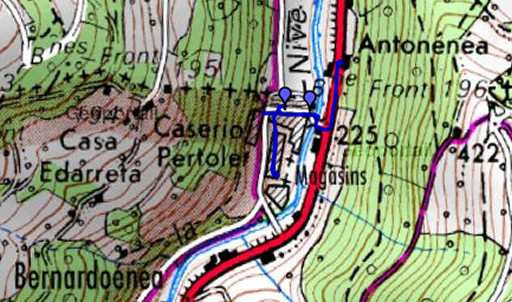
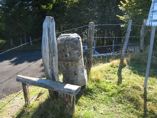
Jean Sermet stated
that already in 1976, this bm was almost buried, only the top
visible. It's place: besides the
venta-building and underneath the word ESPAÑOLA, at the foot of a small wall. (Source: "La frontière des Pyrénées", p134 - 5 by Jean Sermet) Sermet tells that this borderstone was larger than the other ones in this region en had a diamond-shaped top. |
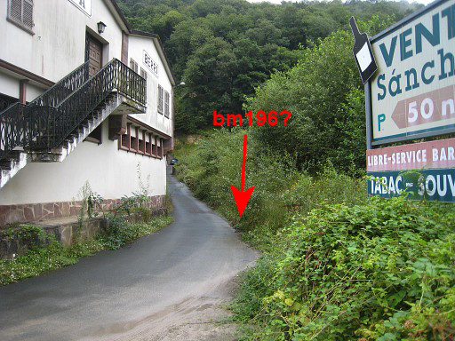 |
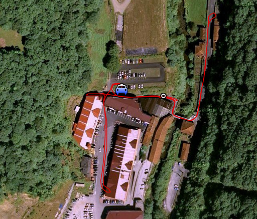
The
building on the picture has replaced. But I think I can reconstruct
the location of bm196 : more or less under the word “Berri”. Then I ask two aged men in a house nearby what they know. They confirm Jean Sermet’s story: it’s buried since 40-50 years, they tell. The little road next to the building is Spanish (so the Navarra maps are wrong in this) and bm196 was located at the other side. |
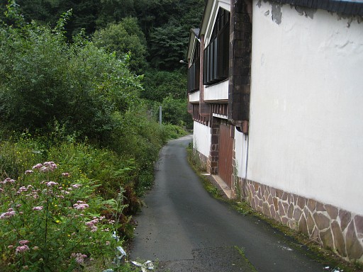 |
Looking from the other side. I’m content with this confirmation by means of oral history. Bm-officials: it’s time to do some archaeological bm-digging. |
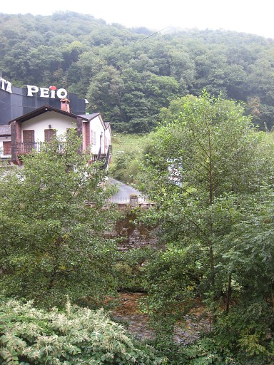 |
From the other side of the river. |
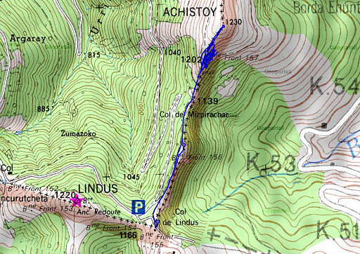 |
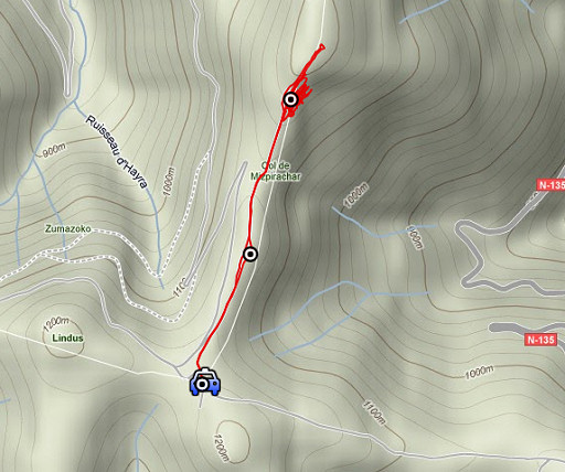
esfr-trip-track-20110816-trip2.kml (click to open this trip in Google Earth or copy link to Google Maps; click right on this link to download gpx-version) Trip 2: from Col de Lindus to bm157, not found on earlier trip but reported to have tumbled from the ridge. |
 |
For
explanation of
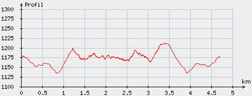
the gps-coordinates and other cartographic backgrounds: see my cartography page En route (±): 10.45 – 14.15 (3.30h) According to the gps-tripteller: Distance: 4,7 km Cum. elevation gain : 230m Total elevation: 460m Maximum height: 1227m Time: 3.28h |
 |
According
to visugpx - distance : 4,8km - cum. elevation gain : 146m - cum. elevation loss : 153m - total elevation: 299m - altitude maxi : 1212m - altitude mini : 1135m - altitude average : 1176m |
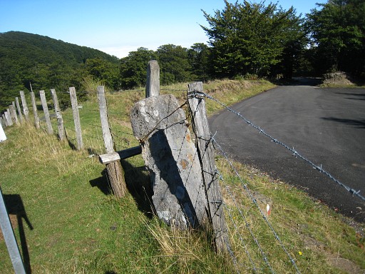 |
Bm155 Col de Lindus is easily accessed on a forest-road from the col of Puerto de Ibañeta in Spain. |
 |
Bm155 |
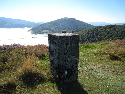 |
Bm156 |
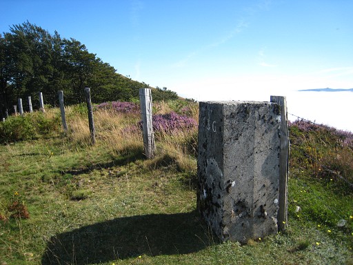 |
Bm156 |
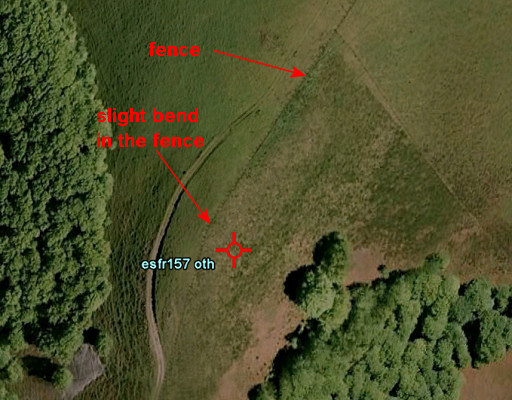 |
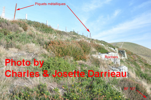
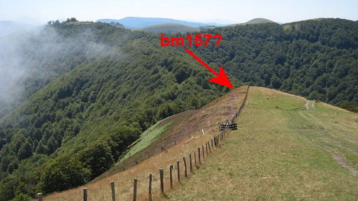
Bm157 has tumbled down the ridge and lies -
according to Vigor & Sanz and Charles Darrieu - 20 m lower on the
Spanish side. I have a picture of it from Charles Darrieu. However,
I can’t find it in spite of searching for more then 2 hours,
zigzagging on the hill slope. Later - back home - I will see on Google Earth that one Dr. Grijando has geotagged it's pictures of bm157. His localisation correspondends with the 20 meters, mentioned above. |
 |
There’s heavy undergrowth, pricky and very tough to wade through. I try to match Charles’ picture with the scene but that doesn’t help me either. I have to give up. |
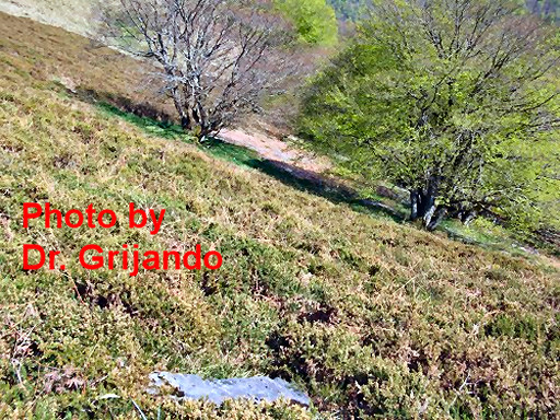 |
But this picture of Dr. Grijando (see his panoramio-page) gives a better clue. Unfortunately too late. |
 |
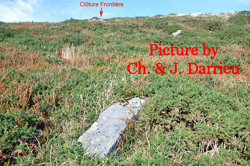
And I found back this picture, giving even more directions. |
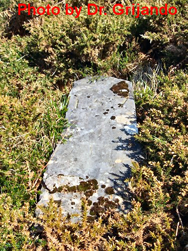 |
What strikes is that this
bm seems to be of an older type. Most of the bm's on the ridge from 156
to the north are large square concrete blocks. But it also seems different from the previous series bm152-155. |
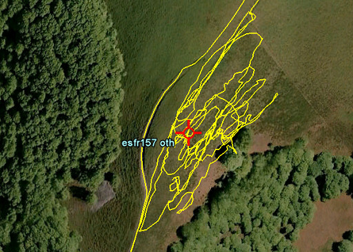 |
If we compare Dr. Grijando's waypoint with my gps-track, I must have passed bm157 several times. Early spring 2012 will be a better time to scrutinise this hill-slope. |
 |
This picture: a bit higher on the ridge and looking back. |
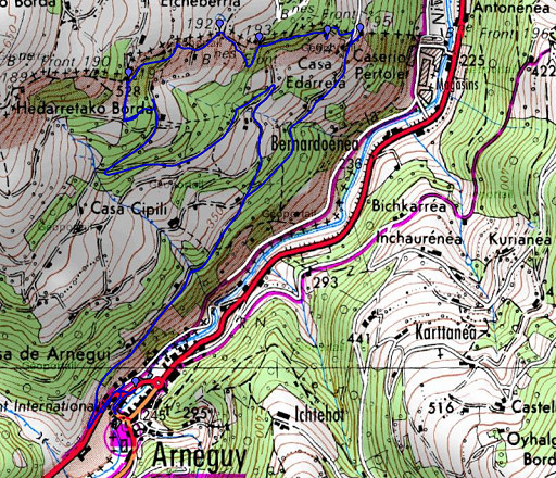 |
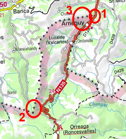
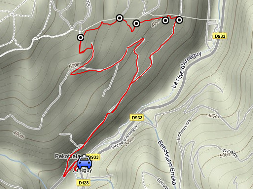
esfr-trip-track-20110816-trip3.kml (click to open this trip in Google Earth or copy link to Google Maps; click right on this link to download gpx-version) Trip 3: a reconnaissance of routes from Arneguy to bm195. |
 |
For
explanation of
the gps-coordinates and other cartographic backgrounds: see my cartography page En route(±) : 15.30 - 1730 (2h) According to the gps-tripteller: Distance: 6,1km Cum. elevation gain : 314m Total elevation: 628m Maximum height: 528m Time: 1.57h |
 |
According
to visugpx - distance : 5,8km - cum. elevation gain : 310m - cum. elevation loss : 305m - total elevation: 615m - altitude maxi : 537m - altitude mini : 249m - altitude average : 390m |
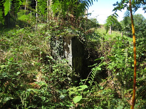 |
From Arneguy, a tarmac road
climbs after some winding (± ½h) until the road
ends at a farm. I see on my gps that I’m ± 120m from bm191 and I walk through the forest and via a forest road to bm191. It’s beyond that crossing with that peculiar metal barrier. This could be part of the GRPdesBF main trail: from b191, crossing the metal barrier |
 |
and then at the next crossing (± 120m) with a road coming from the right: go left, |
 |
right through the forest (NEE) to the tarmac road S of the
farm. Then descending on the road to Arneguy. |
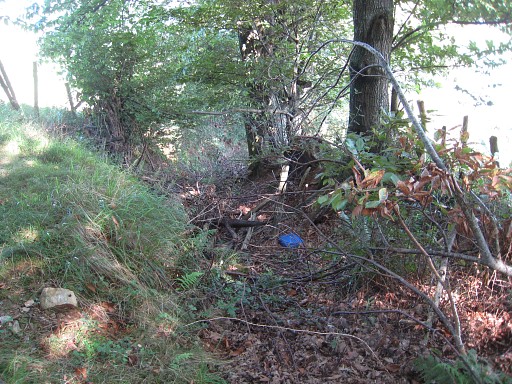 |
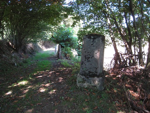
I redo bm191-195: - 191-192: down the dirt-road, at its end descending to the right on a no longer used walled path (the meadow at the right is easier to use), then to the left |
 |
until bm192. |
 |
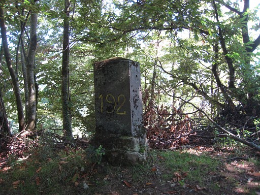
Bm192
- 192-193: same story, from 192 descend to the right on a no longer used walled path. The meadow at the right is - again - easier. Then bend to the left and you’ll find |
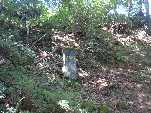 |
bm193. |
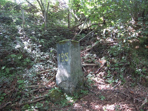 |
Bm193 - 193-194: continue on the forest trail, you’ll reach an open space at your right. |
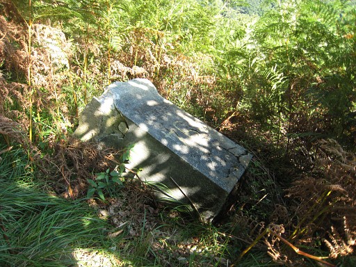 |
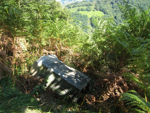
Bm194 is a bit off the forest ridge and currently lying flat. |
 |
Bm194 - 194-195: descend in the forest, not on the old trail along the forest edge because that trail is blocked at the end. Descend parallel to that trail until you reach the tarmac road NE of a house. Access from the forest to the road might be a bit difficult. |
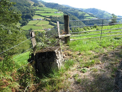 |
Bm195 is standing on the other side of the road. Then a gentle walk and some jogging back to Arneguy. I see where I skipped - on my way up - the branch to the right which leads directly to bm195. Finally in Arneguy, it’s time for a well deserved beer. In the evening I hear from my 'copine' Karin that an interview on the GRPdesBF-project is published in the Dutch tabloid “De Telegraaf”. I’m very content. See this page |