|
The
bordermarkers of the Pyrenees : all my trips
 |
|
| - 27 august
2011 - A French shepherd in Spain |
 |
 |
Summary:
part of a 3-weeks trip to the Pyrénées to 'do' the ± 60
remaining bordermarkers. All done as daytrips from campings. Day 12: two trips, the main one to bm278 &279 and a short one to bm306-307. Basecamp is Urdos. Weather: in the early morning drizzle and mist, later clearing up to a fine summerday. |
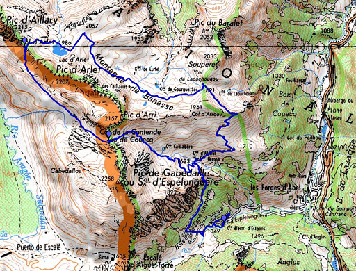 |
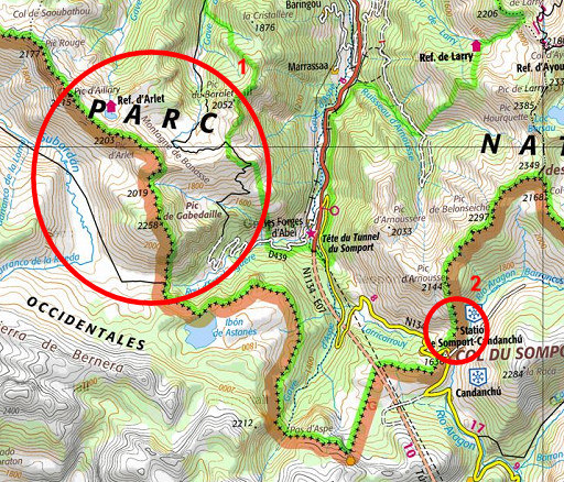
esfr-trip-track-20110827-trip1.kml (click to open this trip in Google Earth or copy link to Google Maps; click right on this link to download gpx-version) Trip1: to cover bm278 and bm279 which went remarkably swift. |
 |
For
explanation of
the gps-coordinates and other cartographic backgrounds: see my cartography page En route (±): 8.30 - 14.00 (5.30h) According to the gps-tripteller: Distance: 18,3km Cum. elevation gain : 1113m Total elevation: 2226 Maximum height: 2102m Time: 5.46h |
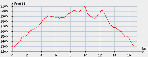 |
According
to visugpx - distance : 17,0km - cum. elevation gain : 1044m - cum. elevation loss : 1041m - total elevation: 2085m - altitude maxi : 2094m - altitude mini : 1285m - altitude average : 1772m |
 |
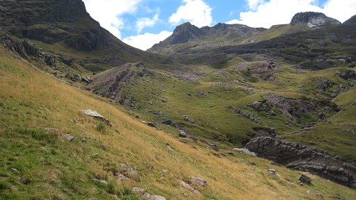
Start
from Forges d’Abel. I tried to drive the last rocky dirtroad to the
parking but that was too much for the exhaust pipe. It let loose
and I had to fix it with a rope and drive the car back to safer grounds. Then the ascent to Refuge d’Arlet. This picture: passing Cabane Grosse. |
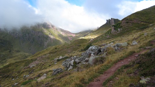 |
The trail is the HRP-trail (waymarked
red-white-red) and it took me 2 1/2 hours to the refuge. The sign at the parking - 3 1/2 hours - must be a misstake. |
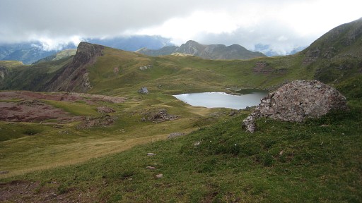 |
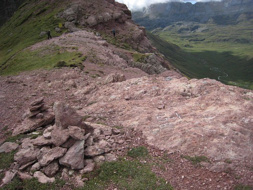
Short break in the refuge for a coffee and a
sandwhich and then the short and easy climb W to Col d’Arlet. There is
a cairns-trail but without it you’ll get there as well. This picture: looking back at Lac d'Arlet with the refuge. |
 |
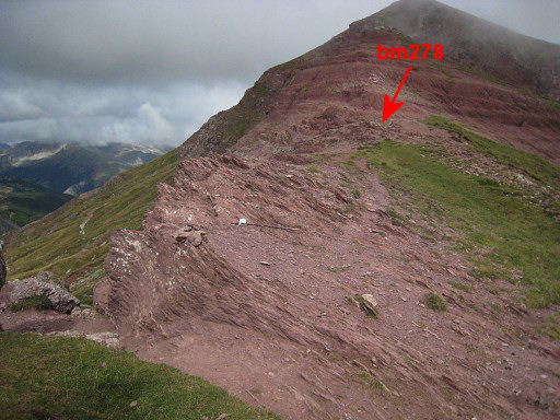
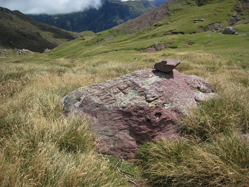
Bm278 is another example of hardly noticeable crosses in rocky
surroundings. Despite an accurate waypoint and a large cairn, it took some time to recognize it. |
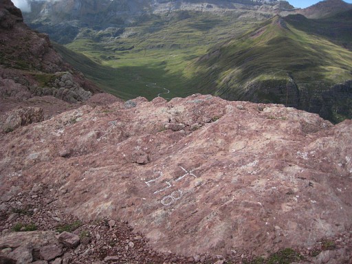 |
With some chalk, it looks better. |
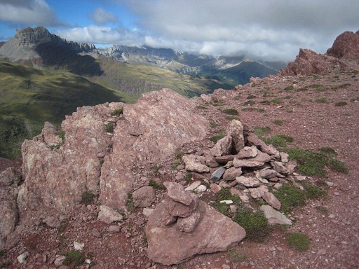 |
It’s position: at the ridge some 40m NW of the
pass itself. |
 |
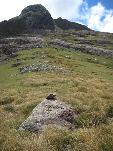
Bm278 with the cairn, looking to the pass. |
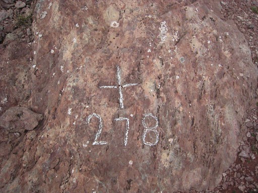 |
Bm278 |
 |
View from the pass to bm271. |
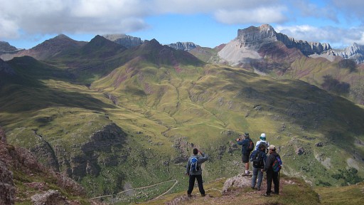 |
The views into Spain are gorgeous. |
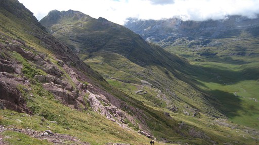 |
Then on Spanish grounds traversing to Col de la Contende. That’s not difficult: descend S (there are some cairns) and after descending along a sort of ravine, traverse SE on cattle tracks while remaining on the same level. If you descend too much, nothing is lost: the Col is still SE and the climb easy. |
 |
A bit further. |
 |
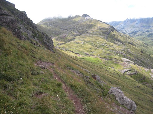
The Col is very obvious in the ridge, the final climb easy though there are no trails or cairns. |
 |
Bm279 is a solitary rock |
 |
Bm279 |
 |
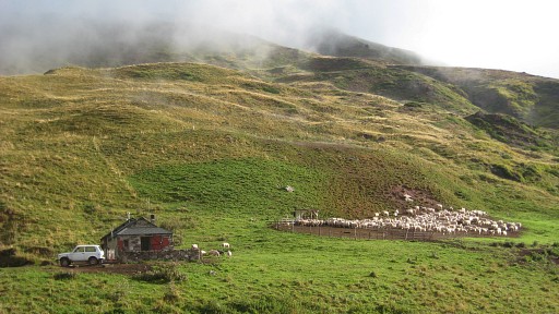
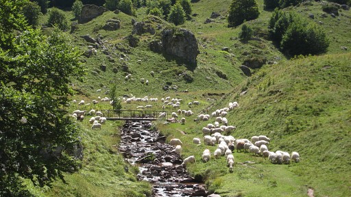
On the Spanish side I meet a French shepherd with his flock. He tells me that
it’s agreed with the Spanish communities that he may let graze his
sheep a bit on the ES-side of the pass. Then the descent, mostly along a cairns-trail but that is not necessary. Having arrived at the dirtroad (a part which is not yet on the maps), I descend further towards the cabanes and join the HRP-trail again. Then back to the car. |
 |
Note: after the descent in the forest, there’s a shortcut-path to avoid the lacelets of the dirtroad. |
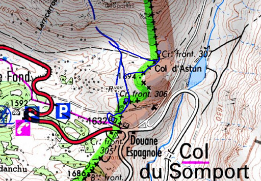 |
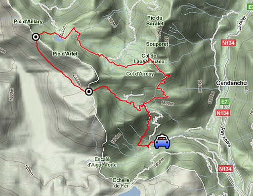
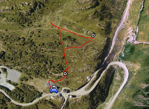
esfr-trip-track-20110827-trip1.kml (click to open this trip in Google Earth or copy link to Google Maps; click right on this link to download gpx-version) Trip 2: a short stroll from Col de Somport to redo bm306 and bm307. |
 |
For
explanation of
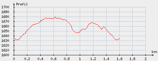
the gps-coordinates and other cartographic backgrounds: see my cartography page En route (±): 16.45 - 17.45 (1h) According to the gps-tripteller: Distance: 1,8km Cum. elevation gain : 100m Total elevation: 200m Maximum height: 1687m Time: 0.55h |
 |
According
to visugpx - distance : 1,6km - cum. elevation gain : 53m - cum. elevation loss : 54m - total elevation: 107m - altitude maxi : 1679m - altitude mini : 1631m - altitude average : 1658m |
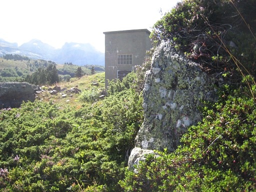 |
Access of bm306 on the path behind the ‘deneigement’ or ‘Ponts et chaussures’ - building, as described on 7 september 2009 |
 |
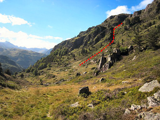
From bm306 I continue on the trail. This picture: looking ahead and showing the access to Col Mayou -> it's a climb through the bed of a stream, arriving at a flatter part which is followed by the final climb N to Col Mayou. From the Col you can proceed eastwards to bm308. Note: on 7 september 2009 I didn't climb as far as the Col but traversed from the 'flatter part' in a semi-circle NE underneath bm408 and finally climbed SW to it. |
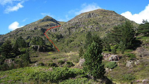
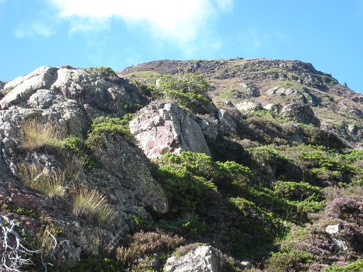
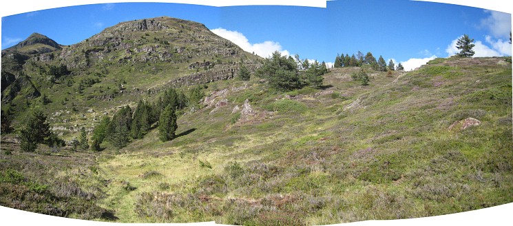 After bm306, there are three successive ‘valleys’ at your right hand. Enter the third one and go through |
|
 |
this
corridor between two hillridges. |
 |
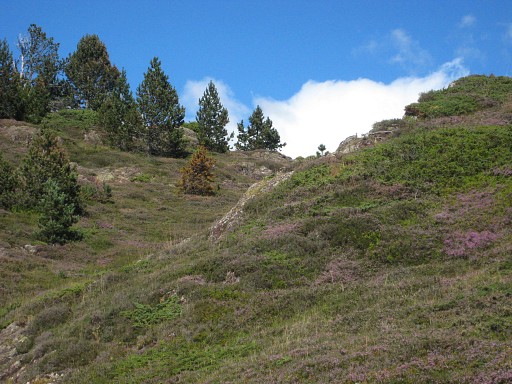
At the end you’ll see to the NE a next
valley with at the NE-edge a rocky outcrop. There you will find - with a few meters climbing - bm307. |
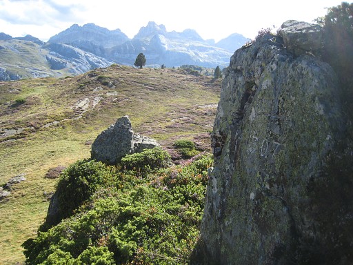 |
Bm307 |
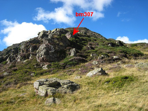 |
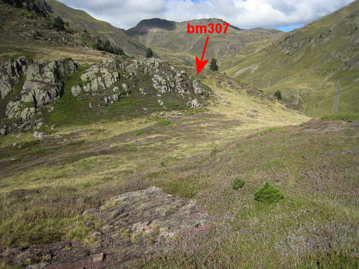
The rocky outcrop with bm307 |
 |
Zoomed in |
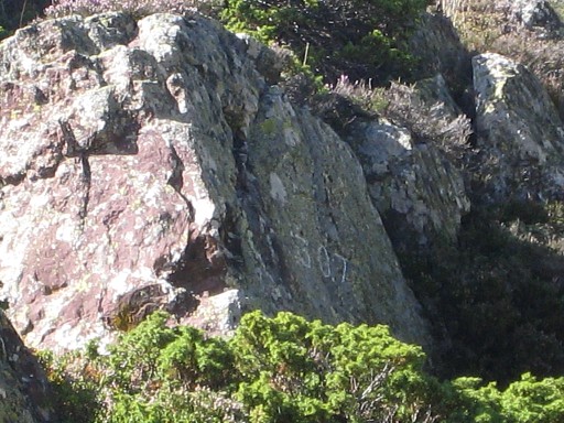 |
and again. If you can't find bm307 with all this help, you'd might consider switching to another hobby. |
 |
Through that fourth valley, descend back to the trail. I spot one cairn
but nothing more of a path or cairned trail up that distinctive ravine.
But you can't miss it. Back to my car, back to my basecamp in Urdos. |