|
The
bordermarkers of the Pyrenees : all my trips
 |
|
| - 31 august
2011 - Bm408-3 and -4 not found |
 |
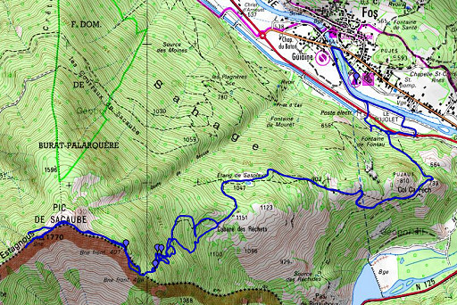 |
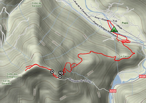
esfr-trip-track-20110831.kml (click to open this trip in Google Earth or copy link to Google Maps; click right on this link to download gpx-version) Summary: part of a 3-weeks trip to the Pyrénées to 'do' the ± 60 remaining bordermarkers. All done as daytrips from campings. Day 15: roundtrip from Fos to bm407-408. Main target: bm408 and 408-2 Weather: cloudy & sunny |
 |
For
explanation of
the gps-coordinates and other cartographic backgrounds: see my cartography page En route: 8.30 - 16.45 (8.15h) According to the gps-tripteller: Distance: 18,8 km Cum. elevation gain : 1307m Total elevation: 2614m Maximum height: 1761m Time: 8.06h |
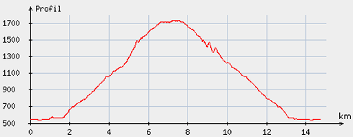 |
According
to visugpx - distance : 15,3km - cum. elevation gain : 1315m - cum. elevation loss : 1318m - total elevation: 2633m - altitude maxi : 1733m - altitude mini : 542m - altitude average : 1120m |
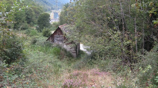 |
It's
an easy walk to the EDF-building, the 'Poste électr.' on the map. Then
to the left and shortly afterwards there’s a barn. That’s where the
trail
to Cabane de Hėrechet starts. This picture: looking back at the barn. A sign says two hours to Cabane de Hėrechet but it took me ± 1.15h. |
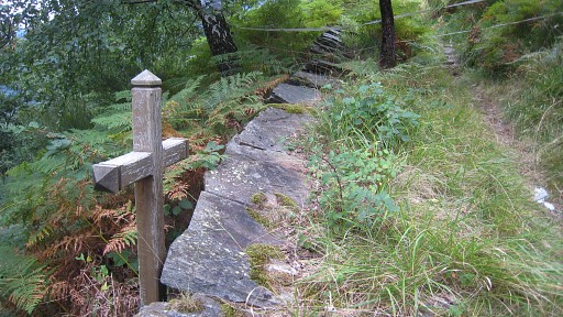 |
A cross along the trail. Why? Why here? |
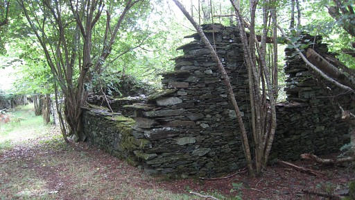 |
Later on - after Col Carrech - you will pass some ruines. |
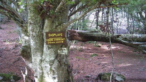 |
Wayfinding to the cabane is easy. |
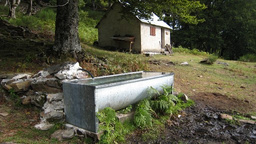 |
The cabane is nice and well equipped. Behind the cabin, to the left, a trail starts to the little cascade where bm408-1 and 408-2 are located. |
 |
But I continued on the trail in front of the cabin to the
SWW. That one soon fades away. Guided by my gps, I climb through the forest to the cascade and find bm408-2. See for the full story the special page on the submarkers I-IV of bm408. |
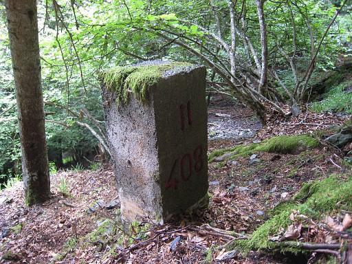 |
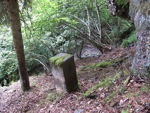
Bm408-2 is about halfway a small cascade (better: a steep stream) at its right side (N-side). |
 |
Bm408-2, the cascade (that darkgrey diagonal strip) in the background. Note: you can see how this bm is built up in two parts. |
 |
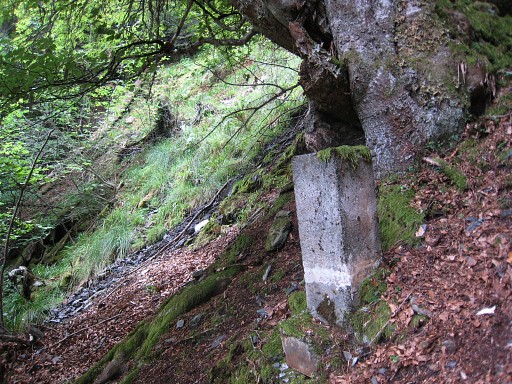
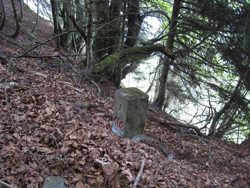
Above it - where the source is - is bm408-1, a few
meters higher to the SE of the source. At the bottom of the cascade, the stream soon disappears in a field of fern. As said before: see for the full story the special page on the submarkers I-IV of bm408. |
 |
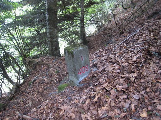
Bm408-1 |
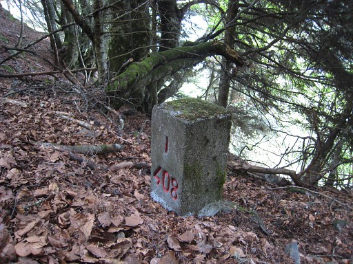 |
Bm408-1 |
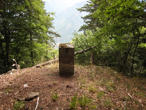 |
With my gps I find (SSW) bm408, there's no obvious trail or direction to get there from bm408-1. |
 |
Bm408 |
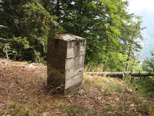 |
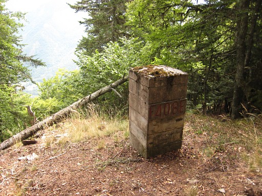
Bm408 |
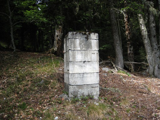 |
Bm408, backside |
 |
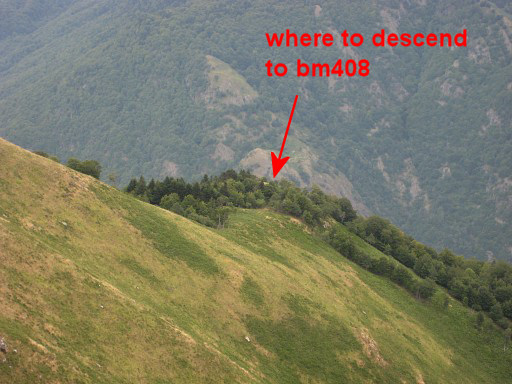
Via a small bassin/valley, it’s easy to
climb SWW to the ridge and continue to bm407. This picture: a bit up the ridge, looking back. So - when coming from bm407 -: before that larger tree, descend NEE to bm408. |
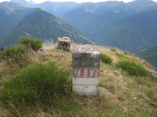 |
Bm407 |
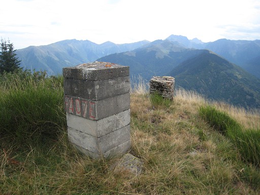 |
bm407
|
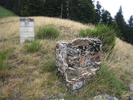 |
Bm407, this must be an older - masonry - version. |
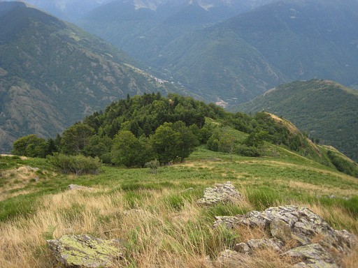 |
Then climbing along the ridge
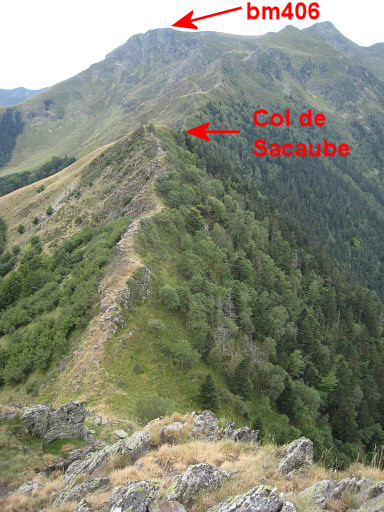
to see if can proceed via Pic de Sacaube and via Crête de Estagnous in
the direction of bm405 and bm406. On 8 june 2009 I went underneath Pic de Sacaube, thinking that the ridge further on, got too steep. This picture: again looking back, probably from the spot of bm407. |
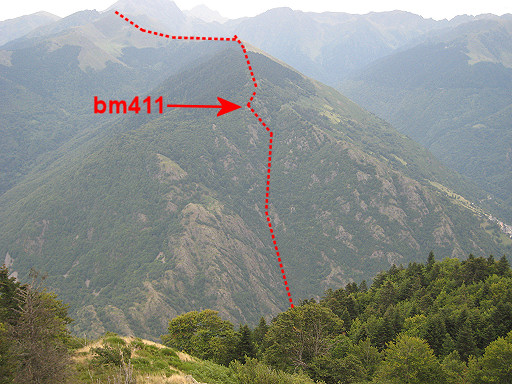 |
and this zoom-in, showing the approximate borderline on the other side of the Garonne, going E. |
 |
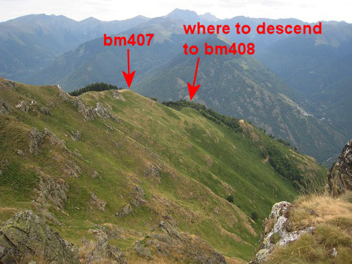
I continue on the ridge to
see - as said before - if that’s a possible route in stead of traversing underneath the Pic de Sacaube.
This picture: my furthest point, looking SW. There's a last steep descent to where the ridge gets more flat but that's no problem for an average walker. In the direction of bm406 or viceversa, you need to leave the crête sometimes and go underneath if the ridge gets too sharp or when trails underneath are easier. From Col de Sacaube onwards, there are trails leading to bm404 / bm405. |
 |
I return. This picture is taken - I think - from Pic de Sacaube, looking in the direction on bm407. |
 |
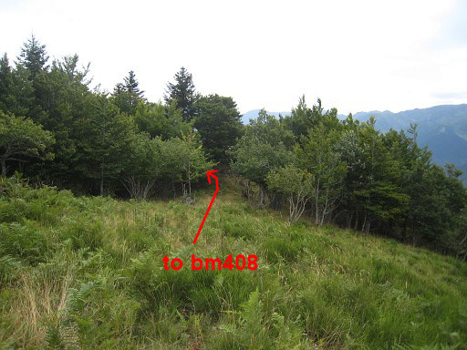
A zoom-in Back to bm408. From there it’s not easy to find bm408-1 without a gps, though it's not far (in a straight line NNE ± 130m). Remember, you have to descend quite a lot on this 130m of distance: ± 70m. Use your ears: the cascade / stream is audible when you get close. From the foot of the cascade, there’s a trail starting to the left (N), first vaguely but later more distinct, finishing at the back of Cabane de Hėrechet. In between, I do some searching for bm408-3 and -4 but to no result. |
 |
Then back to the camping in Fos. I'm tired. |