|
The
bordermarkers of the Pyrenees : all my trips
 |
|||||||||||||||||||||||||||||||
| - thursday 29 august
2013 - The lost bordermarker: bm330 |
 |
||||||||||||||||||||||||||||||
 |
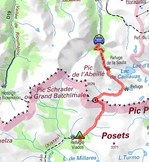
esfr-trip-track-20120829.kml (click to open this trip in Google Earth or copy link to Google Maps; click right on this link to download gpx-version) Summary: part of a 12-days trip to the Pyrenees with a lot of targets from the Ariège mountains to the Basque country Day 8: second day of a 2-days circuit from Pont du Prat visiting bm329 and the original bm330, today climbing from Viadós to Port d’Aygues Tortes (bm330) and then descending to Pont du Prat. Weather: improving, sun and passing clouds |
||||||||||||||||||||||||||||||
 |
For
explanation of
the gps-coordinates and other cartographic backgrounds: cartography-page Start: 8.00, break 13.30-14, finish:17.30 , net walking time: 9h According to the gps-tripteller: Distance: 21,7 km Total ascent: 903m Maximum height: 2685m |
||||||||||||||||||||||||||||||
 |
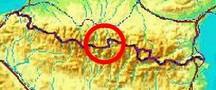
This map is more detailed but lacks a strip in Spain. | ||||||||||||||||||||||||||||||
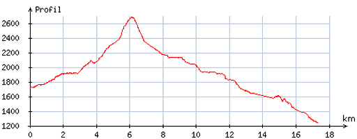 |
According
to visugpx - distance : 17,8 km - cum. elevation gain : 1101m - cum. elevation loss : 1580m - total elevation: 2681m - altitude maxi : 2682m - altitude mini : 1241m - altitude average : 1924m |
||||||||||||||||||||||||||||||
 |
From my bivouac-spot, I walk back to the GR11-trail and continue on it to the NE. When measured from the Refugio de Viadós, it will take you ± 3h to get to bm330. |
||||||||||||||||||||||||||||||
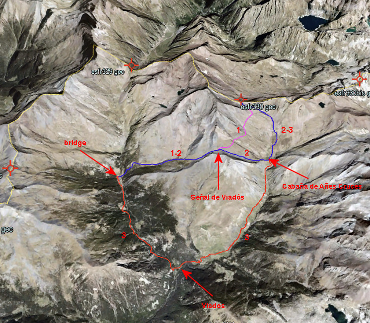
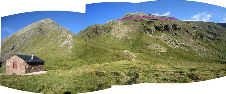
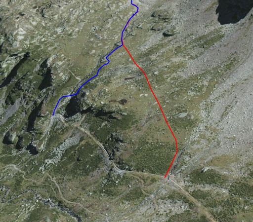
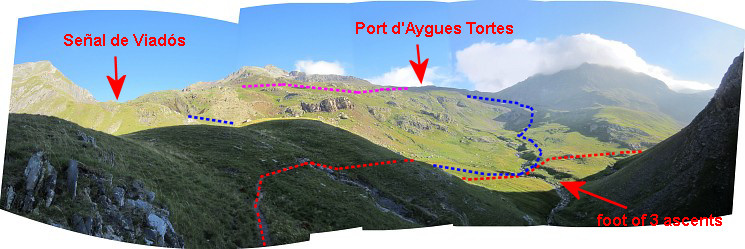 After ± 1½h, I’m at the foot of 3 ascents: - left (=W) leading up to Señal de Viadós (the blue line) - right (=E) where the GR11 continues (GR11 = the red line) - in front (=N) towards Port d’Aigues Tortes (alias “Puerto de Añes Cruces” on Spanish signposts) which is my direction (the continuation of the blue line) The pink line is the approximate shortcut from Señal de Viadós to Port d'Aygues Tortes Let's show these routes in a greater perspective on the map which I showed already yesterday. |
|||||||||||||||||||||||||||||||
 |
|||||||||||||||||||||||||||||||
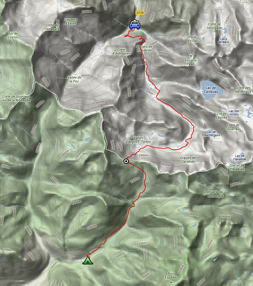
| It concerns the various options to get from the bridge at the foot of both bm328 and 329 to Port d'Aygues Tortes (bm330): 1. climb to Señal de Viadós and traverse to bm330 -> the blue/pink route 2. climb to Señal de Viadós, descend to the Cabaña de Añes Cruces and climb to bm330 -> the blue route 3. descend to Viadós, climb to Cabaña de Añes Cruces and proceed to bm330 -> the red/blue route |
|||||||||||||||||||||||||||||||
|
I concluded: considering that option 1
probably will take more time than scheduled because of the traverse on
the hillside and option 3 is likely to be faster because most of
it is on easy paths, there isn’t that much difference. Option 3 takes
you along the camping and refugio of Viadós. My advice: if you want the fastest connection -> try option 1, otherwise choose option 3. |
||||||||||||||||||||||||||||||
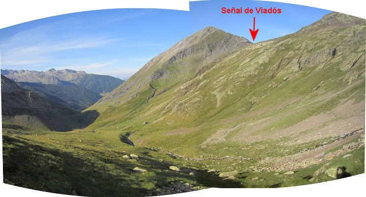
 This is the Cabaña de Añes Cruces, looking towards the pass of Señal de Viadós and (in pink) the approximate shortcut to Port d'Aygues Tortes. |
|||||||||||||||||||||||||||||||
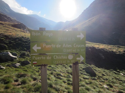 |
Remember: Puerto de Añes Cruces is the Spanish name for Port d'Aygues Tortes. |
||||||||||||||||||||||||||||||
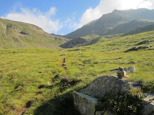 |
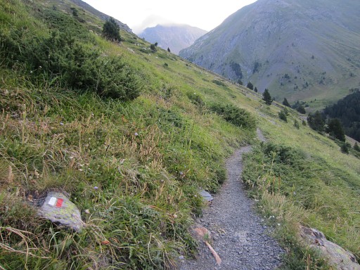
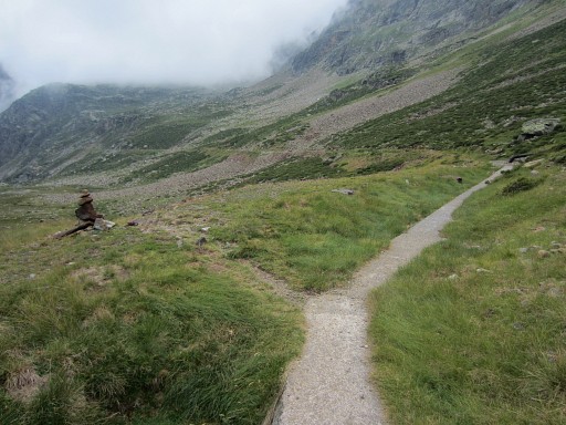
There’s a cairn-waymarked trail up to the Port and that takes me 1.45h. |
||||||||||||||||||||||||||||||
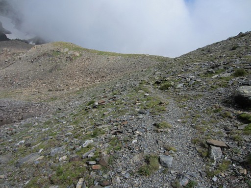
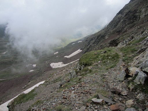
 On my way up to bm330 and looking back
|
|||||||||||||||||||||||||||||||
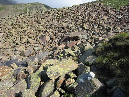 |
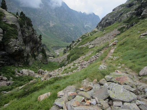
The trail crosses a rockfall |
||||||||||||||||||||||||||||||
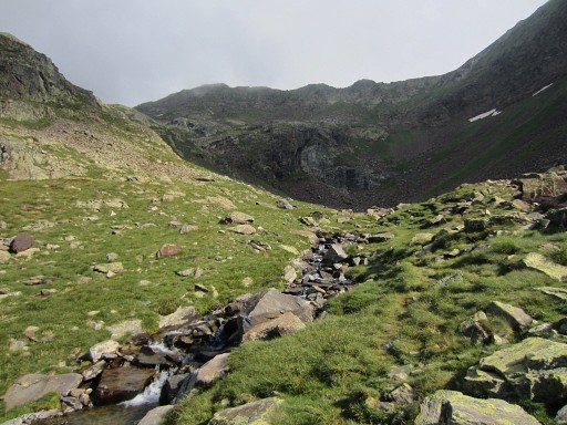 |
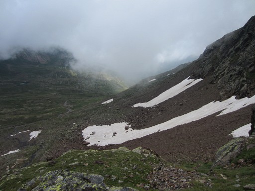
and it climbs further along this stream |
||||||||||||||||||||||||||||||
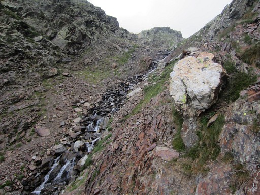 |
and the last part of the climb is quite steep up a ravine but overall there are no problems. |
||||||||||||||||||||||||||||||
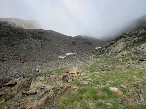 |
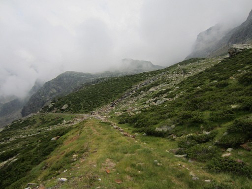
Finally I get closer to the borderridge |
||||||||||||||||||||||||||||||
 |
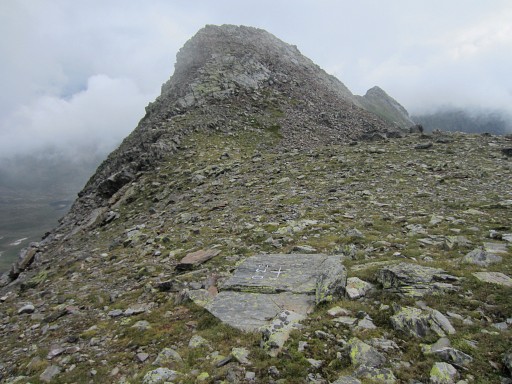
and now the Port d'Aygues Tortes comes in sight. |
||||||||||||||||||||||||||||||
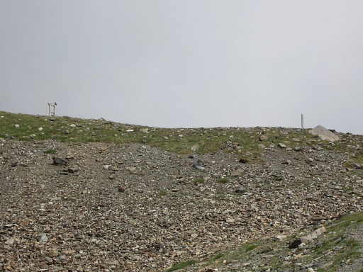 |
This is a zoom-in of the previous picture. There are two information posts on the Port. |
||||||||||||||||||||||||||||||
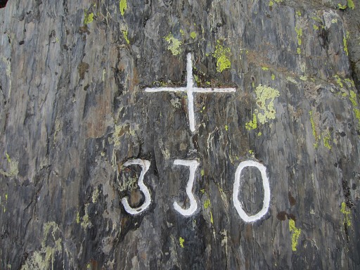 |
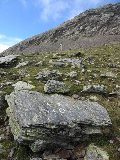
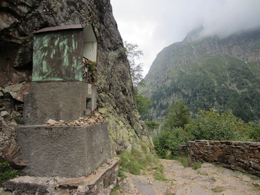
Bm330 is easy to find because of the
pictures I have from Jean-Paul Laborie, Charles Darrieu and Robert
Darrieumerlou. Moreover: cross and number are painted white now. |
||||||||||||||||||||||||||||||
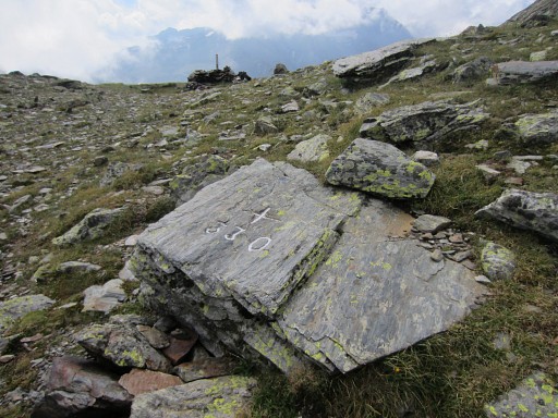 |
It’s located 20m NW of the information post surrounded by a small stone wall. |
||||||||||||||||||||||||||||||
 |
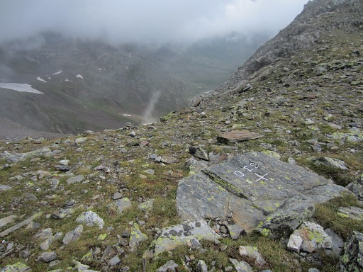
Bm330 was considered lost for many
years because the names of the borderpasses have changed on the maps in the course of time. Port d’Aygues Tortes used to be Port de Clarabide and that's where the Treaty of Bayonne of 1862 prescribed a bordercross. On the current Port de Clarabide - 3,5km to the E - a new bordercross 330 was engraved in 2003 because the original cross couldn’t be found there. Bm330 was refound in 2012 by Jean-Paul Laborie. See the Curiosities-page. This picture: note the second information post. |
||||||||||||||||||||||||||||||
 |
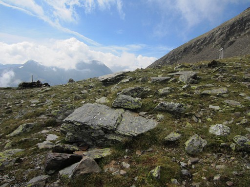
Bm330, looking into France |
||||||||||||||||||||||||||||||
 |
Bm330
|
||||||||||||||||||||||||||||||
 |
Bm330, now you can see both information posts. |
||||||||||||||||||||||||||||||
 |
Then descending along a well and cairns-waymarked path |
||||||||||||||||||||||||||||||
 |
through an extended rockfall. |
||||||||||||||||||||||||||||||
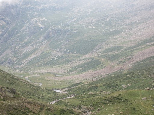 |
At the bottom of the valley |
||||||||||||||||||||||||||||||
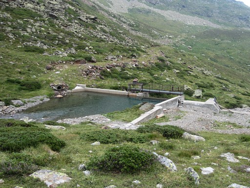 |
at a small barrage, |
||||||||||||||||||||||||||||||
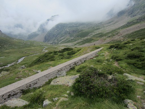 |
starts a concrete ridge covering a
huge waterpipe. That ridge extends to the E, keeping more or less the
same altitude. It’s easy to walk on or besides it. |
||||||||||||||||||||||||||||||
 |
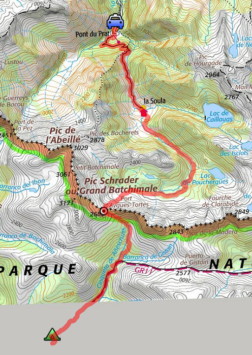
The trail crosses the concrete ridge
and descends further but I will follow the ridge because that's a
direct access to the ascent to Port de Clarabide (bm330bis) I want to check where you can leave the ridge and start the ascent. |
||||||||||||||||||||||||||||||
 |
There are two places where you can leave the concrete ridge to climb
towards Port de Clarabide. The first is where two steel pipes enter the concrete ridge and a stream comes from above. This seems the most obvious but needs a check on Google Earth . See further on. |
||||||||||||||||||||||||||||||
 |
Now you can see the black metal pipe entering the concrete ridge. |
||||||||||||||||||||||||||||||
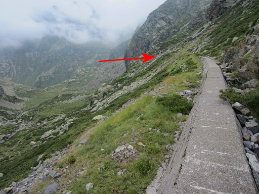 |
The second one is where the concrete ridge ends. That's where I climbed up last year: see this page. |
||||||||||||||||||||||||||||||
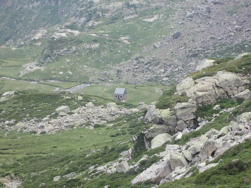 |
Far away I can spot the cabane de Prat-Casaneuve. When I get there later, the cabane is closed/locked. So apparently it's not a public cabane. |
||||||||||||||||||||||||||||||
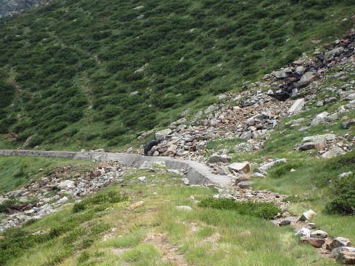
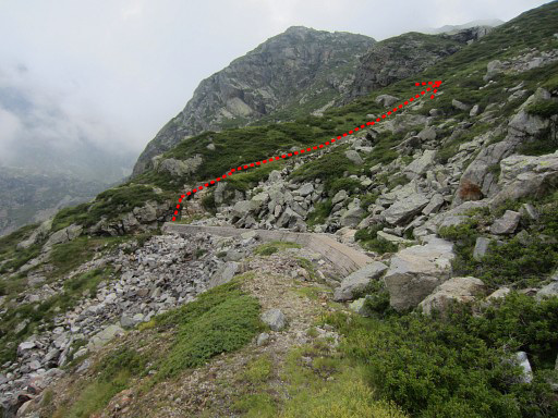 |
And now you can see the end of the concrete ridge and where to climb towards Port de Clarabide. |
||||||||||||||||||||||||||||||
 |
And now these 2 options shown on Google Earth. Coming from bm330, the red route is the most obvious. So: where the black metal pipes enter the concrete ridge -> climb the hill in eastern direction for ± 400m untill you reach a stream. Then follow the stream uphill, picking up the cairns which will lead you to Port de Clarabide. |
||||||||||||||||||||||||||||||
 |
I've seen enought and descend to the cabane de Prat-Casaneuve. From
Port d’Aigues Tortes to this cabane is ± 2h. I take a short break
besides it. Then from 14h to 17.30h a long descent through this long valley, |
||||||||||||||||||||||||||||||
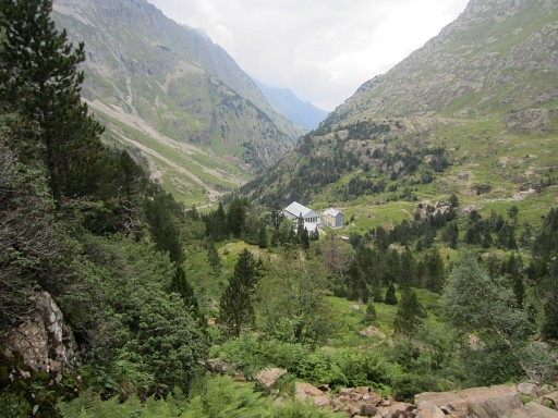 |
along Reguge la Soula |
||||||||||||||||||||||||||||||
 |
and this chapel to Pont du Prat. Then driving back to the Loudervielle-camping. The next day I will spend a day in Lourdes. |
||||||||||||||||||||||||||||||