|
The
bordermarkers of the Pyrenees : all my trips
 |
|
| -
thursday 29 may
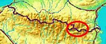
2014 - Around Llivia |
 |
 Summary: a one-week trip to the
Pyrenees with Jan-Willem, covering various
targets from the Atlantic ocean up to Llivia and including a meeting
with 'Murgoi'. Summary: a one-week trip to the
Pyrenees with Jan-Willem, covering various
targets from the Atlantic ocean up to Llivia and including a meeting
with 'Murgoi'.Today: we try a direct access to Llivia-22, (trip 1), revisit several bordermarkers in Bourg-Madame (trip 2) and check a little part of the GRPdesBF (trip 3). Our basecamp is camping Las Closas in Err. Yesterday we made the transer from Bagnères de Luchon t0 Err with a very pleasant visit in-between to Charles and Josette Darrieu. Weather: dry, lightly overcast |
|
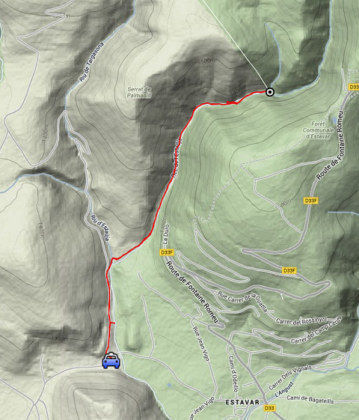 |
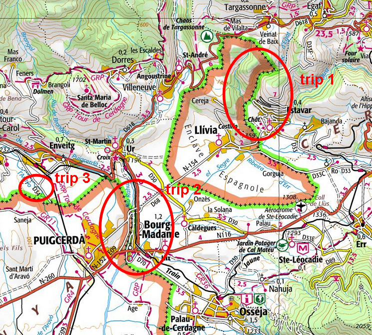
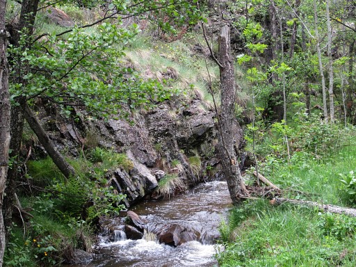
Trip1 esfr-trip-track-20140529-trip1.kml (click to open this trip in Google Earth or copy link to Google Maps; click right on this link to download gpx-version) Small trip to see if you can reach LL22 by following the borderstream upstream. Answer: yes, you can. To our surprise there's a trail at its w-bank up to LL22. |
 |
For
explanation of
the gps-coordinates and other cartographic backgrounds: see the cartography-page Start: 10.30, no break:, finish: 13.30, net walking time: 3h According to the gps-tripteller: Distance: 5,4 km Total ascent: 131m Total denivellation: 262m Maximum height: 1380m Total time: 2.54h |
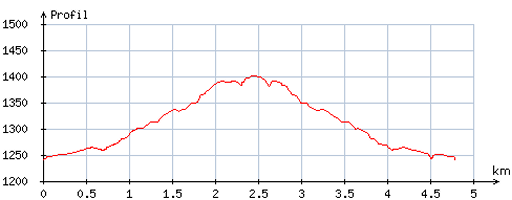 |
According
to visugpx - distance : 4,8 km - cum. elevation gain : 156m - cum. elevation loss : 149m - total elevation: 305m - altitude maxi : 1401m - altitude mini : 1240m - altitude average : 1307m |
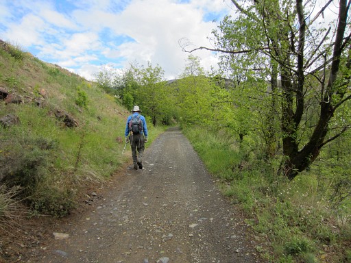 |
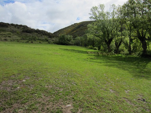
On our way, having parked our car at the dirtroad between Estavar and Llivia. That dirtroad is more manageable on the Llivian side. |
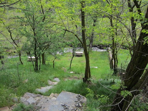 |
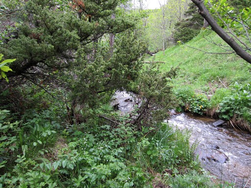
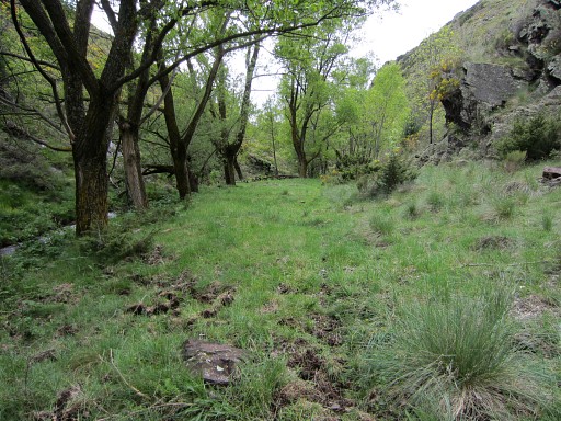
A small picknick-spot to the right, a trail passes the stream on a footbridge. You could bivouac here though flat space is limited and the water of the stream seems not safe enough to drink. The bridge over the stream could be useful to reach LL22 as an alternative access (see further on) |
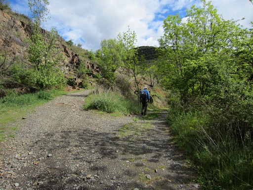 |
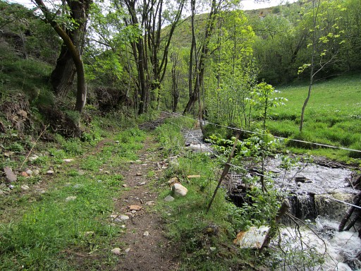
Here we leave the main dirtroad and descend on a branch to the stream which can be crossed by a bridge. From there it's simple: just follow the w-bank of the borderriver. |
 |
But there's one
problem: at the beginning there's a horse-meadow, now empty and open
but otherwise - if you don't want to disturb the horses or farmer - an
obstacle. Then there are two options: 1. Go left around the horse meadow and descend further on to the stream 2. Earlier on the route, there's a picknick-spot near the stream with a footbridge to cross the stream. At the E-bank you can then walk upstream until the fence of the horse-meadow at the other side ends. Then cross the stream to the w-bank. |
 |
But now, we are lucky and can cross the meadow. At the end of the horse- meadow, a kind of dirtroad appears which becomes a trail leading you |
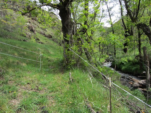 |
to the end of the fence. |
 |
Then the trail continues, gets vaguer but is still easy to follow until LL22. Reckon ± 1.15h from the bridge just before the horse-meadow until LL22. |
 |
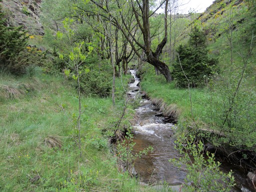
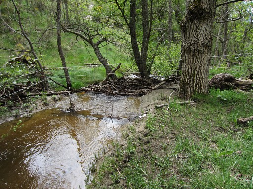
At one point you have to cross the stream because a rockwall blocks progress on the w-bank. (we took off our shoes and waded through it) |
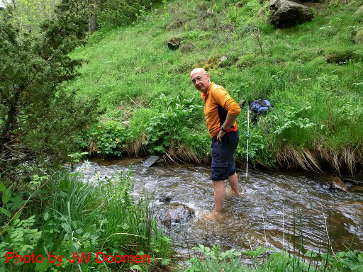 |
Crossing is easy here. |
 |
Jan-Willem needed a little persuasion to leave the comfortzone of his warm and dry shoes |
 |
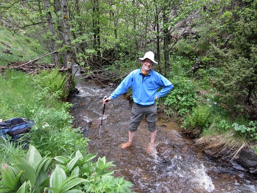
This is the steep rockwall blocking the path at the w-bank. We tried to take a detour above it but that was too steep. Crossing the stream is far easier. |
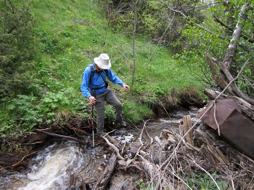 |
After ± 20m you can easily cross back. You could also continue on the E-bank and cross it later but it seems easier to switch to the W-bank because of the trail on the W-bank. |
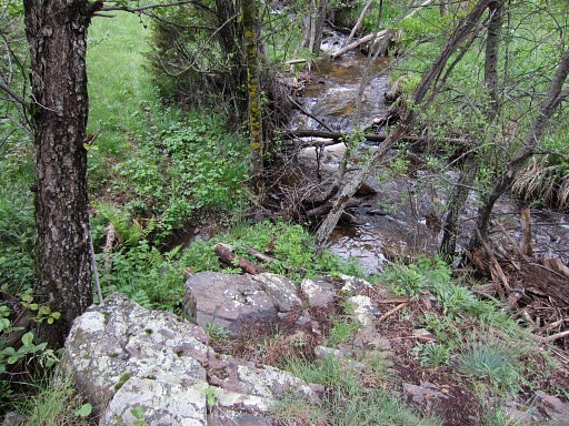 |
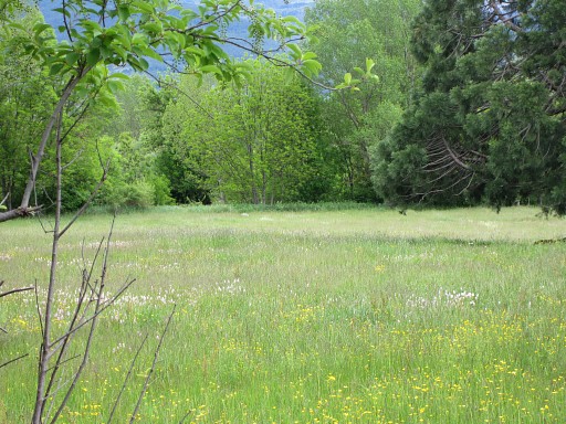
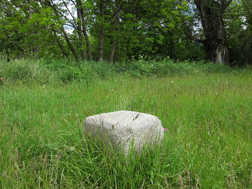
And then LL22 is not far away: where a small stream coming from the N merges with the borderriver. |
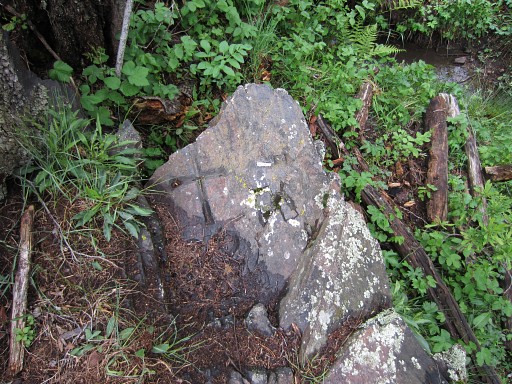 |
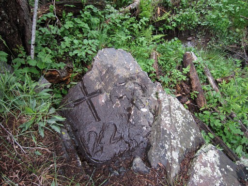
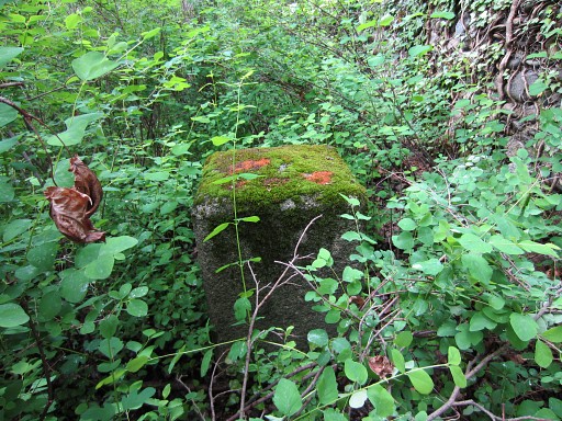
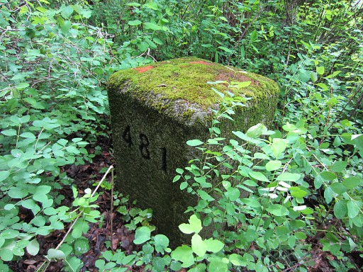
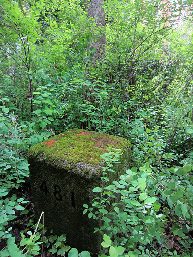
LL22, it's number needs some cleaning. |
 |
LL22 |
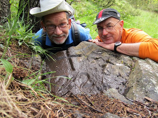 |
LL22 with your bm-investigators. |
|
We return the same way. |
 |
Back at the entrance to the horse-meadow. |
 |
To
the left a crossing seems possible from or to the other side of the
stream to continue on the E-bank to (or coming from) the
picknick-spot. Back at the car, we are content and treat ourselves with a "grand café crème" in LLivia. |
 |
Trip 2 To Bourg-Madame for several targets |
 |
We first visit the French customs-office at Rue des Narcisses in Bourg-Madame
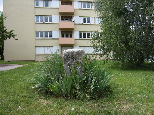
where the old bm481 and 482 can be found. The old bm482 still stands before the apartment-building. |
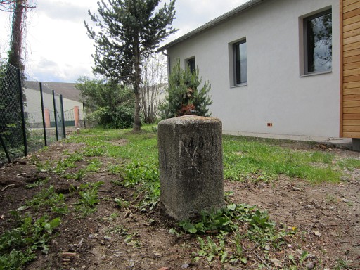 |
Bm481-old has been erected again after the building of a new office/garage. |
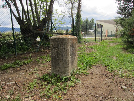 |
Bm481-old |
 |
Bm481-old |
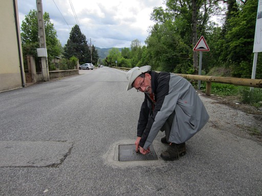 |
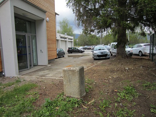
Then to the original spot of bm481 Here the bronze plaque replacement on streetlevel has been covered in ±2012 by a new layer of tarmac, then later made visible again by a hole. See this page. Now we find a metal plate covering the hole. |
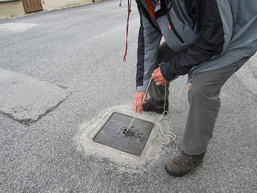 |
We manage to remove the cover, |
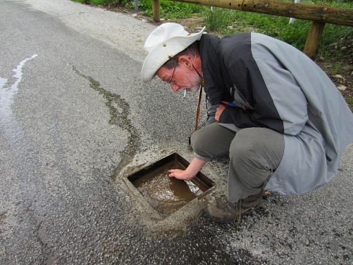 |
wipe away most of the water in it and |
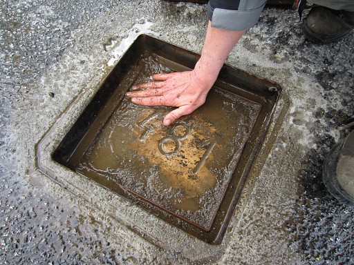 |
expose the plaque
with the number 481. It's a quiet on the street because it's Ascension Day, that helps. What strikes: the round placque is a lot larger than I previously thought. |
 |
The hole closed again. |
 |
Another picture to show its position. |
 |
Then we redo bm482es Access via the allotments-dirtroad, this is the end of that dirtroad. I already tried the path along the Rahur to see if that provides an access to the meadow but that ends too soon |
 |
You can spot bm482es in the far distance. There are no cows now in
this part of the meadow. |
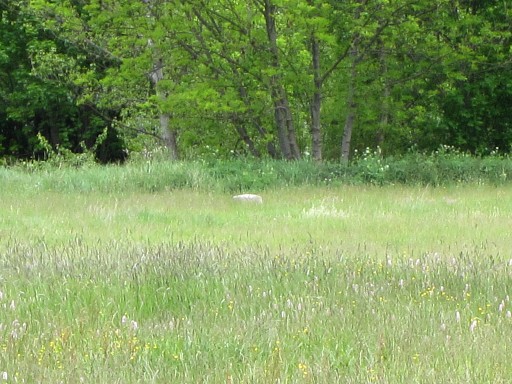 |
Further zoom-in |
 |
It's a short walk through the meadow to the bm. |
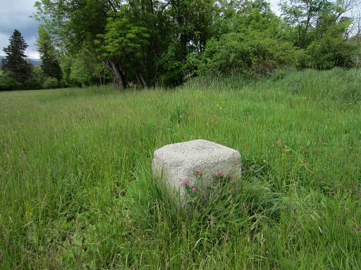 |
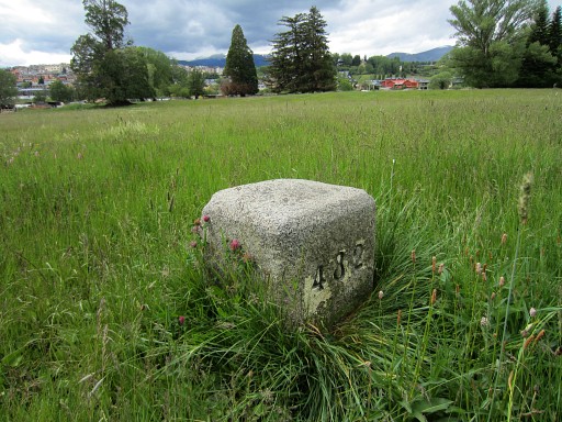
Bm482es |
 |
Bm482es |
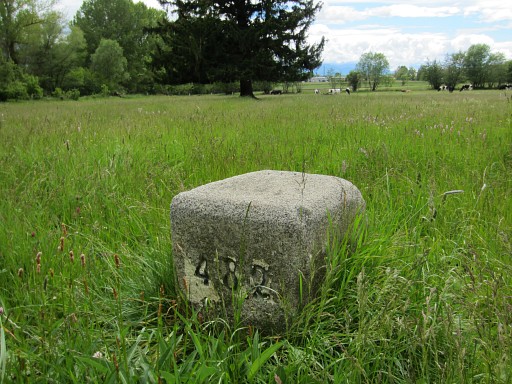 |
Bm482es |
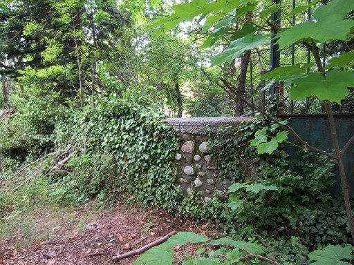 |
Then back to the bridge over the Rahur to do bm481es. I sneak once again, climbing over this wall along the Rahur, into the garden of the villa which looks deserted for many years. At the streetside, the gate is locked from the outside so I assume no one is inside on the premises. |
 |
When you have climbed over the
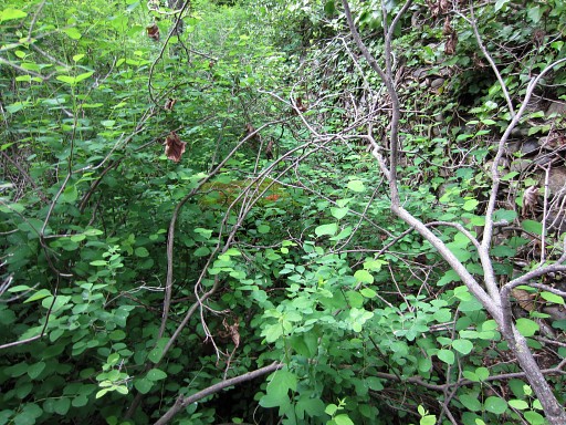
wall - which is easy - go left. Bm481es is hidden in a bush ± 1m from the wall. You have to enter the bush to spot it. It gets more overgrown every year. |
 |
Bm481es |
 |
Bm481es |
 |
Bm481es |
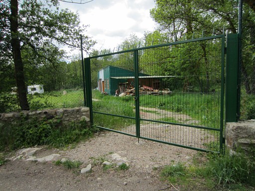 |
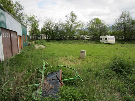
Then a walk to bm478fr to see if by chance the gate of the fence is open. But no, the meadow annex caravan storage is still inaccessible |
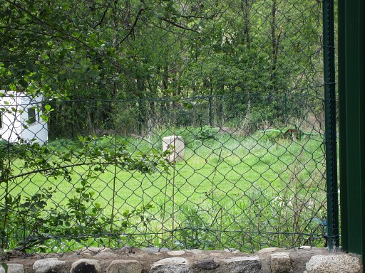
|
behind the high and sturdy fence. |
 |
But the grass is much lower than last year |
 |
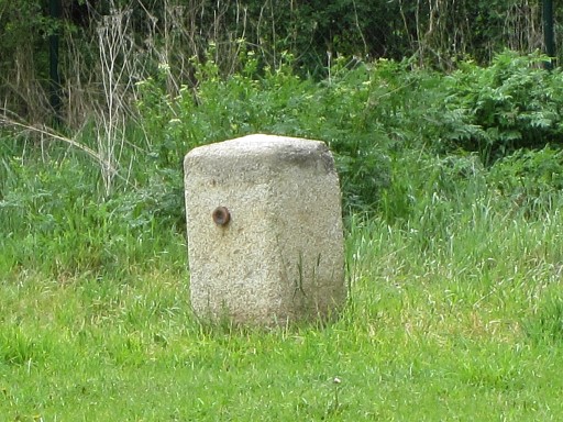
and from the riverside the bm can be well photographed (still from behind the fence) |
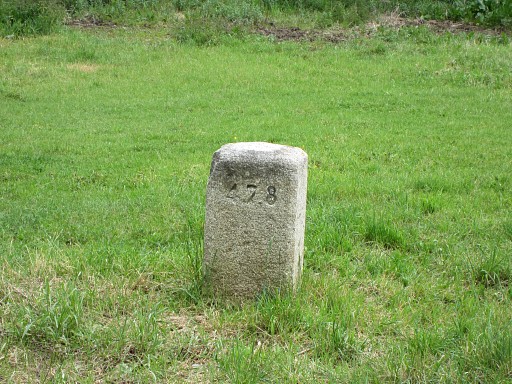 |
Bm478fr |
 |
Then - while walking back to the car - 'doing'
bm470fr from behind the fence. |
 |
A lady inside the garden is afraid that we photograph the playing children of this children's home. |
| Trip 3 Finally a drive to Enveitg to the Rue de la Vignole to where a bridge crosses the river. I want to check if a crossing of a farmyard is allowed or not. The main GRPdesBF-trail passes here the farmyard but avoids in principle tresspassing of private property. On this arial view: the red line shows where we checked the route, the blue dotted line is the GRPdesBF in its first design. But unfortunately (or you might say: being unprepared), I didn have this map with me. 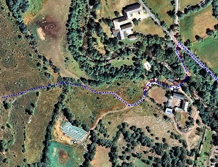 |
|
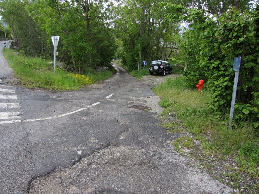 |
This is the road descending to the bridge |
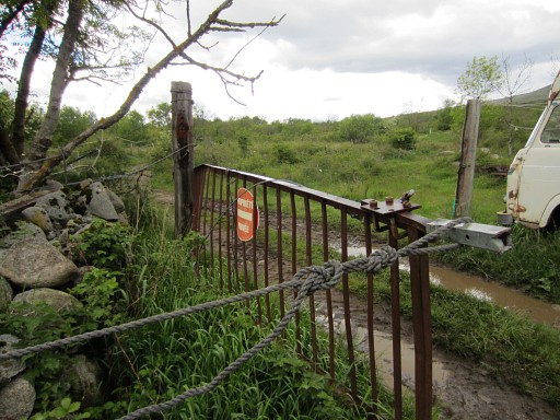 |
Beyond the bridge, a dirtroad brings us right around the farmhouse to this gate (which seems permanently
open). The red sign says it's "private property". But that doesn't necessarily imply 'entry forbidden'. |
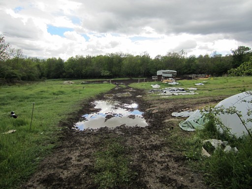 |
But the dirtroad ends in a very muddy
meadow. But what is confusing: we have spotted some blue waysigns until the gate, suggesting that is has been used as a walking route. I happen to see the farmer and he says that there is no on-going trail and that it is indeed private property. |
| But
back at home, I discover that the GRPdesBF-route has a different
course to get to the farm and its bridge. And we didn check that route
(the blue dotted one). For the time being, I keep the GRPdesBF
like that and will check it again next time I'm in LLivia. |
|
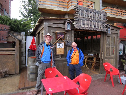 |
Finally we drive back to LLivia to have a delicious dinner in the same cute cafe-restaurant where we had our coffeebreak. End of our Pyrenees-trip. Tomorrow we will drive back to the Netherlands via Perpignan, Lyon and Liège. |