|
The
bordermarkers of the Pyrenees : all my trips
 |
|
| - sunday 7 september
2014 - Three trips along the Garonne |
 |
 |
Summary: part of a 2-weeks trip along the entire Pyrenees, focussing on
high altitude reconnaissance of parts of my GRPdesBF-trail. Today: some explorations near Fos, mainly along the Garonne. It's also a transfer-day: from a camping in Bagnères-de-Luchon to a camping near Tavascan. Weather: warm, sunny |
 |
Trip 1 esfr-track-20140907-trip1.kml (click to open this trip in Google Earth or copy link to Google Maps; click right on this link to download gpx-version) Just a short walk to check if the dirtroad W of the canal is public or not. |
 |
For
explanation of
the gps-coordinates and other cartographic backgrounds: see the cartography-page According to visugpx - distance : 1,3 km - altitude average : 543m |
 |
This is the bridge over the canal. On the other side goes my GRPdesBF-trail along the canal. From the right comes the GR10-trail and crosses this bridge towards Fos. The GRPdesBF-trail however continues along the canal. But is that allowed or not? |

|
I'm now at the other side looking SE. Well: there are 'private property'-signs but |
 |
there's a yellow waymarked trail going along it. So: the answer is yes, apparently it is allowed to walk here. |
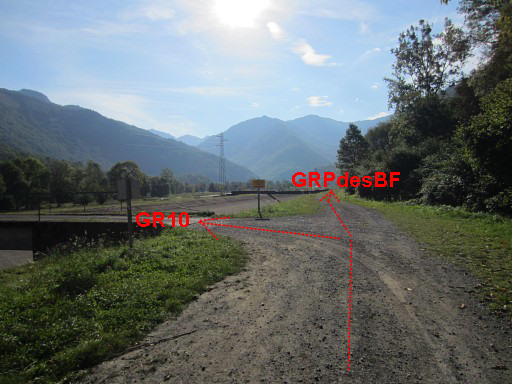 |
Same direction of view but a bit backward. To the left the bridge which the GR10-crosses. The GRPdesBF goes straight on. |
 |
Trip 2 esfr-track-20140907-trip2.kml (click to open this trip in Google Earth or copy link to Google Maps; click right on this link to download gpx-version) This is mainly a check if the continuation further on to the barrage-lake is a public path or not. The answer is yes and I could have known that before. The traffic sign allows walkers. And a first search for Cross D of the four crosses delimiting the Terrain Indivis of Bidaubus. See this page for their background. |
 |
For
explanation of
the gps-coordinates and other cartographic backgrounds: see the cartography-page |
 |
According
to visugpx - distance : 9,6 km - cum. elevation gain : 221m - cum. elevation loss : 218m - total elevation: 439m - altitude maxi : 614m - altitude mini : 546m - altitude average : 575m |

|
Point of departure. I cross the new road towards the blue building which is an electricity building. |

|
These signboards are on the other side of road with |
 |
this one pointing to Cabane d'Héréchet which is the access to the bm408-submarkers. |
 |
Looking NW, where the GRPdesBF comes from. At the other end (trip 1), yellow waysigns 'allow' access to this dirtroad. |
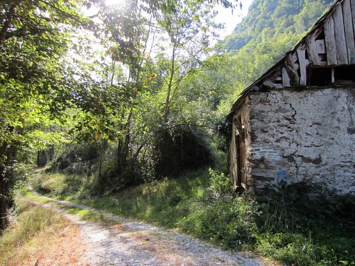 |
A bit futher S this old barn. Behind the barn, the trail to Cabane d'Héréchet begins. |
 |
Further on, there is at the roadside |
 |
this signboard, saying “only for proprietors”. The signboard as such forbid cars/vehicles but - when I checked that on the internet - not walkers. So there's no problem walking on there. |
 |
I continue. |
 |
Further on there are waysigns of a (nature education-) trail. The GRPdesBF however continues on the dirtroad. |
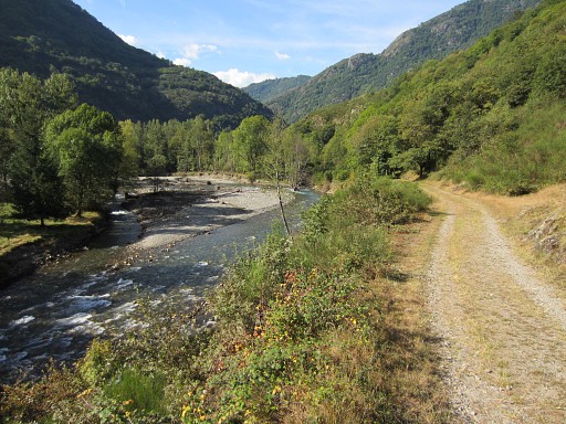 |
Further on this nice view of the Garonne |
 |
By the way: there are two nice bivouac-spots along the dirtroad leading to the barrage. This is the first. However: no fresh water around. |
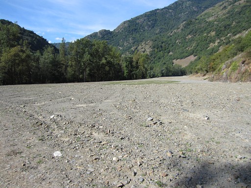 |
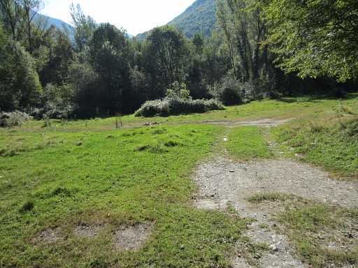
Then I arrive at this terrain, stripped from its trees in recent years. Why? I don't know. At the end the dirtroad appears again, and |
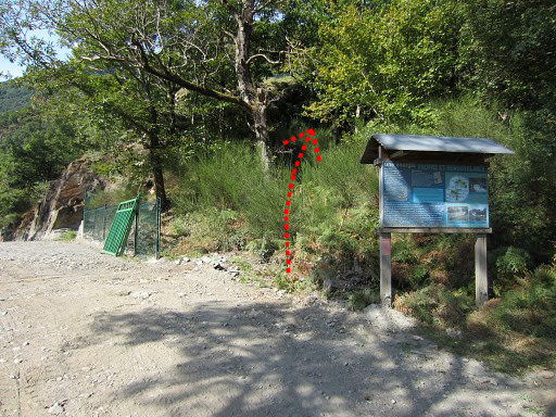 |
arrives at the barrage. The gate is open now but you don't need access to the premises as the red arrow shows. That's where the (nature education-) trail continues. |
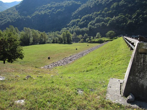 |
This is the second opportunity for a bivouac: on the vast meadow at the foot of the barrage-dam. But: no fresh water nearby, you have to bring it. But there's no (reliable) source nearby. Either you collect – a few kilometers earlier - water from the stream (Ruisseau de la Batch) which descends along the GR10 to the Garonne-valley, either you get your water from the Ruisseau du Terme at bm409 further on (0,6 km). But at bm409 there's also some place for a bivouac. |
 |
From the barrage looking upstream with the approximate spot of bm409 indicated. |
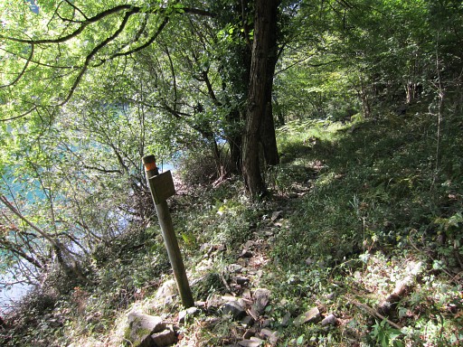 |
I
decide to continue: the trail from the barrage-dam up to bm409 is vague
in places (but simple in its overall course = along the lake). Some
waymarks help |
 |
and in some parts there are cords attached. |
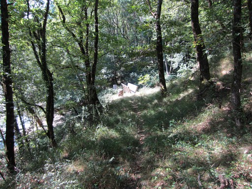 |
The footbridge over the borderstream of Ruisseau du Terme in sight. From the bridge onwards the trail is better. |
 |
As you can see, this spot also provides some bivouac-place and there's the advantage of fresh water from the borderstream. |
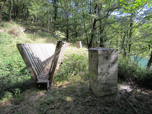 |
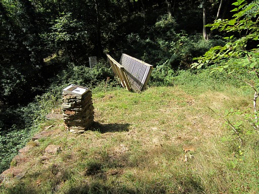
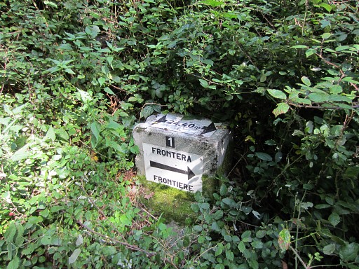
Bm409 |
 |
Bm409 with a peculiar round stone at his foot. |
 |
That stone in detail. There's a 'B' engraved but that's hard to see on this picture. |
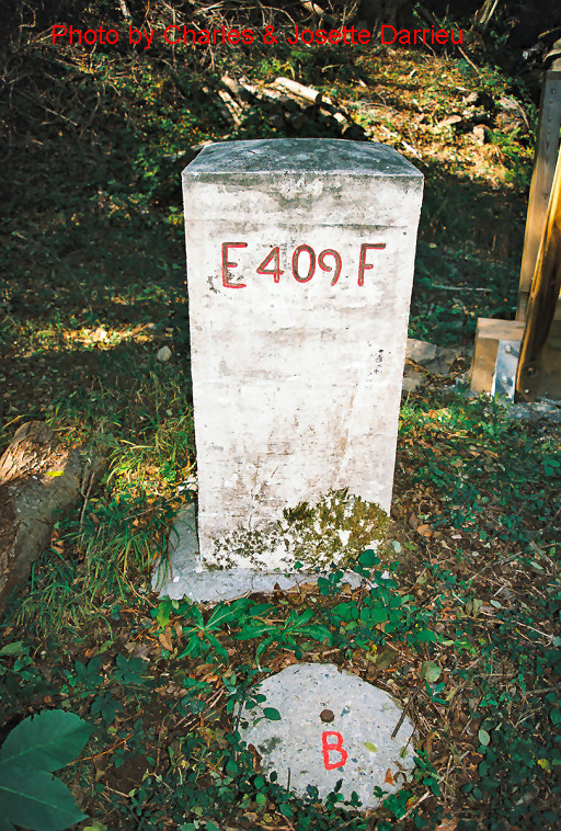 |
This picture - kindly provided by the Darrieu's - shows the 'B' well. |
 |
The submarker (no.1) down below can be easily reached from the lakeside via a little detour clockwise. |
 |
At the lakeside, the borderstream at my feet. |
 |
The submarker is hard to see in the undergrowth. |
 |
Zoom-in of previous picture. |
 |
And the submarker after some cleaning. Then continuing along the trail. |
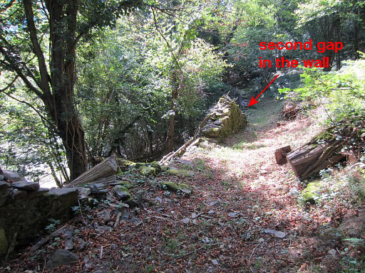 |
I'm now almost at the spot (second gap in the old wall) where to descend to submarker 3. To my surprise afterwards I must have passed submarker 2 without noticing. Note: the submarkers 3 and 5 are down by the river, the numbers 2-4-6 along the path, no. 7 via a little descent left of the path. |
 |
The second gap in close-up |
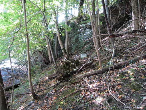 |
Submarker 3 from some distance. |
 |
Submarker 3. Back to the trail and continuing. |
 |
Then I climb the rocks (“Mail”?) above the trail between submarkers 2 and
3 to search for Cross D of the four crosses delimiting the Terrain Indivis of Bidaubus. See this page for the backgrounds. Climbing to it is easy but my search is in vain. |
 |
But the rock provides this nice view to the N and |
 |
this one to the S. |
 |
Submarker 4, along the path |
 |
Submarker 5 which needs a little descent. |
 |
Submarker 6, along the trail. |
 |
And this is the spot where you have to descend |
 |
to submarker 7 |
 |
Submarker 7 |
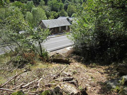 |
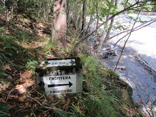
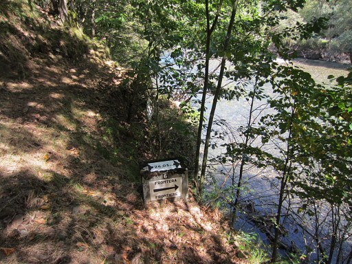
Further on, the trail descends to the road. |
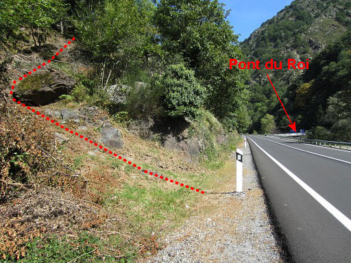 |
This is where the trail joins the road. In the distance: Pont du Roi. |
 |
Same spot but now looking S and the arrow showing the beginning of the trail. |
 |
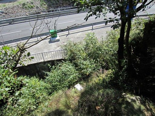
I continue to Pont du Roi. In fact there are two bridges: the old Pont du Roi and a newer broader one. This picture taken from the old bridge: you can see how the borderstream descending from bm411 is tunneled beneath the road. |
 |
This waysign points to a trail which traverses on the E-side of the Garonne to the hamlet of Pontaut. I have tried that before but in the forest I couldn't find a trail or waymarkings. It confirmed my choice to walk along the main road from Pont du Roi to Pontaut. It's a busy road with a lot of heavy traffic but you can walk safely on the roadside and it's only 1,5 km. |
 |
Then I walk back to the car. First along the French road to Fos until the barrage. This is a view from the road to the W, towards the borderline = the Ruisseau du Terme. |
 |
I climb illegally over the gate to the barrage-dam. This is the large field which could suit you for a bivouac somewhere along its sides. Then I return to the car as I came. |
 |
Trip 3 esfr-track-20140907-trip3.kml (click to open this trip in Google Earth or copy link to Google Maps; click right on this link to download gpx-version) From the hamlet of Pontaut: looking for bivouac spots at the other side of the river. |
 |
For
explanation of
the gps-coordinates and other cartographic backgrounds: see the cartography-page According to visugpx - distance : 1,3 km - altitude average : 611m |
 |
At the other side of the bridge, there's a meadow to the left but blocked by a fence and quite in sight of passengers-by. Then - at the bend of the tarmac road - there's a dirtroad to the left. It crosses after 50m a stream (Arriu de Toran) which is at that spot not easy to reach because of its deep streambed. A bit further: this waysign: - to the right is climbing to Canejan on a winding path - straight on is the trail to Pont de Roi on the E-side of the Garonne. I go straight on. |

|
A dirtroad leads to |
 |
a half-ruined farm where an old man lives. |

|
There's
a large meadow besides/behind the farm but you should ask permission from the
old man to camp here. Still: no fresh water here, neither at the watertaps near the bridge itself. I ask the old man where the trail to Pont du Roi continues. It's either along the right side of his house (which is quite overgrown) or by crossing the meadow at the left. That's what I do. |
 |
Behind the house - ± 50m further along the forest-edge - there's this entrance into the forest. |
 |
A bit further in the forest : a distinct trail visible but there's no waymarking whatsoever. Conclusion: the trail seems hardly or not waymarked apart from the beginning on either side. As said before: it confirms my choice to walk along the main road from Pont du Roi to Pontaut. It's a busy road with a lot of heavy traffic but you can walk safely on the roadside and it's only 1,5 km. |
 |
Another feature close to the bridge:
watertaps in a rebuilt clothes-washing building. However: no running
water, the taps are dry. |
 |
Back to my car where I see that there's still a busstop |
 |
in Pontaut which connects with Vielha. Then: driving – via the mountainpass of Puerto de la Bonaigua to |
 |
camping Bordes de Graus near Tavascan. I arrive there when a fierce thunderstorm breaks loose. But the camping's cafe provides a friendly shelter. |