|
The
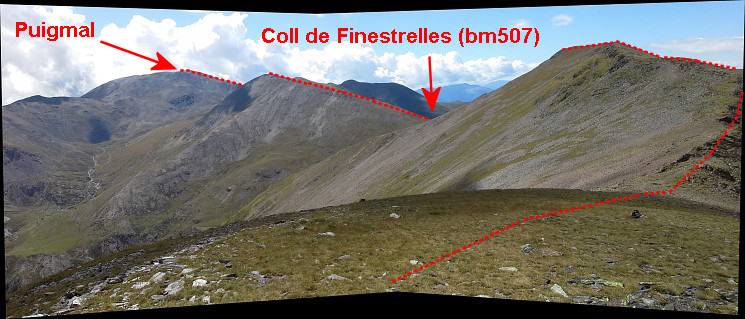
bordermarkers of the Pyrenees : all my trips
 |
|
| - wednesday 10 september
2014 - Visiting the new bm510 |
 |
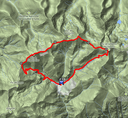 |
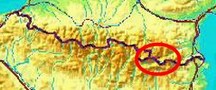
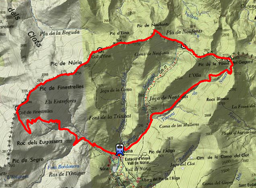
esfr-trip-track-20140910.kml (click to open this trip in Google Earth or copy link to Google Maps; click right on this link to download gpx-version) Summary: part of a 2-weeks trip along the entire Pyrenees, focussing on high altitude reconnaissance of parts of my GRPdesBF-trail. Today: a trip from Núria to bm510 and then going W over the borderridge to bm507 and descending back to Núria Weather: sunny |
 |
For
explanation of
the gps-coordinates and other cartographic backgrounds: see the cartography-page Start: 10.15, finish: 16.30, net walking time: 6.15h Gps-tripteller: no stats due to partial gps-failure |
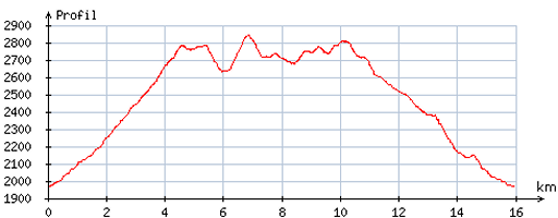 |
According
to visugpx - distance : 16,3 km - cum. elevation gain : 1207m - cum. elevation loss : 1201m - total elevation: 2408m - altitude maxi : 2841m - altitude mini : 1967m - altitude average : 2566m |
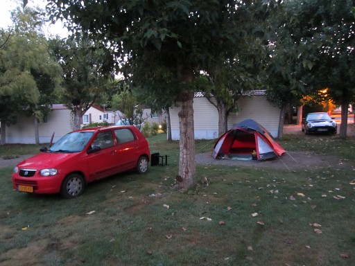 |
The camping in Err where I slept the last two nights. I pack my tent and drive to Ribes de Freser where I take the train to |
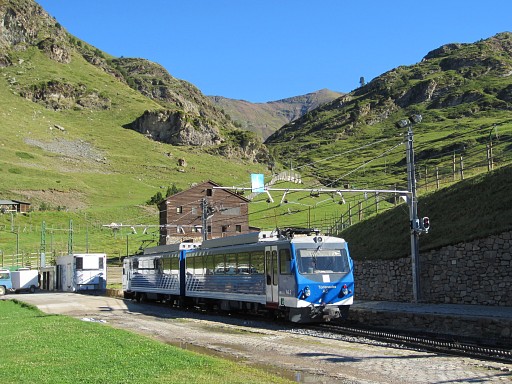 |
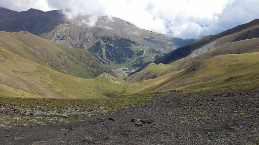
the pilgrimage site of Núria where I arrive at 10.15h. |
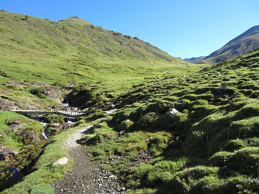 |
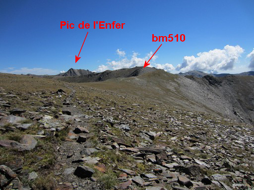
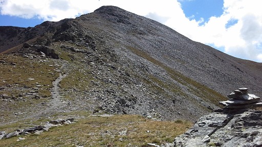
Then taking the trail to Coll de Noucreus |
 |
which comes in view on this picture. |
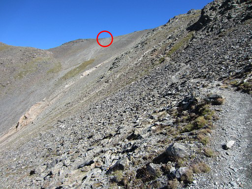 |
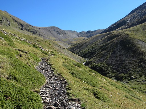
The last part with the pass visible. |
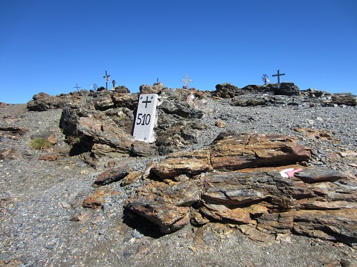 |
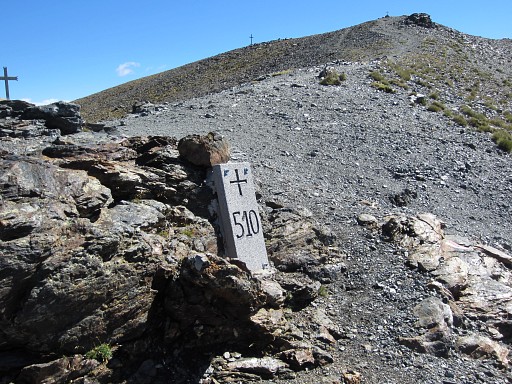
At 12h at Col de Noucrous. Bm510 has been replaced in 2013, the original marker was destroyed since many years. See my blog |
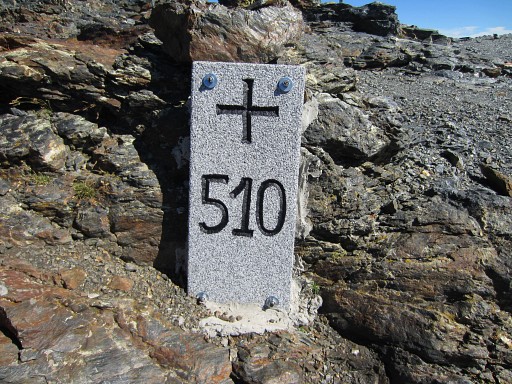 |
Bm510 |
 |
Bm510, looking W |
 |
Bm510, looking E |
 |
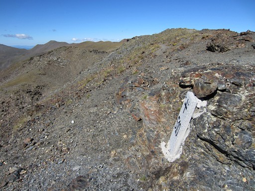
The trail (GR11) continuing E |
 |
A last view - looking W - of this spot with its peculiar crosses. |
 |
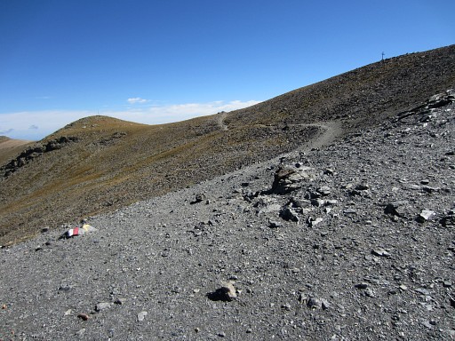
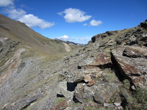
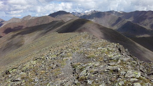
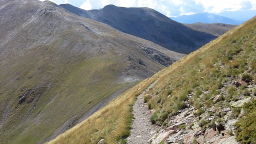
Then following the trail to the W over the borderridge until Coll de Finestrelles The denivellation in between is considerable, the trail is well and in general leads you over the borderridge itself. |
 |
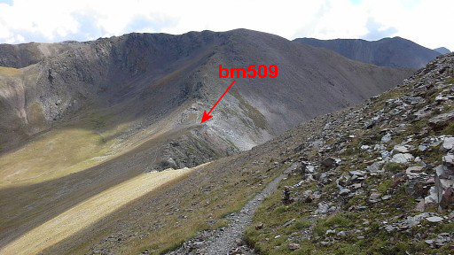
Further on, looking back to the E. Then the descent to Col de Noufonts with bm509 starts |
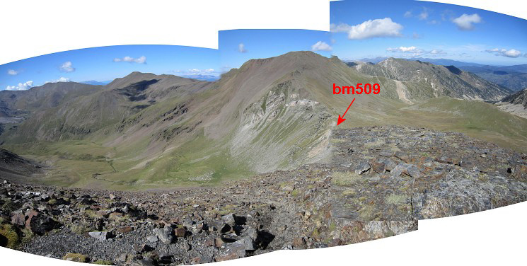 This panorama (looking E) shows two things: Col de Noufonts with bm509 AND at both sides green valleys where a bivouac with water-supply seems possible without having to descend too much. That's important to know when doing my GRPdesBF-trail. That trail follows this high-altitude borderridge for a long, long stretch without direct access to water and hardly suitable bivouac-places. To the S (descending into Spain) will bring you after 150m elevation descent to a stream. To the N the descent is less but if there's running water there, is doubtful when studying the pictures and Google Earth. |
|
 |
Getting close to Col de Noufonts with the stone cabin already visible |
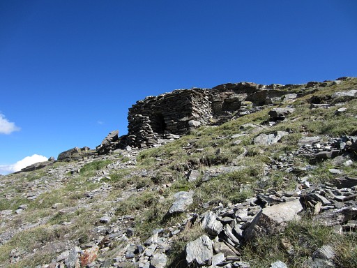 |
It's small |
 |
and has a low ceiling but it could be a very helpful shelter in bad weather. |
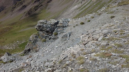 |
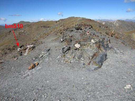
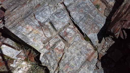
At the col this rocky outcrop |
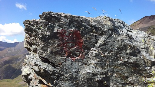 |
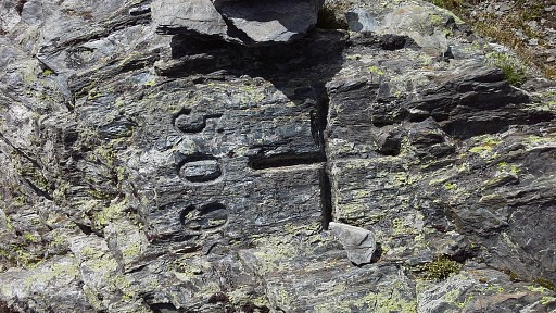
with this peculiar engraving "509". I spotted this already on my first visit here on 20050713 The real bm509 is however ± 35m further NW |
 |
at this spot |
 |
Bm509 |
 |
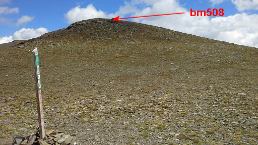
Bm508, looking E |
 |
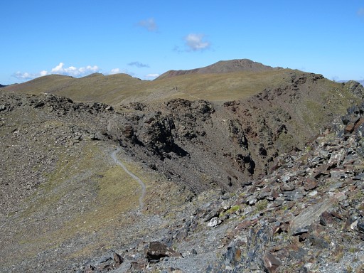
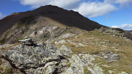
Further on, looking back to Col de Noufonts with bm509. From Col de Noufonts it's a considerable climb |
 |
to Pic de Noufonts with this view to Núria far away in the valley. And a view ahead with the borderline. |
 |
|
 |
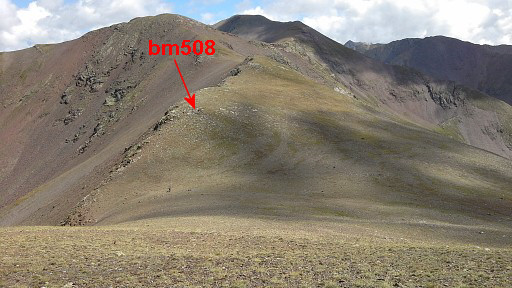
Close to Coll d'Eina (or Col de
Núria)- 75m uphill to the E - there's bm508. That is to say: the cross
that's left of the cross and number 509. Why am I sure? Well: the location fits perfectly in the description of the treaty and the cross has a large resemblance with the other crosses around (bm409 and bm407) |
 |
Bm408, looking uphill to the E It's hidden behind a halfcircle or wall of rocks. |
 |
Bm408, looking W to Coll d'Eina (or Col de Núria) |
 |
Coll d'Eina (or Col de Núria) with its waymark and looking E. |
 |
I have continued and now look back at Coll d'Eina. |
 And approximately from Pic de Núria, looking W. with the borderline.
|
|
|
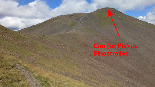
Looking back to the E, just before arriving at Cim (or Pic) de Finestrelles. |
|
Further on, you will pass beneath the Puig del Coll de Finestrelles with this view back to the E to Cim (or Pic) de Finestrelles |
|
and approximately from the same spot, looking forward to Coll de Finestrelles. |
|
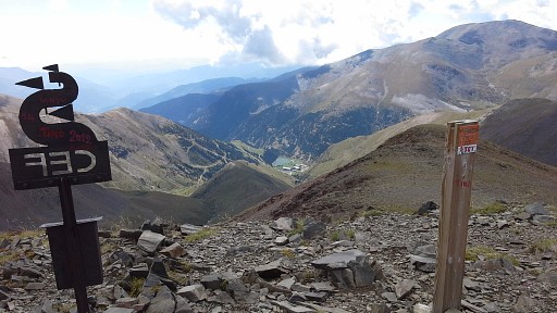
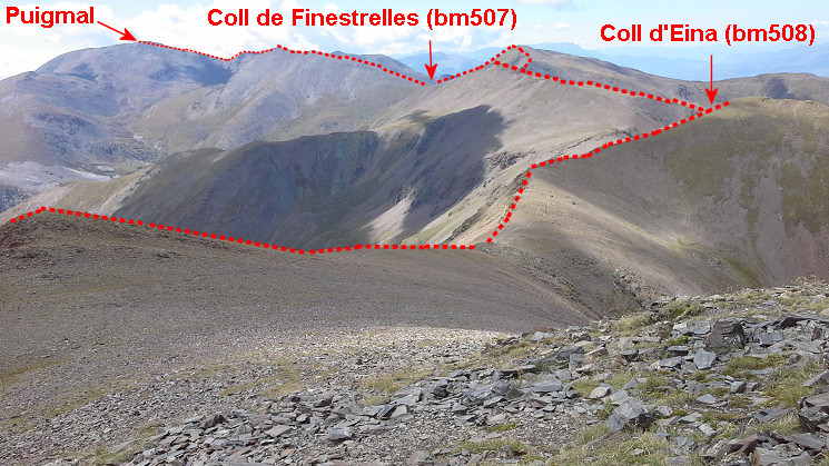
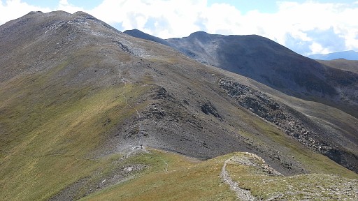
Getting closer to Coll de Finestrelles
with a fine view of the continuation of the trail over the borderridge
to the Puigmal de Segre |
|
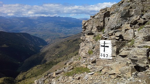
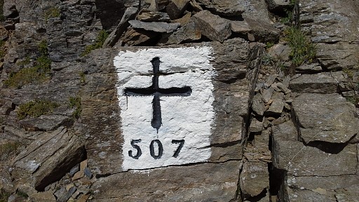
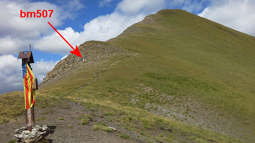
Bm507 is not at the Coll itself but ± 100m uphill to the N of it. |
|
Bm507 |
|
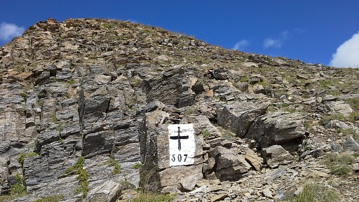
Bm507 |
|
Bm507, a bit lower |
|
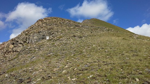
At 15h at Col de Finistrelles. Bm507 is visible as a white spot. |
 |
Then descending back to Nùria |
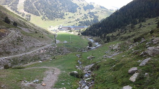 |
which takes quite a while. |
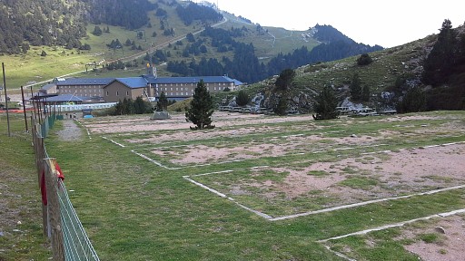 |
The camping terrain at Nuria still exists. Then taking the train back to Ribes de Freser and driving to St-Laurent-de-Cerdans. |