|
The
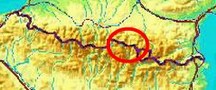
bordermarkers of the Pyrenees : the GRPdesBF
 |
|||||||||||||||||||||||||||||||||||||||||||||||||
| - stage 34 - Passage de la Lègne - Port de Salau (bm420bis-422bis) |
 |
||||||||||||||||||||||||||||||||||||||||||||||||
 |
|||||||||||||||||||||||||||||||||||||||||||||||||
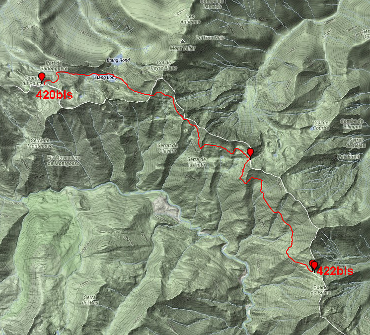
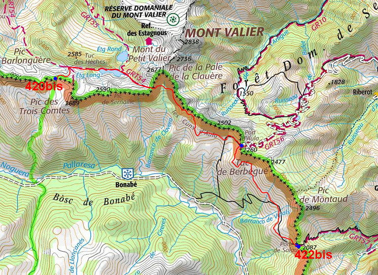
| Only
the bordermarkers on this stage are shown (and some adjoining ones).
The main route is red, the variants have other colors. Click here for an fullscreen interactive map. In short In this stage you will remain above 2000m and it's essentially - after the descent to Étang Long and the climb to Col de la Pale de la Clauère - a long traverse underneath the borderridge to Port d'Aula (bm421) and from there to Port de Salau (bm422 and 422bis). Considerations Take care of your watersupplies when passing Étang Long, the next watersource is between Port d'Aula en Port de Salau. Wayfinding from Col de la Pale de la Clauère to Port d'Aula is not straightforward and requires attention. Between Port d'Aula and Port de Salau there's a fine white waymarking (except for the last part). At Port de Salau, there's enough flat (and windy) space to pitch your tent but you need to bring your water. You might find some shelter in the ruins on the Port. But: after ± 1h of descending into France you will reach a nice and cosy cabin with a source further on along the trail. Factsheet
Gps-files needed
Useful You might check the relevant webpages in the 'All markers'-section and 'All my trips'-section. They provide pictures of the bordermarkers and additional information. Version 01 December 2013. If you have any correction, suggestion etcetera -> please email me: eefberns@grenspalen.nl MAPS AND DIRECTIONS December 2013. Maps and directions yet to be worked out in more detail. You might check the relevant webpages in the 'All markers'-section and 'All my trips'-section for pictures of the bordermarkers and wayfinding-issues. Print your own maps It's easy to print your own - custom made - maps with the GRPdesBF-route and the bordermarkers on them. See: Print your own maps |
|||||||||||||||||||||||||||||||||||||||||||||||||
 |
|||||||||||||||||||||||||||||||||||||||||||||||||