|
The
bordermarkers of the
Pyrenees : all bordermarkers
 |
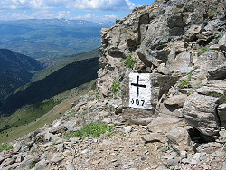 (Do you want to proceed to the pictures? -> Click here ) (Do you want to proceed to the pictures? -> Click here )This part provides the pictures of all the bordermarkers in the Pyrenees, found so far. At present (2024) I've found 99% of them, leaving 7 bordermarkers yet to find but most of these are considered to be lost. See the to-do list on this page All pictures are made during my daytrips found in the "all my trips"-section. The pages of the daytrips give additional information on localisation, surroundings and access. |
| All bordermarker-coordinates in 1
gps-file Two flavours: - Google Earth-kml: esfr-bordermarkers-all-waypoints.kml - Gpx-file: esfr-bordermarkers-all-waypoints.gpx (with altitudes added) The coordinates in this file can differ from the coordinates in the individual daytrip-tracks. In those cases, this is the authoritative list, showing the locations as exact as I can get them. Most of them are based on my own gps-readings and are corrected to show as exact as possible. A few (the missing ones) are derived from the French IGN-maps or from other sources. See the cartography-page for more explanation. Which bordermarkers are missing? (march 2023) On this map the remaining bordermarkers still to be found or considered to be lost. See also my to-do-list 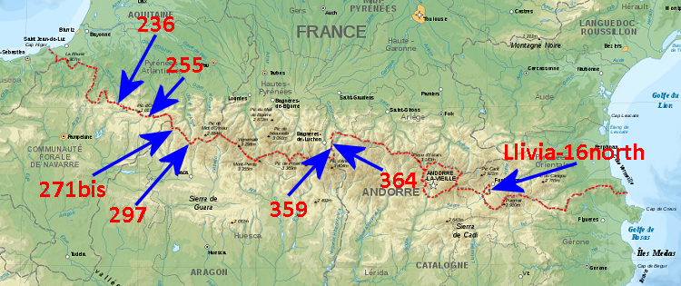 |