The bordermarkers of the Pyrenees : all my trips  | |
| - 5 april
2008 - First attempts for bm542 |
 |
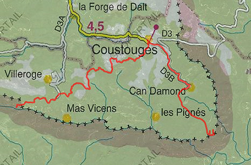 |
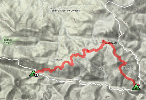
esfr-trip-track-20080405.kml (click to open in Google Earth or copy link to Google Maps) Part of a 8-days backpacking-trip in the eastern Pyrenees with Jan-Willem, roughly covering the area bm528 - bm575 and bm600 - 601bis. Day 3: via Coustouges to bm541 and a first search for an access to bm542. From Hostel de la Muga to ± bm540, what is faster: via France or Spain? Well, it's faster via Coustouges (± 3h) than via the winding Spanish dirtroad (± 4h). |
 |
For explanation of the gps-coordinates and other cartographic backgrounds: see my cartography page En route 9.45-17.00. According to my watch: 7.15 529↑ 579↓ 1108↑↓ Hmax 927 Lmin 649 |
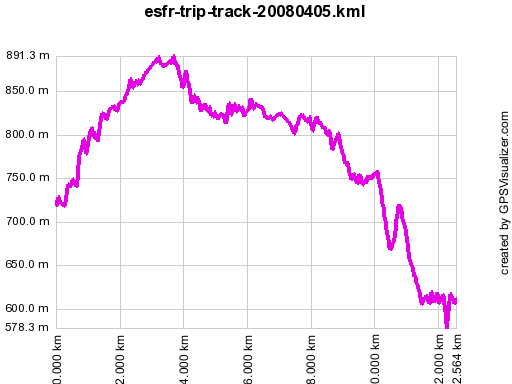 |
According to gpx-view Distance : 12.547 km Altitudes : Maxi 891 m Mini 578 m Dénivelées : ~ +300 m -290 m From Can d'Amunt to a spot with a sign P5 (probably a hunter's post, 5 minutes from bm541) takes 45 min. |
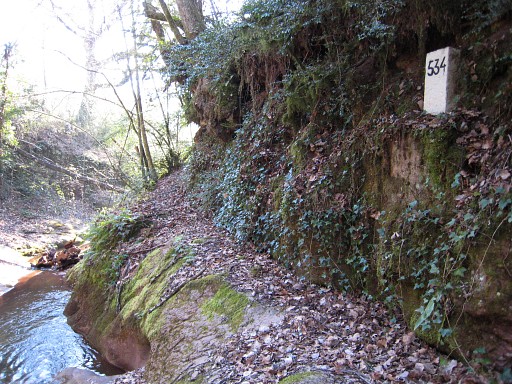 |
In the morning - before leaving - I 'do' bm534 |
 |
In
1.45 we walk to Coustouges. This picture: a view on the fenced terrain
where we were yesterday evening. Bm535 is just behind the houses. |
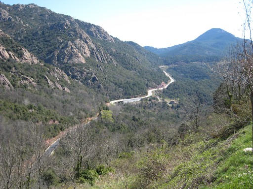 |
And this is a view - from the edge of
Coustouges - to the road into Spain, the bridge crossing the stream
which is the border there. |
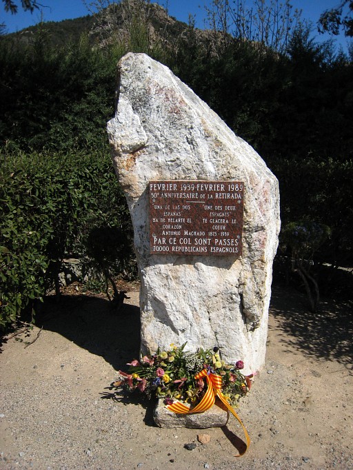 |
Nearby: this monument on the Spanish refugees after the Civil War in Spain. |
 |
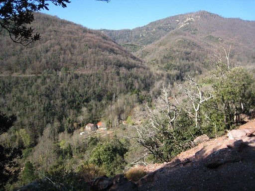
From Coustouges it takes 30 min. to reach the hamlet of Can d'Amunt. From Can d'Amunt, this view down the valley. We know that the border descends somewhere from the ridge (bm541) in a straigth line to bm542 besides the stream, deep in that "canyon". At Can d'Amunt we get - dirty looking - water from the inhabitants of the closed restaurant. Water is scarce here, the sources getting dry, they tell. |
 |
From Can d'Amunt, we
follow the trail S and suddenly spot yellow waymarks, probably leading
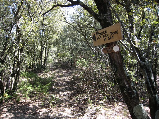
to bm540, confirmed by a sign "540". Further on, there's a bifork with 2 signs: to bm540 ánd 541. We head for 541 and pass several "postes", hunter's posts we assume, neglecting branches to P2 and like. |
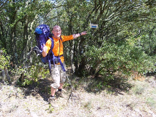 | Me, happily posing by another sign pointing to "borne 540". We end up at "P6", a small open space, close to the rockridge which is the border. |
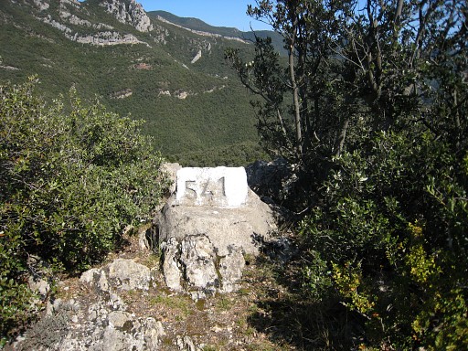 |
From there, I follow the ridge to the left (E) on a trail and reach in 5 minutes bm541 |
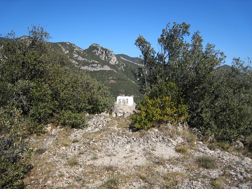 |
Bm541 |
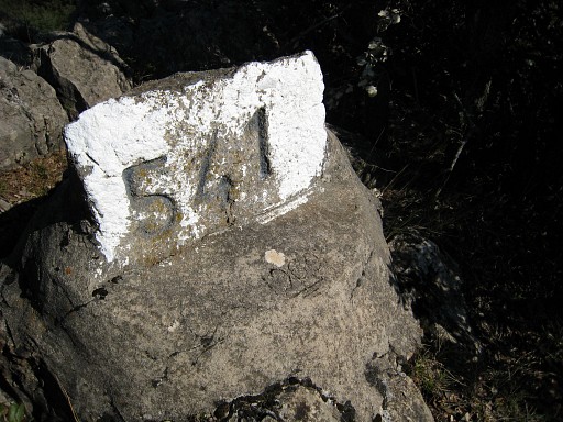 |
Bm541, it seems that the original marker is secured in this concrete base. In the base I see '1960' engraved. |
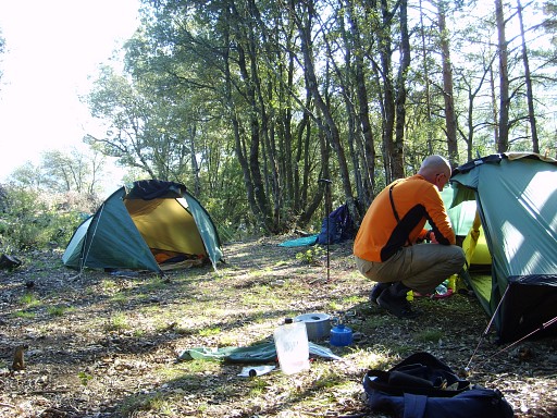 |
I return to "P6" where Jan-Willem is waiting and then I try twice to descend to bm542: 1. on a trail from P6 descending fast N but which vanishes 2. from bm541 along the rockwall downwards but that gets too steep. Frustrating. We pitch our tents at P6. We have to be frugal with our water, collected earlier at Can d'Amunt. |
|
| |