|
The
bordermarkers of the Pyrenees : all my trips
 |
|
| -
20 march
2009 - The hidden cave |
 |
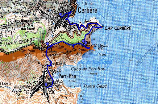 |
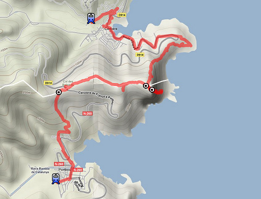
esfr-trip-track-20090320.kml (click to open in Google Earth or copy link to Google Maps; click right on this link to download gpx-version) Part of a 5-days trip to the eastern Pyrenees. Day 5: a daytrip from Figueres to Cerbère - Port-bou. Main target: to explore the access to bm602, the mysterious bordercross in a cave at sealevel. |
 |
For explanation of
the gps-coordinates and other cartographic backgrounds: see my cartography page En route 4.40 hours (10.20-15.00) According to my watch: - elevation gain:380m - elevation loss: 383m - total elevation: 763 totaal According to gps: - 7,7km -> 1,6km/hour, - while moving: 1.58 hour - standing still: 2.41 hour |
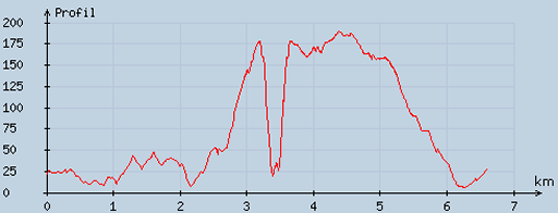 |
According
to visugpx - distance : 6.82 km - cum. elevation gain : 379 m - cum. elevation loss : 378 m - total elevation: 757 m - altitude maxi : 189 m - altitude mini : 6 m - altitude average : 101 m |
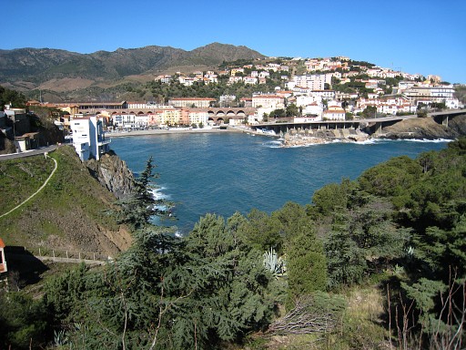 |
From the
trainstation of Cerbère, I walk to the viewingpoint of Cap Cerbère. This picture: looking back at Cerbère. |
|
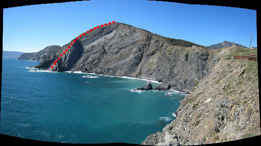
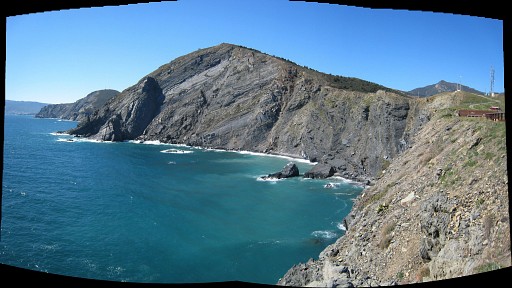
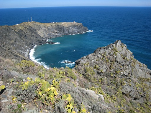
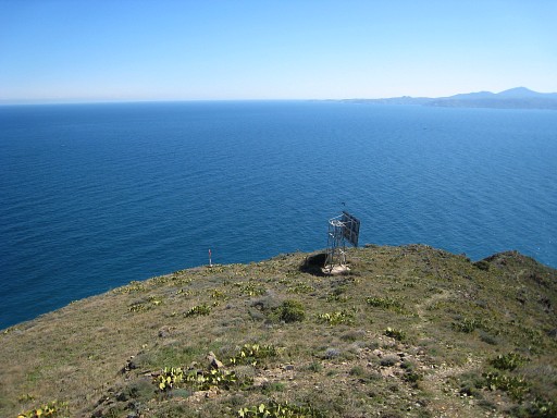
From Cap Cerbère
there's this view of the coast southwards. Maps and Procès-Verbal make the borderline clear: from the hilltop it descends along that giant vertical boulder to the sealine. Move the mouse over the picture to see the borderline. |
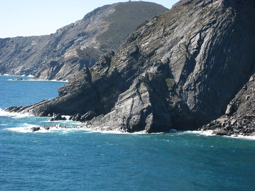 |
There's a trail along the cliff leading to the hilltop and while climbing I study with my binoculars the coast. |
 |
As I get closer, I see more and more clearly a cave in the north-side of that boulder. |
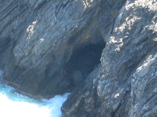 |
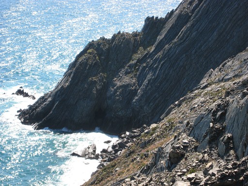
This is a digital zoom-in of the cave. Only accessible by boat, I think. I see no possibilties to reach it by foot. So this is - I'm quite sure - the "Cova Foradado", the hidden cave. In june 2010 Alain Laridon sent me pictures of bm602, confirming that this is indeed the "Cova foradado". See: esfr-html-markers-600-602.html |
 |
On top of the hill, it's not too hard to descend to the top of that boulder ("falaise" in the Proocès-Verbal). Descending further in the ne-corner of boulder and rockwall seems possible but for me - being alone - it got too steep. Still: not impossible with some rockclimbing experience and/or -courgae. At the coastline - however - there are some seawaves to tackle to get to the entrance of the cave |
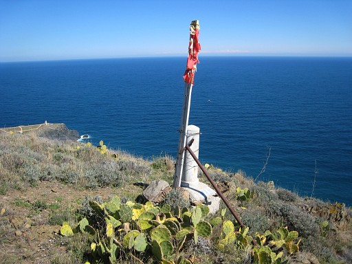 |
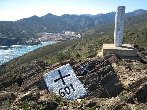
I climb back and visit: bm601BIS (N42 26 05.4 E3 10 17.9 H191m) |
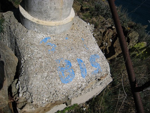 |
The painted numbers are worn away. There are no other signs whatsoever. |
 |
Bm601 ( N42 26 06.8 E3 10 14.8 H212m) |
 |
Looking down at bm601bis (the tiny post to the left of the construction) |
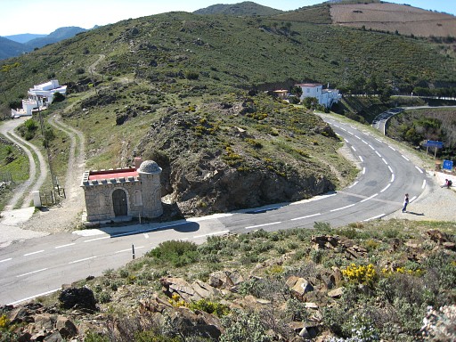 |
Then to the borderpass (Coll dels Belitres) |
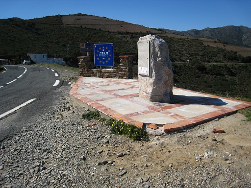 |
with the inevitable monument on |
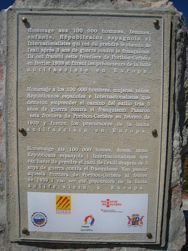 |
the refugees from the Spanish civil war in 1939. |
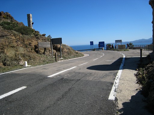 |
Another view of the pass. One wonders where the exact borderline is. Is it at the changing of the tarmac? |
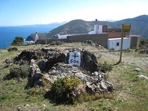 |
Bm600 (N42 26 04.5 E3 09 30.9 H170m) From bm600 there's a waymarked trail descending to Portbou. A nice and relaxed walk. Satisfied with the discovery of the cave. |