|
The
bordermarkers of the Pyrenees : all my trips
 |
|
| -
8 april
2009 - The IGN-map is wrong |
 |
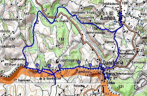 |
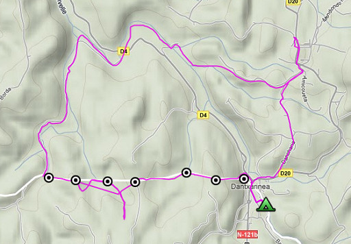
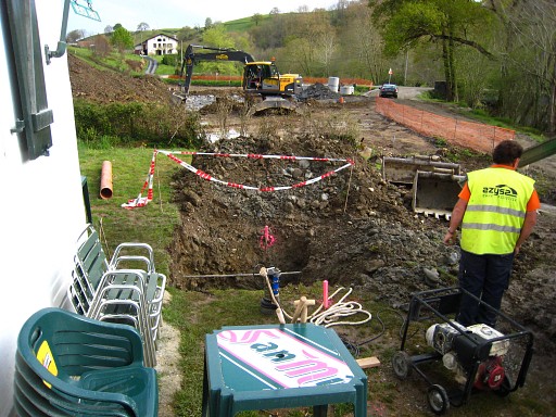
esfr-trip-track-20090408.kml (click to open in Google Earth or copy link to Google Maps; click right on this link to download gpx-version) A daytrip from the camping in Dantxaria. Target: bm072-067. It's a tough expediton wrestling through bush and climbing over trees and fences. Weather: partly clouded, now and then sunny, a fine walker's temperature/ We like the gentle, green and pastoral landscape. |
 |
For explanation of
the gps-coordinates and other cartographic backgrounds: see my cartography page En route: ± 8 hours |
 |
According
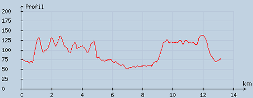
to visugpx - distance : 13.21 km - cum. elevation gain : 212 m - cum. elevation loss : 213 m - total elevation: 425 - altitude maxi : 137 m - altitude mini : 51 m - altitude average : 93 m |
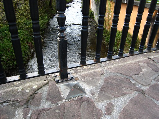 |
On the bridge in Dantxaria, these unnumbered markers. |
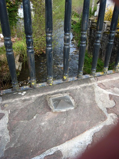 |
They are mentioned in the Procès-Verbal. |
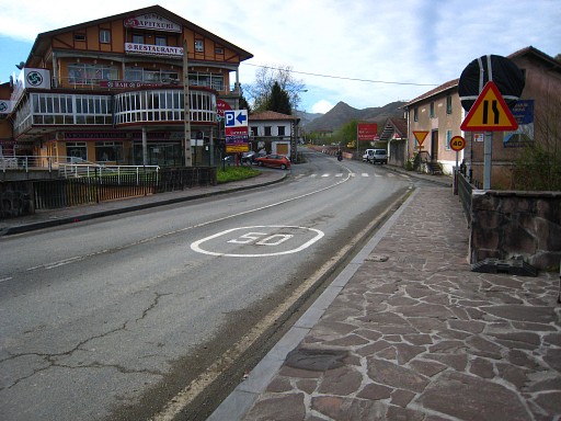 |
The bridge from some distance, looking into Spain. |
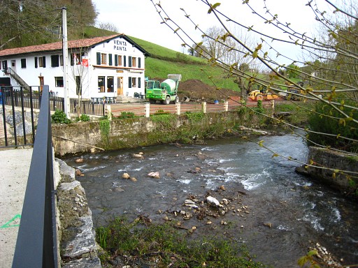 |
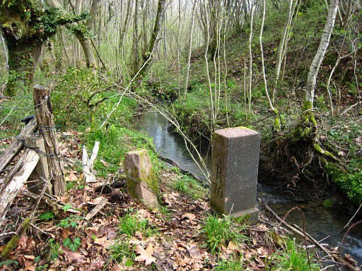
This
picture: looking to the venta where bm072 should be. We see
(foreground) where a stream (which is the borderline upstream until
bm074) merges with the larger stream of la Nivelle which is for a
little stretch the border until bm072. But we can't find bm072 near the venta. In the venta-shop they tell us that it is temporarily removed because of the road being reconstructed. |
 |
This hole is the spot of bm072, they said. But that's was probably wrong information. One year later at 20100506 we find bm072 replaced but at the end of the fence on this picture. A bit further from the road then previous, as Charles Darrieu informed me in 2011. |
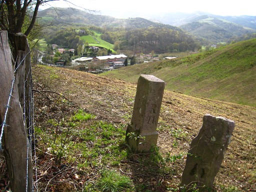 |
Then a climb along the forest-edge to bm071. There are two other markers besides it. |
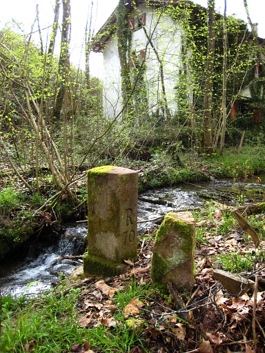 |
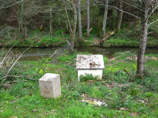
Next: descending to bm070, which stands along a stream and close to an abandoned house. Besides it: an old triangular marker, mentioned in the Procès-Verbal. |
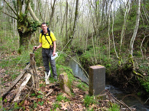 |
Bm070 with Jan-Willem |
 |
Bm070. |
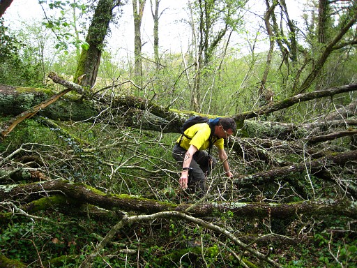 |
Until now, things went smoothly, the borderline indicated by fences and easy to follow. The climb to bm069 however is tough, over and through falles trees like these. The alternative route - via a fenced meadow at the Spanish side of the border -seemed to be in full view of a farm uphill. But that was - afterwards - only a barn. |
 |
Bm069, at the end of dirtroad coming
from Spain and continuing into France to a farm uphill (or viceversa).
The access from Spain seems more 'public' than from France. The bm stands on the French side of the gate. |
 |
Bm069. In the background - in Spain - this large apartment-building. Locked and not inhabited. Strange. |
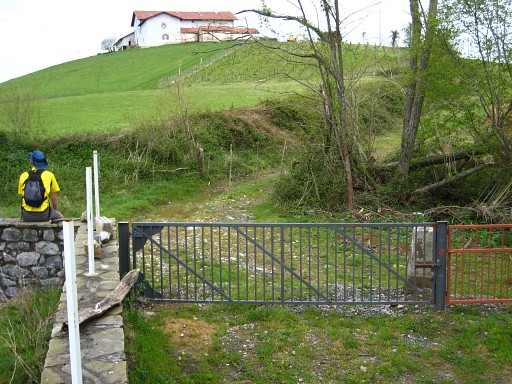 |
Bm069, Jan-Willem and that French farm uphill. |
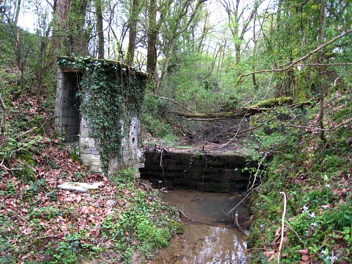 |
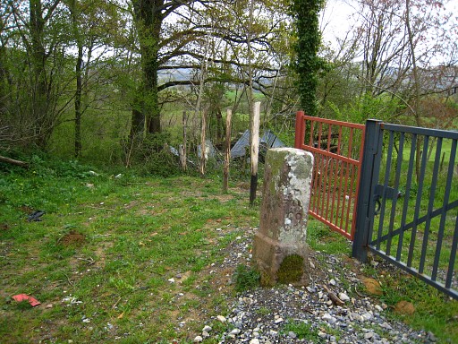
Then things go wrong. We cannot find
bm068. According to the map along a stream, according to the
Procès-Verbal at a "parage" (an undeep crossing of a stream?). We search extensively along the stream and wondered what this building & barrage was meant to be. |
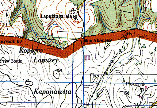 | Much later, I will discover that our map is wrong. This is the map we used, from the new French 25k series. Between bm067 and bm069, the borderline goes SEE to bm068 and then NEE to bm069. |
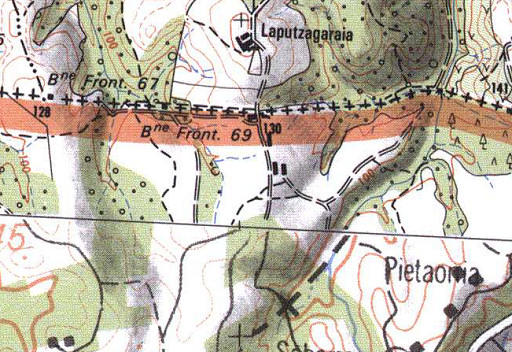 | This is an older map and now we see that the border is a straight line between bm067 and bm069. |
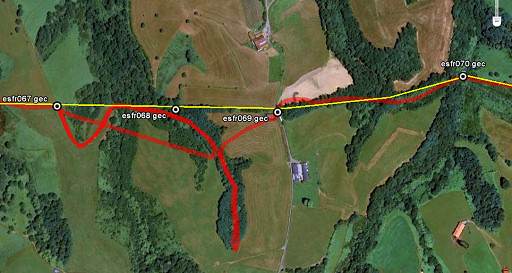 | In 2010, we will find bm068: see 20100506 This map (Google Earth): you can see where we searched for bm068. Actually we were quite close. Also: visible our winding route to bm067 ánd the straight line we tried from bm067 in search for bm068. |
 |
Following the stream downstream, we
get to where a dirtroad/trail crosses that stream. We follow the trail
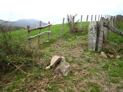
SW, arrive at open grassland and curve to the NNW and reach bm067. But there are only bits and pieces and there's no part with a number. But the dimensions of the base and the color are unmistakable: this must be bm067. In the background another marker (?) with no engravings. |
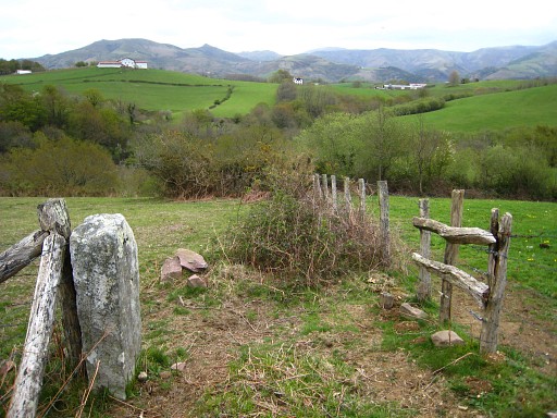 |
Bm067, looking in the direction of bm069 etc. A last fruitless try to find bm068: in a straight line on compass-reading to where bm068 is according to the map, measuring the distance mentioned in the Procès-Verbal with the gps. |
 |
Back to bm067 and descending steeply (best be done on the French side) and crossing the stream to bm066. |
 |
Finally via the GR10 to
Ainhoa for a sightseeing's visit and back to the camping. |