|
The
bordermarkers of the Pyrenees : all my trips
 |
|
| -
8 june
2009 - Daytrip to bm408 |
 |
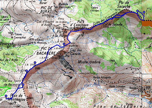 |
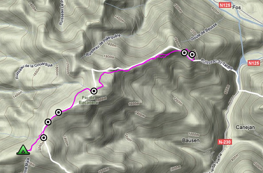
esfr-trip-track-20090608.kml (click to open in Google Earth or copy link to Google Maps; click right on this link to download gpx-version) Part of a 16-days trip, using day 1-10 to cover bm154 to 264 in the eastern Pyrenees and day 11-16 for bm416 to 365 near Bagnères-de-Luchon. Day 14: from my bivouac-spot near Cabane de Peyrehitte I make a roundtrip to bm407 and bm408-I |
 |
For explanation of
the gps-coordinates and other cartographic backgrounds: see my cartography page According to my watch: Duration: 8.45-19, in total 10.14 hours, 1 hour break Up: 1290 m Down: 1287 m Total elevation: 2577 m Highest point: 2116 m Lowest point: 1446 m |
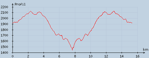 |
According
to visugpx - distance : 15.62 km - cum. elevation gain : 1084 m - cum. elevation loss : 1086 m - total elevation: 2170 - altitude maxi : 2126 m - altitude mini : 1440 m - altitude average : 1918 m |
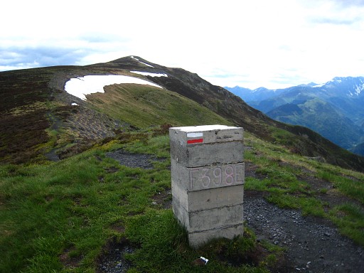 |
A long night's sleep after the tiring trip of yesterday. There are
still clouds but high up in the sky. It's clear enough for a new
attempt for bm407 and 408. Back along the GR10, doing (again) bm398 |
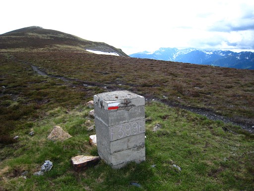 |
and bm399. Then I go left underneath the summit with bm400 (snowfield) on cattle-tracks to |
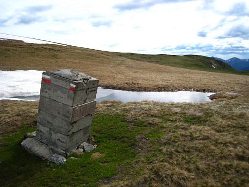 |
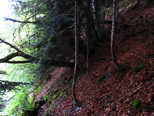
bm401 From here I follow the trail of yesterday, which goes a bit left of a first small lake, passes a second small lake and continues as a sort of cattle trail. That 'cattle trail' brings you to a sort of col on the borderridge, probably the Col de Sacaube. There's a branch earlier to the left which also leads to the ridge to a sort of col but that seems too sharp to actually cross it. |
|
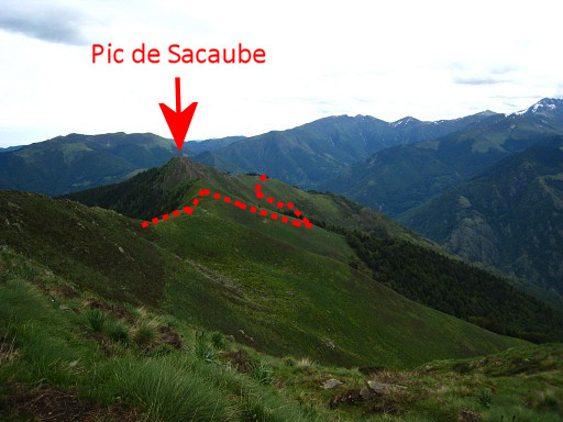
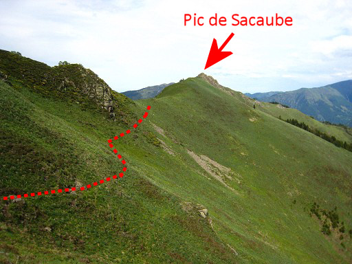
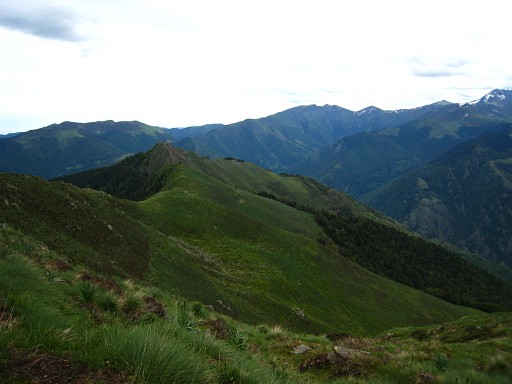
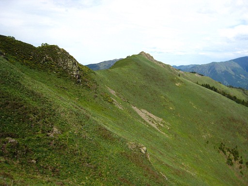
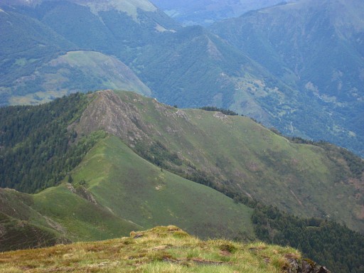
From
the col I follow the ridge until the Pic de Sacaube gets closer and the
ridge more narrow and rocky. It's obvious that you have to traverse
underneath the Pic. By the way: in 2011 I will learn that you can proceed along the ridge via Pic de Sacaube. Move the cursor over the picture to see where the Pic de Sacaube is and how I went underneath it. |
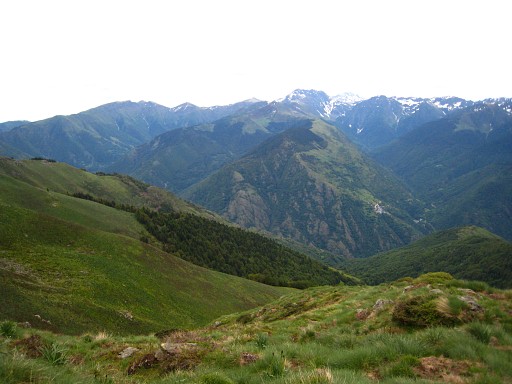 |
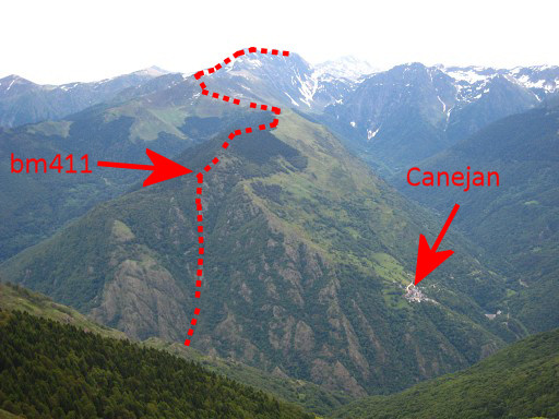
A view to the SEE with the village of Canejan on the hillside far away. |
|
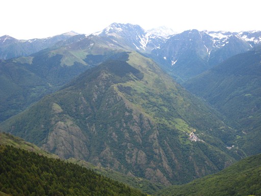
A zoom-in Move the cursor over the picture to see the border. |
|
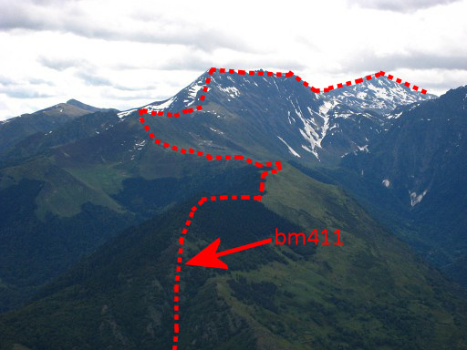
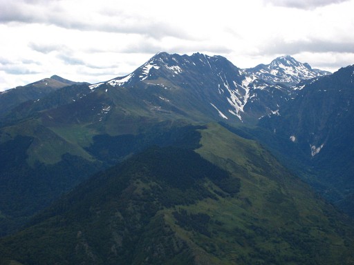
And another zoom-in Move the cursor over the picture to see the border. |
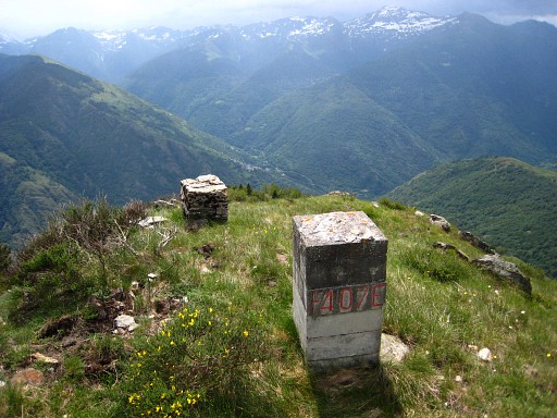 |
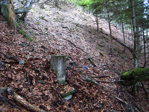
I descend and traverse with some difficulty underneath the Pic and return at the ridge, bm407 already in sight. Bm407 |
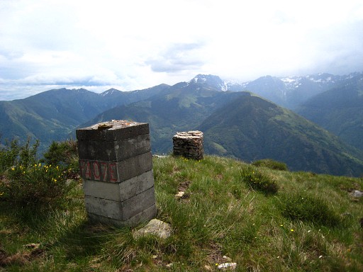 |
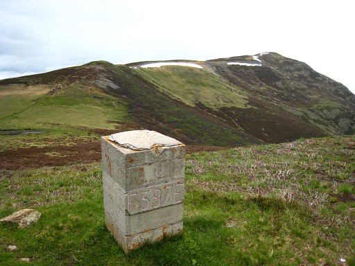
Bm407 |
 |
Bm408, not found However, I did find a bm408, see the next pictures . But in june 2010 I learned on Paco Nudels blog that there is a large bm408 similar in shape like bm307 and previous stones. And I didn't find that one. |
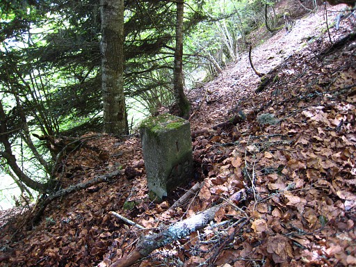 |
Then things get more troublesome. De
borderline leaves (Procès-Verbal) the ridge at bm407 and goes in a
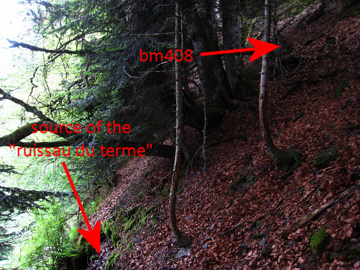
straight line for 310m to bm408. First I descend further on the ridge for about 310m (gps tripteller) and then circle into the forest to the left, keeping the distance to bm307 at ± 310m. Then I hear a stream and as I get close, I spot bm408 (I thought, later I will learn that it is the submarker bm408 I) |
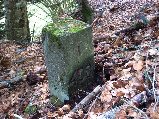 |
It's a small marker and there's a "I" above the number. I look in vain for another marker on top of the rockwall behind it. But the description in the "Procès-Verbal" seemed to fit well: "From bm407, the borderline leaves the ridge and descends on the north side directly to the source of the "ruisseau du Terme". Borderstone 408 is placed on a rock above this source." |
 |
This marker is about 5m above the source of a stream. |
|
Move the
cursor over the picture
to see where bm408 and the source of the "Ruisseau du Terme" are. At least, that was what I thought at that time. In fact bm408 is 408 I and that 'ruisseau' an unnamed stream. |
 |
Bm408 I |
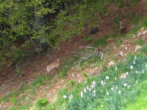 |
Back to bm407 and taking a break. From there, I spot these deers. I return on roughly the same route, now doing the traverse underneath the Pic a bit lower, following some (animal-)track. |
|
Looking back, the Pic de Sacaube in the far distance. Move the cursor over the picture to see the trail to the border-ridge. |
 |
Further on, this view (zoom-in) back to the Pic de Sacaube. |
 |
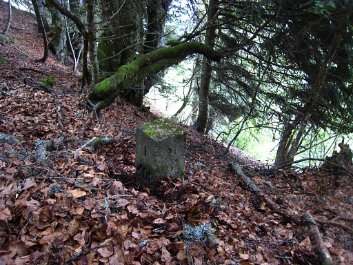
I finish by doing bm397 to save time the next morning. |
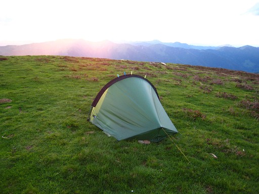 |
I pitch my tent at the same spot as yesterday. |
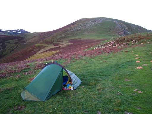 |
But have discovered a source nearby. It's along the trail which you can see on this picture going along the hillside to the left. About 10 minutes away. |