|
The
bordermarkers of the Pyrenees : all my trips
 |
|
| -
23 march
2011 - I forgot bm585 |
 |
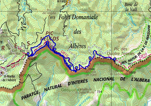 |
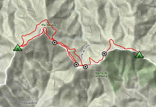
esfr-trip-track-20110323.kml (click to open this trip in Google Earth or copy link to Google Maps; click right on this link to download gpx-version) Summary: part of a 5-days trip from Portbou to a bit beyond Le Perthus (bm600-bm560). A remake of a trip in april 2006, now with a gps. Day 3: from bm587 to beyond Pic Neulos, spending the afternoon walking back & forth to bm585. Weather: clear sky, sun! On the ridge a chilly wind. |
 |
For explanation of
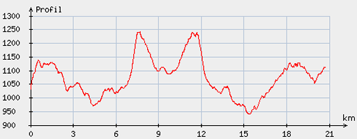
the gps-coordinates and other cartographic backgrounds: see my cartography page Start: 9.45, break: 13.15-14.15, finish: 17.30, net walking time: 6.45h According to the gp-tripteller: Distance: 21,6km Time en route: 7.44h Total ascent: 850m Maximum height: 1263m Final height: 1122m |
 |
According
to visugpx - distance : 20.89 km - cum. elevation gain : 823 m - cum. elevation loss : 744 m - total elevation: 1567 m - altitude maxi : 1241 m - altitude mini : 940 m - altitude average : 1082 m |
 |
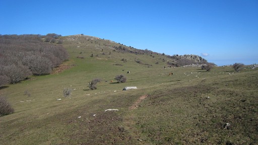
After a cold night -
in which the sky cleared and the moon & stars & the
city lights of the coastal towns became visible - I continue on the
GR10. |
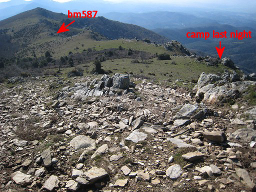 |
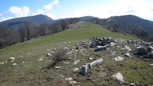
This picture: on
the GR10 looking back eastwards. If you are going west-east, it's
easier from here to follow the ridge to bm587 then the GR10.
If you need water, the fountain of Font de la Maçana is beneath bm587 in the forest. |
| The GR10 brings me
- through a nice beech-forest - to bm586, well visible in this direction |
|
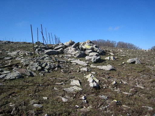 |
Bm586 |
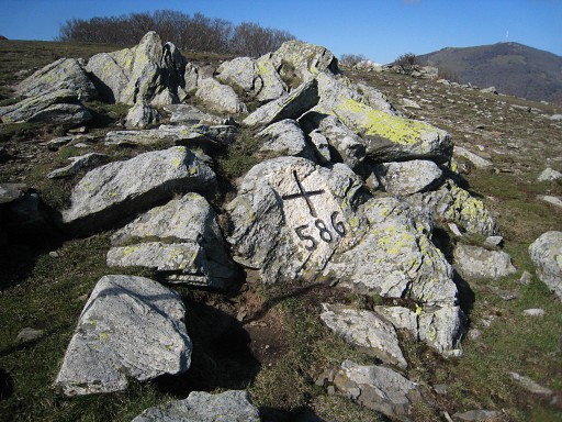 |
Bm586 |
 |
Bm586 is not directly visible in
the GRPdesBF-direction. On this picture we see that bunch of rocks from SW. You need to look back to spot it. I continue on the GR10 and loose the trail. I go too far north but return at the GR10 |
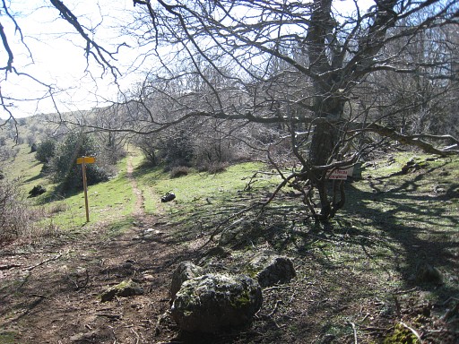 |
and reach spot of bm584. It's where the GR10 enters/leaves a forest. There is a signpost at this place. |
 |
Bm584, a bit hidden and
unconspicuous, about 30 meters south of the signpost. |
 |
Bm584 |
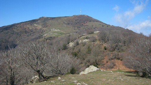 |
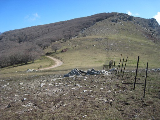
And again I loose
the GR10-trail and return at the ridge. This picture: looking ahead along the ridge with Pic de Neulos well visible. |
 |
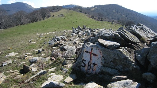
Beyond the refuge
de la Tanyareda on the ridge I find bm583. Well visible while walking the
GR10. This picture: looking SE. |
 |
Bm583 |
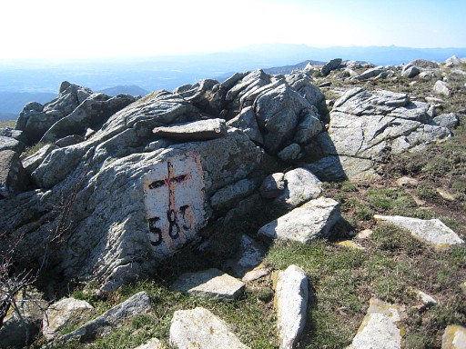 |
Bm583 |
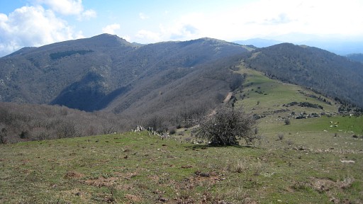 |
For reaching the
Pic Neulos, you can climb straight ahead along the fence. That applies
also for the GRPdesBF going down from the Pic to bm583. This picture: looking back at the borderridge bending to the left in the far distance. |
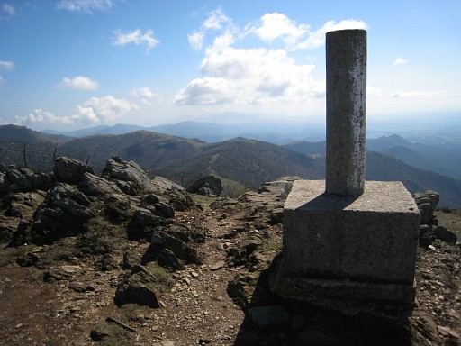 |
At the Pic de Neulos. There are two landmarks here and I'm curious for the exact borderline here. This is a geodetec pillar |
 |
with a Spanish signature. So standing at Spanish soil, I suppose. |
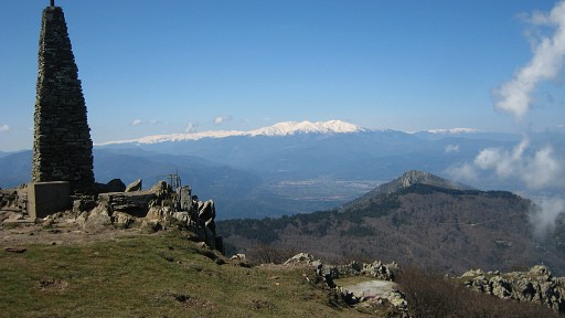 |
The other landmark is this pillar, a few meters of the geodetic one. In the distance we see the Canigou mountain, still covered with snow. |
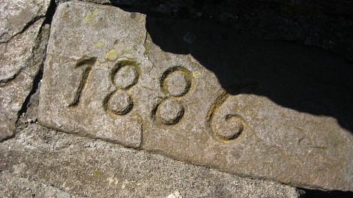 |
This is apparently the year of
building of that second pillar. Other inscriptions indicate a
French origin so the second pillar is on French territory, I suppose. |
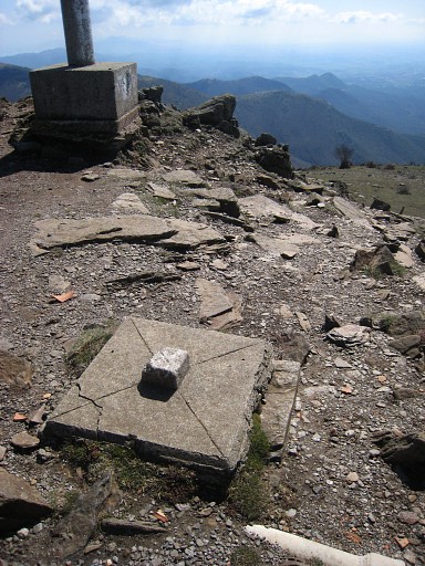 |
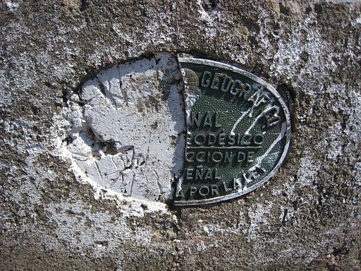
In between the two pillars, I spot this geodetic indication. |
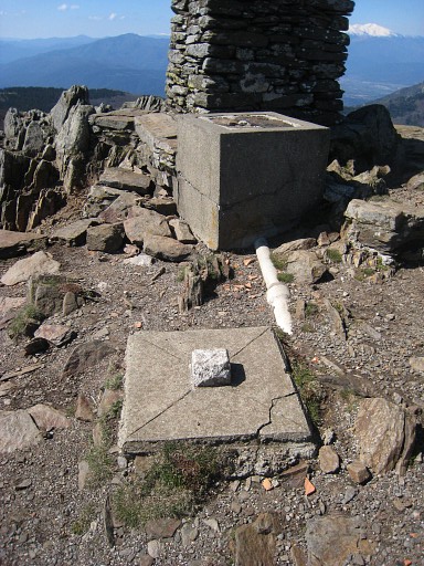 |
The same indicator with the French pillar. I think that this indicator is the real bordermarker. |
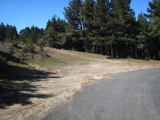 |
Then following the
GR10 untill the sharp bend in the tarmac road where the GR10 descends
in the forest. I take the forest road uphill in the direction of the
border. A lunch-break near a sort of GSM-transmitter-unit. A nice sunny place. And here I discover that I forgot bm585! So back to bm585. I follow the GR10 but in the circling of Pic Neulos, I loose the trail and pick it up again close to bm583. |
 |
Further along the GR10
and past bm584, |
 |
untill close to Collada de l'Orri, |
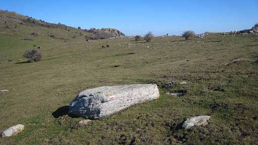 |
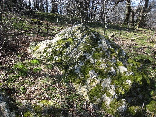
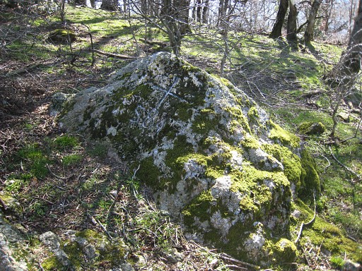
making a detour to
the ridge, departing from this rockstone |
 |
where I find bm585
west of the actual pass. |
 |
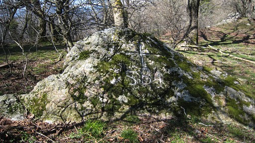
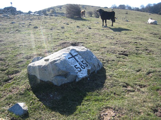
Bm585 |
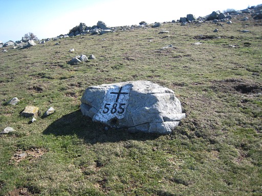
| Bm585 - the backside - seen from a large cairn with a signpost, 25 meters to the SW. |
|
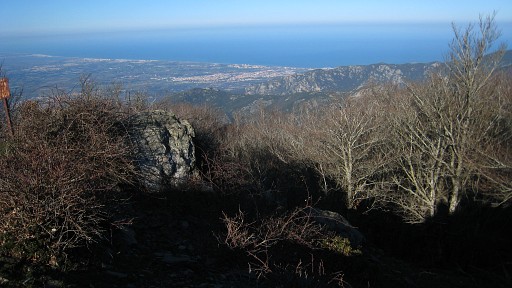 |
I return on the
forest road which encircles Pic Neulos with this view on the coast. |
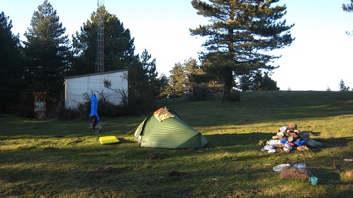 |
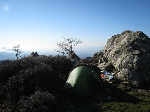
and return to my lunch
spot where I pitch my tent. At night, I hear voices in the distance as if other people are camping nearby. But I see nothing when I leave my tent for a pee. Another -intriguing - sound: a solitary cow slowly "clingling" by, disappearing into silence. |