|
The
bordermarkers of the Pyrenees : all my trips
 |
|
| - 20 august
2011 - The Table of the Three Kings |
 |
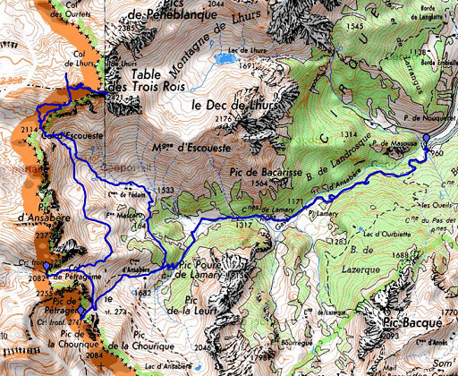 |
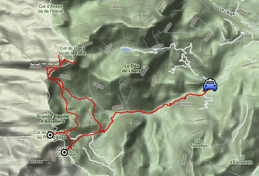
esfr-trip-track-20110820.kml (click to open this trip in Google Earth or copy link to Google Maps; click right on this link to download gpx-version) Summary: part of a 3-weeks trip to the Pyrénées to 'do' the ± 60 remaining bordermarkers. All done as daytrips from campings. Day 6: A trip to the 'Table des Trois Rois", with the target of finding a route from the table to bm272. This must be my longest Pyrenees-trip until now. Weather: blazing sun, very hot |
 |
For
explanation of
the gps-coordinates and other cartographic backgrounds: see my cartography page En route (±): 8.30-19.45 (11.15h) According to the gps-tripteller: Distance: 26,0 km Cum. elevation gain : 2648m Total elevation:5296m Mamimum height: 2439m Time: 11.10h |
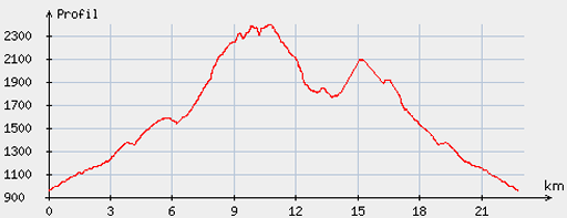 |
According
to visugpx - distance : 23,4km - cum. elevation gain : 1954m - cum. elevation loss : 1955m - total elevation: 3909m - altitude maxi : 2397m - altitude mini : 957m - altitude average : 1682m |
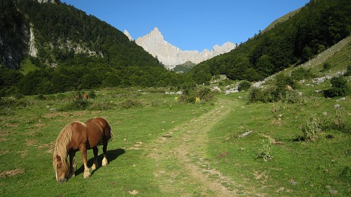 |
Start from the parking at Pont de Masousa and climbing in the direction of Cabanes de Ansabère. |
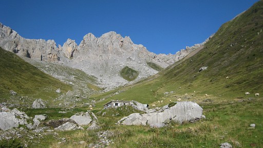 |
When those cabanes come in sight, I take a forest
road/trail to the right to Cabane de Pedain and arrive in this valley |
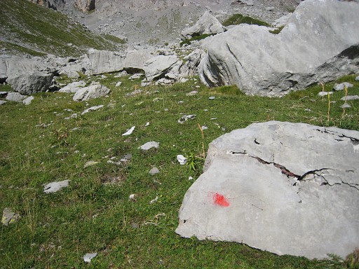 |
From the cabane, up
the valley along the stream, later on a cairns-trail with some red waymarks, |
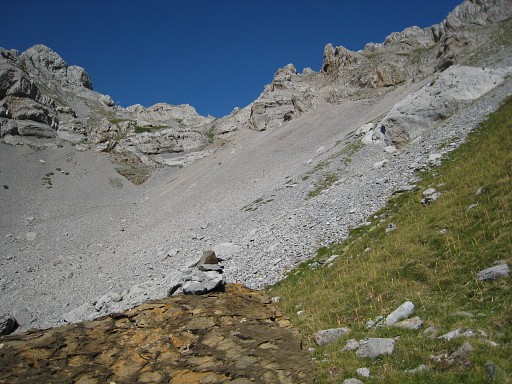 |
to Col d’Esqueste. And that’s a steep and tough climb. |
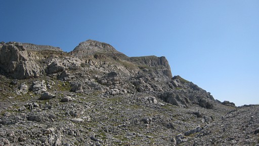 |
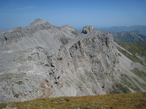
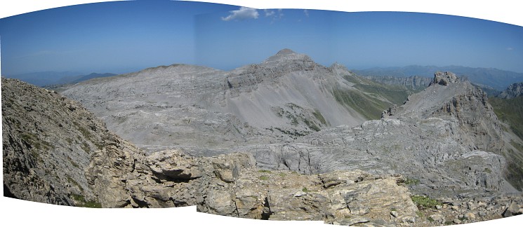
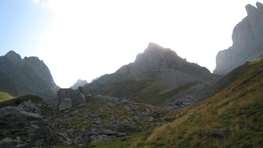
At the col I follow the cairns to the right which climbs to the foot of
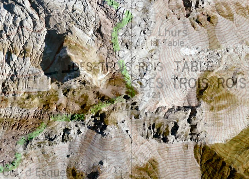
Pic des Trois Rois and the Table des Trois Rois. This picture: looking NEE to the Table. This is the ancient tripoint of Navarra, Aragon and France, mentioned as such in the Procès Verbal. |
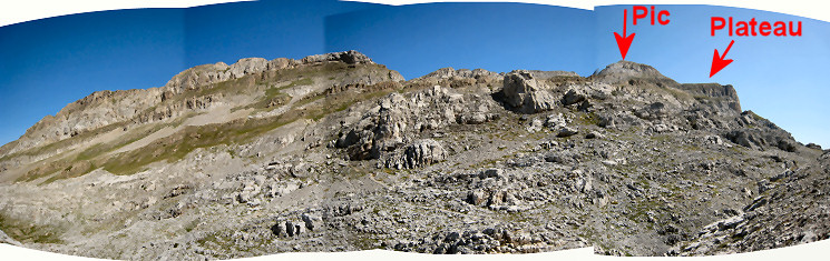 But where is exactly the Table? We see a distinct Pic and a flattened and tilted plateau east of the Pic. There seems to be some confusion if the Table des Troi Rois of the Procès-Verbal is located on the Pic or on that plateau. Well, the Table of the Procès-Verbal is the tripoint. Thus: where the borderline is, is the Table. However: the various French and Spanish maps show the esfr-border differently. See further on this page. For this moment: the Pic is the Pic, the Table is that plateau. |
|
 |
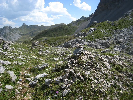
Looking back at in the direction of Col d’Esqueste. |
 |
And there is more in life than bordermarkers. |
 |
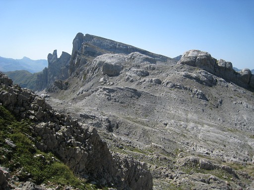
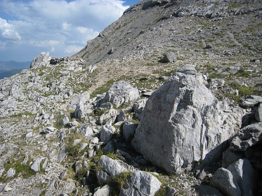
I've proceeded further, this picture
- looking back from the foot of the Pic - showing the terrain you have
to traverse when coming from Col d'Esqueste. |
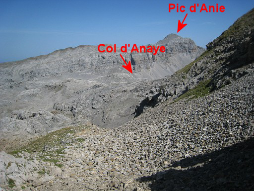 |
That 'foot of Pic des trois rois’ is in fact a sort of pass between the Pic and the ridge to the west . From
there I descend to the N to see if there’s a trail in the
direction of bm272 but there’s none. This picture: looking in the direction of Col d'Anaye and Pic d'Anie. I return to the 'pass’. There are many walkers, arriving on a well path from the west and heading for the pic and the table. A popular daytrip. |
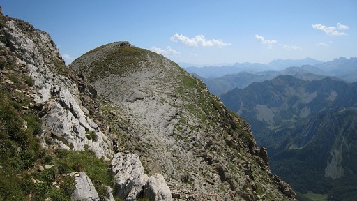 |
First I walk - alongside the steep slope of the Pic - to the Table |
 |
One can imagine that this tilted plateau got the name 'Table". |
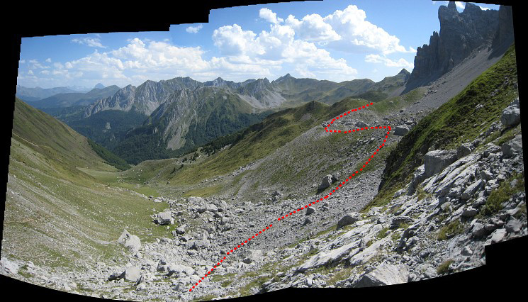
 The Table offers splendid views of the French valleys below, views which give ideas for routes. This picture: looking down on Lac de Llurs. One idea seems promising: |
|
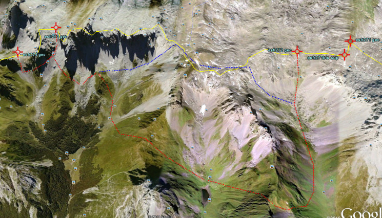 View is W. Click to here to see an enlargement. Red line: from Col d’Anaye (bm272) descending to sources de Marmitou, then climbing SEE to a sort of Col, then descending S to a bit W of Lac de Lhurs. From there, there’s a trail (according to the map of „La senda de Camille“) leading to an unnamed Col. From that col, descend to the lower bunch (of the two) of big boulders up in the valley, then climb S to a sort of ridge going semicircle around a kind of bowl. There’s a trail on the ridge, leading to Col de Petrageme (bm273). From bm273, it's a semi-circle to bm274. Blue line: a shortcut via Cols des Ourtets to the Table des Trois Rois to the Col d'Esqueste, described in the HRP-guide of Georges Véron. |
|
 |
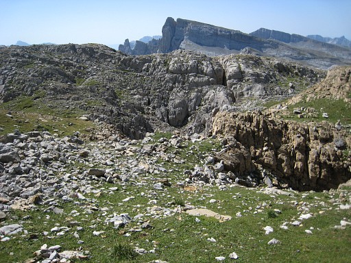
A view from the Table to the N with the Pics de Peneblanque in front and Pic d'Anie in the background. |
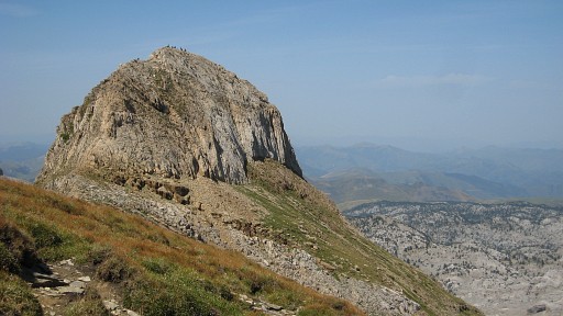 |
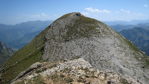
And from the Table a view of the Pic, with a lot of walkers on top of it. |
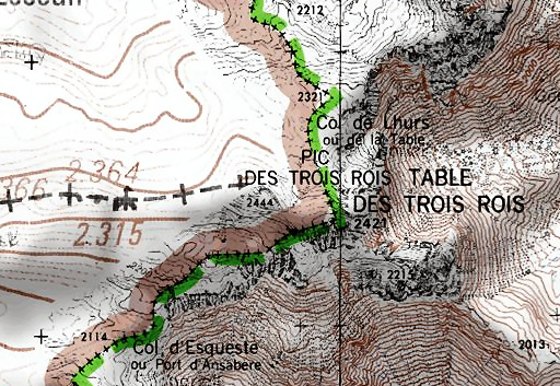 |
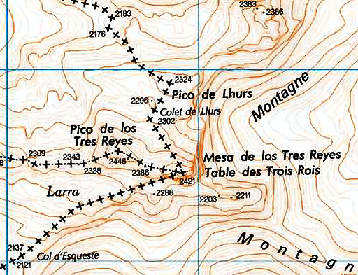
It's time to return to the question where the borderline is and thus the Table des Trois Rois. This is a French IGN-map, unfortunately vague on the Spanish side. |
 |
But if we combine it with an orthoimage-layer. we can see that the border follows the tilted plateau and not the Pic. |
 |
Then a Spanish map -
copied from the Sitna-site - which shows the same borderline. Note the
difference between the 'Pico' and the 'Mesa' (=table). |
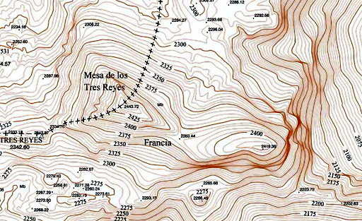 |
But - strangely enough - if we zoom in, the borderline is different: via the Pic which is suddenly renamed to 'Mesa'. Note: this is the borderline of Navarra but N of the Mesa that should be the esfr-border. |
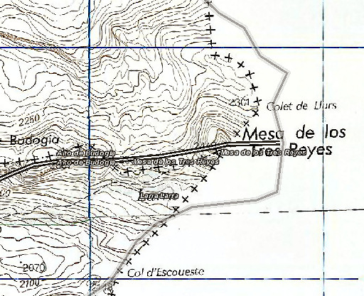 |
And finally a map from the
Aragon Sitar-site which shows two versions of the esfr-borderline, the
grey one similar to the IGN-one. My conclusion: the esfr-border passes the tilted plateau west of the Pic des Trois Rois and that's thé Table des Trois Rois. |
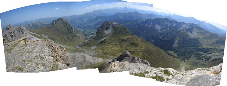
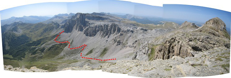 Another panorama: now looking south. At the far right: the Pic des Trois Rois. And the route / shortcut I will take to bm273 after descending from Col d'Esqueste. |
|
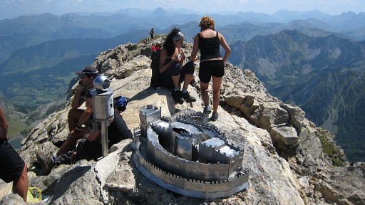 |
Then I climb the Pic des Trois Rois, ornamented with the model of a castle (It's the castle of Javier, the birthplace of St. Francis Xavier, the patron saint of Navarre, so I was told by one Angel Serrona) |
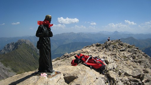 |
and a statue of
Saint Xavier himself. |
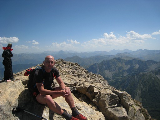 |
and for one moment with me. |
 A last view from the Pic, looking N to - again - Pics de Peneblanque in front and Pic d'Anie in the background. Just beyond the Pics the Peneblanque, there's the Col des Ourtets which should give access to the Table. |
|
 I return to Col d’Escoueste and try a shortcut to Col de Petragème- also spotted from above at the Table des trois rois. I descend to the lower bunch (of the two) of big boulders, then climb S to a sort of ridge going semicircle around a kind of bowl. |
|
 |
There’s a trail on the ridge, |
 |
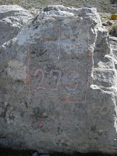
leading to Col de Petragème with bm273. |
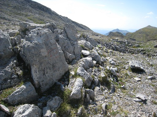 |
Bm273 |
 |
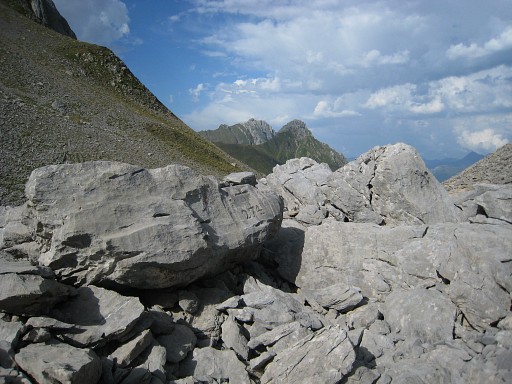
Bm273 Then I descend back into France and semicircle on a well trail to Col de Chourique |
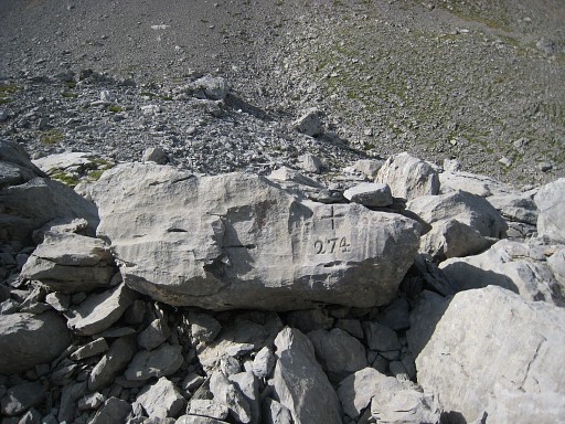 |
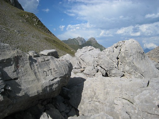
with bm274 |
 |
Bm274 |
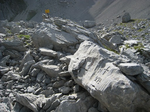 |
Bm274 |
 |
Bm274 |
 |
This picture: I've descended back into France in the direction of Cabanes de Ansabère. I look back to the two passes with bm273 and bm274. |
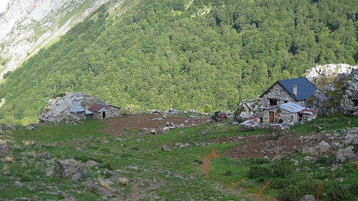 |
Cabanes de Ansabère, one of them is meant for hikers. Then finishing with a long, long descent to my car. And back to my basecamp in Urdos. |