|
The
bordermarkers of the Pyrenees : all my trips
 |
|
| - 25 august
2012 - Archaeological fieldwork |
 |
 |
Summary: part of a 2½-weeks-trip to the Pyrenees with a lot of targets, most of them reconnaisances of routes for the GRPdesBF. Day 1: two trips: 1. an attempt to excavate bm196 2. visiting bm087m, recently replaced My basecamp is a camping in Saint-Étienne-de-Baïgorry. I arrived there yesterday after a long day of driving from the Netherlands. Weather: rainy |
 |
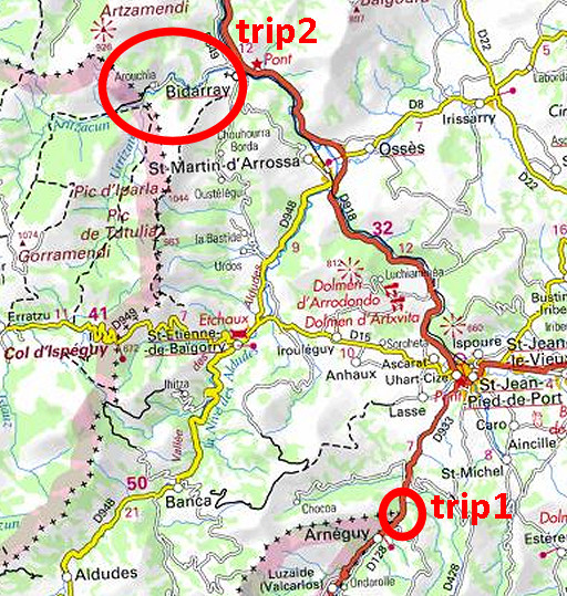
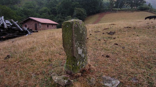
Trip 1 2½ Hours of digging for bm196. I took a shovel from Holland for this purpose. First I give it a try at the left post of the former gate to the meadow. I knew that position quite precise by combining several sources. One of them stated that the bm196 stood at the left post. |
 |
While I’m digging, a farmer passes by in his car and stops. He knows - because the meadow was their property - that the bm stood at the right post of the gate and he points me that spot, say 2-2,5 meters to the right and ± 1 meter from the tarmac. So I start digging at this second location. |
 |
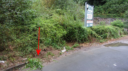
Digging
here is tough because of stones and the dense, pressed soil, becoming
more difficult as I get deeper which is stil not quite deep. I give up after 2 hours, maybe next year a new attempt with better tools like a pickaxe and a co-worker (Jan-Willem?) |
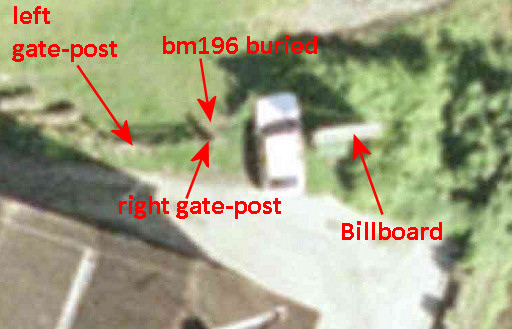 |
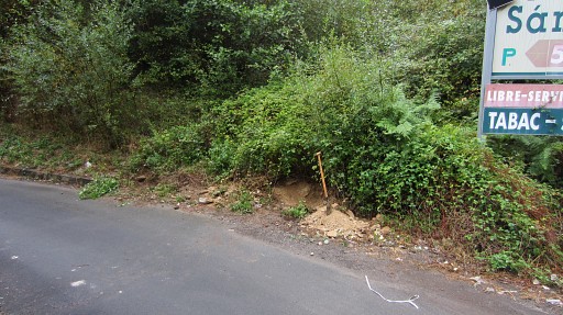
But I'm content that the exact location of the buried bm196 is now established. With the information of the farmers, I can show the position of bm196 on this old aerial picture on the Navarran Sitna-site. |
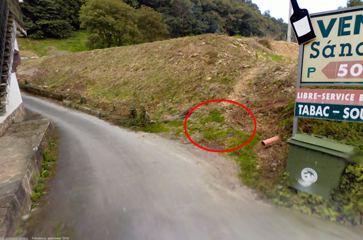 And we can show it on this Google Streetview-picture of september 2008. The parking-lot has been recently constructed as you can see. |
|
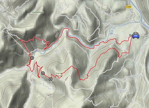 |
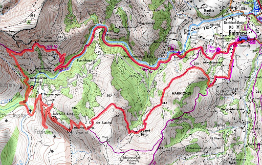
Trip 2 esfr-trip-track-20120825-trip2.kml (click to open this trip in Google Earth or copy link to Google Maps; click right on this link to download gpx-version) A roundtrip from Bidarray, main target being the recently replaced bm087. |
 |
For
explanation of
the gps-coordinates and other cartographic backgrounds: see my cartography page Start: 13.15, finish: 18.45, net walking time: 5½h According to the gps-tripteller: Distance: 16,0km En route: 5.17h Total ascent: 829m Maximum height: 529m |
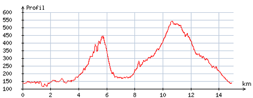 |
According
to visugpx - distance : 15,2 km - cum. elevation gain : 819m - cum. elevation loss : 813m - total elevation: 1632m - altitude maxi : 543m - altitude mini : 114m - altitude average : 302m |
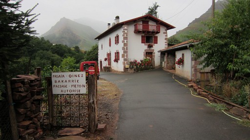 |
On the GR10, I walk in the direction of bm084. I have discovered on
Google Earth a shortcut from bm084 in the direction of bm085. This picture shows another shortcut between the GR10 and bm085, crossing this farmyard which is permitted for pedestrians. We surveyed this one on 20090410, at that time not knowing for sure if crossing the farmyard was allowed. |
 |
On my way up I visit the ‘holy’ cave |
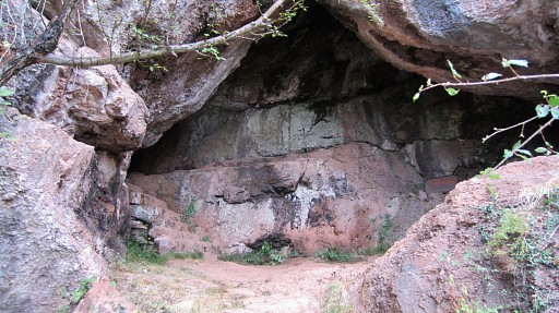 |
of Harpékosaïndo. |
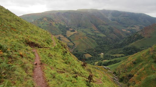 |
And now I have reached the spot where the shortcut to bm084 starts. We are looking SE. The distinct trail straight on is the GR10 where I came from. The shortcut descends to the right. |
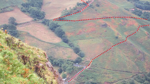 |
And this is a zoom-in. You can see how I - beyond bm085 - will climb uphill towards bm086. |
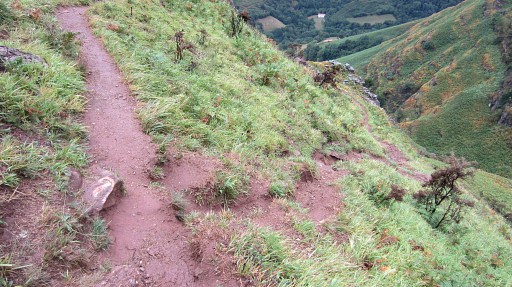 |
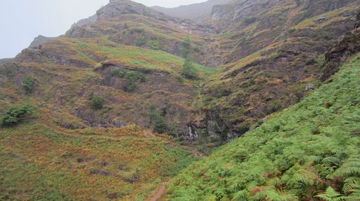
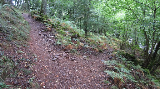
The shortcut starts here (waymarked by pink dots) and brings you |
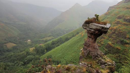 |
- steep but manageable - along this remarkable rockpillar |
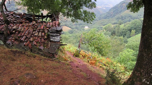 |
and this barn |
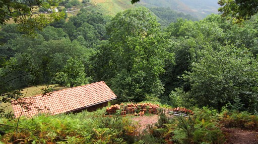 |
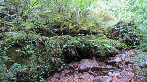
to this barn. Behind the barn - after passing a streambed (which is the border) - the trail brings you |
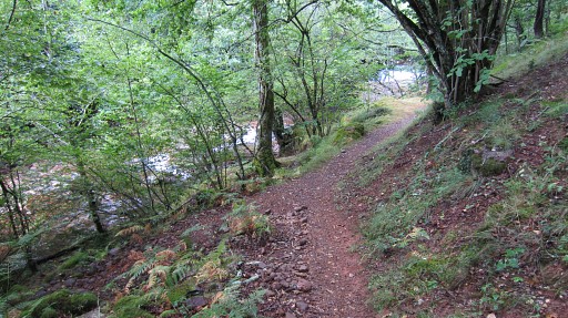 |
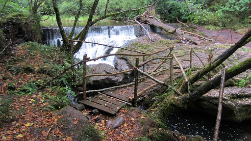
to the river. As soon as you spot the barrage/cascade |
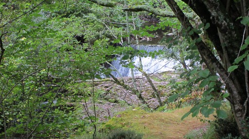 |
(this picture is a zoomin), |
 |
there’s a branch of the trail going left along the river. |
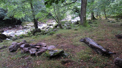 |
You will pass this nice bivouac spot |
 |
until you reach the stream of streambed (=the border) which flows into the river. On this picture you can see bm085 |
 |
standing a bit higher on its north-bank. |
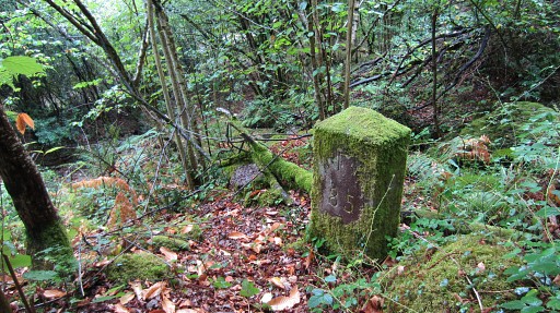 |
Bm085 |
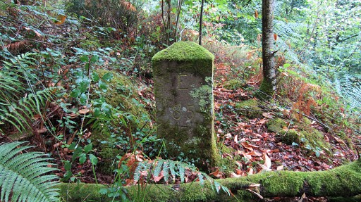 |
Bm085 |
 |
Then back along the river, crossing it on a wooden footbridge. Then climbing to a dirtroad which brings you to another bridge after which the dirtroad becomes a tarmac road. |
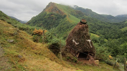 |
The tarmac road climbs to a farm with this peculiar pigshed. |
 |
After the farm, continue to the next
bend of the road and then leave the road (going straight ahead) on a
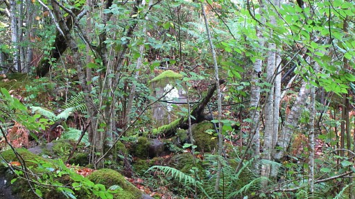
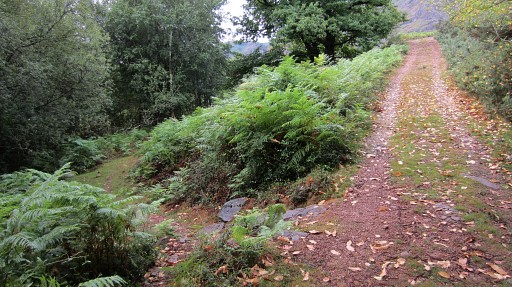
footpath which brings you to a dirtroad. A direct climb uphill from the bend in the road is discouraged by a dense fern-field uphill |
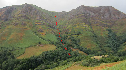 |
At the dirtroad, go to the left and reach another dirtroad. That's where I took this picture, looking back, with the borderline in red from bm084 to 085. At this junction of the two dirtroads, you’ll see a gate to a meadow. Ignore that gate and go the right. |
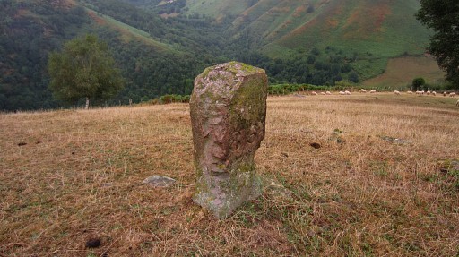 |
At the second gate, I enter the meadow, go uphill and ‘do’ bm086. |
 |
Bm086 |
 |
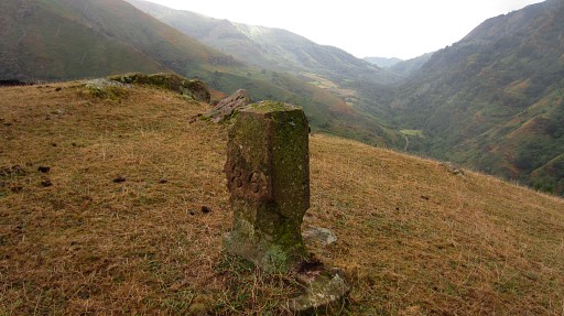
bm086 And proceed to the third gate and leave the meadow. |
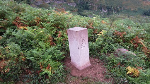 |
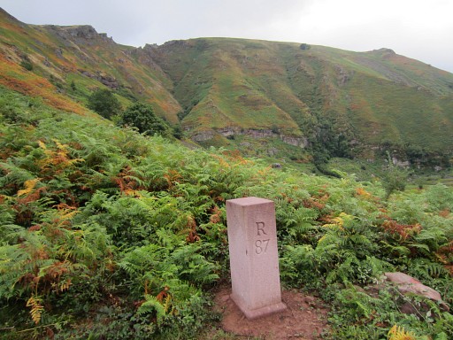
Further on the dirtroad - in the bend - is the brand new bm087. Apparently replaced in last summer. I was kindly informed by Javier Martínez Ruiz of this resurrection. |
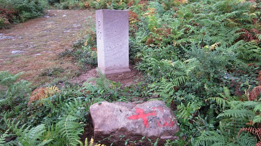 |
Bm087 with at the foreground the probable foot of the former bm087. It was destroyed years ago. |
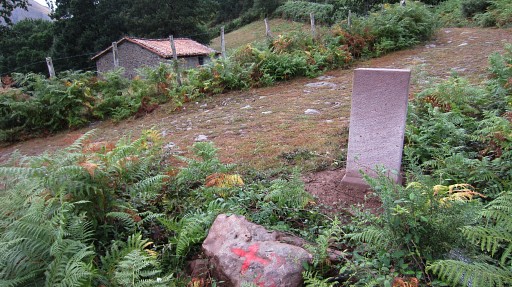 |
Bm087 |
 |
Bm087 |
 |
From here the borderline is a straight one to bm088 on the hillside far away. Then I return to Bidarray, mainly on a yellow path. |