|
The
bordermarkers of the Pyrenees : all my trips
 |
|
| -
sunday 11 september
2016 - Revisiting bm52 |
 |
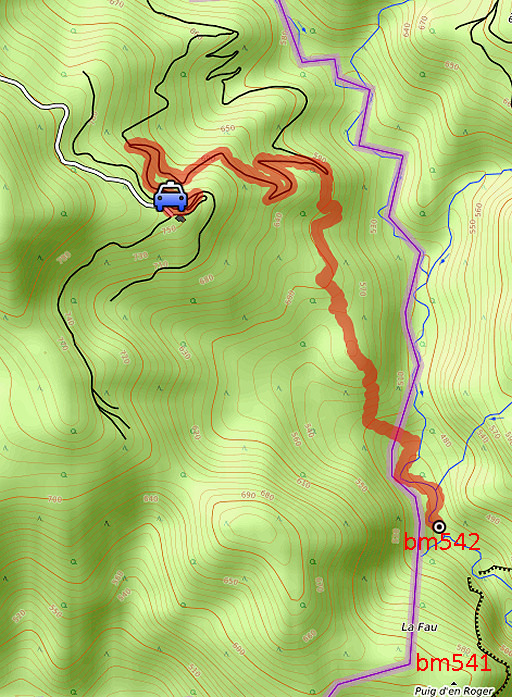 |
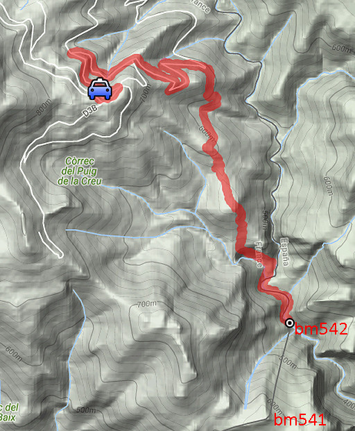
track-20160911.kml (click to open this trip in Google Earth or copy link to Google Maps; click right on this link to download gpx-version Summary: Part of a 9-days trip to the Pyrenees, covering various targets from east to west. Today: taking the 'classic' route to bm542. Weather: warm, sunny |
 |
For
explanation of
the gps-coordinates and other cartographic backgrounds: see the cartography-page The gps-track has not been manually corrected which explains the inaccuracy and misalignment at some points. Started at 9h , finish at 14:30 |
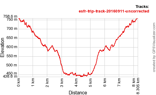 |
According
to Gps-Track-Analyse - distance : 8,5 km - cum. elevation gain : 787m - cum. elevation loss : 787m - total elevation: 1573m - altitude maxi : 759m - altitude mini : 439m - altitude average : 577m |
 |
From Can d'Amunt, descending along the winding dirtroad. At one of the lacelets (I have to be attentive to take the right one, I once took the wrong one on 14 april 2014). This picture: I'm at the right lacelet where this trail enters the forest, bringing me |
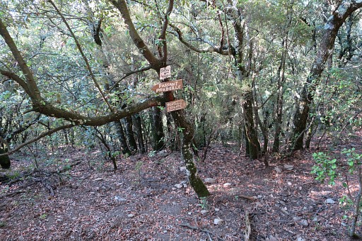 |
in ± 250m to this "waysign-post" pointing to hunter's posts 'Passant Pradeille' and 'Porteills Estaçades Font Gabat'. In navigating to bm542 it's essential to follow hunter's trails along posts like these. If you use a gps with the waypoints of these hunter's posts, it's hard to get lost. From here I proceed on a trail, first ± 50m SW, then ± 300m S and |
 |
arrive at the next post: P8. I must have missed a sign pointing to P9 and P10 about 50m before (or it has dissapeared). I continue S on the trail. |
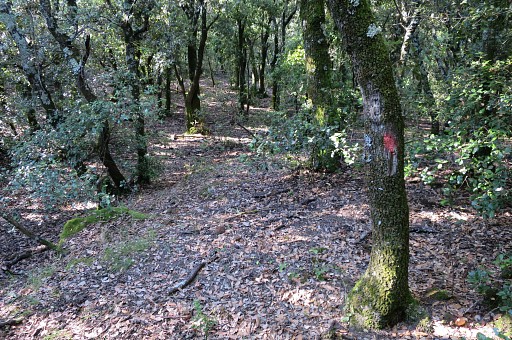 |
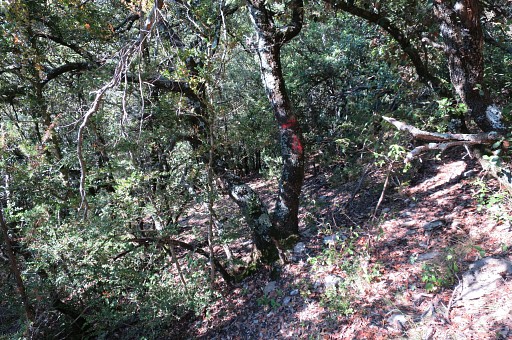
There are painted waysigns (often faded) like these in between but not abundant or consistent. |
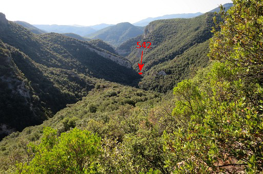 |
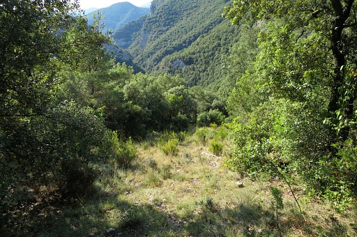
After 300m (from P8) the trail descends quite steeply in a curb for a short distance (100m) At that point, this view ahead. |
 |
In between - while descending - P4 |
 |
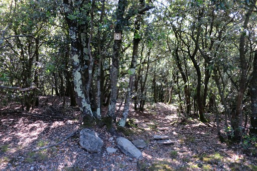
Then you arrive at this open stretch of about 150m long, descending S. Since 2009, my first visit to bm542, I see this stretch becoming forested again, more and more. |
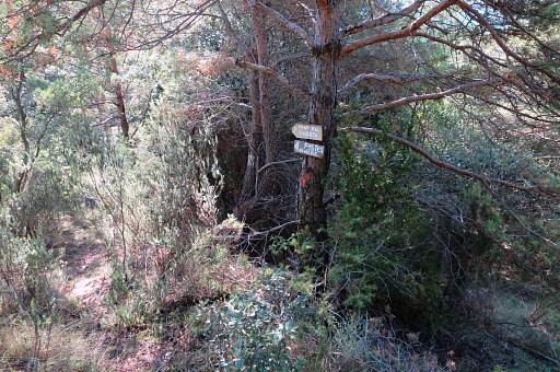 |
At the beginning of this open stretch, there are these signs (at the left side) pointing to 'Postes Rivière'. |
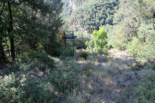 |
But I have to descend S along the open stretch, passing this hunter's watchtower |
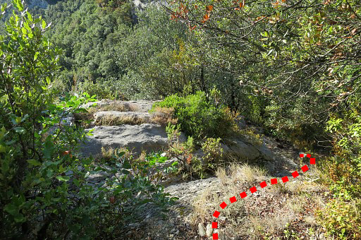 |
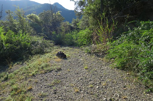
and
arriving at the end of the stretch where - at the right side - a
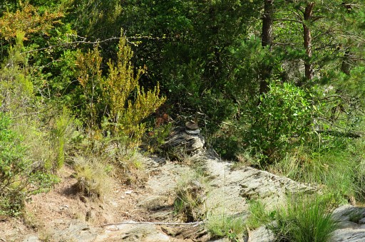
rocky trail descends along the steep hillside, going SEE for about 200m. |
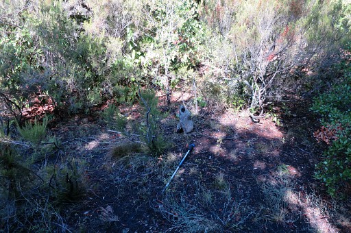 |
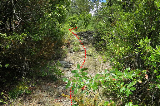
Then wayfinding gets more difficult because the trail has been partly hidden by the vegetation. This picture: having arrived at a small open spot, I made a cairn here and call it "open spot 1". I'm close to the river and have to turn SSW and go ± 75m to reach it. |
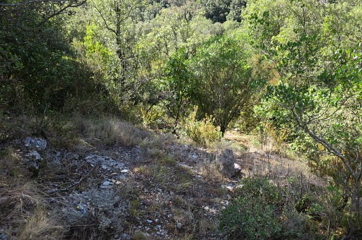 |
Further on, after 30m - there's another open spot. I call this one "open spot 2" and erect another cairn. After this open spot, the vegetation becomes more dense and I use my garden-scissors to clear the trails. |
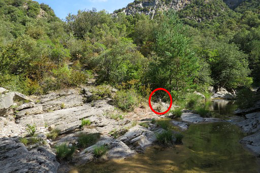 |
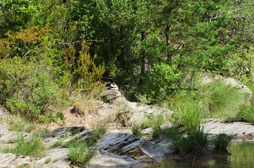
In that way I manage to reach the river Riu Major. This picture: from the river looking back to where I come from and |
 |
zooming-in to a cairn where I reached the river. On my way back from bm542, I will learn that there is also another track from the riverside, to the open spots and the more explicit trail higher on. |
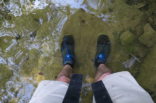 |
Then
I have to follows the river downstream for ± 350m, switching from one
side to another and for some parts wrestling through the bush at its
W-bank. It's trial and error how to proceed and it helps if you don't mind getting wet feet. |
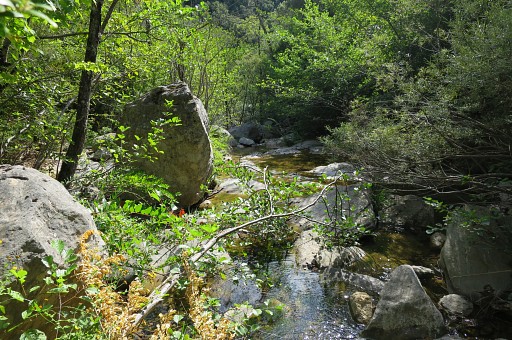 |
A view of the lush river valley |
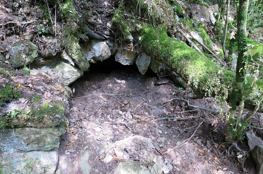 |
and here you see the remnants of what probably used to be a watermill. |
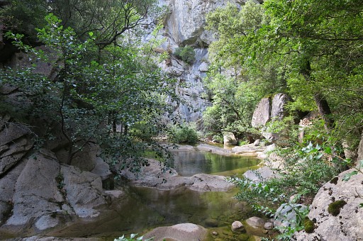 |
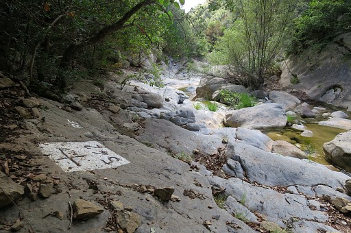
Now I'm getting close to bm542. I recognize the steep rockface ahead and bm542 is just beyond it around a bend of the river. I go through the bush at the left river-bank |
 |
and am surprised to suddenly arrive at bm542. |
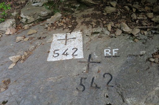 |
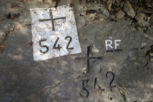
Curious: two crosses. No explanation for that. I see that the crosses have been painted since my last visit two years ago. What's new: the RF. The initials of the painter? Yesterday I saw the same RF at bm541. |
 |
|
 |
It's a beautiful and quiet spot. |
 |
|
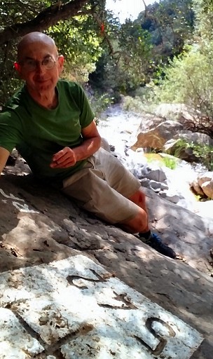 |
A picture taken with a selfie-stick. |
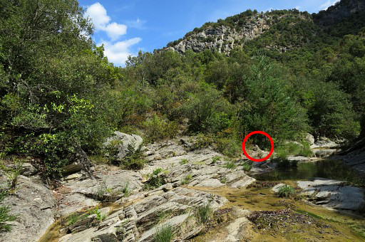 |
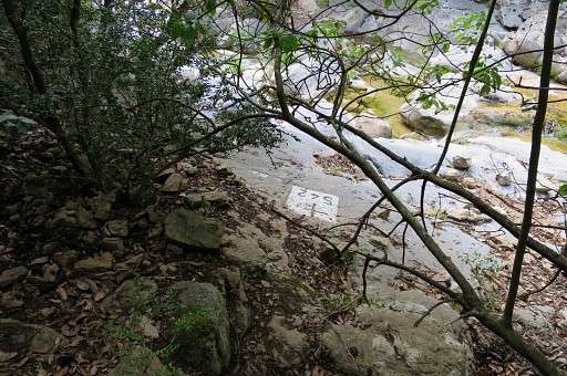
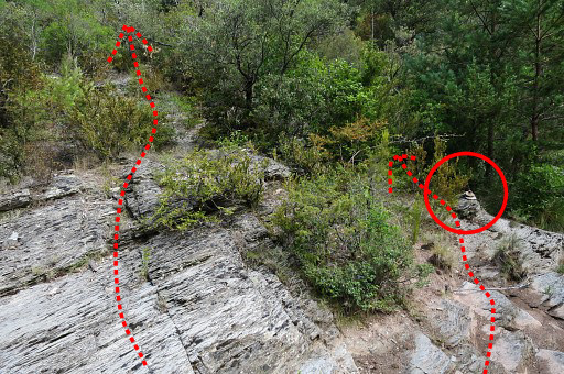
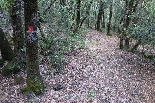
I return along the river and arrive again at the spot where I have to leave the river to climb the hills. In the red circle |
 |
once again the cairn where you can pick up a trail. |
 |
But that's not the only way up. |
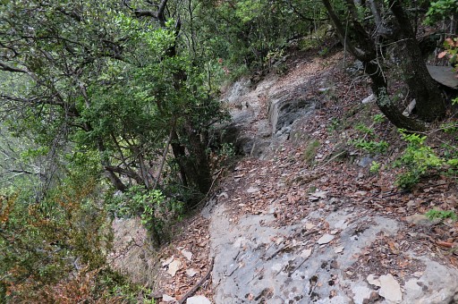 |
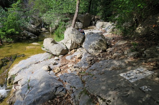
Via the open spots 1 and 2 I get on the trail climbing along the steep hillside. There is one passage to be careful not to slip away into the deep. |
 |
The end of the trail, just before it reaches the open stretch. |
 |
Then returning as I came. As said, there are painted waymarks but not consistent and fading in the last years. |
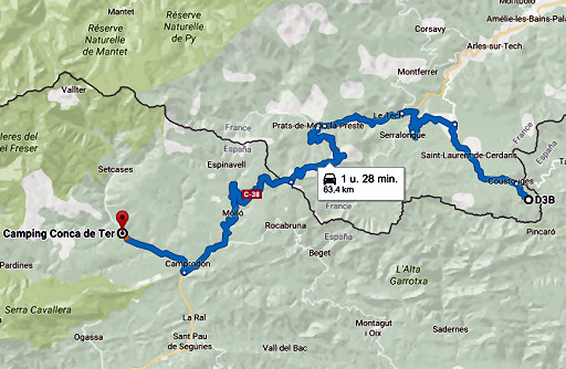 |
Finally driving to camping Conca de Ter in Vilallonga de Ter. |