|
The
bordermarkers of the Pyrenees : all my trips
 |
|
| -
sunday 25 august
2019 - Visiting the new adfr-bordermarkers |
 |
 |
Summary:
part of a series of 11 trips in august-september 2019 in the
Pyrénées-Orientales, Andorra and the Hautes-Pyrénées. This is trip 1. Today: visiting the brand new bordermarkers (july 2019) between Andorra and France near Pas de la Casa in the company of Corinne Gourgeonnet, Michel Molia and Jean-Paul Laborie. See also my blog-posts on this visit and the background of these new markers. Weather: splendid |
 track-20190825.kml
(click to open this trip in Google Earth or copy link to Google Maps; click right on this link to download gpx-version). The gps-track has not been manually corrected which explains the inaccuracy and misalignment at some points. For cartographic backgrounds: see the cartography-page Gps-waypoints of all bordermarkers (most recent version): kml: esfr-bordermarkers-all-waypoints.kml gpx: esfr-bordermarkers-all-waypoints.gpx |
|
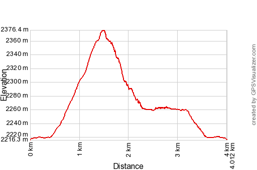 |
According to Garmin
Basecamp (uncorrected track): Distance: 4,0 km Max-height: 2370m Min-height: 2212m Elevation: +166m -161m Total elevation: 327m Start 10:39 Finish 13:41 Total time: 3:02 |
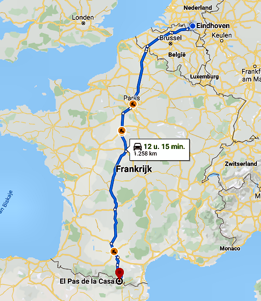 |
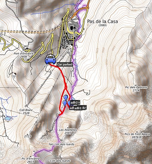
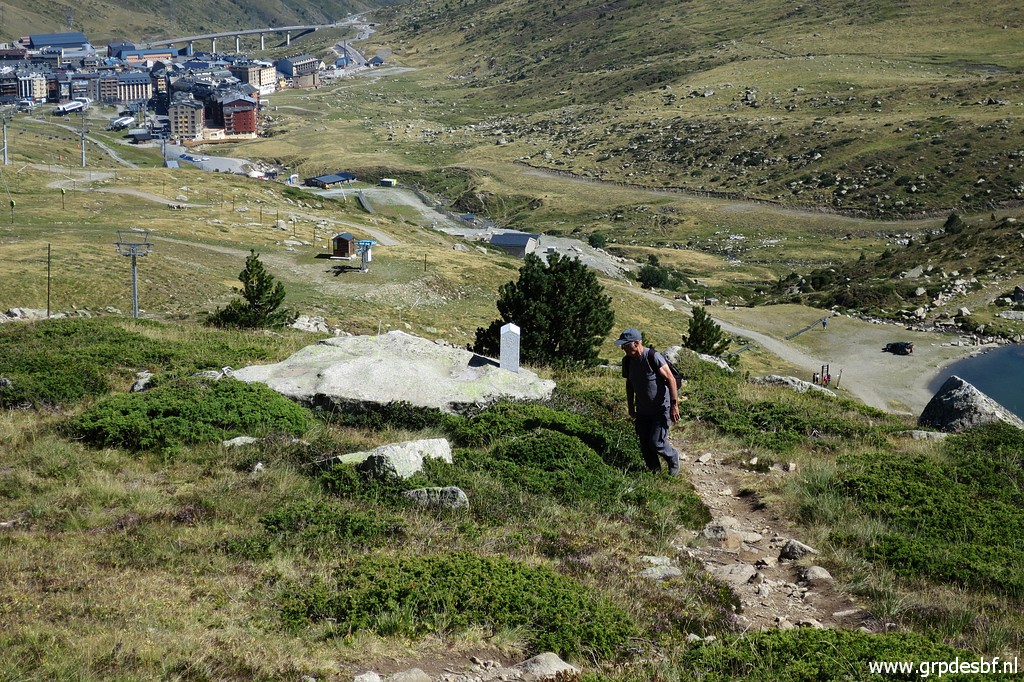
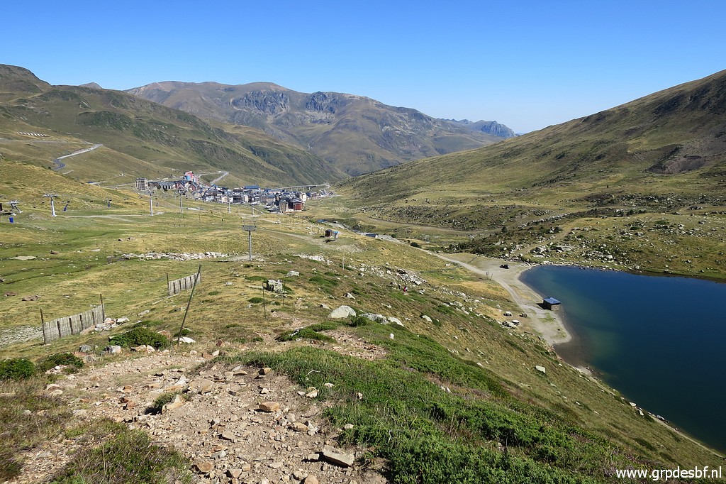
The previous day I started my drive to the Pyrenees in the afternoon. Driving through the night with a few resting and sleeping pauses, I arrive 9:30h at Pas de la Casa. Soon Corinne Gourgeonnet and Michel Molia arrive, both bordermarker devotees. Michel has his own website. And we meet for the first time Jean-Paul Laborie, an official delegate of the Pyrenean bordercommission. He was responsible for the cooperation with the Andorran authorities to install the new bordermarkers. He is proud to show 'his' bordermarkers and performs as our guide and tells a lot. He knew personally the famous french bordercommissioner Jean Sermet whom he admired for his writing capacities and the esteem for him by the Spanish. |
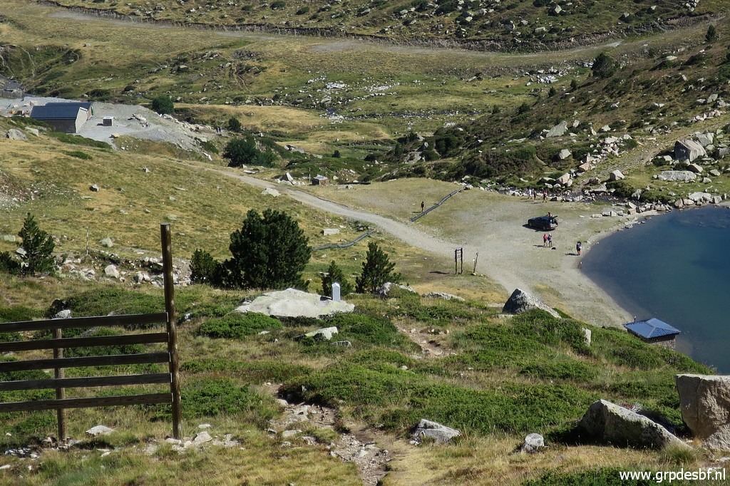
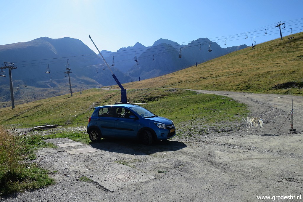 | This starting point provides a more or less horizontal approach to the scene of the new bordermarkers. (click photo to enlarge) |
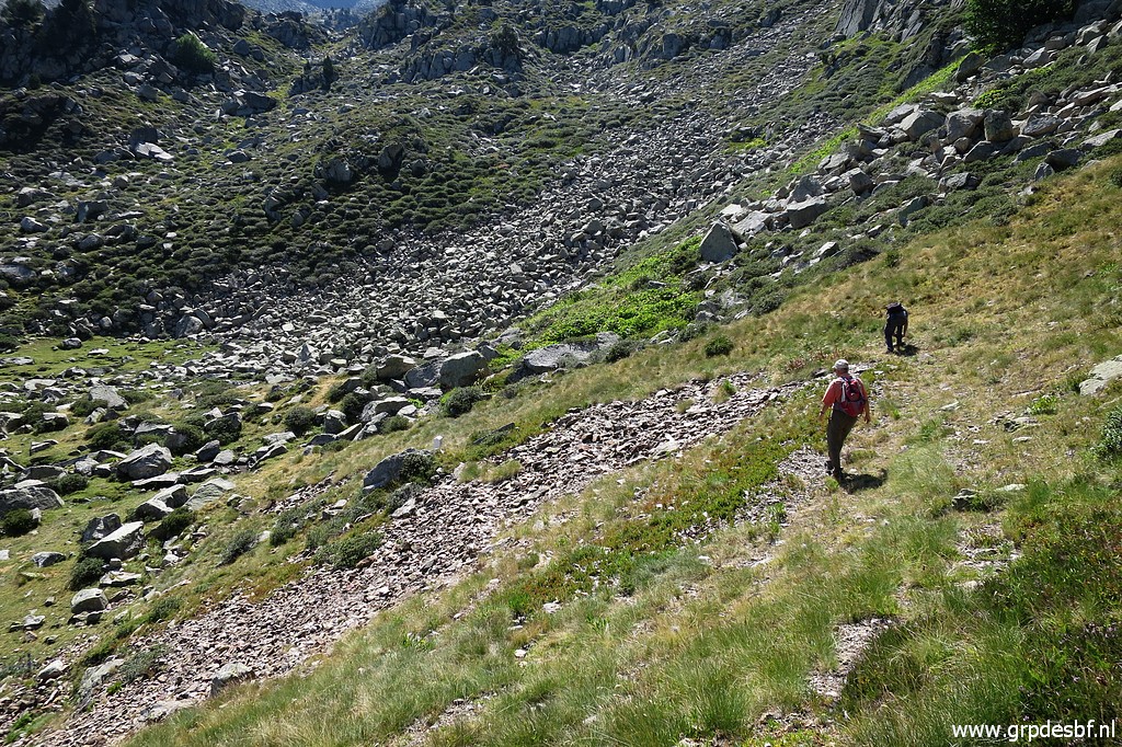
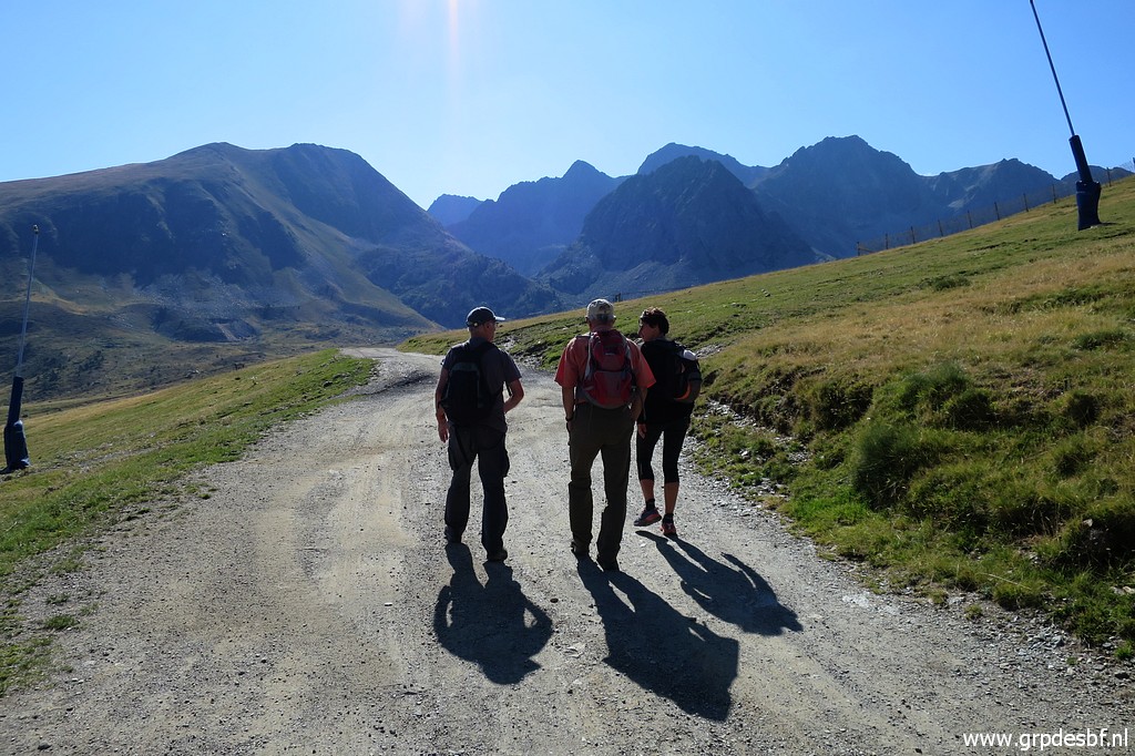 | And off we go. (click photo to enlarge) |
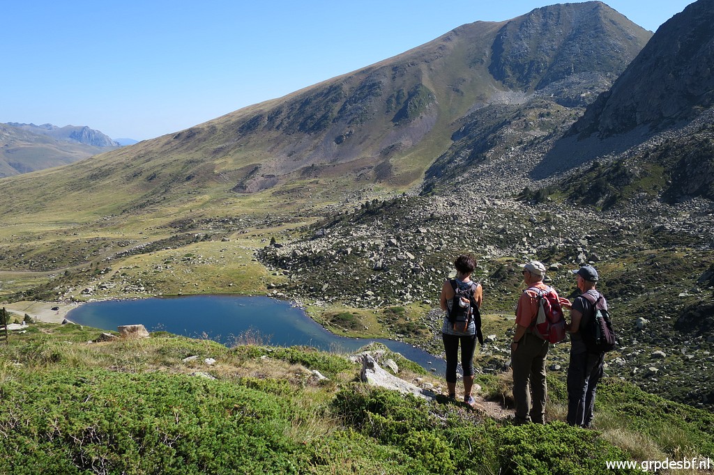
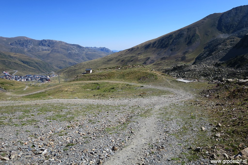 | Later on, we climb steadily to (click photo to enlarge) |
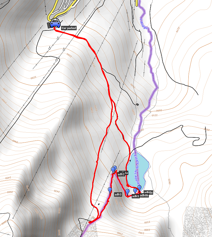
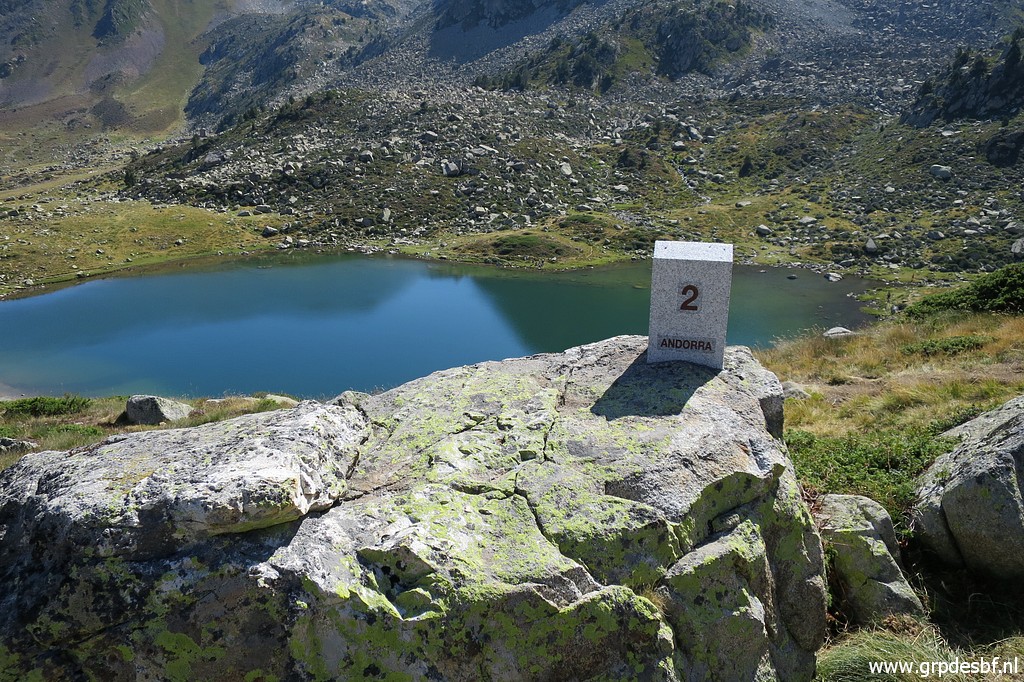
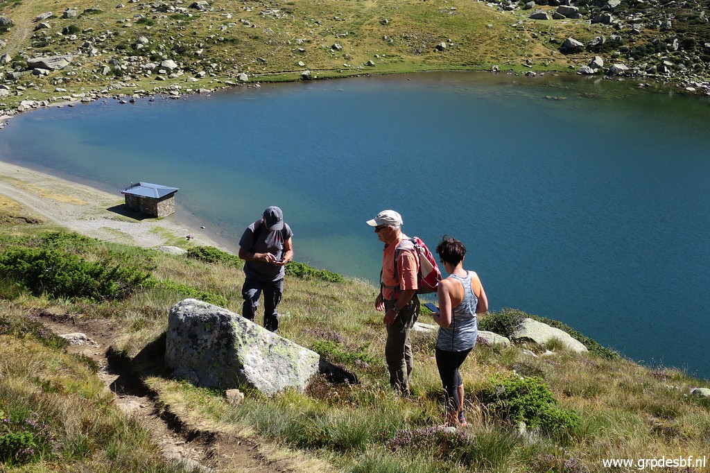
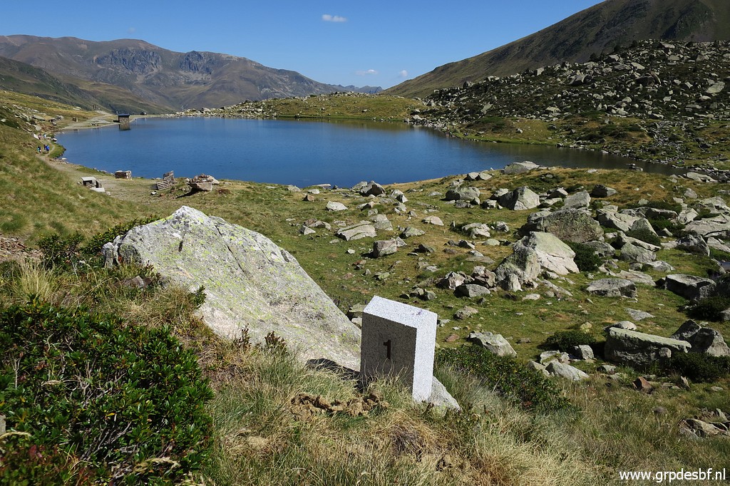
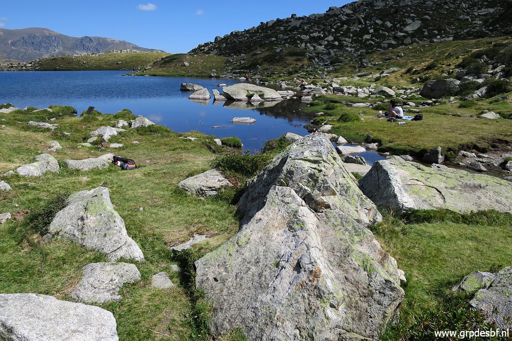
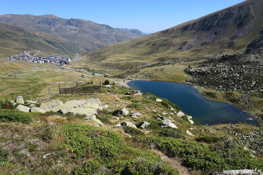 | this viewpoint of the lake of Estany de les Abelletes. The lake is crucial for the water supplies of Pas de la Casa. The new borderline splits the lake in half between Andorra and France. And around the lake the new bordermarkers have been placed. (click photo to enlarge) |
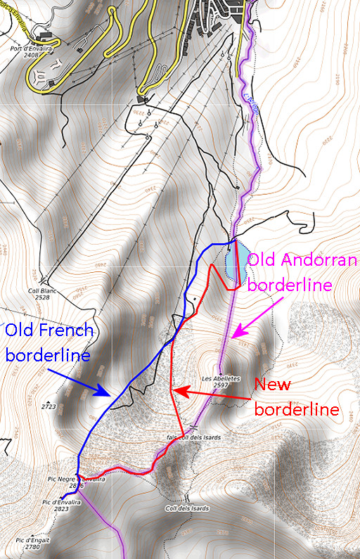 |
Let's show the three borderlines on a map. The (old) French borderline kept the lake for itself while the Andorran borderline divided it in half. The new line confirms the division of the lake and thus secures the water supply of Pas de la Casa. The remainder of the disputed terrain is roughly divided between both countries. From the Coll dels Isards it follows a trail downhill until above the lake. That part of the new border was apparently distinct enough using the trail as delimitation. The last part however - the curve descending to the lake - needed bordermarkers and that's where the new markers are placed. |
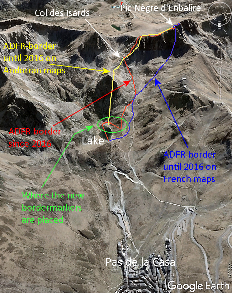 Same scene but now seen from N to S on Google Earth. Remember that there never was an official overall delimitation between Andorra and Spain/France. The constitution refers only to the borderline as the "traditional one". However, in two areas Andorra and France/Spain came to a delimitation act. The first is about the border of the Andorran parish of St. Julia de Loria with Spain (1856). The second (2000) delimited the border near the French village of Porta. That last one was in order to build a tunnel. |
|
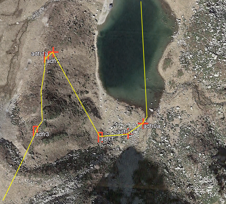 And finally the new markers and new borderline on Google Earth. |
|
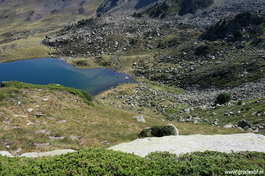
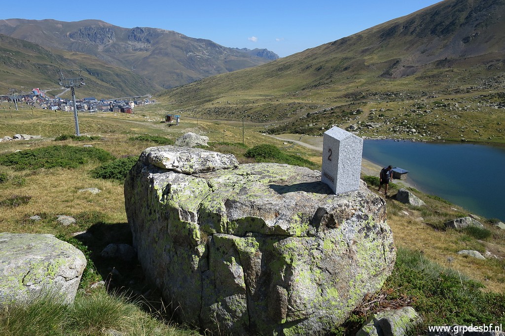
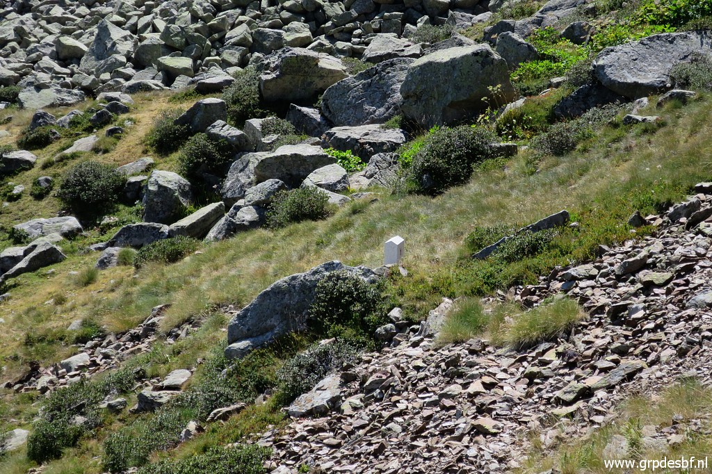
 | From our viewpoint, we can already spot the first bordermarker. (click photo to enlarge) |
 | Corinne, Jean-Paul and Michel study the terrain. (click photo to enlarge) |
 | Zoom-in to (click photo to enlarge) |
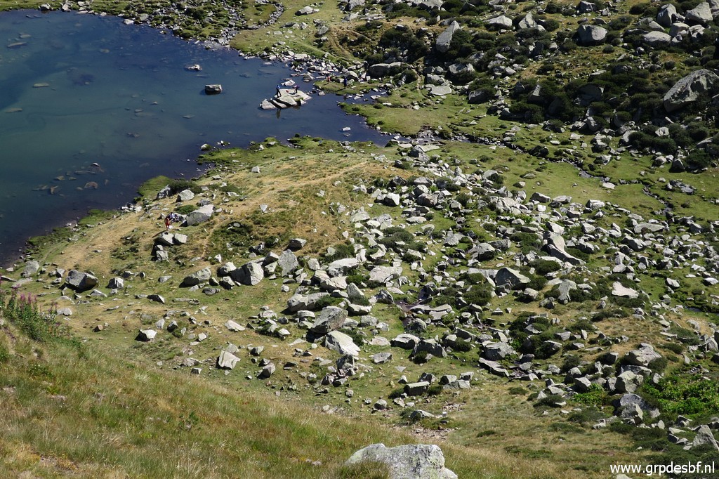 | the rocky bank of the lake where three bordermarkers are placed. (click photo to enlarge) |
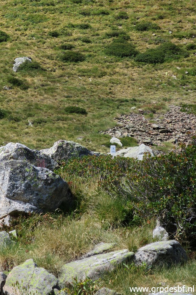
 | But first we descend to (click photo to enlarge) |
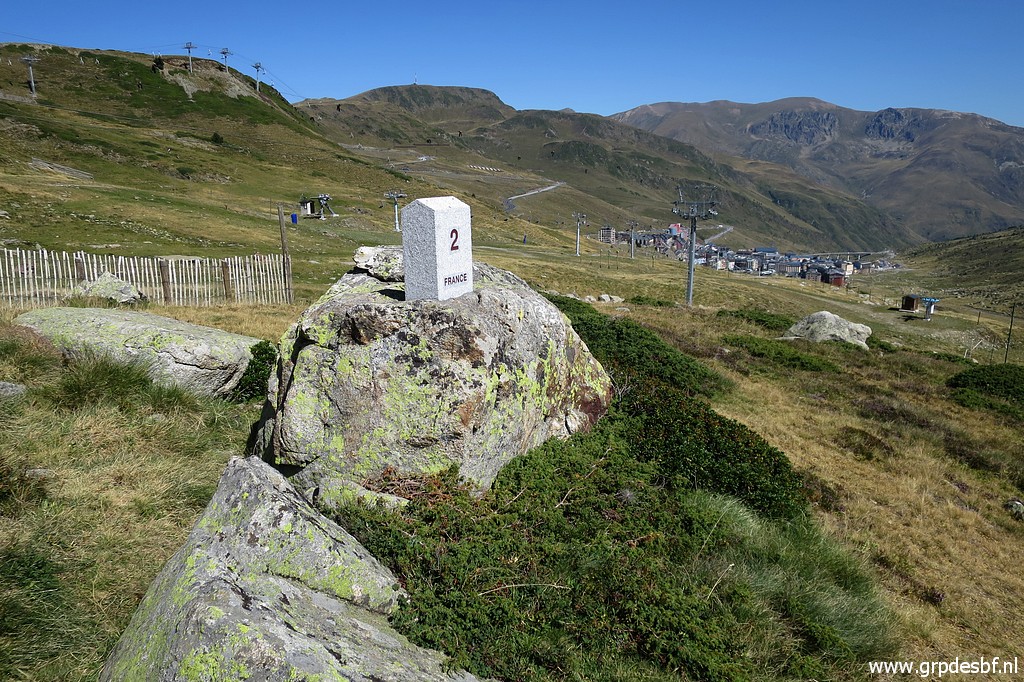
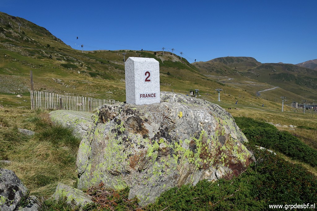
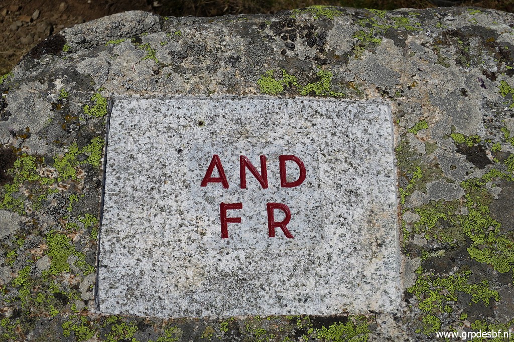
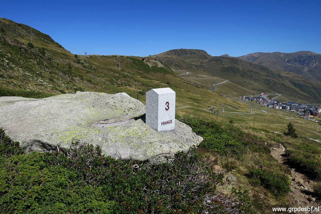 | bm3, the first we cover but the last of the six new markers in numerical order. (click photo to enlarge) |
 | Bm3 (click photo to enlarge) |
 | Bm3. The line of the 'roof' of the markers points to the next marker. (click photo to enlarge) |
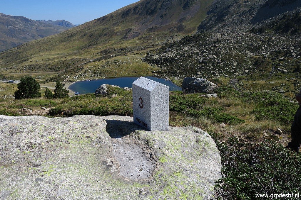
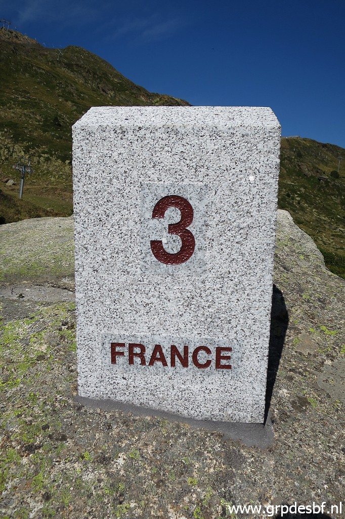 | Bm3 (click photo to enlarge) |
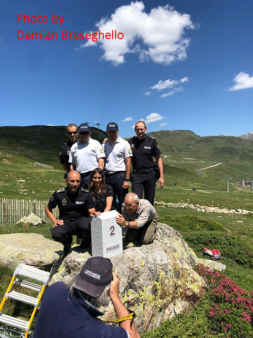 |
The markers were made / engraved by the stonecutter Damien Breseghello of www.pierrescreations.fr. He proudly shows pictures on his Facebook-page. This picture: Jean-Paul Laborie and Sara Pijuan (Andorran Geographical Institute) at the foot of the marker with some police officers. The cooperation with the Andorran authorities has been very well, Jean-Paul told us. Apparently they were delighted to get their very first bordermarkers. |
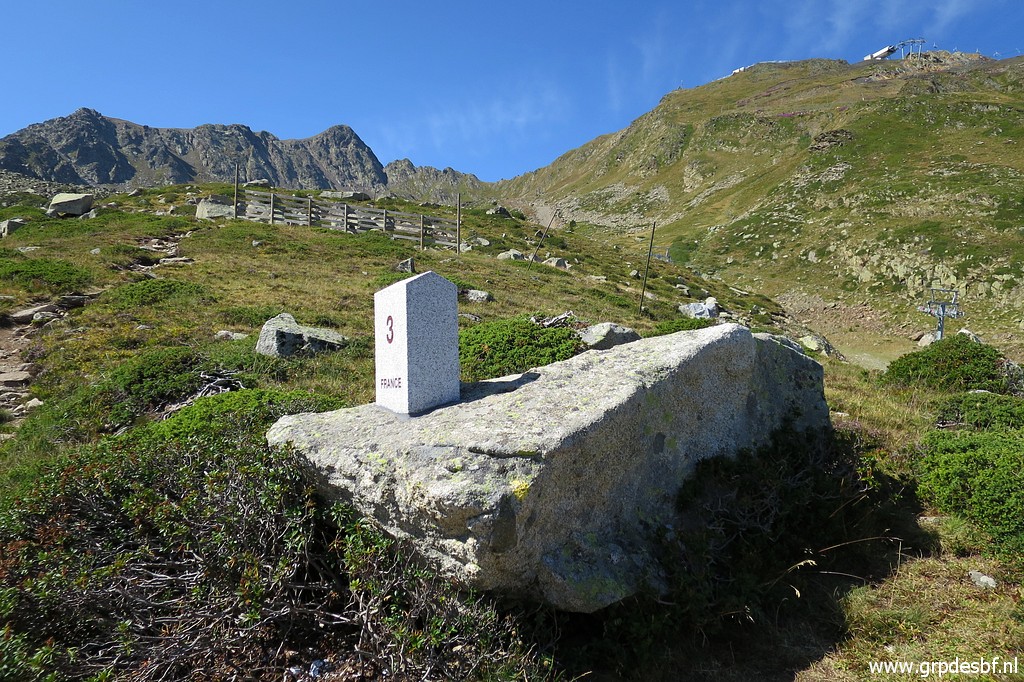 | Bm3 (click photo to enlarge) |
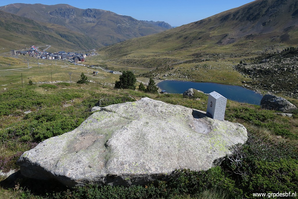
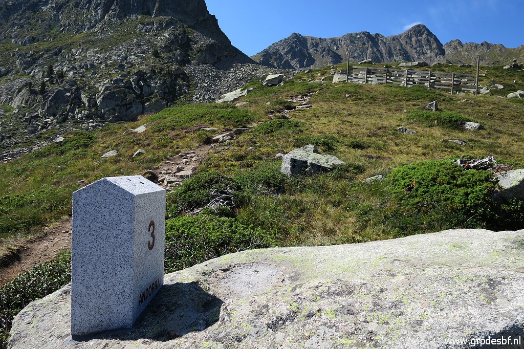 | Bm3, looking uphill where the trail climbs to Coll dels Isards. (click photo to enlarge) |
 | Along the trail we descend to (click photo to enlarge) |
 | bm2. (click photo to enlarge) |
 | Bm2 (click photo to enlarge) |
 | Bm2 (click photo to enlarge) |
 | Bm2 (click photo to enlarge) |
 | About 15m further, we reach the first unnumbered submarker: bm1a. Why are not all markers numbered stone pillars? The reason - according to Jean-Paul - was practical: the limited budget. NB: I made up my own numbering of these new unnumbered adfr-bordermarkers to be able to sort them in numerical order. (click photo to enlarge) |
 | Bm1a (click photo to enlarge) |
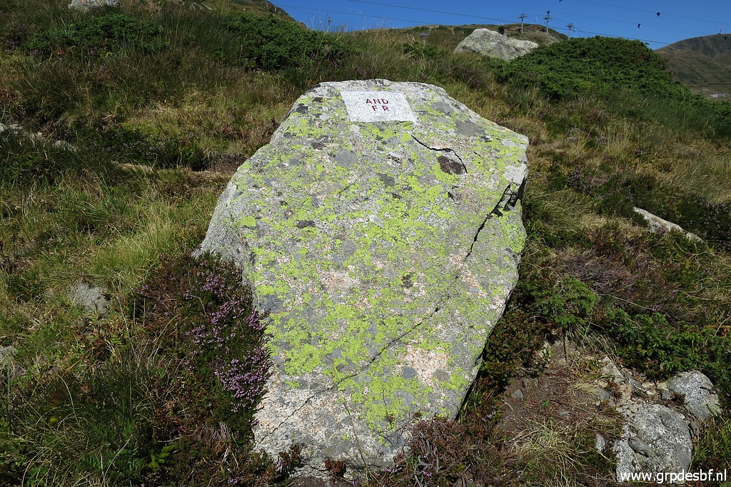 | Bm1a (click photo to enlarge) |
 | Bm1a (click photo to enlarge) |
 | Bm1a As you can see, no numbering. (click photo to enlarge) |
 | At bm1a the borderline makes a sharp bend and descends in a straight line along the hillside to (click photo to enlarge) |
 | bm1 (click photo to enlarge) |
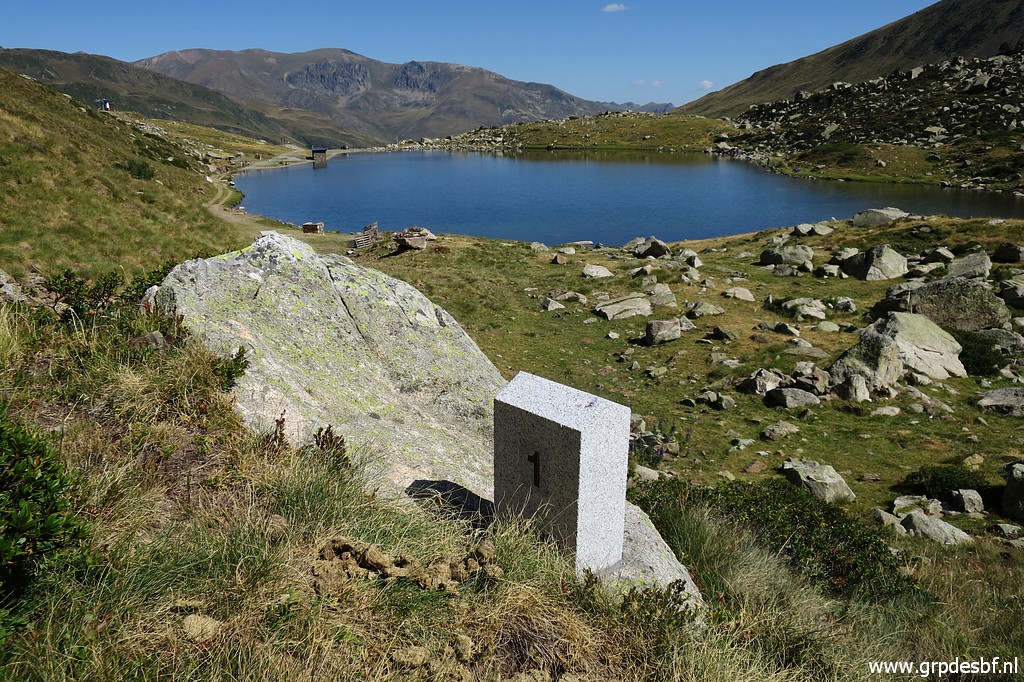 | Bm1 (click photo to enlarge) |
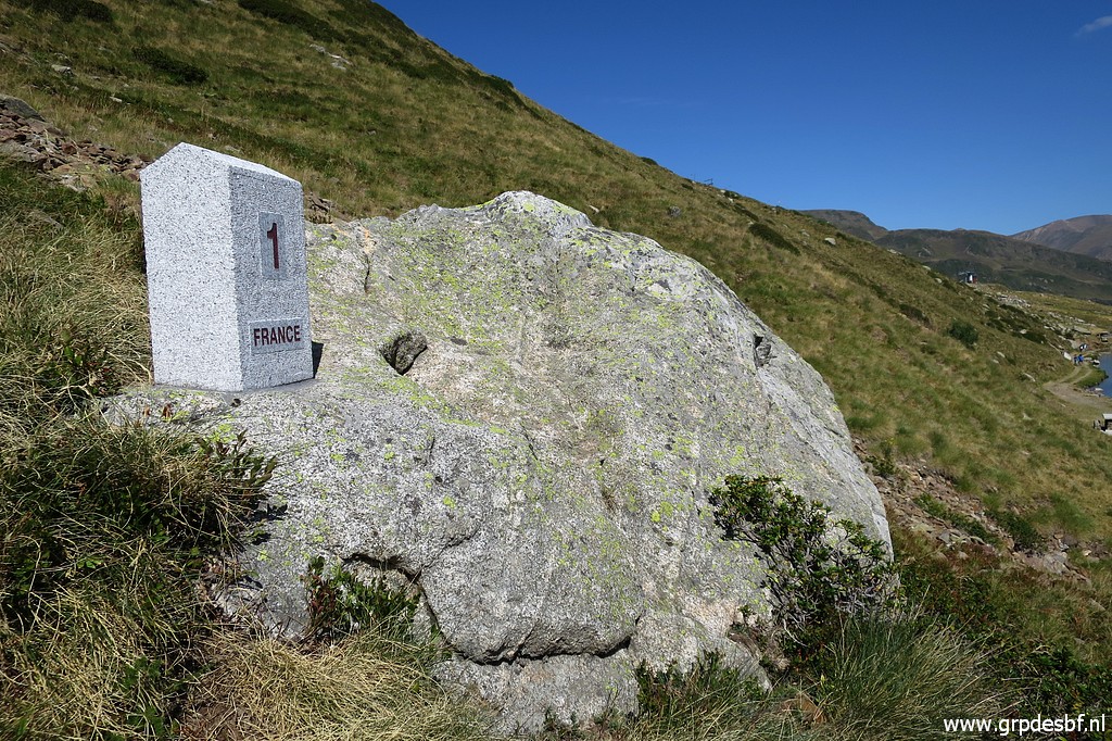 | Bm1 (click photo to enlarge) |
 | Bm1 (click photo to enlarge) |
 | Bm1 (click photo to enlarge) |
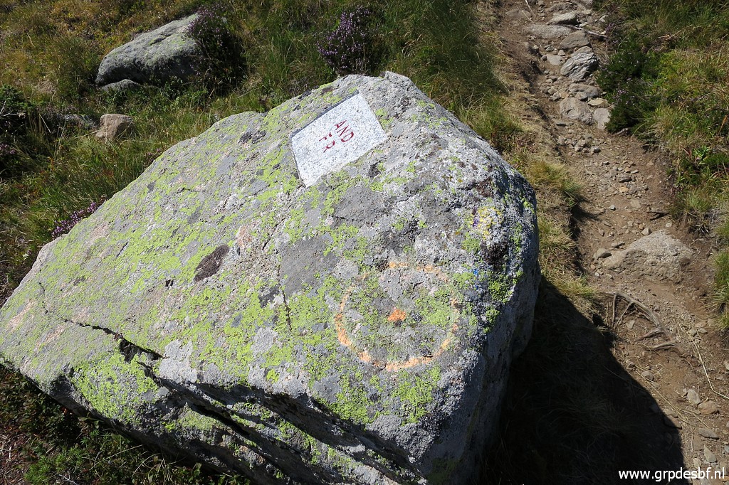
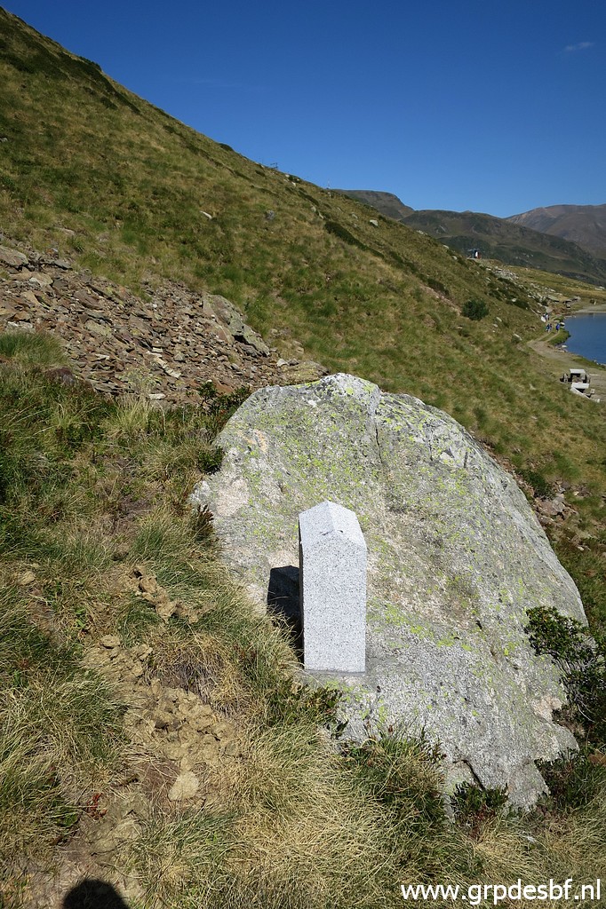
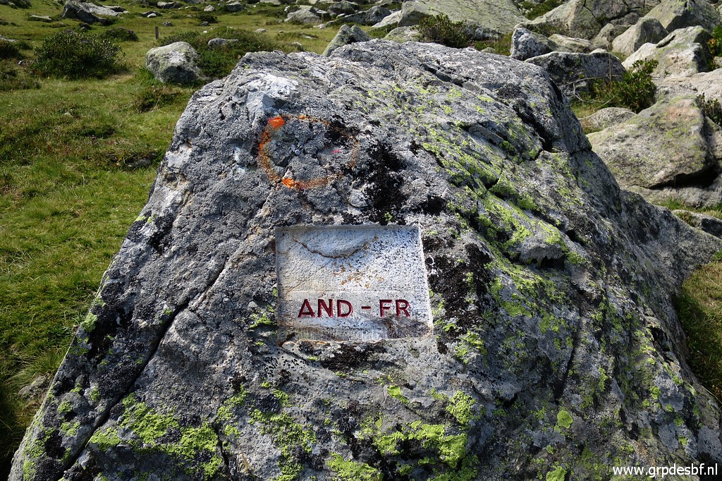
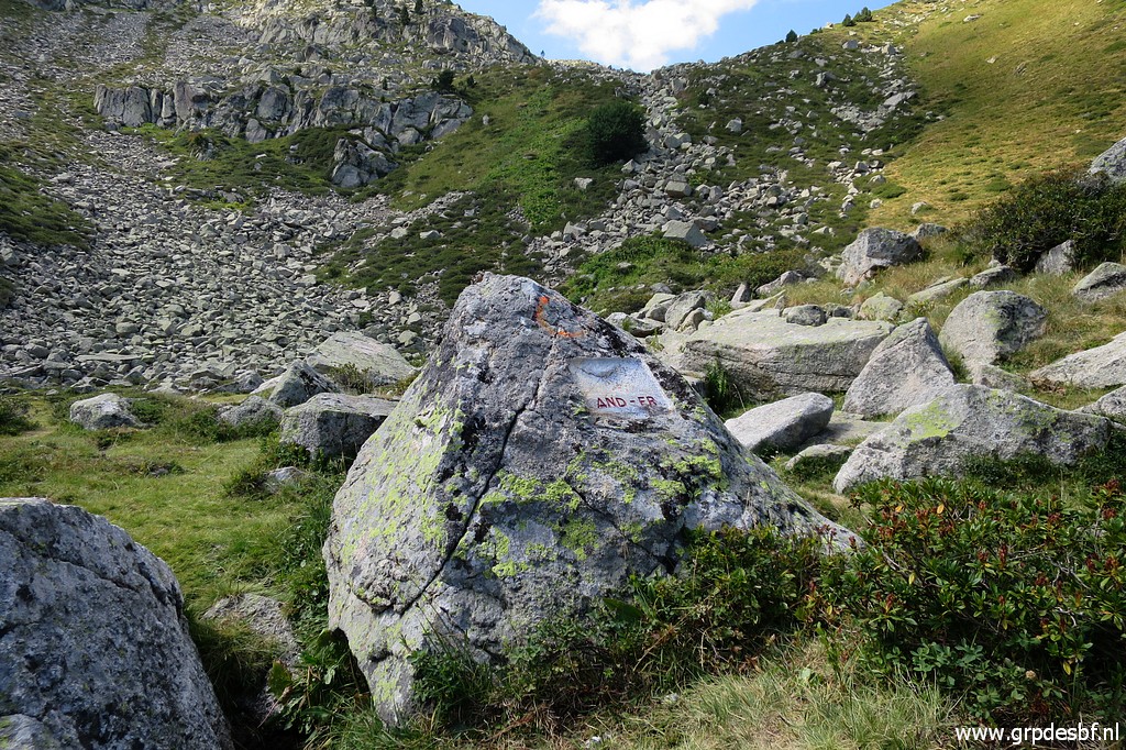
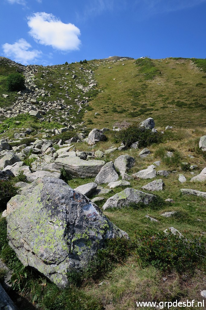
 | There are two submarkers left in the lower part of the terrain. This is bm0b, might be difficult to find amidst all these rocks. (click photo to enlarge) |
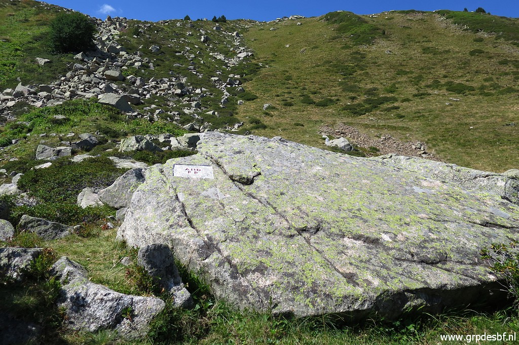 | Bm0b (click photo to enlarge) |
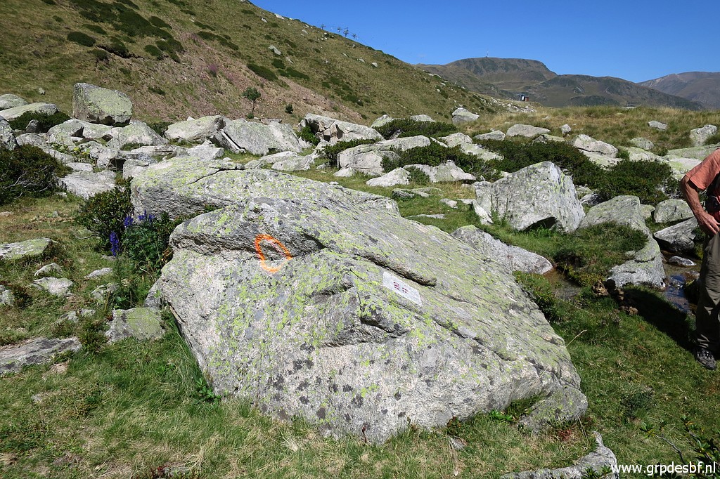 | Bm0b, note the orange circle used to mark the spots of the markers to be placed or engraved. (click photo to enlarge) |
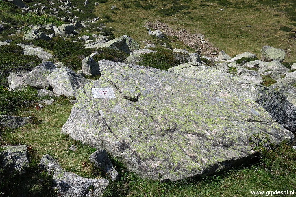
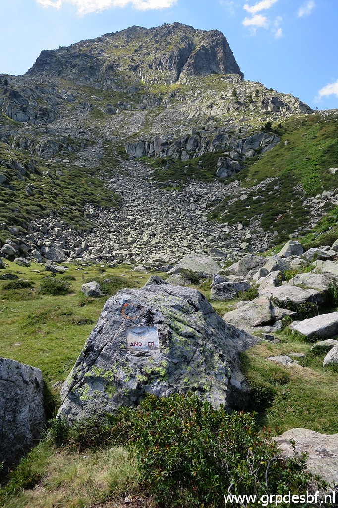 | We proceed to the last one -bm0a - which is the first in the numerical order ending at bm3. (click photo to enlarge) |
 | Bm0a (click photo to enlarge) |
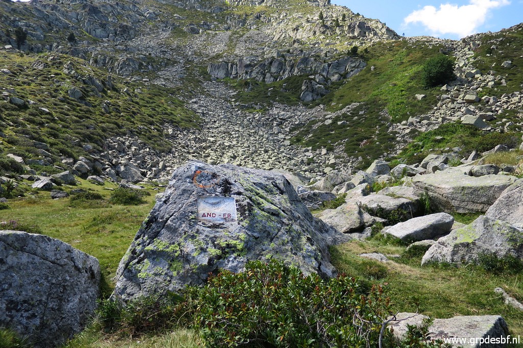
 | Bm0a (click photo to enlarge) |
 | Bm0a (click photo to enlarge) |
 | Bm0a, but seen from its backside. (click photo to enlarge) |
 | Bm0a with in the background (click photo to enlarge) |
 | Bm1 (click photo to enlarge) We have a pleasant lunch - provided by Corinne - at a picknick-table, discussing matters of the border. One important subject: the new borderline between bm407 and 409 near Bagnères-de-Luchon, contested by Michel and me (see this blogpost). We walk back to our cars and I drive - after some dutyfree shopping in Pas de la Casa - to camping Las Closas in Err, arriving there at 3pm. I'm dead tired. |