|
The
bordermarkers of the Pyrenees : the GRPdesBF
 |
||||||||||||||||||||||||||||||||||||||||||||||||||||||||||||||||||||||||||||
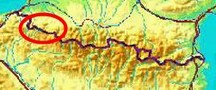
| - stage 10 - Col d'Orgambidé - D18 (bm212-229) |
 |
|||||||||||||||||||||||||||||||||||||||||||||||||||||||||||||||||||||||||||
 |
||||||||||||||||||||||||||||||||||||||||||||||||||||||||||||||||||||||||||||
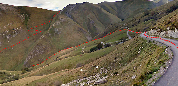
| Only
the bordermarkers along this stage are shown (and some adjoining ones).
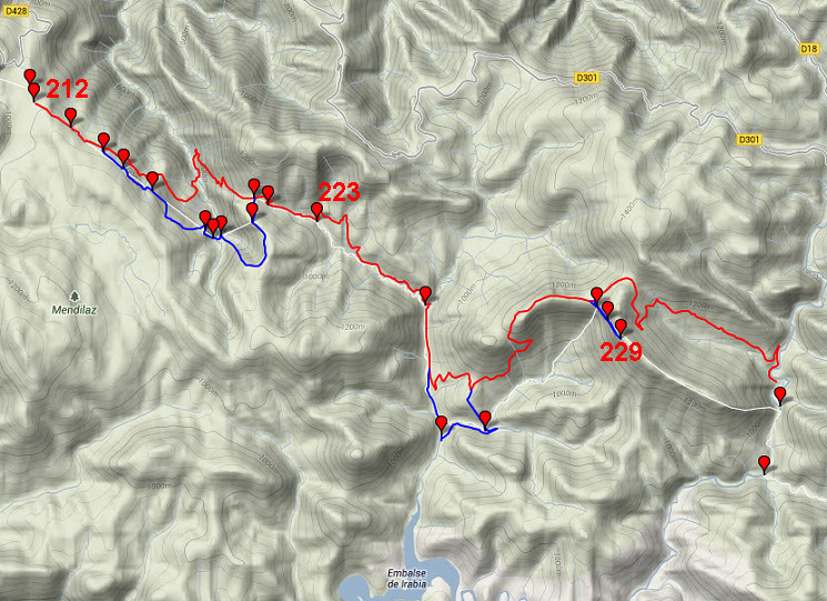
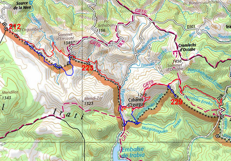
The main route is red,
the variants are blue. The main route provides a smooth
on-going route along most bordermarkers, the variants give access to
the remaining bordermarkers. See the GRPdesBF-principles. Click here for an fullscreen interactive map. Note In spring 2018 I have made some changes in the route, not yet worked out in the maps and description. The latest version (Google Earth kml-file) is grpdesbf-212-229-vs03.kml In short The main route is fairly easy in wayfinding and walking despite two tough climbs in between. A large part is on easy-going tarmac. The first two variants are tougher. Variant 1 (via 214-220) however has a bonus: the magical cave of Harpea (which is also worthwhile the detour: 600m one way from the main route). The second one along bm225 and 226 involves crossing streams and a steep climb from bm226 through the forest to the main route. The third variant is an easy detour to bm228-229. Considerations Nice bivouac-possibilities between bm224 and 225. Also at the end of this stage. Water available at various streams until bm226. At the end of this stage ther's water again. Factsheet
Gps-files needed
Useful You might check the relevant webpages in the 'All markers'-section. They provide more pictures of the bordermarkers and additional information on them. Version 02 March 2014. If you have any correction, suggestion etcetera -> please email me: eefberns@grenspalen.nl MAPS AND DIRECTIONS Print your own maps It's easy to print your own - custom made - maps with the GRPdesBF-route and the bordermarkers on them. See: Print your own maps |
||||||||||||||||||||||||||||||||||||||||||||||||||||||||||||||||||||||||||||
 |
||||||||||||||||||||||||||||||||||||||||||||||||||||||||||||||||||||||||||||
|
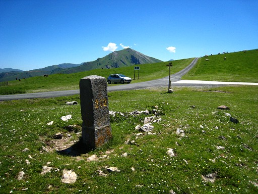
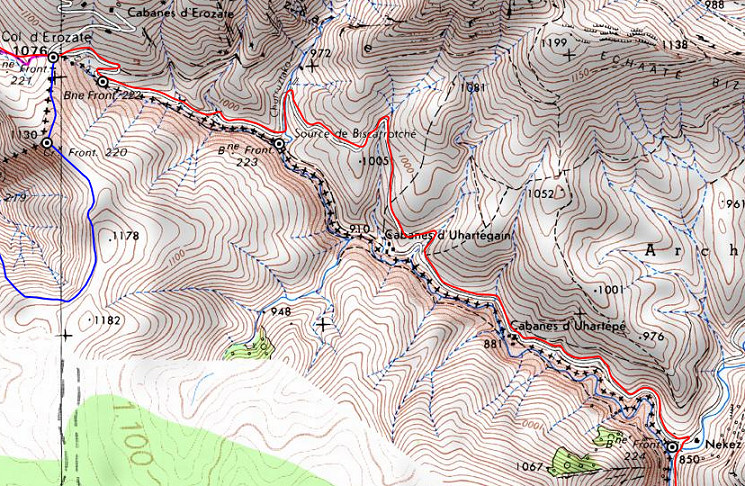
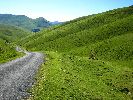
Your starting-point: bm212 at Col d'Orgambidé. |
|||||||||||||||||||||||||||||||||||||||||||||||||||||||||||||||||||||||||||
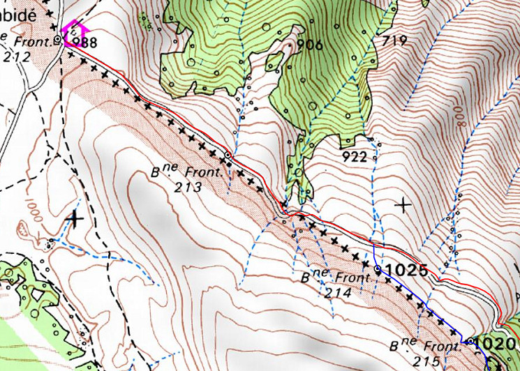 Pick up the tarmac road SE. Both bm213 and 214 are within short reach from the road. |
||||||||||||||||||||||||||||||||||||||||||||||||||||||||||||||||||||||||||||
|
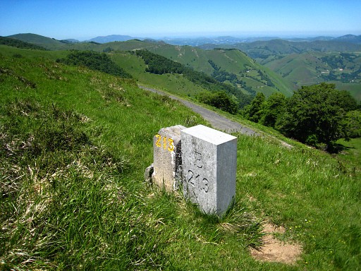
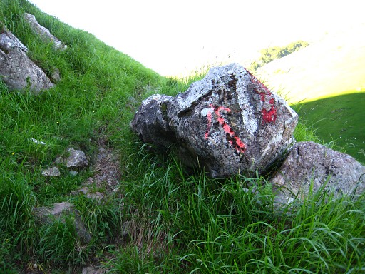
After 600m- just above the road - bm213. There's an old and a newer bm. |
|||||||||||||||||||||||||||||||||||||||||||||||||||||||||||||||||||||||||||
|
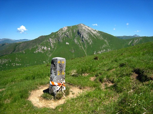
Further on - ± 250m after a bend - you have to climb the hillside for bm214. It's about 75m from the road and it may not be visible from the roadside. If you want to include variant 1, you have to stay on the hillside and continue SE. The main route continues on the road. |
|||||||||||||||||||||||||||||||||||||||||||||||||||||||||||||||||||||||||||
 From bm214, the main route continues on the tarmac road for 1,6 km |
||||||||||||||||||||||||||||||||||||||||||||||||||||||||||||||||||||||||||||
 After passing the second farm at your left hand, leave the road and descend NE on the grassy slope towards the bottom of the valley. A trail will appear and lead you to a small bridge over the stream. |
||||||||||||||||||||||||||||||||||||||||||||||||||||||||||||||||||||||||||||
 |
After
the bridge, continue N on the trail for 500m until a branch bends sharp
to the right and climbs uphill. That branch is waymarked. The trail climbs to the Col d'Erozate. Neglect branches to the left and keep the ravine at your right hand. |
|||||||||||||||||||||||||||||||||||||||||||||||||||||||||||||||||||||||||||
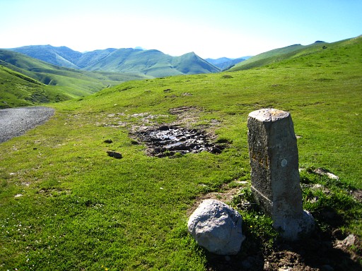 |
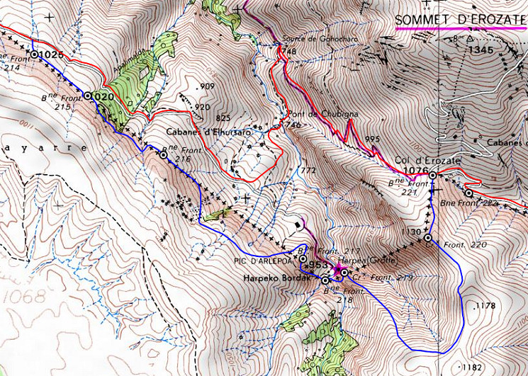
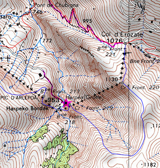
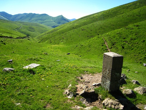
At the pass you'll find bm221 besides a tarmac road. | |||||||||||||||||||||||||||||||||||||||||||||||||||||||||||||||||||||||||||
| Variant 1 via bm215-220 |
||||||||||||||||||||||||||||||||||||||||||||||||||||||||||||||||||||||||||||
From bm214 continue SE on the hillside towards a small forest. |
||||||||||||||||||||||||||||||||||||||||||||||||||||||||||||||||||||||||||||
|
At the SW-edge of that forest: bm215. Distance bm214-215: ± 300m. Then continue SE, passing along the S-side of the forest. Then -after 150m - you need to cross a small groove and |
|||||||||||||||||||||||||||||||||||||||||||||||||||||||||||||||||||||||||||
|
climb a bit to bm216. |
|||||||||||||||||||||||||||||||||||||||||||||||||||||||||||||||||||||||||||
 |
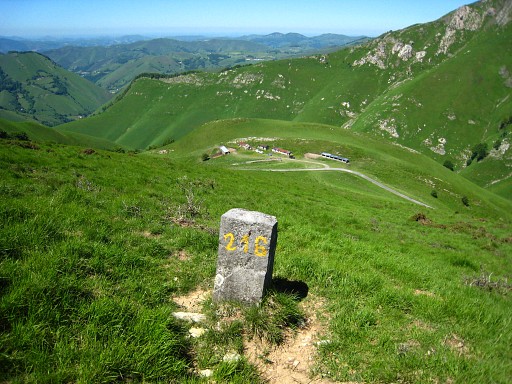
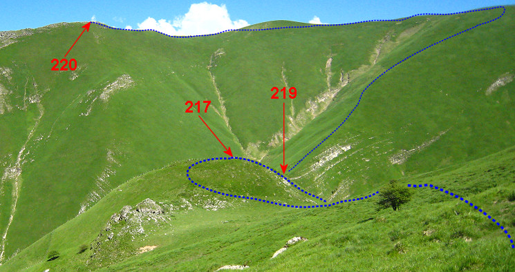
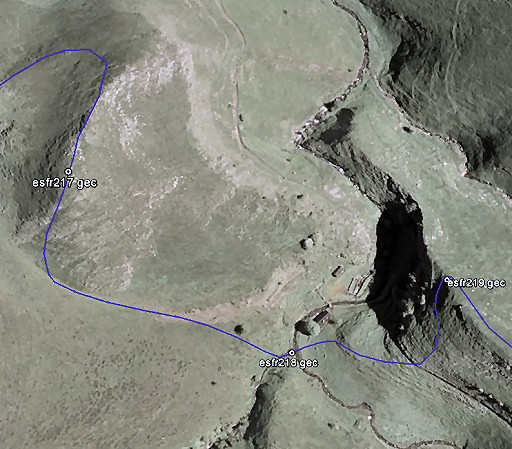
Continue SE and after 250m make a curve S-SEE higher on the hillside to pass S of a small forest-strip. Then, you can already see in the distance on the hills the spot of bm217, 219 and 220. |
|||||||||||||||||||||||||||||||||||||||||||||||||||||||||||||||||||||||||||
 This zoom-in gives a better view of the route ahead. This zoom-in gives a better view of the route ahead. |
||||||||||||||||||||||||||||||||||||||||||||||||||||||||||||||||||||||||||||
 |
Same part of the variant on the IGNfr-map. |
|||||||||||||||||||||||||||||||||||||||||||||||||||||||||||||||||||||||||||
|
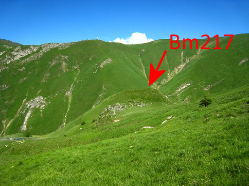
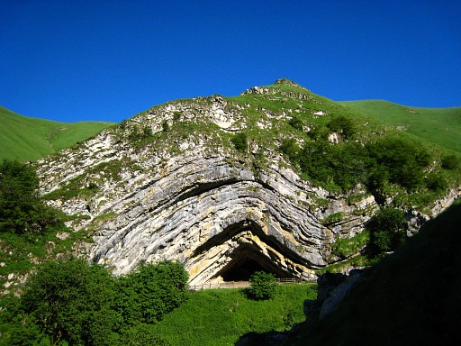
Bm217 is an easy find. On the other side of the hilltop, you can already see the Grotte Harpea. |
|||||||||||||||||||||||||||||||||||||||||||||||||||||||||||||||||||||||||||
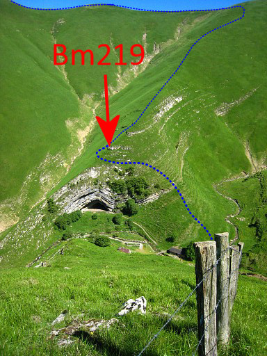 |
Another view of Grotte Harpea and the indication of bm219 and the route to go. |
|||||||||||||||||||||||||||||||||||||||||||||||||||||||||||||||||||||||||||
 |
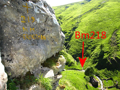
From bm217 descend steeply S and then descend SEE to the valley and the stream where |
|||||||||||||||||||||||||||||||||||||||||||||||||||||||||||||||||||||||||||
|
bm218 stands proudly. The Grotte Harpea is behind the tree. |
|||||||||||||||||||||||||||||||||||||||||||||||||||||||||||||||||||||||||||
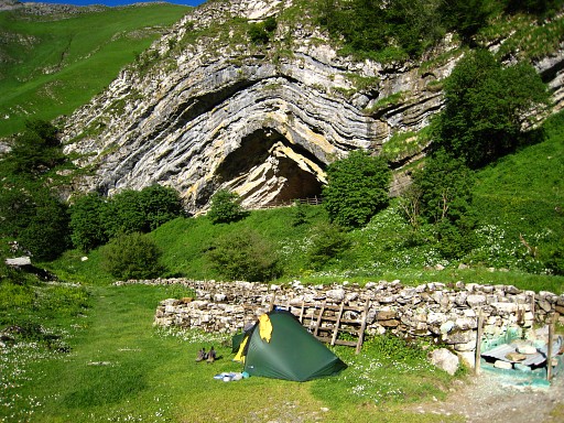 |
By the way, this valley is a wonderful spot to camp (if the shepherd allows it). |
|||||||||||||||||||||||||||||||||||||||||||||||||||||||||||||||||||||||||||
 |
A view towards the Grotte and |
|||||||||||||||||||||||||||||||||||||||||||||||||||||||||||||||||||||||||||
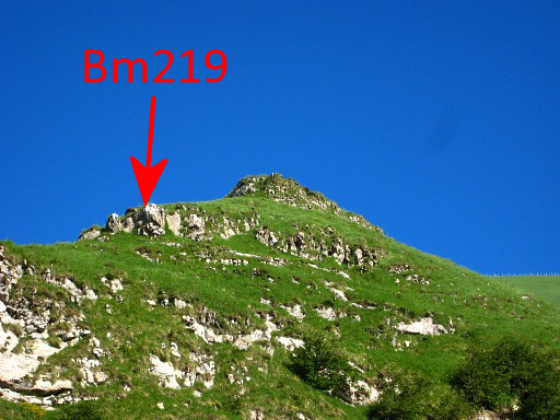 |
- zoomin - to the spot of bm219. |
|||||||||||||||||||||||||||||||||||||||||||||||||||||||||||||||||||||||||||
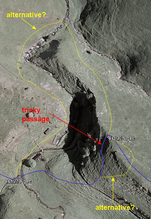 |
The steep climb to bm219 presents a tricky passage, especially in wet weather when the grass is slippery. The map shows two alternatives if you feel unsafe. |
|||||||||||||||||||||||||||||||||||||||||||||||||||||||||||||||||||||||||||
|
Bm219 |
|||||||||||||||||||||||||||||||||||||||||||||||||||||||||||||||||||||||||||
|
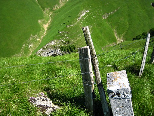
The remaining part of the variant is - though steep - easy to navigate. From bm219, climb SE up the hillridge until the fence. Climb over or crawl under the fence to the other side. Then follow the fence to the N until |
|||||||||||||||||||||||||||||||||||||||||||||||||||||||||||||||||||||||||||
 |
bm220 (this picture: looking back along the fence and ridge). | |||||||||||||||||||||||||||||||||||||||||||||||||||||||||||||||||||||||||||
|
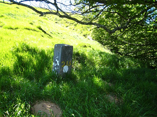
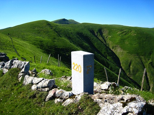
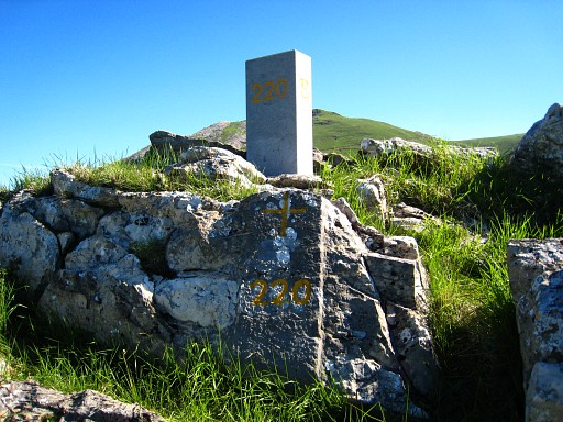
Don't forget the original bordercross 220 at its foot. From bm220, head N and pick a track/dirtroad and arrive in 350m at bm221. |
|||||||||||||||||||||||||||||||||||||||||||||||||||||||||||||||||||||||||||
| End of variant 1 |
||||||||||||||||||||||||||||||||||||||||||||||||||||||||||||||||||||||||||||
 |
||||||||||||||||||||||||||||||||||||||||||||||||||||||||||||||||||||||||||||
|
|
Bm221. Ahead the tarmac road to descend on until -after some bends and 400m - |
|||||||||||||||||||||||||||||||||||||||||||||||||||||||||||||||||||||||||||
 |
bm222 can be spottted to the right of the road. | |||||||||||||||||||||||||||||||||||||||||||||||||||||||||||||||||||||||||||
|
bm222 Besides it, an older bm222 lying flat. |
|||||||||||||||||||||||||||||||||||||||||||||||||||||||||||||||||||||||||||
|
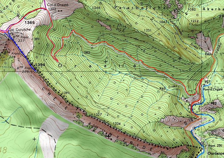
Descend for another 700m on the road. To the right, at a confluence of two streams, there is bm223 Continue on the tarmac road. |
|||||||||||||||||||||||||||||||||||||||||||||||||||||||||||||||||||||||||||
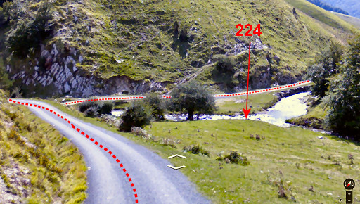 |
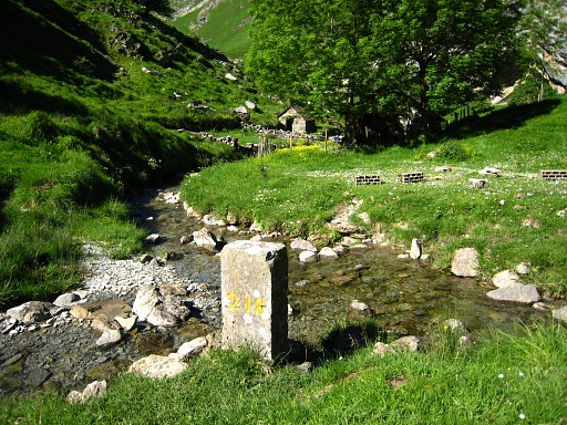
Then - after 3km on the winding road - there's another and larger confluence of two streams to the right. That's where bm224 is. |
|||||||||||||||||||||||||||||||||||||||||||||||||||||||||||||||||||||||||||
|
Bm224 Now take the road going S along the river. |
|||||||||||||||||||||||||||||||||||||||||||||||||||||||||||||||||||||||||||
 |
After 1 km the main route goes left, climbing on a zigzagging road to various farms/cabins, while variant 2 continues S. After 1,3 km the main route arrives at its second junction with variant 2. |
|||||||||||||||||||||||||||||||||||||||||||||||||||||||||||||||||||||||||||
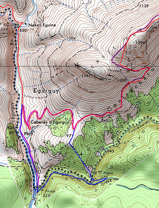
| Variant 2 via bm225-226 |
||||||||||||||||||||||||||||||||||||||||||||||||||||||||||||||||||||||||||||
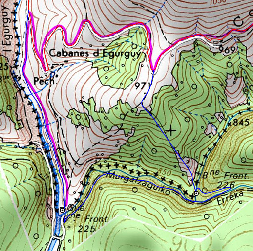 |
The navigation to bm225 and from bm225 until bm226 is easy. From bm226 you need to climb uphill through the forest (no trails) towards the junction with the main route. |
|||||||||||||||||||||||||||||||||||||||||||||||||||||||||||||||||||||||||||
|
Bm225 is after 1 km along the road and at another confluence. Continue S for 250m - first wading through a stream (easy) - and then turn left on a forest road. |
|||||||||||||||||||||||||||||||||||||||||||||||||||||||||||||||||||||||||||
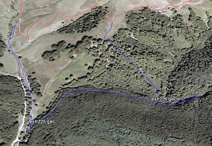 That forest road climbs NE-E parallel to a stream (= the border). After 750m you will spot another stream descending from the N and merging with the stream down the forest road. If you walk further for 200m, you can cross the river and return to where the two streams merge. |
||||||||||||||||||||||||||||||||||||||||||||||||||||||||||||||||||||||||||||
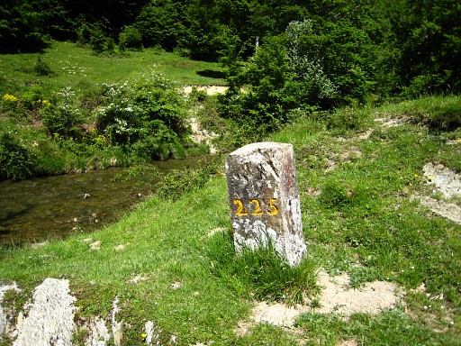
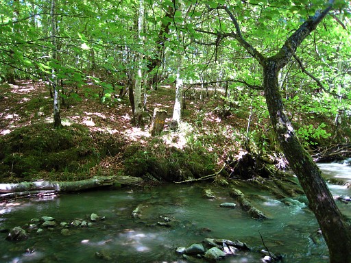 |
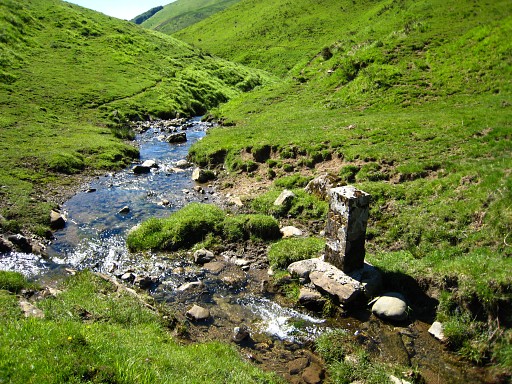
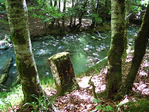
About 20m from the confluence - on
the W-side of the stream coming from the N - you can find bm226 Wading through the river is easy here. |
|||||||||||||||||||||||||||||||||||||||||||||||||||||||||||||||||||||||||||
|
Bm226, looking down on the stream. |
|||||||||||||||||||||||||||||||||||||||||||||||||||||||||||||||||||||||||||
 |
Now walking gets tougher. You have to climb 500m NNW (100m in elevation) through the forest (including an open space in the beginning) until you leave the forest and a track appears. Then it's 150m climbing N to arrive at the dirtroad and the main route. |
|||||||||||||||||||||||||||||||||||||||||||||||||||||||||||||||||||||||||||
| End of variant 2 |
||||||||||||||||||||||||||||||||||||||||||||||||||||||||||||||||||||||||||||
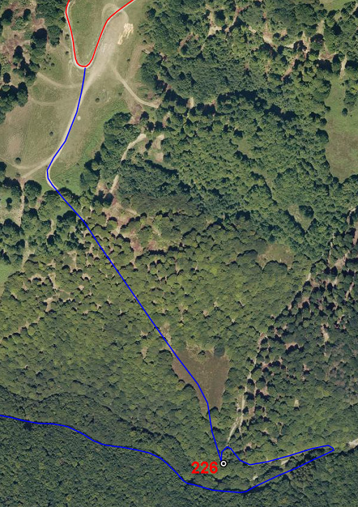
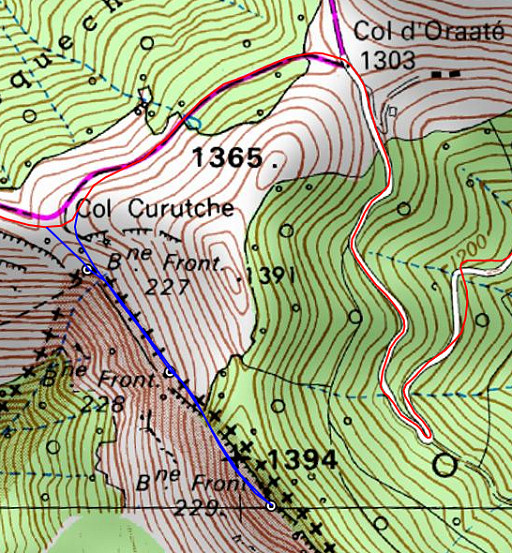
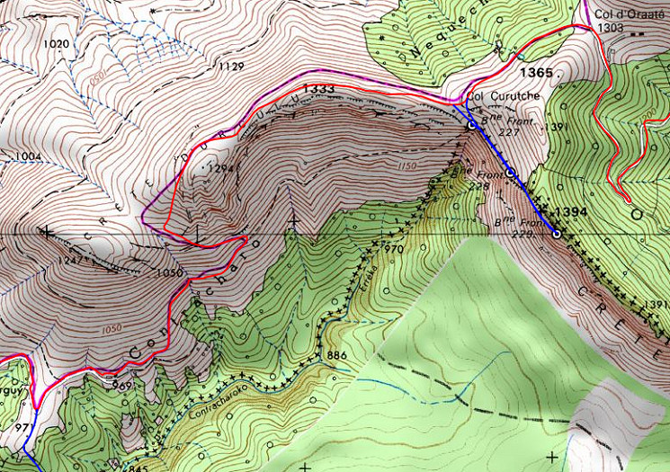 After the junction with variant 2, the dirtroad with the main route continues for 400m and ends at a farm. A waymarked trail (GR12 Sendero de Euskal Herria?) continues and will climb to the ridge. Then - once at the ridge - it continues along the ridge in 1,5 km to Col Curutche. However: bm227 is not at the Col itself but ± 100m SE downhill (but therefore still part of the main route). |
||||||||||||||||||||||||||||||||||||||||||||||||||||||||||||||||||||||||||||
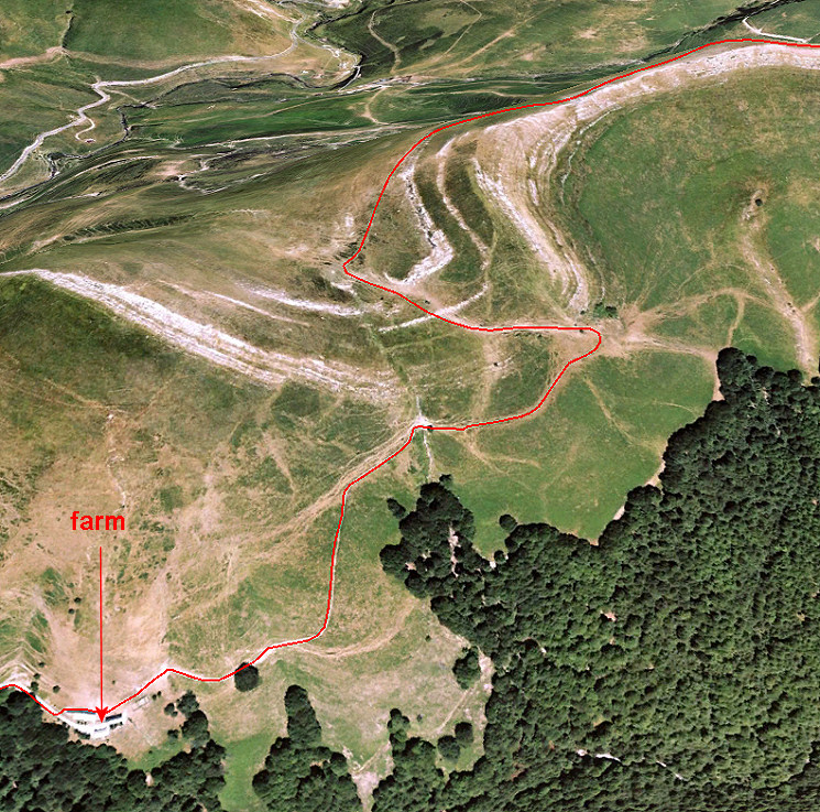 Let's show the first part (from farm to ridge) better, in case the waymarks are vague or missing. |
||||||||||||||||||||||||||||||||||||||||||||||||||||||||||||||||||||||||||||
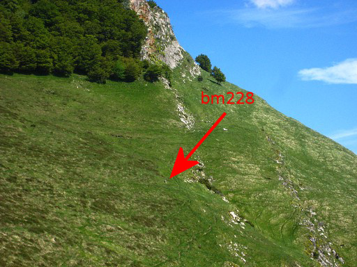
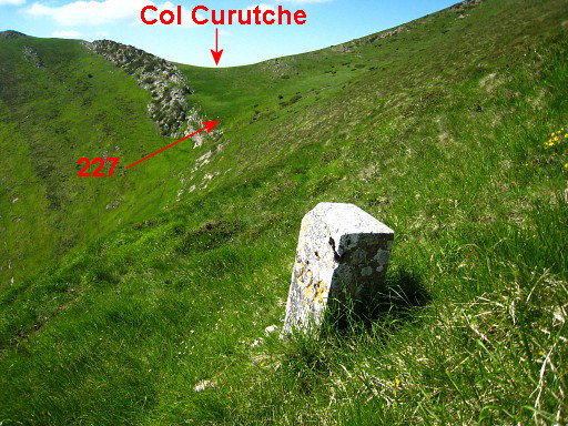 |
This picture - taken from bm228 - shows the position of bm227 well: not at the col but 100m SE downhill. |
|||||||||||||||||||||||||||||||||||||||||||||||||||||||||||||||||||||||||||
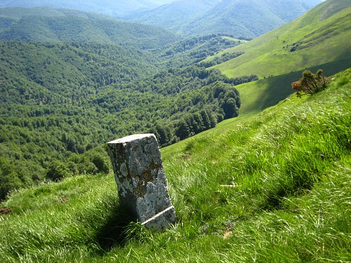
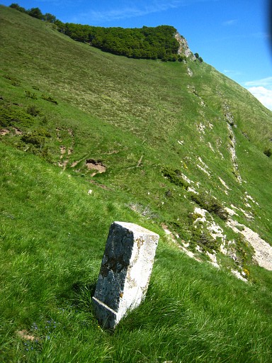
|
Bm227, looking SW. |
|||||||||||||||||||||||||||||||||||||||||||||||||||||||||||||||||||||||||||
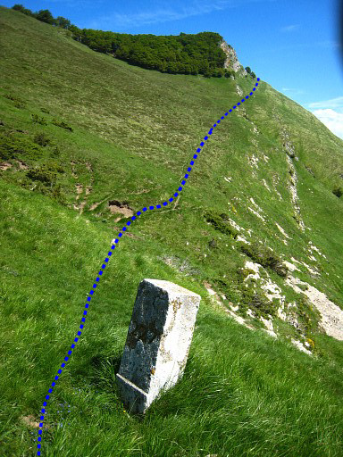
 |
Bm227, looking SE |
|||||||||||||||||||||||||||||||||||||||||||||||||||||||||||||||||||||||||||
| Variant 3 via bm228-229 |
||||||||||||||||||||||||||||||||||||||||||||||||||||||||||||||||||||||||||||
 |
This hence & forth trip is easy to navigate but still involves a climb through grass and 130m elevation gain. |
|||||||||||||||||||||||||||||||||||||||||||||||||||||||||||||||||||||||||||
 |
The starting point is bm227. From here the borderline goes straight to the rockridge visible on this picture. Walk toward s the rockridge. |
|||||||||||||||||||||||||||||||||||||||||||||||||||||||||||||||||||||||||||
 |
Bm228 comes in sight when you get closer to the ridge. | |||||||||||||||||||||||||||||||||||||||||||||||||||||||||||||||||||||||||||
|
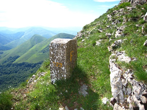
|
bm228 Bm228, looking back in the direction of bm227. From bm228 continue SE to the rockridge and traverse further underneath the ridge. Bm229 can be found at ± 350m from bm228 |
|||||||||||||||||||||||||||||||||||||||||||||||||||||||||||||||||||||||||||
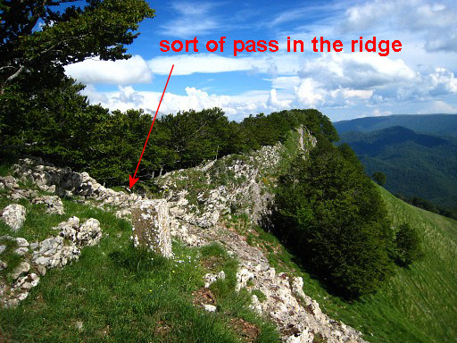 |
near a spot where the ridge lowers for a short while. A sort of pass you might say. |
|||||||||||||||||||||||||||||||||||||||||||||||||||||||||||||||||||||||||||
|
Bm229, looking back Return to Col Curutche and join the main route. |
|||||||||||||||||||||||||||||||||||||||||||||||||||||||||||||||||||||||||||
| End of variant 3 |
||||||||||||||||||||||||||||||||||||||||||||||||||||||||||||||||||||||||||||
 The rest of this stage is very easy. From Col Curutch, follow the waymarked trail SE to the road at Col d'Oraaté. Then descend on the road in southern direction in 4,5km to the bottom of the valley and the D18 |
||||||||||||||||||||||||||||||||||||||||||||||||||||||||||||||||||||||||||||
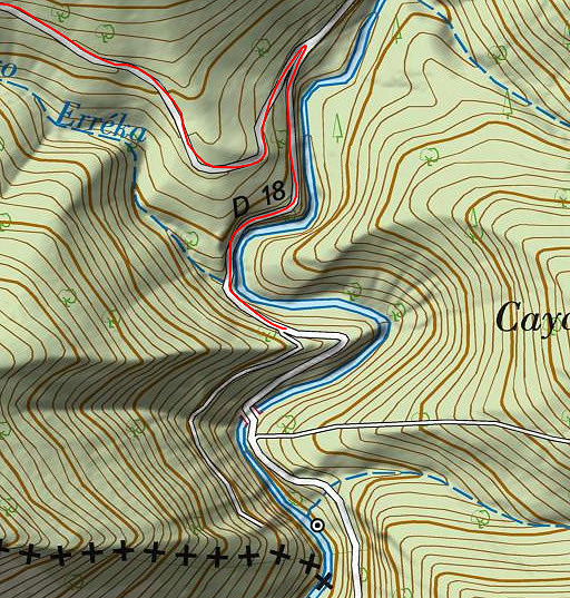 |
At the D18, go right and reach in 700m a |
|||||||||||||||||||||||||||||||||||||||||||||||||||||||||||||||||||||||||||
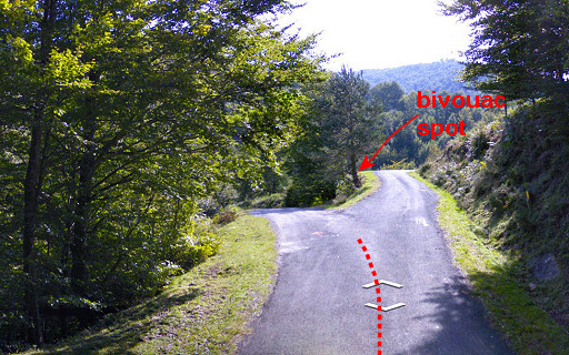 |
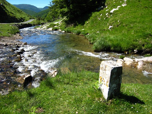
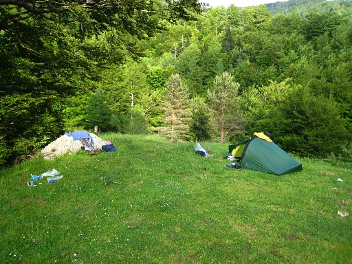
this bifurcation. This is the end of this stage. A bit further |
|||||||||||||||||||||||||||||||||||||||||||||||||||||||||||||||||||||||||||
|
this nice spot to bivouac. The stream is nearby as the map above shows. |
|||||||||||||||||||||||||||||||||||||||||||||||||||||||||||||||||||||||||||