|
The
bordermarkers of the Pyrenees : the GRPdesBF
 |
||||||||||||||||||||||||||||||||||||||||||||||||||||||||||
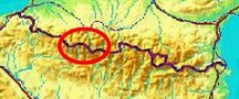
| - stage 18 - Col de Pourtalet - Embalsa de Respomuso (bm310-311) |
 |
|||||||||||||||||||||||||||||||||||||||||||||||||||||||||
 |
||||||||||||||||||||||||||||||||||||||||||||||||||||||||||
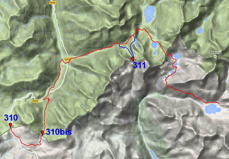
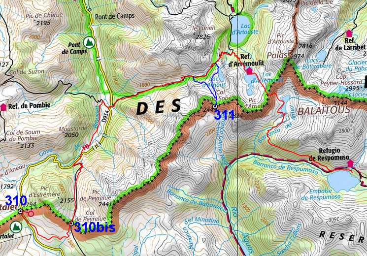
| Only
the bordermarkers along this stage are shown (and some adjoining ones).
The main route is red,
the variants have other colors. The main route provides a smooth
on-going route along most bordermarkers, the variants give access to
the remaining bordermarkers. See the GRPdesBF-principles. Click here for an fullscreen interactive map. In short In this stage we are climbing into higher and rougher mountain terrain. After the easy visit of bm310bis, the descent to the D934 and further on the climb to Col d'Arrioùs and progress to Refuge d'Arrémoulit, things get tougher. First over rocky terrain climbing to Col d'Arrémoulit, then a steep descent to Ibon de Ariel Alto. The rest is easier and more gentle and gets greener while approaching Embalse de Respomusa. There's one variant, climbing to bm311 and joining the main route at Col d'Arrioùs. Considerations There's
a refuge in the second half of the stage (refuge d'Arrémoulit) and
there are various bivouac-opportunities with running water along the
route. Having arrived at the end of this stage (Refugio de Respomusa),
it's too rocky to pitch a tent. But 2km beyond Embalse de Respomuso
there's an ideal bivouac-spot at the lake of Embalse
de
Campo Plane.
Factsheet
Gps-files needed
Version 03 December 2014. If you have any correction, suggestion etcetera -> please email me: eefberns@grenspalen.nl MAPS AND DIRECTIONS You might check the relevant webpages in the 'All markers'-section and 'All my trips'-section for more pictures of the bordermarkers and wayfinding-issues. Print your own maps It's easy to print your own - custom made - maps with the GRPdesBF-route and the bordermarkers on them. See: Print your own maps |
||||||||||||||||||||||||||||||||||||||||||||||||||||||||||
 |
||||||||||||||||||||||||||||||||||||||||||||||||||||||||||
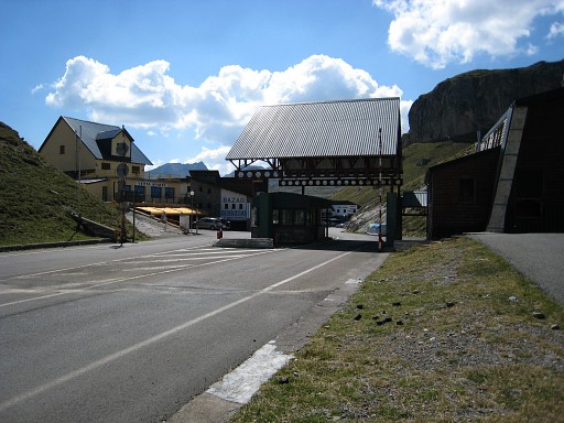 |
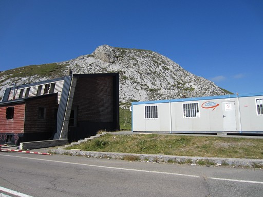
Col du Pourtalet, seen from France |
|||||||||||||||||||||||||||||||||||||||||||||||||||||||||
 |
Turn a bit to the right |
|||||||||||||||||||||||||||||||||||||||||||||||||||||||||
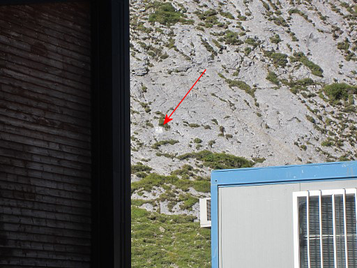 |
and you can spot bm310 |
|||||||||||||||||||||||||||||||||||||||||||||||||||||||||
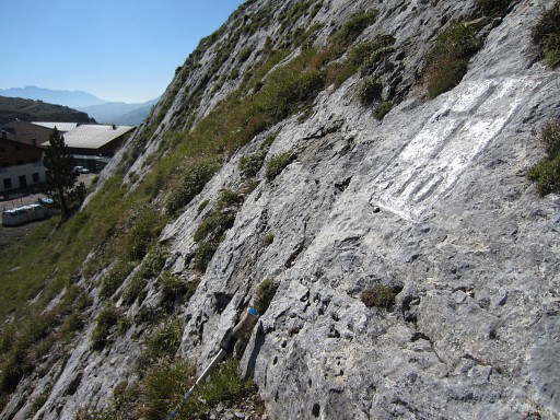 |
It requires a small climb to get cloes to bm310 |
|||||||||||||||||||||||||||||||||||||||||||||||||||||||||
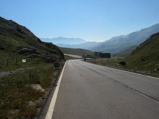 |
Then making a semi-circle to Col de Peyrelue. That’s an easy and more or less horizontal stroll. First descend ± 500m into Spain along the road until a roundabout. This picture: the roundabout in the distance. From the roundabout, continue to the left for ± 100m. |
|||||||||||||||||||||||||||||||||||||||||||||||||||||||||
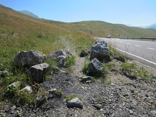 |
And at this point, leave the road at its left side and take this old dirtroad, now blocked with these rocks. Further on, it becomes a trail and brings you to a fence which you can follow at its right side. When you see a concrete cattle watering device at the other side of the fence, you can creep through or under the fence |
|||||||||||||||||||||||||||||||||||||||||||||||||||||||||
 |
and continue SEE-E on a dirtroad. After ± 1km on the winding dirtroad, you’re at the S-side of a large grassy valley which leads to the Port de Peyrelue. It’s very obvious as such. Leave the dirtroad and follow a trail throught the grass (there are various trails, all leading towards Col de Peyrelue) |
|||||||||||||||||||||||||||||||||||||||||||||||||||||||||
 |
The Col de Peyrelue comes in sight. | |||||||||||||||||||||||||||||||||||||||||||||||||||||||||
 |
The trail brings you to this fence. The fence is the border and bm310bis is 40m to the right at the small hill. |
|||||||||||||||||||||||||||||||||||||||||||||||||||||||||
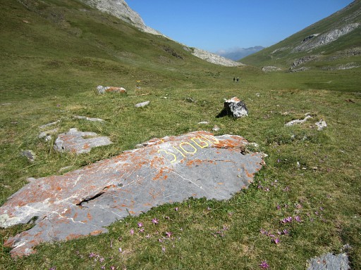 |
Bm310bis At the other side of that small hill is the Compostella-trail. You should descend along that trail to the N until you reach the road (D934). |
|||||||||||||||||||||||||||||||||||||||||||||||||||||||||
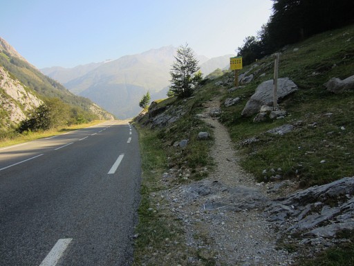 |
This picture: the trail coming from the Col, meets the road. |
|||||||||||||||||||||||||||||||||||||||||||||||||||||||||
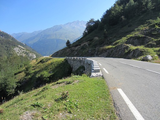 |
Then continue along the road NE and immediately after this bridge | |||||||||||||||||||||||||||||||||||||||||||||||||||||||||
 |
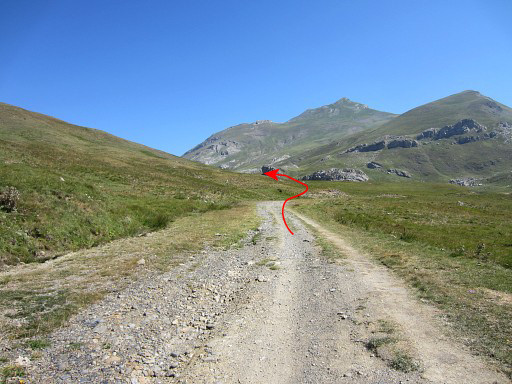
descend to the river (this picture) The trail crosses the river and continues downstream at the left side. After ± 2km, you can cross the stream over a bridge and climb to Cabane du Caillou de Soques, besides the D934-road. At the other side, the trail to Col d'Arrioù starts. A sign says: 2½ hours, it's probably less. |
|||||||||||||||||||||||||||||||||||||||||||||||||||||||||
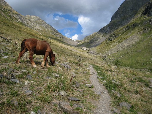 |
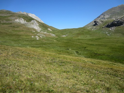
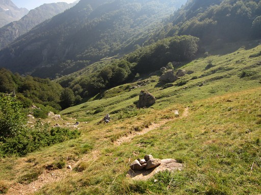
This picture: higher up in the valley, on your way to Col d'Arrioù. | |||||||||||||||||||||||||||||||||||||||||||||||||||||||||
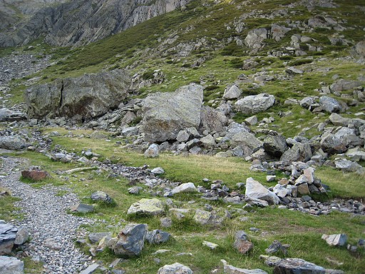 |
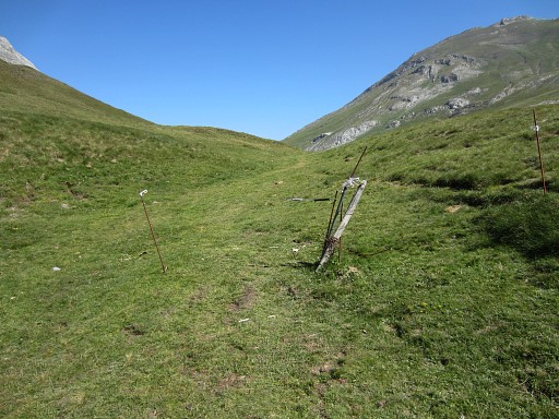
Somewhere, the variant to bm311 at Col de Sobe branches off the main route to the right. But where? Well, at this spot with these two large boulders. The trail to Col de Sobe is waymarked with cairns. |
|||||||||||||||||||||||||||||||||||||||||||||||||||||||||
| Variant 1 via bm311 |
||||||||||||||||||||||||||||||||||||||||||||||||||||||||||
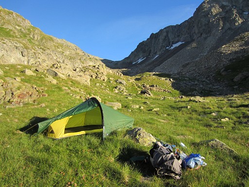 |
The variant climbs steeply and reaches this valley. In the far end is Col de Sobe. As you can see, you could make your bivouac here as I did. There's a tiny stream here but to the left - behind a ledge - there's a larger stream. |
|||||||||||||||||||||||||||||||||||||||||||||||||||||||||
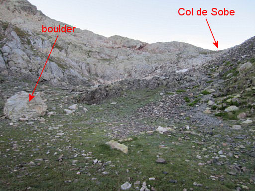 |
Higher up in the valley, this is an important spot. Going hence & forth to Col de Sobe from here is easy. But when you return at this spot, you have to take another trail to get to Col d'Arrious. |
|||||||||||||||||||||||||||||||||||||||||||||||||||||||||
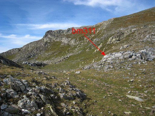 |
Having arrived at Col de Sobe |
|||||||||||||||||||||||||||||||||||||||||||||||||||||||||
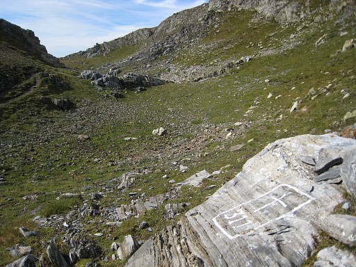 |
with bm311 |
|||||||||||||||||||||||||||||||||||||||||||||||||||||||||
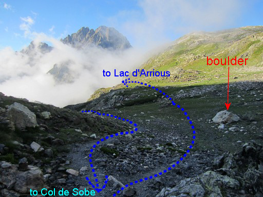 |
Then return but be attentive not to miss a bifurcation after 250m. Note the boulder, mentioned above. Now take the right trail (going N) which will bring you to Lac d'Arrious and Col d'Arrious where you will meet the main route again. |
|||||||||||||||||||||||||||||||||||||||||||||||||||||||||
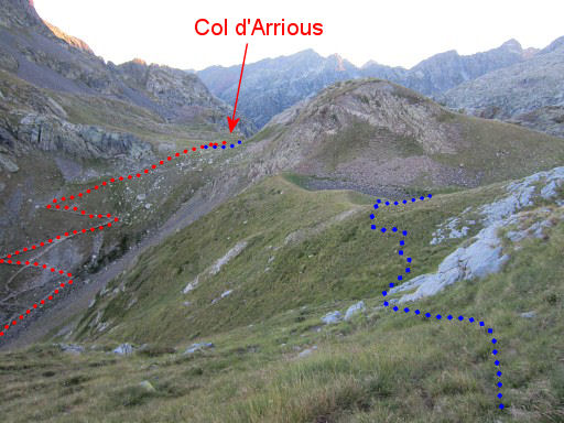 |
Further
on: the variant (blue trail) first descends to Lac d'Arrious (not
visible on this picture) before reaching Col d'Arrious. |
|||||||||||||||||||||||||||||||||||||||||||||||||||||||||
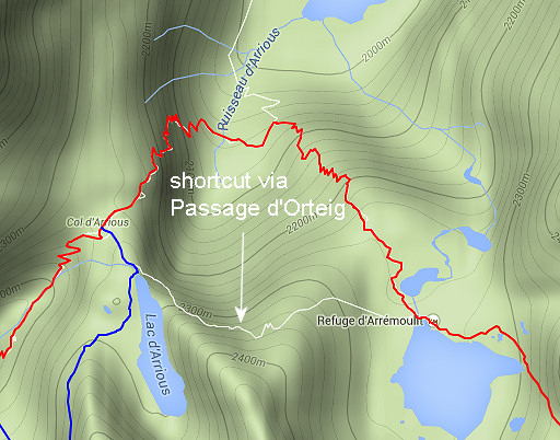 |
From Lac d'Arrious, there's a shortcut possible to Lac d'Arrémoulit. | |||||||||||||||||||||||||||||||||||||||||||||||||||||||||
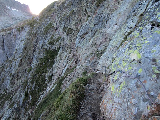
|
It includes this famous 'cliffhanger'-passage: the Passage d'Orteig. It could save you ± 1h. Though secured with cables, I found it too risky with my heavy backpack so I didn't include it in my GRPdesBF-trail. But perhaps you have more guts. For more pictures of the Passage d'Orteig: see this page. |
|||||||||||||||||||||||||||||||||||||||||||||||||||||||||
| End of variant 1 |
||||||||||||||||||||||||||||||||||||||||||||||||||||||||||
 |
Col d'Arrious, we are back at the main trail. |
|||||||||||||||||||||||||||||||||||||||||||||||||||||||||
 |
Descend towards Lac d'Artouste but be attentive to take the branch climbing to Refuge d'Arrémoulit. There are bivouac-opportunities along this descent. |
|||||||||||||||||||||||||||||||||||||||||||||||||||||||||
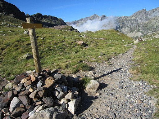
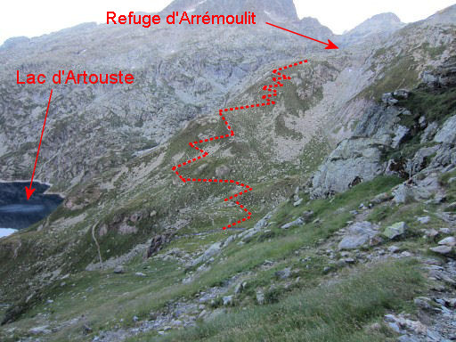
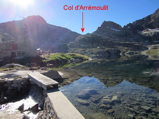 |
Having arrived at Refuge d'Arrémoulit. From the refuge – along the lake – a trail starts with a vague beginning but later on with more cairns. |
|||||||||||||||||||||||||||||||||||||||||||||||||||||||||
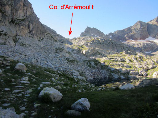 |
The trail climbs through rockfalls (well waymarked with cairns) to Col d'Arrémoulit. | |||||||||||||||||||||||||||||||||||||||||||||||||||||||||
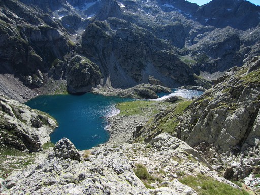 |
From Col d'Arrémoulit, it's a steep, steep descent to the lakes of 'Ibones de Arriel'. A trail leads you along the lakes which offer spots to bivouac. |
|||||||||||||||||||||||||||||||||||||||||||||||||||||||||
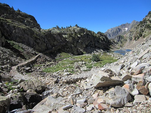 |
Beyond the second lake, a 'paved' path takes you around a bend | |||||||||||||||||||||||||||||||||||||||||||||||||||||||||
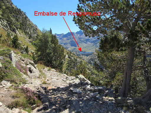 |
and then the barrage-lake of Respomuso comes in sight in the far distance. | |||||||||||||||||||||||||||||||||||||||||||||||||||||||||
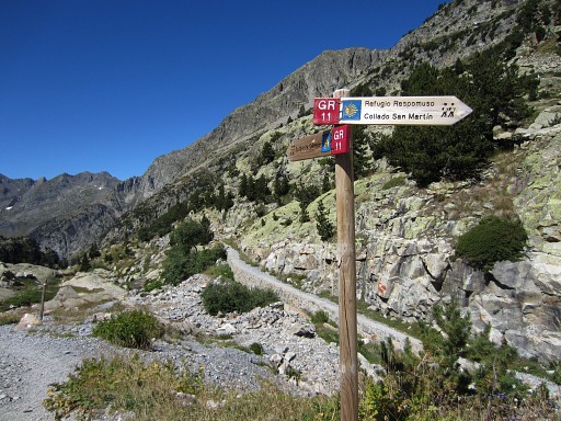 |
Having arrived at the lake, the trail joins the GR11. | |||||||||||||||||||||||||||||||||||||||||||||||||||||||||
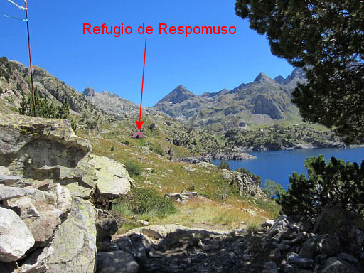 |
The GR11 brings you along Refugio
de Respomuso which is a bit off the GR11. The refugio is the terminus of this stage. If you want to camp for the night, continue for 2 km at the next stage to the lake of Embalse de Campo Plane. |
|||||||||||||||||||||||||||||||||||||||||||||||||||||||||