|
The
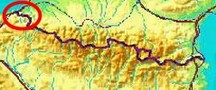
bordermarkers of the Pyrenees : all my trips
 |
|
| -
10 april
2009 - Soaked to the bone |
 |
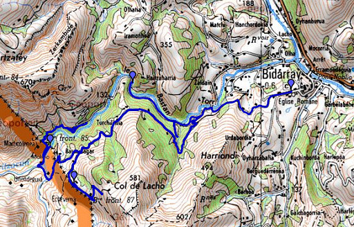 |
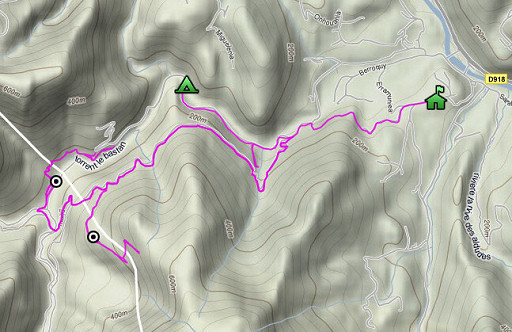
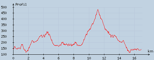
esfr-trip-track-20090410.kml (click to open in Google Earth or copy link to Google Maps; click right on this link to download gpx-version) Summary: in search of bm085, how to access it from the GR10-trail, finding bm086, looking in vain for bm087 and finishing in heavy rain. |
 |
For explanation of
the gps-coordinates and other cartographic backgrounds: see my cartography page According to my watch: duration: ± 6.30uur, up 729m, down 1585, total elevation: 2314. From starting altitude: highest point 343m, lowest point -50m. |
 |
According
to visugpx - distance : 17.13 km - cum. elevation gain : 713 m - cum. elevation loss : 722 m - total elevation: 1435 - altitude maxi : 481 m - altitude mini : 114 m - altitude average : 225 m |
 |
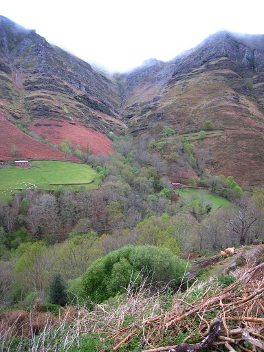
We
started ± 10.00, after a night with
remarkably soft
temperatures, following the road to Bidarray for a while and then
taking a road higher up (south of the river Bastan) which leads back to
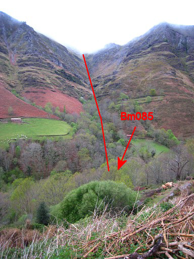
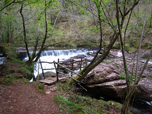
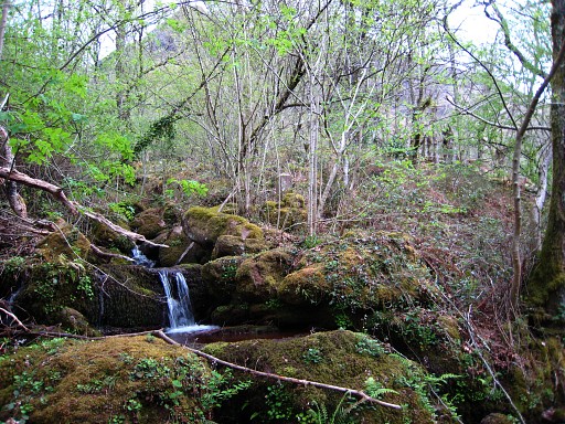
the border. To the end of it, it descends and it passes a littered farm with pigs hanging around and crosses a bridge. Shortly after the bridge, there's a house and a bit further there's a path to the right going down to a barn and then over a little bridge (see picture), crossing a second river. Then, following the path and taking a branch to the right along the river, you will reach the little stream coming from above and flowing into the Bastan-river. This stream is the border coming from high above at bm084. |
 |
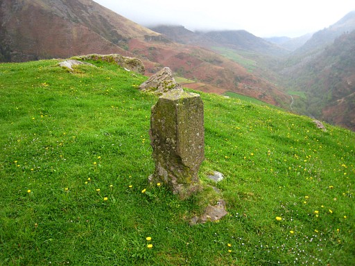
In the
northt-east-corner of this confluence, we find Bm085 |
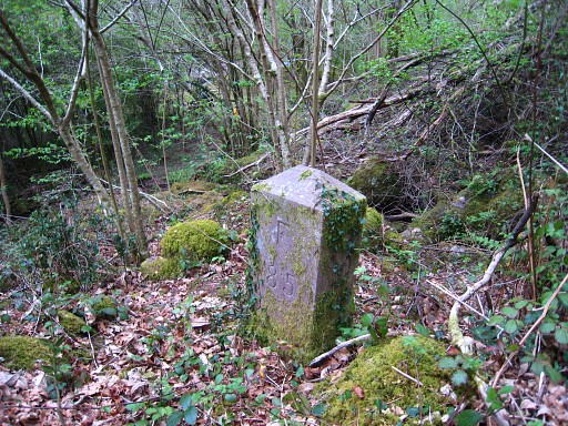 |
Bm085 |
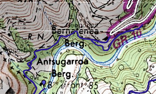 |
We continue with a
reconnaissance of a short-cut from approx. bm085 to the
GR10-trail. First, from bm085, back to the main path and following it to the east. The path ends at a country road which leads to the east to a farm further on and via its gate and farmyard directly to the tarmac road with the GR10-trail. However, you'll need to cross the farmyard. Perhaps there's a right of way. There were other tourists, passing it while asking directions to the farmer. NB: on 20120825 there's a sign at the (former) farm allowing pedestrians to cross the farmyard. |
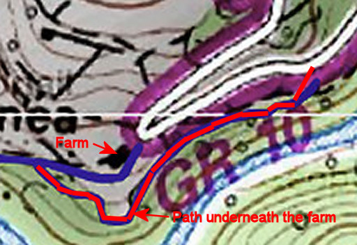 The friendly
farmer didn't give a clear answer to our question if it was allowed in general to
cross his farmyard. But he did make clear that he was afraid
that
passers-by would leave the gates open. The friendly
farmer didn't give a clear answer to our question if it was allowed in general to
cross his farmyard. But he did make clear that he was afraid
that
passers-by would leave the gates open. However there's a poorly maintained footpath leading underneath the farm to the tarmac road. There's a well visible start of it from the country road before (west of) the farm. Well after (east of) the farm it ends at the tarmac road but you'll have to tackle a fence there. You might as well climb - shortly after (east of) the farm - directly from the track to the tarmac road or vice-versa. NB: on 20120825 there's a sign at the (former) farm allowing pedestrians to cross the farmyard. But you don't need to do this, higher-up there's a shortcut from bm084 to bm085 which I tried on that day. |
|
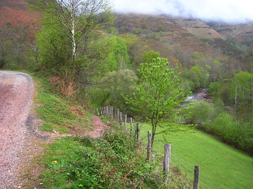 |
We walk back on
the same roads/paths. On this picture you see the spot where a path descends to a barn as mentioned earlier. You can see the river Bastan below, somewhere there at its bank we found bm085. |
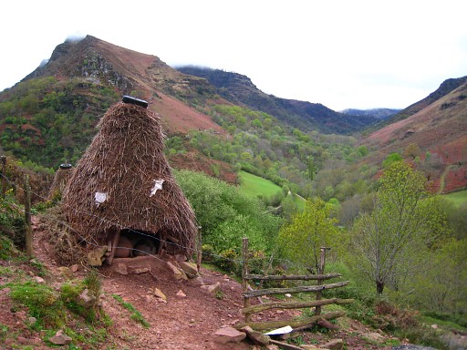 |
We passed once
again that littered farm with on the other side of the road this
peculiar shed for the pigs. |
|
Looking
back . Move the cursor over the picture to see the border. |
 |
We walk back a short while in
the direction of Bidarray and then take a country road to the
right leading uphill, back to the border. In a meadow left of the country road, I find Bm086. There should be a unnumbered cross nearby but there's no trace of it. The search for bm087 is fruitless. Meanwhile it has started to rain heavily and that's why we stop. We walk to Bidarray. The gîte d'étappe is full and we end up in a hotel, soaked to our bones. |