|
The
bordermarkers of the Pyrenees : all my trips
 |
|
| - 7 may
2009 - Followed by a dog |
 |
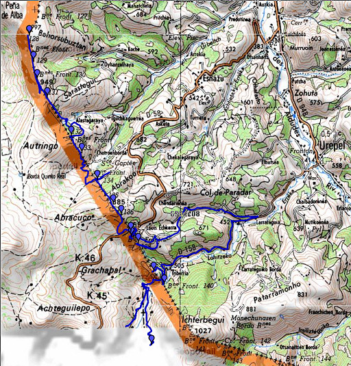 |
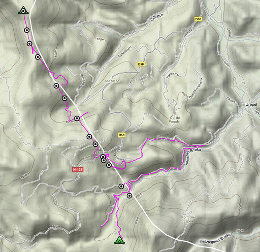
esfr-trip-track-20090507.kml (click to open in Google Earth or copy link to Google Maps; click right on this link to download gpx-version) A full moon at night, sometimes a very strong wind, then calm and silent. Soft temperature. I expected a tough journey: following the straight borderline over the hills with few orientation-points. But with compass, gps and close map-reading, it wasn't that difficult. I found it more challenging than following a distinct ridge. Also more strengthening. Weather: warm and sunny, in the evening rainy and finally foggy. A beautiful day. |
 |
For explanation of
the gps-coordinates and other cartographic backgrounds: see my cartography page En route: 08.30 - 18.00 (9.23h), break 13.15-14.25. Elevation according to my watch: up 990m, down 1276m. in total 2366m. Heighest point 996m, lowest 487m |
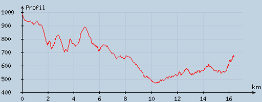 |
According
to visugpx - distance : 16.7 km - cum. elevation gain : 767 m - cum. elevation loss : 1079 m - total elevation: 1846 - altitude maxi : 986 m - altitude mini : 470 m - altitude average : 643 m |
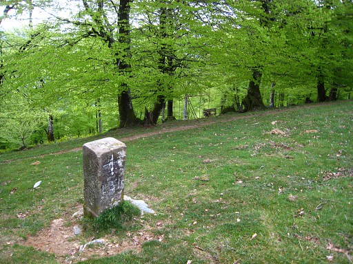 |
I start at bm130, at the other side of the fence. With compass and gps-tripteller I easily find bm131. I keep following the compass (I think I can see the summit of Ichterbegui where the straight borderline is directed at). |
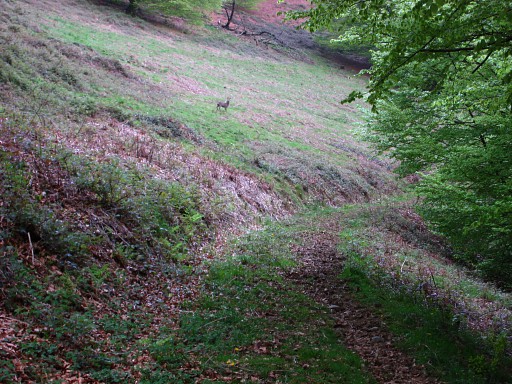 |
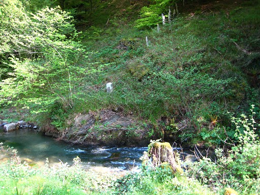
It's a steep descent to a stream, with a farm and meadow visible on the French side. In between - it's very quiet here - I spot this deer. |
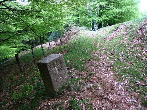 |
After crossing the stream, I
walk E and SW along the forest to bm132. You have to climb a fence and
don't confuse the forest with another small forest to the S. Probably,
this route is easier then going straight through the forest. Bm132 |
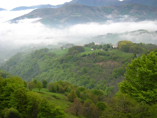 |
A view of this mysterious Basque landscape. |
 |
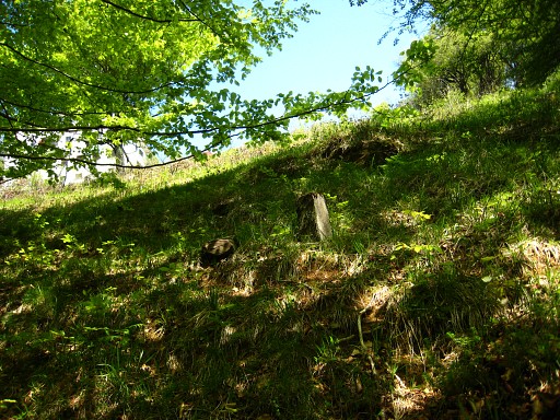
Following my compass, I find bm133. It's location is not well recognizable. The Procès-Verbal mentions an "escarpement" (=escarpment) and a "carrière" (=quarry) but I can't remember those features. Then a steep descent towards a stream, first there's a meadow with a barn. From the west-side of the barn, a little while on the dirtroad to the W, crossing a branch of the stream and a bit further taking a path to the left to the stream itself. Crossing the stream. |
 |
Then on compass-reading a steep climb into the forest. When the forest gets moren open, there's a lot of blackberry. I climb to the left to a fence which I then follow to the right until a dirtroad. After a bit of searching and good map-reading, I find bm134, above the dirtroad on a slope. |
 |
After all this difficult straight
traversing of hills and valleys, I have arrived at a more accessible
part, more suited for a part of the GRPdesBf. On compass-reading I climb uphill and on the hilltop I find: bm135, near some hunter's shelters. |
 |
Then an easy descent to bm136. |
|
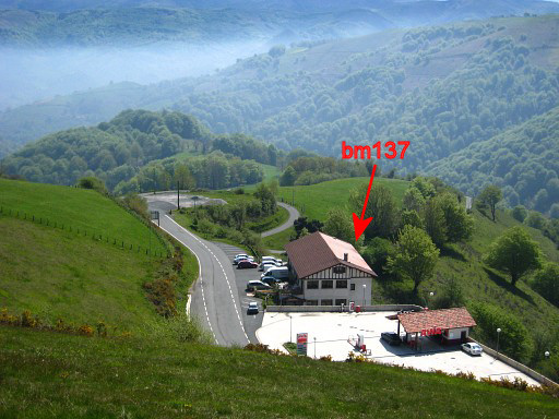
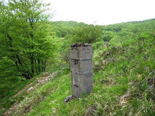
A bit lower I encounter a fence with a view of the bordercrossing and the venta. I spot two concrete pillars (no engraving or painting on it) in the meadow in the direction of the venta, perhaps indicating the borderline. This picture: I'm traversing along the fence and along a stream to the tarmac road. Today I won't find bm137 but later on I will learn from others where its location is. Move the cursor over the picture to see where bm137 really stands. |
 |
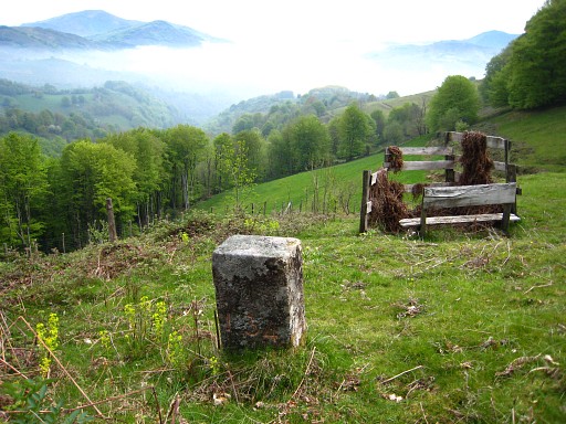
Underneath the venta, I search in vain
for bm137. The Procès-Verbal is clear: 40m south of the bordercrossing
but I can't find anything except this concrete pillar without a number.
I stop searching and enjoy a lunch in the venta. |
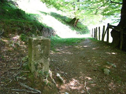 |
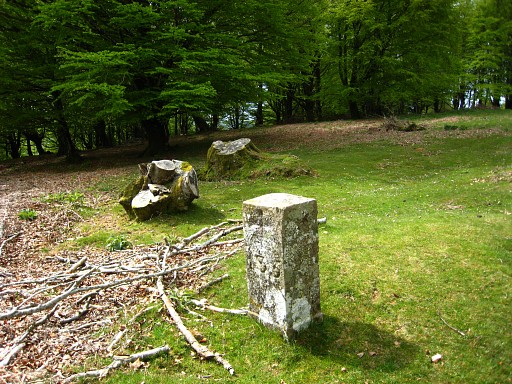
After the lunch, I descend on the tarmac road. Taking an overgrown path as a shortcut, I reach the dirtroad which brings me to bm138. |
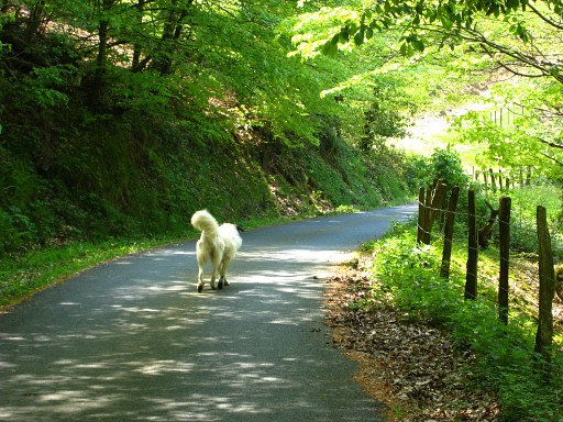 |
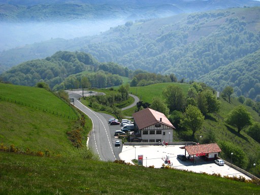
Back on the dirtroad and directly - passing a house - to the tarmac road. From there this dog kept following me until bm139. On the tarmac road, I descend to the river and then follow the D158 towards the border. It's very beautiful, very quiet, very pastoral and an easy walk on the tarmac makes a nice change. I could probably have descended from bm138 directly to bm139 but I wanted to do this reconnaissance for the GRPdesBF. |
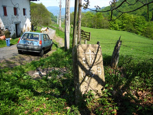 |
Close to the border, I take branch to
the right to Chaliechenborde where two old men and their young
nephew are dealing with a horse and ponies. The border divides their
farm, the farmhouse and barn located on eitherside of the borderline. Meanwhile, I 'do' bm139 with a chained dog nearby. The three men are very nice, give me a short lift, tell where bm140 is and how to reach the summit of Ichterbegui via Spain. I'm very content. |
 |
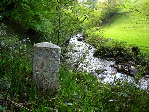
Through a meadow, I descend to the river with bm140, visible on the other side. |
 |
In my underpants, I wade through the stream and reach: bm140. Back to the tarmac road - meeting one of the old men again - and going SW on the road to find the route to Ichterbegui. First I walk too far into Spain until a farm where the tarmac road becomes a dirtroad and I realize where I went wrong. |
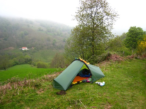 |
I go back and find out the right route: after the first house beyond the border, the road crosses a stream in a bend of the road. Just before that bend, go left on a dirtroad which crosses the river further on and starts climbing. If there's a bifork -> keep left. You will cross some fences and pass a barn. That's where I stop and pitch my tent. The barn can be an emergency shelter for the threatening thunderstorm Coordinates: N43 02 41.4 W1 26 56.9 H 674m. |