|
The
bordermarkers of the Pyrenees : all my trips
 |
|
| -
9 may
2009 - Bm145 is atypical |
 |
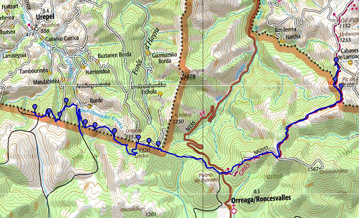 |
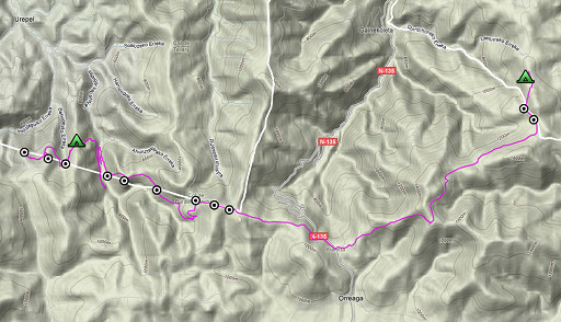
esfr-trip-track-20090509.kml (click to open in Google Earth or copy link to Google Maps; click right on this link to download gpx-version) In the morning the fog has gone, it's clear. Early start. Weather: sunny and windy. Walking getting tough in the afternoon. |
 |
For explanation of
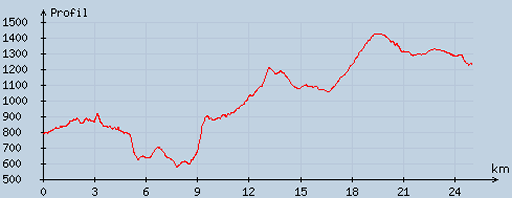
the gps-coordinates and other cartographic backgrounds: see my cartography page According to my watch: walking: ± 07.40 - 17.30 (9.55uur), no break. Up 1609m, down 1180m = 2789 in total. Highest 1404m, lowest 557m |
 |
According
to visugpx - distance : 25.3 km - cum. elevation gain : 1354 m - cum. elevation loss : 909 - total elevation: 2263 - altitude maxi : 1426 m - altitude mini : 574 m - altitude average : 974 m |
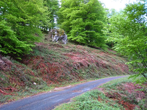 |
Decided suddenly to
go back to search for bm145 which I couldn't find yesterday. On my way I pass the rock with bm147 at the back. ('done' yesterday). |
|
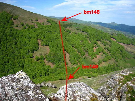
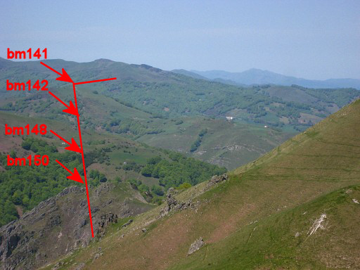
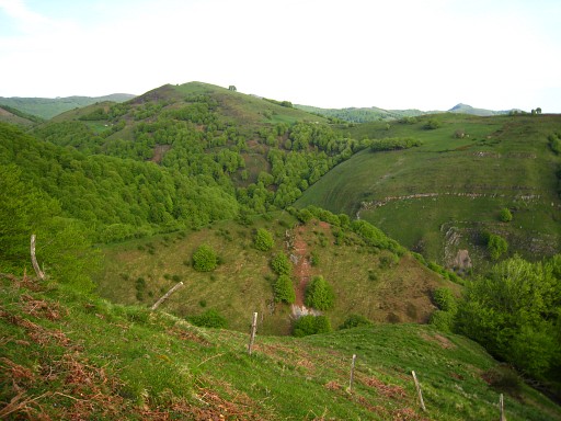
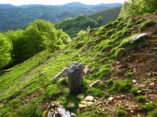
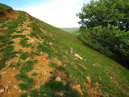
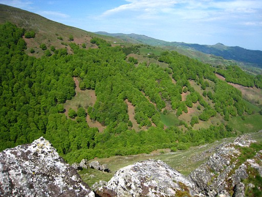
The sky is clear,
allowing to recognize the borderline in the landscape. Move the cursor over the picture to see border-indications. |
|
Move the cursor over the picture to see border-indications. |
|
Move the cursor over the picture to see border-indications. |
 |
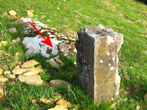
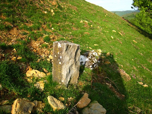
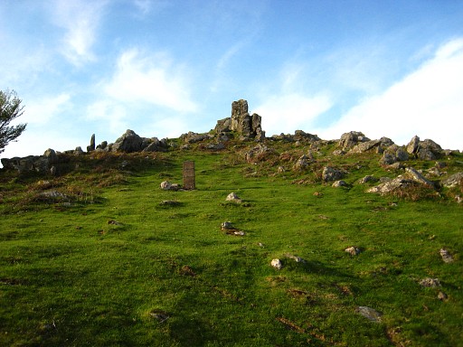
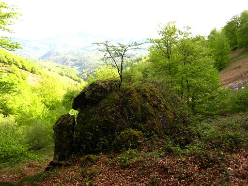
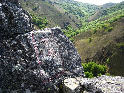
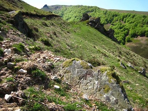
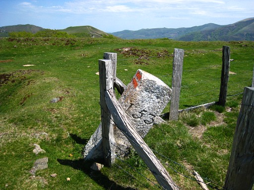
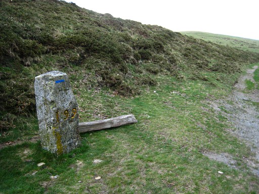
Now I can localize
the spot of bm145
fairly well in relation to the edge of the forest. I can't
find a
bordercross but do see this stone. |
 |
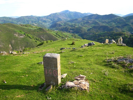
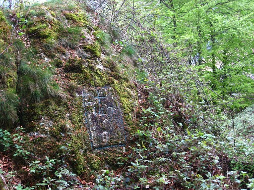
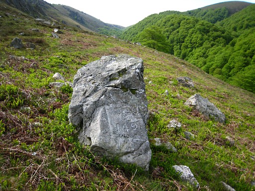
Only
at second sight I discover the number 145 carved vertically in the
stone! |
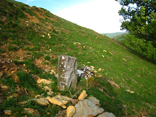 |
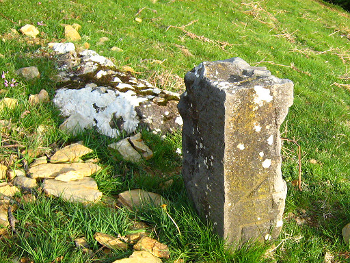
The number with
some chalk. This stone is atypical in shape and number but
it's definitely bm145! |
|
Almost one year
later I will learn that the whitish rock behind this marker has a cross
on it. I discovered it on this page of Robert Darrieumerlou's site. Luckily one of my own pictures showed that cross. Move the cursor over the picture to see where the cross is. |
 |
Localisation: ± 50
meter west of a shepherd's cabin and a few meters besides the
country road coming from the cabin. |
 |
I return to the
tarmac road - with a large barn besides it - following a cattle trail
from the shepherd's cabin to that barn. Once again - like yesterday - up the hill-ridge to bm146. |
 |
Bm146 |
|
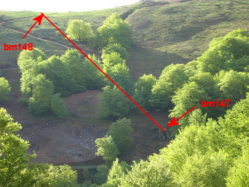
And looking down on
the rock with bm147 Move the cursor over the picture to see border-indications. |
 |
Back to the tarmac
road and on my way back once again passing bm147. |
 |
The rock with bm147 |
 |
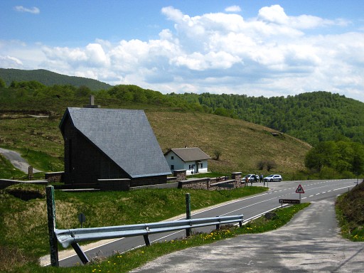
Back to the house
where I camped last
night. Just behind that house I descend steeply on a meadow
and
pick up a cattle trail that becomes a path which ends at a country
road. I follow that road to the border, it merges into another road/path which enters a forest. But I can't find bm149 at the presumed borderline. I see I'm wrong after reading my map more carefully, the bordermarker should be on the other side of the stream down below. I go back and near a farm ("Attention aux chiens"). I take the right road cq. path. You have to stay above the stream at your right and later above the forest at your right. The trail climbs gradually, is sometimes vague and leads to this weathered marker without a number whatsoever. |
 |
But a few meters
further, there's this cross, bm149! The 'Procès-Verbal' and the map mention a borderstone. |
|
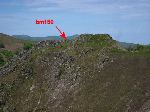
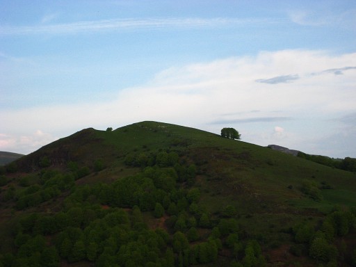
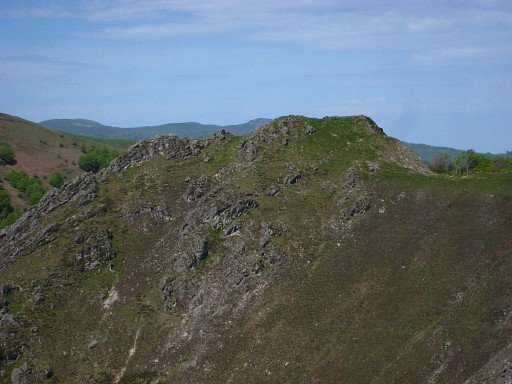
I climb steeply in
the direction of
bm150. I reach the summit which in fact is a ridge with 3 rock-summits.
At the middle of those 3 there's bm150 (as is stated in the
'Procès-Verbal') Move the cursor over the picture to see border-indications. |
|
At
this spot (but also earlier and later) the borderline is well
recognizable in the landscape as long as you know the bm-localisations. Move the cursor over the picture to see border-indications. |
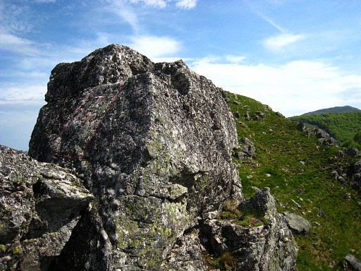 |
Bm150 |
 |
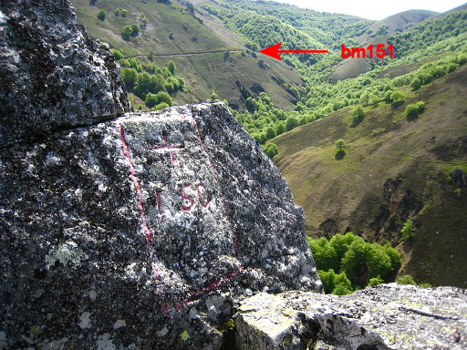
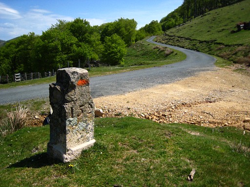
Now it's getting
easier. Following a cattle trail I descend to the a road near a cabin.
That road leads to: bm151, a bit besides and below the road. |
 |
|
|
Looking
back at the ridge with bm150 Move the cursor over the picture to see border-indications. |
 |
I keep following
that road which
enters a forest, bends gradually back and in the end bends sharply in
the direction of the Col with bm152 |
|
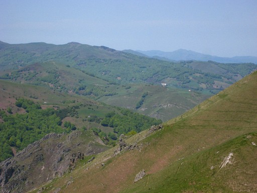
I ascend the next
hill, heading for bm153. Once again looking back, localizing the bordermarkers and bordermarkers. Move the cursor over the picture to see border-indications. |
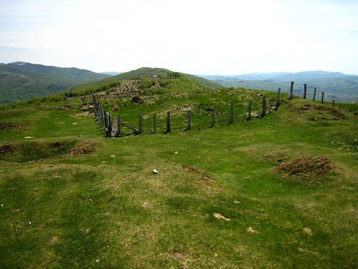 |
On the hilltop
there are the remnants of a fortress, in the midle at the
corner of the fence: bm153 |
 |
Bm153 |
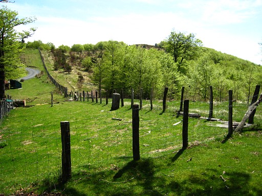 |
And descending to |
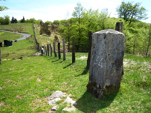 |
Bm154 |
 |
I leave the
borderline and walk into Spain to the Puerto de Ibaneta (part of the
GR11 or GR12-trails with red-white waymarks), |
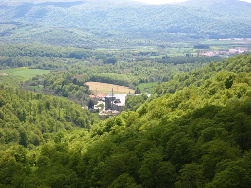 |
and from there I
follow the pilgrim's way of St. James back in the direction of
Saint-Jean-Pied-de-Port. This is a view of the monastery of Roncevaux, the first stop after Saint-Jean-Pied-de-Port. |
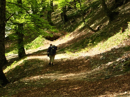 |
One of the pilgrims
on their way to Roncevaux. |
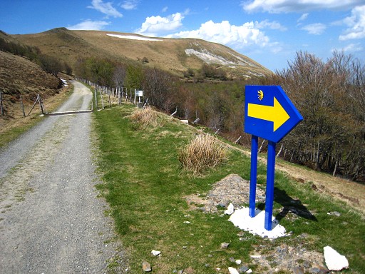 |
The Way of St.
James must be the best waymarked trail of the universe. |
 |
Arriving at the
border, I pass bm199 and |
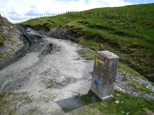 |
Bm198. Here a
little stream is starting being the border untill bm197. |
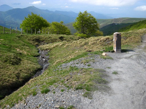 |
Bm198 with a better
view of this stream, the Gorrichaneka Erreka. |
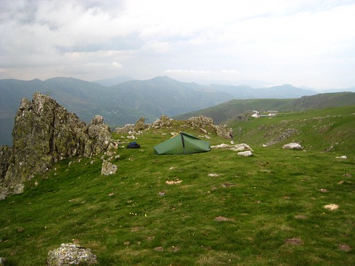 |
A bit further in
France I find this camping-spot (N43 03 25.4 W1 16 04.3 H 1237m) I'm contented: hadn't expect to cover this serie of bm149-154 today. And I found 145! |