|
The
bordermarkers of the Pyrenees : all my trips
 |
|
| -
6 june
2009 - Round-trip to Port de la Portéule |
 |
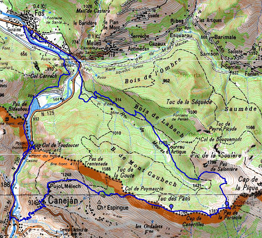 |
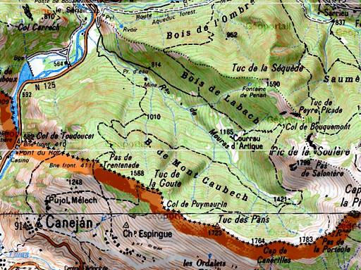
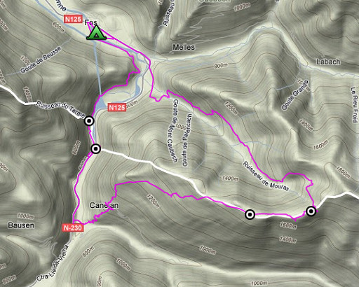
esfr-trip-track-20090606.kml (click to open in Google Earth or copy link to Google Maps; click right on this link to download gpx-version) Part of a 16-days trip, using day 1-10 to cover bm154 to 264 in the eastern Pyrenees and day 11-16 for bm416 to 365 near Bagnères-de-Luchon. Day 12: from Fos a roundtrip to Pas de la Portéule, doing bm409-410 and bm415-416. The target was bm417 but I didn't get so far. But I succeeded in doing bm410 and checking the trail from Canejan to Pas de la Portéule. A lot of denivellation today. The weather was fine, unfortunately in the end the clouds too low. I spotted some deers. |
 |
For explanation of
the gps-coordinates and other cartographic backgrounds: see my cartography page According to my watch: Duration: 8.15-18, in total 9.54 hours, half hour break Up: 1517 m Down: 1524 m Total elevation: 3041 m Highest point:1764 m Lowest point: 539 m |
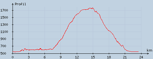 |
According
to visugpx - distance : 24.02 km - cum. elevation gain : 1475 m - cum. elevation loss : 1469 m - total elevation: 2944 - altitude maxi : 1776 m - altitude mini : 542 m - altitude average : 1022 m |
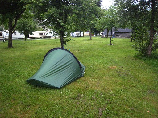 |
The campsite in Fos. |
|
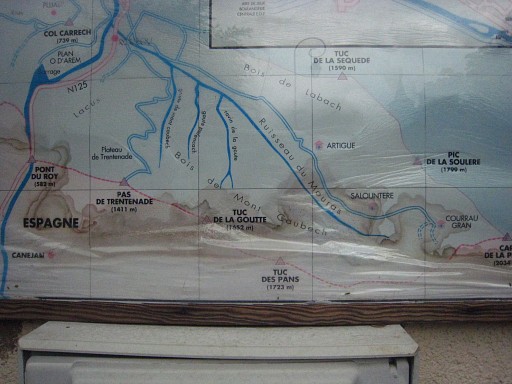
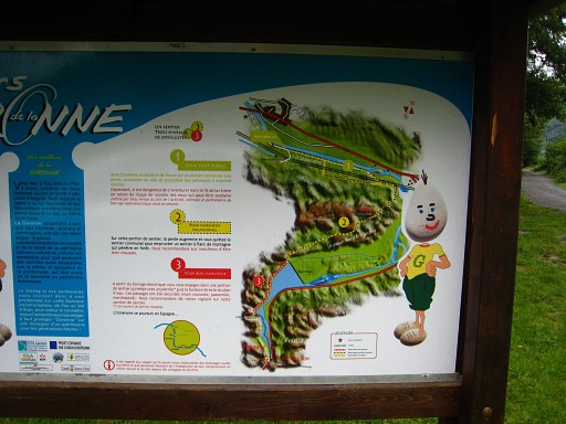
A map on a camping building. What
interests me is the forest road to Pas de Trentenade. Apparently an
access to the borderline from the French side. Move the cursor over the picture to compare it with the IGN-map. You'll see that bm411 is on that Pas de Trentenade. |
 |
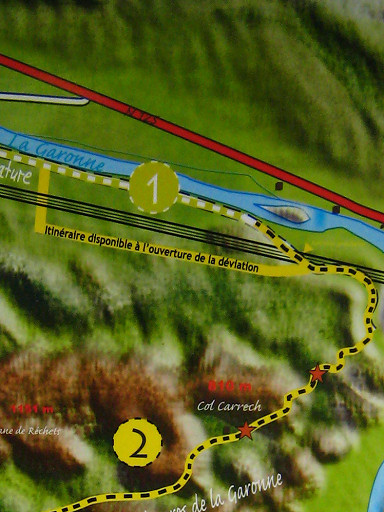
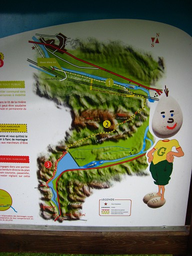
Another map of the nature trail (which I followed yesterday in part), |
|
showing
the deviation after the completion of the new road. Move the cursor over the picture to zoom in. |
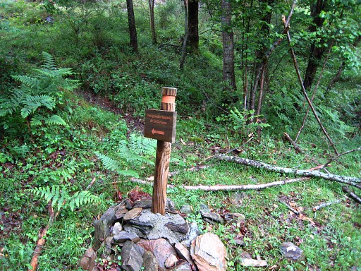 |
Today I follow the nature-trail to get a gps-track of it. |
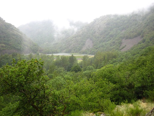 |
I follow it to the barrage-lake and then further to |
 |
bm409 |
 |
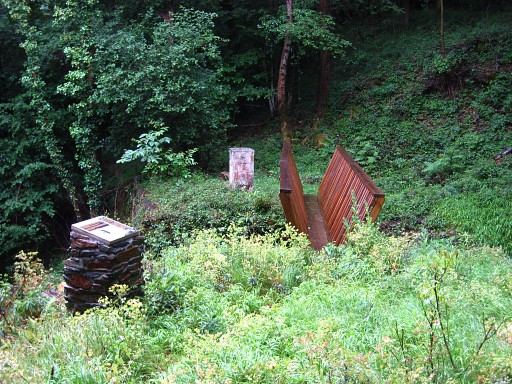
Bm409 |
 |
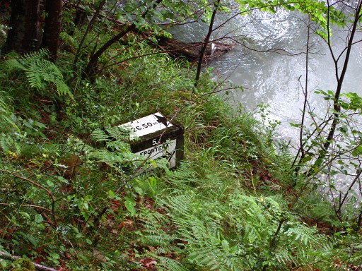
Here, a series of 7 submarkers start along the river. I want to photograph them all. At the foot of this wall, number 1 is visible. Much later I will learn that on the French side of the river, there's another series of 7 markers. |
 |
Bm409-1es |
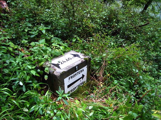 |
Bm409-1es |
 |
Bm409-2es |
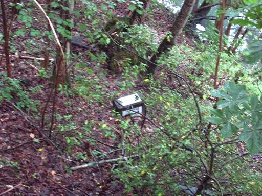 |
Bm409-3es |
 |
Bm409-4es |
 |
Bm409-5es |
 |
Bm409-6es |
|
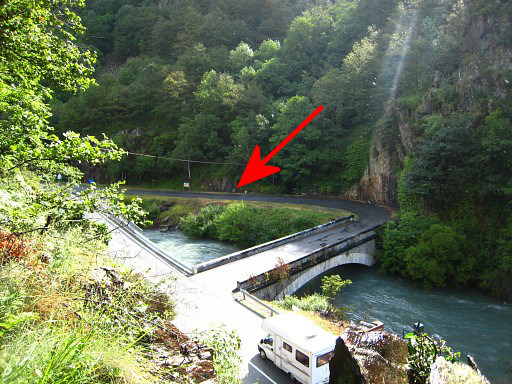
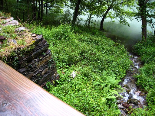
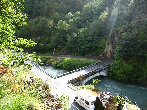
A view from the path to the old bridge over the Garonne, the 'Pont du Roi'. Move the cursor over the picture to see where bm410 stands. |
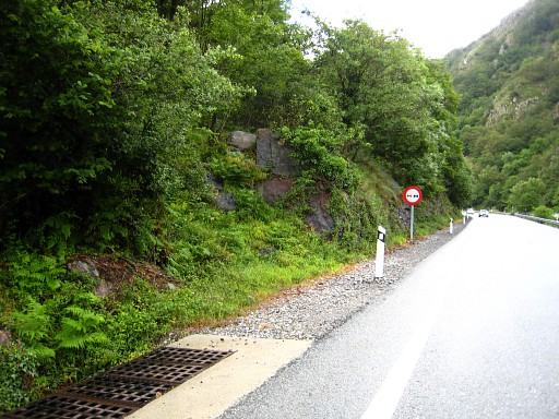 |
A
bit further, the path descends to the main road. But from the road it's
not quite distinct where the trail starts. Well it's here, where you
see the rocks. |
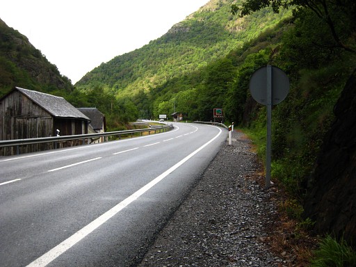 |
And here, seen from the other side looking into Spain, just beyond the traffic sign. |
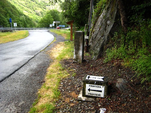 |
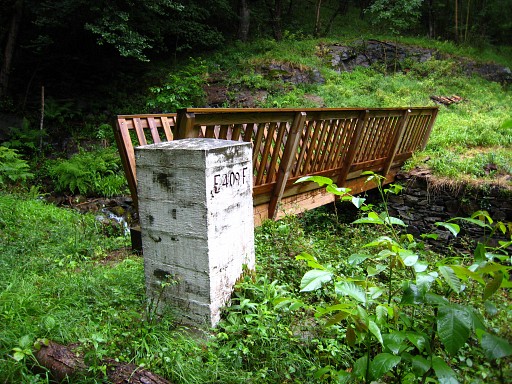
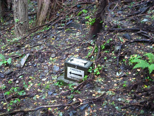
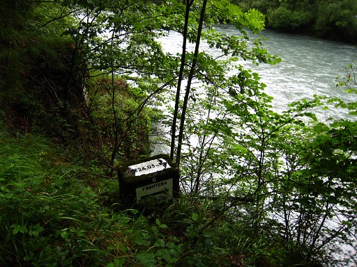
I walk to the Pont du Roi and find bm410 and the submarker bm409-7fr At that time I thought that this was the last of the series of 7 submarkers. Later I will learn - as said before - that there are also 7 submarkers on the French side and that this nr. 7 is the last of the French series. The 'Spanish' nr.7 is at the other side of the Garonne. |
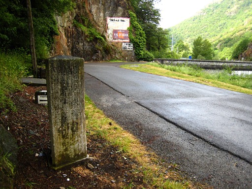 |
Bm410 |
 |
Close
to bm410, there's this sign marking the Spanish continuation of the
Garonne-trail to the hamlet of Pontaut, 1,5km into Spain. I give it a try but there are no further waymarks in the crisscross of tracks higher up. I give up, irritated. In about 20 minutes I walk easily along the main road to Pontaut. There's enough space on the sidewalk to do this safely. I notice that on the other side of the Garonne, that Garonne-trail has to climb quite a lot to pass a steep hillside. Conclusion: take the main road, safe-short-easy |
 |
Coffee-break in the cafe at Pontaut. I tell about my project and the
owner tells me that the "jefe", the warden, of the Refugio nearby knows
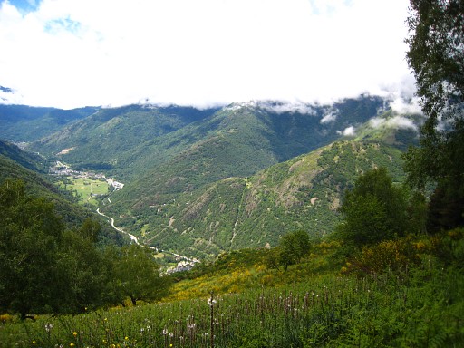
very much of the surroundings. From Pontaut I 'zigzag' uphill to Canejan. Behind the church, I continue on the trail uphill, first very steep, later less steep. This picture, a view of the Spanish valley of the Garonne. |
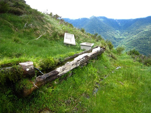 |
Finally the trail reaches this drinking-place for cattle at the edge of a forest. There's no clear path into the forest / uphill. I climb E through the forest and then on the open hillside to the borderridge, finding a path to the ridge. |
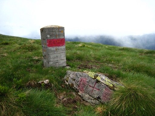 |
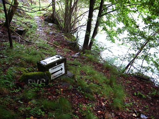
At the borderridge, further on, you can't miss bm415, a cross and a pillar. Then the trail goes left of the borderridge |
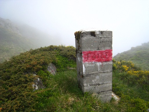 |
until you reach - after 1,5km - bm416, cross and pillar. |
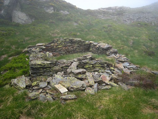 |
The Pas de la Porteule is a bit further, with 2 small ruines. Meanwhile clouds have drifted in and I can't see anything from the pass. And it's already 3pm. I decide to return, this bm417-attempt has failed. |
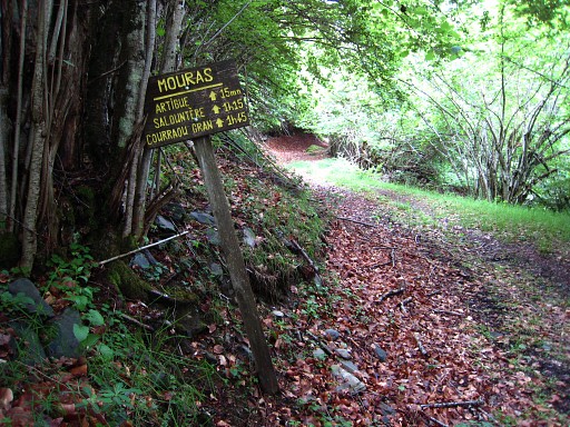 |
I descend on the French side via 3 cabanes: - Courreau Grand, seems to be used (too) by a shepherd, there's a trail leading to it, more or less. - Cabane de Salontère, just descend the hillside if you see it down below, is meant for hikers. Then along a forestroad to - Cabane d'Artigue, also for hikers |
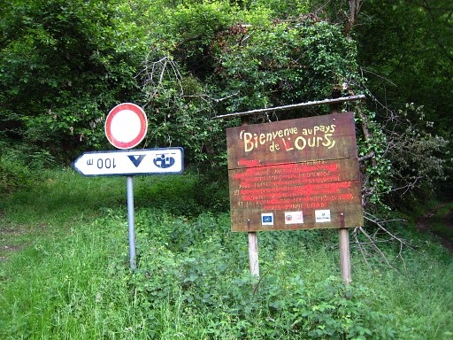 |
And finally via distinct forestroads and -trails to the main road in the valley. "Bienvenue au pays de l'ours" = Welcome to the land of the bear |
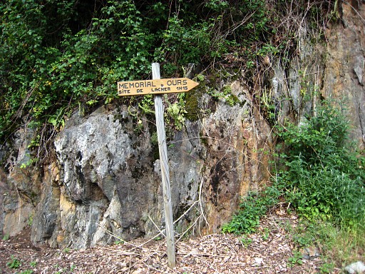 |
A sign waymarking to the place where once a Slovenian brown bear was set free to strengthen the Pyrenean bear-population. Back to Fos -> shop ->camping. |