|
The
bordermarkers of the Pyrenees : all my trips
 |
|
| -
10 june
2009 - Back to Col du Portillon |
 |
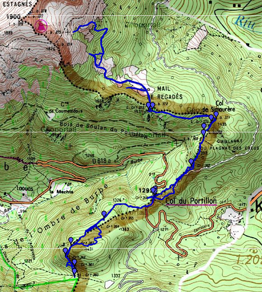 |
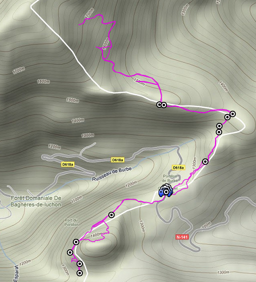
esfr-trip-track-20090610.kml (click to open in Google Earth or copy link to Google Maps; click right on this link to download gpx-version) Part of a 16-days trip, using day 1-10 to cover bm154 to 264 in the eastern Pyrenees and day 11-16 for bm416 to 365 near Bagnères-de-Luchon. Day 16: from Col du Portillon a reconnaissance of routes to bm374, finding bm367 and searching the markers at the W-side of the Col. |
 |
For explanation of
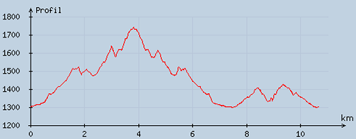
the gps-coordinates and other cartographic backgrounds: see my cartography page According to my watch: Duration: 9.30-18.00, in total 8.26 hours, breaks ± 1 hour Up: 1175 m Down: 1186 m Total elevation 2361 m Highest point:1742 m Lowest point: 1302 m |
 |
According
to visugpx - distance : 10.95 km - cum. elevation gain : 833 m - cum. elevation loss : 826 m - total elevation: 1659 - altitude maxi : 1741 m - altitude mini : 1299 m - altitude average : 1452 m |
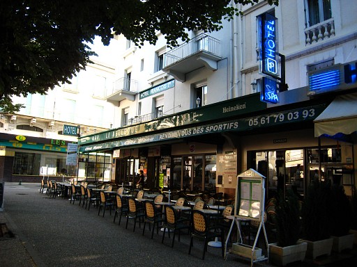 |
My hotel in Bagnères-du-Luchon. I get a lift from two workmen to the Col du Portillon. Underway, they make a short stop to collect mushrooms. |
 |
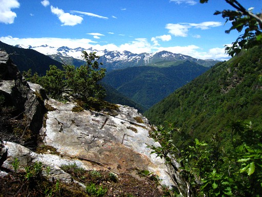
Part 1: exploring the route to the cabane beyond bm373, finding bm367. At Col du Portillon, I climb the rock behind bm366 at its left-side. Apparently, this painted marker is on the backside but I can't remember that exactly. |
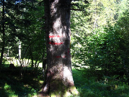 |
From there I keep following the double red stripes on the trees which do indeed follow the ridge. A next rocky hill, I pass on its left side. To the right - down below - there's a Spanish dirtroad close or very close. |
 |
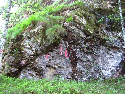
At a certain point, the 'red' route descends to a clear point of contact with the dirtroad. From the dirtroad (this picture) you can see a large tree with red stripes and a F. Moreover there's a mountainbike-sign on that side and a 'CACA'-sign on the other side of the road. This is nice entry point into the forest towards bm367. From bm366, you can simply follow the Spanish dirtroad until this point. |
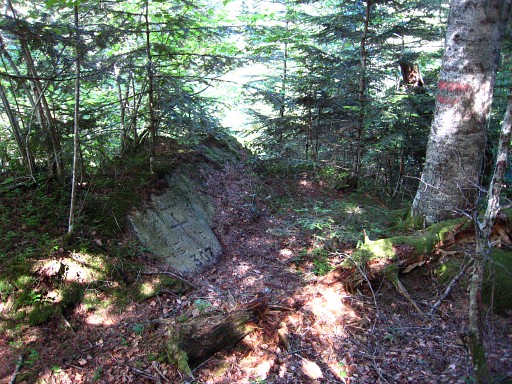 |
I continue along the red stripes, keep an eye on rocky outcrops and discover bm367 |
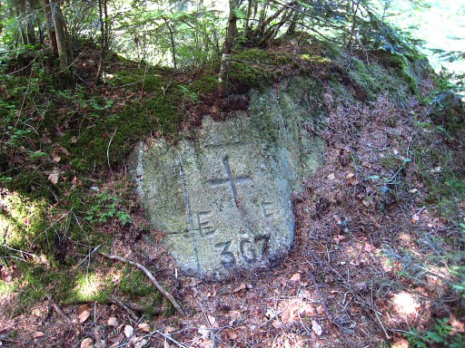 |
Bm367. I continue
along the stripes = the ridge and pass the 'piton' where I searched
intensively yesterdag for bm367. Then there's another small hill after
which - on a sort of pass - I see bm368. Then - after another small
hill - in a muddy valley bm369. From bm369, the borderridge is not clear but there are still red stripes leading you - higher up - to bm371 with already in sight bm371 higher on. Then I go to the left, still following the stripes until I loose them or they vanish. Anyway, the ridge is getting again more distinct but remember to go - further on - to the left of the ridge. Otherwise you might miss the rocky outcrop where bm372 and bm273 are. |
|
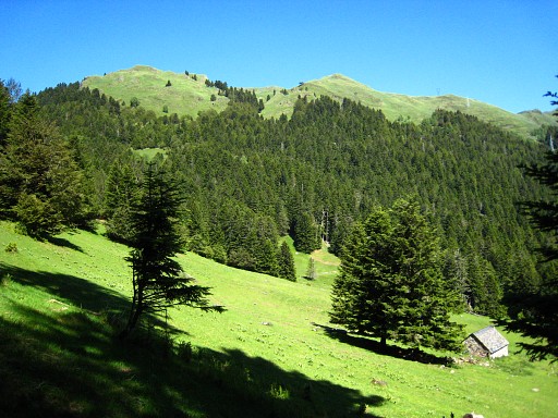
From
bm373, descending N to the cabane. The cabane is good orientation
point. There's a stream in the NW-corner of the meadow. Keep in mind
that the next stream/source is beyond bm397 along the GR10-trail, a
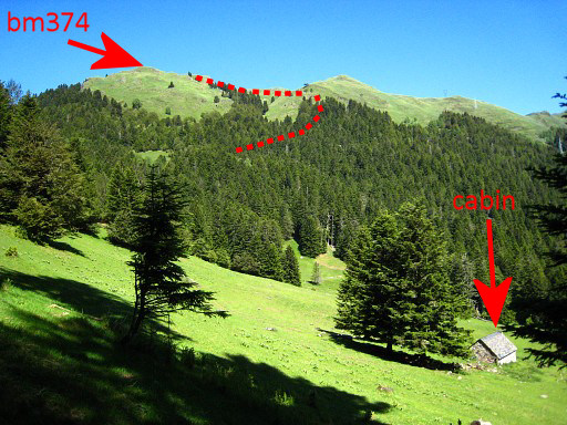
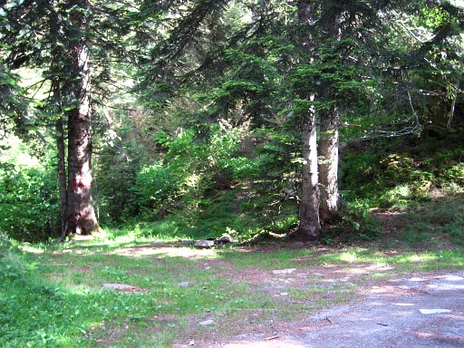
half day of walking further. I take a break, nicely in a garden chair I found inside the cabin. Just before the cabane, a trail goes left, entering the forest further on. Move the cursor over the picture to see the approximate trail from the second meadow, climbing to bm374 |
Part
2: a reconnaissance of a GRPdesBF-route towards bm374 and returning to
Col de Portillon. First a Google Earth map of my reconnaissance from
the cabane.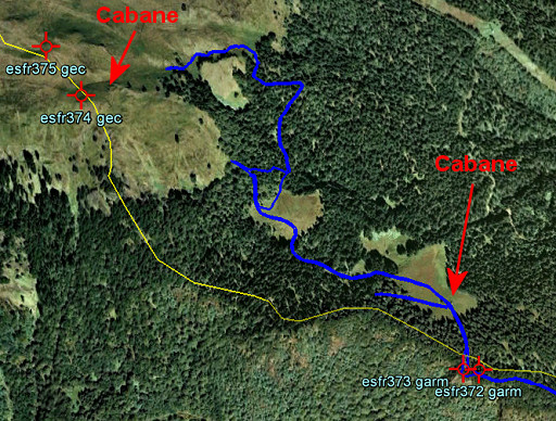 First I try the trail just above the cabane going W but that one enters the forest too high. You have to take a vague cattle track just below the cabane which bring you to the W-corner of the meadow. In the forest the track gets more distinct and brings you with a slight curve to the S-corner of the second meadow. From the second meadow - at its W and NW-side - , there are two entry point into the forest roughly going N: 1. at the lowest (NW) point where two tracks merge and enter the forest and become more like a forest-road. 2. in the higher corner (W) where a forest-road starts but soon becomes a path. ad 2. : I first try nr. 2, as soon as you enter the forest, you will see through the trees the open hillside towards bm374 to your left. I climbed directly to the open hillside. I descend back, apparently don't recognize trail nr. 2 and end up on trail nr. 1 ad 1. : I climb along this forest-road which becomes a path which becomes a cattle track. If you doubt, keep following the most distinct track/path. The trail leaves the forest,winds through large boulders and arrives at the foot of the last climb to the cabane near bm374. At one point the cabane is already visible. I stop and return to the meadow, there I repeat part of trail nr. 2 for a gps-track. Conclusion - trail 2 is shorter but requires steep climbing in the forest and on the hillside - trail 1 is more elegant, more beautiful but longer. I return to the cabane and from there pick up the borderline and go back, making again pictures of the bordermarkers, I did yesterday. |
|
 |
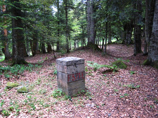
Bm373 |
 |
Bm372 |
 |
Bm371 |
 |
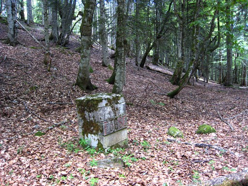
Bm370 |
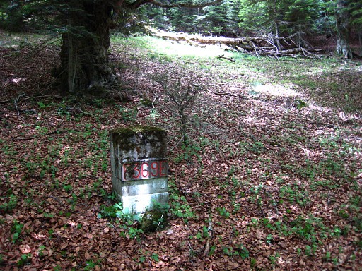 |
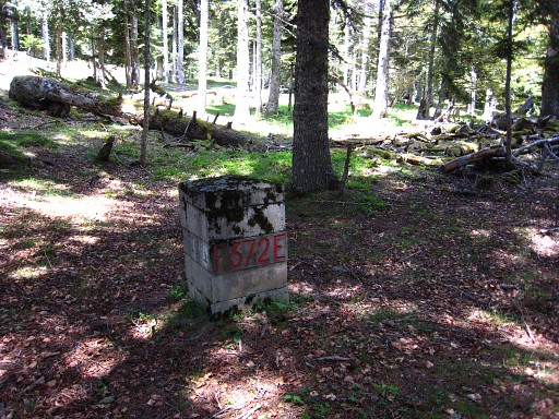
Bm369 |
 |
Bm368 Beyond bm367, at that point of contact with the dirtroad, I pick up the dirtroad and walk back to Col du Portillon with |
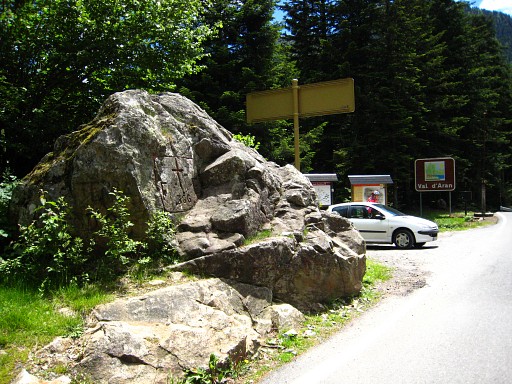 |
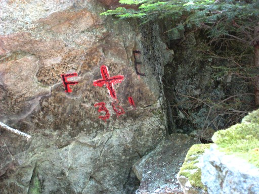
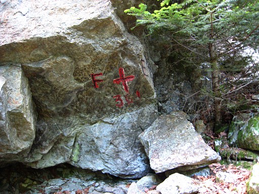
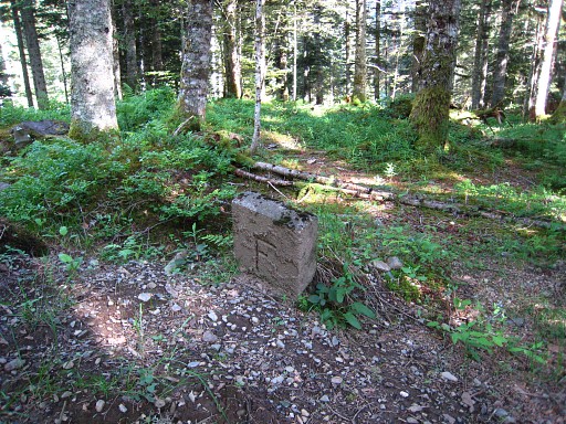
Bm366 A second break at the picknick-table alongside bm366. Part 3: searching the bordermarkers at the other side of the Col. The border doesn't simply cross the Col but descends a while along the west-side of the road to the S/SW and then - at a large triangular pillar - enters the forest on a forest-road. There are small unnumbered markers along the road and in the forest (until bm365), with a F and E on either side. |
 |
Along the forest-road I spot again
those double red stripes which follow/indicate the borderline. But not
everywhere it seems: not at bm361 and perhaps not at bm364 which I
didn't find. I easily find bm365, above the road. |
 |
Bm365 But further on - along the forest-road - I can't find bm364. With help of the red stripes and the distances mentioned in the Procès-Verbal, I can establish its location quite well but no trace of bm364. Higher upon the hill there's a larger rocky outcrop but that seems too far away from the red stripes. In 2010 I will learn that bm364 wasn't found either by Robert Darrieumerlou and Paco Nudels. Paco - however - shows an old picture of the cross on this page. Paco got his picture from the "Archives de La Guardia Civil". |
 |
I go on, following the red stripes. The forest-road has become more of a path and after some winding, I find bm363 |
 |
Bm363 |
 |
Bm363 |
 |
Beyond bm363 there's no real path anymore but the red stripes bring me to bm362. |
 |
Bm362. The distances mentioned in the Procès-Verbal between the bordermarkers are a good help. |
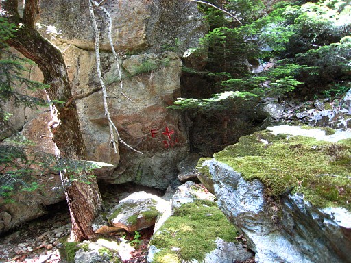 |
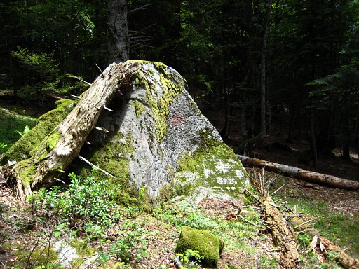
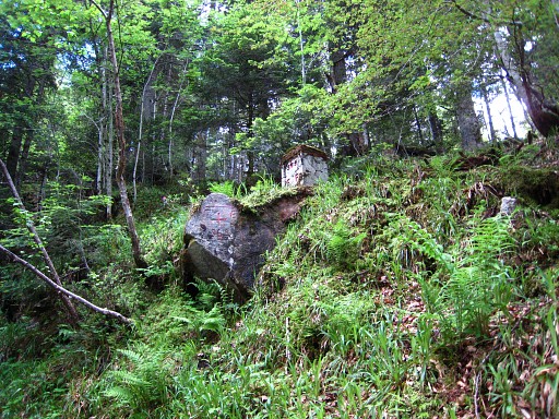
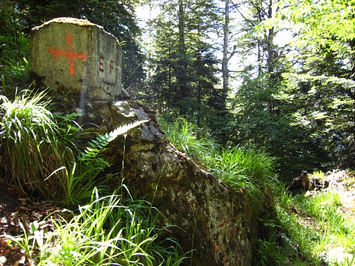
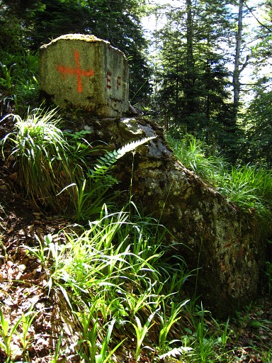
Then walking becomes scrambling over large boulders and I find - more by chance - bm361 It's located at the tilted side of a rockwall on top of those boulders mentioned above. But it's off the 'red line' of double striped trees. However, there's an indication on the red line itself: a bit below bm361 there's red cross painted on a rock. |
 |
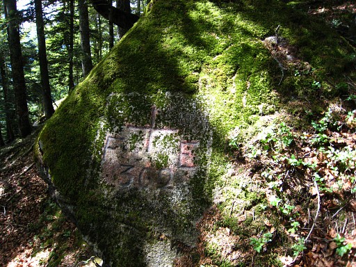
Bm361 looks amateuristic. It seems only painted but the number is engraved (a little). The other bordercrosses around look a lot better and more professional. . |
 |
Bm361 The Procès-Verbal mentions a "anfractuosité" nearby, that's a hole or cave. I can't remember seeing such a hole/cave. |
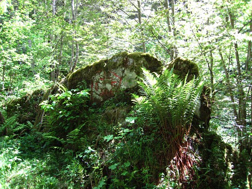 |
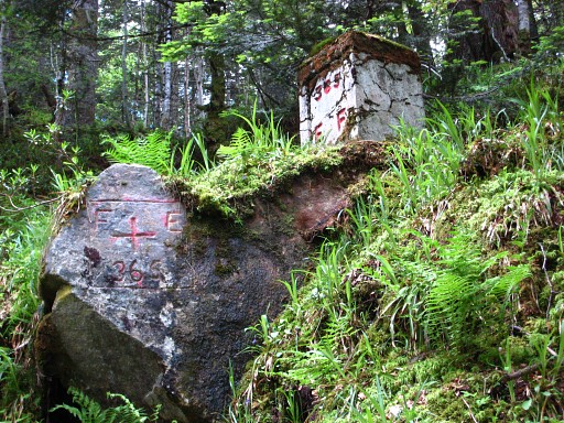
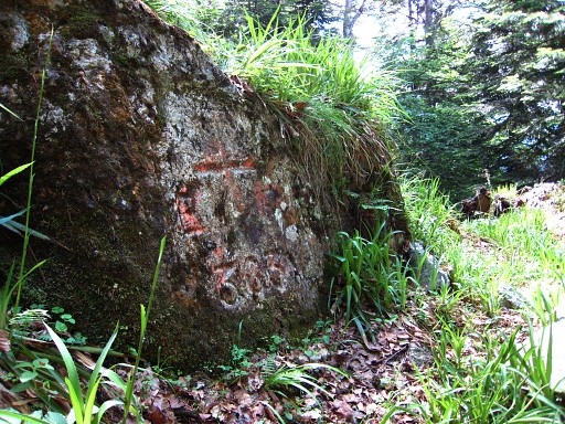
I follow the 'red line' downhill to a stream and a trail. There I find Bm360 |
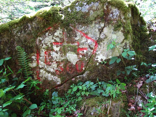 |
Bm360 . |
 |
I return, trying to go along the previous markers with help of my
gps-compass but I get a bit lost. Especially after bm363, I end up too
high in the forest. I search again - in vain - for bm364 Then - beyond bm365 - a picture of one of those unnumbered submarkers. |
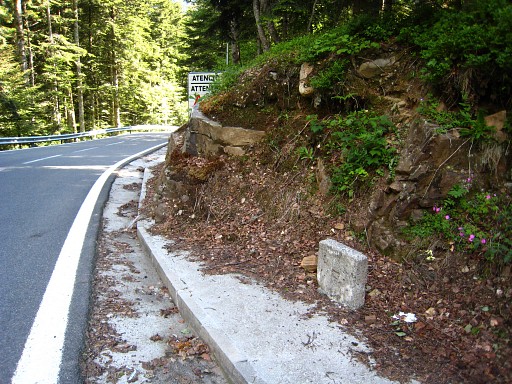
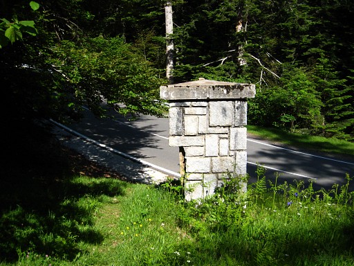 |
And this is the triangular 'submarker' at the point where the border leaves the edge of the tarmac road
and enters the forest. |
 |
Another unnumbered
submarker, this one between the Col du Portillon and the pillar in the
previous picture. From the col I get a lift back to town (again by someone doing a spa-therapy in Bagnères-du-Luchon, this one works in a mortuary). |