|
The
bordermarkers of the Pyrenees : all my trips
 |
|
| -
9 september
2009 - Camping near bm312 |
 |
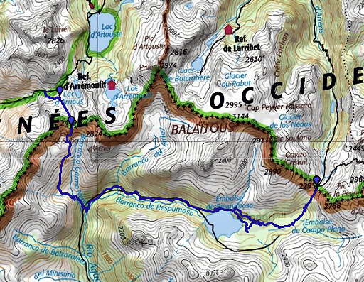 |
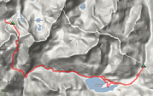
esfr-trip-track-20090909.kml (click to open in Google Earth or copy link to Google Maps; click right on this link to download gpx-version) Part of a 5-days trip from Col de Somport to Cauterets, exploring bm305 to bm314. Day 3: descending into Spain and via the reservoir of Respumoso to Port de la Peyre St. Martin with bm312. Weather: sunny, warm, in the afternoon a chilly wind |
 |
For explanation of
the gps-coordinates and other cartographic backgrounds: see my cartography page According to my watch: Duration: 9.25-18.10, in total 8.45 hours According to my gps: - walking: 5.43 - standing stil: 3.13 - in total: 8.56 - average speed while walking: 3.4 km/h |
 |
According
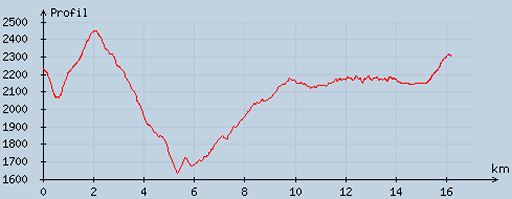
to visugpx - distance : 16.57 km - cum. elevation gain : 1257 m - cum. elevation loss : 1175 m - total elevation: 2432 - altitude maxi : 2450 m - altitude mini : 1635 m - altitude average : 2136 m |
|
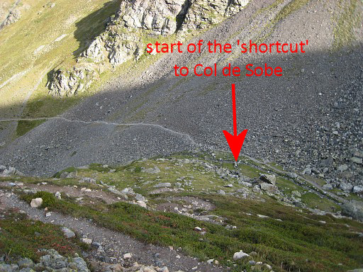
I
start with walking further along the trail of yesterday (a clear trail
with many cairns) downwards to where it joins the trail to Col
d'Arrioù. Purpose: to have a gps-track of it. Move the cursor over the picture to see where the direct trail to Col de Sobe starts. |
 |
There
are two large boulders where that branch starts in the direction
of Col de Sobe. This is a easier & shorter way to reach the
Col. |
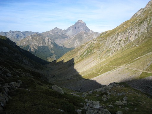 |
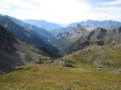
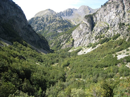
Returning on the direct trail to Col de Sobe. Looking back on the valley with the Pic du Midi d'Ossau in the distance. |
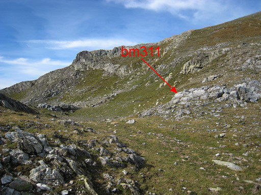 |
Col de Sobe with bm311 from some distance |
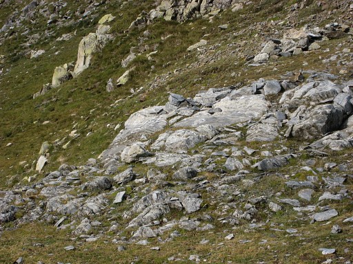 |
Bm311, zoom-in |
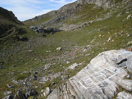 |
Bm311 |
 |
Bm311 |
 |
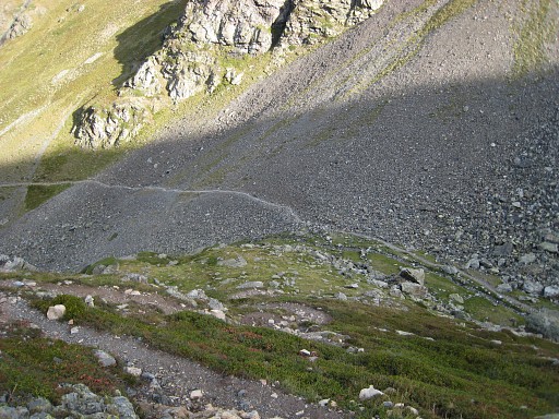
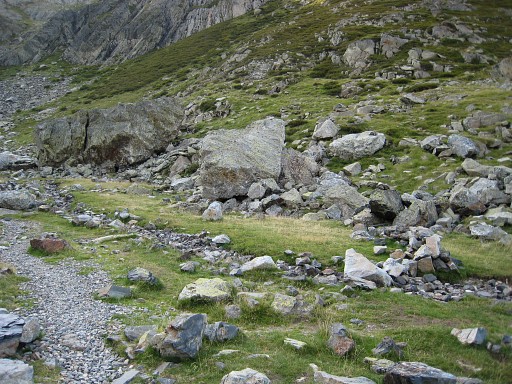
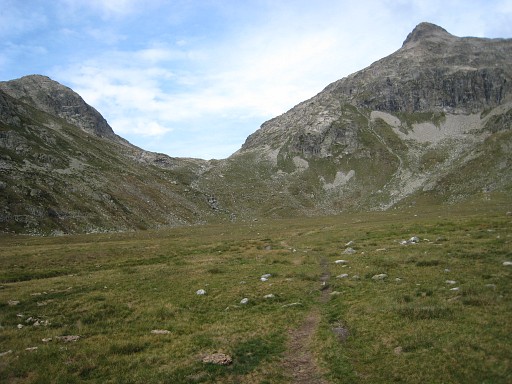
Descending into Spain untill the GR11-trail down in the valley. However: there's hardly a trail or cairns-waymarking. In general you should descend on the west-side of the valley. Going down from the col, you'll notice a sort of hillridge in front of you. Pass that ridge a bit to the left of the middle. By the way: from the col there's a short trail descending to the right but that one disappears in the grass. Finally you'll reach a stream. Follow the stream downwards at the left-side and soon a clear path appears (a bit above the stream) which descends into the forest. |
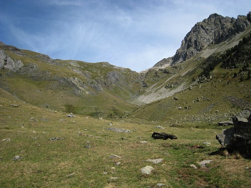 |
Looking back at Col de Sobe. |
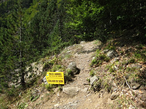 |
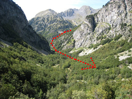
This is where the branch from the GR11 to the Col de Sobe starts. The descent from Col to the GR11-trail take approximately 2 hours. |
|
Then: on the Gr11 to Refugio de Respomuso in about 2 hours. That's a long-long but gradually climb. This picture: while climbing looking back into the valley and where I came form. Move the cursor over the picture to see where you descend in the valley - coming from Col de Sobe - and continue. |
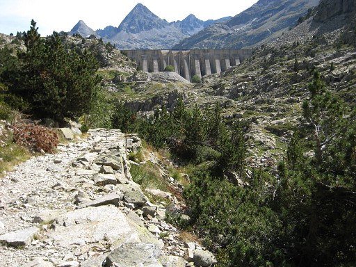 |
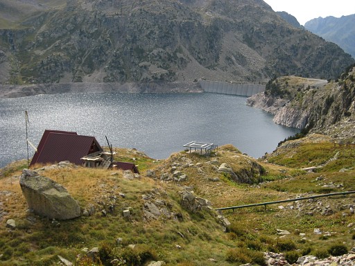
Approaching the barrage of Respumoso. |
 |
The refugio visible at the left, above
the lake. The bar in the Refugio is not quite inviting, so I skip the
long awaited coffee I continue on the GR11 but see that it leads too far south. Along a closed cabin (with a rounded roof) and a small lake I want to get to the lake of Embalse de Campoplane. |
 |
But then I discover / realize that
there is also a higher and more direct route from the
refugio to the lake of Embalse de
Campoplane. To get a gps-track I walk that trail vice-versa. This picture: close to the Refugio this is where you should leave the main trail and climb the hill for the direct route. On this picture we're looking to the west. |
 |
The direct route passes above the refuge. |
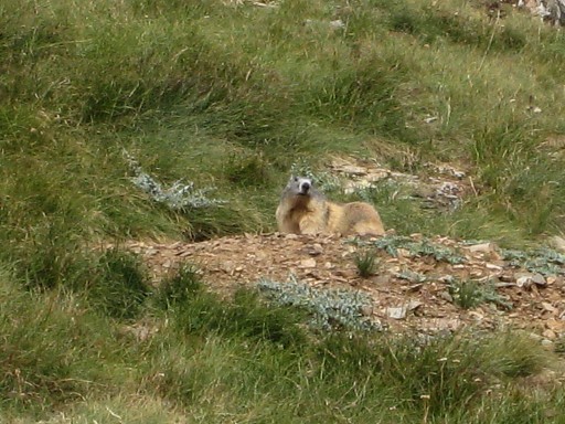 |
And this marmotte. |
|
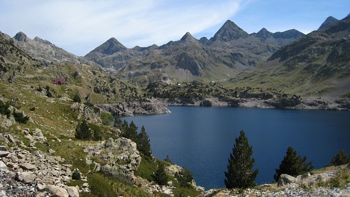
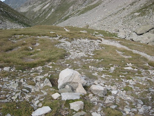
and continues to the lake of Embalse
de
Campoplane. The trail goes underneath the lake and along the north side
of a concrete wall and cabin (with a watertap!) to a grassy plains NW
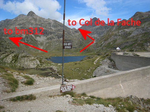
of the lake. Move the cursor over the picture to see the access to bm312 and the next Col. |
 |
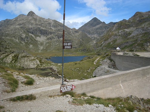
I'm a bit confused about the right
direction but someone points me where the Port de la Peyre St. Martin
is. This is the Port, seen from the plains. |
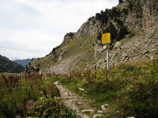
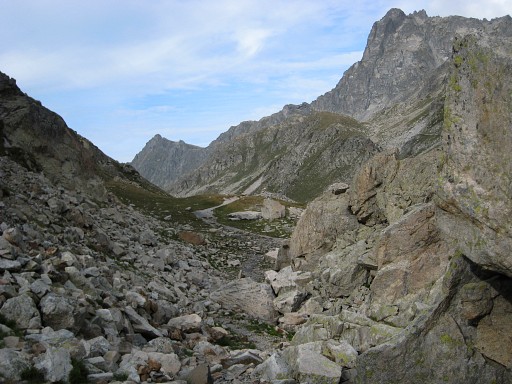 |
It's an easy climb (clear path, ± 150 meter up) to the Port de la Peyre St. Martin. The pass itself is quite elongated. |
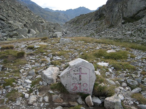 |
And on the end, there's bm312 |
 |
Bm312, from the backside, looking into France |
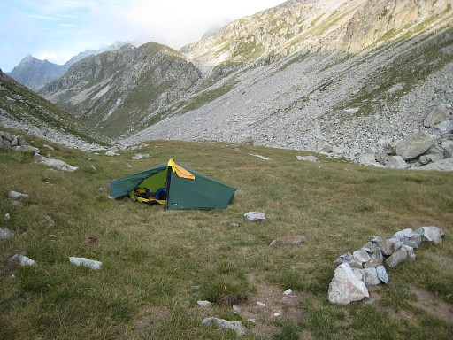 |
And I pitch my tent, close by. Camp: N42 49 21.4 W0 15 38.2 H2302 |