|
The
bordermarkers of the Pyrenees : all my trips
 |
|
| - 11 september
2009 - Such a perfect day |
 |
 |
esfr-trip-track-20090911.kml (click to open in Google Earth or copy link to Google Maps; click right on this link to download gpx-version) Part of a 5-days trip from Col de Somport to Cauterets, exploring bm305 to bm314. Day 5: from Refuge Wallon passing Col d'Arratille (bm314) and Col des Mulets and descending to Cauterets. Splendid day: bright & sunny, very clear sky. Unrivalled sceneries with mountain passes, lakes, views of the Vignemale. A popular area: many hikers around. |
 |
For explanation of
the gps-coordinates and other cartographic backgrounds: see my cartography page According to my watch: Duration: 8.50 - 17.05 , in total 8.15 hours, break 30 min. According to my gps: - walking: 6.07 - standing stil: 2.12 - in total: 8.19 - distance: 23.0 km - average speed while walking: 3,7 km/h |
 |
According
to visugpx - distance : 18.82 km - cum. elevation gain : 870 m - cum. elevation loss : 1336 m - total elevation: 2206 - altitude maxi : 2589 m - altitude mini : 1466 m - altitude average : 2075 m |
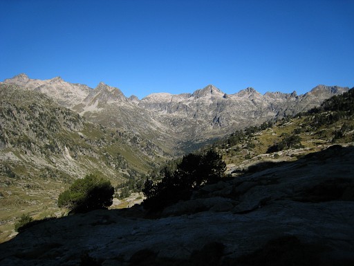 |
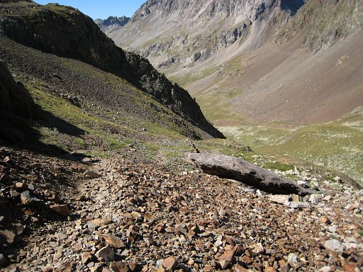
Start 8.50am. Down to Refuge Wallon and picking up the trail to Col d'Arratille. This picture: while climbing looking back at the valley where the refuge is. |
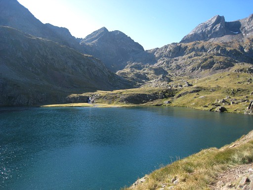 |
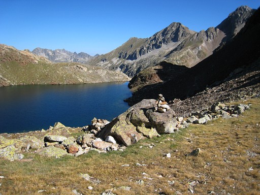
It takes about 2½ hours to climb (from refuge Wallon) to the Col, passing this beautiful lake (Lac d'Arratille) |
 |
The last part is well waymarked (white-red). This picture: looking back at Lac d'Arratille. |
 |
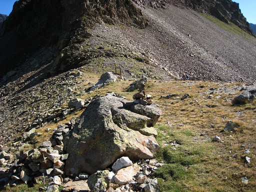
Allmost at the Col |
 |
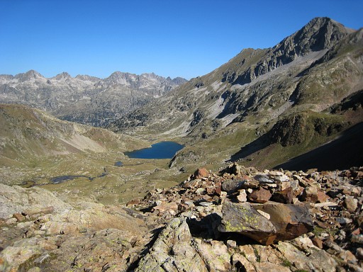
Bm314 Located a bit to the west of the trail. |
 |
Bm314 from some distance. View on Lac du Col d'Arratille. |
 |
Bm314 |
 |
View of the Col, bm314 is the rock with the cairn. |
 |
From the Col looking into Spain. But I'm not going down, I will go to the left on a trail to Col de Mulets. |
 |
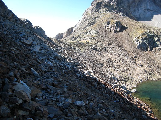
It will take about 1 hour to reach Col de Mulets on a trail through rockslides with white-red-white waymarks. This picture: getting close to Col de Mulets, looking |
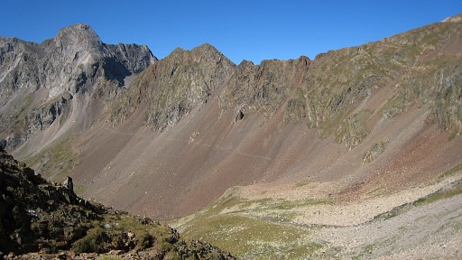 |
Looking back - from close to Col des
Mulets - at the trail coming from Col d'Arratille and for a long
stretch running horizontally along the rockslide-slope. When the fnal climb to Col des Mulets starts, there is also a 'white-red-white'-branch leading into the valley, to the GR11-trail I suppose. But I wonder if there's no direct trail from Col d'Arratille - waymarked or not - into the valley. |
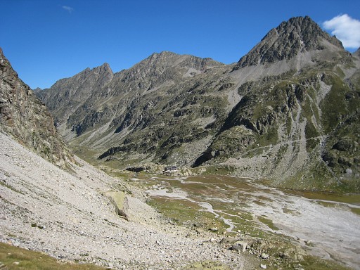 |
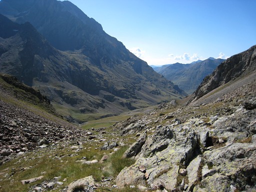
Beyond the Col des Mulets I descend in
1¼ hour on a rocky path to the plains at the foot of the Vignemale .
Visible on this picture: Refuge des Oulettes de Gaube. A long time ago, I slept one night in this refuge with Jan-Willem. Today: many daytrippers. |
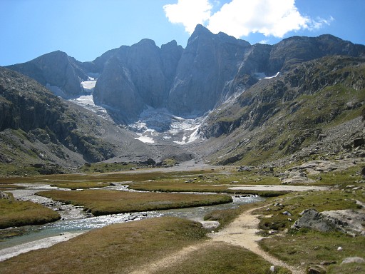 |
From the plains an impressing view on the majestic north-face of the Vignemale. |
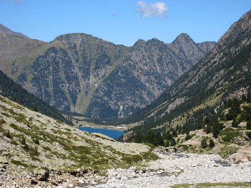 |
Then a long descent (± 2 hours) to the refuge at Lac de Gaube. A short break with coffee and a sandwhich refreshes me for the final descent (± 45 min) to the parking of the Teleferique. |
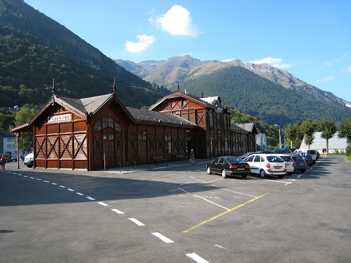 |
I get a hitch-hike from a nice retired couple (from La Rochelle) to Cauterets. In Cauterets - from this former train station - I take the bus to Lourdes. |
|
|
|