|
The
bordermarkers of the Pyrenees : all my trips
 |
|
| -
28 august
2010 - Clouds cover the valleys |
 |
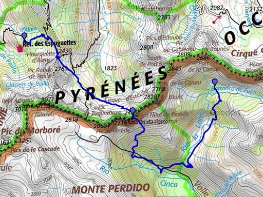 |
esfr-trip-track-20100828.kml (click to open in Google Earth or copy link to Google Maps; click right on this link to download gpx-version) Summary: part of a 11-days backpacking trip from Cauterets to Loudenvielle ‘doing” bm315 to bm330. Day 4: a tough day, passing the Port Neuf de Pinède with bm320 and a risky climb at the end. Weather: warm and sunny |
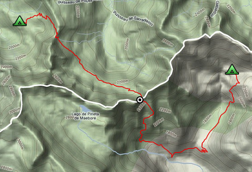 |
For explanation of
the gps-coordinates and other cartographic backgrounds: see my cartography page Start: 7.45, break: no break, finish: 17.30, net walking time: 9.45 According to the gp-tripteller: Distance: 16,6 km Time moved: 6.13h Time standing still: 3.38h In total: 9.51h Total ascent: 1390m Maximum height: 2477m |
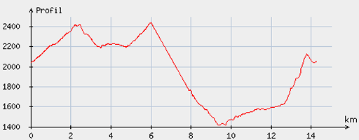 |
According
to visugpx - distance : 14.6 km - cum. elevation gain : 1367 m - cum. elevation loss : 1355 m - total elevation: 2722m - altitude maxi : 2441 m - altitude mini : 1418 m - altitude average : 2060 m |
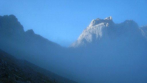 |
I
start in the mist but as I approach the Hourguette d’Alans, I get above
the clouds in the sun. |
 |
The pass of
Hourquette d'Alans |
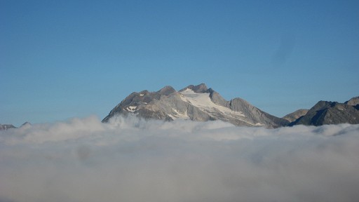 |
From the pass a
spectacular view: the valley covered with
clouds but the mountain peaks above them like islands. I can see the Vignemale drifting on a cloud |
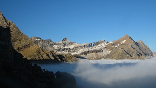 |
And the Brèche de Roland. |
 |
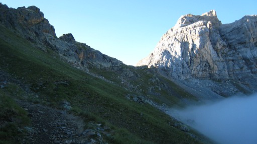
On the
pass itself, the Port Neuf de Pinède is already visible, above
the
mist. From Port Neuf de Pinède (bm320) I will take a route via Spain to the next bordermarker at Port de la Canau. But Jacques Koleck suggested in 2013 another route: "I know this region very well. As the storms of late afternoon are frequent and violent, I would consider an alternative. From Port Neuf de Pinède return down the beautiful valley to reach the Estaubé Gloriettes dam and the road leading to the hamlet of Heas and the Cirque du Troumouse. All along the route there are great places to camp. This is much longer but it is much less dangerous in case of bad weather." |
 |
After descending a bit, there’s path going to the right, that’s a short-cut. The path is ok (waymarked by cairns) and melts into another path (the main path coming from the valley) |
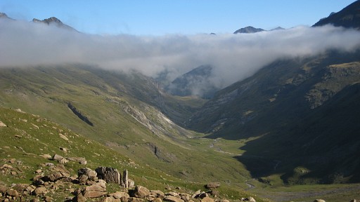 |
Looking
back: the Vallée d'Estaubé |
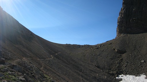 |
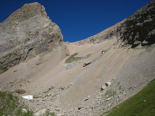
After finally passing a rockslide, the trail leads me to the Port. It took me 3 hours to get there. |
 |
Overview of the Port Neuf de Pinède. |
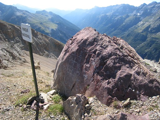 |
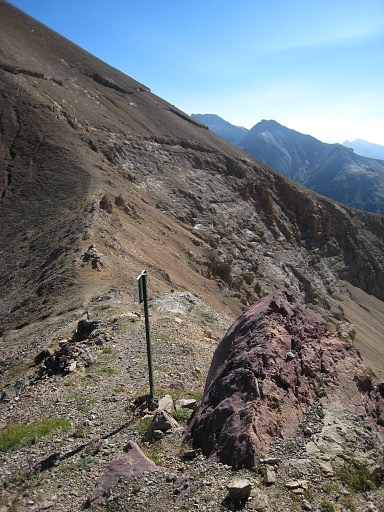
Bm320 |
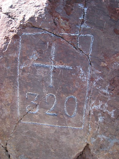 |
Bm320 |
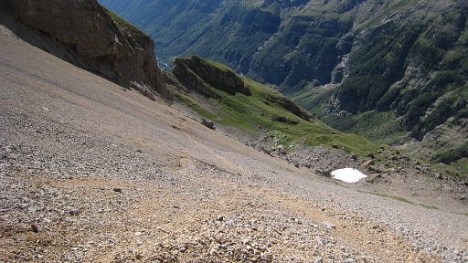 |
Then a long, long descent into Spain. First there’s a steep gravel-slide to tackle |
 |
Looking back at the
Port |
 |
and later on there
are many slippery
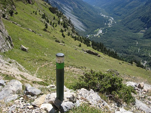
parts, taking 3 hours to reach the road. This is a popular hiking area, making trails to be worn out and slippery. When reaching the road, to the left (passing a fountain) and getting in 30-45 minutes to |
|
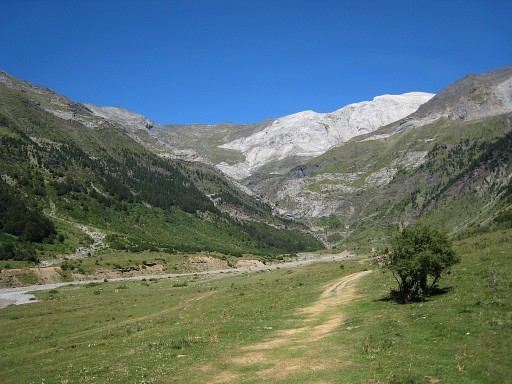
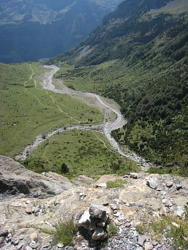
the plains of
LLanos de la
Larri. At the end of it to the right, just a stream (now dry), a track starts, well waymarked with cairns. Move the mouse over the picture to see my approximate route |
 |
It climbs steeply
along the rocky
mountain-side with various vertigo parts, be careful. Too risky for the
Grpdesbf-main-route, I think. |
|
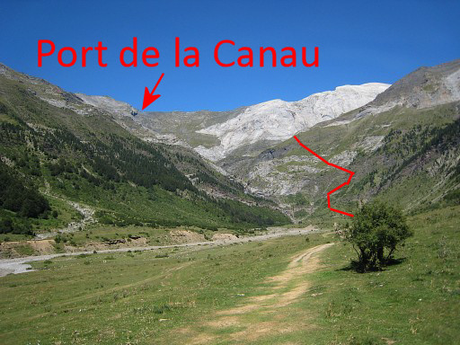
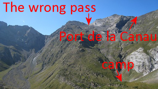
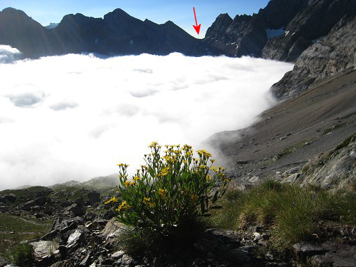
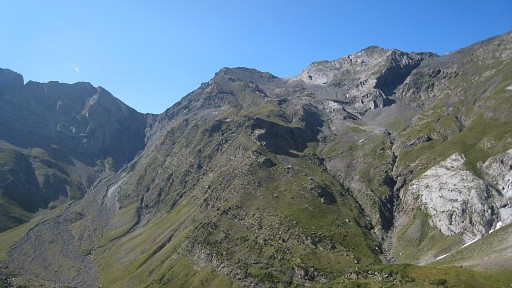
A view of the
borderridge with somewhere Port de la Canau with bm321. I carefully study the maps in the evening but will choose the wrong pass the next morning. Move the mouse over the picture to see where the Port de la Canau really is. |
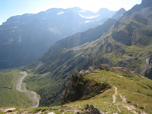 |
Finally all the
rocky climbing is finished and the path
(which leads to Lagos de la Munia) flattens. Looking back at the plains. Further on you’ll see a grassy slope descending NNW to a stream. |
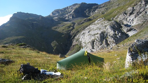 |
I descend
and camp a little beyond
the stream with a view on the borderridge. Camp N42 42 24.3 E000 05 40.2 H2015 |