|
The
bordermarkers of the Pyrenees : all my trips
 |
|
| - 1
september
2010 - Meeting an Englishman |
 |
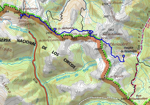 |
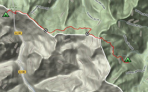
esfr-trip-track-20100901.kml (click to open in Google Earth or copy link to Google Maps; click right on this link to download gpx-version) Summary: part of a 11-days backpacking trip from Cauterets to Loudenvielle ‘doing” bm315 to bm330. Day 8: from Port de Bielsa along the borderridge, finally descending into the valley of Rioumajou. Weather: still beautiful |
 |
For explanation of
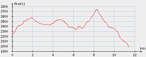
the gps-coordinates and other cartographic backgrounds: see my cartography page Start: 8.30, break: 13-14, finish: 18, net walking time: 8 ½ h According to the gp-tripteller: Distance: 13,8 km Time moved: 5.18h Time standing still: 4.15h In total: 9.33h Total ascent: 1016m Maximum height: 2742m |
 |
According
to visugpx - distance : 11.76 km - cum. elevation gain : 864 m - cum. elevation loss : 1117 m - total elevation: 1981 m - altitude maxi : 2740 m - altitude mini : 1984 m - altitude average : 2441 m |
 |
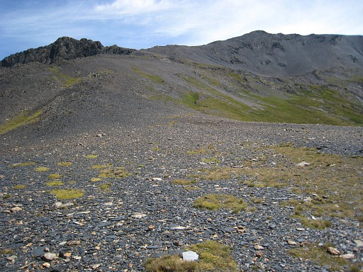
I
climb back to Port de Bielsa and take - before the final climb - the
branch of the trail leading west along the ridge. |
 |
There’s a green/white cross at the start of it and further on there are white waymarks and cairns. |
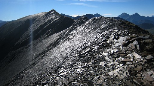 |
In fact this trail
and its continuation leads you on and along
the borderridge untill Port de Moudang. It may get fainter in places, waymarks can disappear and sometimes you need to descend a bit to avoid sharp rocky outcrops but overall it’s ok. The trail climbs first to Pic de Bataillence and continues with lesser waymarks. |
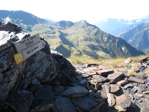 |
I get confused by a pass named Port de Salcorz (according to a sign) but that’s not the real Port de Héchempy which is the gentle curved pass further on. The Procès-Verbal says they’re the same, Port de Salcorz being the Spanish name. |
 |
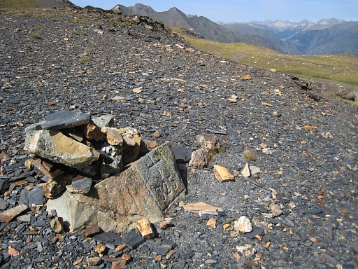
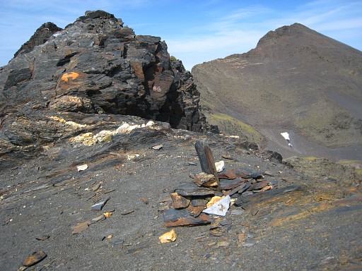
I find bm324 on the top of the first rocky outcrop to the east, |
 |
indicated by a cairn. |
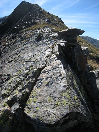 |
Bm324 |
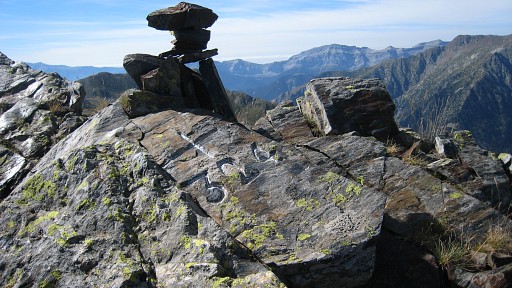 |
Bm324 |
|
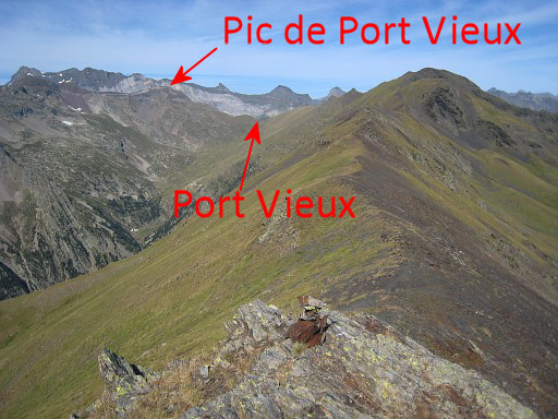
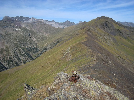
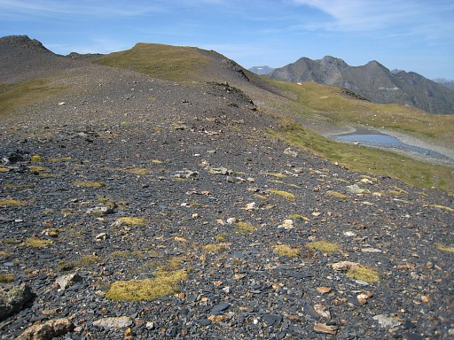
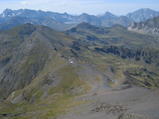
Looking back along
the borderridge. The Port Vieux and the Pic de Port Vieux are visible. Move the mouse over the picture to see port and pic. |
 |
A bit further, the
trail goes left
underneath this mountain-summit, arriving at the foot of the Port
de Moudang where a tiny lake is. |
 |
The trail to the
Port fades out but
it’s a clear target, I suggest you climb diagonically to the west side
of the Port. The Port itself is a broad saddle. |
 |
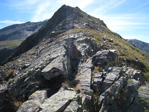
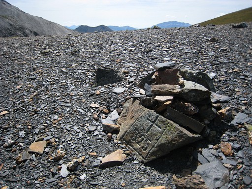
Bm325 is to the right, a small rock with a cairn. |
 |
Bm325 |
 |
Bm325 |
|
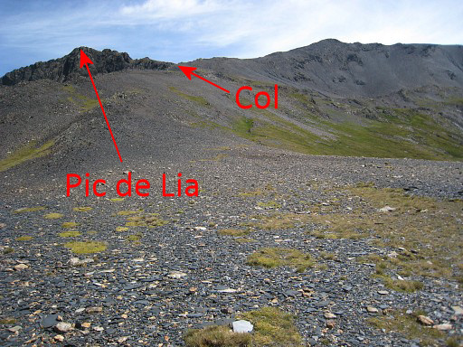
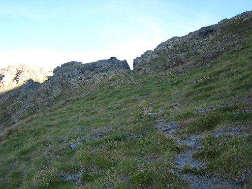
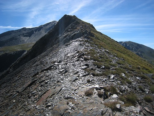
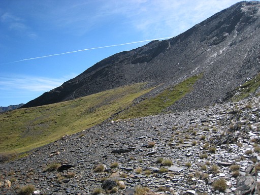
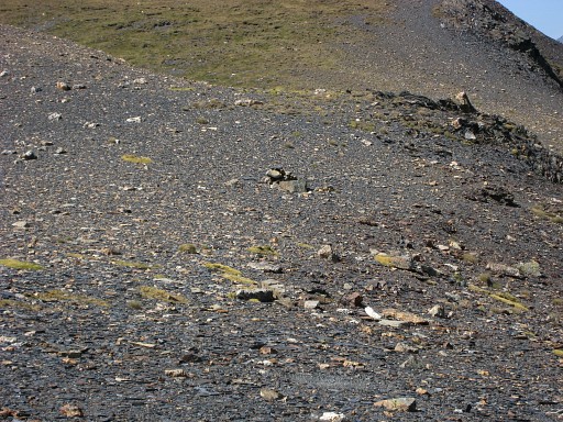
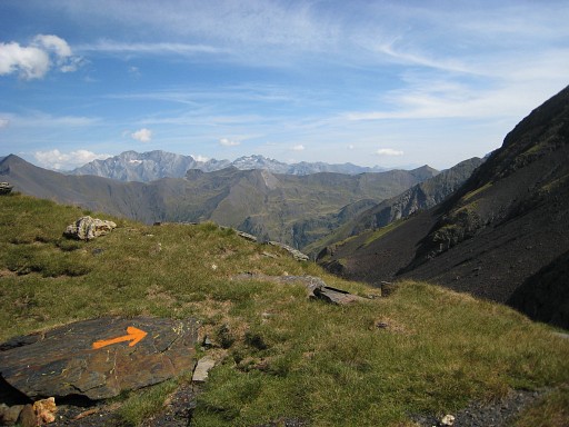
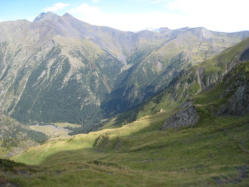
I meet an
Englishman who just has
returned from the Pic d’Arriouère. He tells me that there’s a sort of unnamed col up the borderridge - visible on this picture - with a very steep path (orange waymarked) into France, into the Vallée de Rioumajou. I decide to try that path, I was looking for a shortcut to Port d’Ourdissétou anyway. Leading up to the col, there’s a faint trail. Move the mouse over the picture to see where that col is. |
 |
This is the col.
And indeed, the first descent of the
orange path is quite steep but by following the orange waymarks,
there’s enough grip for feet, hand and stick. The path then continues essentially parallel to the borderridge southwards and descends finally to Hospice de Rioumajou. |
 |
Looking back at
Port de Moudang. |
 |
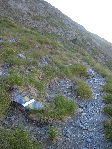
It’s consistently waymarked with orange paint but you have to be attentive for the next waymark. |
 |
Hospice de
Rioumajou, hardly visible deep down in the valley.. However, you don't need to descend that far, there's branch to the right, leading to Port d’Ourdissétou with bm326. But that's for tomorrow. |
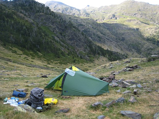 |
I stop on
on a sort of plateau and pitch my tent. Camp N42 42 14.7 E000 16 51.1 H1989 |