|
The
bordermarkers of the Pyrenees : all my trips
 |
|
| -
2 september
2010 - Finishing in the dusk |
 |
 |
esfr-trip-track-20100902.kml (click to open in Google Earth or copy link to Google Maps; click right on this link to download gpx-version) Summary: part of a 11-days backpacking trip from Cauterets to Loudenvielle ‘doing” bm315 to bm330. Day 9: very long solitary day, doing 4 borderpasses. Weather: rainy |
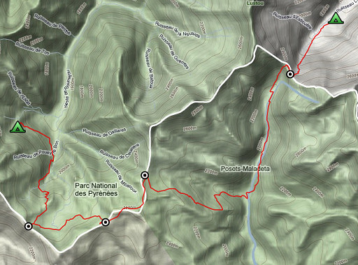 |
For explanation of
the gps-coordinates and other cartographic backgrounds: see my cartography page Start: 10.00, break: no break, finish: 21.15, net walking time: 11.15 According to the gp-tripteller: Distance: 24 km Time moved: 8.17h Time standing still: 3.08h In total: 11.25h Total ascent: 1606m Maximum height: 2622m |
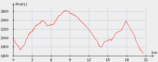 |
According
to visugpx - distance : 21.07 km - cum. elevation gain : 1645 m - cum. elevation loss : 1966 m - total elevation: 3611 - altitude maxi : 2623 m - altitude mini : 1657 m - altitude average : 2227 m |
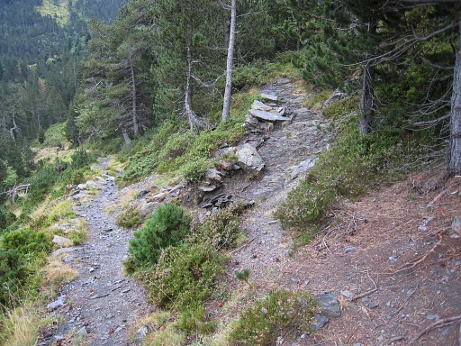 |
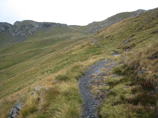
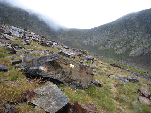
A
late start because of the rain in the morning. Continuing the orange
trail untill there’s red/white trail going up to the right. That will bring you to Port d’Ourdissétou. |
|
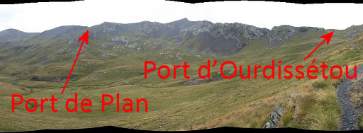
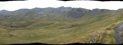
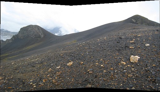
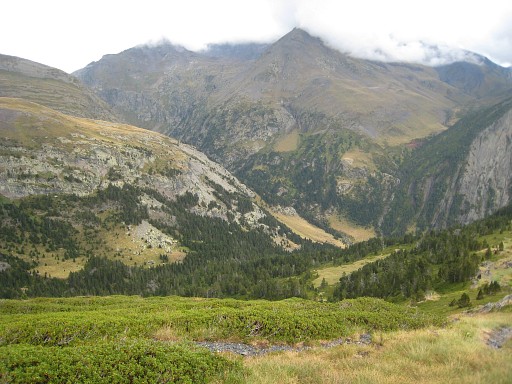
Approaching the
Port, this panorama. Move the mouse over the picture to see where Port d’Ourdissétou and Port de Plan - the next Port - are. |
 |
And the approach
of Port d’Ourdissétou in more detail. |
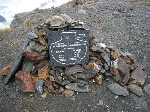 |
The Port is on one
of the pilgrim's ways to Santiago de Compostella. |
 |
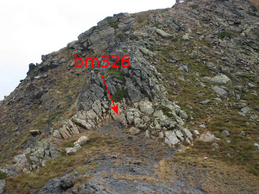
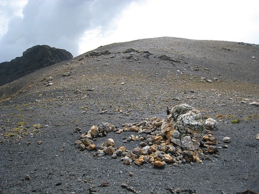
Bm326 is at the far western side of the Port. |
|
Bm326
comes in sight Move the mouse over the picture to see where. |
 |
Bm326 |
 |
Bm326 The rain starts again. |
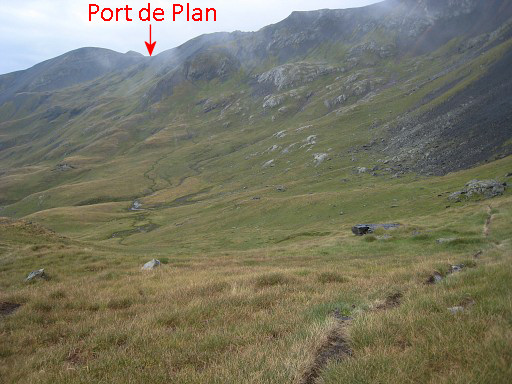 |
Then descending
back a little
untill a small track appears to the right which brings you to the foot
of Port de Plan. Didn’t you notice that trail? Then go in what ever way you like over the plains in the direction of the Port. |
 |
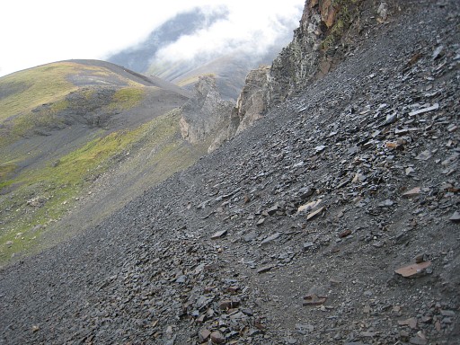
The Port is very broad, on this picture we are at the sw-side of the pass. |
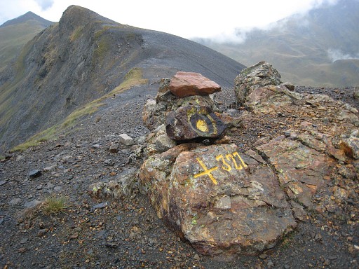 |
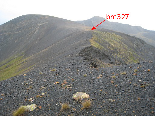
Bm327 is not at the lowest point but at the nw-side of the pass. |
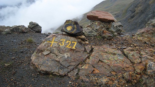 |
Bm327 |
 |
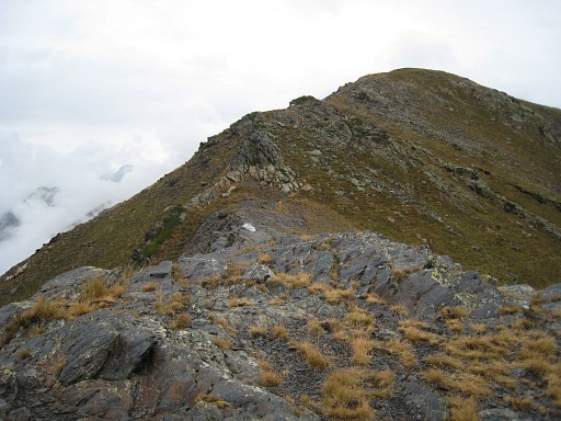
Getting
to Port de Caurère is easy, just follow the ridge. There are trails,
you’ll pass underneath the Tuquet de Caurère (the Pic at the right) |
 |
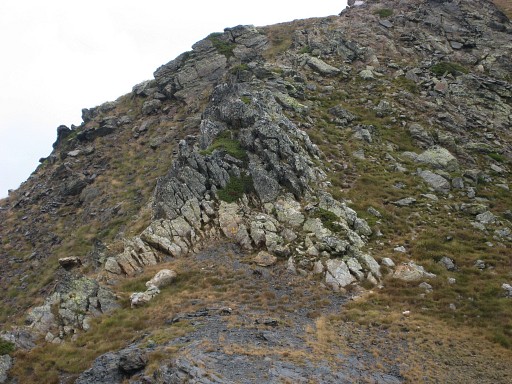
and after that underneath a huge stone wall (also visible at the previous picture) |
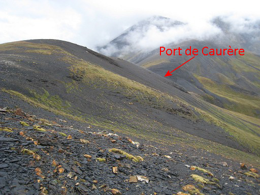 |
and then there’s the saddle-like Port de Caurère visible in the distance. |
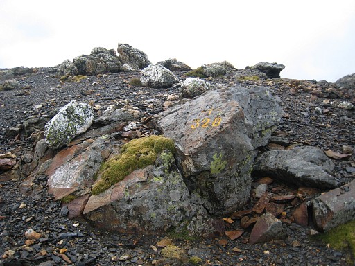 |
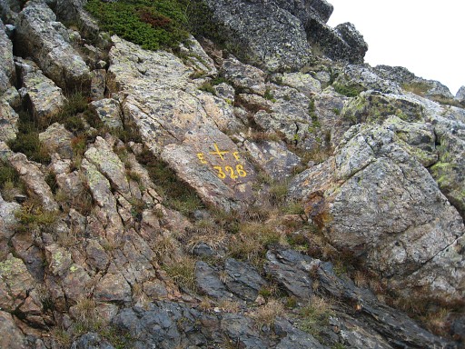
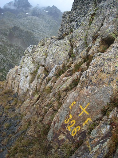
Bm328 is up the southern slope of the port. |
 |
Bm328 |
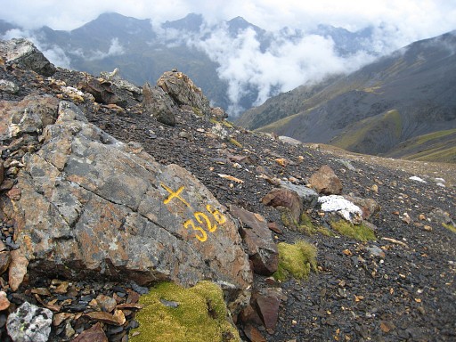
 |
Bm328, looking down
at the pass |
 |
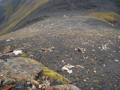
And at the pass,
looking uphill to bm328 |
 |
Then via Spain to
Port de la Pez
on well waymarked paths (green-white). That means descending in eastern direction to the bottom of the valley and then climbing to the north. Descending is smooth. |
 |
The trail from the
valley to the
Port is stoney and takes more effort and time. The Port itself seems
very steep from both sides but the paths are ok and manageable. On this picture: approaching the final (steep) climb to the Port. |
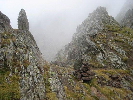 |
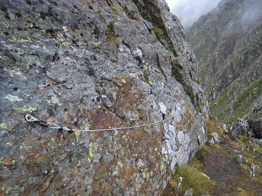
Arriving at the Port, the trail follows the ridge a bit to the east and passes through this brêche (breach). |
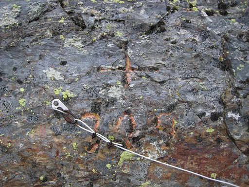 |
There - at the
west-side of that brêche - is bm329,
somewhat hidden behind the attachment of a cable. It took me a quite some searching before I discovered this cross. |
 |
Bm329 |
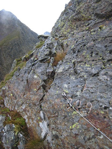 |
Bm329 |
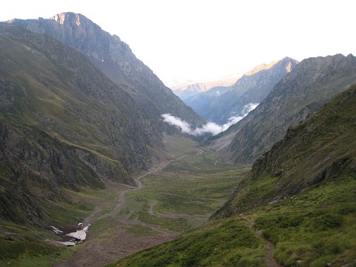 |
It’s getting
late and the steep descent takes more time then expected. In the dusk I
finally
find a place to pitch my tent. It’s been a long day, too long, too
risky at times. Camp N42 43 50.7 E000 23 11.5 H1606 |