|
The
bordermarkers of the Pyrenees : all my trips
 |
|
| -
22 march
2011 - Proud of myself |
 |
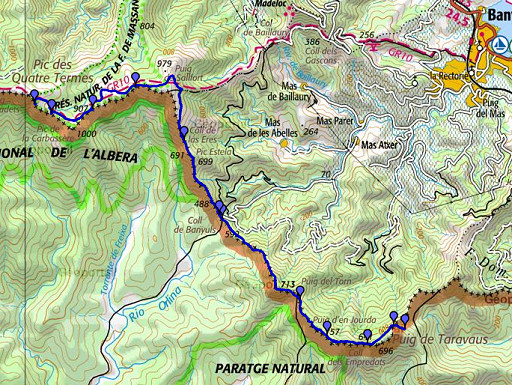 |
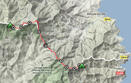
esfr-trip-track-20110322.kml (click to open this trip in Google Earth or copy link to Google Maps; click right on this link to download gpx-version) Summary: part of a 5-days trip from Portbou to a bit beyond Le Perthus (bm600-bm560). A remake of a trip in april 2006, now with a gps. Day 2: from bm596 to bm587. Weather: some sun, in the afternoon a chilly wind from the sea. |
 |
For explanation of
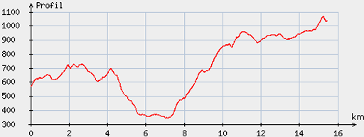
the gps-coordinates and other cartographic backgrounds: see my cartography page Start: 9.15, break: 12.45-13.45, finish: 17.30, net walking time: 7.15h According to the gp-tripteller: Distance: 19,8km Time en route: 8.24h Total ascent: 1290m Maximum height: 1077m Final height:1046m |
 |
According
to visugpx - distance : 15,7 km - cum. elevation gain : 1146 m - cum. elevation loss : 683 m - total elevation: 1829 m - altitude maxi : 1068 m - altitude mini : 344 m - altitude average : 706 m |
 |
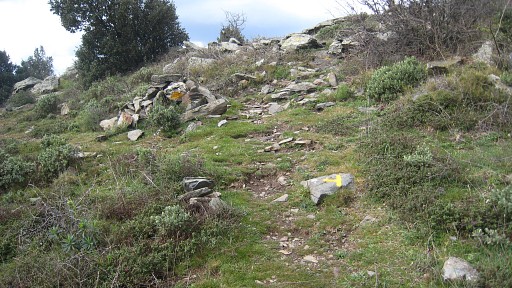
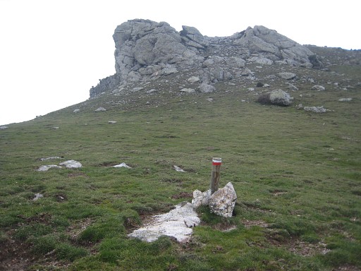
From Font de Taraveus - where I camped - (just to the right of
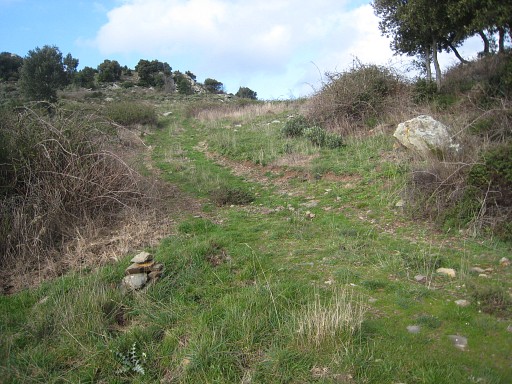
it) there's a waymarked trail climbing to the pass of bm596. From the pass however the start of the trail going down, is not well visible. My direction: from the pass, descend first a bit along the dirt road (± 30m ?) and just beyond a rockstone lying left of the road, descend to the right into the bush, the trail becoming soon clear. I made a cairn at the start. This picture shows it: you are looking back to the pass with my cairn left and the rockstone right. |
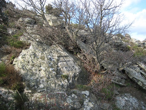 |
Bm596 |
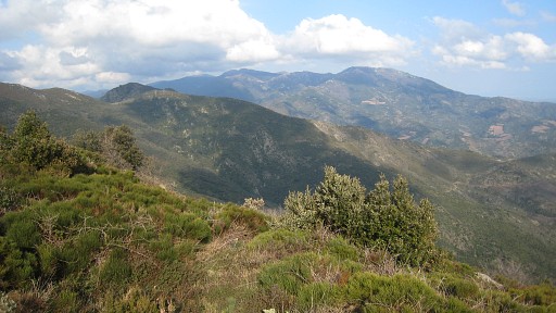 |
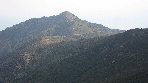
This is a view ahead: the mountain ridge yet to follow today. |
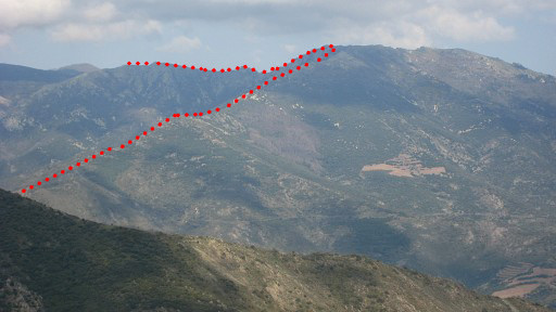 |
With
this zoom-in. You see the borderline ascending from approximately Col
de Banyuls (bm591) to Pic de Saltfort and then going to the west. But that's for the afternoon. Now I walk from bm596 along the waymarked trail through the forest at the french mountain slope to |
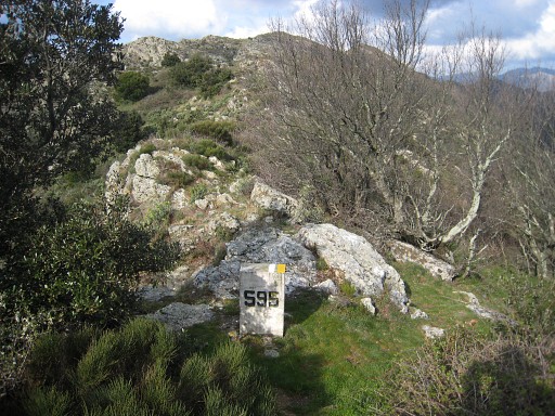 |
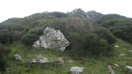
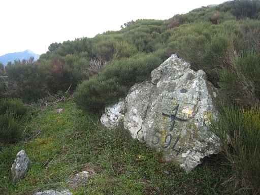
Coll dels Empredats with bm595 with its double markers. |
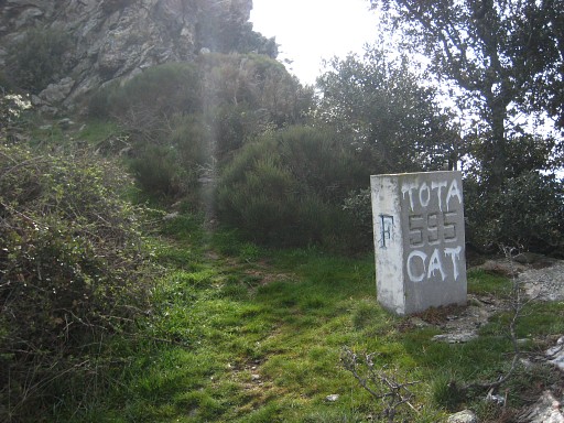 |
Bm595, the newer stone. |
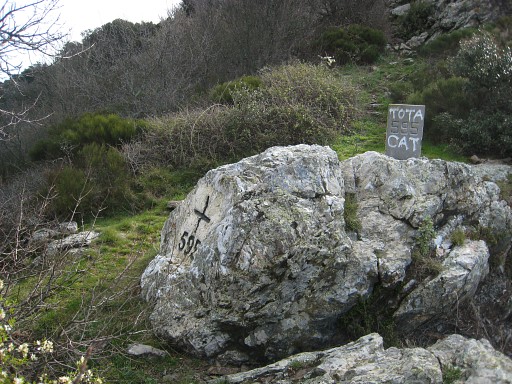 |
Bm595, cross and stone. No idea why this perfect cross has been supplemented with a boundary stone and the other crosses on the ridge not. |
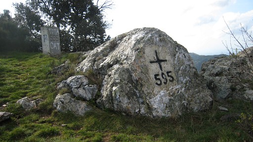 |
Bm595, cross and stone |
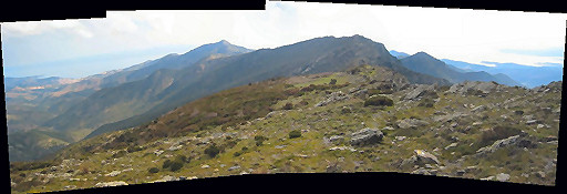 |
Further along the trail (I went back once after loosing the main trail), I photographed this panorama, looking back along the borderridge. |
 |
and - in this zoom-in - we see again the Torr de Querroig. |
 |
Bm594 is located inconspicuously at the east upperside of the Col del Teixo. |
 |
Bm594 |
| Bm594, from far, seen from NW. If you come from NW you won't miss it. If you descend from SE like I did, you might. |
|
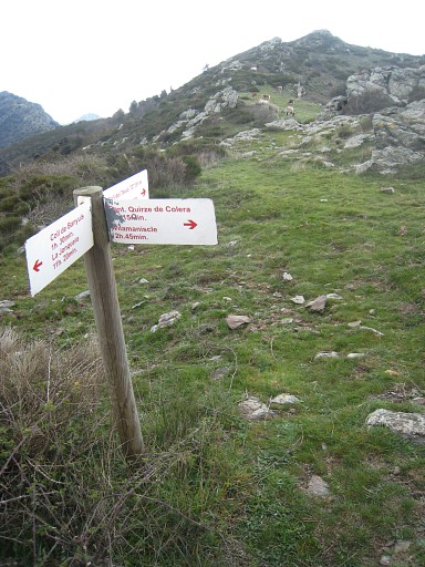 |
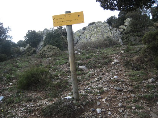
And a little bit further on the pass,
this signpost, indicating that this is the Col del Teixo. The location
of bm594 still visible. |
 |
Further along this trail - I'm looking back - a bifork waymark on a rock on groundlevel. It might confuse you if you walk the the other way. I came from the distinct trail at the right, at the spanish side of the ridge. |
 |
Close-up |
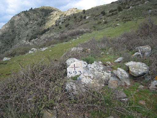 |
Bm593 at Coll del Torn. |
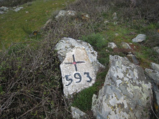 |
Bm593 |
| Bm593 might be conceiled in the bush in summertime. This picture gives a view to the NW with the location of bm593. |
|
 |
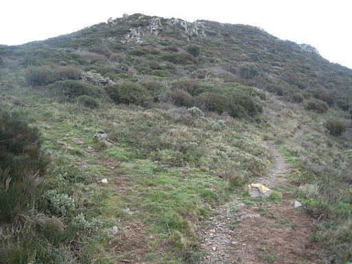
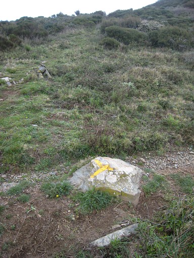
After Puig de la Calma when returning at the borderridge, there's a kind of bifork (which is important if you go the other way = the GRPdesBF-direction). |
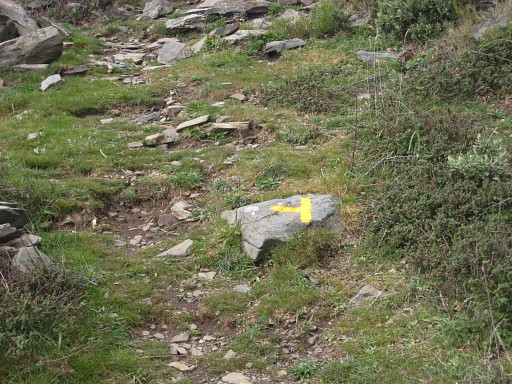 |
So: when coming from the other way (from N), you have to go to the left here and climb the east slope of Puig de la Calma. The only indication is this yellow painted waymark of a bifork on ground level. |
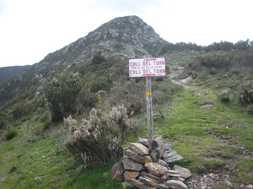 |
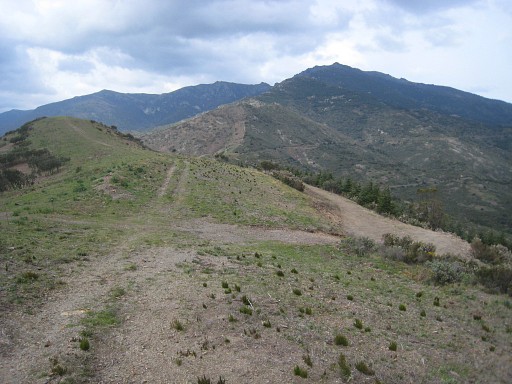
Then a tough rocky descent from Pic de la Calma to here, which is probably Coll de Llop. This sign - I'm looking back in southern direction - points out two routes to Coll del Torn with bm593. I came straight ahead from the Pic de la Calma, that steep hill. But there's another route - so the signpost tell's us - to the left along a watersource. That might be important in this dry area. The route ahead - along Pic de la Calma - is more direct. |
 |
After some other rocky descending on the Spanish slope, I arrive at a well dirt road, just underneath the borderridge. At this picture: at the right. We are looking to the north. |
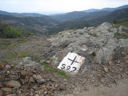 |
That dirt road brings you easily to bm592. It is indicated wrong at the IGN-map: 300m SE of its actual place. I had to search a while. |
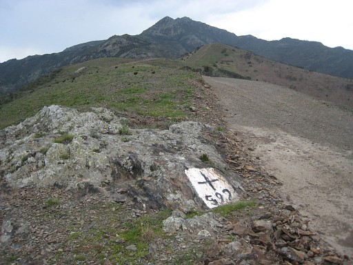 |
Bm592 |
 |
Bm591 is close at Col de Banyuls |
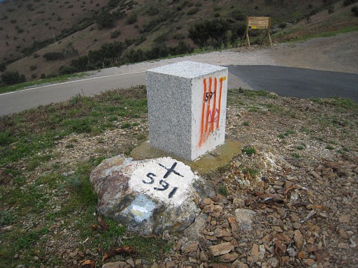 |
Bm391, cross and stone The red stripes are meant to represent the Catalan Coat of Arms. I see this kind of vandalizing a lot on this 5-days trip. For the offenders apparently a way of boosting Catalan patriotic feelings. For me it's just vandalizing cultural-historical monuments. |
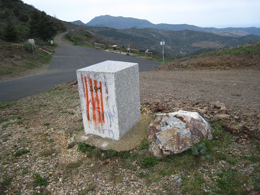 |
Bm591, stone |
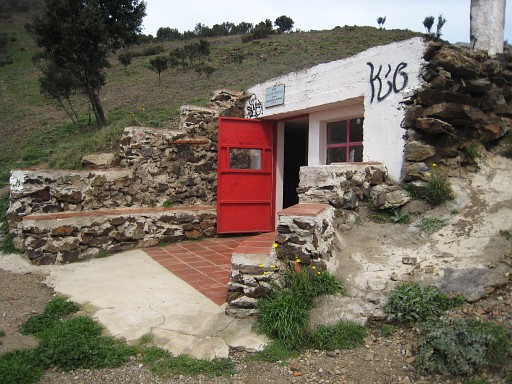 |
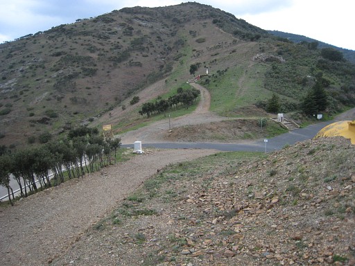
Lunch-break in the clean refuge at the Coll de Banyuls. I know by now that the waypoints of bordermarkers, found at Google Earth are unreliable. And (I'm proud of myself): it was quite an achievement finding these bordermarkers in 2006 without a gps. Or you might say, I've become too dependent of my gps. |
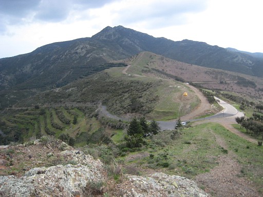 |
Climbing after luch to the north. I'm looking back at Coll de Banyuls and the borderridge I tackled in the morning. The trail is a well - also yellow - waymarked path. |
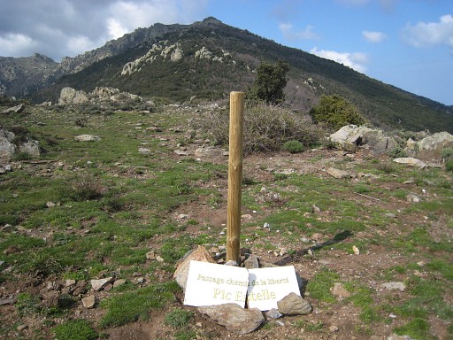 |
The location of bm590 is not obvious, somewhere on a pass on the ascending ridge. But this signpost - I'm looking to the north - gives a clue. It's the "Passage chemin de la liberté Pic Estelle". On my map I see that bm590 is further on. This "Chemin de la liberté" refers to the various WOII escape-routes across the Pyrenees into neutral Spain. |
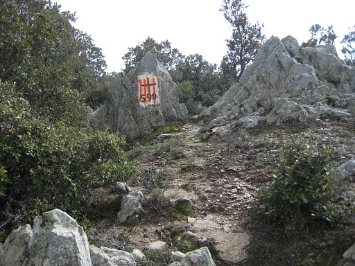 |
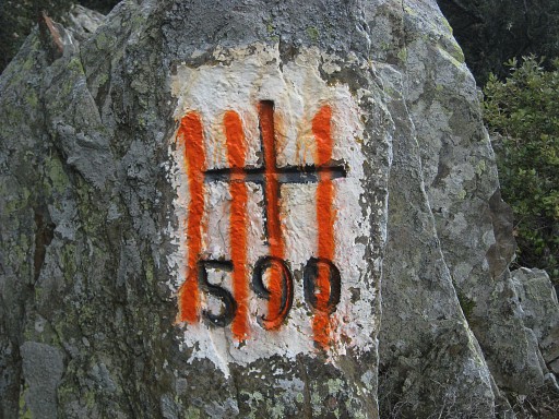
Bm590 |
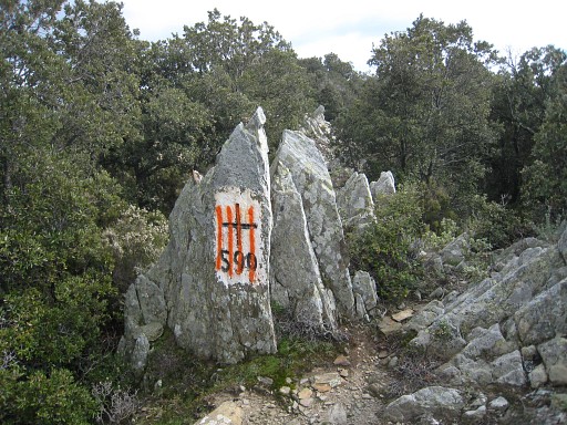 |
Bm590 |
 |
Bm590 |
 |
Bm590, if you descend from the north, you can't miss it. It's located
west of the path, a bit higher, as shown on this picure, looking southwards. Climbing however from the Col de Banyuls, you have to be attentive to look back. |
 |
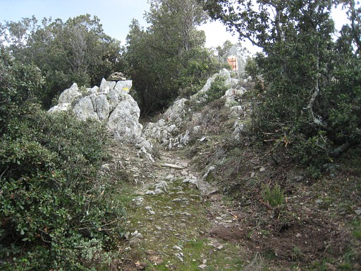
Further on - at this point - the yellow trail
continues on the eastern slope and reaches the GR10-trail. In 2003 I followed the ridge straight up. It's probably easier to follow the yellow path untill the conjunction with the GR10. In addition this route passes a source close to that junction. |
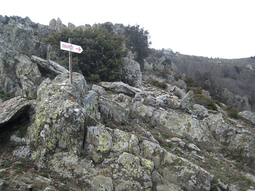 | At the conjunction, this sign pointing to a source. |
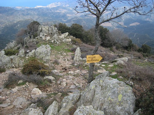 | From the conjunction I follow the GR10 eastwards. This picture: the conjuncion seen from west with the yellow sign pointing to the Col de Banyuls. That's the trail you have to take when coming from the east from above. |
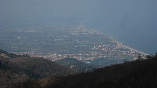 | Nice views of the French coast far away. |
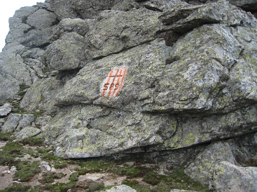
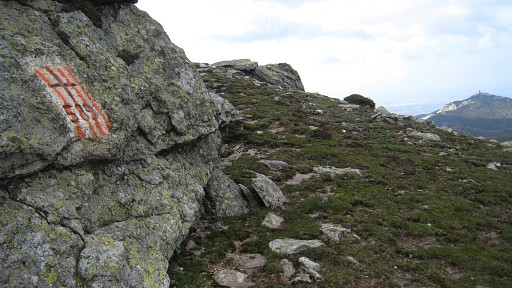
 | Bm589, vertical against a rockwall, hardly visible on this picture. |
 | Bm589 |
 | Bm589 |
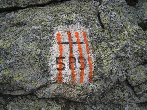 | Bm589 |
 | Bm589 |
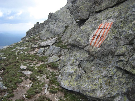
| Further on, looking back along the ridge. Indicated is the rocky outcrop where bm589 is engraved at the backside. | |
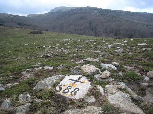 | Bm588, inconspicuously flat on the ground, easy to miss |
 | Bm588 |
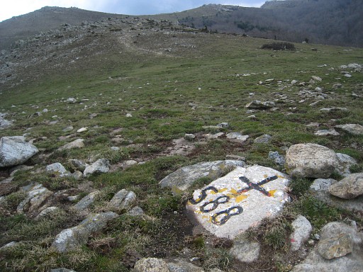
| Again looking back to the east, further on. I'm not sure, but I think that bm588 is located on the pass where the arrow points. | |
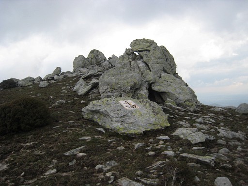 | Bm587 |
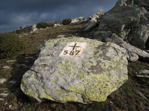 | Bm587 |
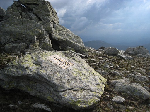 | Bm587 |
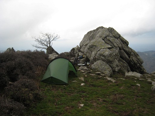 | Near
Font de la Maçana, I can't find a suitable camping-spot (though I did
in 2006). Further on the GR10 I spot a better place, a bit off the GR10
on the ridge at a sheltered place. It has become chilly. It's dark at 19.30 and soon I'm in my sleepingbag. |