|
The
bordermarkers of the Pyrenees : all my trips
 |
|
| -
26 may
2011 - Orange plastic waymarking |
 |
 | Summary:
part of a 7-days trip to the Pyrénées Orientales with Jan-Willem.
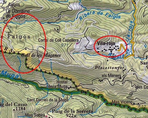
Mainly reconnaissances of routes. Supreme highlight: sailing to bm602 on day 1. Day 6: two trips: the first one exploring again routes from bm524 to Vilaroja and bm526, the second one around Vilaroja Weather: warm & sunny, thunderstorm in the afternoon |
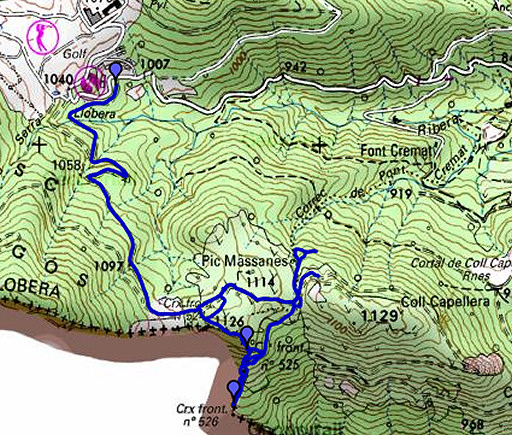 |
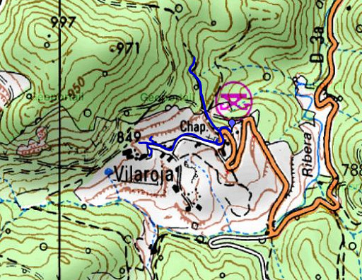
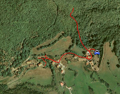
esfr-trip-track-20110526-trip1.kml (click to open this trip in Google Earth or copy link to Google Maps; click right on this link to download gpx-version) Trip 1: exploring routes from bm524 to Vilaroja / Hostal de la Muga |
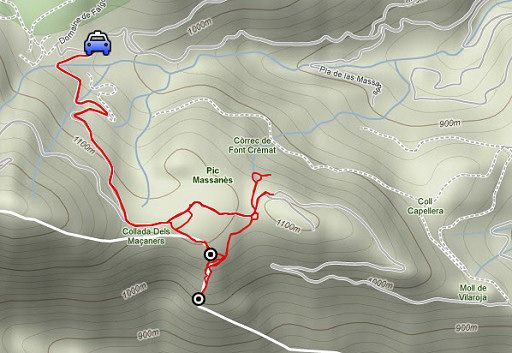 |
For explanation of
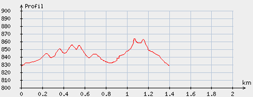
the gps-coordinates and other cartographic backgrounds: see my cartography page En route: 11.45-15.15 (3.30h) According to the gp-tripteller: Distance: 8,5 km Total ascent: 335m Maximum height: 1128m |
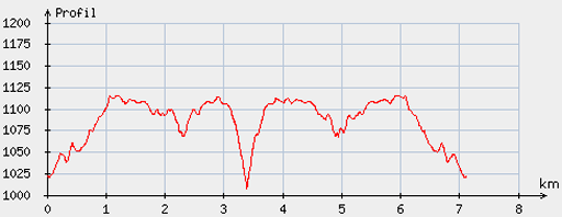 |
According
to visugpx - distance : 7.21 km - cum. elevation gain : 267 m - cum. elevation loss : 268 m - total elevation: 535 - altitude maxi : 1115 m - altitude mini : 1007 m - altitude average : 1086 m |
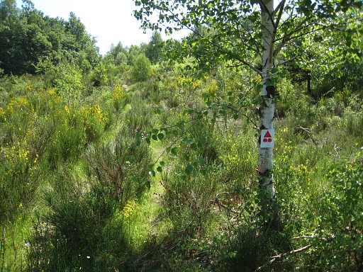 |
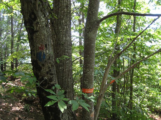
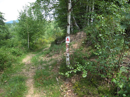
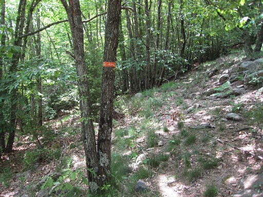
Once again, we park our car near the Golf de Falgo and climb to near bm524. Our target: finding a hiking route to Vilaroja for the main trail of the GRPdesBF. It should be a shortcut from bm524 via Vilaroja to Hostal de la Muga. This mountainbike waymark gives us a little hope that it will lead us to Vilaroja. The MTB-trail - however - bends to the north. |
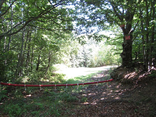 |
We
follow the dirtroad to the east but are blocked further-on by a chain over the road
and several prohibition signs. A few years ago we just passed the chain and continued but the GRPdesBf has to avoid such private terrain-signs. |
 |
We try a
sort of hunters-trail a while back to see if passes the roadblock
underneath it at its north-side but that trail disappears. |
 |
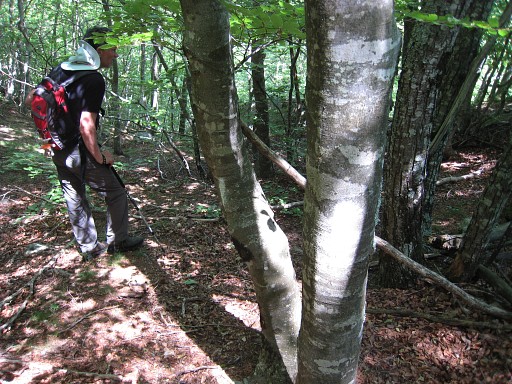
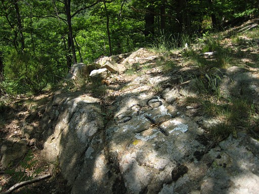
Next
step: exploring possible waymarked trails from bm525 to bm526. Getting from the dirtroad to bm525 isn't that straightforward. There's no obvious trail and the little trails we spot end up in the brambleberry-marquis. But we find two access routes, explained below. We have arrived - on this picture - on top of the rocky outcrop of bm525. (photo by Jan-Willem) |
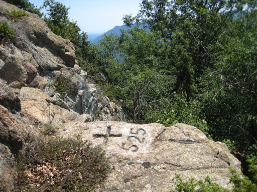 |
Bm525 is a bit lower, at the west side. |
 |
Bm525, looking west |
 |
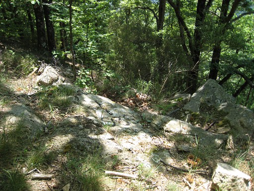
As said, there are two routes from the dirtroad to bm525. In both options it’s a ‘orange’ path (with paint and plastic tape) which can guide you from bm525 to bm526 but it’s advisable to use your compass as well. In the beginning it’s a steep descent, later on less steep. |
 |
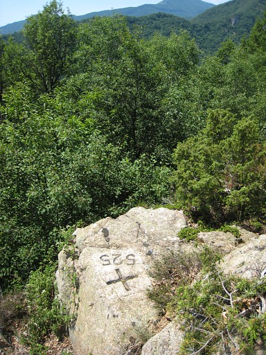
Bm525 is located
at the top of a second rocky outcrop which is actually composed of a
few differents rocky strips. |
 |
Bm526 |
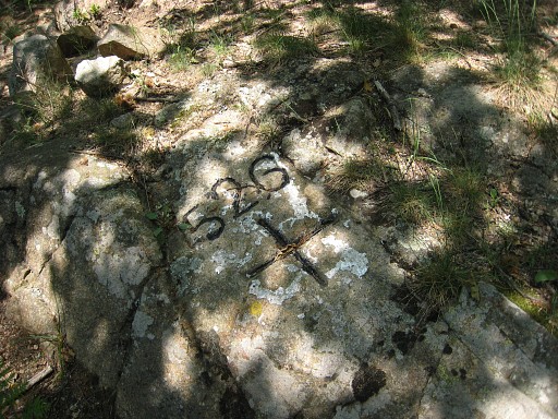 |
Bm526 |
 |
Bm526 Meanwhile, it has started to thunder and we decide to get back to the car. |
 |
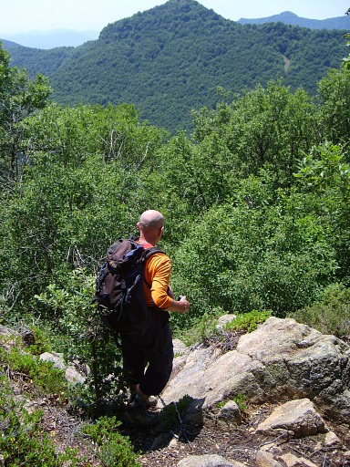
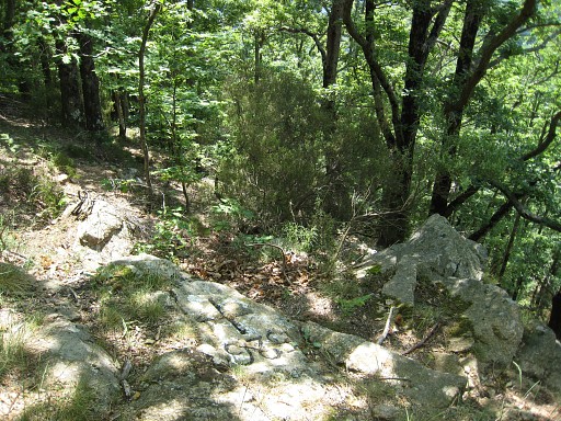
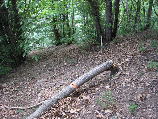
There are two routes possible from the dirtroad close to bm524. Option 1: go from the ‘valley’ near bm524 over the dirtroad to the first small hilltop. At its top, just beyond the bend, just beyond a tree with a MTB-trail-sign, there’s a trail starting to the right. As shown on this picture. It brings you - sometimes vaguely, sometimes thorny - over a sort of hillridge to bm525. But remember: bm525 is not on the ridge itself but a bit underneath (5-10 meter?) on a distinctive rocky outcrop. It's not directly visible when standing on the outcrop itself. It's on the westside. On the east-side of the outcrop, you can descend and proceed to bm526 |
 |
Jan-Willem suggested another possibility which I tried. Option 2.: continue on the dirt-road - past the point described in option 1 - until you spot at the right side a tree with in white paint “P7”. That’s where a trail starts - waymarked with orange paint and tape - |
 |
which will bring you to underneath the rocky outcrop with bm525. |
 |
This picture: the tree at the right side of the dirtroad. |
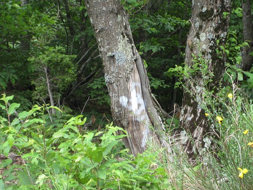 |
The "P7" painted on it. |
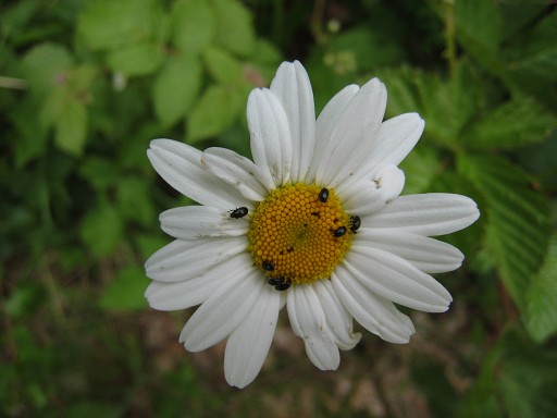 |
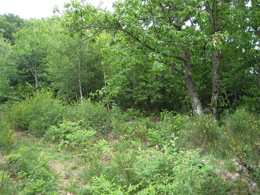
We return to our car. Life is not all about bordermarkers, we can still enjoy a nature scene like this. As soon as we’re in the car, it starts showering and the rain won’t stop today. |
|
esfr-trip-track-20110526-trip2.kml (click to open this trip in Google Earth or copy link to Google Maps; click right on this link to download gpx-version) Trip 2: exploring routes from Vilaroja to bm524. |
|
For explanation of
the gps-coordinates and other cartographic backgrounds: see my cartography page According to the gp-tripteller: Distance: 1,8 km Time en route: 40 minutes Total ascent: 37m Maximum height: |
|
According
to visugpx - distance : 1.41 km - cum. elevation gain : 40 m - cum. elevation loss : 33 m - total elevation: 73 - altitude maxi : 863 m - altitude mini : 828 m - altitude average : 843 m |
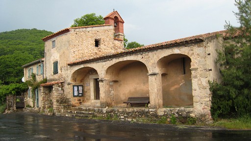 |
A short reconnaissance from the pretty hamlet of Vilaroja with its
charming chuch to see if there’s a road of trail going in the direction
of bm524. But we can’t find any (public) access to such a trail. Checking once again the maps, I see that there’s one option left: a trail directly from Pla de Muga to Hostal de la Muga. A goal for tomorrow. |