|
The
bordermarkers of the Pyrenees : all my trips
 |
|
| -
23 august
2011 - The longest day |
 |
 |
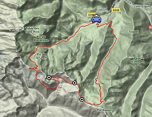
esfr-trip-track-20110823.kml (click to open this trip in Google Earth or copy link to Google Maps; click right on this link to download gpx-version) Summary: part of a 3-weeks trip to the Pyrénées to 'do' the ± 60 remaining bordermarkers. All done as daytrips from campings. Day 9: a large loop covering bm275 to 277. It will become the longest day ever of all my Pyrenees-trips: in time, distance and elevation. Weather: splendid in the mountains, not so hot anymore, cloudy in the valleys |
 |
For
explanation of
the gps-coordinates and other cartographic backgrounds: see my cartography page En route (±): 7.45 - 19.15 (11.30h) According to the gps-tripteller: Distance: 43,3 km Cum. elevation gain : 2097m Total elevation: 4194m Maximum height: 2072m Time: 11.19h |
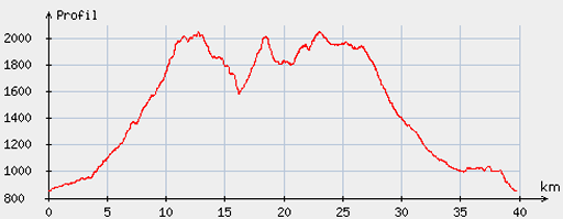 |
According
to visugpx - distance : 40,3km - cum. elevation gain : 2083m - cum. elevation loss : 2079m - total elevation: 4162m - altitude maxi : 2056m - altitude mini : 852m - altitude average : 1586m |
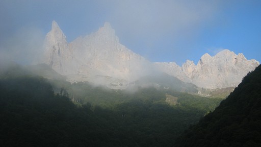 |
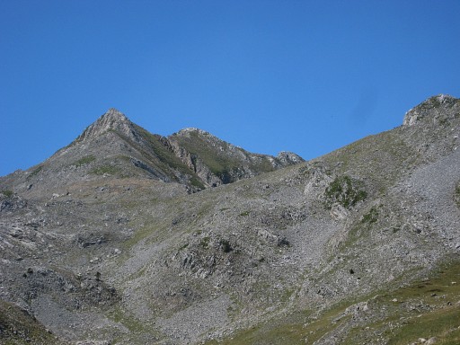
Early start from the Lescun camping where I parked my car. My
basecamp is still in Urdos. This picture: the rocks of Aiguilles d'Ansabère appearing out of the morning fog. |
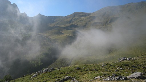 |
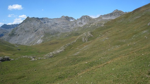
This
is my direction: to the Lac d'Ansabère. |
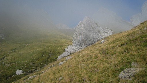 |
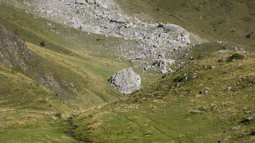
I have passed the Cabanes
d'Ansabère and come along this boulder. |
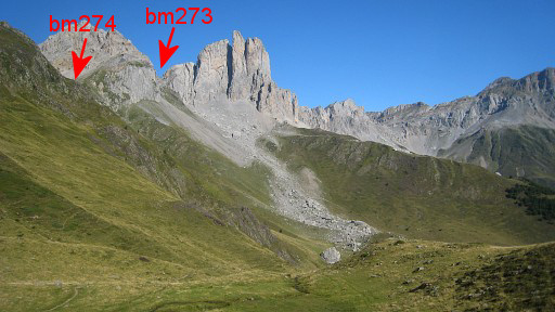 |
It's a landmark when descending from
bm274. |
 |
It's where - coming from
bm274 - you have to bend to the SE to climb to Lac d'Ansabère. |
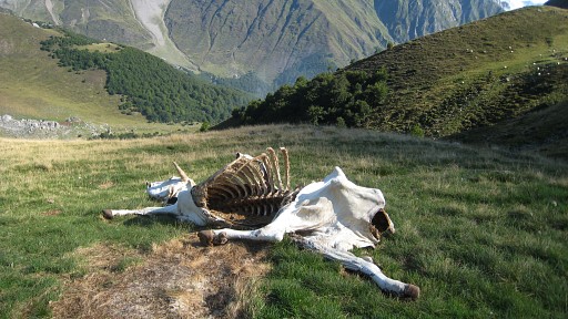 |
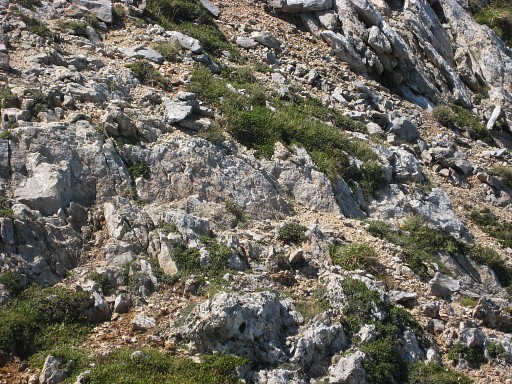
There's
more to life than bordermarkers, death for instance. |
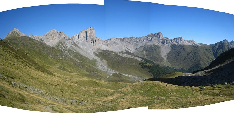
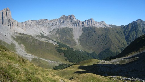
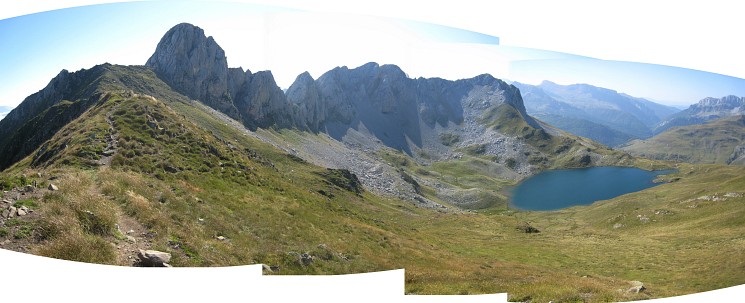
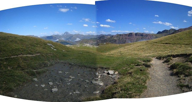
From Lac d'Ansabère this splendid panorama. Move the mouse over the picture. |
|
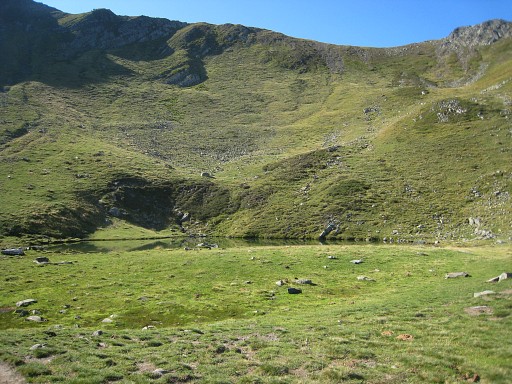 |
I have arrived at Lac d’Ansabere (perfect for a bivouac, streaming water available). |
 |
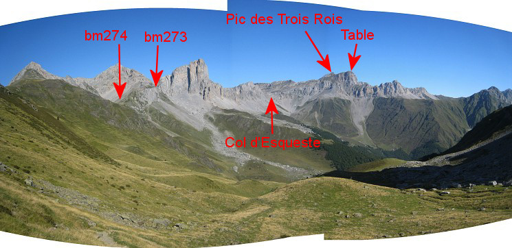
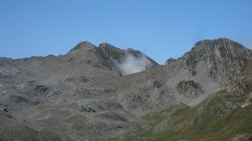
And from there another view to the Pic and Table des Trois Rois |
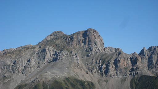 |
Zoom-in |
 |
From the Lac I take the
trail up to the ridge. This picture: looking back at the Lac. |
 |
At the ridge I do a short
reconnaissance of a trail
going N. This picture: looking that way. We see two trails: one over the ridge, the other one going left along the slope. I wonder if that could be a direct route to bm274. But too little time to investigate that thoroughly. |
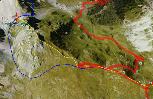 |
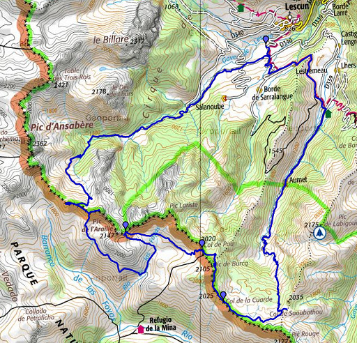
But months later, I do a check on Google Earth. Yellow line = borderline Red line = my route via Lac d'Ansabère to the borderridge Blue line = a possible shortcut which is definitely worth trying. |
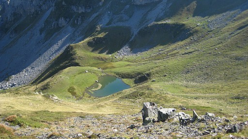
 Back and then following the trail to the S until I spot the lake „Ibon de Acherita“ down below in Spain. First I try to continue on the trail on the ridge but that’s not very promising for my purpose: getting to bm275. |
|
 |
But afterwards - studying my maps - I wonder if it’s possible to climb from Lac d’Ansabère over the
ridge to the adjacent French valley and then proceed to bm275. Blue line: my suggested short-cut to bm275, also worth trying. |
 But my time is limited. I return and descend to the lake and pass it along its W-side. I trust on the trails on the map which should bring me with a large loop to bm275. The lake is a popular daytrip destination. |
|
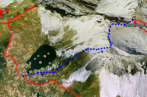 |
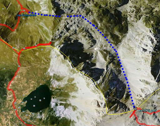
But again, months later, I
ask myself if there isn't a more direct route. In this case via the
ridge behind the lake to Col de Laraille with bm275. This webpage proves there's an alternative and provides loads of pictures. Blue line = shortcut to bm275 from Ibon de Acherito, derived from the above webpage. |
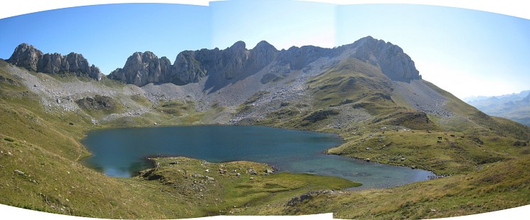
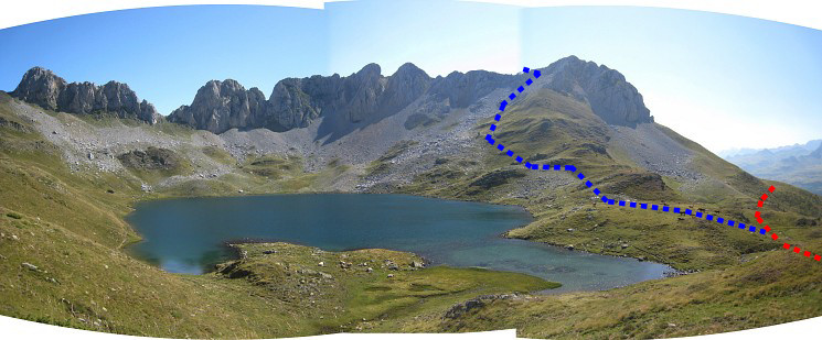 And that shortcut projected on the panorama. |
|
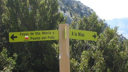 |
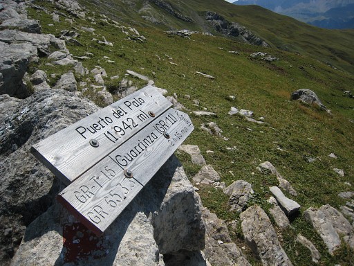
I descend
further along the trail until this signpost. I go
left in the direction
of Col de Pau (Puerto del Palo), climbing again. But first I’ll have to tackle bm275 at
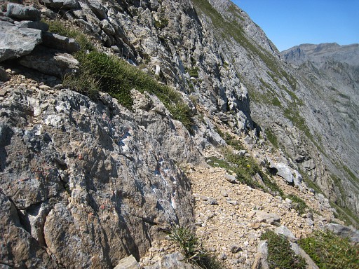
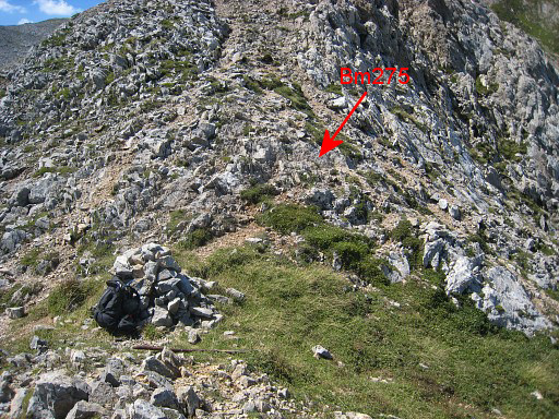
Col de Laraille. So having arrived at the valley floor, I leave the trail, go the left and climb over rocky slopes to the col. Its location isn’t very clear. The gps with Charles Darrieu’s waypoints helps me out. |
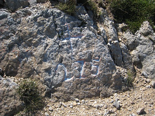 |
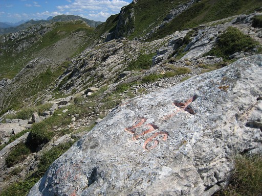
But bm275 isn't easy to
find on the pass itself because of the
weathered engravings. But Robert Darrieumerlou’s pictures are another help. The bm is a few meters to the N and the engravings look amateuristic. |
 |
Bm275 |
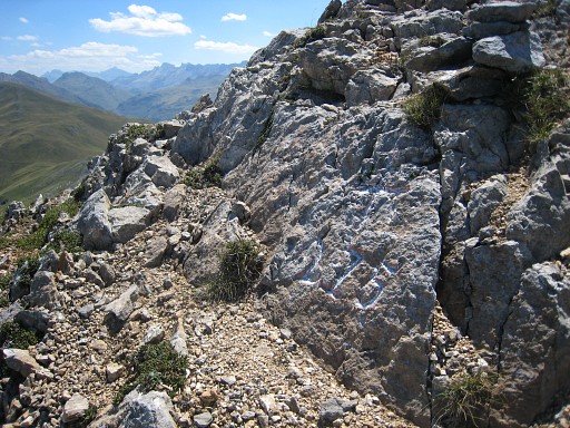 |
Bm275 |
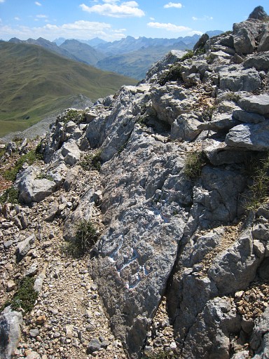 |
Bm275 |
 |
View of the pass from the other side. |
 |
with this zoom-in of bm275 |
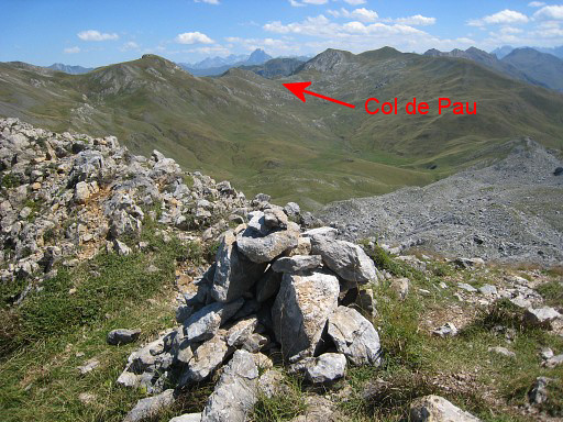 |
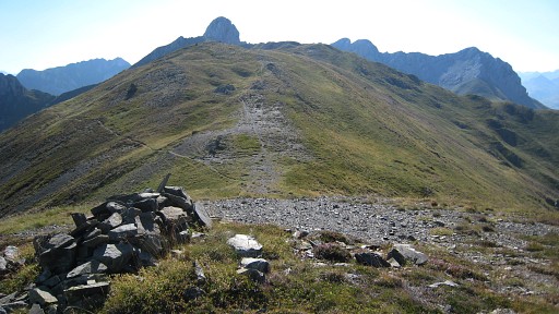
Then: to bm276 at Col de Pau. This picture: view from Col de Laraille to Col de Pau |
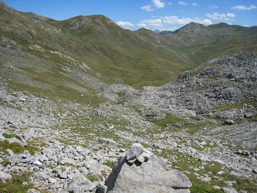 |
I descend on a ‚cairned’
trail which is more to the N of the rocky
slope towards Col de Laraille. Along various (cattle-)trails along the slope I proceed in the direction of Col de Pau. |
 A view back |
|
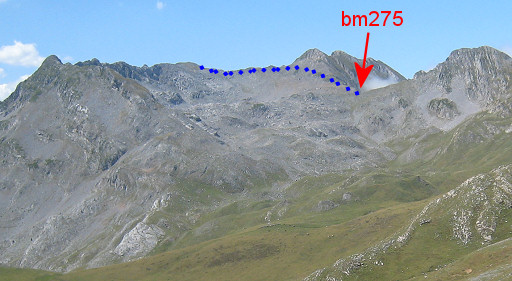
 |
with this zoom-in of Col de Laraille with bm275. |
 |
And - further on - again looking back |
 |
with again a zoom-in of Col de Laraille. |
 |
And this digital crop & zoom-in to show the shortcut from Ibon-de-Acherito to bm275, mentioned above. |
 |
In the final part I
join the red/white waymarked trail which brings me
to Col de Pau. |
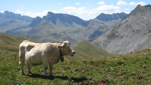 |
Is this cow completely in the Now or just dreaming away? |
 |
Anyway, we're on the Col de Pau. |
 |
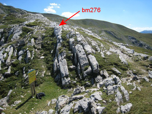
Bm276 is a bit higher up on the ridge to the S. |
 |
Bm276, looking back at the Col. |
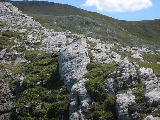
 |
Bm276, looking forward to the mountainridge with the trail which will lead me to bm277. |
 |
And a view from the other side of the pass |
 |
with this zoom-in. |
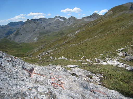 |
And from bm276 a final view back to Col de Laraille far far away. |
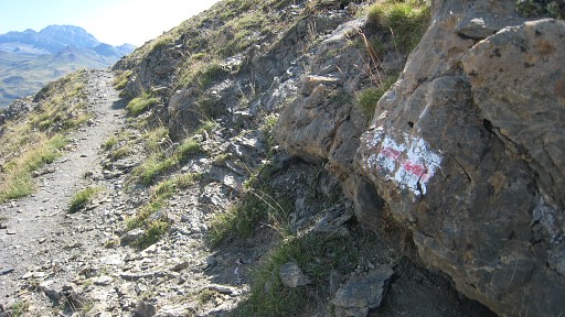 |
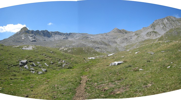
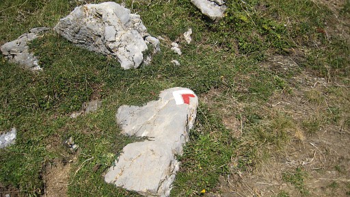
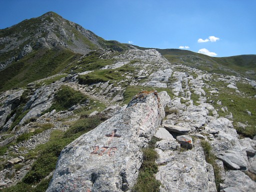
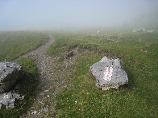
Then to the S on a trail that follows the ridge (mainly underneath). These waymarks (red stripe on a white rectangular) seem to mark the HRP in this area. Surpringly because the Haute Route Pyrénéenne is essentially not waymarked. |
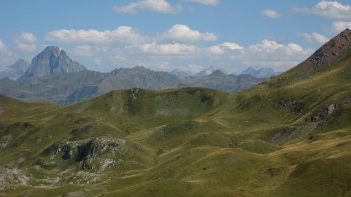 |
The Pic du Midi d'Ossau far away to the E. |
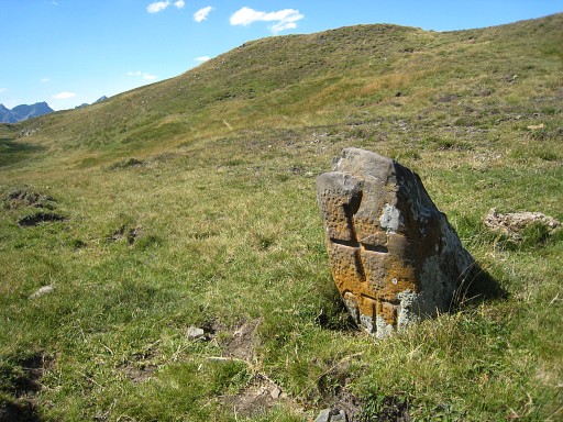 |
At Col
de la Cuarde I find bm277. The bm is ± 50m off the path. |
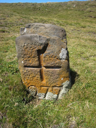 |
Bm277 |
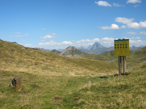 |
A landmark for bm277: this information board of the Parc National des Pyrénées. |
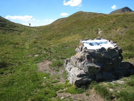 |
And to the SSE this monument. In the distance the information board and bm277 visible. |
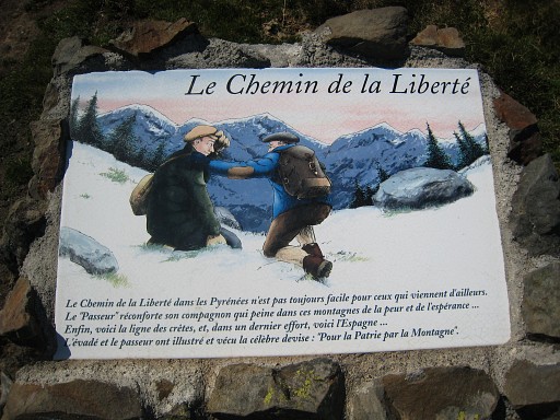 |
Remembering the escape routes in WWII from occupied France to Spain. |
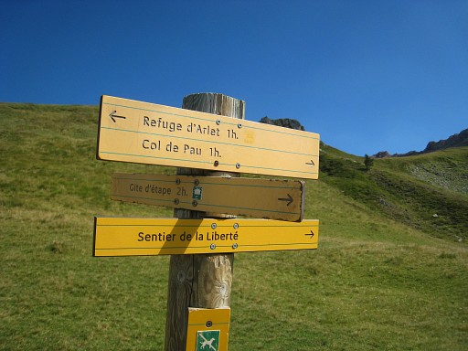 |
I continue on the trail until Col de Saoubathou where you can proceed to Refuge d'Arlet. |
 But I have to return. From approximately Col de Saoubathou this panorama to the E with Pic du Midi d'Ossau in the far distance. |
|
 |
Then back to Lescun via Cabane de Caillou. Clouds are drifting in. The last 5km or so trail-running. |