|
The
bordermarkers of the Pyrenees : all my trips
 |
|
| - 24 august
2011 - No vertigo |
 |
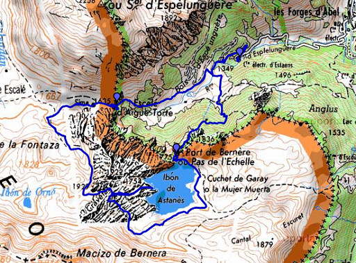 |
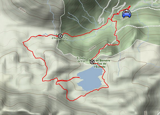
esfr-trip-track-20110824.kml (click to open this trip in Google Earth or copy link to Google Maps; click right on this link to download gpx-version) Summary: part of a 3-weeks trip to the Pyrénées to 'do' the ± 60 remaining bordermarkers. All done as daytrips from campings. Day 10: an afternoon trip doing bm280 & 281. Weather: all day cloudy, manifesting as fog at this height |
 |
For
explanation of
the gps-coordinates and other cartographic backgrounds: see my cartography page En route (±): 12 - 17.30 (5.30h) According to the gps-tripteller: Distance: 14,9 km Cum. elevation gain : 773m Total elevation: 1546m Maximum height: 1843m Time: 5.16h |
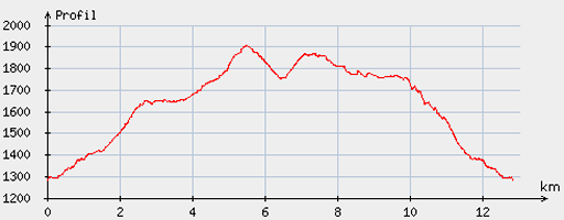 |
According
to visugpx - distance : 13,1km - cum. elevation gain : 790m - cum. elevation loss : 790m - total elevation: 1580m - altitude maxi : 1904m - altitude mini : 1284m - altitude average : 1655m |
 |
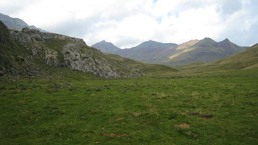
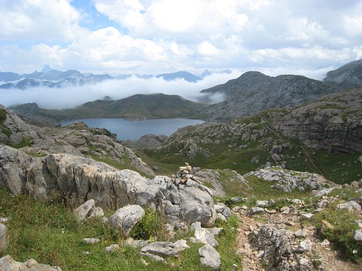
From the parking of Forges d’Abel climbing to the pass of Escalé d’Aigue
Torte. This picture: the final part of the climb. |
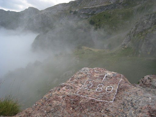 |
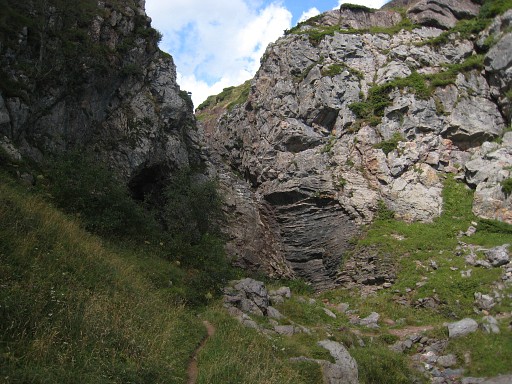
I would expect the cross bm280 to be on the pass itself but it’s
on the edge of a rock at the N, overlooking the pass. The engraver
apparently didn’t suffer from vertigo. |
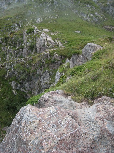 |
Bm280, overlooking the pass |
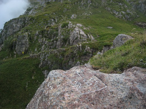 |
Bm280 |
 |
Then on the Spanish side over the grass heading SW along the hill slopes,
crossing a few times a stream, following cattle-tracks as it suits.
Later on you will enter foothills and soon join the GR11-trail (be attentive not to miss it). Continue SE on the GR11. |
 |
The GR10 will bring you to the Lac d’Estaens, a large lake. It takes quite some time to go along/above it untill you descend to the SE-corner of the lake. I missed a bend of the GR11 and descended by misstake to the NW corner of the lake. I returned to the GR11 but much later I wondered if my misstake might be a more direct route to bm281. See next picture. |
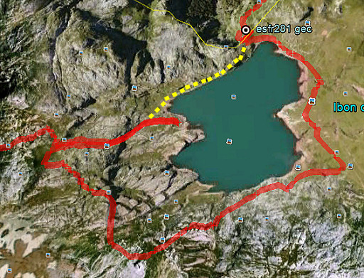 |
The yellow line is the suggested shortcut. |
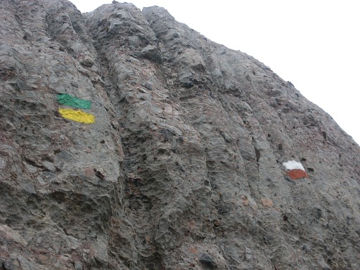 |
So back to the GR11. On my way, I spot green/yellow waymarks which I saw two days earlier near Col de Somport, here together with the GR11-waymarks. |
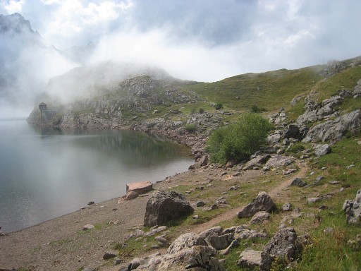 |
At the SE-corner of the lake, I leave the GR11 and go N along
the lake. At its most nothern point, the Port de Benere Vannu (visible on this picture) is just a small climb. |
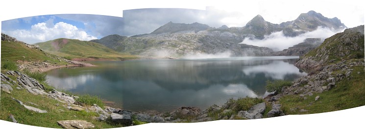 From the Port de Benere Vannu, this panorama-view of the lake. |
|
 |
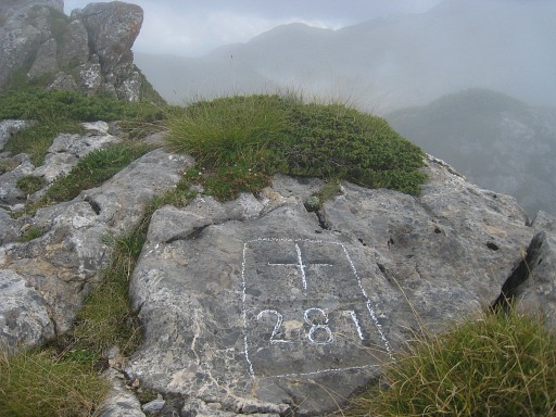
Bm281 Again the cross is not on the pass itself but on a outcrop sticking out of the ridge. In this case: ± 40m to the NE. |
 |
Bm281 |
 |
Bm281. The fog is now permanent and I decide to descend, back to my car. |