|
The
bordermarkers of the Pyrenees : all my trips
 |
|
| -
14 may
2012 - Bm408-III and IV unfindable |
 |
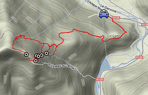 |
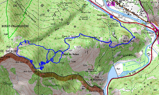
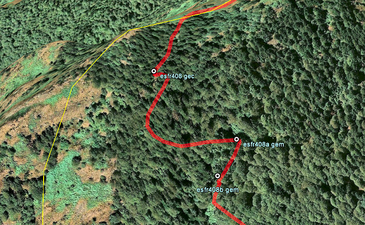
esfr-trip-track-20120514.kml (click to open this trip in Google Earth or copy link to Google Maps; click right on this link to download gpx-version) Summary: part of a 6-days trip - accompanied by Jan-Willem Doomen- with daytrip-targets in the Basque country, near Fos and around Puigcerda. Day 3: from Fos a trip to Cabane to Hérechet and beyond, main target being an new search for bm408-III and 408-IV. Weather: clear skies, sunny |
 |
For
explanation of
the gps-coordinates and other cartographic backgrounds: see my cartography page En route: 8-18 (10h) According to the gps-tripteller: Distance: 14,6 km Cum. elevation gain: 1367m Total elevation: 2734m Maximum height: 1677m Time: 9.38h |
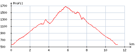 |
According
to visugpx - distance: 11,8 km - cum. elevation gain: 1345m - cum. elevation loss: 1339m - total elevation: 2684m - altitude maxi: 1678m - altitude mini: 557m - altitude average: 1162m |
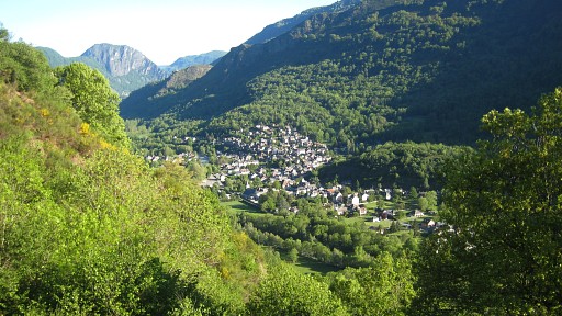 |
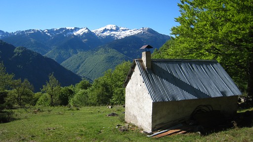
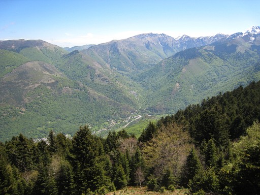
From the electricity-building at the foot of the hills, we climb in 1 ½ h to Cabane de Hérechet along a well path. In between - looking back - this view of Fos. |
 |
The Cabane de Hérechet is well maintained and clean and there's a water-supply. After a coffee-break, I explore for a while the terrain south of the cabane using my gps with waypoints of my theoretical guesses of bm408-IV and 408-III. A stream springs in this area but I can't find any bordermarker. |
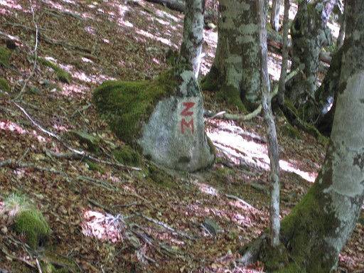 |
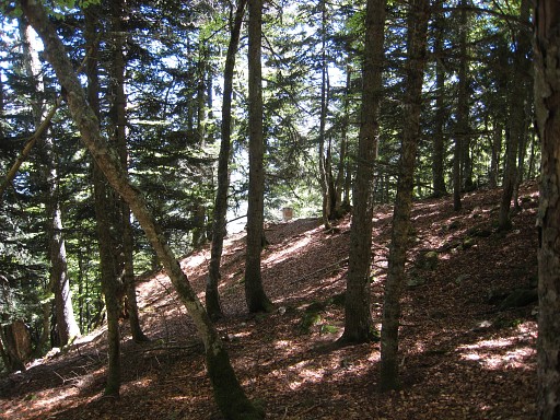
Then we hike up the path which starts behind the cabane.
It's now waymarked with cairns (it wasn't in september 2011). Jan-Willem spots this mysterious sign alongside the trail. |
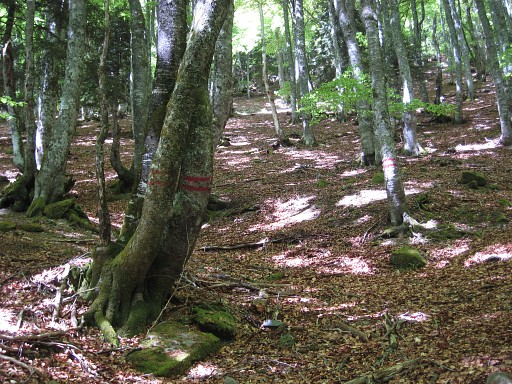 |
This trail doesn't bend to the cascade with bm400-I and II as
I expected it would do. Actually there's at one point (where two trees have a double red stripes) a branch going left to the cascade. This picture shows that point. The double stripes puzzle me. I'm used in this region to double red stripes on trees, marking the esfr-borderline in forests. But here we are definitely not on the esfr-border and the double stripes here might only indicate the border between two forestry parcels. |
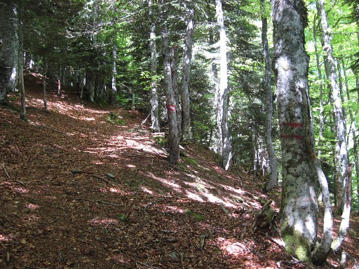 |
When we climb further west along the
cairned path, we spot more double red stripes. I wonder if this trail will bring us at the border-ridge but at some point the trail and cairns vanish (or we lost them). |
 |
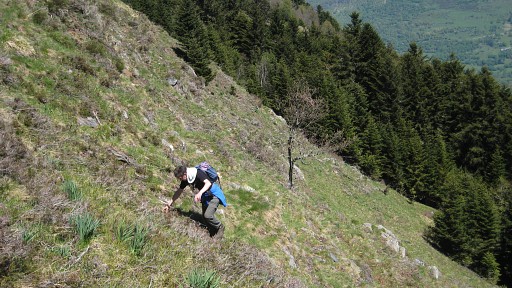
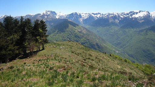
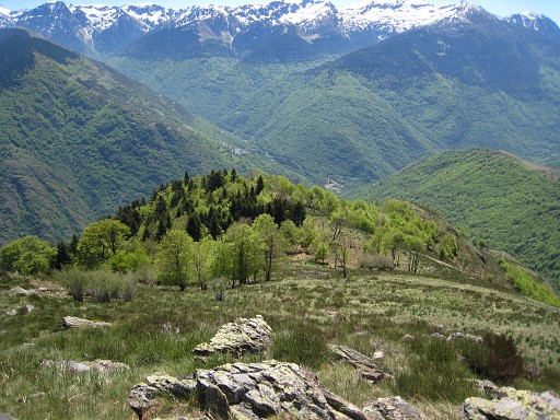
Then we climb
directly SW to the borderridge, first through forest and then on the
bare mountain-slope with this view in the direction of Melles. |
 |
The last part is tough. |
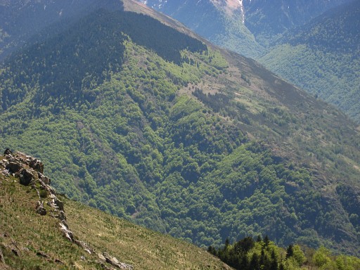 |
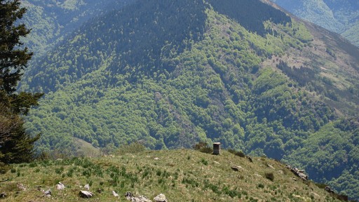
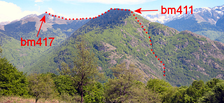
Then we descend along the borderridge to bm407. This picture: a zoom-in to the mountain at the other side of the Garonne. See the last picture of this page for the borderline. |
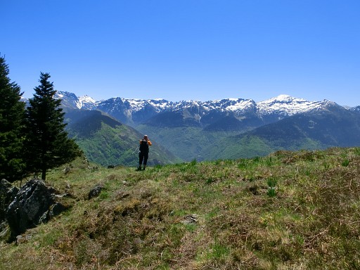 |
It's a marvellous day with breath-taking vistas (photo by Jan-Willem) |
 |
We approach bm407, visible in the far distance. |
 |
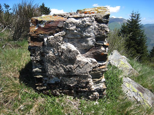
Zoom-in of bm407
|
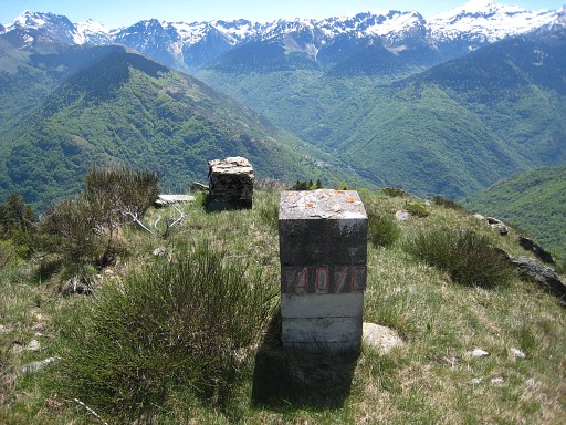 |
Bm407 |
 |
Bm407, backside with the old bordermarker in front, |
 |
with the remains of an arm on its side. |
 |
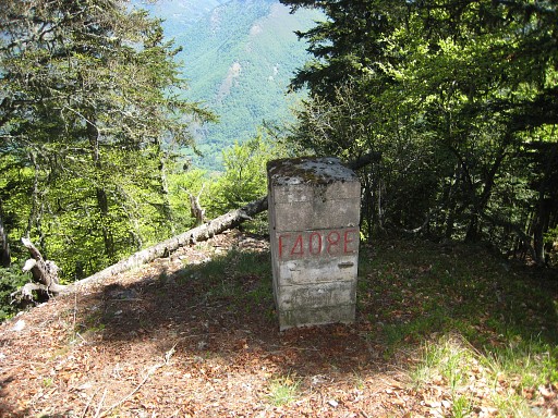
Further on - where the ridge flattens and after the pine trees - , go
left (east) and descend into the forest and after ± 125m you will spot
bm408. |
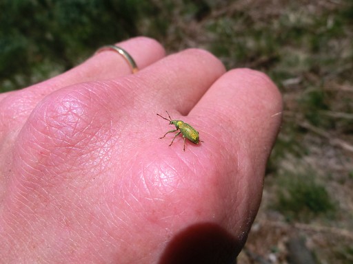 |
But Jan-Willem keeps his eye for nature: "All things bright and beautiful, all creatures great and small". (photo by Jan-Willem) |
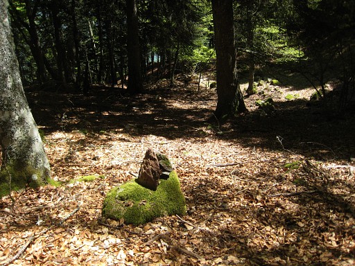 |
While I keep focussed on my beloved bordermarkers. This picture: descending to bm408, I create a cairn to help ... maybe you? |
 |
Bm408 visible in te distance. |
 |
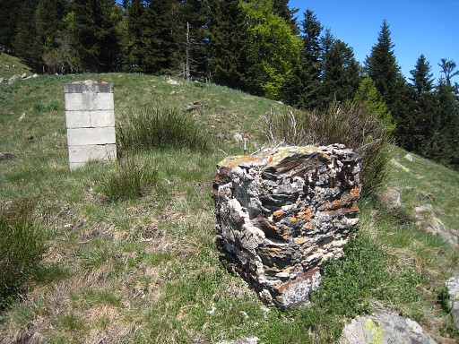
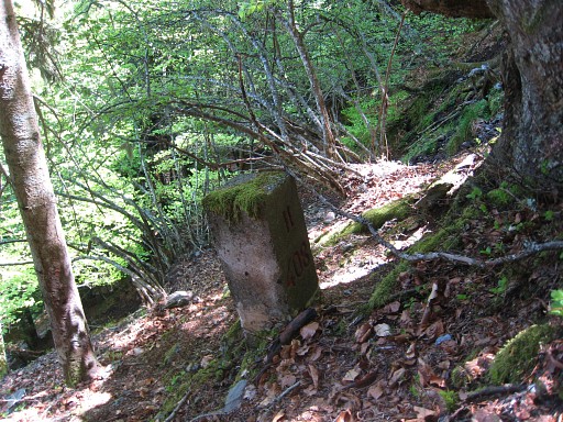
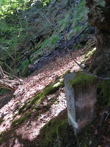
Bm408 From bm408 to bm408-I is a difficult search on a steep wooded hillside. The gps is here - in a forest on steep terrain - of limited value. Your ears are as much important in finding the little stream/cascade which springs just underneath bm408-I |
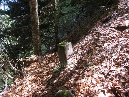 |
Bm408-I From bm408-I, I walk back to bm408 which is again not a straightforward route, neither when returning again to bm408-I. But the best route between those markers gets more clear. |
 My directions: from bm408 go a bit N (say 20m), there you are able to descend E down the hillside. Descend considerably (± 70m in altitude) to the E, then go N on approximately the same level for ± 125m until you see bm408-I and/or hear the stream. |
|
 |
Bm408-I |
 |
From bm408-I along the stream to 408-II and further to the bottom of the cascade is a difficult task, clinging from one tree to another. |
 |
Bm408-II |
 |
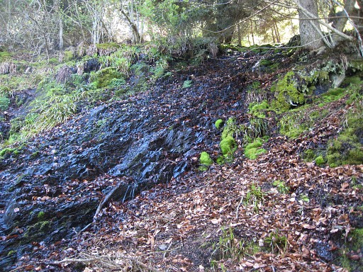
Bm408-II, looking to cascade. At the bottom, the stream disappears in a fern-field, not to re-emerge again along the relatively 'open' strip in the forest descending NEE to where it gets (too) steep. There's no trace of a bm408-III or IV. They remain a mystery. Have they disappeared or are we looking in the wrong place? We climb back for a while, then traverse through the forest to the trail from cascade to cabane. |
 From the cabane this panorama to the SE. Then back to the car and the camping municipal in Fos. On our way down, I meet a local shepherd or likewise who doesn't know anything of the 408-submarkers. |
|