|
The
bordermarkers of the Pyrenees : all my trips
 |
|
| - 1 september
2012 - Another longest day |
 |
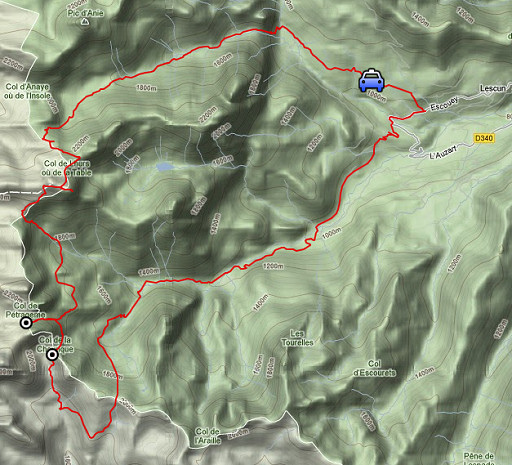 |
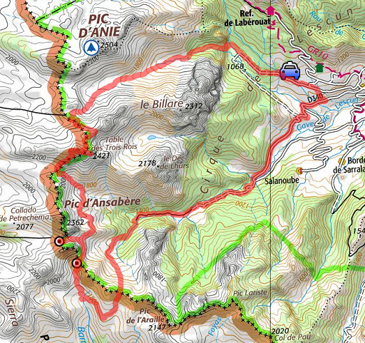
esfr-trip-track-20120901.kml (click to open this trip in Google Earth or copy link to Google Maps; click right on this link to download gpx-version) Summary: part of a 2½-weeks-trip to the Pyrenees with a lot of targets, most of them reconnaisances of routes for the GRPdesBF. Day 7: a long roundtrip via the Table des trois rois to bm273 & 274 and almost the lake of Ibon de Acherito Weather: sunny but very strong & cold wind on the ridge |
 |
For
explanation of
the gps-coordinates and other cartographic backgrounds: cartography page Start: 8.45, no break, finish: 20.15, net walking time: 11½h According to the gps-tripteller: No data available because of battery-failure |
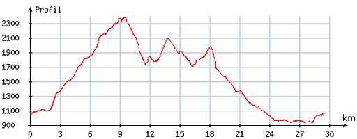 |
According
to visugpx - distance : 30,2 km - cum. elevation gain : 2226m - cum. elevation loss : 2227m - total elevation: 4453m - altitude maxi : 2383m - altitude mini : 932m - altitude average : 1654m |
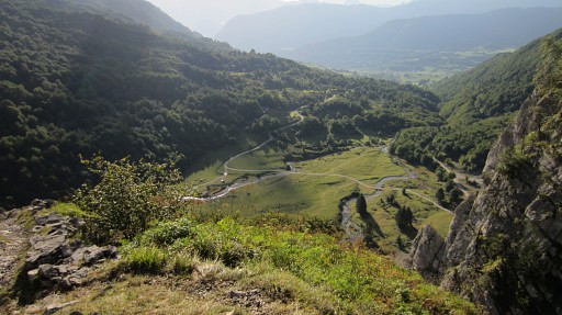 |
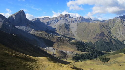
Starting from Pla de Sanchez, I parked my car nearby. This picture: looking back on Pla de Sanchez, I have climbed to the valley of Cayolars d'Anaye. |
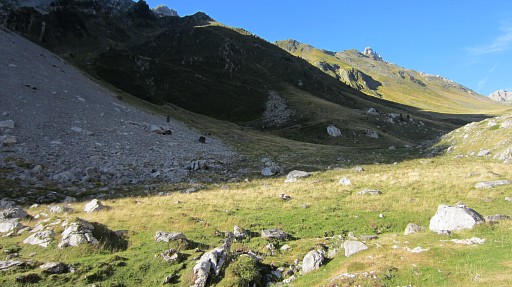 |
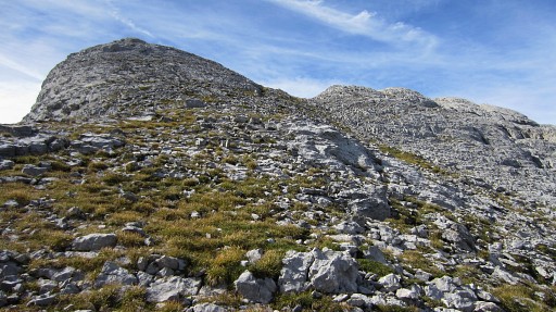
I have crossed the forest and am approaching the cabane on a clear trail. At this point, there's a branch to the left climbing to the hillridge and leading to the summit of Le Billare. From that hillridge you might descend to Lac de Llurs and further, as has been described yesterday |
 |
This is the cairn where that branch starts. |
 |
I'm passing the cabane, looking back at this picture, and |
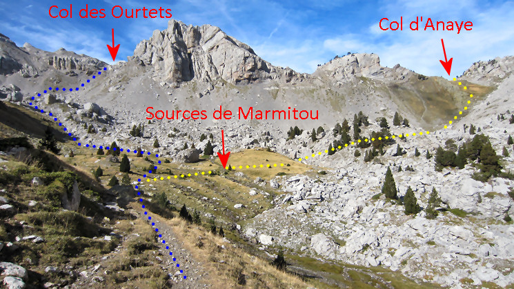 I
climb further to Sources de Marmitou on a clear trail. At Marmitou, the
‘dominant’ cairned trail leads you SW to Col des Ourtets. I
climb further to Sources de Marmitou on a clear trail. At Marmitou, the
‘dominant’ cairned trail leads you SW to Col des Ourtets.
|
|
 |
And here I'm approaching the Col des Ourtets.
|
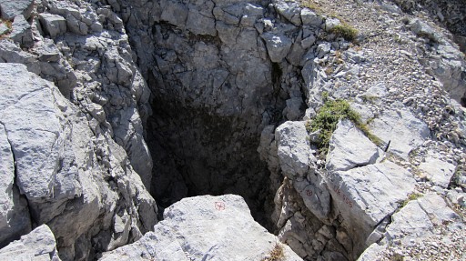 |
Just beyond the Col this hole. |
 |
which is apparently the entrance to a cave. |
 |
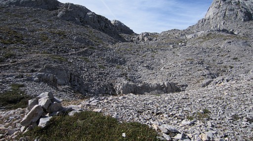
From the Col des Ourtets, looking back into the valley where I came from. |
 |
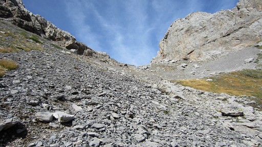
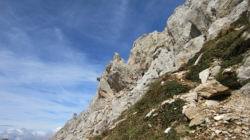
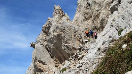
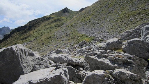
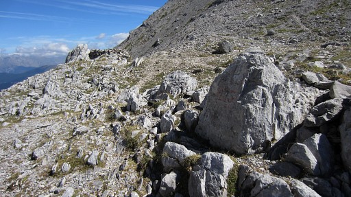
From the Col, the cairns lead you through rugged & rocky terrain. |
 |
This is a view back to the N towards Pic d'Anie |
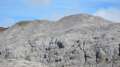 |
with this zoom-in of the two-headed hillridge with bm271 and (the lost) bm271bis. |
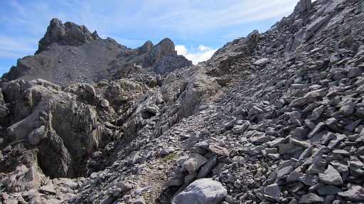 |
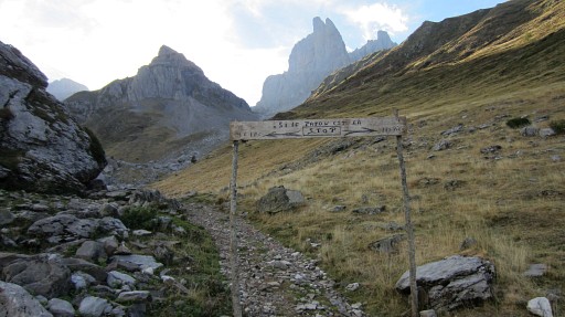
I contine on the trail. |
 |
Looking forward along the trail. Before the large rock, the trail makes a bend to the right. If you go straigh on, you'll get to the Pics de Peneblanque at the far end. |
 |
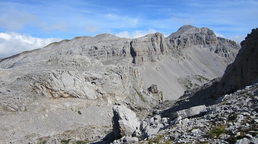
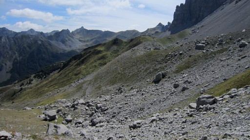
Then climbing on SE until you arrive |
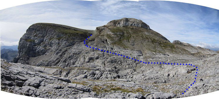
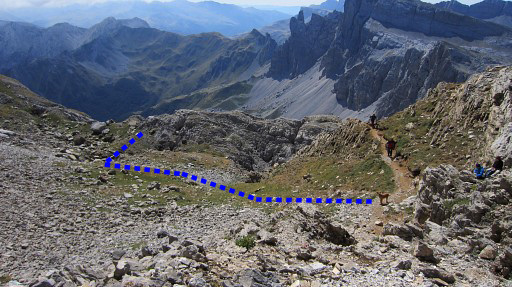
at this point with a view of the ‘valley’ which separates you from the characteristic Table and Pic. The trail gets more vague here but there are enough cairns to bring you at the other side, at the ‘pass’ between Pic and Table. The blue line is a rough indication of the route through the 'valley'. |
|
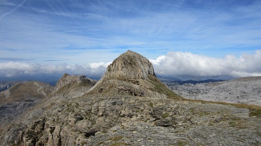 |
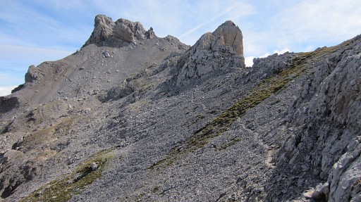
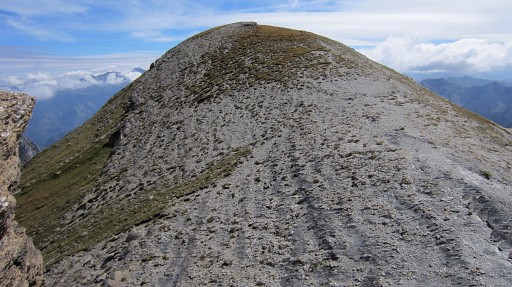
I have arrived at the Table and look NWW to the Pic des Trois Rois |
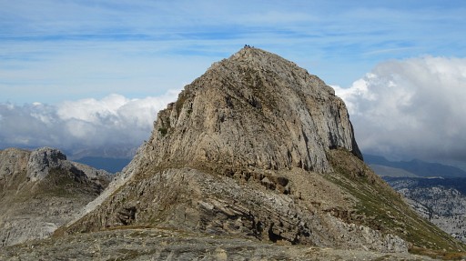 |
with this zoom-in, you can see people at the summit. The Pic is a popular daytrip destination in Navarra. |
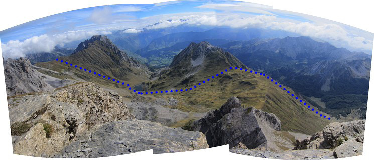
A panorama-view to the E from the Table towards the valleys below. We can see the Lac de Llurs. The blue line is a possible crossing/shortcut from Cayolars d'Anaye over two hillridges in the direction of Col de Petragème. |
|
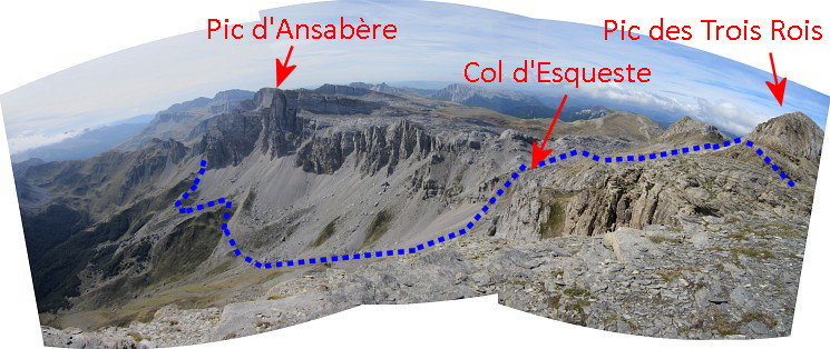
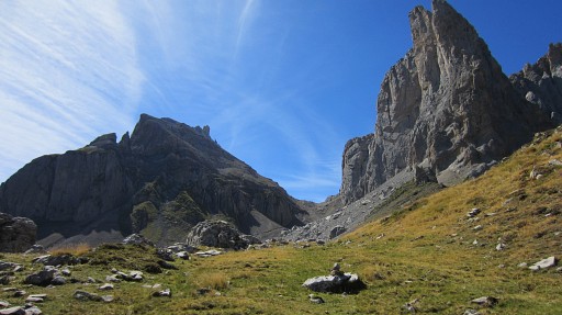
And this panorama looking S to the Pic d'Ansabère. Watch my approximate route to Col de Petragème with bm273. |
|
 |
I descend to the saddle between Table and Pic. This is a view back at the rounded plateau of the Table. |
 |
Then along the S-side of the Pic on a trail |
 |
with here the branch which climbs to the summit. I 'did' that summit on 20110820. |
 |
This is the pass or saddle between Pic and
the ridge to the W. The main trail continues W along the S-side of that
ridge. But at this pass you have to descend S on the grass and pick up a ‘cairned’ trail that will bring you to Col d’Esqueste (it seems partly another route than last year). |
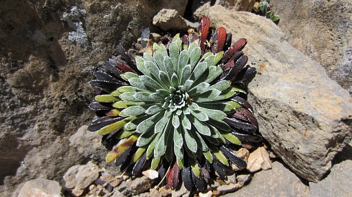 |
And - yes - there's more to life than just bordermarkers. |
 |
The Col d’Esqueste may not be obvious as such but it’s where you can descend E-SE in the valley. |
 |
Then descend to the lowest of two bunches of boulders where a cairned trail starts that climbs S |
 |
to - finally - the edge of a kind of bowl. This picture: I'm still climbing. |
 |
This picture: looking back NW to see of that hillside is manageable when descending from above. Remember: on the other side is Lac de Llurs. |
 |
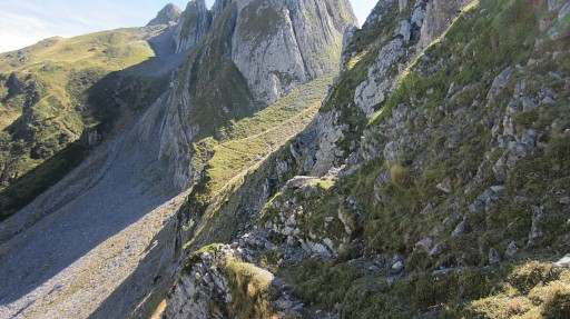
When having arrived at the ridge, the trail follows in a semicircle the
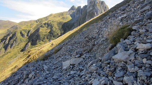
ridge. Then it climbs to and merges - after a last tough climb through loose rockfall - with the trail that leads from Cabanes d’ Ansabère up to Col de Pétragème. This picture: the Col de Petragème well visible. |
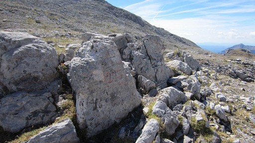 |
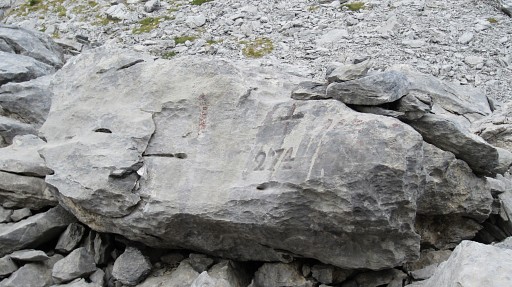
Bm273. |
 |
Bm273 |
 |
Bm273, looking E |
 |
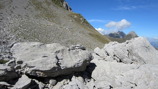
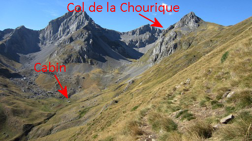
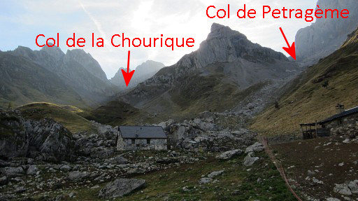
Then back - descending on the main
trail - and making a semicircle to Col de la Chourique. Remember to take the branch to the right at this spot. Otherwise you descend to Cabanes de Ansabère. |
 |
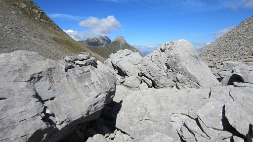
Col de la Chourique allmost visible, just around the corner. |
 |
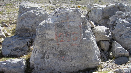
Bm274 is easy to find in the mess of boulders because of the yellow sign close to it. |
 |
Bm274. looking NE |
 |
Bm274 |
 |
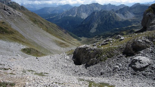
Now I descend into Spain on an uncairned trail that will bring me to a cabin in the bottom of the valley. |
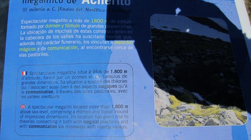 |
But in between a prehistoric monument. |
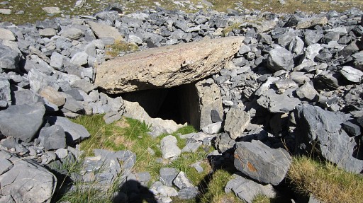 |
A megalith above a burial mound. |
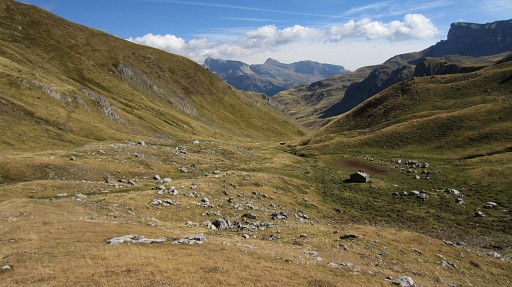 |
The cabin at the bottom of the valley iss used as a storage room by
shepherds. There are no facilities inside - you have to sleep at the floor - but outside the cabin it’s flat and grassy and that makes a nice bivouac location. There's water a bit down the valley or a bit further along the trail I'm about to follow. |
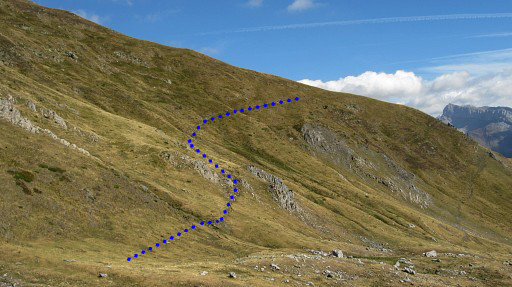 |
There is a - unwaymarked - trail visible, climbing SE diagonally up the the hillside. |
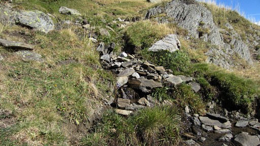 |
I pick that up and pass this little stream mentioned above. |
 |
I have climbed considerably and look back. |
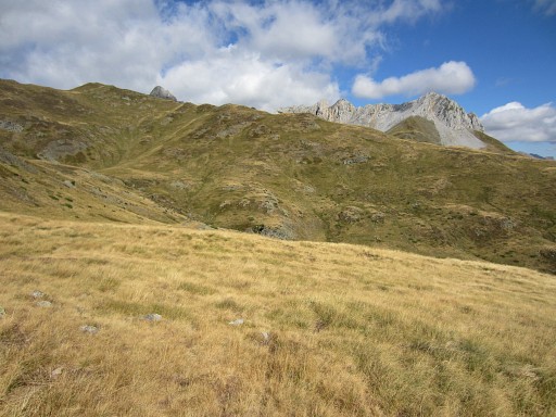 |
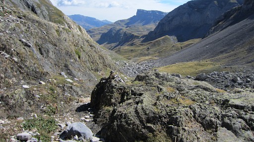
Then the trail arrives at a more
flat level. It starts to make a large semicircle before reaching
- not yet visible - the lake of Ibon de Acherito. The rock-hills - behind the lake - which I will climb tomorrow, are already visible. |
 |
But time is running out and I can’t do the
final part: a direct route from Ibon de Acherito to bm275. I climb directly to the borderridge with this view into France and the Pic d'Ansabère to the left. |
 |
I descend to Cabanes de Ansabère. I look back to the mountain ridge |
 |
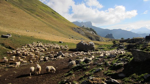
The shepherd doesn't like you to cross his yard. He directs you either to the right of it ("Les Pics") or to the left ("Le Lac") It's getting later and later and I’ve started trailrunning to speed up. From Pont Lamareich I walk/run NNE to my parking-spot, the last part straight through meadows. |
| previous
trip next
trip |
|