|
The
bordermarkers of the Pyrenees : all my trips
 |
|
| - friday 5 september
2014 - Shortcut too steep |
 |
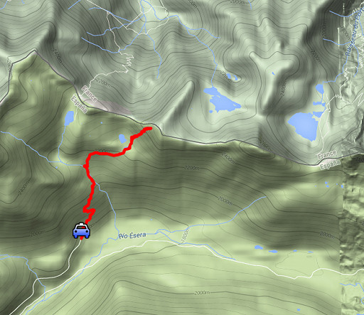 |
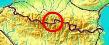
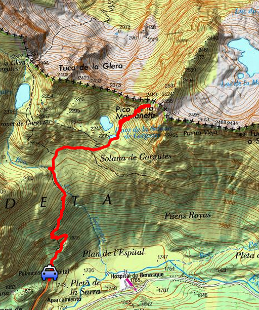
esfr-trip-track-20140905.kml (click to open this trip in Google Earth or copy link to Google Maps; click right on this link to download gpx-version) Summary: part of a 2-weeks trip along the entire Pyrenees, focussing on high altitude reconnaissance of parts of my GRPdesBF-trail. Today: survey of a shortcut between bm331 and 332 via Lac de la Montagnette. That survey starts with a very steep climb - presented on this webpage - and I want to try that myself. Conclusion aferwards: too steep for me, thus too steep for the GRPdesBF. Weather: bright & sunny |
 |
For
explanation of
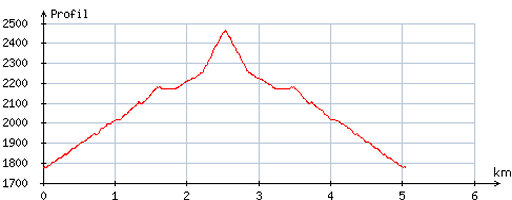
the gps-coordinates and other cartographic backgrounds: see the cartography-page Start: 10.30, finish: 14.30, net walking time: 4h According to the gps-tripteller: Distance: 5,7 km Total ascent: 572m Total denivellation: 1144m Maximum height: 2416m Total time: 4.03h |
 |
According
to visugpx - distance : 5,4 km - cum. elevation gain : 682m - cum. elevation loss : 680m - total elevation: 1362m - altitude maxi : 2464m - altitude mini : 1778m - altitude average : 2059m |
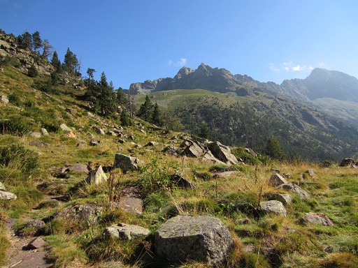 |
From the road's end above Hospital de Benasque, a waymarked trail (green/white) climbs towards Port de la Glère. |
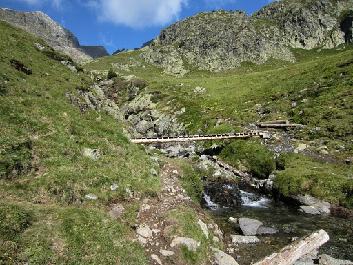 |
It crosses a stream and climbs more gently to |
 |
this bend (the blue trail). That's where I leave the main trail and will follow the red course. |
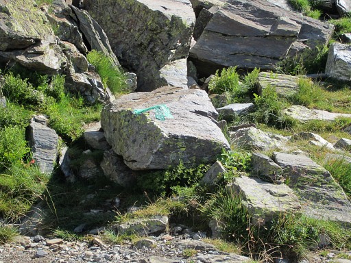 |
The green/white waymarks |
 |
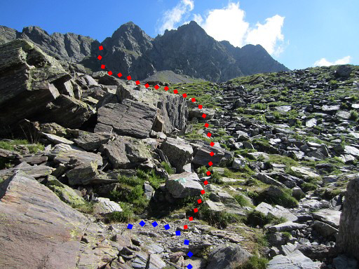
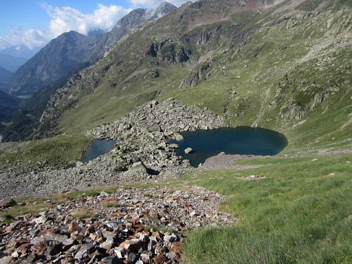
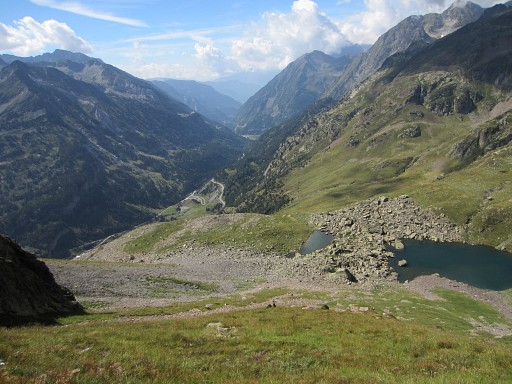
One of the two small lakes of Ibons de la Solana de Gorgutes and my approximate route. |
 |
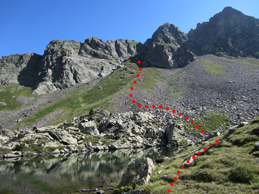
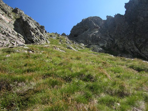
The mountainside to climb is mainly grassy. There are many 'mini'-terraces – steps as it were – which makes climbing quite easy. But halfway I already decide that this will not be part of the GRPdesBF: it gets too steep. If you slip and start to glide, the grassy slope will glide you downhill as fast as on snow, especially with a heavy backpack. |
 |
Nevertheless I go on for myself but close to the final climb through a corridor, I give up. Too risky, I think. |
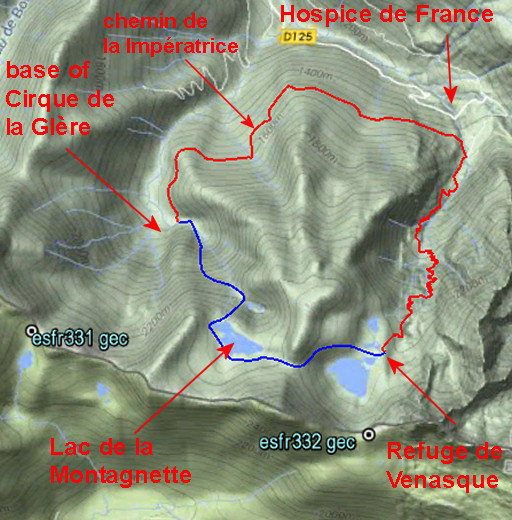 |
What is then the alternative to get from bm331 to 332? Well: descend from bm331(Port de la Glère) into France to the base of Cirque de la Glère, then take the forest path of "chemin de la Impératrice" towards Hospice de France and climb via Refuge de Venasque to Port de Venasque (bm332). I've also spotted on the internet a trail or route from the base of the Cirque de la Glère via Lac du Maille to the Lac de la Montagnette. That is the blue route. It's is approximately 4km shorter, requires 400m less denivellation and would save you (in theory) 1.45h. That could be the target of a survey next year. For the time being, the GRPdesBF will take the chemin de la Impératrice |
 |
I descend back, carefully. In the car – earlier than I thought - I decide to drive on |
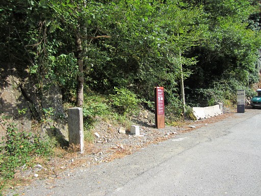 |
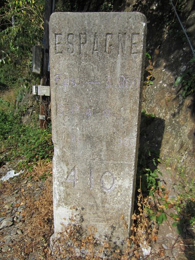
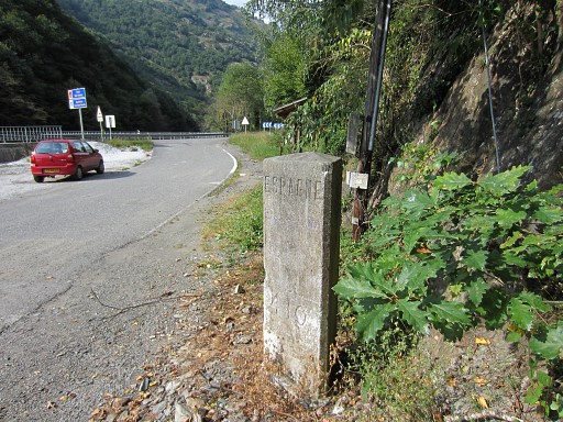
to the Garonne-valley via Vielha and Pont du Roi. At Pont du Roi I stop for a check on bm410. This picture: bm410 and the last submarker (French side) between bm409 and 410. |
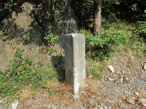 |
Bm410 is a three-sided marker with a slight piramid-top. |
 |
This is the backside: no engravings |
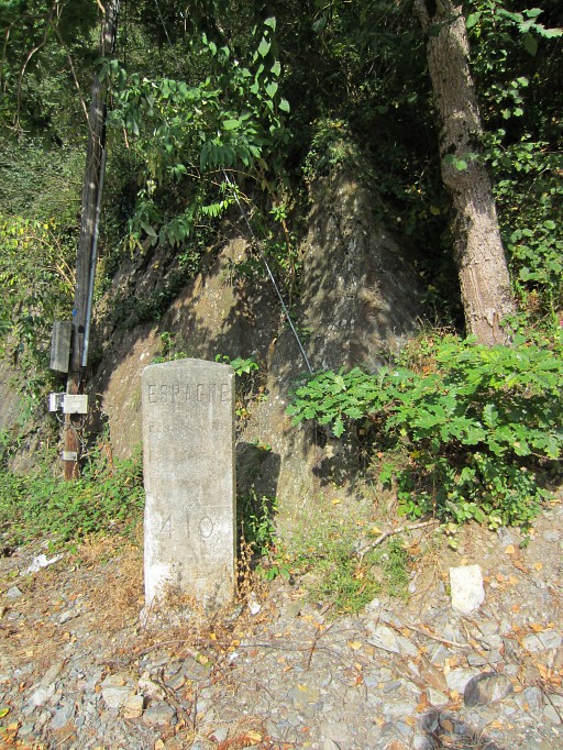 |
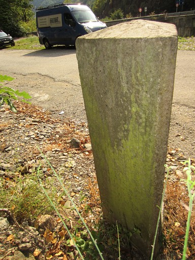
The 'Espagne'-side. Very interesting: there has been a predecessor of bm410 on a horizontal rock, hanging above the current bm410. That horizontal rock (and the original b410) has disappeared. |
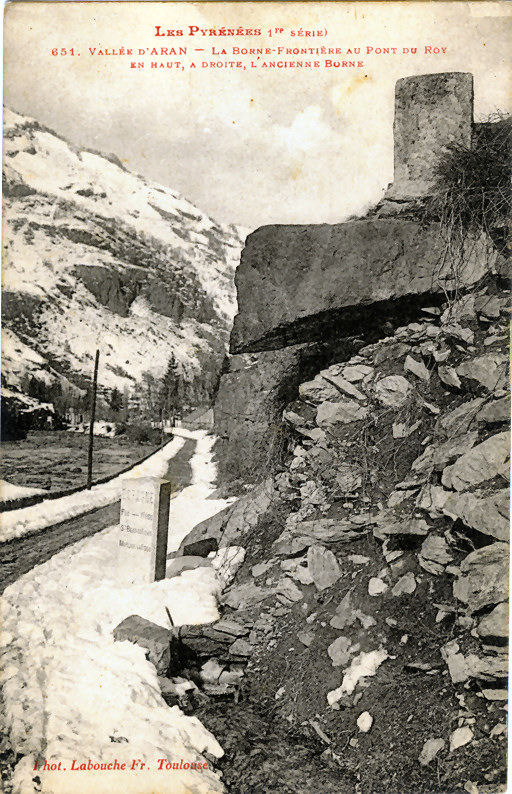 |
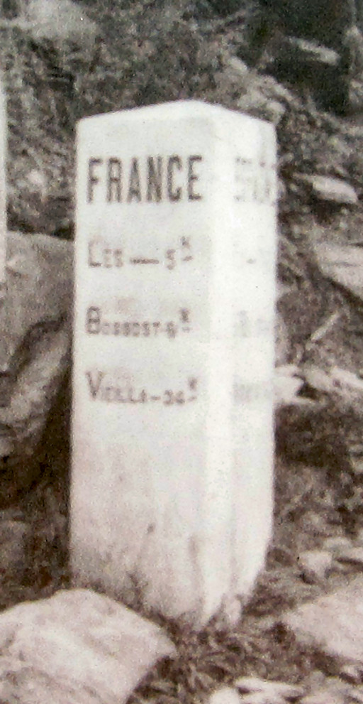
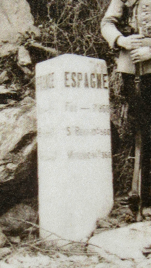
This picture (provided by the Darrieu's) shows that well. The marker along the road is only a milestone at that time, no official esfr-bordermarker. |
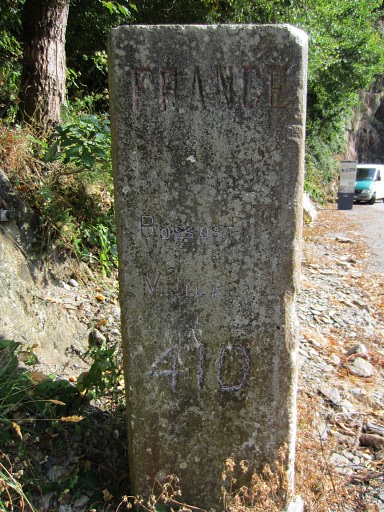 |
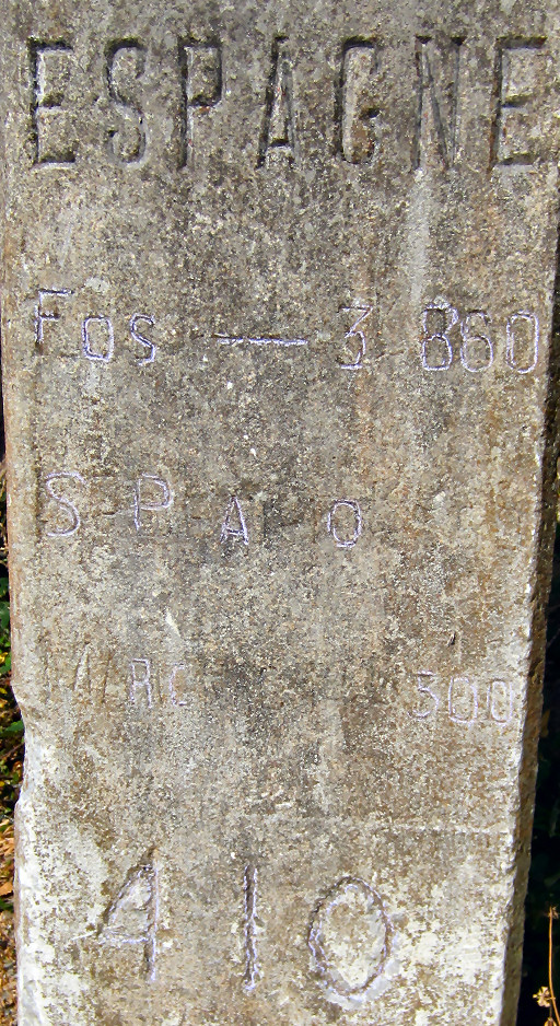
I wonder if the current bm410 is the same as the one on the old picture. I use chalk to enhance the visibility of the engravings and try to compare them with the old pictures. These old pictures are on the information board nearby (on this picture in the far end) |
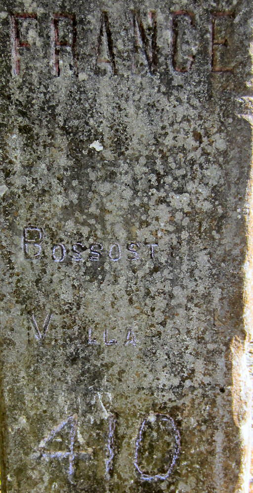 |
A digital crop and enhancement of previous picture. |
 |
Well, this seems quite identical, apart from the number 410. |
 |
The other side of bm410 |
 |
A digital crop and enhancement of previous picture. |
 |
Well, this seems also quite identical, apart from the number 410. Conclusion: this marker was originally a sort of milestone which was upgraded to bordermarker 410 after the orginal bm410 (on a rock above this milestone) was removed. If it's still on the exact same spot, we don't know. The road seems now broader and that broadening can be the reason of the removal of the original bm410. |
 |
If you compare this picture with the old postcard-picture above, the road seems definitely broader. |
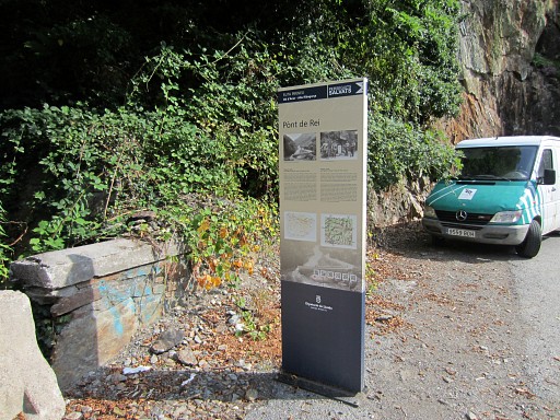 |
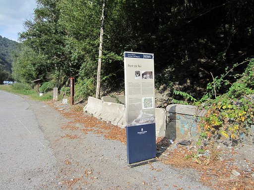
The information board. It's just beyond the borderriver thus on Spanish soil. It provides us with some interesting old pictures. |
 |
Seen from the other side. Behind the concrete ridge: the borderstream coming from bm411 which goes underneath the road to merge with the Garonne. |
 |
Close-up |
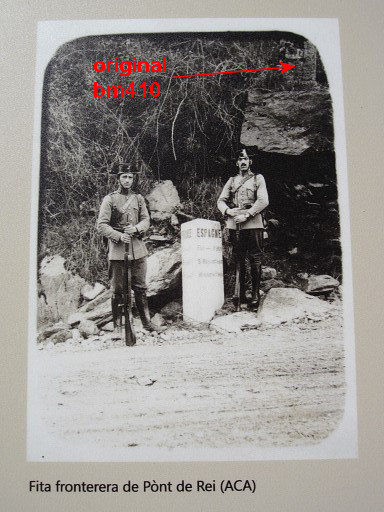 |
Two custom officers at the border. These must be Spanish officers. |
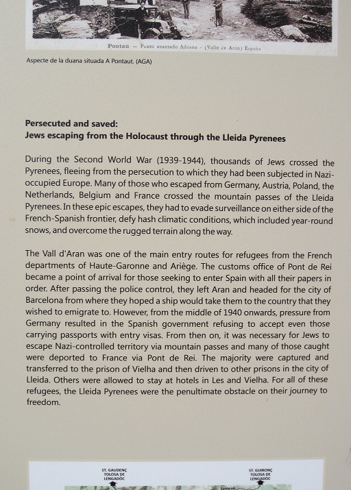 |
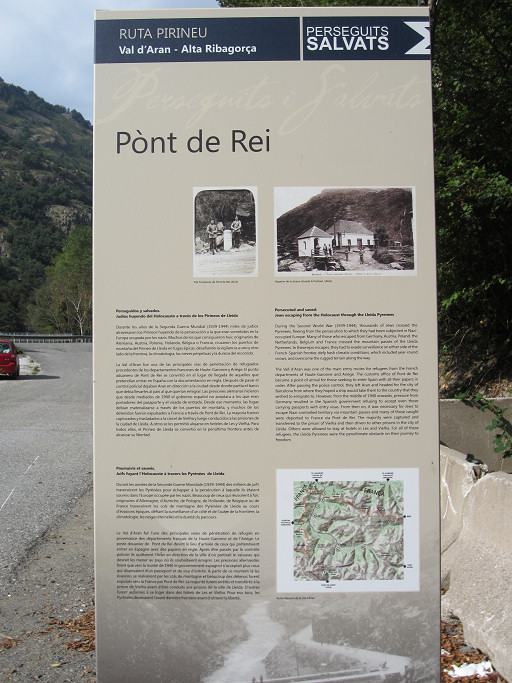
This is the theme of the information board: jews escaping the Nazis. |
 |
The other side. |
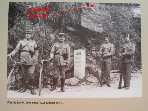 |
Apparently a popular subject: custum officers posing at the borderline. The French had a technological advance: bicycles. |
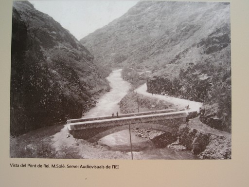 |
An old postcard of Pont du Roi, looking S. |
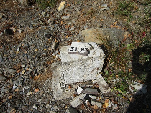 |
Then the sadly destroyed submarker 7. Then driving on, ending up on camping Arõme Vanille in Bagnères-de-Luchon. Other campings in Fos and Saint-Béat were closed. |