|
The
bordermarkers of the Pyrenees : all my trips
 |
|
| - thursday 4 september
2014 - Roundtrip via Señal de Viadós |
 |
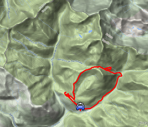 |
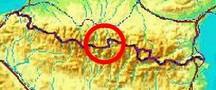
esfr-trip-track-20140904.kml (click to open this trip in Google Earth or copy link to Google Maps; click right on this link to download gpx-version) Summary: part of a 2-weeks trip along the entire Pyrenees, focussing on high altitude reconnaissance of parts of my GRPdesBF-trail. Today: a check if the shortcut Señal de Viados – Port d'Aygues Tortes as shown on Topopirineos is really a trail which can be included in the GRPdesBF. So: or existing in the terrain and/or waymarked or easy to navigate. Weather: fine weather, a fierce thunderstorm starting just 1 minute after finishing |
 |
For
explanation of
the gps-coordinates and other cartographic backgrounds: see the cartography-page Start: 12, finish: 17.45, net walking time: 5.45h According to the gps-tripteller: Distance: 14,0 km Total ascent: 941m Total denivellation: 1882m Maximum height: 2488m Total time: 5.55h |
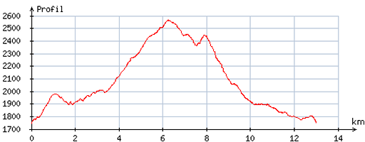 |
According
to visugpx - distance : 13,3 km - cum. elevation gain : 1025m - cum. elevation loss : 1016m - total elevation: 2041m - altitude maxi : 2565m - altitude mini : 1746m - altitude average : 2084m |
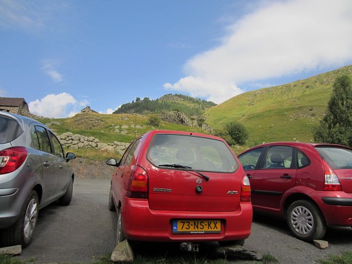 |
After a long drive (7.30-11.30) from Lourdes via the Bielsa-tunnel and a 10km bumpy dirtroad, I arrive at Refugio de Viadós. |
 |
From the refuge, I climb uphill on a waymarked trail which should bring me to the Cuella (=col) de la Señal de Viados. |
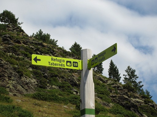 |
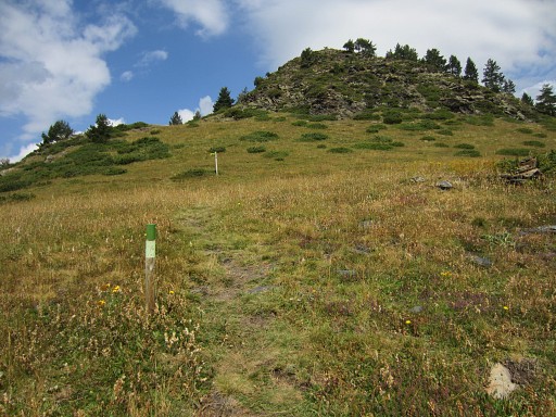
But I must have missed some signpost because I end up at the green/white trail |
 |
towards Refugio de Tabernés. |
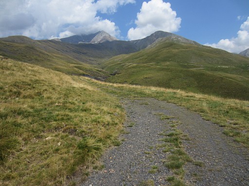 |
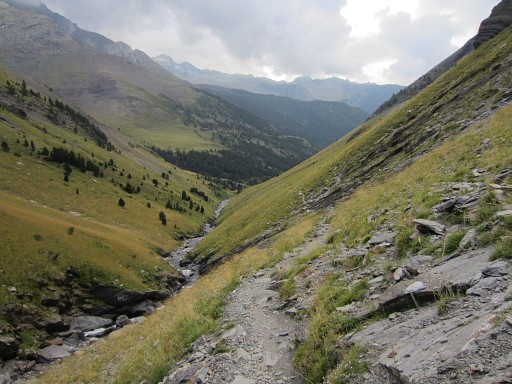
But a dirtroad brings me after a bend to a valley looking up to the Pic de Viados. A bit further I can catch up with the trail to Cuella de la Señal de Viados. |
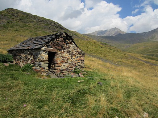 |
which passes this simple cabin |
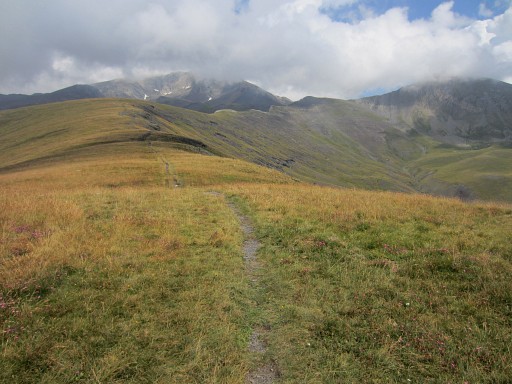 |
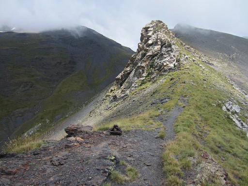
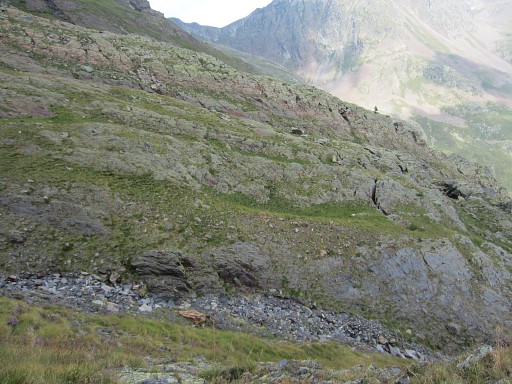
and continues along this mountain ridge. |
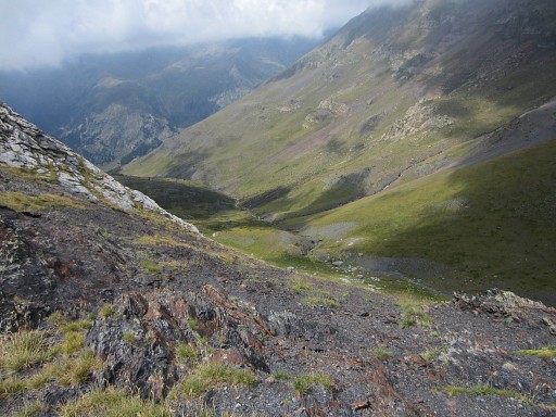 |
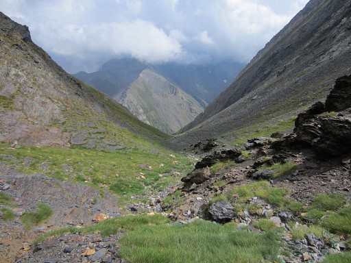
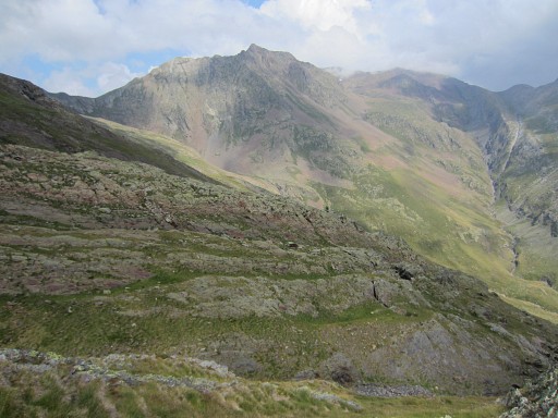
Further on - at the other side of the ridge - I get a view of the W-E-valley of the Barranco de Bachimala. Access from that side to the Cuella de la Señal de Viadós seems not difficult though I don't see a distinct trail. |
 |
The col comes in sight (now still behind the rock) |
 |
and I'm getting closer. At 14.45 I'm at the col of Señal de Viados. |
 |
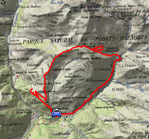
Now this intermezzo: the next day I will spot this map at the wall of the camping Los Vives. |
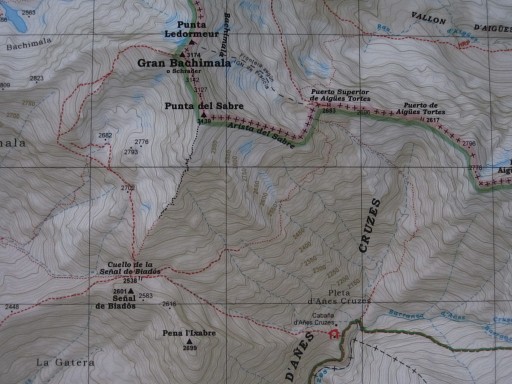 |
It shows also the trail which I want to check today: the shortcut from Cuella de Señal de Viados to Port d'Aygues Tortes (bm330) |
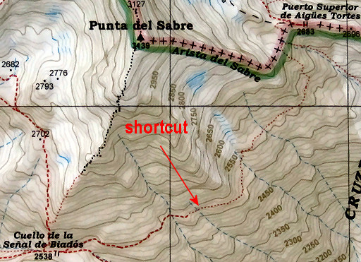 |
This digital enhanced crop shows the shortcut better. |
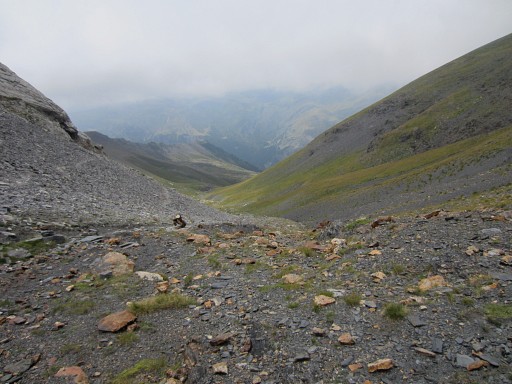 |
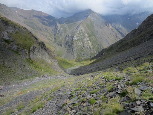
View from the col to the E. We will have another look at this picture further on. |
 |
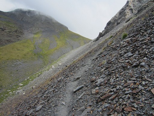
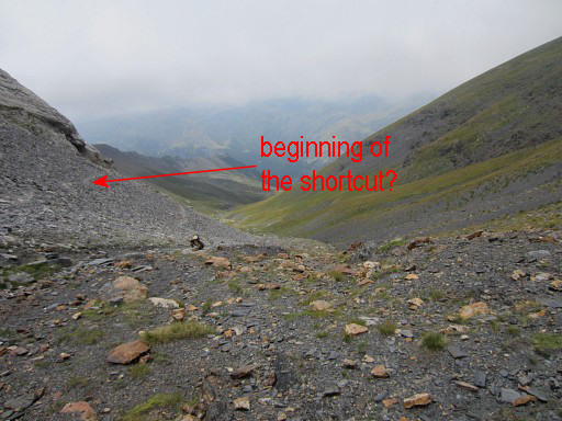
From the col, I descend ± 400m (± 150m elevation loss) but there's no trace of a trail going left towards Port d'Aygues Tortes. |
 |
Nevertheless, I give it a try |
 |
but I can't find a fluent or straightforward route, let alone waymarked or an existing trail. |
 |
This is a kind of rift blocking an easy passage towards Port d'Aygues
Tortes. So my conclusion: the shortcut doesn't qualify as a variant or semi-variant for the GRPdesBF. |
 |
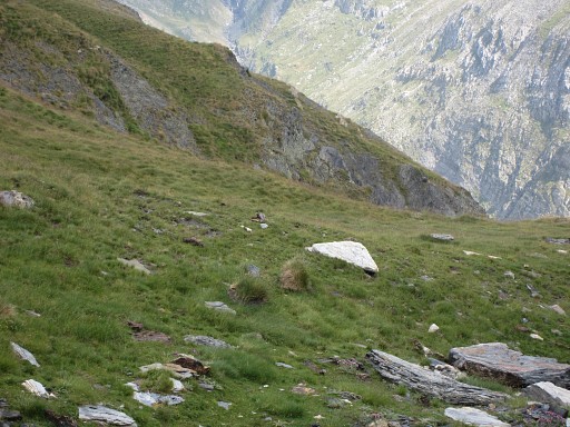
But there's something disturbing when I study at home my pictures again. This picture is taking from the col. I can now see a trail which I obviously didn't notice at the col itself. I was convinced that I had to descend first before bending to the left. |
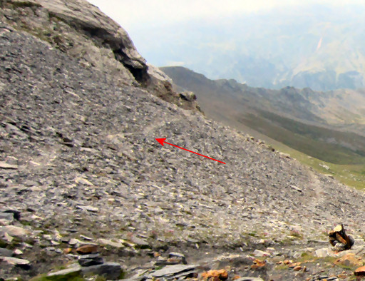 |
Let's zoom-in and then that trail becomes more clear. |
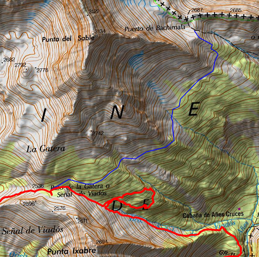 |
And now the verdict: did I make a misstake? Well: on this map my (red) route of today and in blue the shortcut which I wanted to check (derived from Topopirineos and available for you as a kml-file). Conclusion: I did make a misstake, the shortcut starts already at the col. |
 |
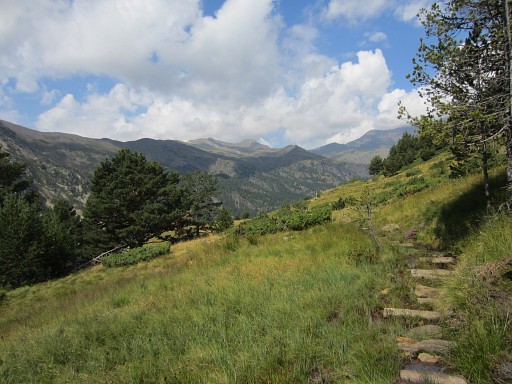
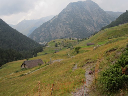
I return to the car by descending first to the valley of Añes Cruces. |
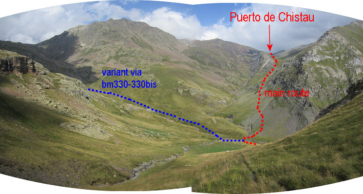 This panorama shows the routes ahead. The main route follows the GR11 in this part. |
|
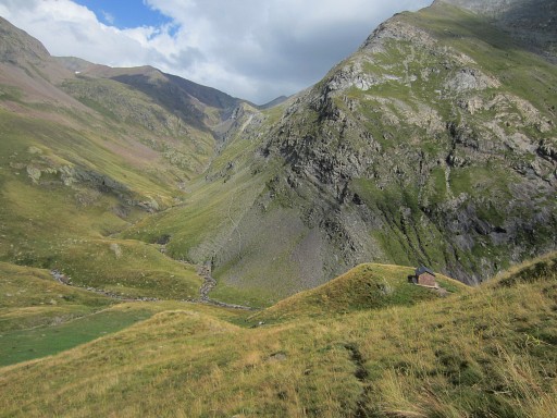 |
And now the Cabaña de Añes Cruces comes in sight. |
 |
Via the Cabaña I walk back |
 |
along the GR11 to Refugio de Viadós. |
 |
Then through pouring rain back on the
bumpy dirtroad and driving to camping Los Vives. I have just enough time to pitch my tent before a second thunderstorm. |