|
The
bordermarkers of the Pyrenees : all my trips
 |
|
| - sunday 19 april
2015 - Don't upset the farmers |
 |
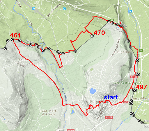 |
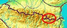
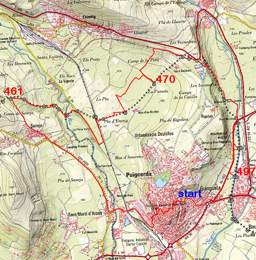
esfr-trip-track-20150419.kml (click to open this trip in Google Earth or copy link to Google Maps; click right on this link to download gpx-version) Summary: the first of four daytrips around Puigcerda, re-doing the 444 to 505 bordermarkers to check coordinates and wayfinding. Today: covering bm461 to bm479. Weather: sunny, cloudy, a few raindrops, a nice temperature for walking |
 |
For
explanation of
the gps-coordinates and other cartographic backgrounds: see the cartography-page The gps-tracks have not been manually corrected which explains the inaccuracy and misalignment at some points. I walked from 12.15 to 18.15. According to the gps: - distance : 14,6 km - total elevation: 480m - maximum height: 1245m - total time: 5.45 |
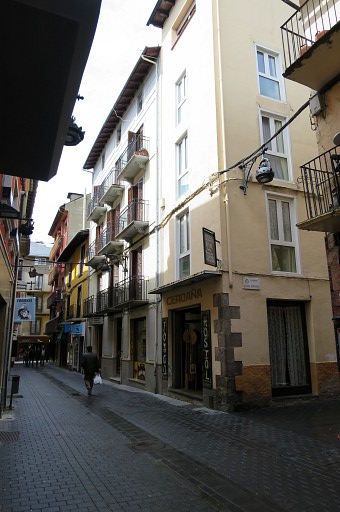 |
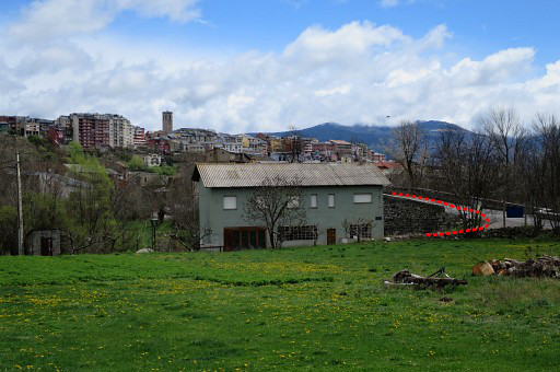
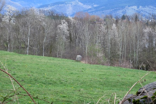
I the early morning I flew to Girona and arrived in a rental car around noon in Puigcerda. I started walking right away. This picture: my hotel where I will check in later. My goal for this afternoon: covering a range of bordermarkers which traverses fields in the vicinity of some farms. Also farmers rest on sunday and stay at home. I don't want to upset them with me climbing their fences and disturbing their flocks. |
 |
This picture: I have just left Puigcerda over an old bridge and look back. I follow the GR11-waymarks but in fact it's more convenient and more quiet to follow a new road along the river which is in fact a shortcut. NB: the red and purple lines on the pictures: that's the 'official' course of the GRPdesBF but not necessarily how I walked today. |
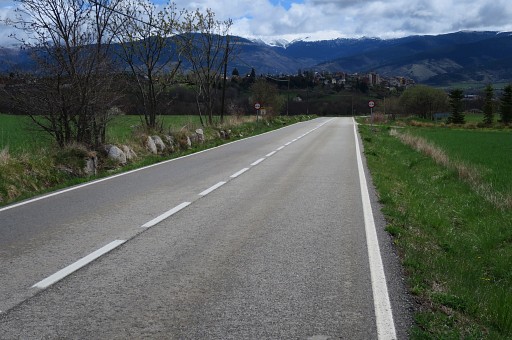 |
I continue to Saneja along this road (this picture: looking back to Puigcerda). |
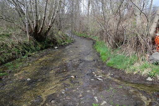 |
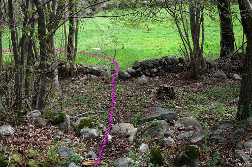
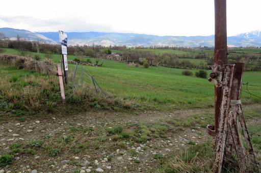
The dirtroad from Saneja leading to the borderline has partially become a stream. |
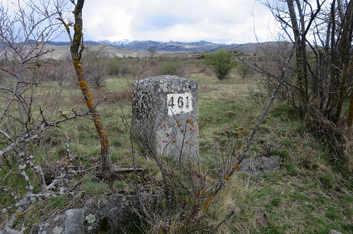 |
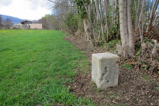
However, bm461 is not far away, less than 100m from the dirtroad and standing in a hedge. |
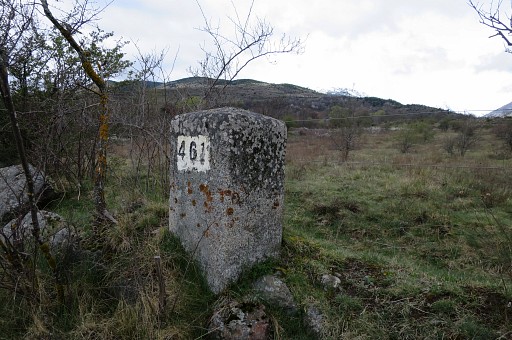 |
Bm461 |
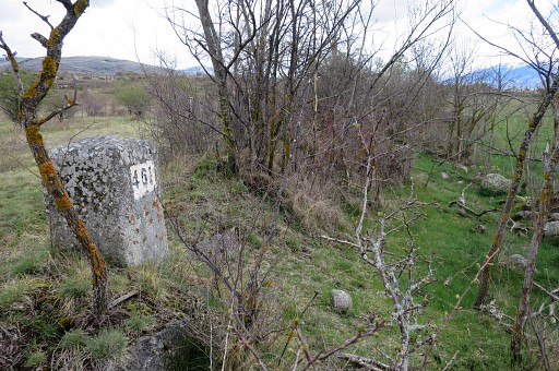 |
Bm461, looking forward in the direction of bm462. |
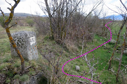 |
Just follow the hedge/fence and then |
 |
bm462 is ±250m further on. |
 |
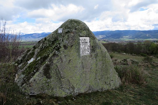
Bm462 |
 |
Bm462, the backside of the boulder |
 |
Zoom-in From bm462 I continue SE and descend along a stone wall cq fence. |
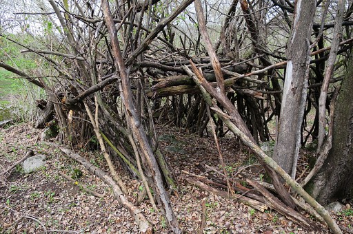 |
The slope becomes a sort of ridge and you will pass this 'cabin' before |
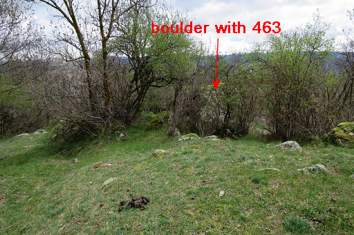 |
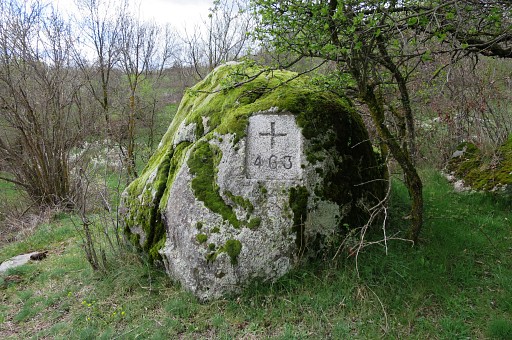
arriving at bm463. Bm463 is also engraved on a boulder but a smaller boulder than the one of bm462. It's hidden behind a bush and in summertime you might miss it alltogether. |
 |
The number is on the other side. |
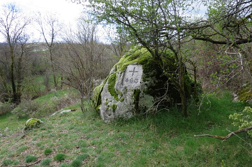 |
Bm463 |
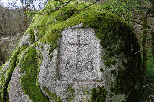 |
Bm463 |
 |
I continue E and cross this - no longer used - dirtroad with stone walls on either side. |
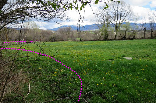 |
Then I enter this meadow and proceed NEE to its NE-corner. |
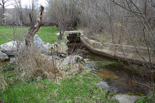 |
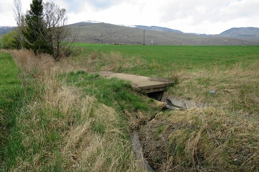
That NE-corner is here with a concrete irrigation canal and a small bridge further on. Now I have to switch to the adjacent meadow to cross the canal on that small concrete bridge. It's better to switch to that adjacent meadow in the beginning as the purple line above indicate. |
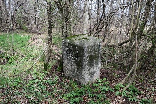 |
Bm464 is ± 20 m E of the bridge, in the bush. |
 |
Bm464 |
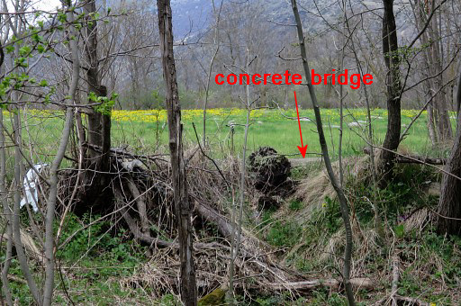 |
From bm464 you can still see the concrete bridge. |
 |
Bm464 |
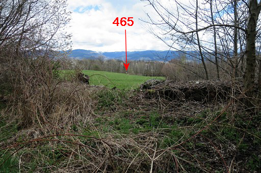 |
A bit further to the E, there's another meadow and |
 |
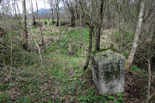
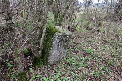
I can already spot bm465 to the SE. There's a steep stone-wall to jump from to get into the meadow, a bit too high for me. I make a little detour to the NE where access to the meadow is easier. |
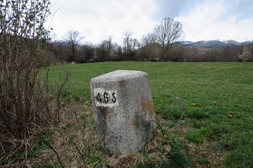 |
Bm465 |
 |
Bm465 |
 |
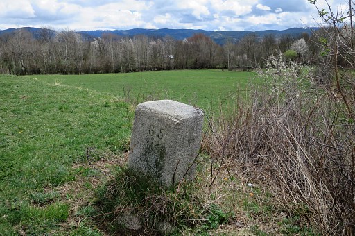
From bm465, I head SSE to the river and to |
 |
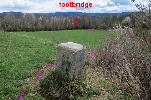
the footbridge over it. |
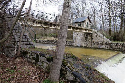 |
The footbridge |
 |
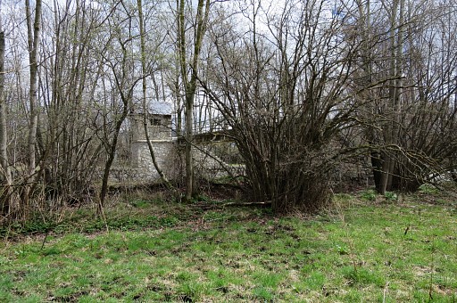
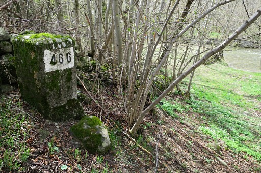
Bm466 is on the other side, 50m the NE near the ford which is just N of the footbridge. |
 |
Bm466 |
 |
This shows the position of bm466 better: you can see the river where the ford is, just N of the footbridge. |
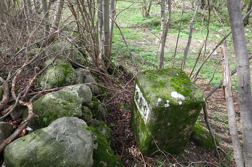 |
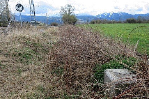
Bm466 From here I follow the hedge NE at its N-side and arrive at a dirtroad which climbs SE to |
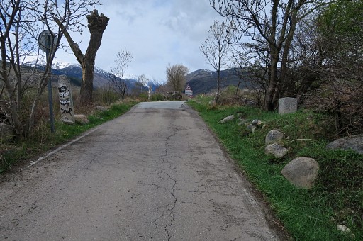 |
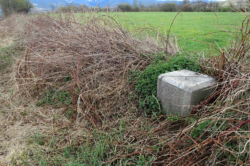
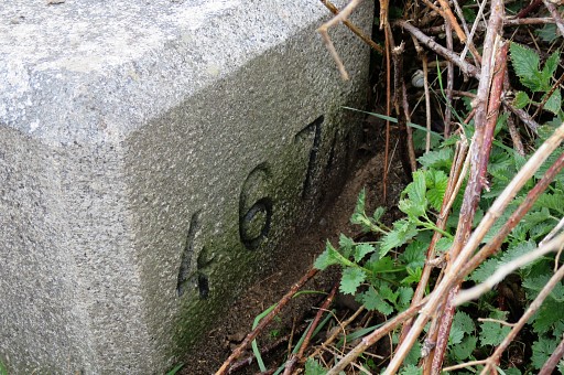
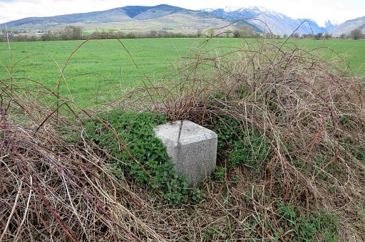
this road. To the left I spot bm467. |
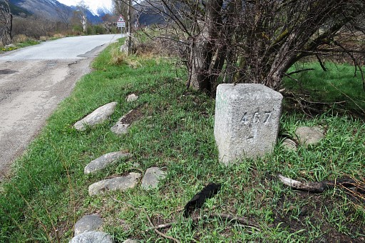 |
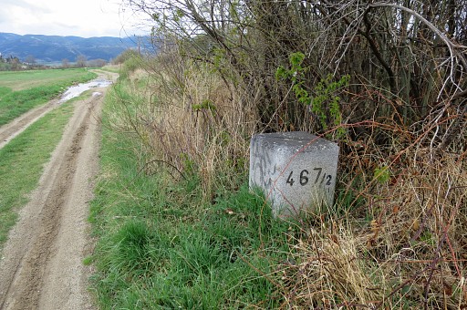
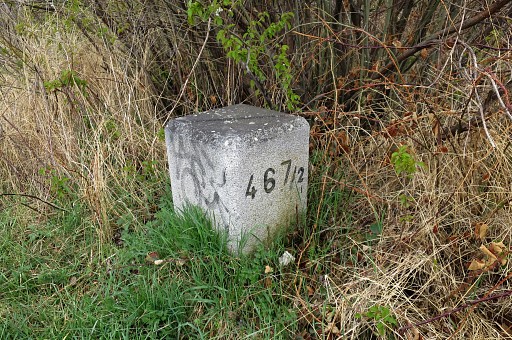
Bm467 |
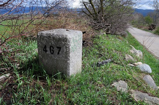 |
Bm467 |
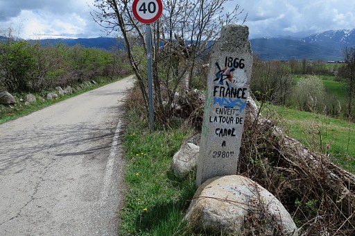 |
And this peculiar and rather unique milestone. |
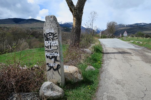 |
Same milestone, now looking towards Spain. |
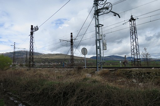 |
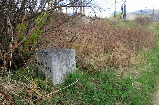
From bm467, I go S on the tarmac road but proceed too far S before going left to the railway and go N to the spot of bm467/1. |
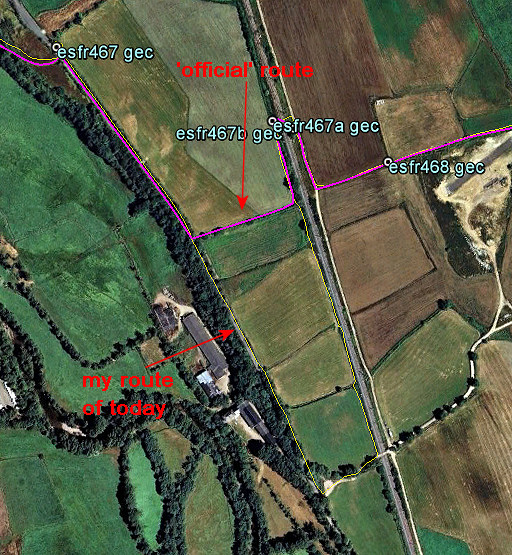 |
You should take a more direct route along the field edges. |
 |
Bm467/1 is at the W-side of the railway |
 |
Bm467/1 |
 |
Bm467/1, the groove at its top pointing to bm466 (and bm467/2 at the other side of the railway) |
 |
Bm467/1 |
 |
Bm467/2 can be found diagonally at the other side of the railway. |
 |
Bm467/2. Also with a groove at its top. |
 |
Bm467/2 |
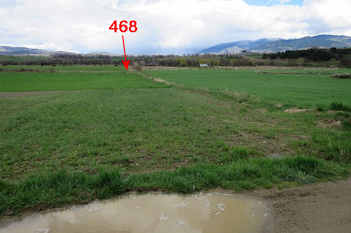 |
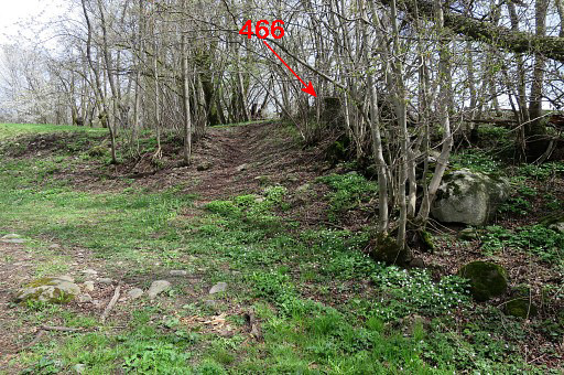
Using the map, navigating along field edges is an easy thing to reach bm468 and bm469. From bm467/2 this view towards bm468 |
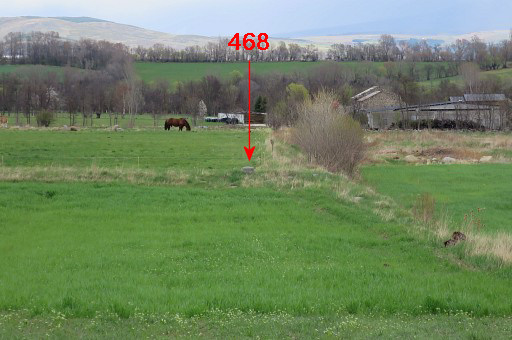 |
Zoom-in towards bm468 |
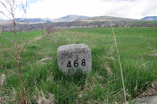 |
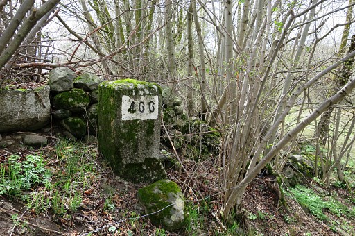
Bm468 |
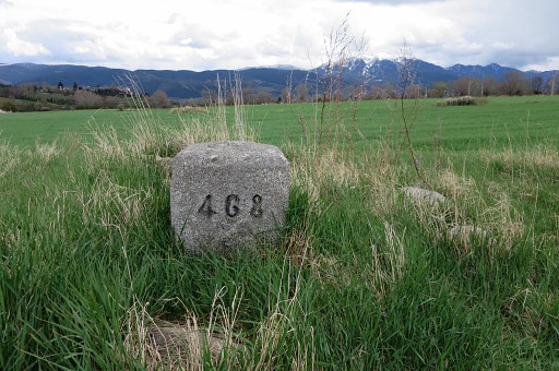 |
Bm468 |
 |
Bm468 Then I go NEE along a rough field-edge to |
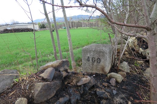 |
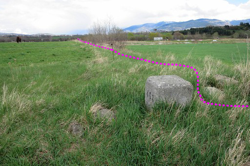
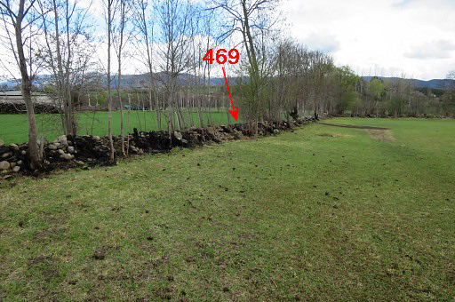
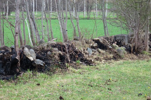
bm469, a farm is closeby. The hedge has suffered from a fire making bm469 more visible. |
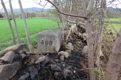 |
Bm469 |
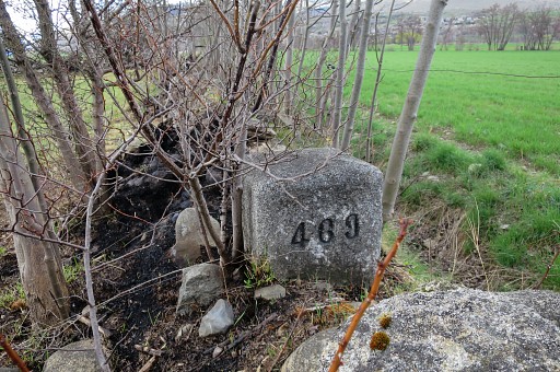 |
Bm469 |
 |
Bm469 from some distance |
 |
with this zoom-in. Then making a detour NNW-NE-SE to keep away from the farm |
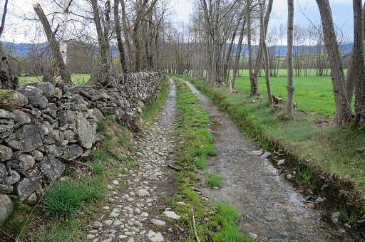 |
and arriving at this dirtroad. You might have to improvise when field hedges/fences are difficult to cross due to blackberry or cattle (often horses) in the fields. |
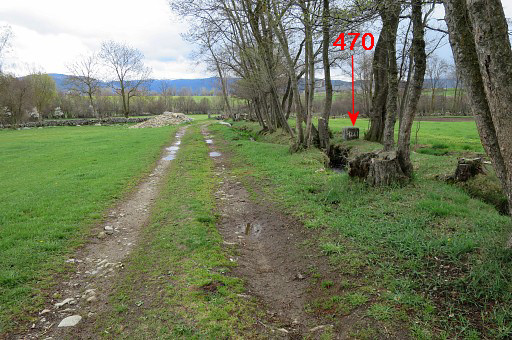 |
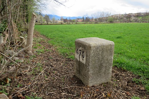
Further SE along the dirtroad, bm470 is an easy find. |
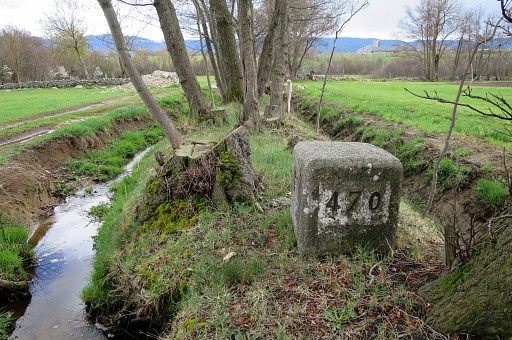 |
Bm470 |
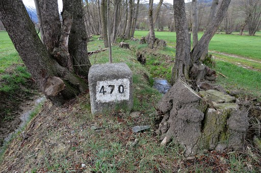 |
Bm470 Now my intended route is 'blocked' by a horse-meadow and I take a different route to climb finally to |
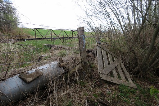 |
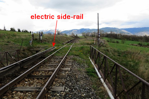
the 'yellow train' railway-track to which this gate gives access to. Be careful! The side-track is electric! See hereunder what the side-track is. |
 |
A bit further E is this level-crossing |
 |
with this view SE to a farm. |
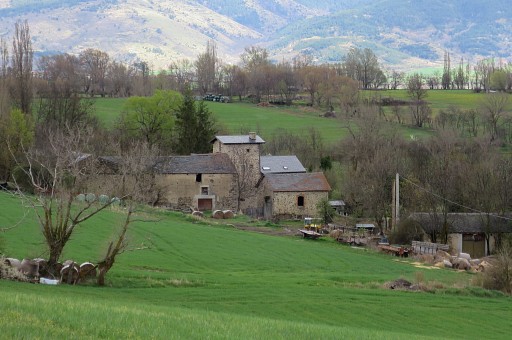 |
Close-up of the farm which is just beyond the borderline on Spanish territory. Its main access-road however comes from France. |
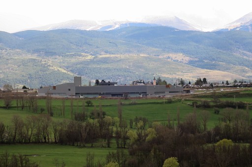 |
The view SE also extends to the (backside of the) recently build hospital of Cerdagne. It's a bi-national hospital serving both Spanish and French inhabitants of the Cerdagne and is as such unique in the world (they say). |
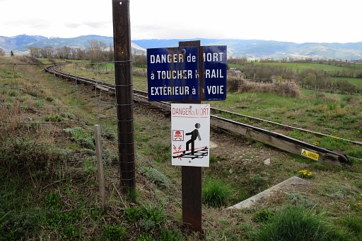 |
This picture to remind you of the dangers of the 'yellow train' railway-track. The side-rail is electric, don't touch it! |
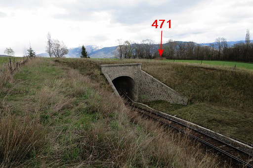 |
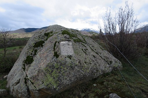
I continue on the N-side of the railway until it dives into a tunnel. The boulder with bm471 can be spotted from here. |
 |
Zoom-in. |
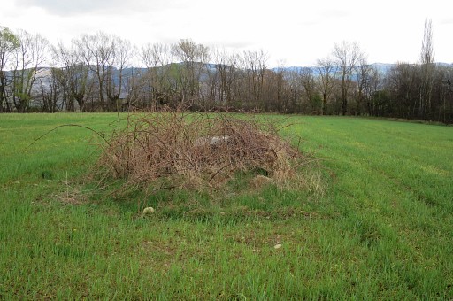 |
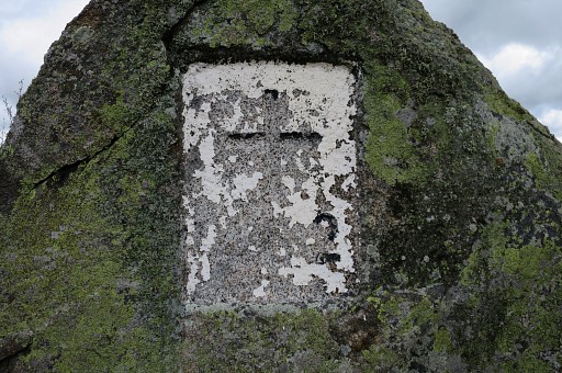
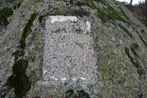
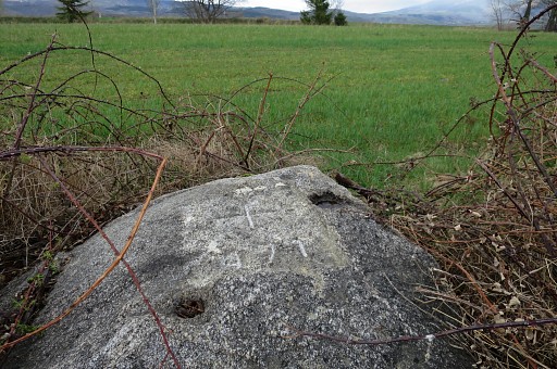
Bm471 |
 |
Bm471 |
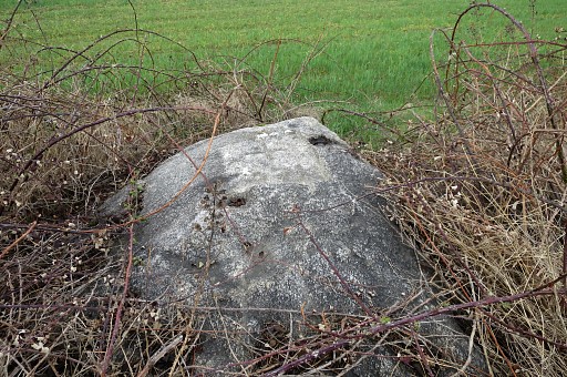 |
Bm471 |
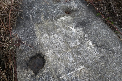 |
Bm471 |
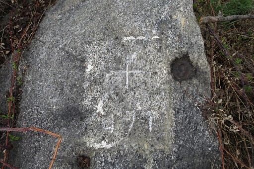 |
Bm471 |
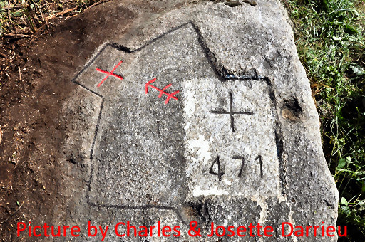 |
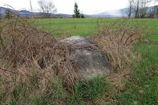
In january 2011 I received this picture from Charles & Josette Darrieu. From the documentary on Jean Sermet ("L'homme de la frontière" - Luc Bazin - ArisFilm) they learned that an old cross and arrow were conceiled under the bush. They uncovered the rock and coloured cross and arrow. |
 |
Bm471 |
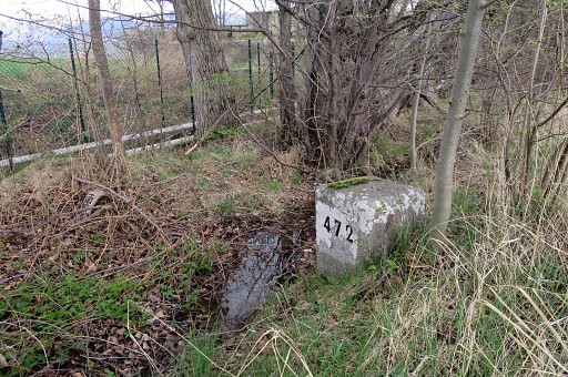 |
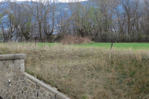
Bm472 is 100m SEE along a small canal/ditch. |
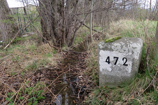 |
Bm472 |
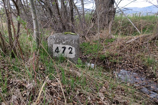 |
Bm472 |
 |
A small bridge a bit to the NE lets me enter the next field |
 |
and bm472 is already visible |
 |
in the distance near the road. |
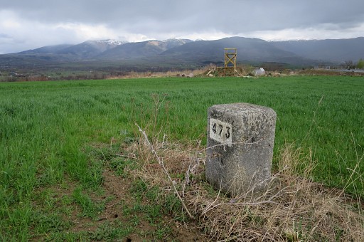 |
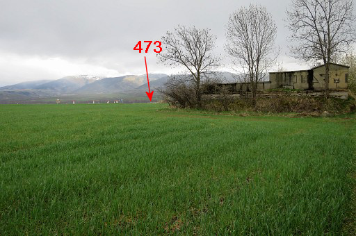
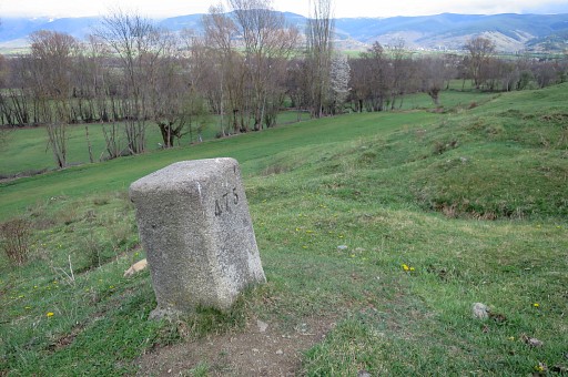
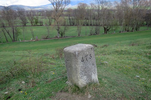
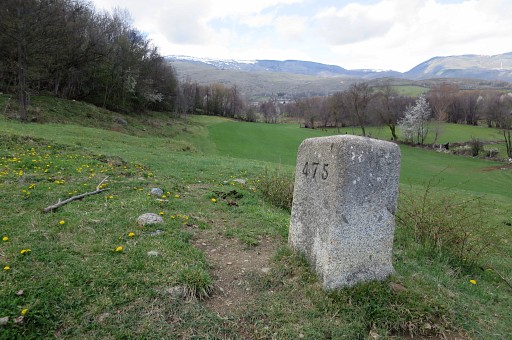
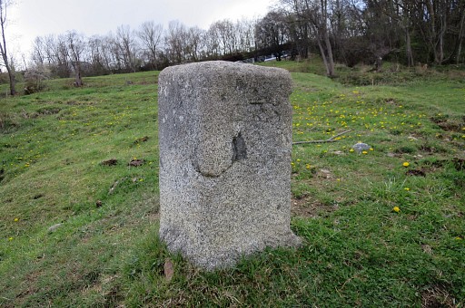
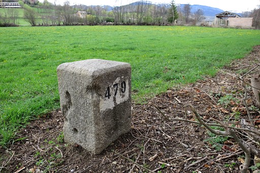
Bm473 |
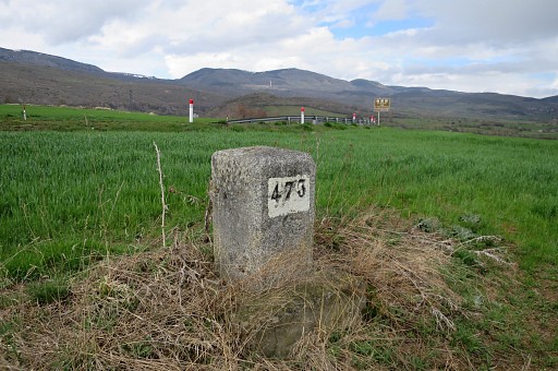 |
Bm473 Getting directly to bm474 isn't that straighforward due to the changing and fenced terrain. You can better traverse the field to the road (visible on this picture), follow it NE-N for 200m and take the branch to the right |
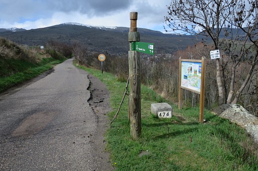 |
and walk to bm474 (this picture = looking back if reaching bm474 that way) |
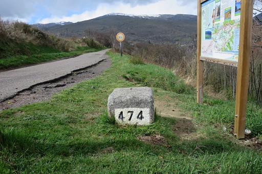 |
Bm474 |
 |
Bm474, looking towards Puigcerda. |
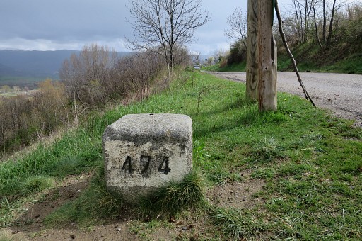 |
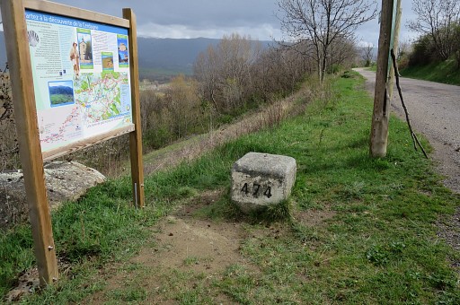
Bm474 |
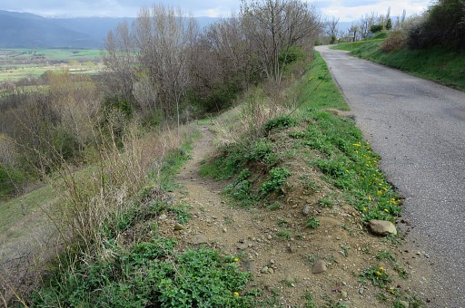 |
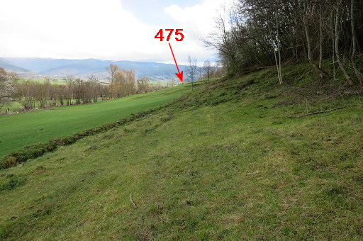
Then to bm475. About 20m S from bm474, this trail descends SE |
 |
At the first bend, I enter the field/forest |
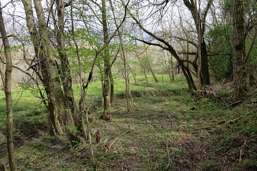 |
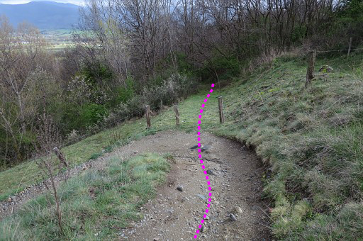
and descend in the same direction on a kind of trail. The forest opens up after a while and |
 |
I arrive at meadows like these. Keep the forest at your right hand |
 |
while progressing |
 |
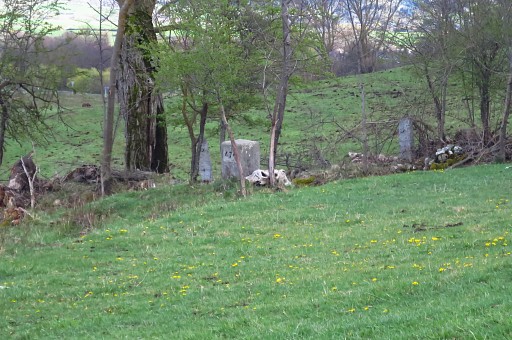
and then - in the far distance - |
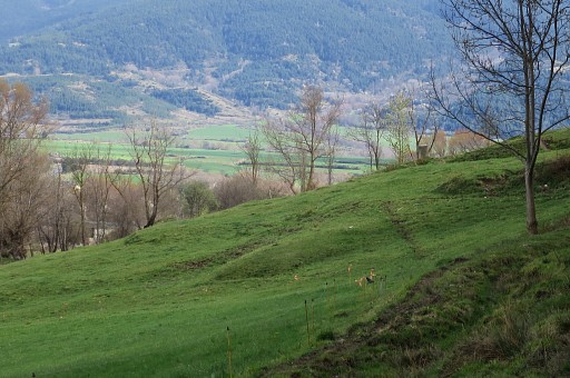 |
bm475 comes in sight. |
 |
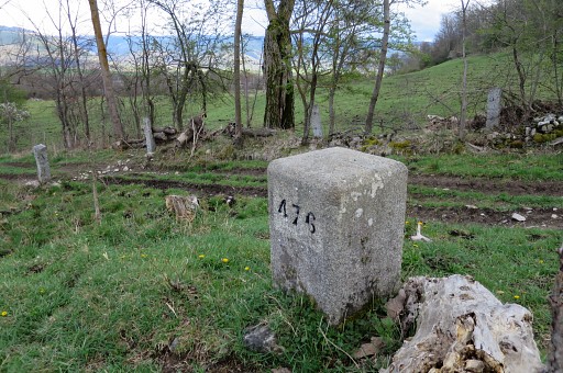
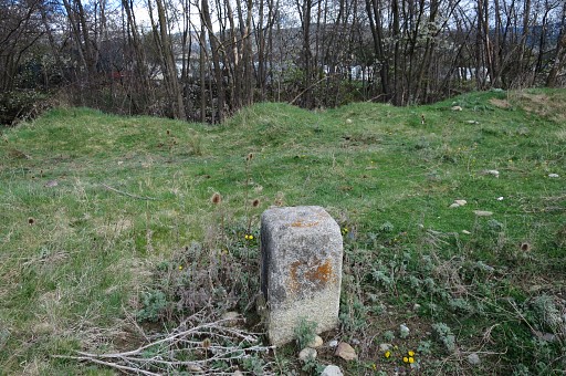
Bm475 |
 |
Bm475 |
 |
Bm475, looking back |
 |
Bm475, backside |
 |
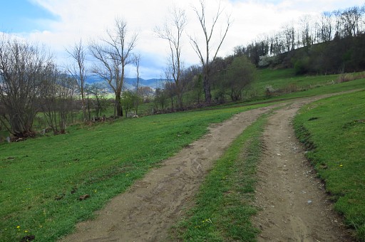
Bm475 with your route ahead. If you descend SE, you will get at a dirtroad cq track. |
 |
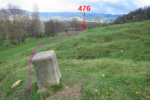
A bit further S on that dirtroad, bm476 is in the corner of the meadow. |
 |
Bm476 |
 |
Bm476 |
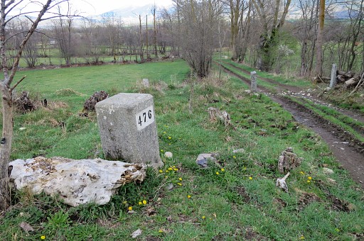 |
Bm476 |
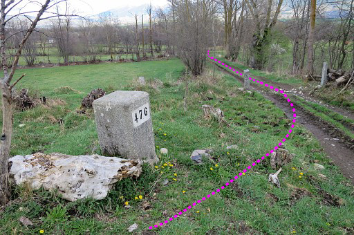 |
Same picture, now with the 'official' route. |
 |
Bm476, looking back from where I came from |
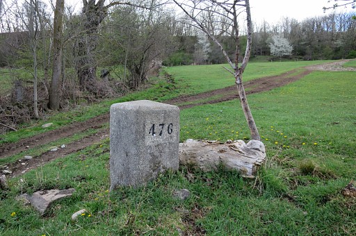 |
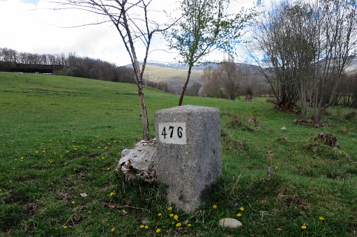
Bm476 |
 |
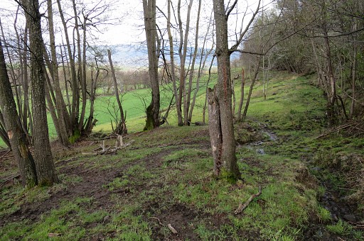
Then I proceed SSE to the bridge. A direct route is blocked by a field with horses and cows. So I go along the edge of the field and also on an overgrown trail along the river, meant for fishing. All done with the intention not to bother the cows or horses or farmers. It's not an easy route along the river, if possible stick to the meadow. |
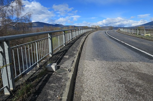 |
Finally I arrive at the (new) bridge over the river Rahur |
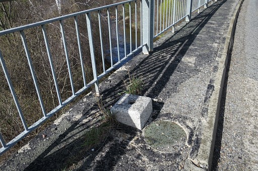 |
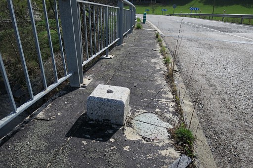
with its own - unnumbered - bordermarkers |
 |
on both |
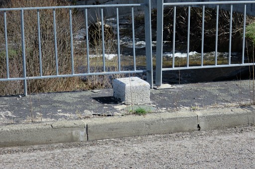 |
sides. |
 |
|
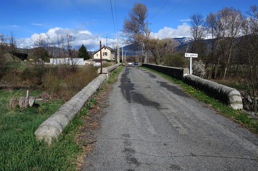 |
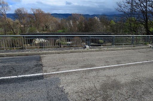
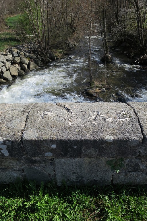
Parallel to the new bridge is the old bridge |
 |
where bm477 is engraved at both balustrades. |
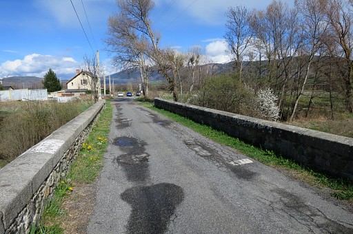
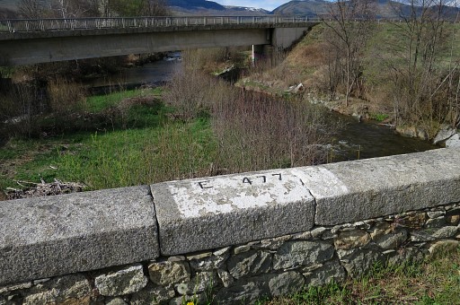 |
Bm477, the N-balustrade with a view to the new bridge. |
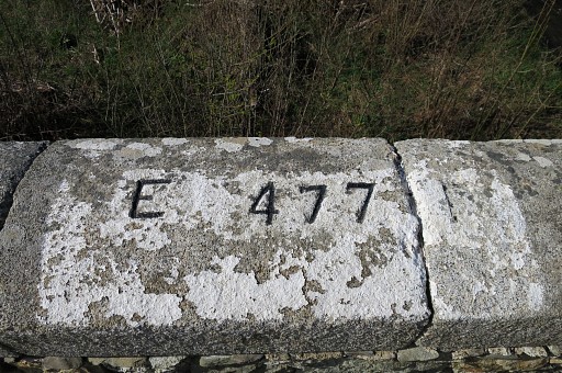 |
Bm477, the N-balustrade |
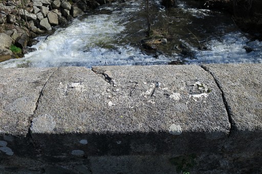 |
Bm477, the S-balustrade |
 |
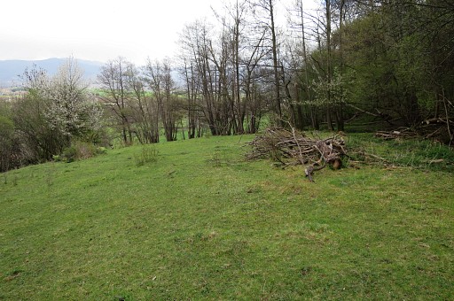
Bm477, the S-balustrade The remaining two bm's of today are easy to do because the two fields in question are empty. |
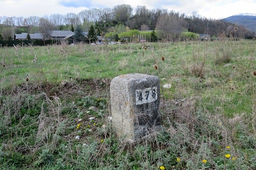 |
Bm478es, with camping Stel in the background. |
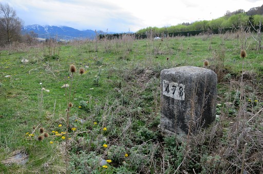 |
Bm478es |
 |
Bm478es, looking towards the river with at the other side glimpses of the caravans where twinbrother bm478fr is located. |
 |
Then along the busy road towards bm479es There's an entrance to get into the field of bm479es. This picture: looking towards the river with on the other side the children's home with |
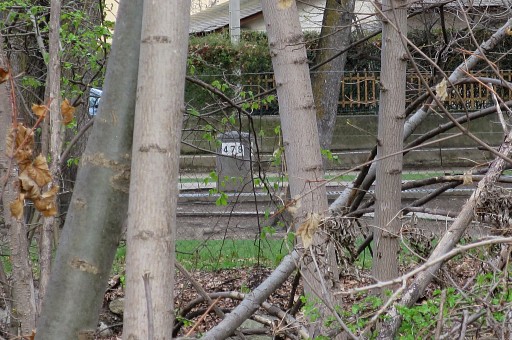 |
bm479fr visible. |
 |
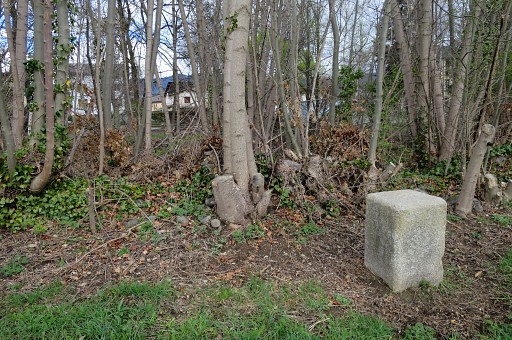
Bm479es |
 |
Bm479es |
 |
Bm479es, last picture of today. I walk back to my car and check in at the cosy pension of Fonda Cerdanya, content of today's production. |