|
The
bordermarkers of the Pyrenees : all my trips
 |
|
| -
saturday 12 september
2020 - Backpacking along 272-279 -> day 1: doing 272 |
 |
 |
Summary:
part of a series of 6 daytrips and 1 multiday trip in september 2020 in
the Pyrénées Atlantiques. This is trip 7 - day 1 Today: from the camping in Lescun hiking to the Sources de Marmitou. After pitching my tent, a short trip to bm272 and a reconnaissance of the trail up the Añelarra-ridge. Weather: sunny, warm |
 track-20200912.kml
(click to open this trip in Google Earth or copy link to Google Maps; click right on this link to download gpx-version). The gps-track has not been manually corrected which explains the inaccuracy and misalignment at some points. For cartographic backgrounds: see the cartography-page Gps-waypoints of all bordermarkers (most recent version): kml: esfr-bordermarkers-all-waypoints.kml gpx: esfr-bordermarkers-all-waypoints.gpx (with elevation added by gpsvisualizer.com) |
|
 |
According to Garmin
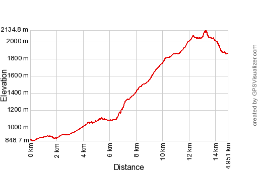
Basecamp (uncorrected track): Distance: 14,9 km Max-height: 2123m Min-height: 853m Elevation: +1400m -404m Total elevation: 1804m Start 9:06 Finish 16:47 Total time: 7:41 |
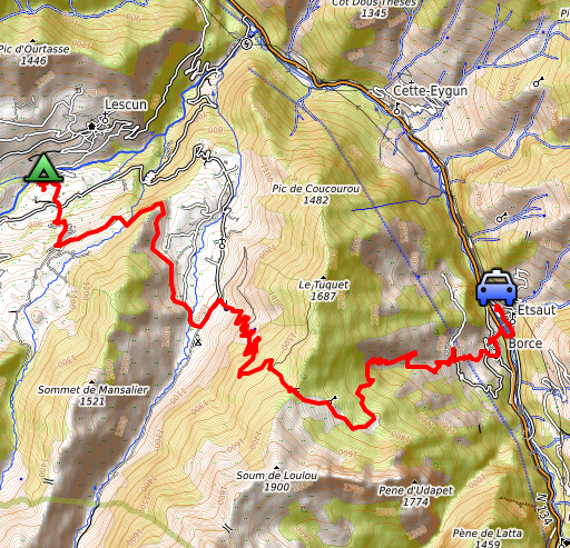 |
Yesterday, I left the camping in Arette and parked my car in Etsaut and followed the GR10-trail to the camping in Lescun. Seemed an easy approach to Lescun but I didn't look well on the maps. You need to climb ± 1000m to Col de Barranq and that was hard in the full sun and with a full backpack. Then a long descent to Lescun. My target was Sources de Marmitou but I stopped at the Lescun-camping around 4pm. |
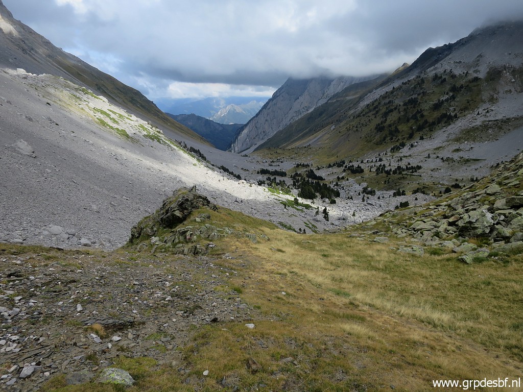
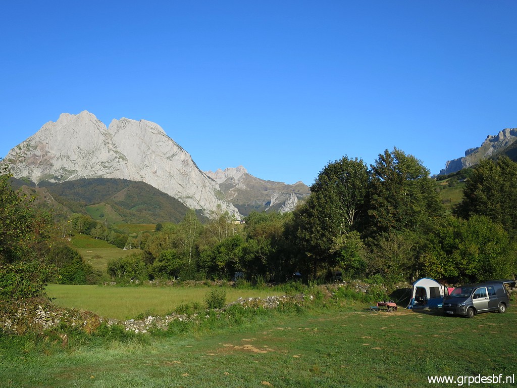 | After a mediocre night of sleeping, I continue. This picture: from the camping, looking in the direction of today and that is (click photo to enlarge) |
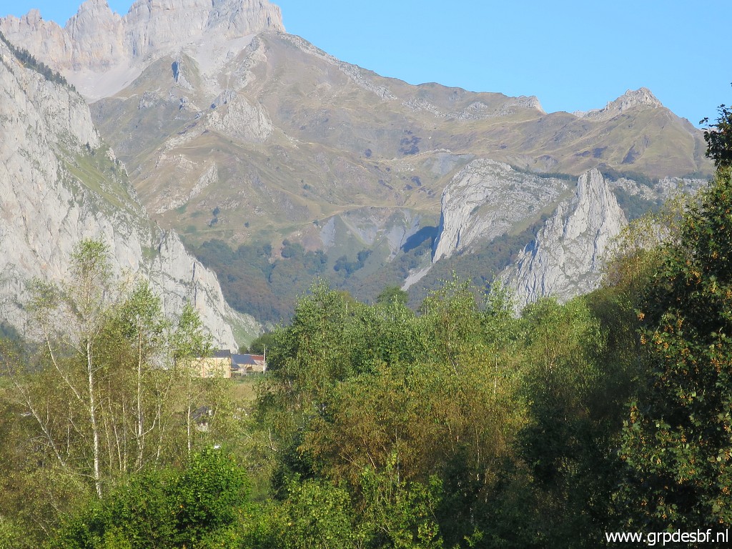 | first the beginning of the valley leading up to Sources de Marmitou. (click photo to enlarge) |
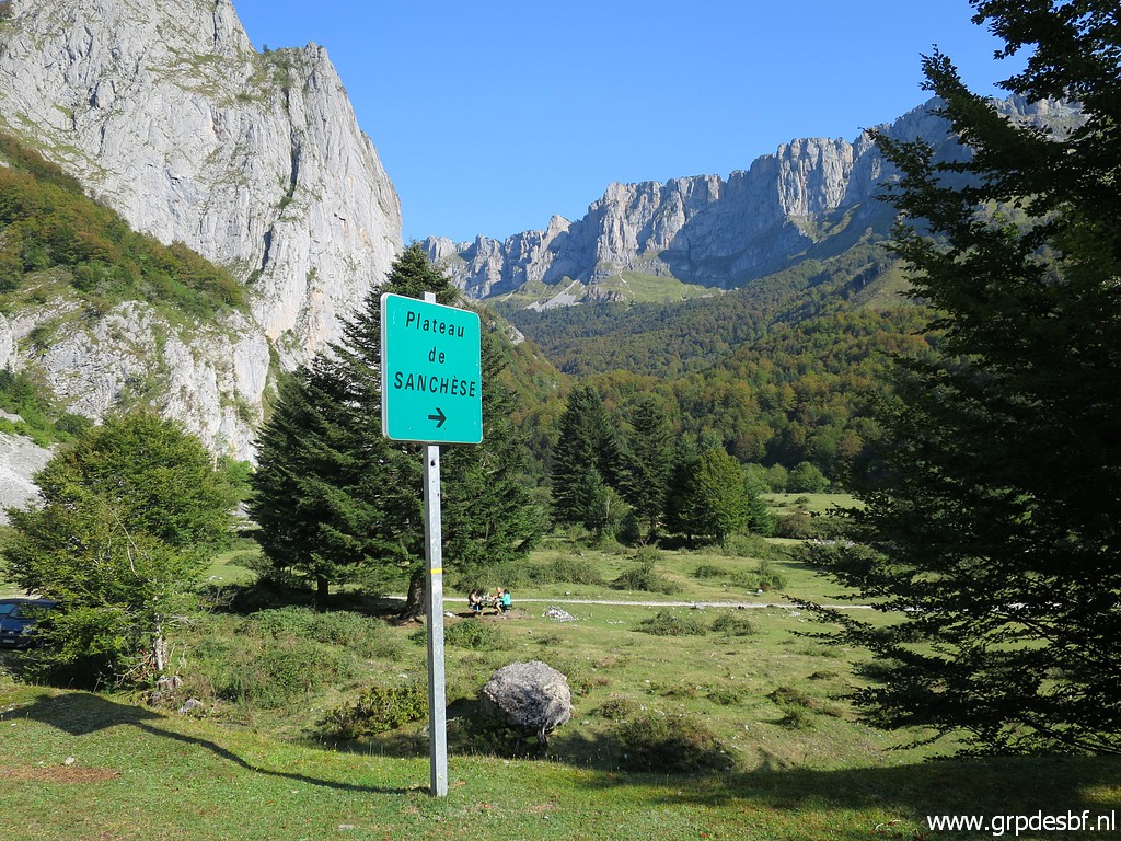
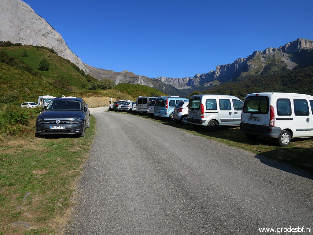 | On meandering roads I walk to the Plateau de Sanchèse. This is the parking before the final part of the (dirt)road to the Plateau. (click photo to enlarge) |
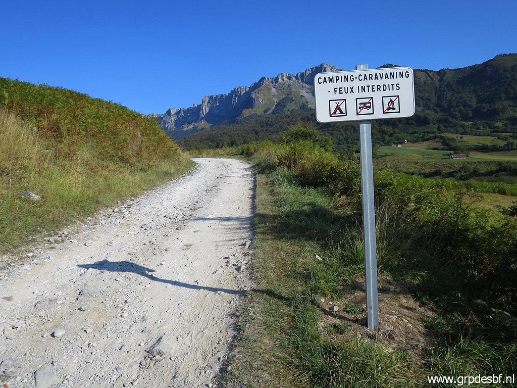 | That is still 2km walking and camping is forbidden. This dirtroad is no problem for ordinary cars and driving as such to the Plateau is not forbidden. (click photo to enlarge) |
 | Arriving at the beautiful and vast plains of (click photo to enlarge) |
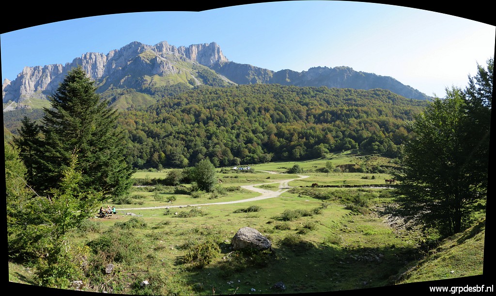 | Plateau de Sanchèse where I spot several campers and tents despite the ban on camping. It's a perfect place for a bivouac (click photo to enlarge) |
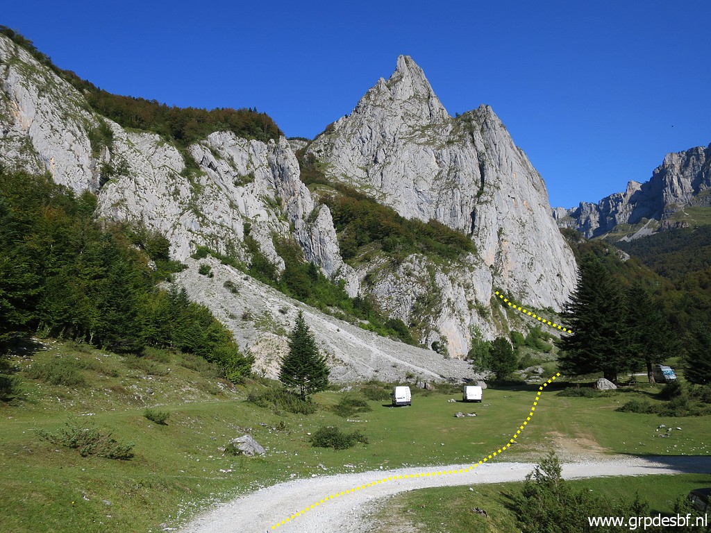 | This picture: the route up to the valley (click photo to enlarge) |
 | which climbs to Sources de Marmitou. (click photo to enlarge) |
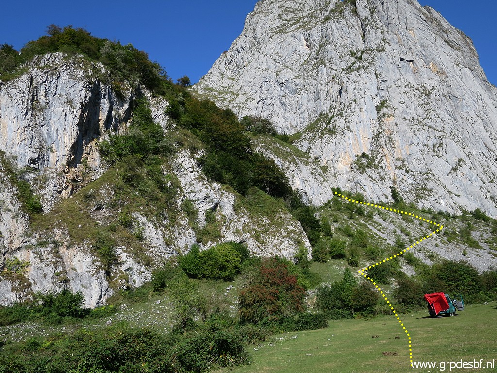
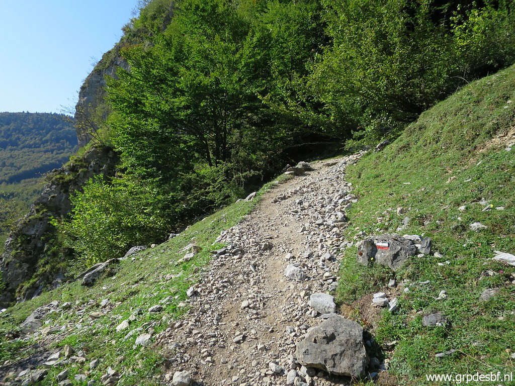 | Climbing along the path, (click photo to enlarge) |
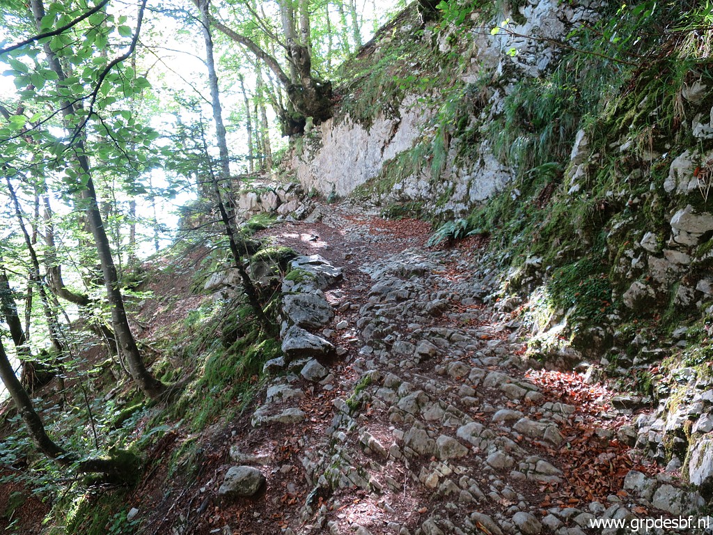 | partly rocky, to (click photo to enlarge) |
 | to the beginning of the valley which (click photo to enlarge) |
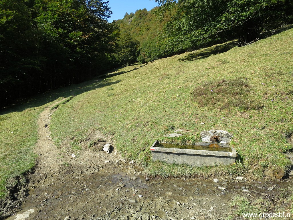
 | opens soon in full glory. To the left the cabin of Cayolars d'Anaye. It took me one hour from the Plateau to this cabin. (click photo to enlarge) |
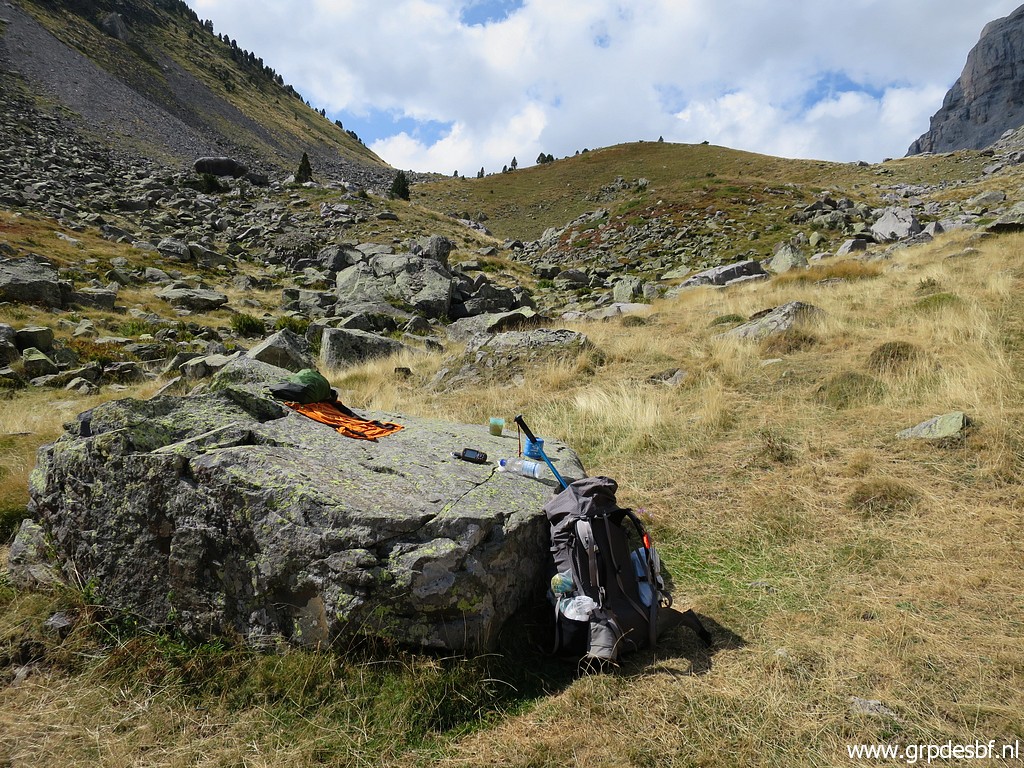 | This is in fact the second day of my multiday trip and my backpack is feeling heavy. On this rock, I have my lunch and take a nap lying on the warm surface of the rock. (click photo to enlarge) |
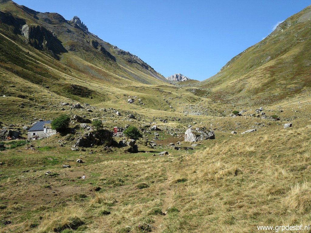
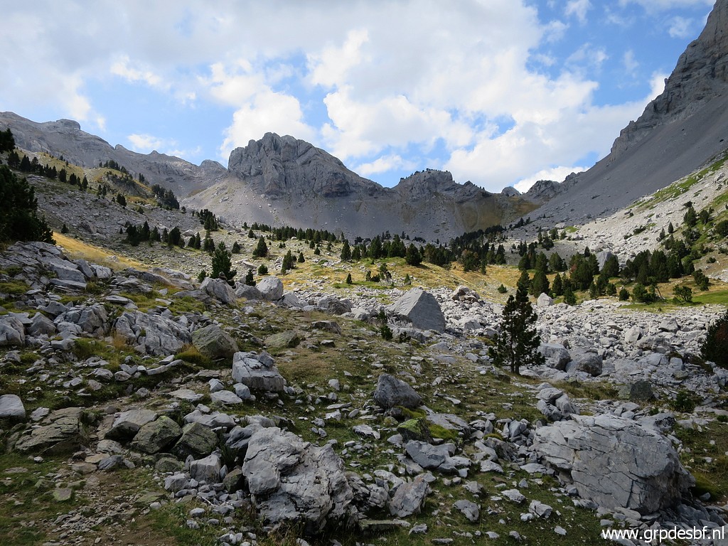 | After an hour - from the cabin - arriving at the upper valley with (click photo to enlarge) |
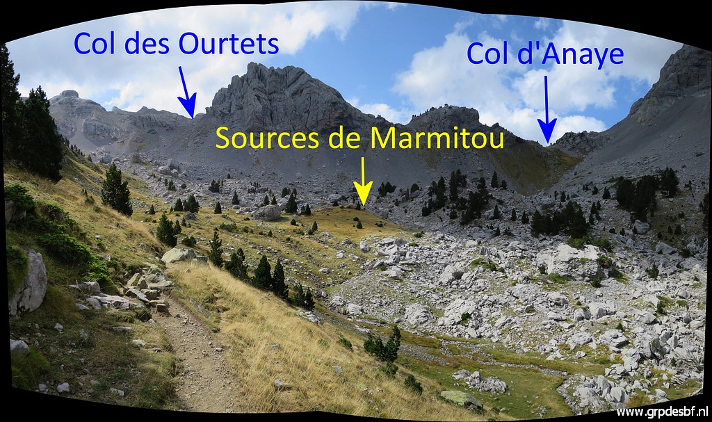 | the Sources the Marmitou and the 2 Cols pointed out on this picture. (click photo to enlarge) |
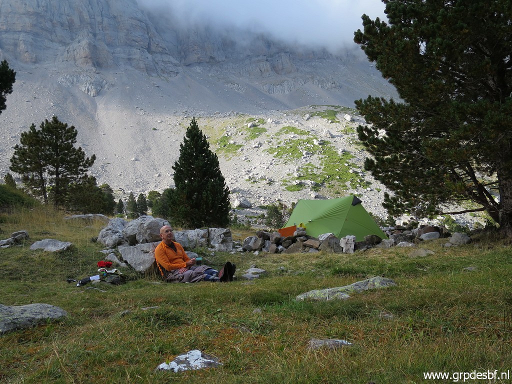
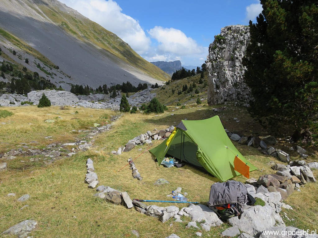 | I find a perfect spot for my tent, in a circle of stones. (click photo to enlarge) |
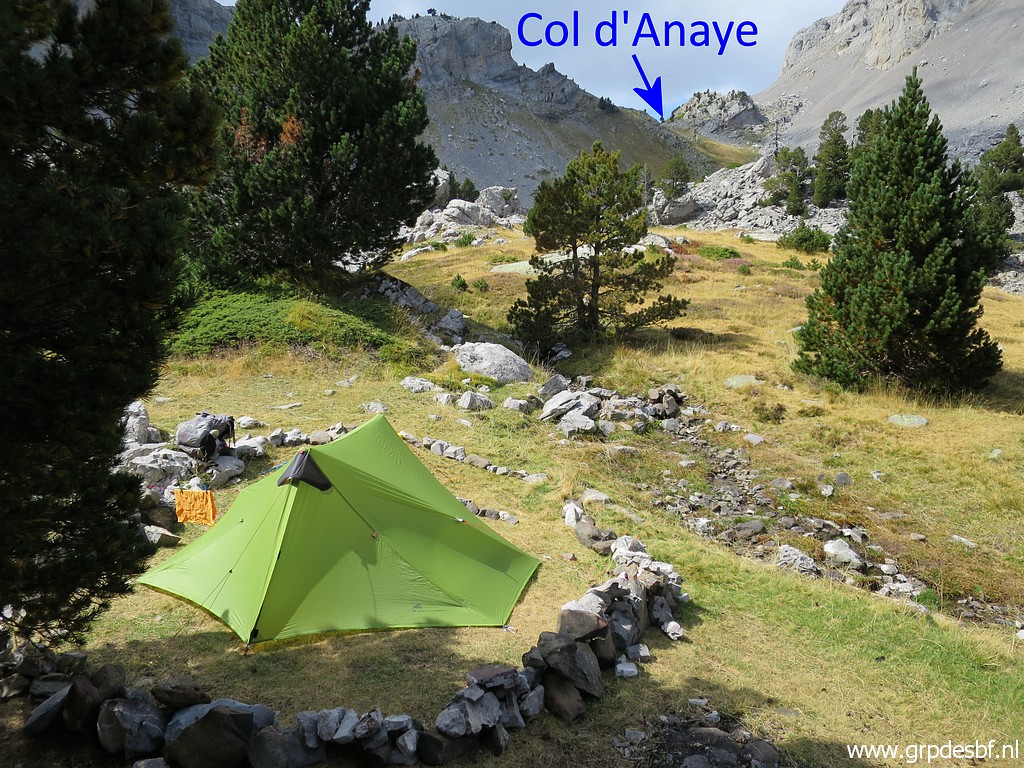 | With a sort of daypack, I will do a hence and forth trip to Col d'Anaye. (click photo to enlarge) |
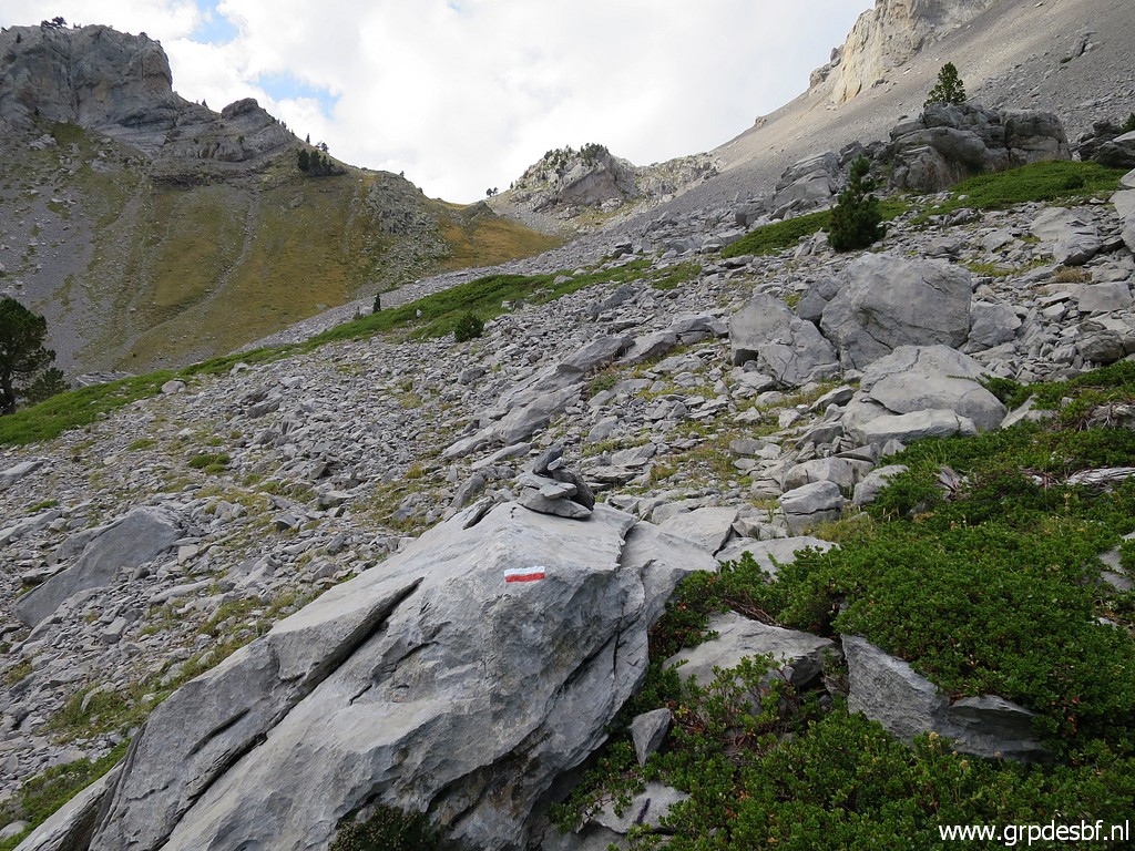 | Further on towards Col d'Anaye, I spot red-white waymarks. They are from the GRT12/13-trail between Refugio de Belagua in Spain via Col d'Anaye to the Refuge de l'Abérouat in France. See this pdf with a map and information and this gpx-file. (click photo to enlarge) |
 | Arriving at a higher level (click photo to enlarge) |
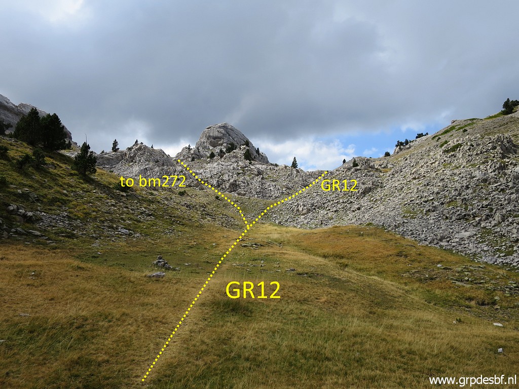 | with a bifurcation ahead (click photo to enlarge) |
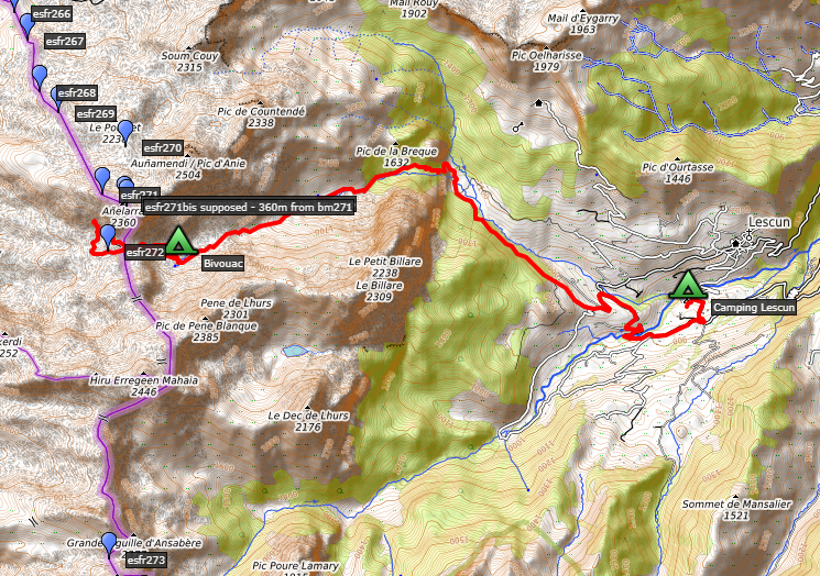
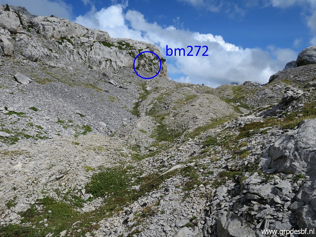
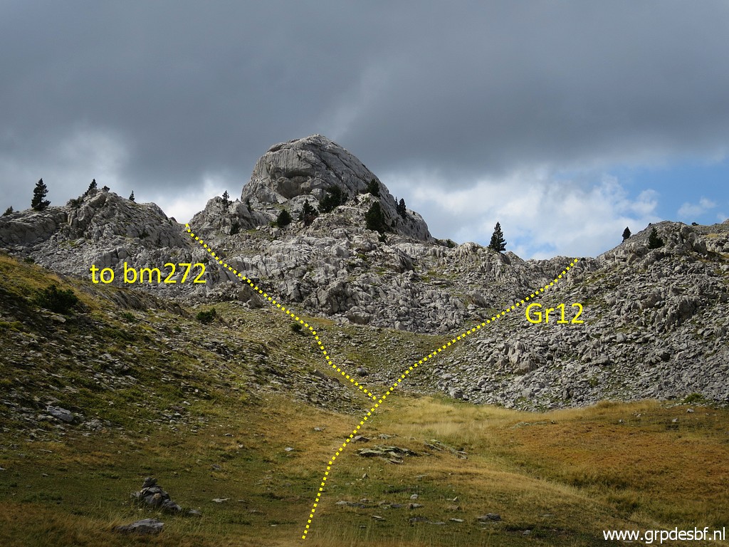 | to bm272 and the Col d'Anaye (or Insole). I suppose that the pass where bm272 can be found was the principal passage in the 19th century. (click photo to enlarge) |
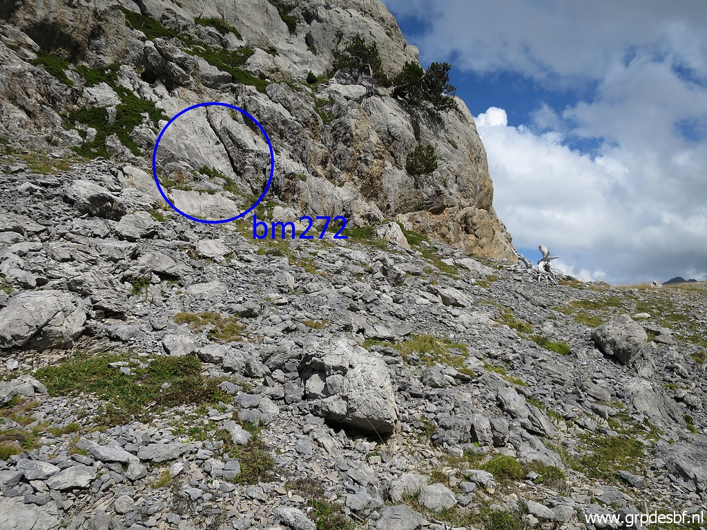
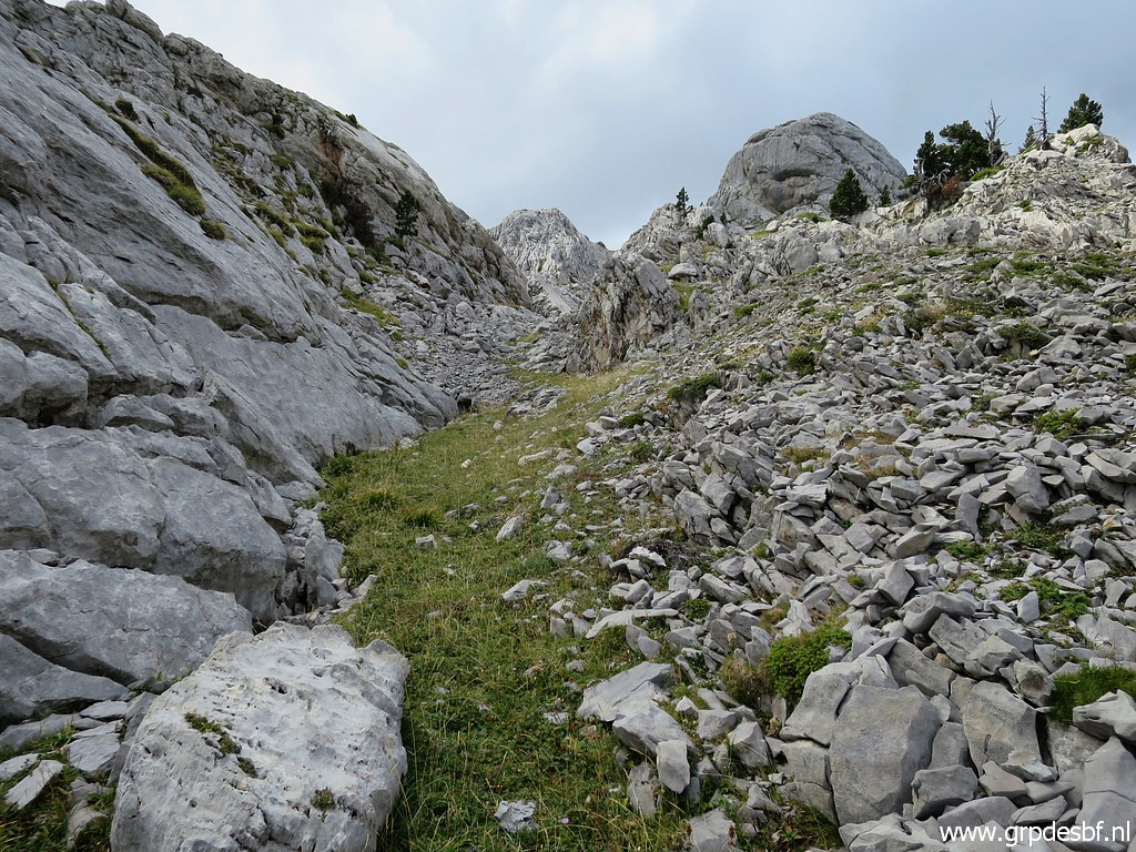 | I head for bm272. No trails but not difficult to find your way. (click photo to enlarge) |
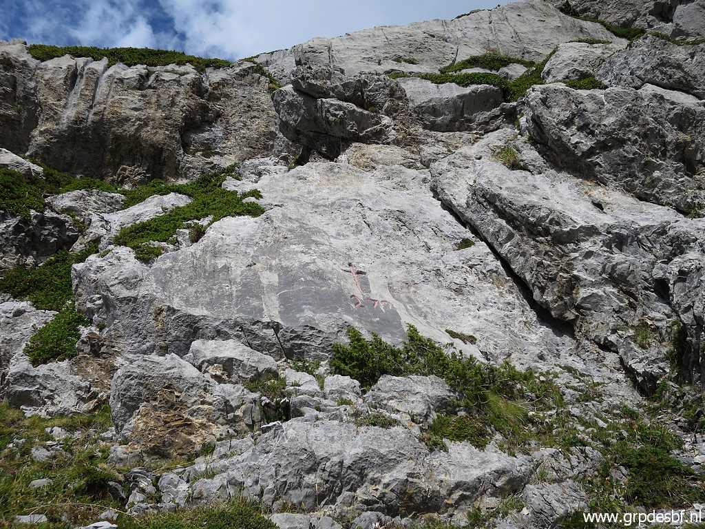
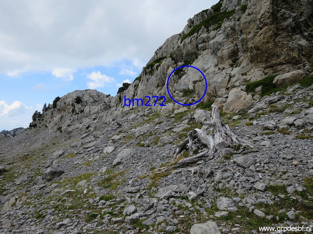 | Arriving at bm272. Spot the dead tree in front, that helps locating bm272. (click photo to enlarge) |
 | Bm272 (click photo to enlarge) |
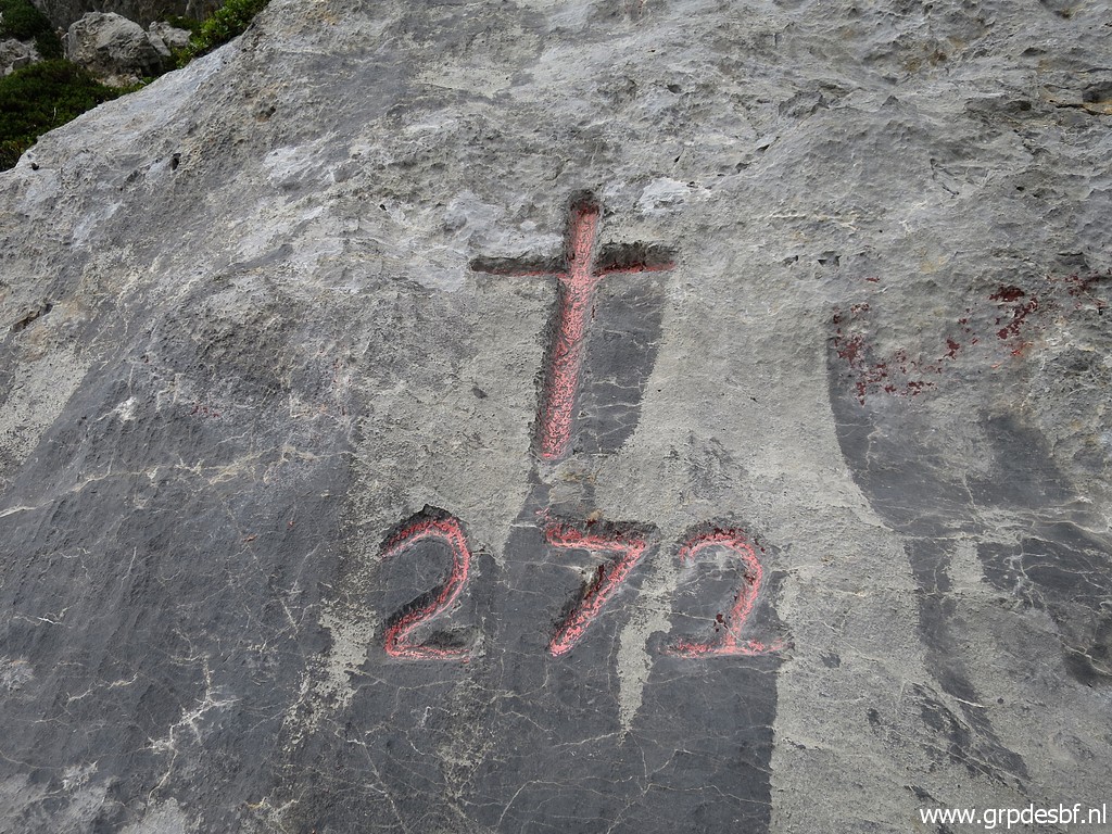 | Bm272 (click photo to enlarge) |
 | Bm272 (click photo to enlarge) |
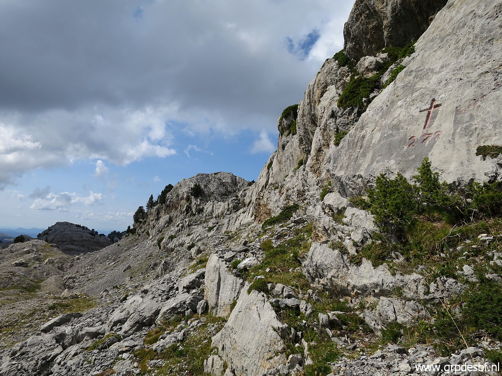 | Bm272, looking to the west where I will continue. (click photo to enlarge) |
 | Looking back to bm272, spot again the dead tree. (click photo to enlarge) |
 | Further on, looking back to bm272. (click photo to enlarge) |
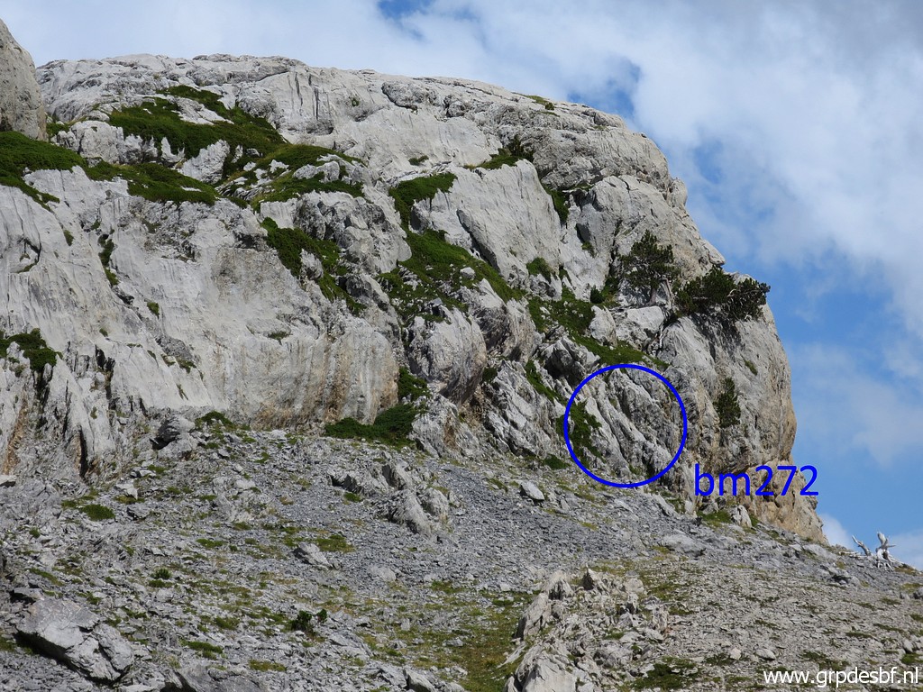 | Zoom-in to bm272. (click photo to enlarge) |
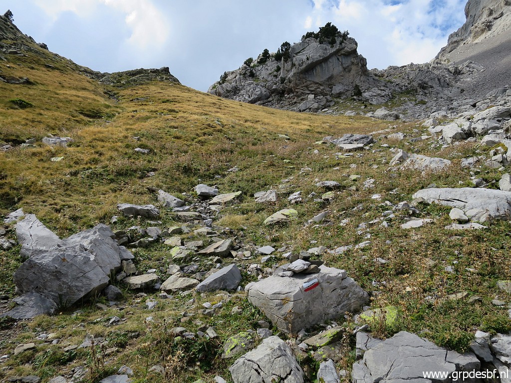
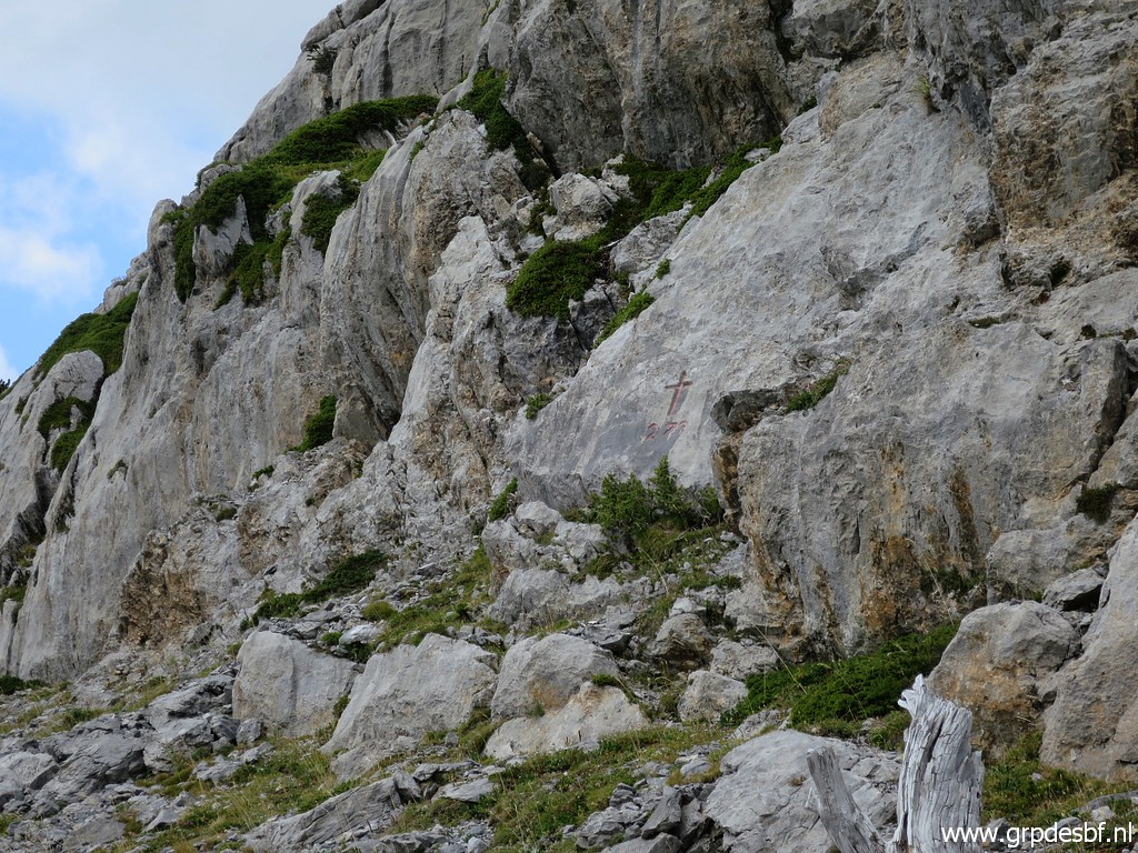
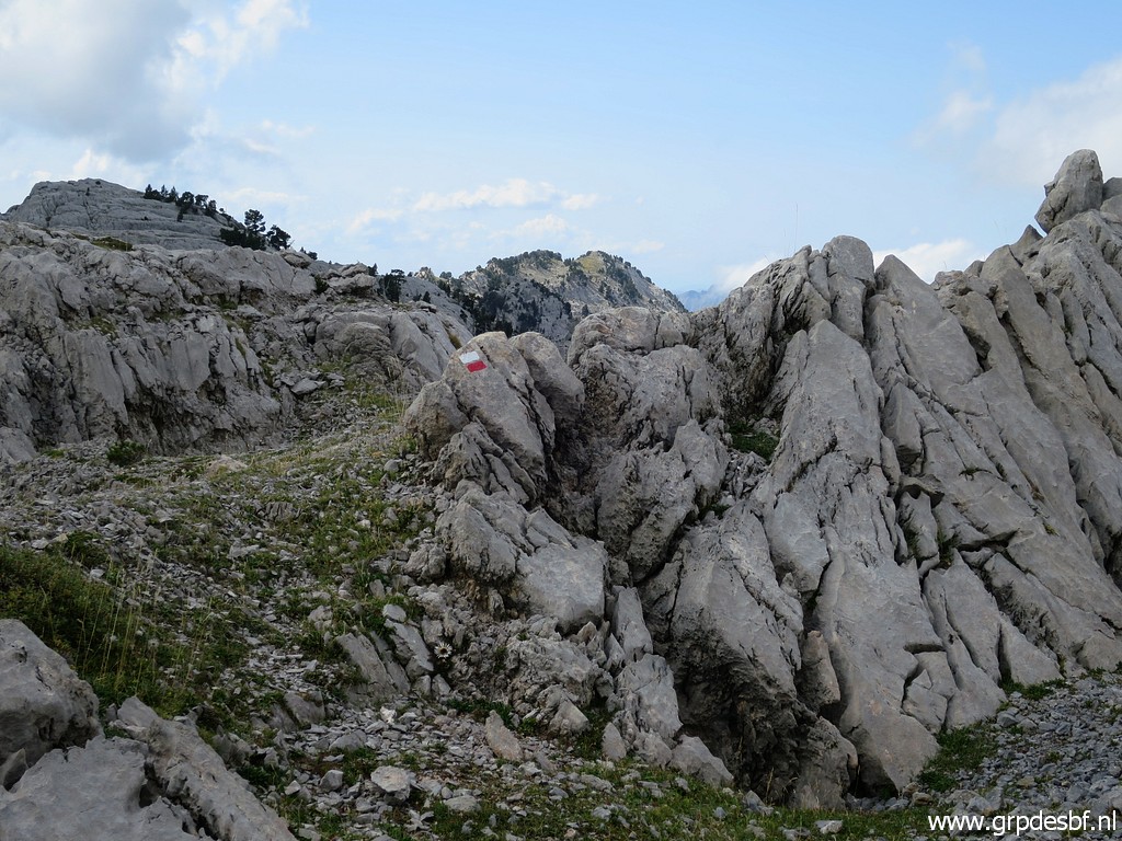 | About 200m W of bm272, I come across these red-white waymarks. They are from a trail (GR12) from Refugio Belagua to Col d'Anaye and returning via a southern traject back to the Refugio. (click photo to enlarge) |
Let's show that on a map (derived from this pdf):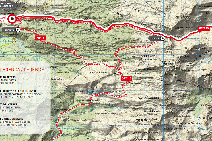 What is very interesting is that there is a GRT13-extension to the south. This GRT13 is a connection between the French GR10-trail and the Spanish GR11-trail. At one point one can leave the GRT13 and follow trails to Col de Pétragème (bm273). That provides an alternative route from bm272 to bm273 (largely waymarked) instead of the route I will follow tomorrow. Let's show this in more detail on the following map: 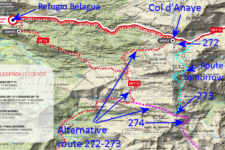 More about this alternative route tomorrow. |
|
 | Back to today: I follow the red-white waymarks through rough terrain towards Col d'Anaye. (click photo to enlarge) |
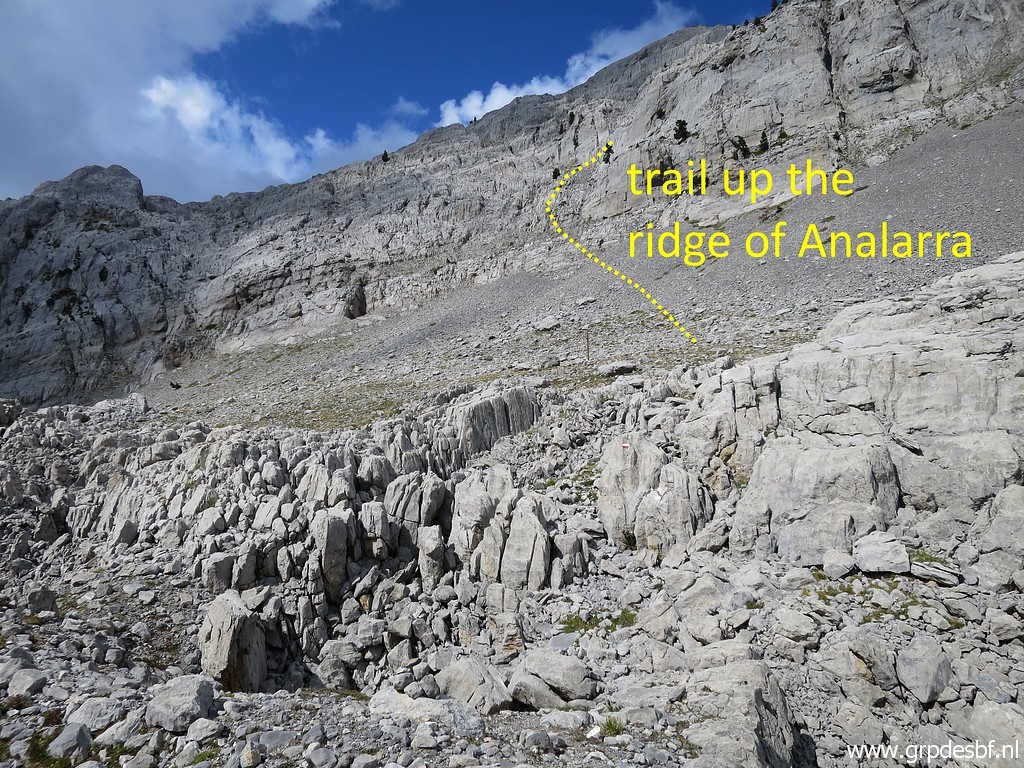 | My target is the trail steep up to the Añelarra-ridge. (click photo to enlarge) |
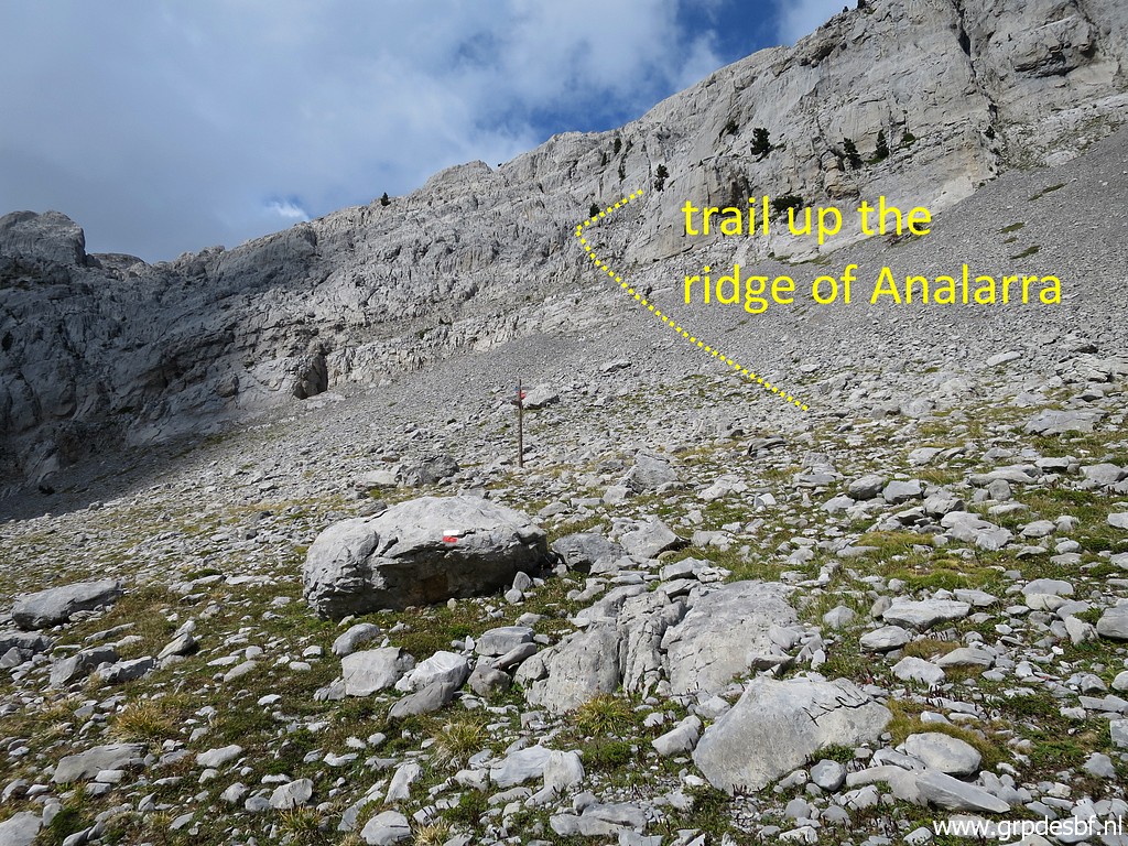 | Now I am close to the waysign-post at the Col. I want to try again that trail. I did that first on 1-9-2013. (click photo to enlarge) |
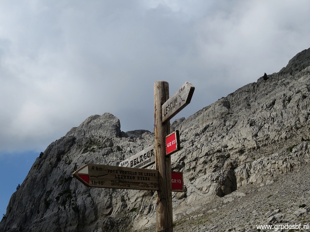 | The signpost. (click photo to enlarge) |
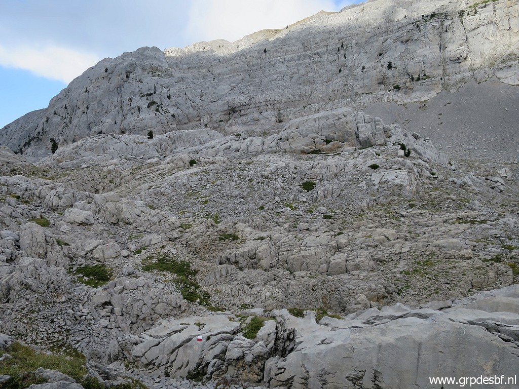
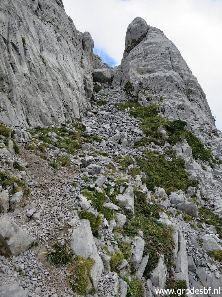
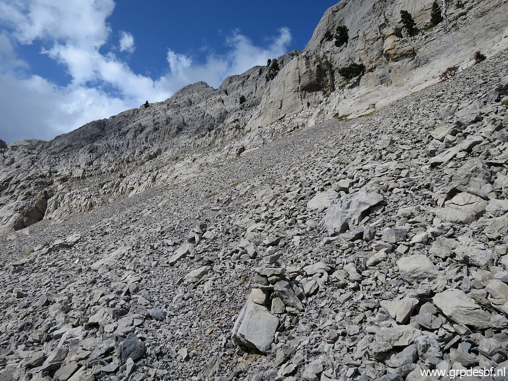 | I start - from the signpost - climbing along a trail towards the rockwall. (click photo to enlarge) |
 | Getting closer to the rockwall. (click photo to enlarge) |
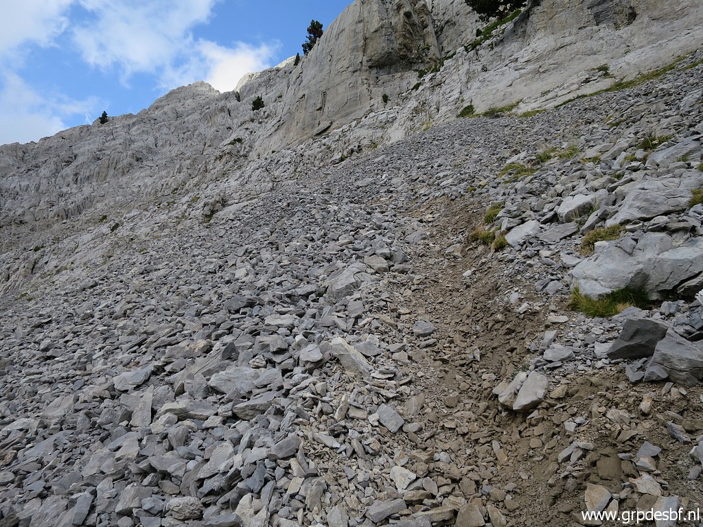
 | Having arrived at the rockwall and looking back. (click photo to enlarge) |
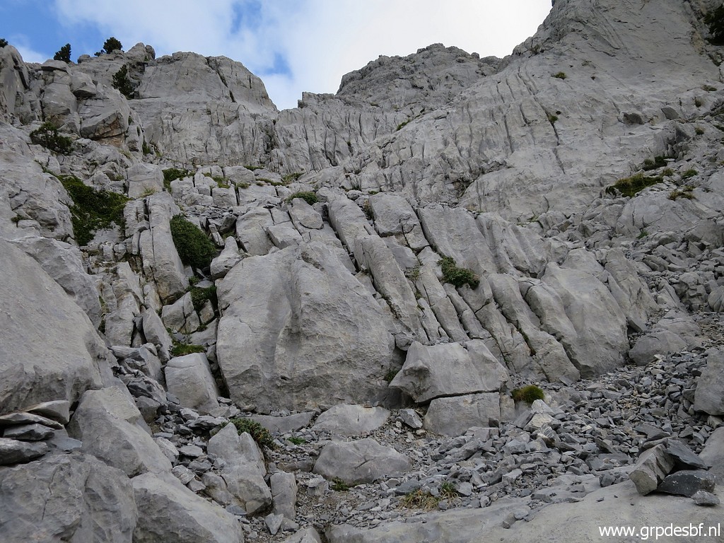 | Then it's a bit of rock-scrambling until (click photo to enlarge) |
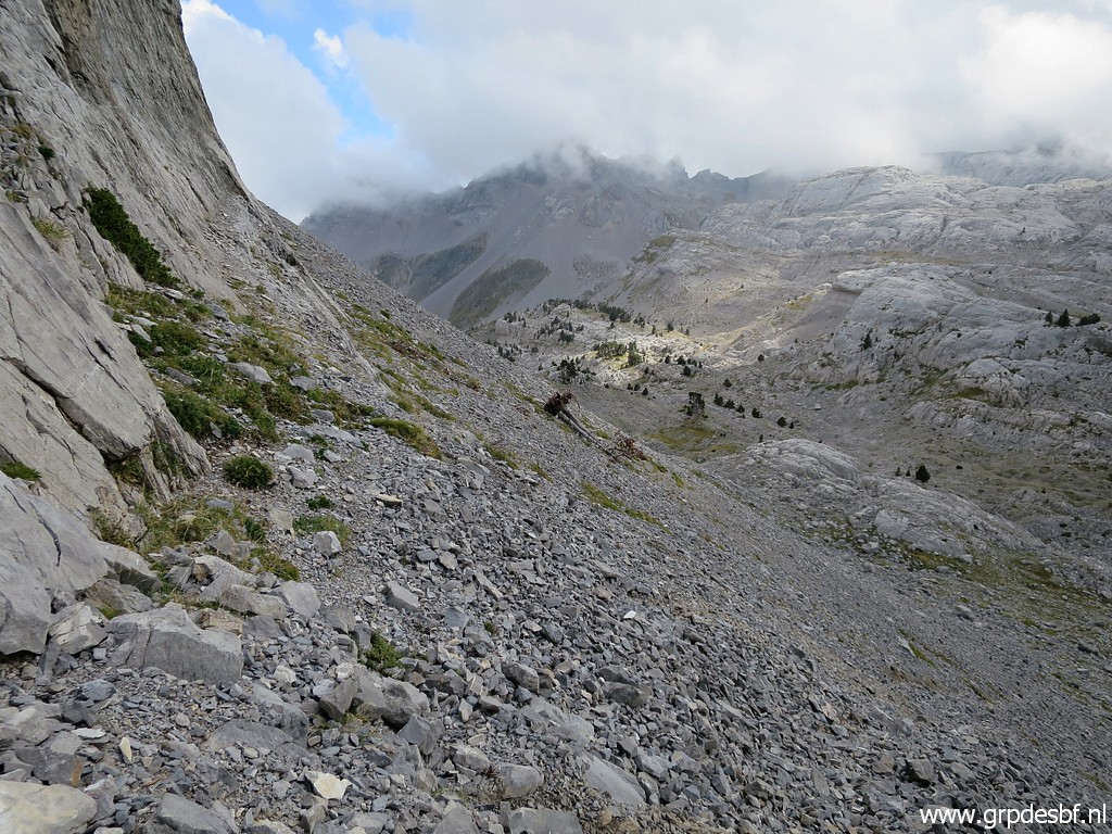
 | you are at the foot of this corridor. (click photo to enlarge) That's where I stop. Since 2013 the trail has become more slippery with loose grit. Or: I have become more cautious. And it's already too late to continue to the ridge. But most of all, I doubt if this is a safe enough route from bm271 up on the ridge down to bm272. My Grpdesbf-trail is meant for full backpacking and descending with a full backpack on this slippery underground seems hazardous. I decide that it's better to skip this part in my itinerary. |
What does that mean for my GRPdesBF-trail? The stage from bm262 to Sources de Marmitou will then change as follows: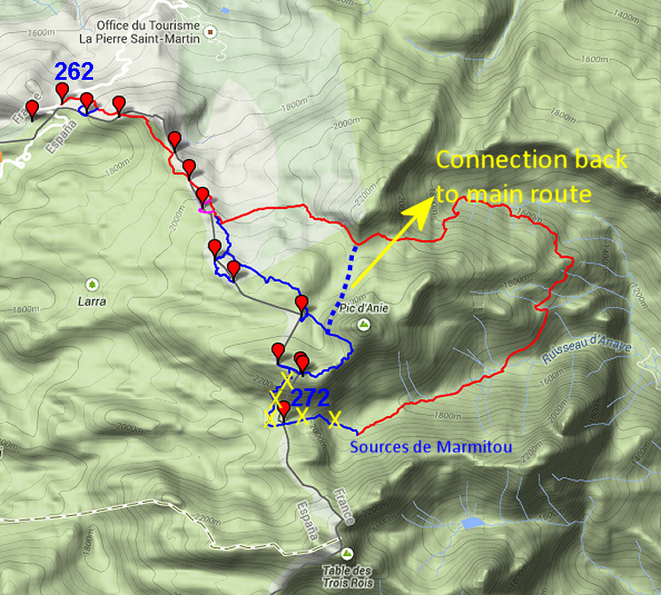 And the ne map becomes as follows: 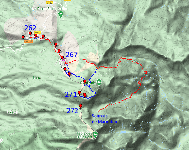 |
|
 | Enough about the routes. I return to Sources de Marmitou, (click photo to enlarge) |
 | to my tent where I arrive around 5pm. So time enough for cooking, eating and preparing myself for the night. (click photo to enlarge) |