|
The
bordermarkers of the Pyrenees : all my trips
 |
|
| -
sunday 13 september
2020 - Backpacking along 272-279 -> day 2: doing 273-274 |
 |
 |
Summary:
part of a series of 6 daytrips and 1 multiday trip in september 2020 in
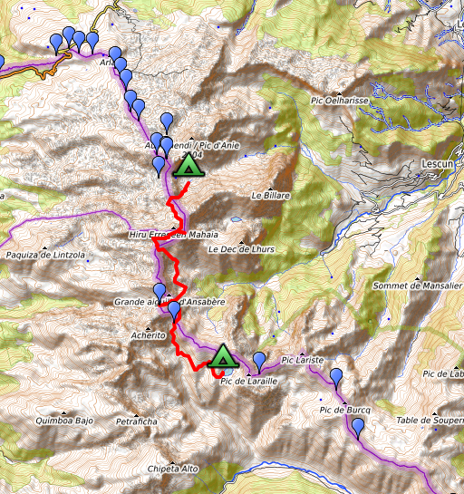
the Pyrénées Atlantiques. This is trip 7 - day 2 Today: from the Sources de Marmitou climbing via Col des Ourtets to the Table des Trois Rois. From Col d'Esqueste traversing on the French side to Col de Pétragème (bm273). Then in a semicircle to Col de la Chourique (bm274) and continuing to Lac de la Chourique. Weather: splendid |
 track-20200913.kml
(click to open this trip in Google Earth or copy link to Google Maps; click right on this link to download gpx-version). The gps-track has not been manually corrected which explains the inaccuracy and misalignment at some points. For cartographic backgrounds: see the cartography-page Gps-waypoints of all bordermarkers (most recent version): kml: esfr-bordermarkers-all-waypoints.kml gpx: esfr-bordermarkers-all-waypoints.gpx (with elevation added by gpsvisualizer.com) |
|
 |
According to Garmin
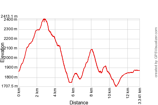
Basecamp (uncorrected track): Distance: 13,2km Max-height: 2407m Min-height: 1708m Elevation: +1191m -1239m Total elevation: 2430m Start 8:46 Finish 17:53 Total time: 9:07 |
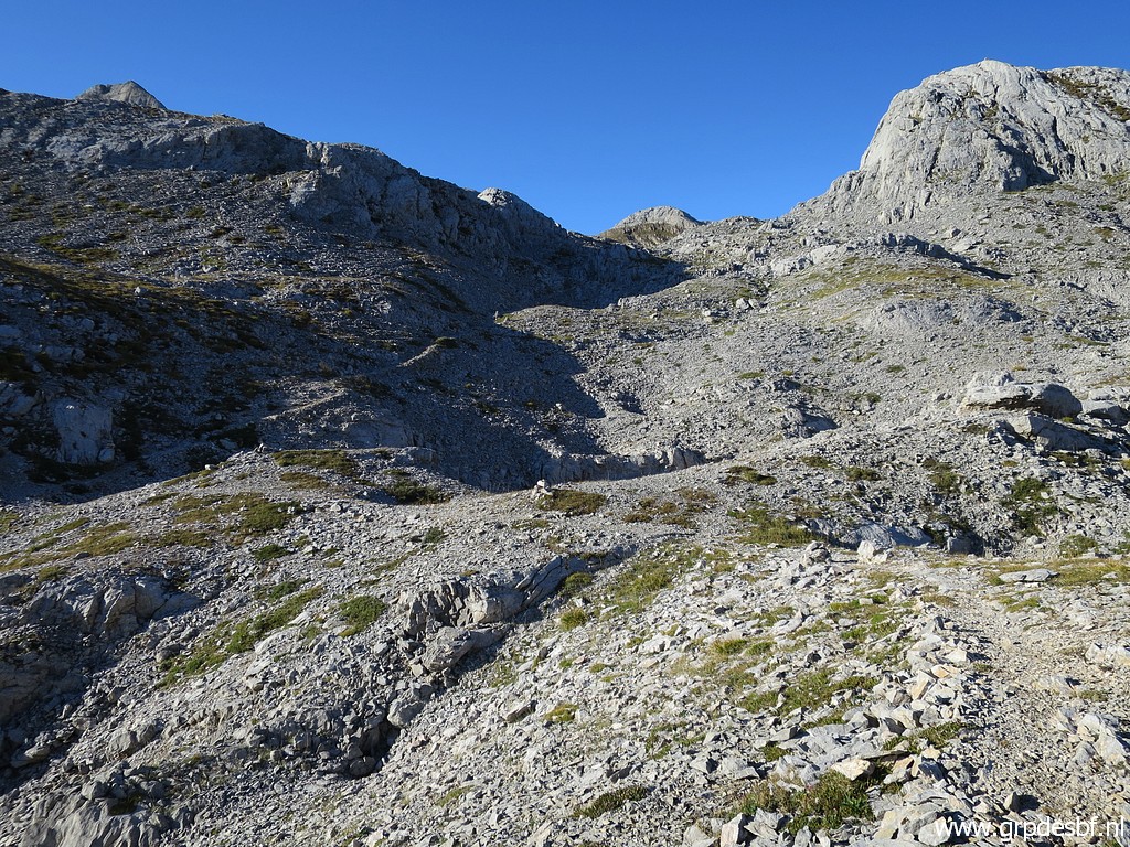
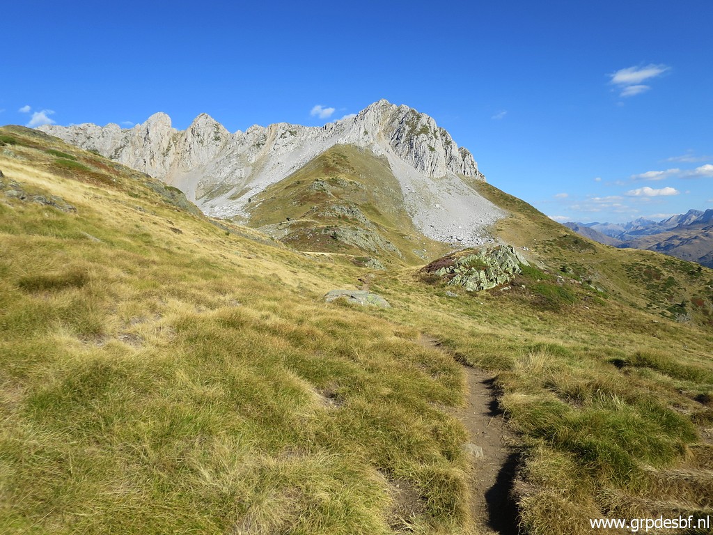
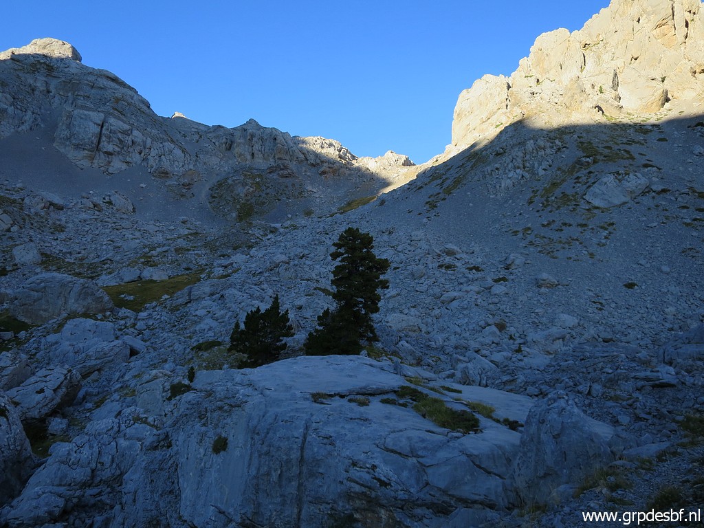 | After a long night of sleep, I climb towards Col des Ourtets on a trail waymarked with cairns. (click photo to enlarge) |
 | Getting closer to the Col. (click photo to enlarge) |
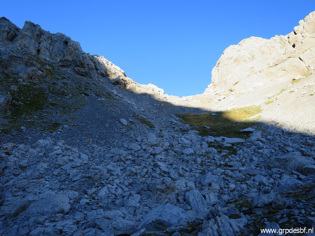
 | Arriving at the Col. (click photo to enlarge) |
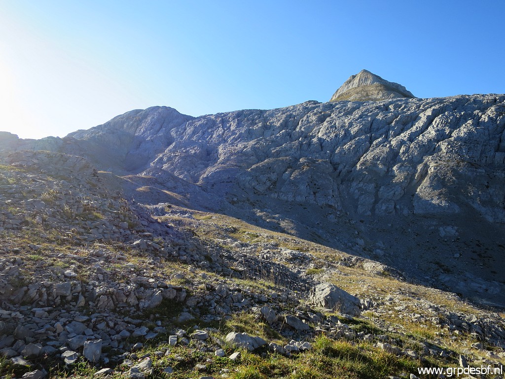
 | Looking forward to (click photo to enlarge) |
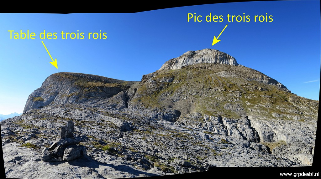
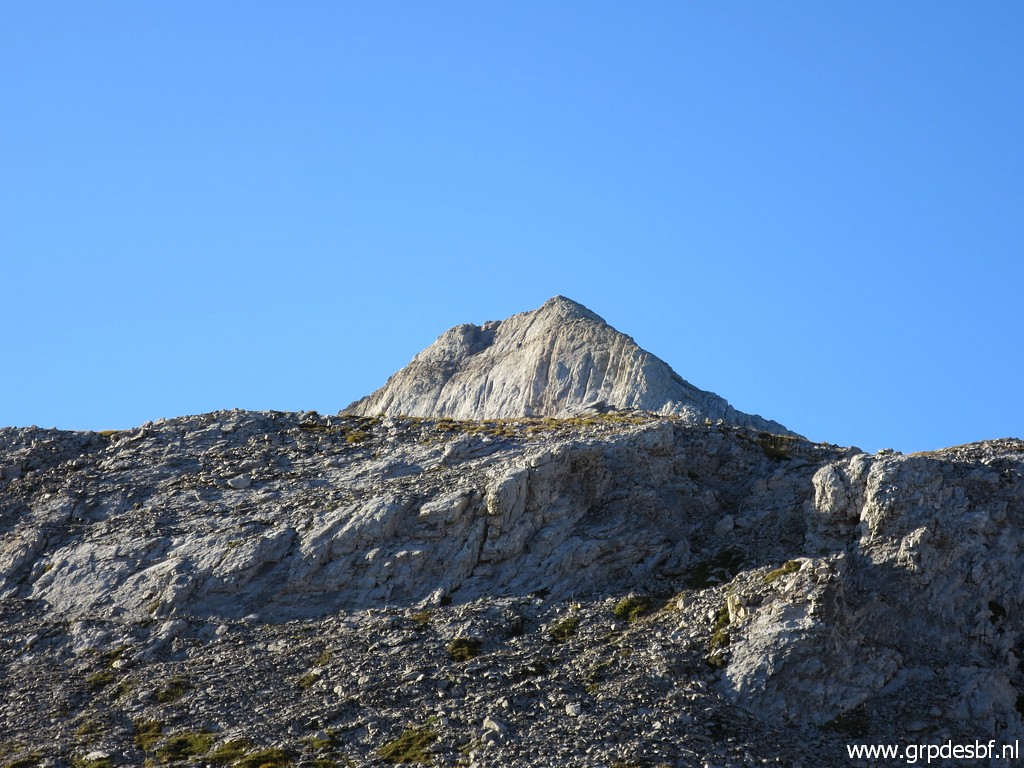 | Pic des Trois Rois. (click photo to enlarge) |
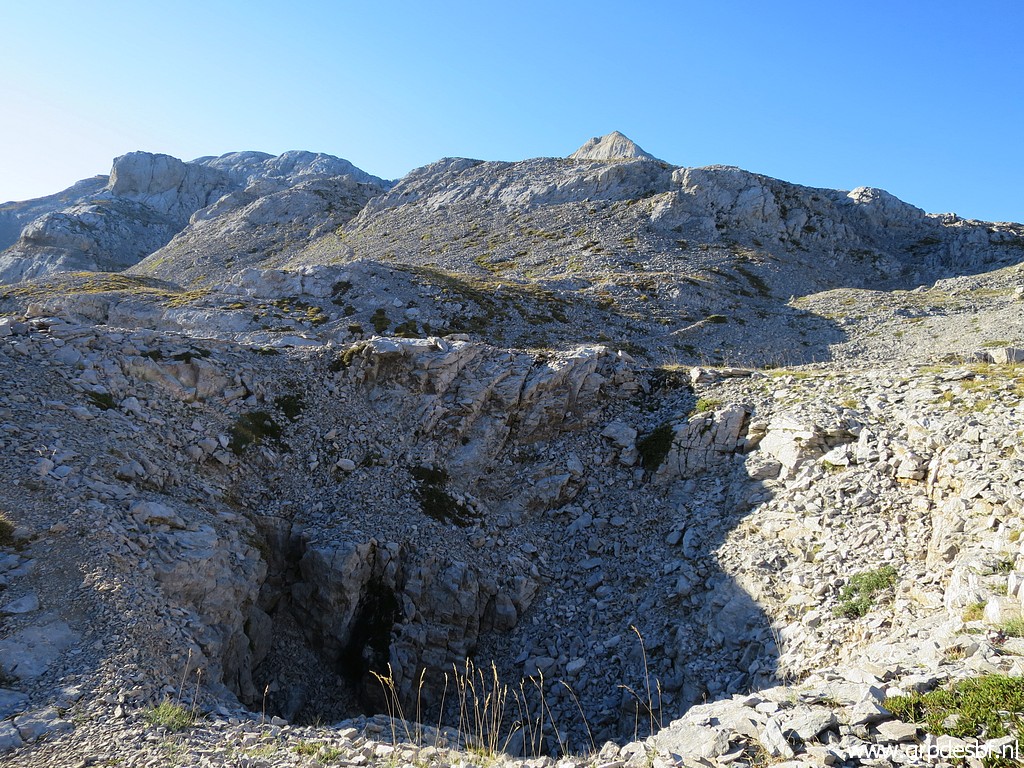
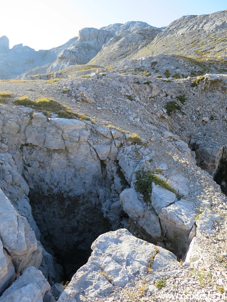 | An interesting hole (click photo to enlarge) |
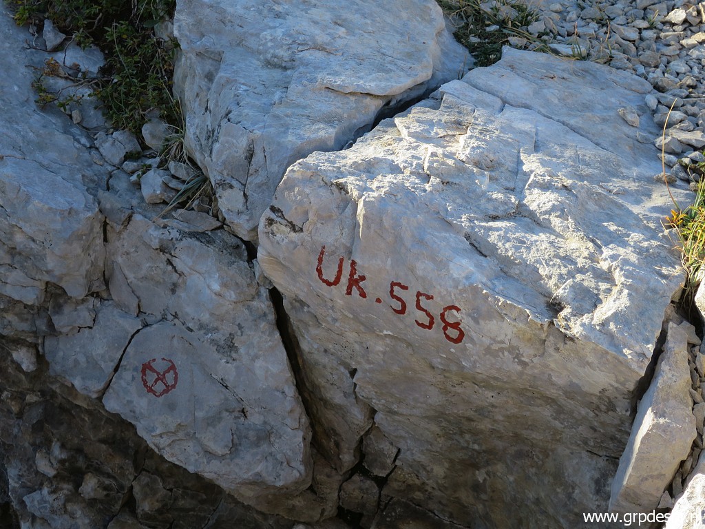 | with a number. (click photo to enlarge) |
 | I follow the cains, (click photo to enlarge) |
 | proceeding towards Pic des Trois Rois. (click photo to enlarge) |
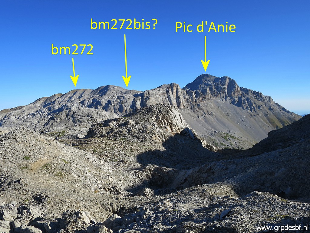 | Looking back with (click photo to enlarge) |
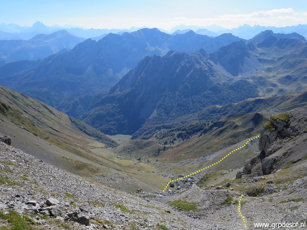
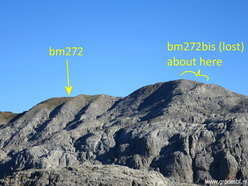 | a zoom-in to the ridge of Añelarra. Bm272 still exists (click photo to enlarge) |
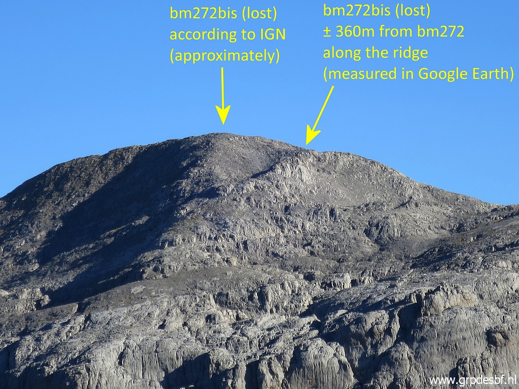 | but the cross 272bis is lost. As such ("détruite") it is indicated on the maps and it hasn't been found by anyone. This is a very interesting view of the possible spots for 272bis. The French IGN-maps still indicate the position but if we measure (in Google Earth) the distance of 360m (Treaty) between bm272 and 272bis, we arrive at place 45m to the SEE. But looking at this picture, the IGN-position seems more likely as a geophysical landmark. See also this page. (click photo to enlarge) |
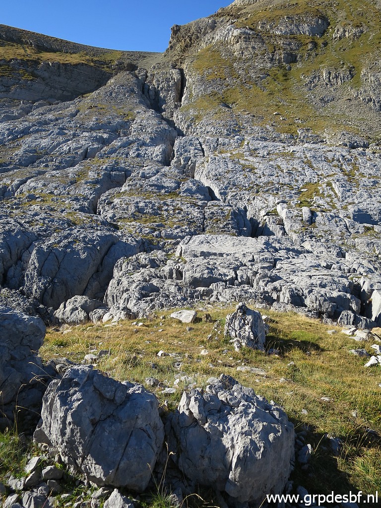
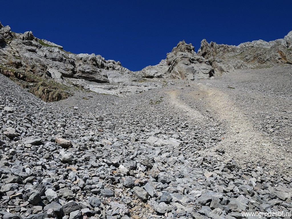
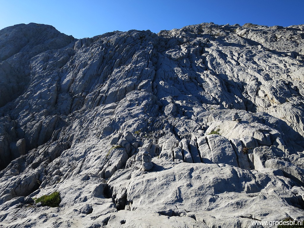 | The cairns-marked route brings me to this tilted rockwall (click photo to enlarge) |
 | which means some scrambling while climbing. Not that easy with a full backpack. (click photo to enlarge) But I can't remember this scrambling from my trip of 1-9-2012. |
If I compare these 2 routes from Col des Ourtets to Table des Trois Rois, the difference becomes very visible (up is south):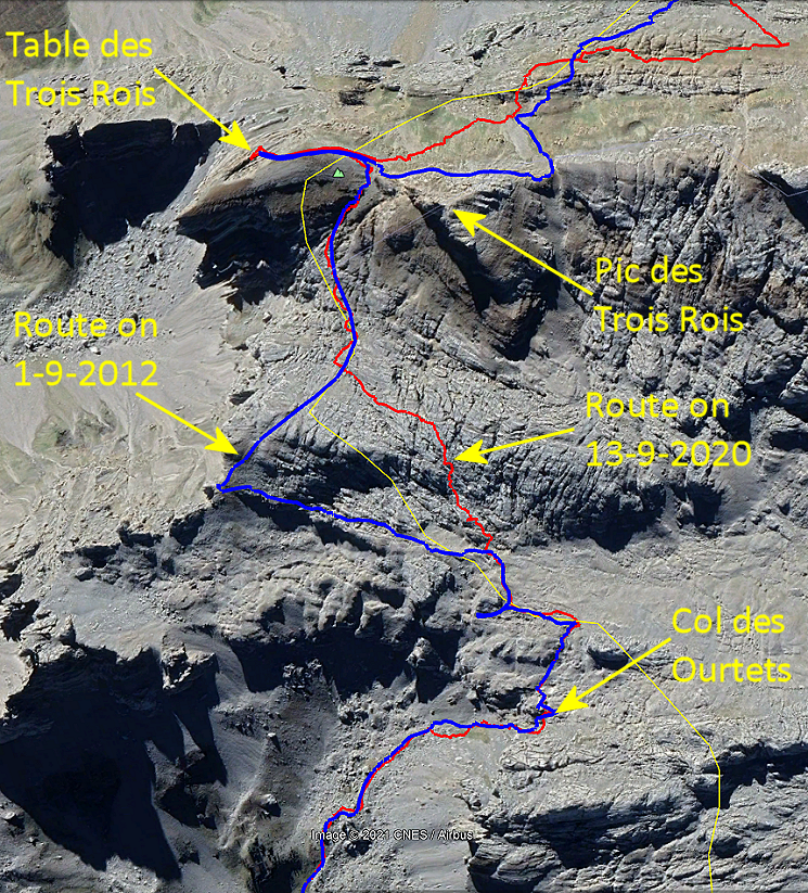 I think the blue route is easier. |
|
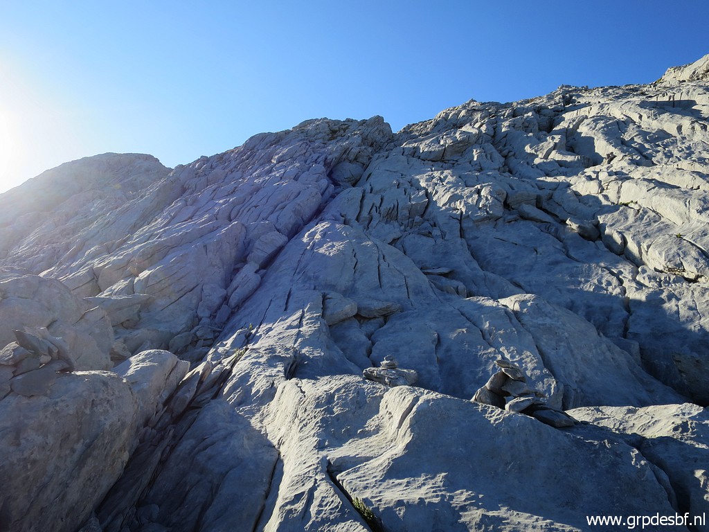
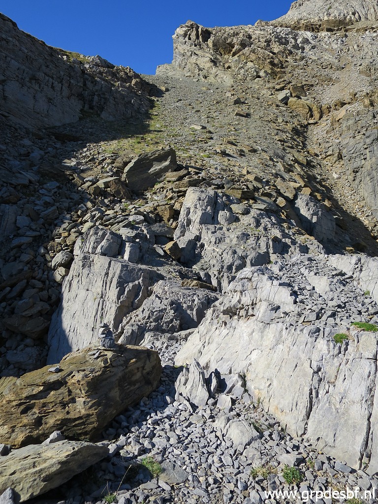
 | At the top of the rockwall, this view back and (click photo to enlarge) |
 | this view ahead. (click photo to enlarge) |
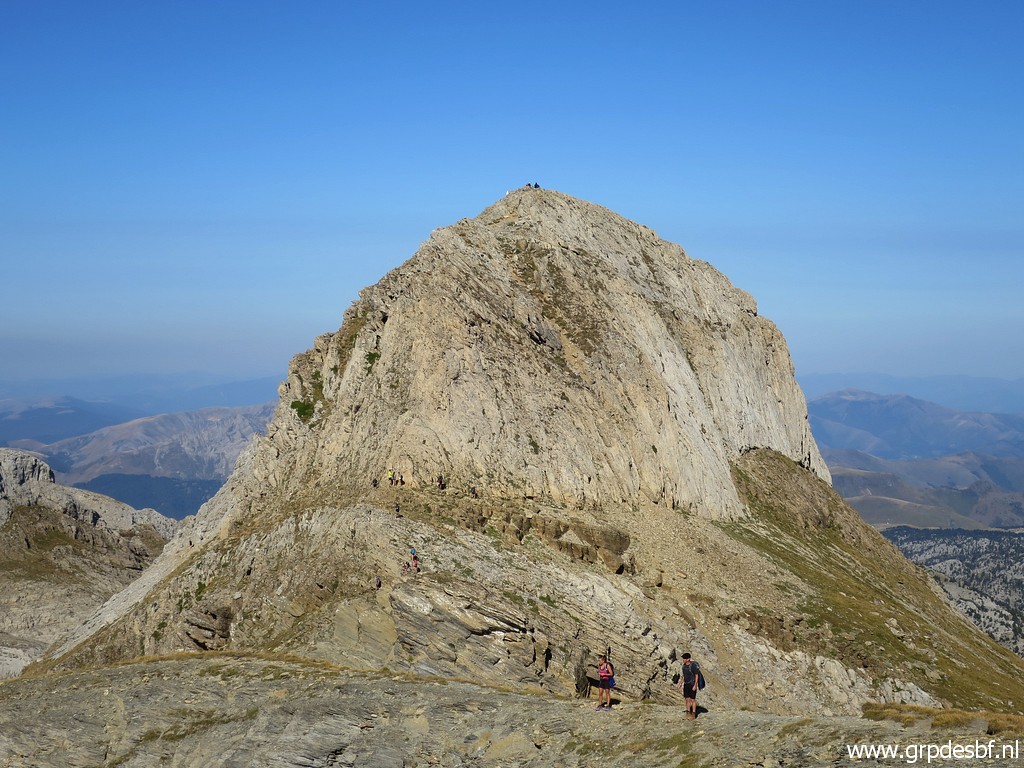
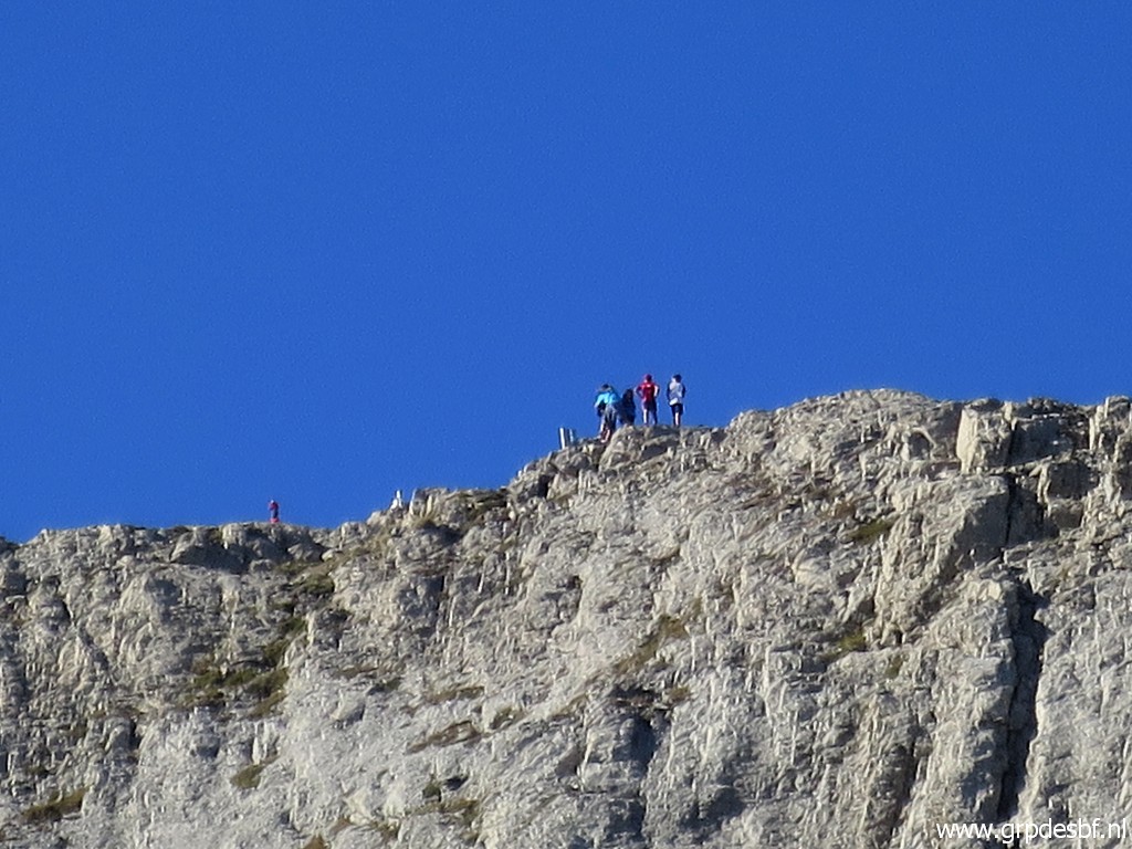 | Zoom-in to the climbers of the Pic. I did that climb on 20-8-2011. (click photo to enlarge) |
 | Looking ahead to the climb to the 'pass' between the Table and the Pic des Trois Rois. (click photo to enlarge) |
 | And again a view back. (click photo to enlarge) |
 | I'm approaching the 'pass' between the Table and the Pic des Trois Rois. (click photo to enlarge) |
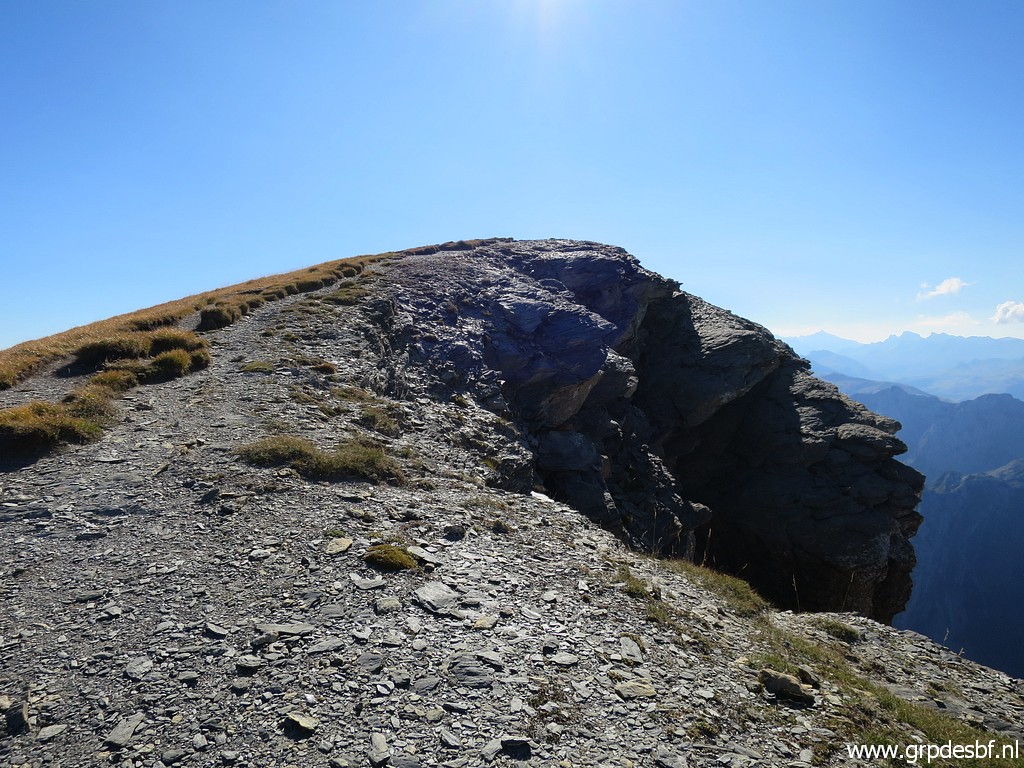 | From there I walk up the Table des Trois Rois. It took me 2 hours to get here from the Sources de Marmitou. (click photo to enlarge) |
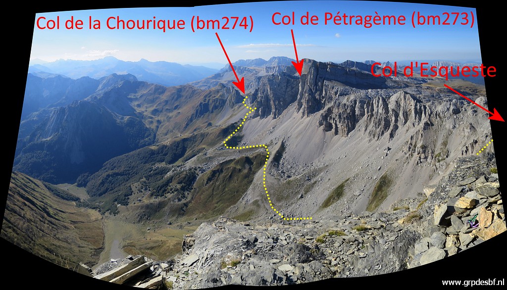 | From the Table I have a tremendous view of the landscape and route ahead. (click photo to enlarge) |
 | From the Table a view to the Pic and (click photo to enlarge) |
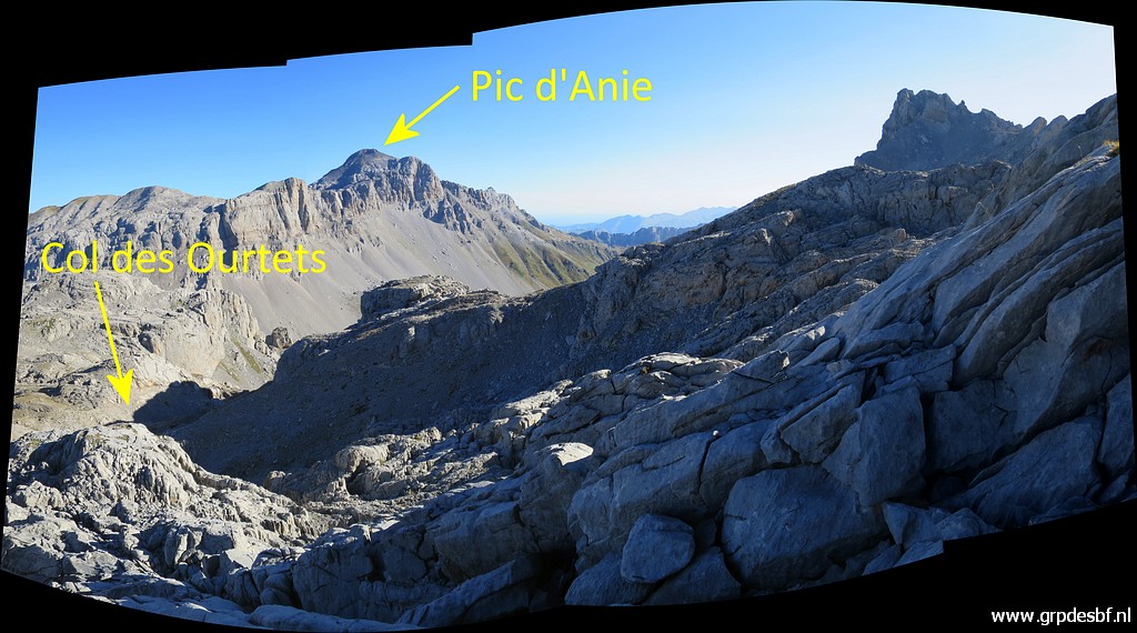
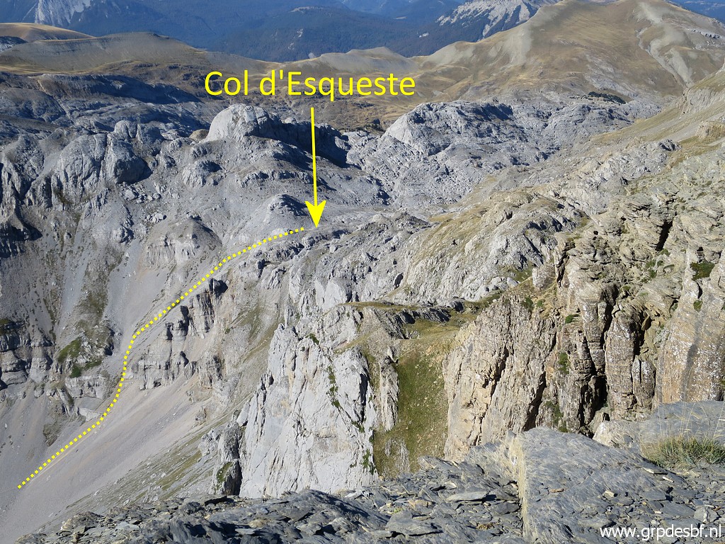 | a zoom-in to Col d'Esqueste. (click photo to enlarge) |
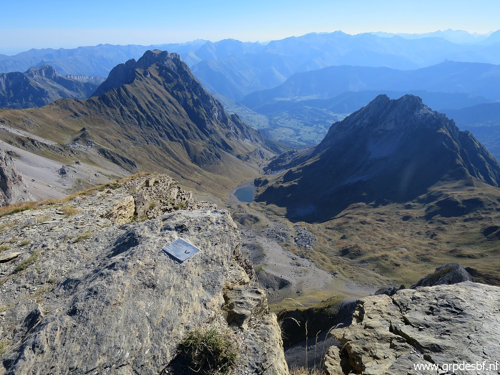 | From the Table looking down at Lac de Lhurs. (click photo to enlarge) |
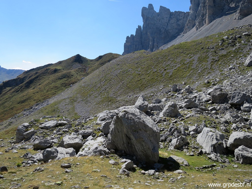
 | It's time to continue: along the north-side of the Pic des Trois Rois descending (click photo to enlarge) |
 | in the direction of Col d'Esqueste. There is no distinct trail, only an occasional cairn will help but it is mainly navigating on sight towards the Col. From the saddle west of Pic des Trois Rois there might be a better waymarked trail to Col d'Esqueste. (click photo to enlarge) |
 | Getting closer to the Col. (click photo to enlarge) |
 | Col d'Esqueste. (click photo to enlarge) |
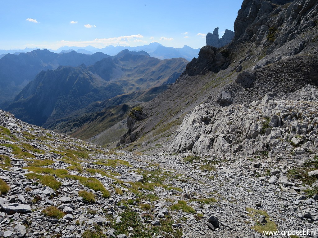
 | It's a steep, slippery and tiring descent. (click photo to enlarge) |
 | Looking back to Col d'Esqueste. (click photo to enlarge) |
 | I descend to this bunch of boulders where I take I break. (click photo to enlarge) |
 | From these boulders I climb S to this ridge where (click photo to enlarge) |
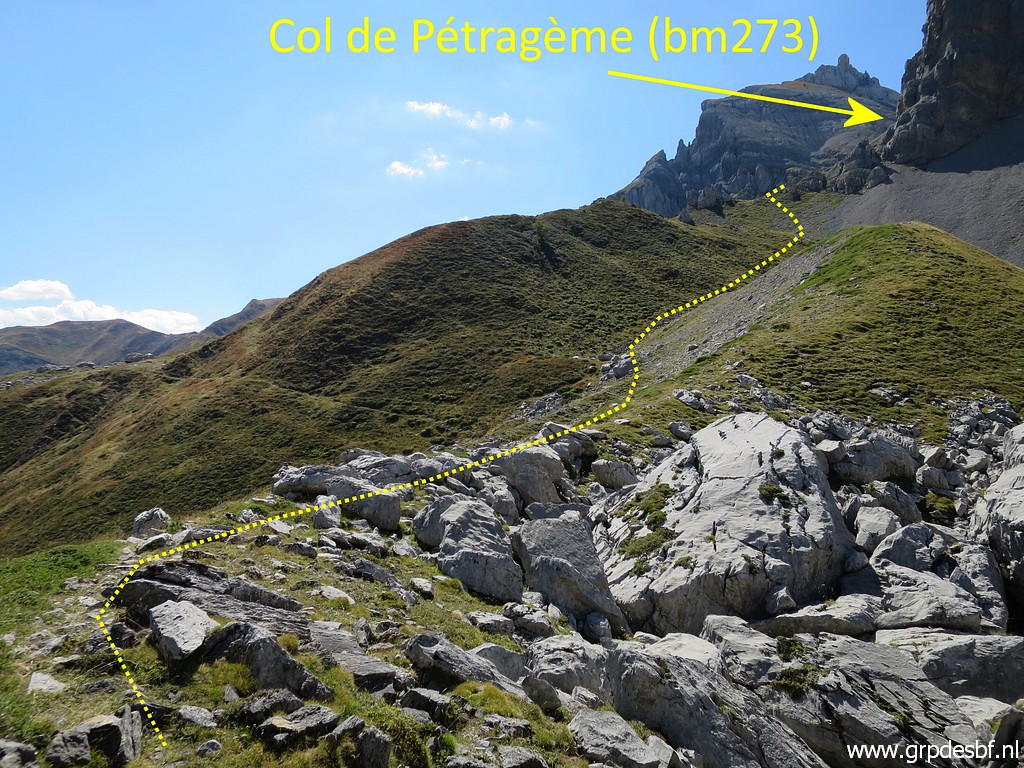 | a vague trail brings me closer to Col de Pétragème. (click photo to enlarge) |
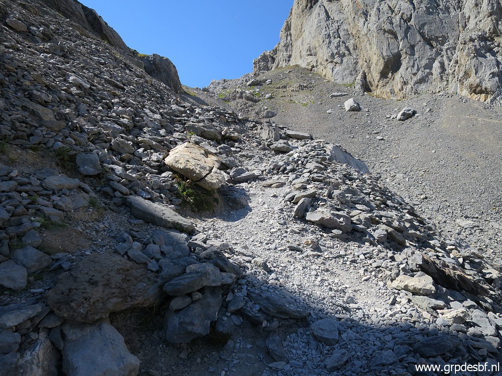
 | Further on navigating like this (click photo to enlarge) |
 |
and then the last climb to the Col, now on a distinct trail. |
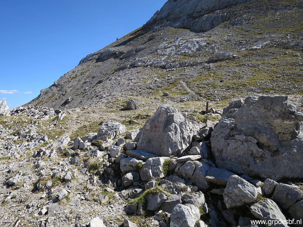
 | Having arrived at the main trail from Cabanes d'Ansabère to Col de Pétragème (click photo to enlarge) |
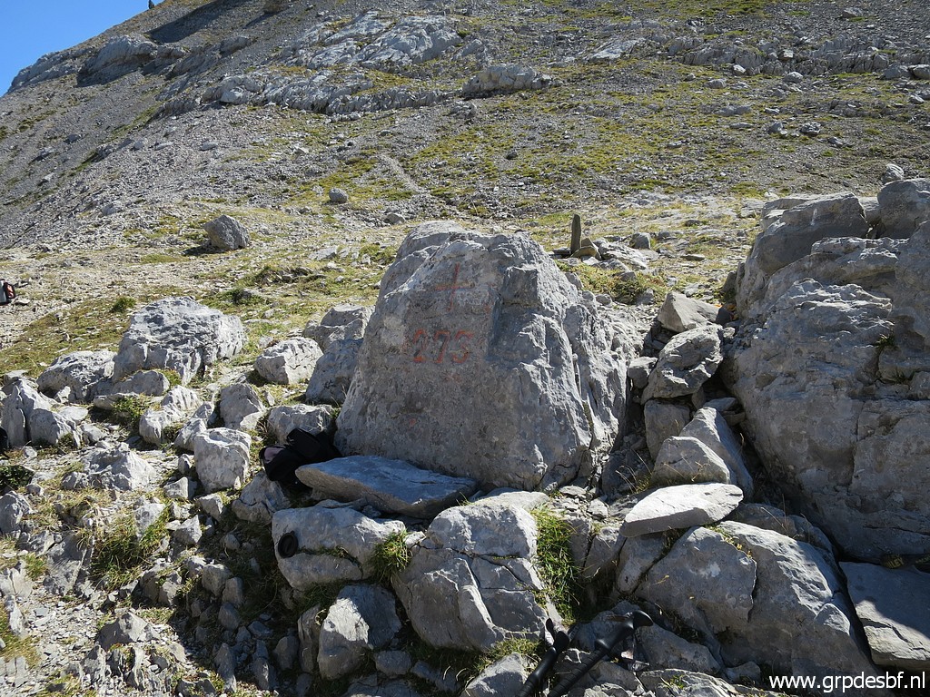 | Bm273 at Col de Pétragème. From Col d'Esqueste to Col de Pétragème took me 2,5h walking. That makes a total of ± 5h from Sources de Marmitou to Col de Pétragème. (click photo to enlarge) |
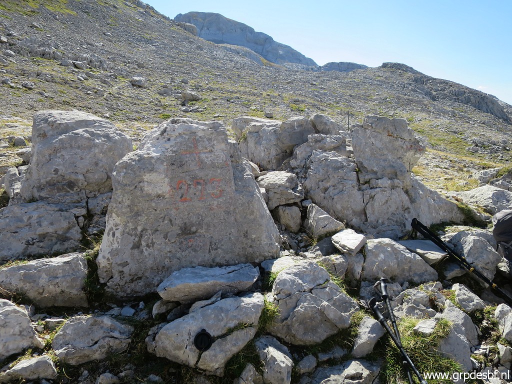 | Bm273 (click photo to enlarge) |
 | Bm273 (click photo to enlarge) |
 | Bm273, looking into Spain. (click photo to enlarge) |
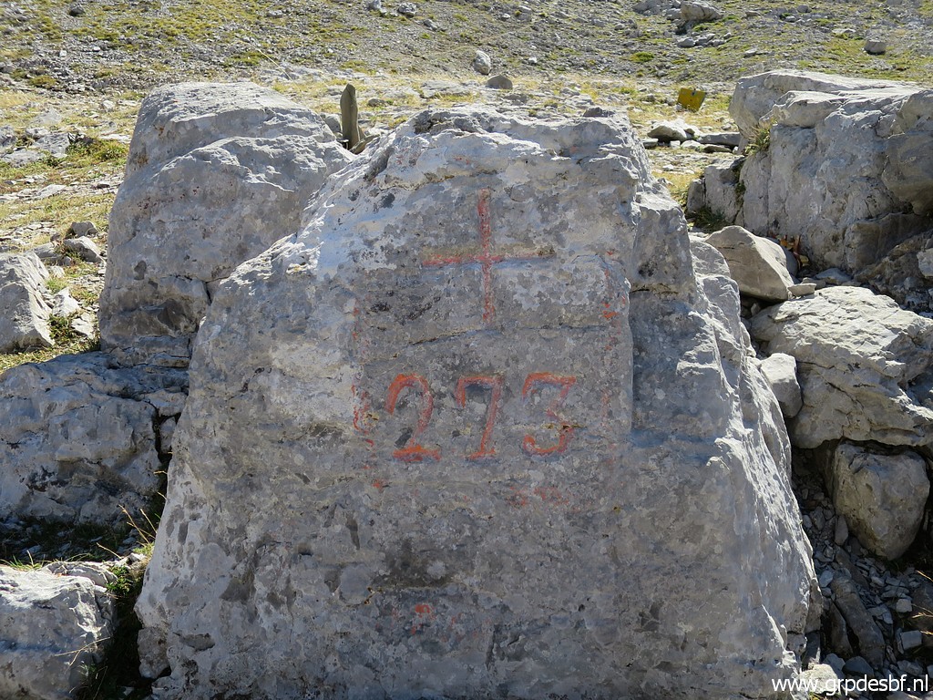 | Bm273 (click photo to enlarge) |
I
wondered yesterday if there is a route from Col d'Anaye (bm272) to Col
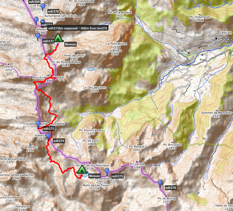
de Pétragème (bm273) on the Spanish side. If we look on the 4umaps-site, we see a lot of trails on the Spanish side. That makes a route possible as shown on this map: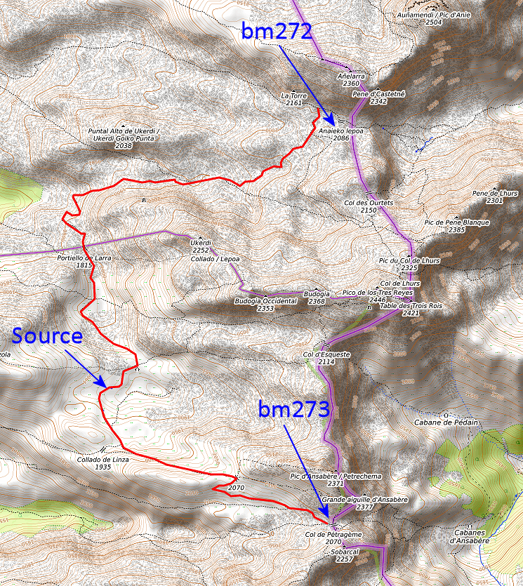 There is even a source and bivouac-opportunity on the route. The distance is ± 10km with a total denivellation of ± 1100m. Could be faster and safer than the route of today. A route to check myself in 2021. You can download the above track as a kml-file. |
|
The route above is confirmed by this map (derived from this pdf): Let's annotate the above map: 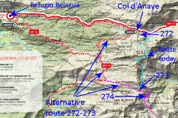 We can now see that this alternative is waymarked for a large part: from Col d'Anaye to ± Collada de Linza. From there it's ± 2,5km walking E on trails to Col de Pétragème (bm273). |
|
What
would the alternative route from above mean for my GRPdesBF-stage from
Sources de Marmitou onwards? The 'old' route is as follows: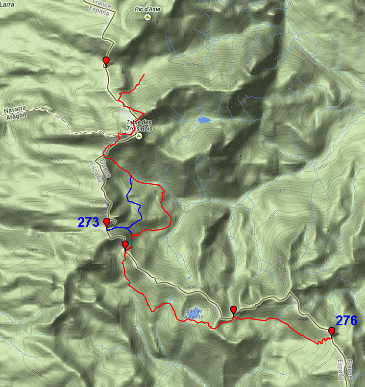 It would change to this route itinerary: 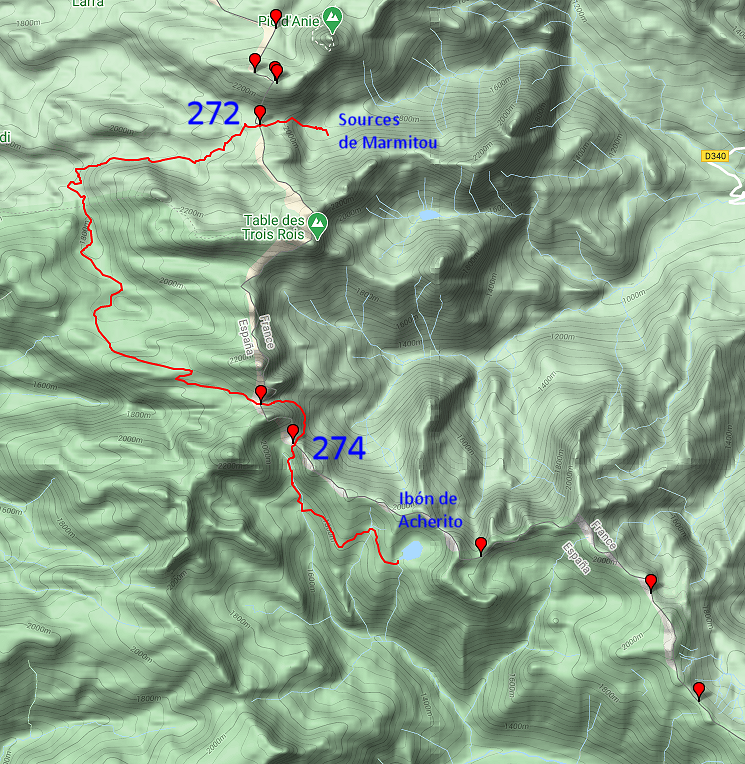 As you can see: no variants needed and an earlier stop at Ibón de Acherito instead of continuing to bm276. Reason: the lakeside is a perfect bivouac-spot. |
|
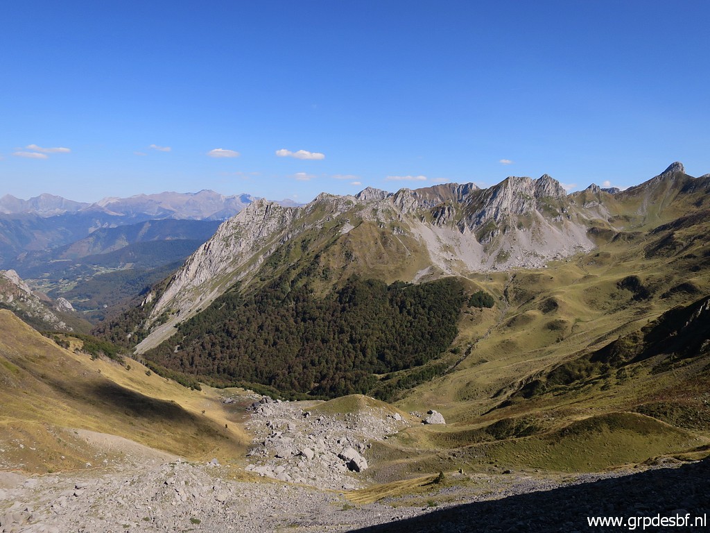 | Then descending back, towards Cabanes d'Ansbère. I start to get tired. (click photo to enlarge) |
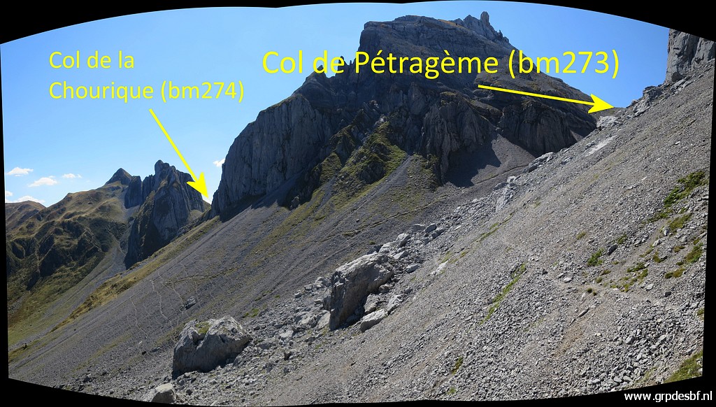
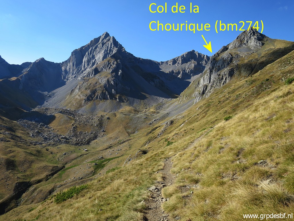
 | The Col de la Chourique becomes soon visible to the right. (click photo to enlarge) |
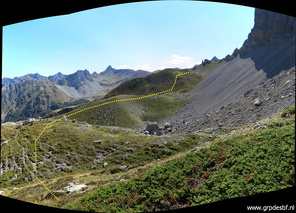
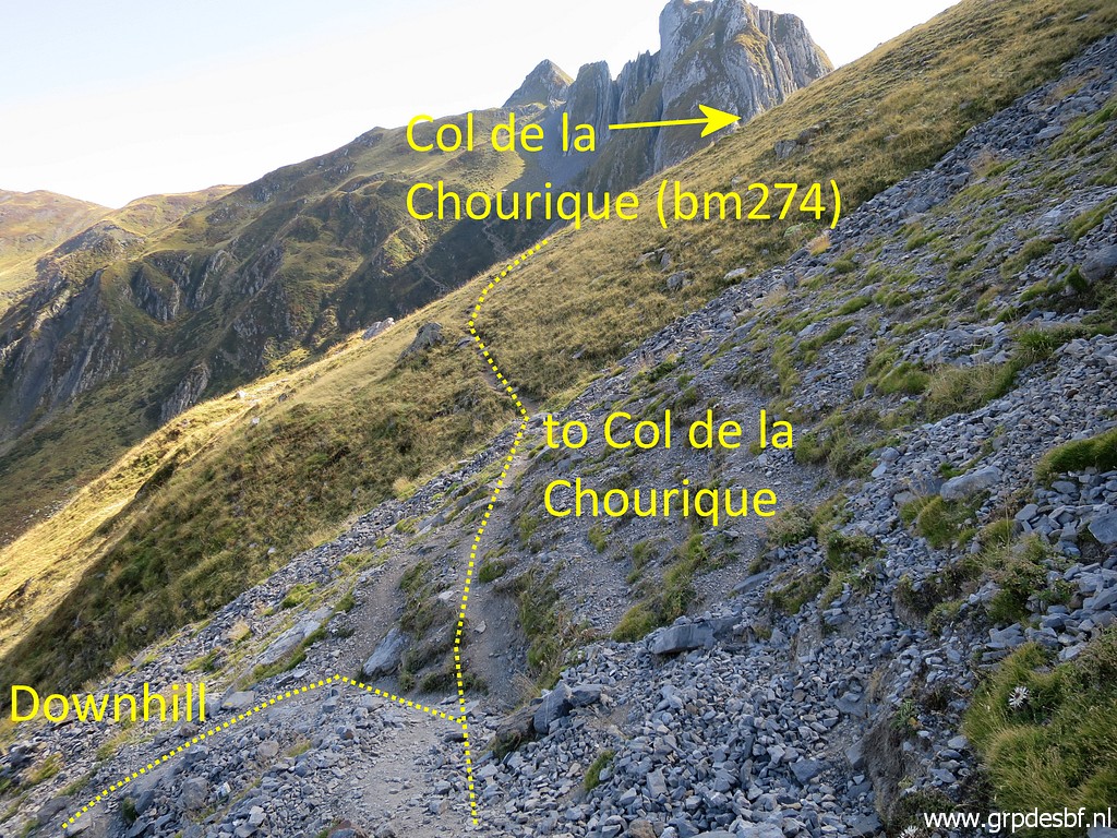 | This
is a bifurcation: the main trail descends to Cabanes d'Ansabère and a
smaller trail continues the half circle to Col de la Chourique. (click photo to enlarge) |
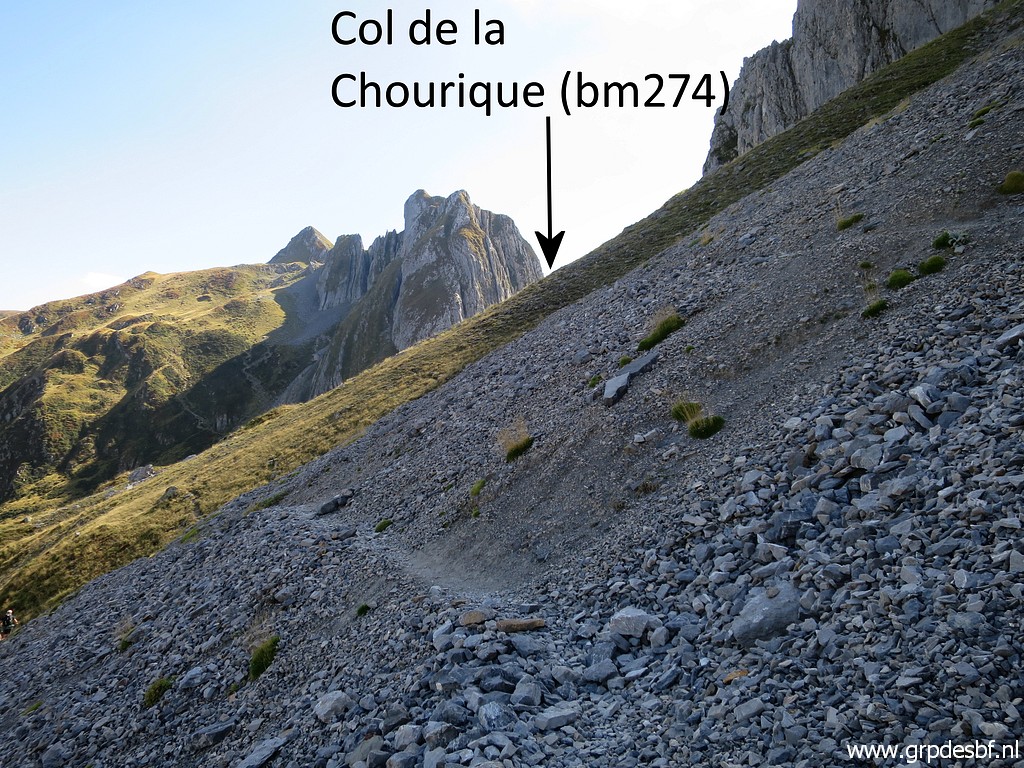
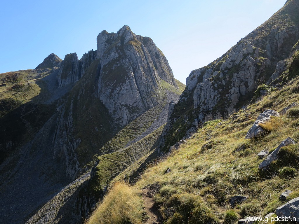 | Getting closer to Col de la Chourique. (click photo to enlarge) |
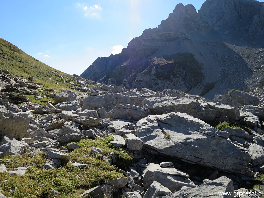 | Arriving at Col de la Chourique. (click photo to enlarge) |
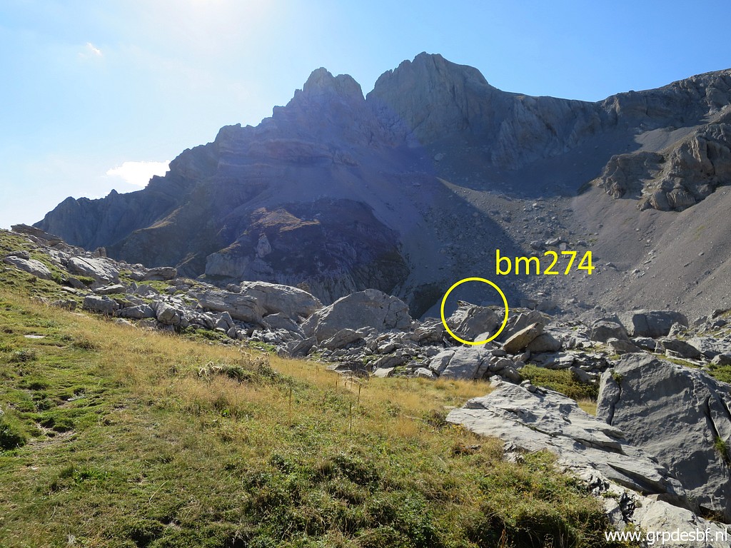 | Bm274 is not easy to find. (click photo to enlarge) |
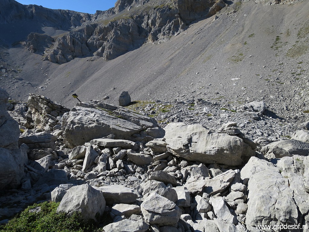 | Bm274 (click photo to enlarge) |
 | Bm274 (click photo to enlarge) |
 | Bm274 (click photo to enlarge) |
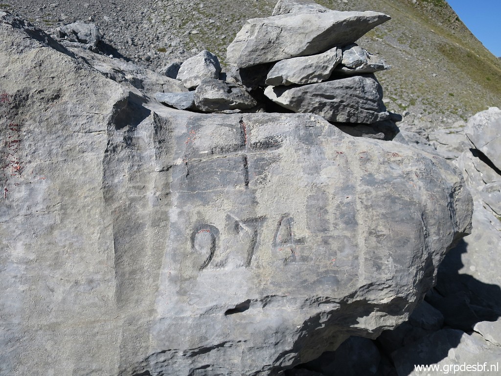 | Bm274 (click photo to enlarge) |
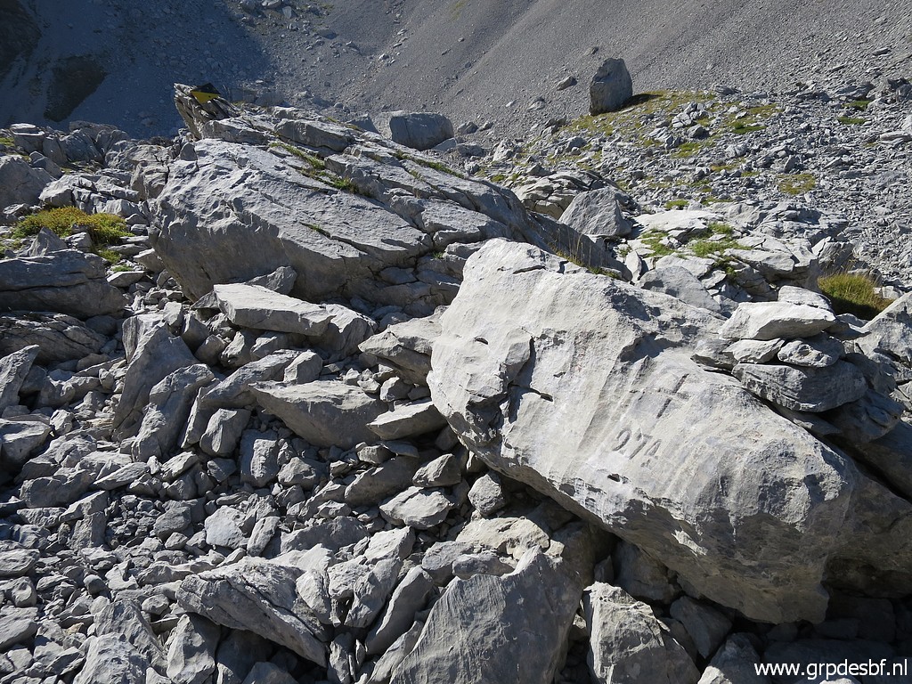 | Bm274 (click photo to enlarge) |
 | Then descending into Spain, (click photo to enlarge) |
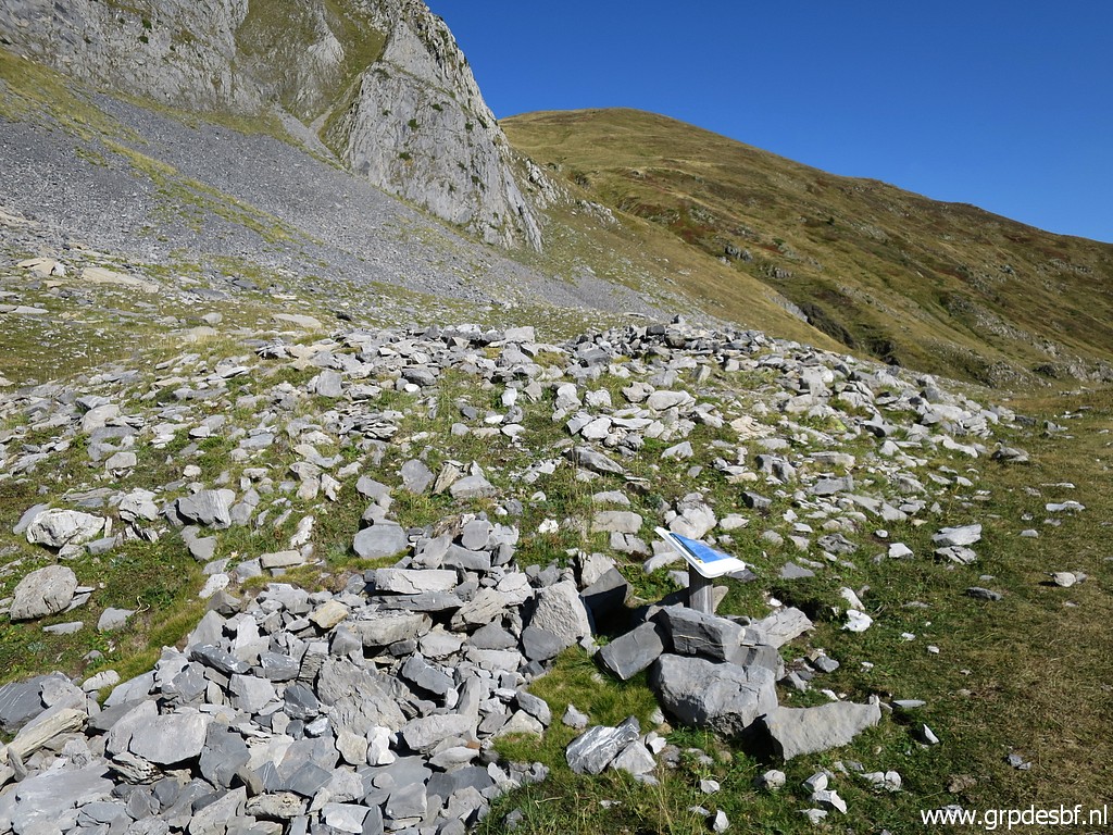 | passing this archeological site. (click photo to enlarge) |
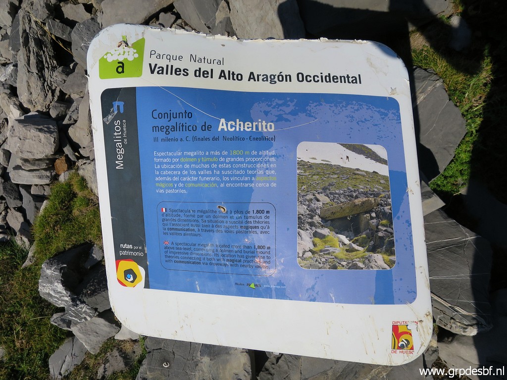 | It concerns a megalith (click photo to enlarge) |
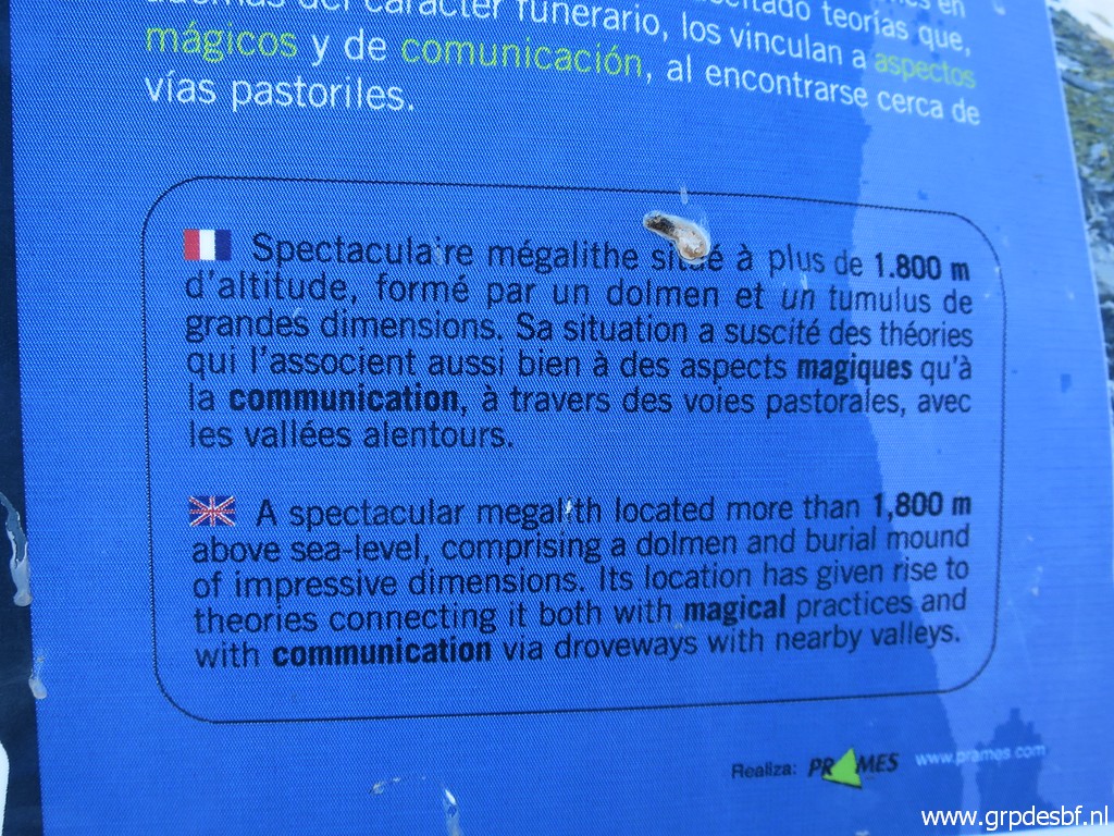 | and the information panel gives an explanation. (click photo to enlarge) |
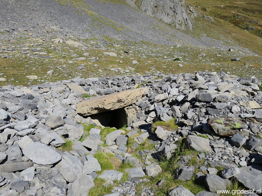 | And the horizontal large rock is the megalith in question. (click photo to enlarge) |
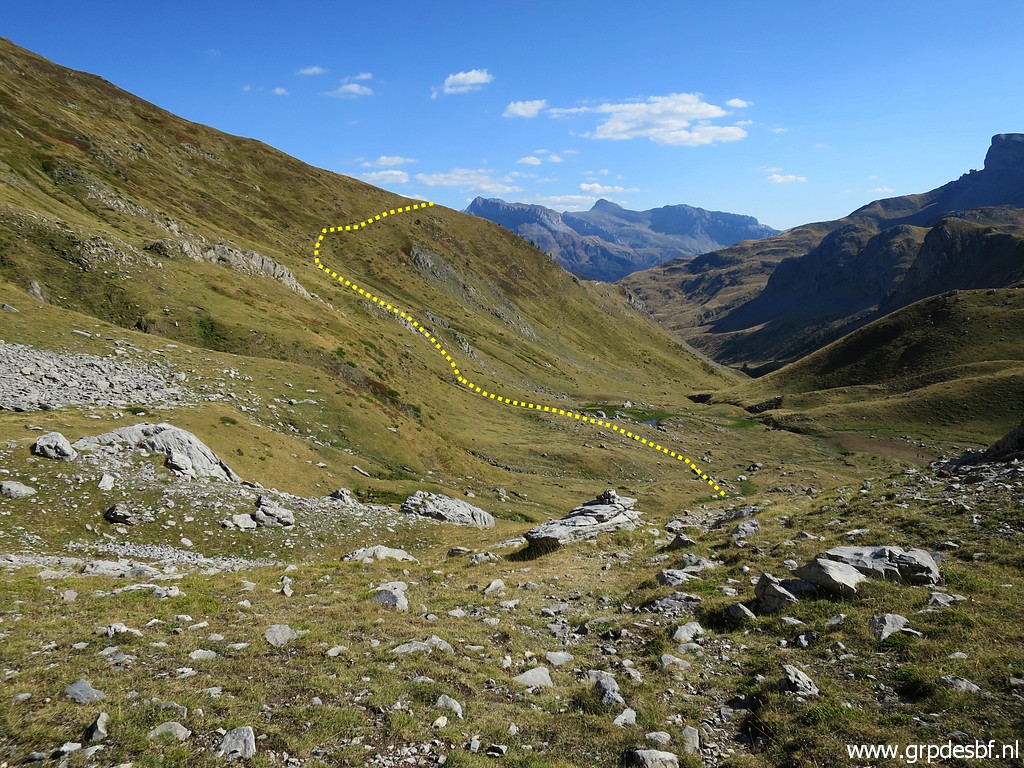 | Descending
further to the bottom of the valley with a view of the route ahead to
Lac de la Chourique (or Ibón de Acherito in Spanish). (click photo to enlarge) |
 | There is a distinct path climbing up the hillside. (click photo to enlarge) |
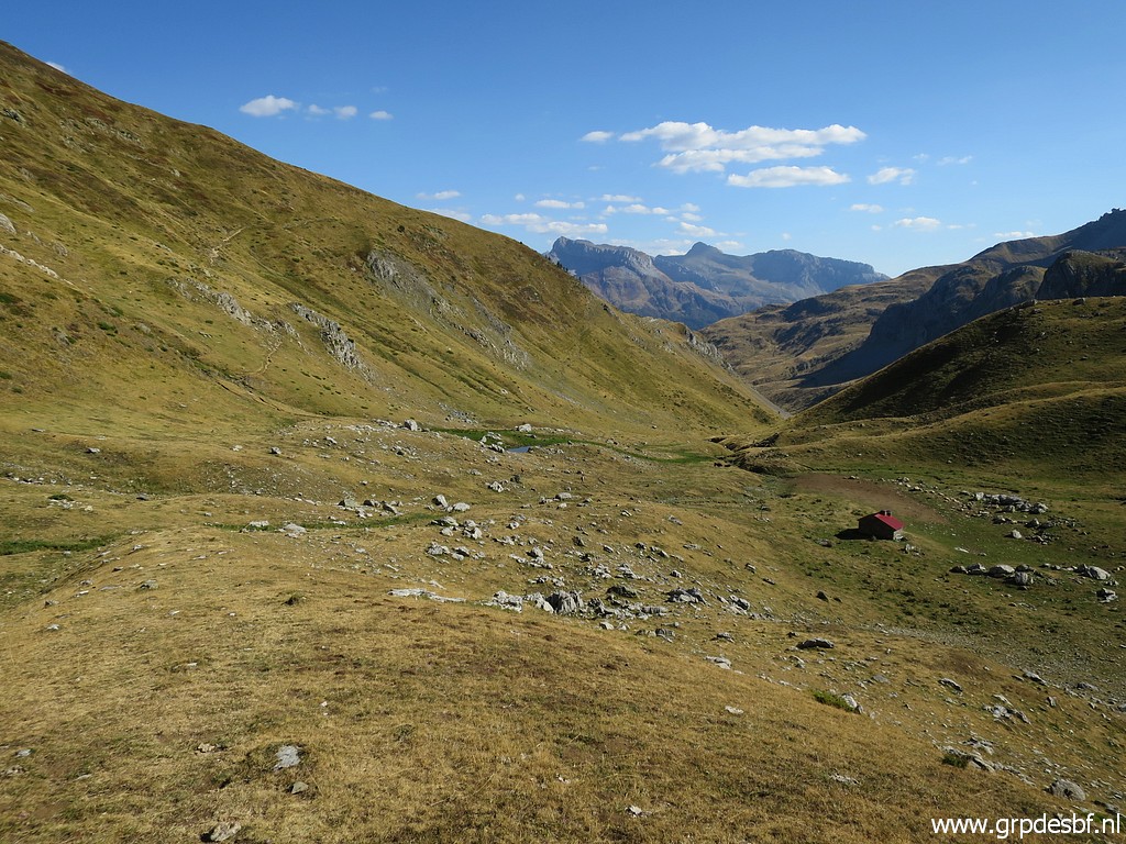 | At the bottom of the valley (click photo to enlarge) |
 | this cabin. (click photo to enlarge) |
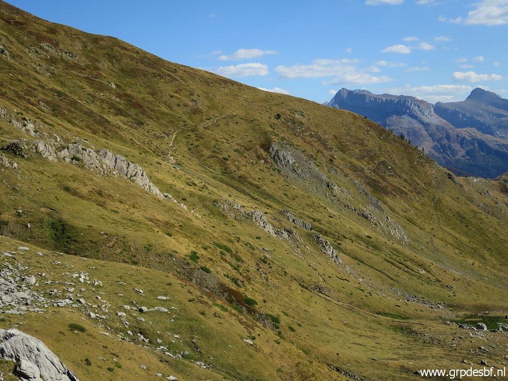
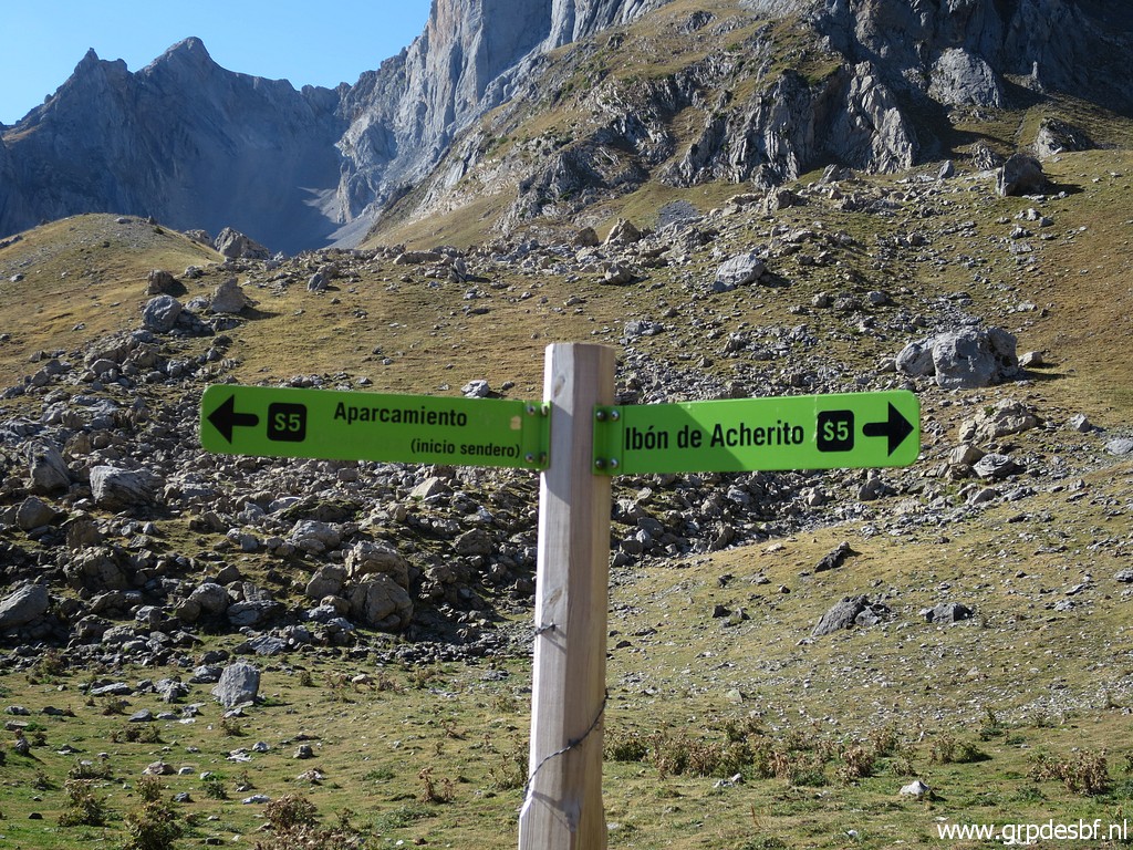 | Nowaday the route to Ibón de Acherito is part of a well waymarked and trodden circular walk. (click photo to enlarge) |
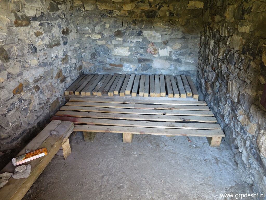 | The cabin has been upgraded since my last visit on 1-9-2012 offering now better sleeping facilities but still very basic. Around the cabin excellent bivouac-possibilities. A water source is available nearby on the trail uphill to Ibón de Acherito. (click photo to enlarge) |
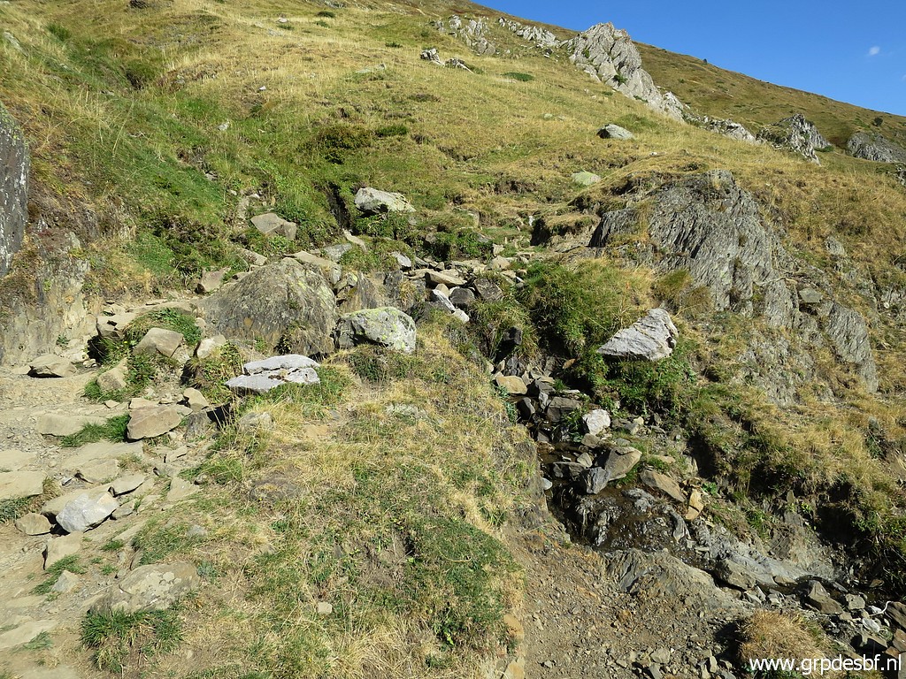 | This is that source. Between Sources de Marmitou and Ibón de Acherito, it's the only watersource on my route. (click photo to enlarge) |
 | Looking back. (click photo to enlarge) |
 | Having arrived at the upper level, the trail makes a half circle (click photo to enlarge) |
 | to arrive here with (click photo to enlarge) |
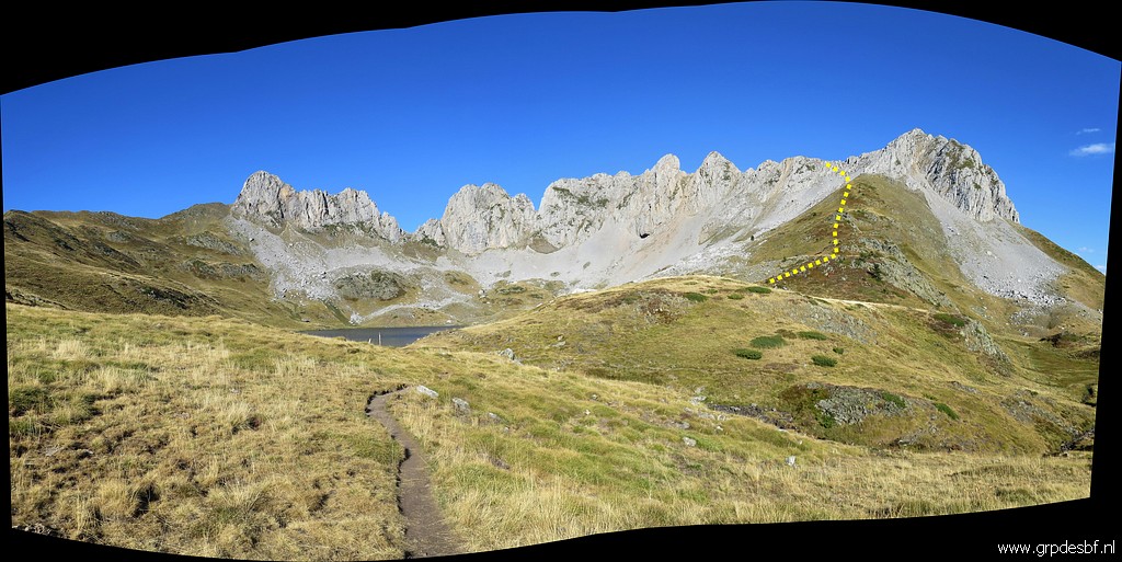 | the lake of Ibón de Acherito soon visible. Also visible: the route up to the rocky ridge which I will climb tomorrow morning. (click photo to enlarge) |
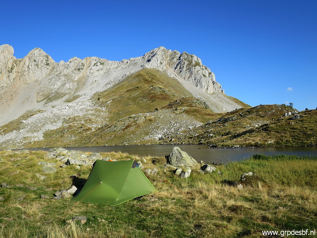 | A nice bivouac spot at the lakeside. I have to collect water from the lake. (click photo to enlarge) |