|
The
bordermarkers of the Pyrenees : all my trips
 |
|
| -
sunday 4 september
2022 - Revisiting bm602 by swimming |
 |
 |
Summary:
part of a series of 9 daytrips in august & september 2022 across
the Pyrenees. The main goal was to finish my plan to have visited all
bordermarkers at least twice. It was also a kind of sentimental farewell journey, visiting old friends and cherished places. This is daytrip 9. Today: after a summer of training in outdoor-swimming and a failed trial a few days earlier, I succeeded today in swimming to the cave of bm602. By doing that, I have visited every esfr-bm at least twice with at least one year difference. Mission accomplished! Weather: sunny, warm Basecamp: camping Verte Rive in St-Laurent-de-Cerdans |
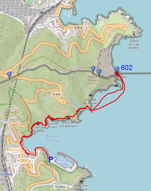
 track-20220904.kml
(click to open this trip in Google Earth or copy link to Google Maps; click right on this link to download gpx-version). The gps-track has not been manually corrected which explains the inaccuracy and misalignment at some points. For cartographic backgrounds: see the cartography-page Gps-waypoints of all bordermarkers (most recent version): kml: esfr-bordermarkers-all-waypoints.kml gpx: esfr-bordermarkers-all-waypoints.gpx (with elevation added by gpsvisualizer.com) |
|
 |
According to Garmin
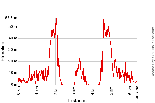
Basecamp (uncorrected track with elevation added by Gpsvisualizer.com): Distance: 6,4 km Max-height: 58m Min-height: 0m Elevation: +575m -576m Total elevation: 1161m Start 8:41 Finish 12:47 Total time: 4:05 NB: - swim to 602: 725m in 0:27 - swimming back: 750m in 0:28 |
 | Parking in Port Bou (click photo to enlarge) |
 | Beautiful weather (click photo to enlarge) |
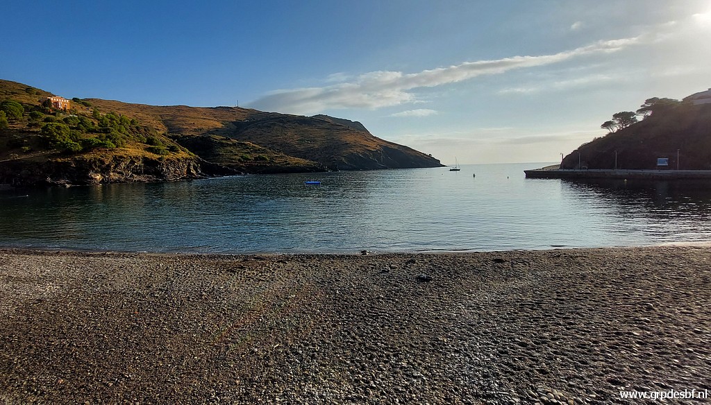 | and a calm sea. It is a sunday morning and everything is quiet. (click photo to enlarge) |
 | I walk along the coast with (click photo to enlarge) |
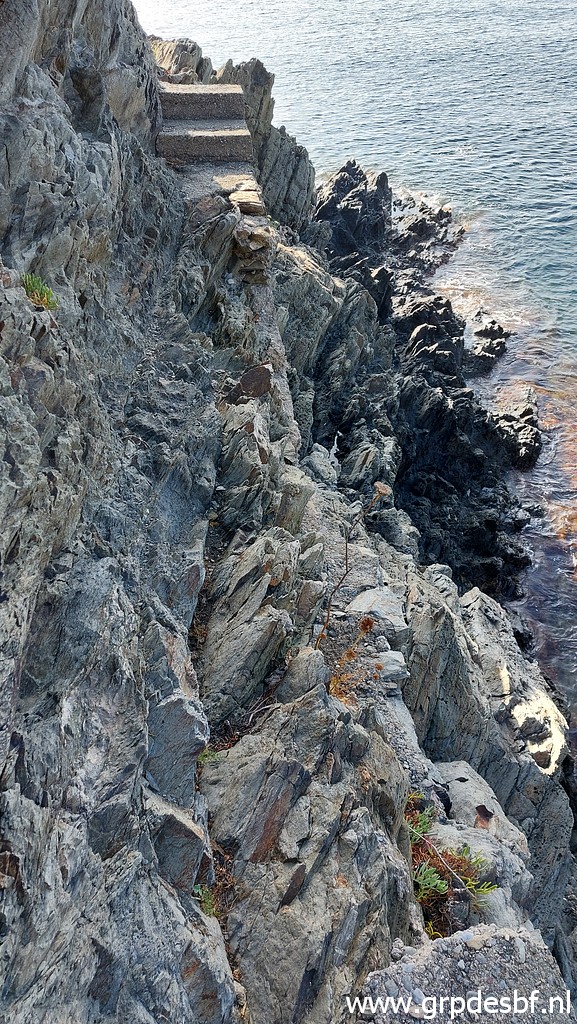 | its winding trail and with some tricky parts, (click photo to enlarge) |
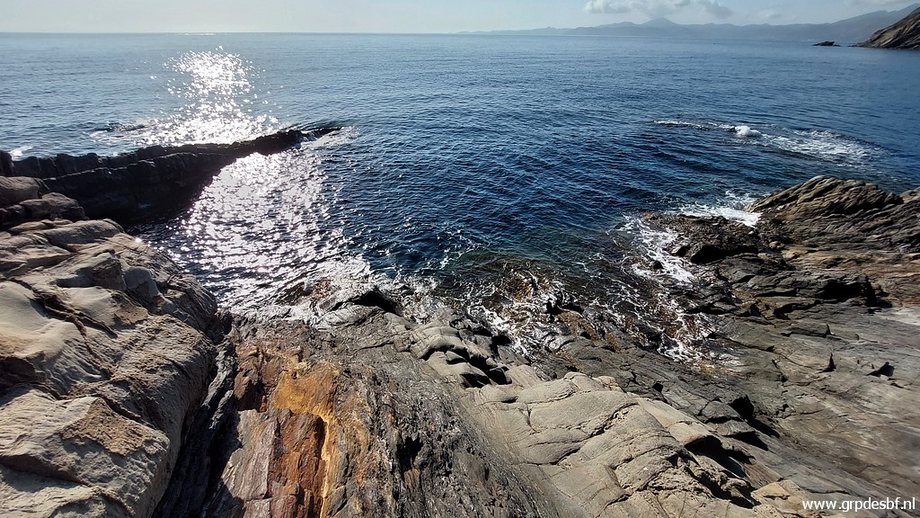
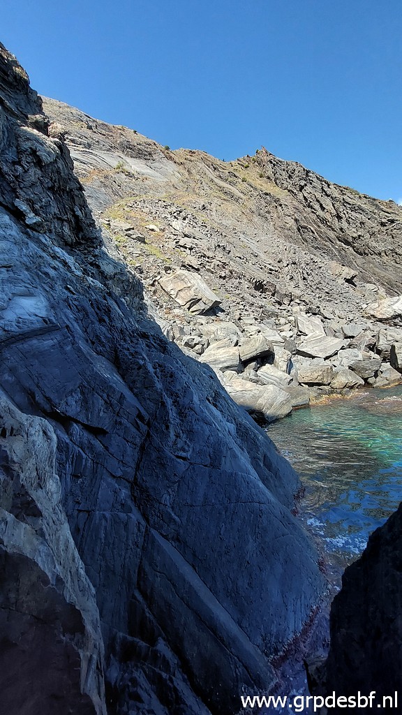
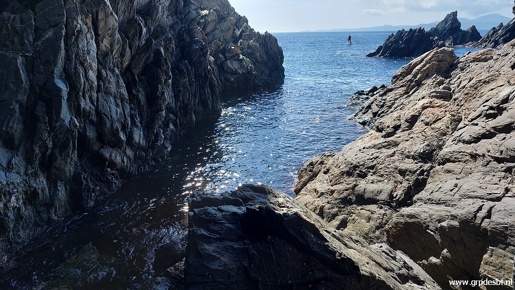
 | Thus proceeding along the shore, (click photo to enlarge) |
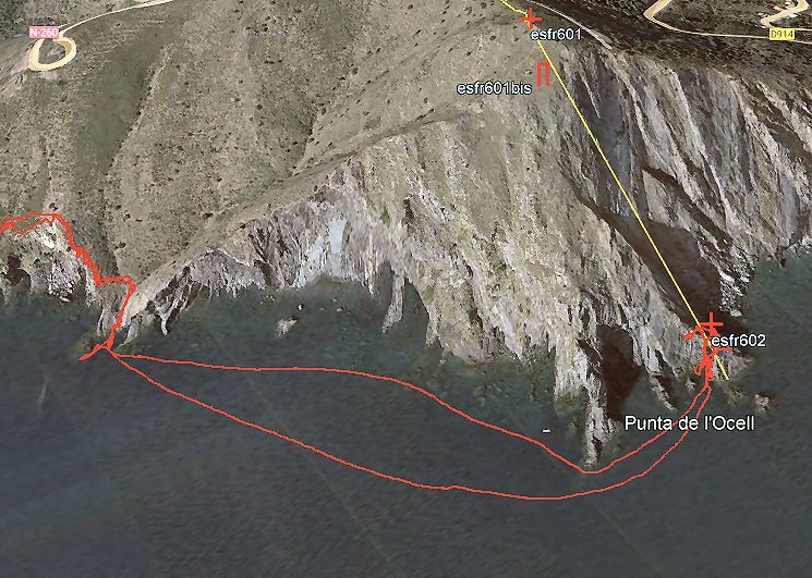
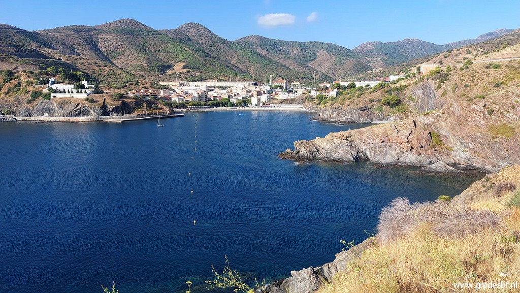
 | I approach my starting point to swim. With thanks to Corinne Gourgeonnet who showed and explained this point of departure. The Punta del Falcó is a rocky point which is a fine point of direction while you are swimming. Once past this Punta, the cave is only 200m away. (click photo to enlarge) |
 | Descending to the point of disembarkation and (click photo to enlarge) |
 | that is here. Sliding into the water is easy here. (click photo to enlarge) |
 | I have changed my clothes for my wetsuit and I am ready to start swimming, leaving my backpack behind. From the parking to this place (including changing clothes) took me ± 1 hour. Of course no pictures while swimming, my phone kept securely dry in my swimming buoy. (click photo to enlarge) |
|
An this is the swimming part. The outer route is my way to the cave, the one closer to the coast how I swum back. As said, the Punta del Falcó is fine point of direction and once you curve along this Punta, the cave already becomes visible. And the rest is piece of cake, only 200m. |
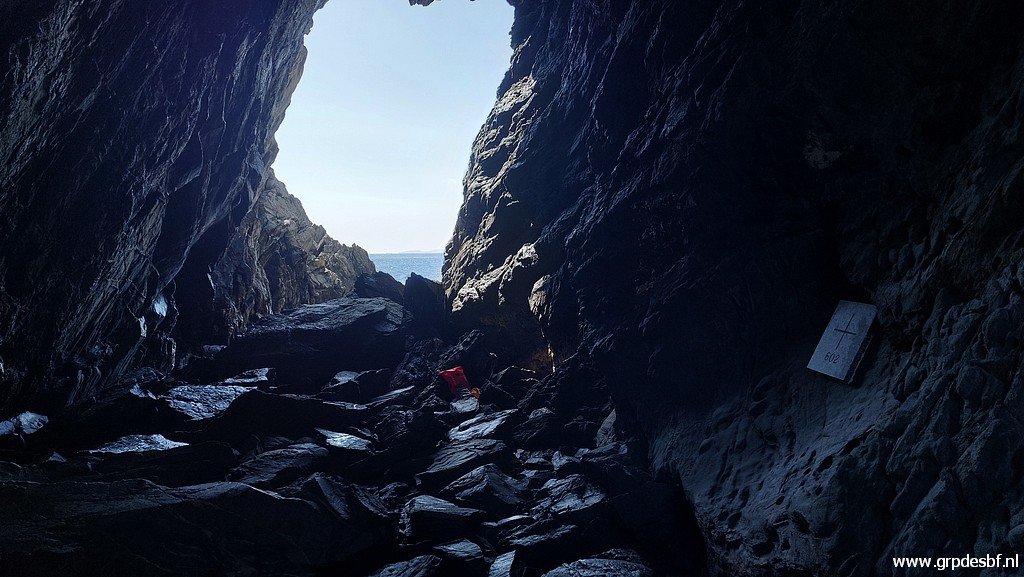
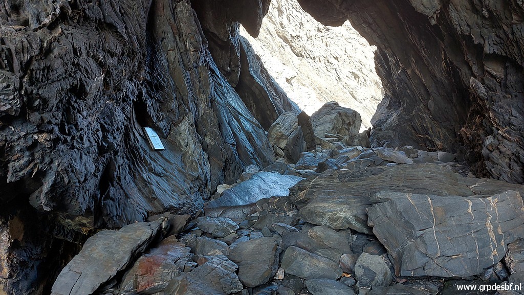 | I have now reached the cave. The swimming was easier than I thought and lasted less than half an hour. I am thrilled that I did it! (click photo to enlarge) |
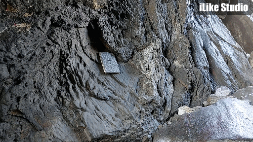
 | Then exploring the cave: to the left the plaque with the number. (click photo to enlarge) |
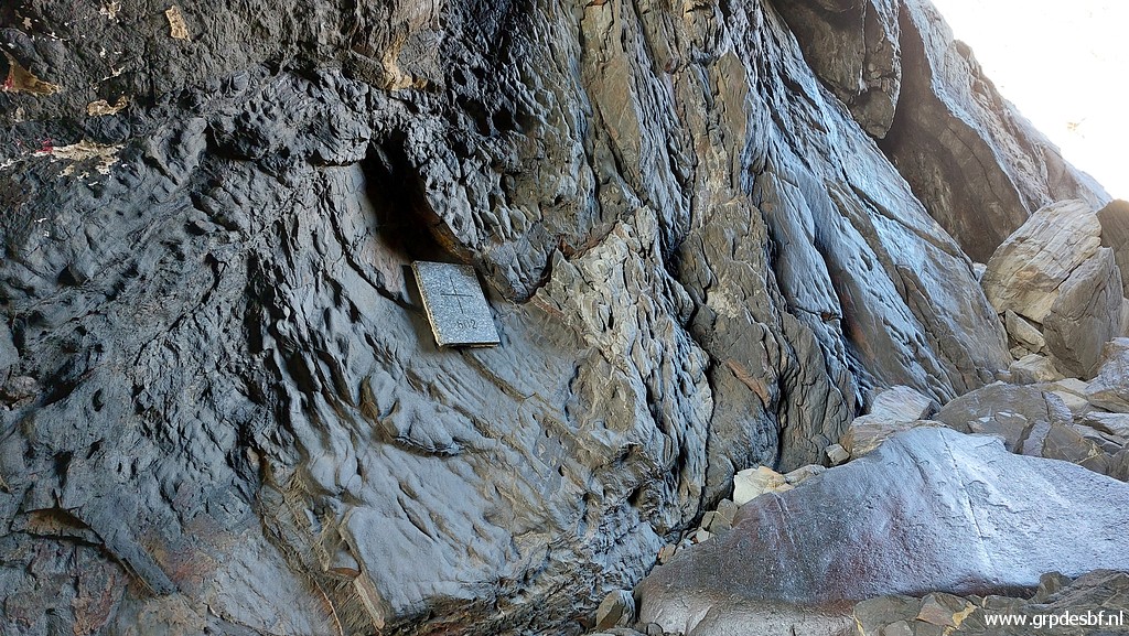 | Bm602 (click photo to enlarge) |
 | Bm602 (click photo to enlarge) |
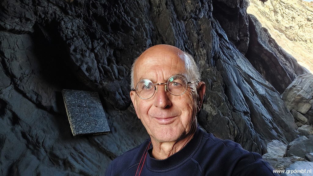 | Selfie 1 (click photo to enlarge) |
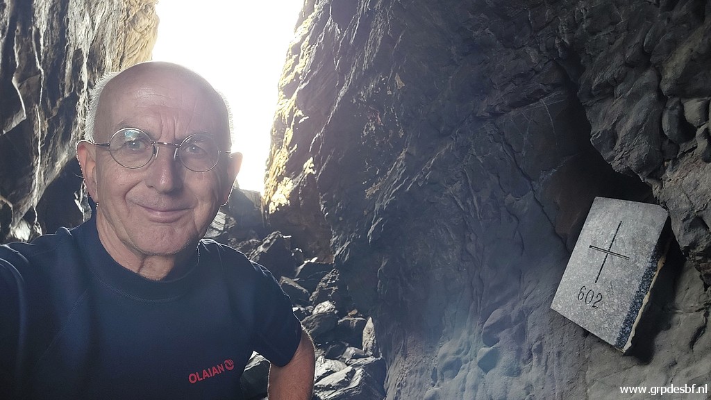 | Selfie 2 (click photo to enlarge) |
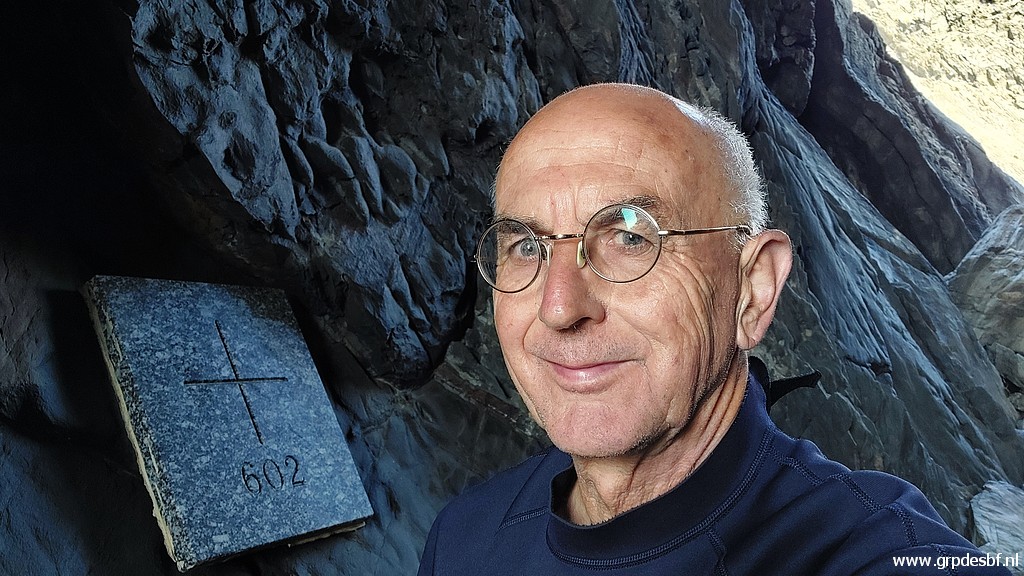 | Selfie 3 (click photo to enlarge) |
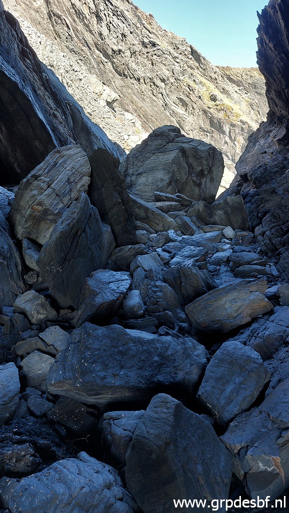 | Then a view of the other end of the cave, the French side. The cave has two open ends and is in fact a natural tunnel. I check the walls for a possible old cross but of course to no result. (click photo to enlarge) |
 | That side is too steep for entering of leaving the cave. (click photo to enlarge) |
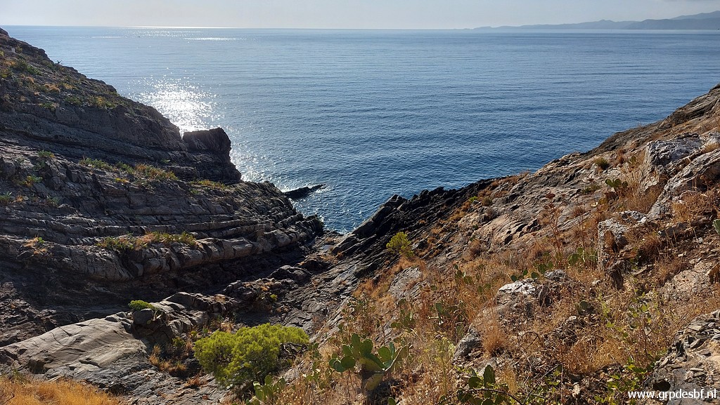
 | The steep coast at the French side. (click photo to enlarge) |
 | It seems not impossible to get down to the coastline for a shorter swimming route. (click photo to enlarge) |
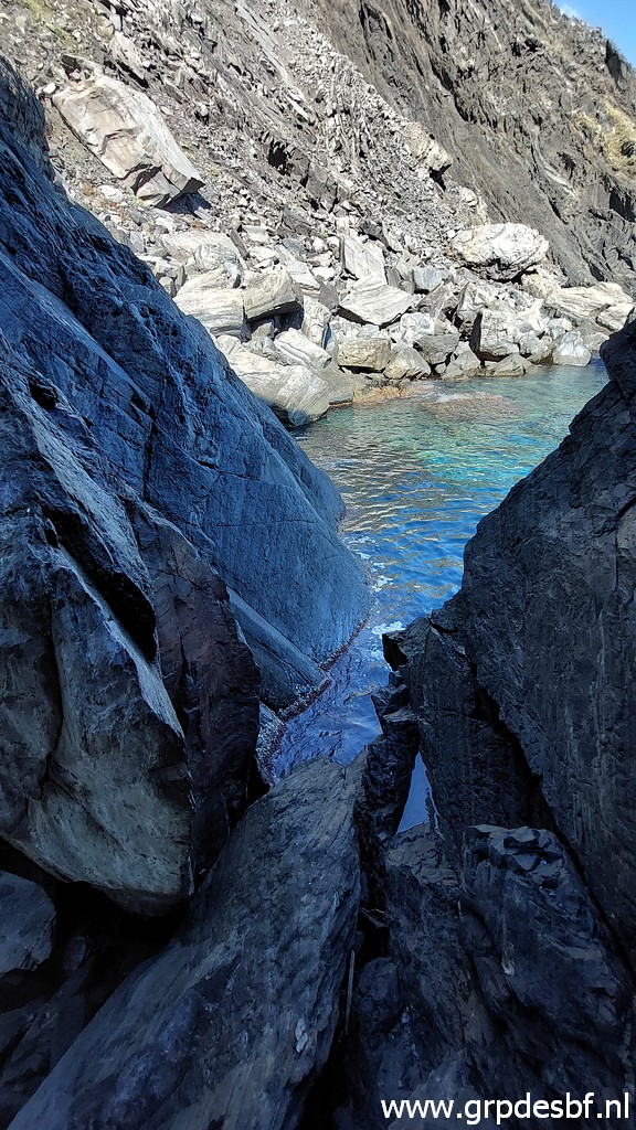
 | Then a look to the other (Spanish) side of the cave. (click photo to enlarge) |
 | This picture: to the left the remains of a painted bordermarker. (click photo to enlarge) |
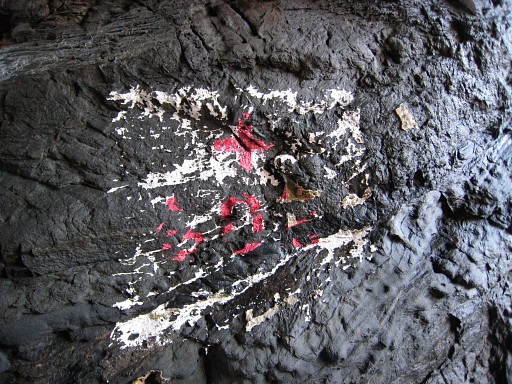 |
This is how the painted marker looked on 21-5-2011, the first time I visited the cave. |
 |
And now a 360° view of the cave. It's a movie converted to an animated gif. |
 | From the entrance I see to my surprise a supboard coming nearby. The proof that the sea is calm. (click photo to enlarge) |
 | A last view before I pack my things again in the buoy and start swimming back. (click photo to enlarge) |
 | The return-swim is closer to the coast and takes also half an hour. I have some trouble recognizing from the sea where I left the shore but then I spot my orange backpack on the shore. Climbing out of the water is easy, then changing into my clothes and a relaxed walk back to (click photo to enlarge) |
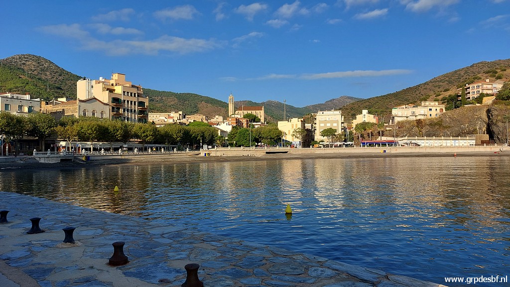
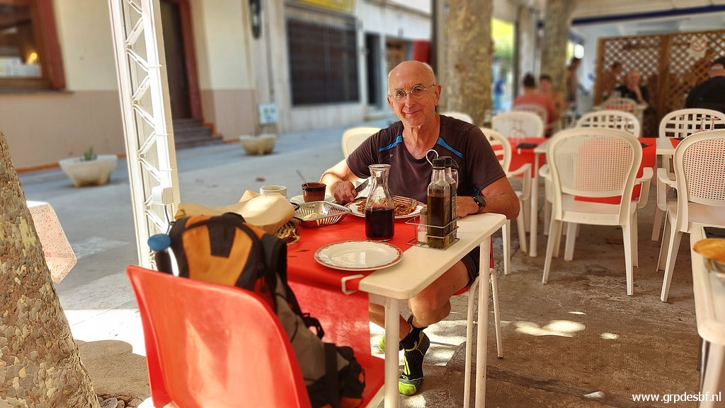 | Port Bou and treating myself with a lunch. I am very content and proud I succeeded. Taking my time to whatsapp to the world that I did it. (click photo to enlarge) |
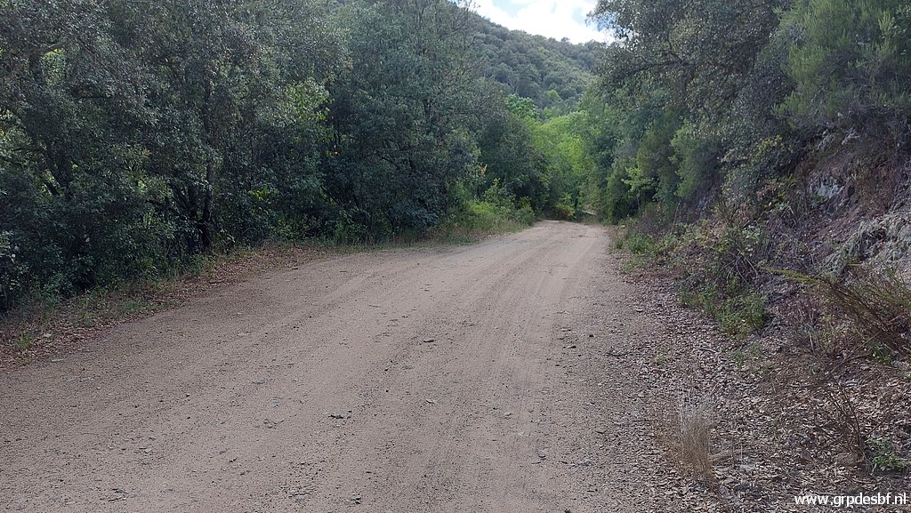 | Then a quiet and relaxed drive back to the camping in St-Laurent-de-Cerdans. I am in a nostalgic mood and visit some places I remember from years ago. This is a sideroad between Tapis and Maçanet de Cabrenys (click photo to enlarge) |
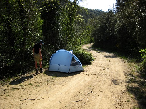 |
where I camped with Jan-Willem Doomen on 23-4-2007. |
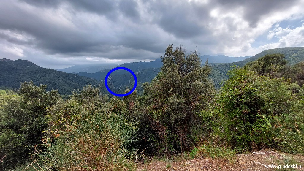 | Further on, there is a viewpoint and I can distinguish (click photo to enlarge) |
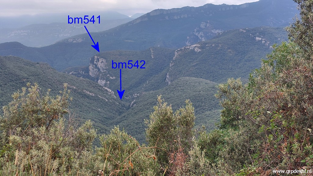 | the spots where bm541 and 542 are. (click photo to enlarge) |
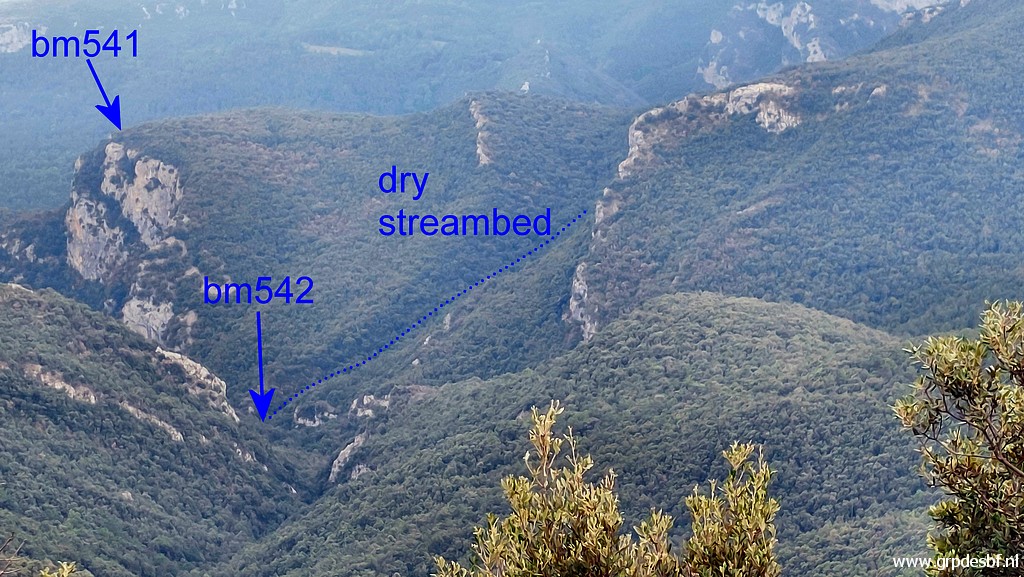 | Zoom-in. I love this landscape: wild, rough, mysterious. (click photo to enlarge) |
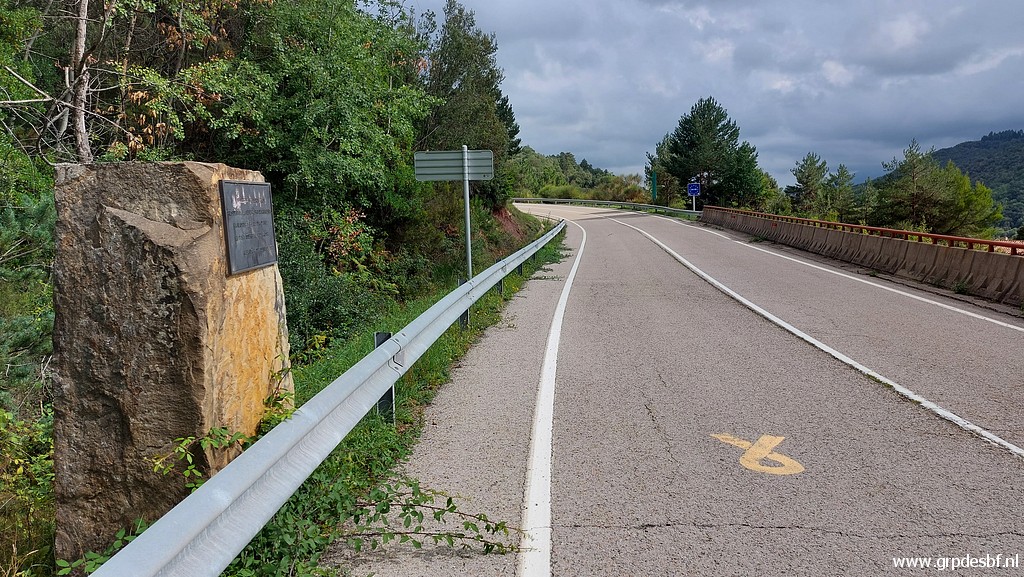
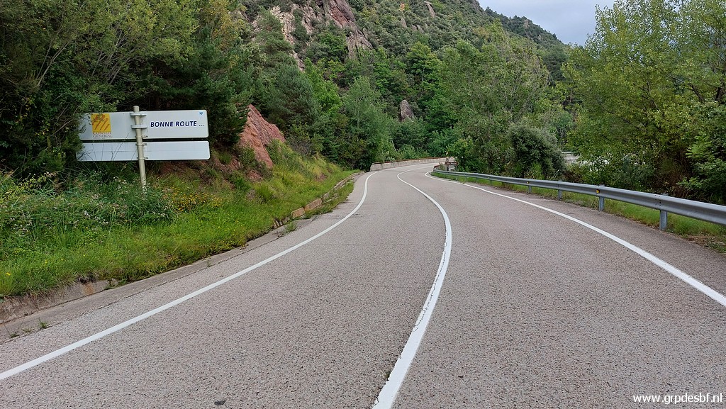 | And then a last stop to visit the bridge over (click photo to enlarge) |
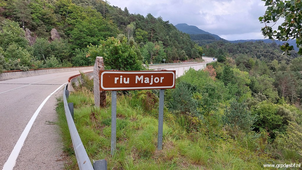 | the Riu Major, the border between bm542 and 543. (click photo to enlarge) |
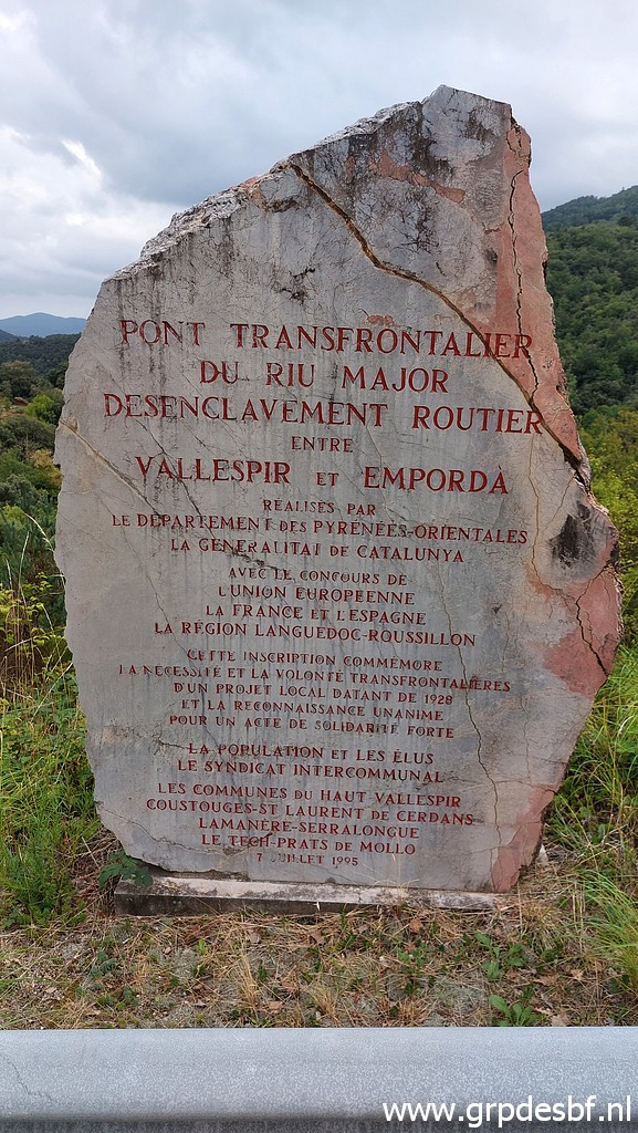 | We read that the bridge was opened in 1995. (click photo to enlarge) |
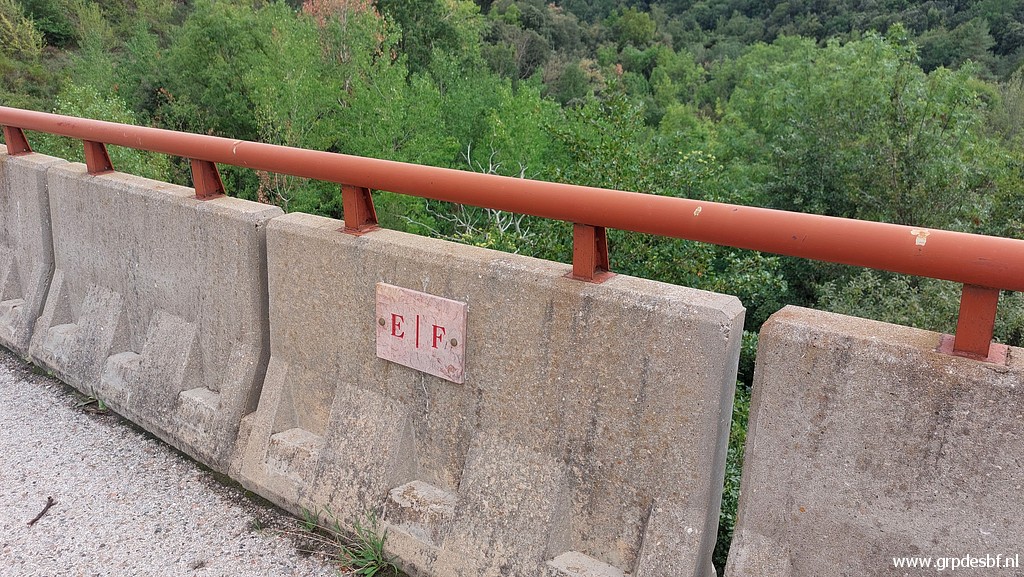 | Kind of bordermarker on the bridge itself. This is the south-side of the bridge (click photo to enlarge) |
 | And this is (click photo to enlarge) |
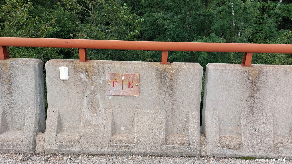 | the north-side of the bridge. (click photo to enlarge) |
 | There is another monument at the Spanish side, (click photo to enlarge) |
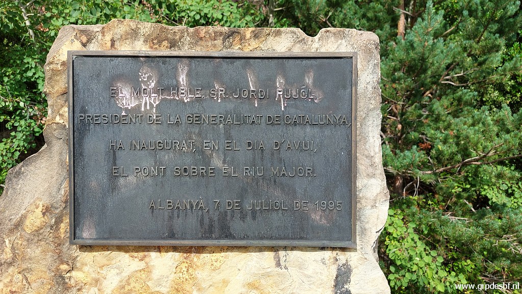 | remembering the same event: the inauguration of the bridge on 7 july 1995. Enough for today, returning to the camping. It's the last day of my Pyrenees-trip. (click photo to enlarge) |
 |
Tomorrow I will drive home in 2 days with in between |
 |
a
day of rest at a camping near Taizé. including a visit to the monastic
community of Taizé with its own special services and mantra-like hymns I like so much. |