|
The
bordermarkers of the Pyrenees : all my trips
 |
|
| -
sunday 10 september
2023 - Revisiting bm417 with Carlos & Conchita |
 |
 |
Summary:
part of a series of 9 daytrips in september 2023. This is day 8. Today: a tring trip to bm417 with Carlos & Conchita Roca. Weather: overcast and sunny Basecamp: camping Espalias in Bossòst. Same trip to be seen at Carlos & Conchita's website. |
 track-20230910.gpx
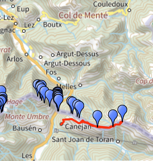
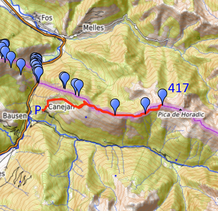
This gpx-track has not been manually corrected which explains the inaccuracy and misalignment at some points. The original elevation recording has been replaced by more accurate DEM-data with Gpsvisualizer.com. For cartographic backgrounds: see the cartography-page Gps-waypoints of all bordermarkers (most recent version): kml: esfr-bordermarkers-all-waypoints.kml gpx: esfr-bordermarkers-all-waypoints.gpx (with reliable elevation data added by gpsvisualizer.com) |
|
 |
According to Garmin
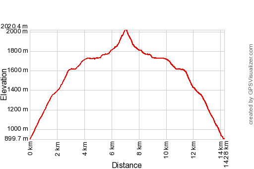
Basecamp (uncorrected track with elevation added by Gpsvisualizer.com): Distance: 14,3 km Max-height: 2020m Min-height: 900m Elevation: +1171m -1169m Total elevation: 2340m Start 7:06 Finish 16:26 Total time: 9:20 |
 | Yesterday I made a transfer from Arthies to camping Espalias in Bossòst. In the evening I met Carlos and Conchita Roca who arrived from Barcelona. (click photo to enlarge) |
 | Together we will climb today to bm417. Early start in Caneja, so early that we had to wait a while in the car until dawn. (click photo to enlarge) |
 | The start of the steep trail (click photo to enlarge) |
 | which gets flatter higher on. (click photo to enlarge) |
 | Now we are not far from (click photo to enlarge) |
 | a drinking place for cattle. (click photo to enlarge) |
 | Then traversing a forest to the other site where (click photo to enlarge) |
 | a second drinking place has been constructed in recent years. (click photo to enlarge) |
 | From the second drinking place we climb through the forest uphill. Note the green waymarking at the tree, also something new. (click photo to enlarge) |
 | Having arrived at the borderridge. (click photo to enlarge) |
 | The trail takes us E, sometimes traversing underneath hilltops like here. (click photo to enlarge) |
 | We pass bm415. (click photo to enlarge) |
 | Bm415 (click photo to enlarge) |
 | Bm415 (click photo to enlarge) |
 | Bm415 (click photo to enlarge) |
 | Bm415 (click photo to enlarge) |
 | Bm415 (click photo to enlarge) |
 | Bm415 (click photo to enlarge) |
 | Now we are a lot further, we skip bm416 for now. We have crossed a sort of ridge and have an overview of the terrain to conquer. From an earlier trip to bm417, I remember a solitary tree as orientation point. (click photo to enlarge) |
 | We have now reached the solitary tree and from there (click photo to enlarge) |
 | we will climb to a sort of pass (click photo to enlarge) |
 | On our way up. No trails but grass and rockfalls, very tiring. (click photo to enlarge) |
 | Zoom-in to the solitary tree. (click photo to enlarge) |
 | Now we are almost at the pass and in the far distance (click photo to enlarge) |
 | I can spot the old shepherd's cabin where I had dinner with shepherd Roger on 28-8-2006. The cabin seems deserted since years. (click photo to enlarge) |
 | From the 'pass' we climb E uphill to (click photo to enlarge) |
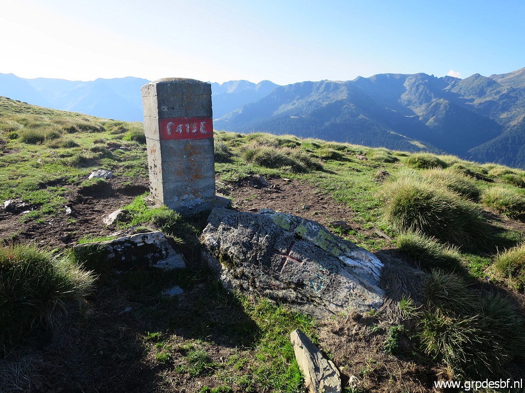
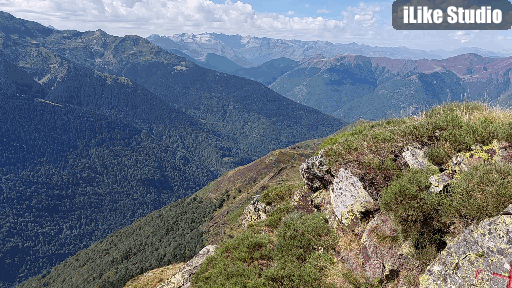
 | the summit of Cap de la Pique with bm417. (click photo to enlarge) |
 | Bm417 (click photo to enlarge) |
 | Bm417 (click photo to enlarge) |
 |
And this is panorama-video (converted to an animated gif-file). |
 | It's been a touch climb and Carlos takes a rest, enjoying the landscape. (click photo to enlarge) |
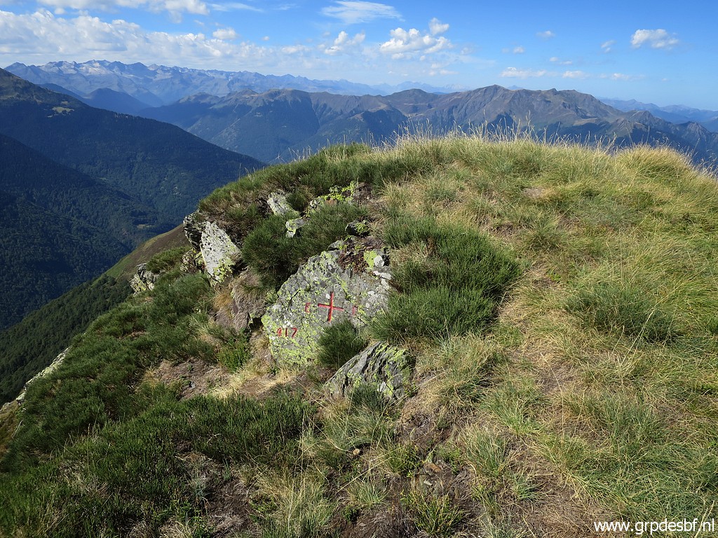 | Bm417 (click photo to enlarge) |
 | Bm417 (click photo to enlarge) |
 | Bm417 (click photo to enlarge) |
 | We have now returned to the pass and will descend back. (click photo to enlarge) |
 | A view back to Cap de la Pique. (click photo to enlarge) |
 | Now almost back at the solitary tree. (click photo to enlarge) |
 | Further on we take a break. (click photo to enlarge) |
 | Now we have time to do bm416. (click photo to enlarge) |
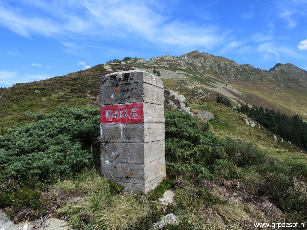 | Bm416 (click photo to enlarge) |
 | Bm416 (click photo to enlarge) |
 | Bm416 There should be number 416 on this rock but I can't find it. (click photo to enlarge) |
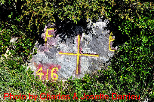 |
But this old picture of Charles & Josette Darrieu shows the spot. "Charles & Josette Darrieu pointed out in january 2011 that on the cross besides the pillar, the number was missing and later added. Their source: "1957- Journal de la Restauration de l’Abornement de la Haute Garonne, J Sermet-L. Alija"" |
 | Bm416 (click photo to enlarge) |
 | A last view back to Cap de la Pique (click photo to enlarge) |
 | with on this zoom-in the route to bm417. (click photo to enlarge) |
 | Back at the second drinking place, short drinking break. (click photo to enlarge) |
 | Later on, another moment of rest. I was once invited in the house in the background: see "Drinking wine with a sailor". (click photo to enlarge) |
 | And now we are back in Canejan (click photo to enlarge) |
 | with an artistic flower exhibition. (click photo to enlarge) |
 | Enjoying a beer at the cafe in Canejan. (click photo to enlarge) |
 | And at night we have dinner at C&C's cabin. A bottle of cava to celebrate (click photo to enlarge) |
 | the conquering of bm417 and eliminating it on the to-do-list. Tomorrow we will spend a day in Lourdes for some sight-seeing and a day of rest. (click photo to enlarge) |