|
The
bordermarkers of the Pyrenees : all my trips
 |
|
| -
13 september
2010 - Drinking wine with a sailor |
 |
 |
Summary: A daytrip from Bagnères-de-Luchon in two subtrips with two
targets: bm364 and bm417, both not found yet. The two trips together: 8½h, maxH 1777m, total ascent 1381m Weather: hazy in the morning, bright in the afternoon. |
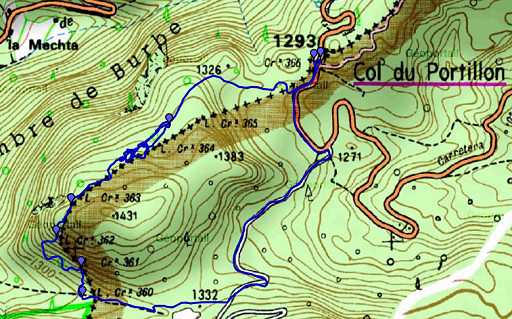 |
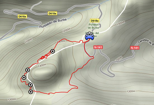
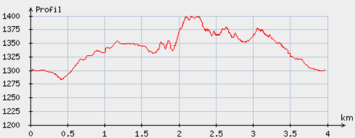
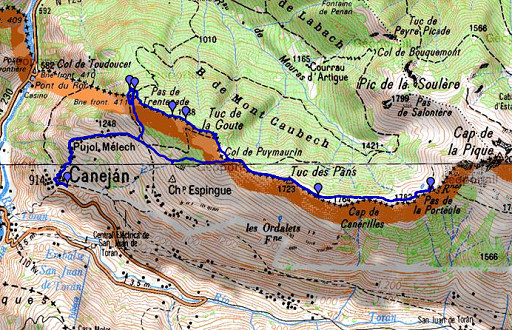
esfr-trip-track-20100913-trip1.kml (click to open in Google Earth or copy link to Google Maps; click right on this link to download gpx-version) For explanation of the gps-coordinates and other cartographic backgrounds: see my cartography page Trip1 Start: 9.15, finish: 12.15, net walking time: 3h |
|
According to the gp-tripteller: Distance: 5,1 km Time moved: 1.30h Time standing still: 1.32h In total: 3.02h Total ascent: 244m Maximum height: 1406m |
 |
According
to visugpx - distance : 4.03 km - cum. elevation gain : 175 m - cum. elevation loss : 177 m - total elevation: 352 m - altitude maxi : 1399 m - altitude mini : 1283 m - altitude average : 1351 m |
 |
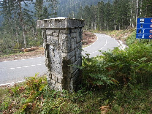
I parked my car at
Col de Portillon. Target: to see if bm360 (and further) is accessible from the Spanish country road, coming down from Col de Barèges. I've been here before on 10 june 2009 But first bm366 |
 |
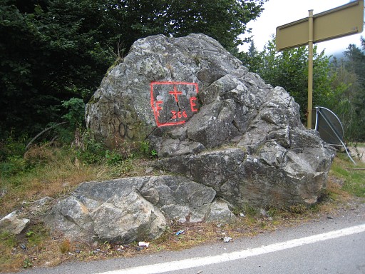
Bm366, looking to
Spain |
 |
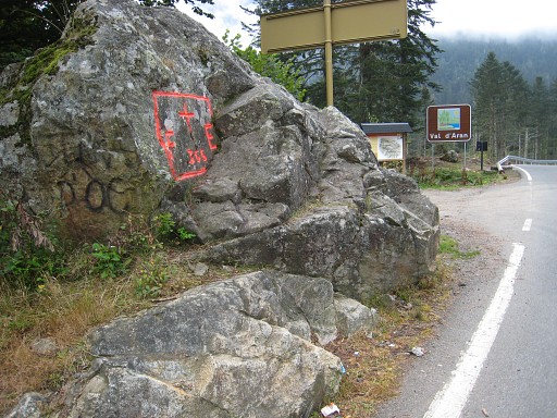
I descend from the
Col into Spain and pass along this border-pillar. At this point the
border leaves the sidewalk and enters into the forest. |
 |
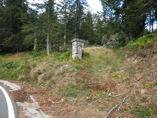
But I keep following
the road untill . . . |
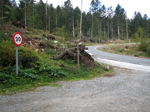 |
the country
road to the right to Col de Barèges. This picture: at the start of that country road and looking back. |
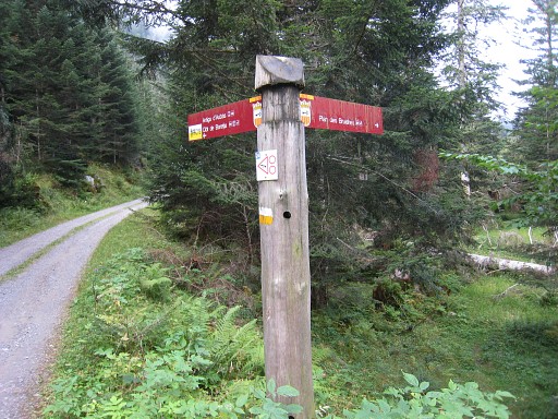 |
Further on there’s
a sign
pointing to the right: “Plan des Bruishes”. That's a trail leading to an open grassy space, a bit rerouted because of the fallen trees. It goes along the right side of the open space, then to the left of the tiny stream and to the right of it |
 |
untill bm360. |
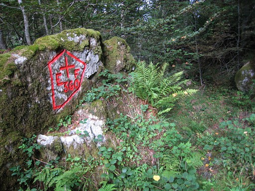 |
Bm360 is repainted since last year. |
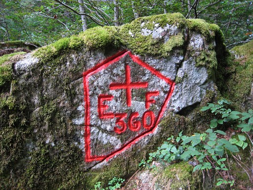 |
Bm360 |
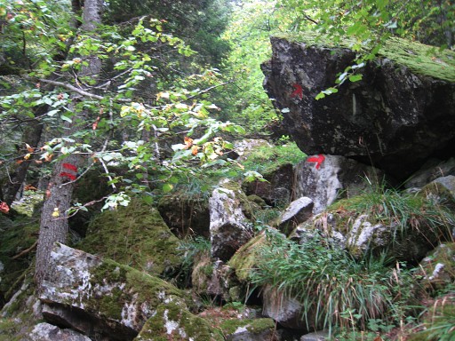 |
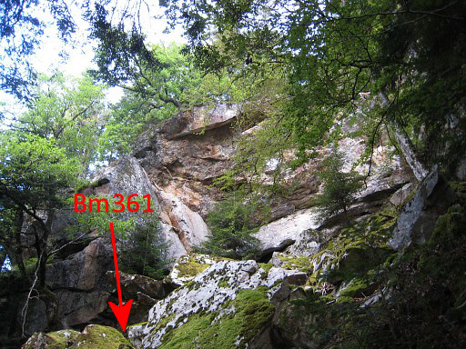
The double red stripes at trees (bordermarkers as it were) and arrows help to get close to bm361. |
|
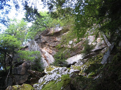
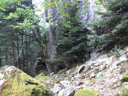
It’s under a large
overhanging rock wall. Move the mouse over the picture to see where bm361 is. |
 |
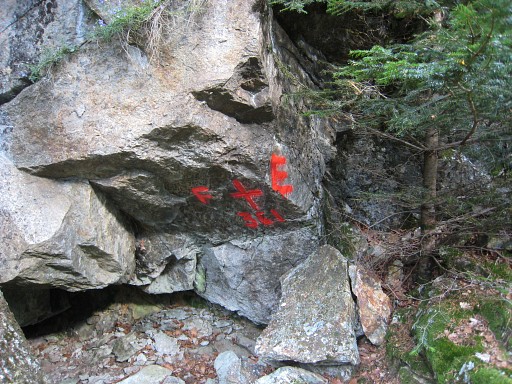
The red color of
bm361 is visible through the pine tree. |
 |
Bm361 |
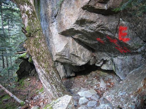 |
Bm361 |
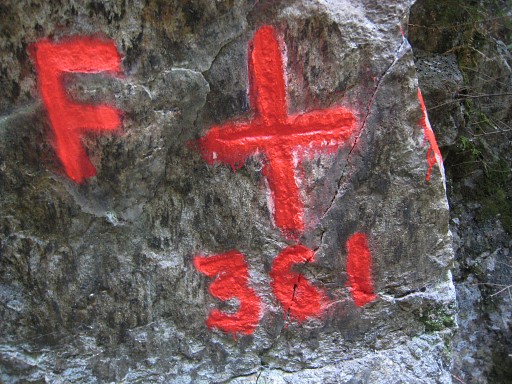 |
Bm361, the number and cross are engraved, not the F and E |
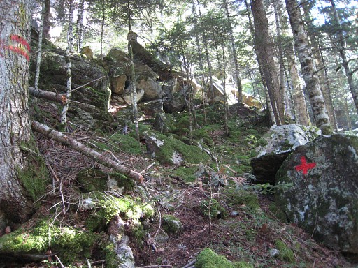 |
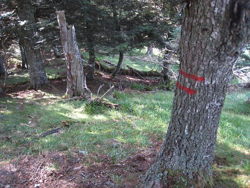
Red stripes and
crosses help again, now to get to bm362 Getting to bm362 required some searching. From bm361, it’s climbing in a clockwise curve, keeping an eye on the double red stripes. |
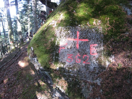 |
Bm362 |
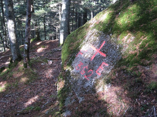 |
Bm362 |
 |
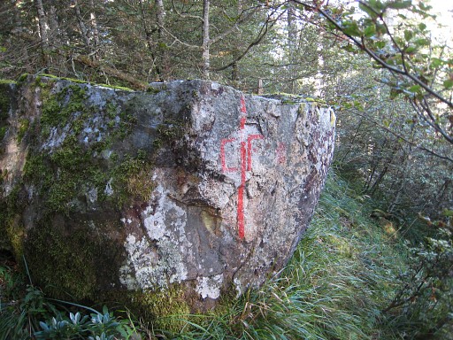
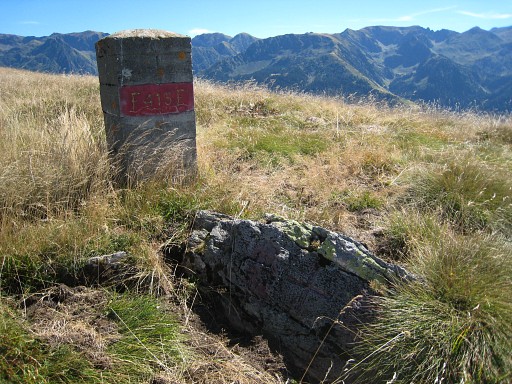
Bm363 is easier to find since it has a borderstone outside a cross. |
 |
Bm363 |
 |
Bm363 |
 |
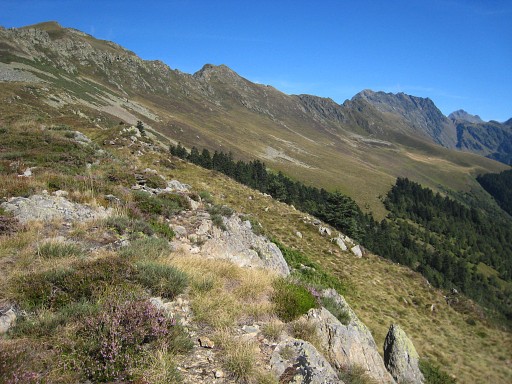
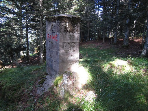
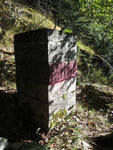
Bm364 is unfindable
as it was last year. This picture: somewhere in the forest, indicator of the border. The position of bm364 can be established quite exact, taking in account the distances from bm363 and bm365 to bm364 as mentioned in the Procès-Verbal and the red stripes on trees and an occasional boulder. Apparently this is the same rock as Jacques Koleck found in 2010 and he reports that it is located 108m from bm463 and ± 4m west from the dirtroad |
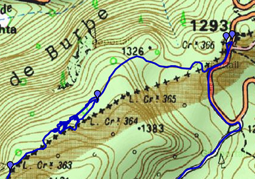 | But there's a clue left. If we examine the IGN 25k map more closely, you'll see that my waypoints of bm364 and bm365 and my red-stripes-trail from bm363 to the Col du Portillon don't fit with the borderline and bm364 and bm365 on the map. So: the question remains where the real borderline between bm363 and the Port is. |
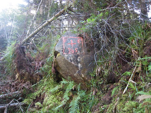 |
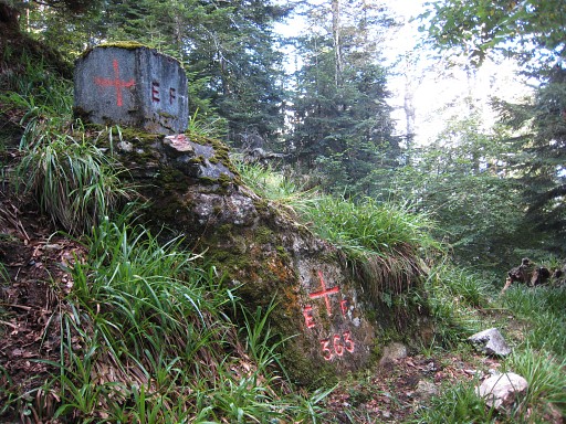
Bm365 is several meters above the roadside. |
 |
Bm365 |
 |
Bm365, the stone
pillar now covered by a fallen tree. |
 |
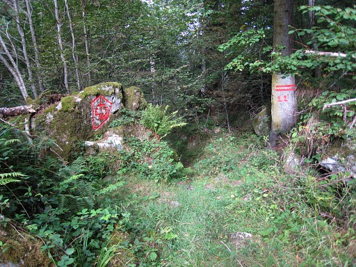
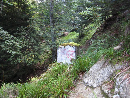
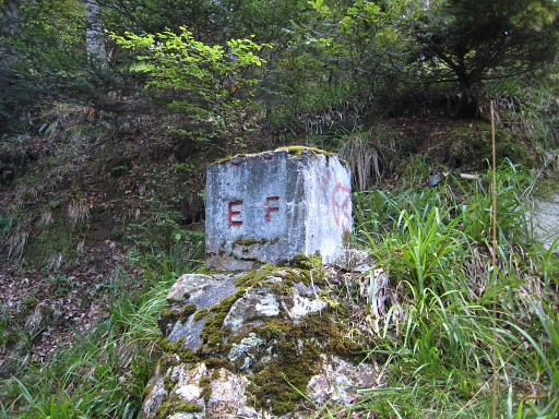
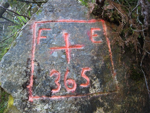
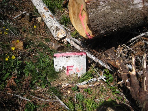
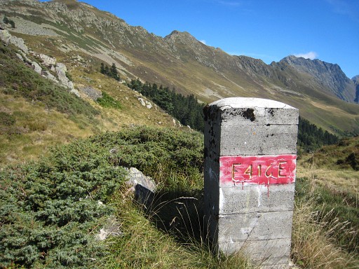
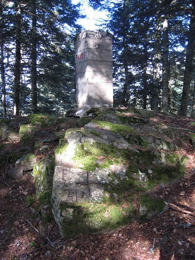
And there are some unnumbered bordermarkers like this one |
 |
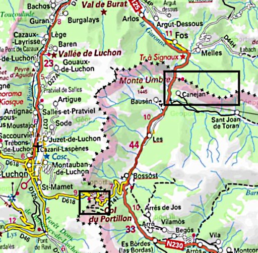
and this one with F on one side and E on the other. Then - over and under fallen trees - back to the col. And driving to Canejan in Spain. |
 |
esfr-trip-track-20100913-trip2.kml (click to open in Google Earth or copy link to Google Maps; click right on this link to download gpx-version) For explanation of the gps-coordinates and other cartographic backgrounds: see my cartography page Trip2 Start: 13.00, break: ½ h, finish: 19.00, net walking time: 5½ h From Canejan I climb the same path as last year, with a break at an old couple’s house who invited me for a glass of wine. The man was once sailor and retired here with his wife. |
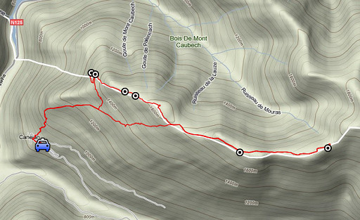 |
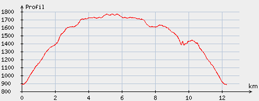
According to the gp-tripteller: Distance: 13,7 km Time moved: 4.01h Time standing still: 1.59h In total: 6.00 Total ascent: 1074m Maximum height: 1777m |
 |
According
to visugpx - distance : 12.6 km - cum. elevation gain : 1005 m - cum. elevation loss : 1001 m - total elevation: 2006 m - altitude maxi : 1772 m - altitude mini : 886 m - altitude average : 1423 m |
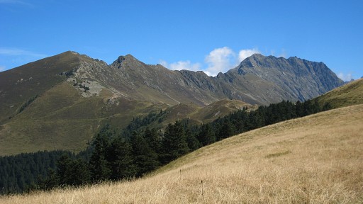 |
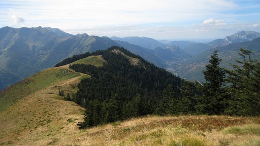
Roundtrip
from Canejan, the target being bm417 since the sky has
cleared. But
that is too ambitious, at Pas de la Portéule it’s already 15.30. This
picture was taken when I arrived at the ridge, before bm415. Later on - in autumn - I will learn that bm417 was more close then I have thought for years. Robert Darrieumerlou showed on this webpage pictures of his recent conquest of bm417. |
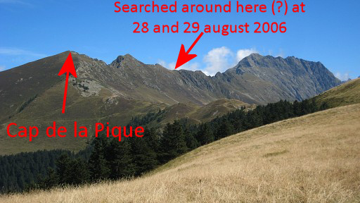 |
And those pictures
proved that bm417 is on the Cap de la Pique and not on the Pic de
Huradic which is further on the ridge. The Procès-Verbal mixes up both Pics and shepherd Roger was resolute on the bm417 being on or near Pic de Huradic. According to him a pillar-shaped one like bm416 and that puzzles me still. He was so explicite in his statements. See esfr-html-trips-20060829.html Anyway I have to return and then will try to walk the whole ridge. |
 |
But I'm not yet at
Pas de la Portéule Having arrived at the ridge, I first pass bm415. There’s a trail starting from here |
 |
leading to bm416 |
 |
and Pas de la Portéule which is a bit further than here. At this spot I stop and |
 |
return and decide to do bm414-411 again and to explore the footpath
from/to Pas de Trentanade. You need to tackle a steep rocky wall (at the end of the ridge on this picture), just before you enter the forest but that can be done on either side or in the middle. |
 |
Then a gentle descent in the forest on the hillridge. Being attentive to make some noise to warn the possible bear(s), as the shepherd told me in 2006. |
 |
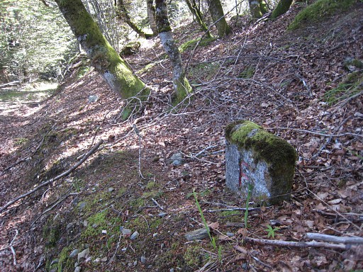
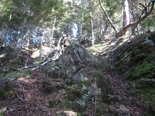
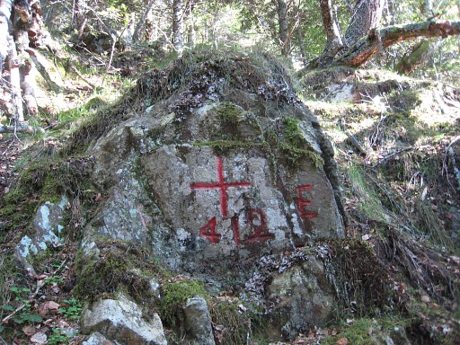
Bm414 is easily found (note the cross at the foot of it) |
 |
as is bm413, also stone + cross. |
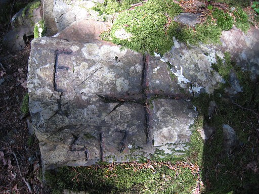
|
Bm413, the cross at
the foot |

|
Bm413 |
 |
But, as in 2006, I
miss bm412 (only a cross) and first find bm411 (only a borderstone)
which is a bit to the left of the crête. |
 |
Bm411 |
 |
Bm411 |
 |
Back uphill I find bm412. According to my gps it's 62 meters from bm411. |
 |
Bm412 Then I try to find the trail to the footpath Canejan - Tuc de Pan as it is shown on the maps. First from bm411 but without success. However, I manage to find a kind of a trail underneath bm412. So that’s where I should locate Pas de Trentanade, I think, not at bm411. But the trail vanishes in a field of dense fern. Wrestling through it, I reach the footpath. |
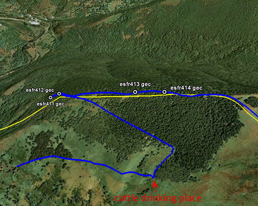 |
It might be easier
- I think - to do bm411-bm414 as follows. Instead of diagonically crossing the forest from the cattle drinking place eastwards to the borderridge, go from the drinking spot first in NE-direction along the edge of the forest. Then NW through the forest. If you do that while staying horizontally or gently climbing, it should take you to the borderridge at approximately Pas de Trentanade. From there you can find bm411 and 412 and climb along the borderridge to bm413 and bm414 and so on. |
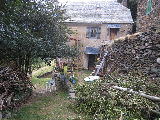 |
I descend to
Canejan and pass again the house where the retired sailor and his wife
live. From Canejan driving back to Bagnères-de-Luchon. |