|
The
bordermarkers of the Pyrenees : the GRPdesBF
 |
|||||||||||||||||||||||||||||||||||||||||||||||||||||||||||||||||||||||||||||||||||||
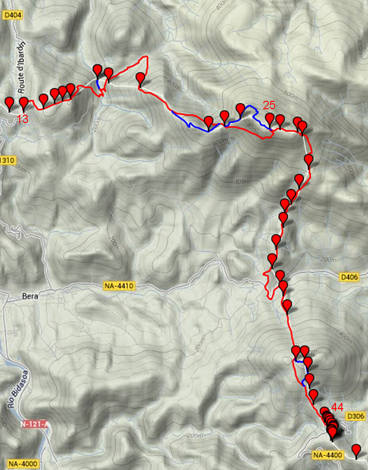
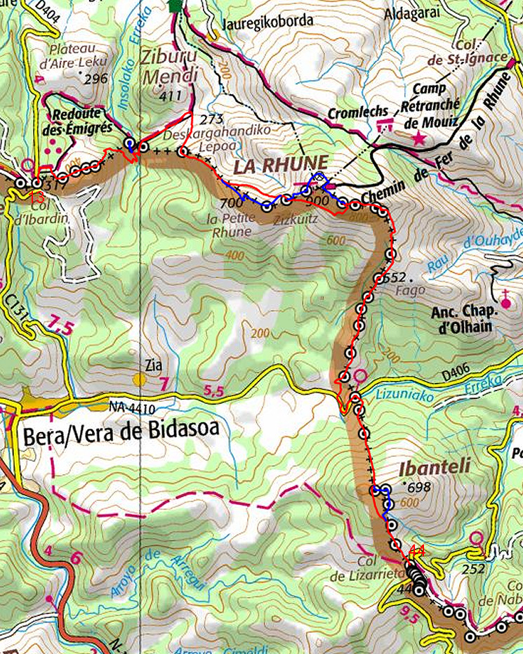
| - stage 2 - Col d'Ibardin - Col de Lizarrieta (bm013-044) |
 |
||||||||||||||||||||||||||||||||||||||||||||||||||||||||||||||||||||||||||||||||||||
 |
|||||||||||||||||||||||||||||||||||||||||||||||||||||||||||||||||||||||||||||||||||||
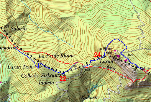
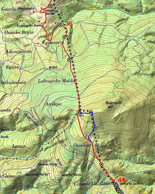
| Only
the bordermarkers along this stage are shown (and some adjoining ones).
The main route is red,
the variants are blue. The main route provides a smooth
on-going route along most bordermarkers, the variants give access to
the remaining bordermarkers. See the GRPdesBF-principles. Click here for an fullscreen interactive map. In short Continuing on the borderridge, not to be underestimated in its continuously going up & down. You'll climb the mythical landmark of La Rhune, also a nice opportunity to lunch in one of the restaurants. Wayfinding is generally easy except after bm029 when the ridge goes SE while you need to descent SSW. There are four variants to the remaining bordermarkers, hardly adding to your total time. So why don't you ... Considerations Plan your water refuel, most of the route is on the ridge. There's a stream between bm018 and 019. About one kilometer NE of bm023, there are bivouac-possibilities including a cabin nearby. Having arrived at Col de Lizarrieta, you'll need to proceed to find a bivouac-spot. There's a source just N of bm049 along the dirtroad and a bit further, N of bm050, there's an appropriate field. Factsheet
Gps-files needed
Useful You might check the relevant webpages in the 'All markers'-section. They provide more pictures of the bordermarkers and additional information on them. Version 02 March 2014. If you have any correction, suggestion etcetera -> please email me: eefberns@grenspalen.nl MAPS AND DIRECTIONS Print your own maps It's easy to print your own - custom made - maps with the GRPdesBF-route and the bordermarkers on them. See: Print your own maps |
|||||||||||||||||||||||||||||||||||||||||||||||||||||||||||||||||||||||||||||||||||||
 |
|||||||||||||||||||||||||||||||||||||||||||||||||||||||||||||||||||||||||||||||||||||
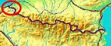
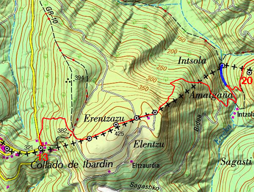
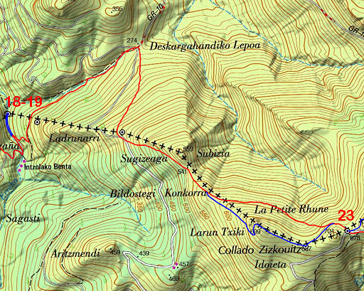
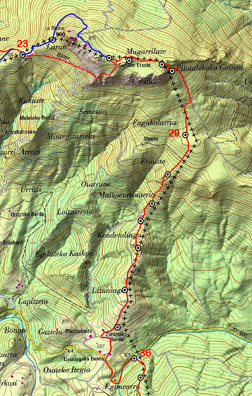
| Overview on the French IGN-map. |
|||||||||||||||||||||||||||||||||||||||||||||||||||||||||||||||||||||||||||||||||||||
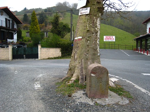 |
This is the starting point of the stage: bm013 at Col d'Ibardin. From here: go left and |
||||||||||||||||||||||||||||||||||||||||||||||||||||||||||||||||||||||||||||||||||||
 |
take - after 75m - the trail to the right (=GR10), climbing the hillside. When the GR10 - after 400m - takes a sharp turn left -> continue SE until |
||||||||||||||||||||||||||||||||||||||||||||||||||||||||||||||||||||||||||||||||||||
 |
bm014. You are back on the borderline which you will follow along the fence until bm017. |
||||||||||||||||||||||||||||||||||||||||||||||||||||||||||||||||||||||||||||||||||||
 |
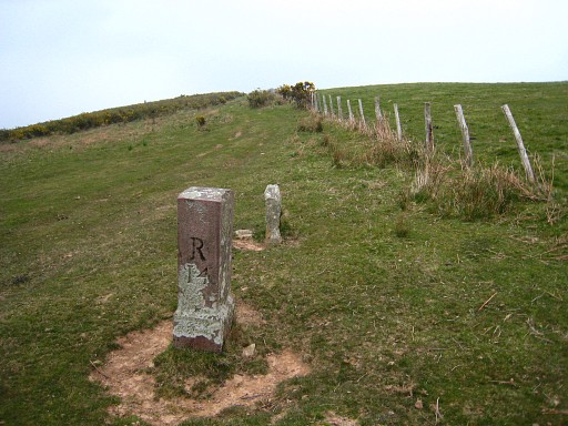
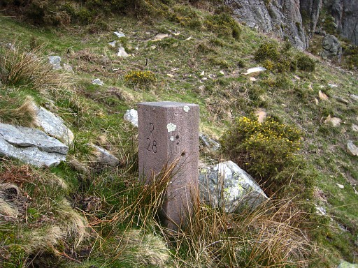
Bm015 |
||||||||||||||||||||||||||||||||||||||||||||||||||||||||||||||||||||||||||||||||||||
 |
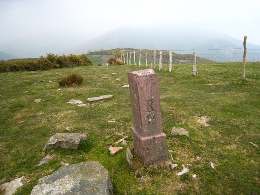
Bm016 This picture: in the end the fence turns sharp to the right. At that point keep straight on for 25m to reach bm017. |
||||||||||||||||||||||||||||||||||||||||||||||||||||||||||||||||||||||||||||||||||||
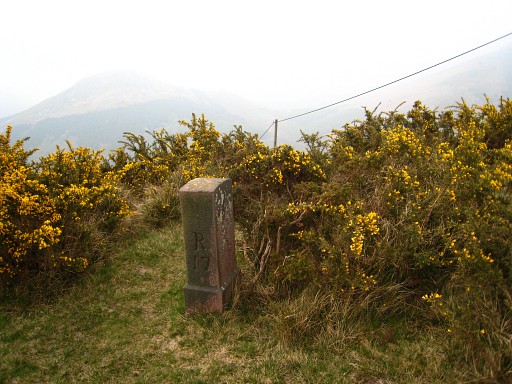 |
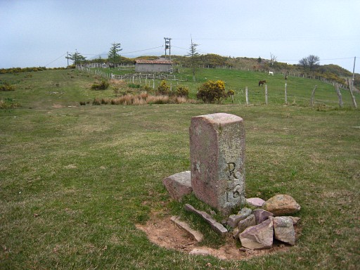
Bm017 is located a little bit to the left of the path, before the rocky part to the right. A few meters to the E of this marker, a purple waymarked path starts and descends NE. |
||||||||||||||||||||||||||||||||||||||||||||||||||||||||||||||||||||||||||||||||||||
 |
This trail first descends globally along the border: first to the left of electric wires up high, later going underneath is. Then it descends SE and ens at a tarmac road in Spain. Descend along that winding road until Venta Isola. Just beyond the Venta there's a small bridge over the stream. Now you are back on the GR10. The main route crosses the bridge and continues on the GR10. |
||||||||||||||||||||||||||||||||||||||||||||||||||||||||||||||||||||||||||||||||||||
| Variant 1 via bm018-019 |
|||||||||||||||||||||||||||||||||||||||||||||||||||||||||||||||||||||||||||||||||||||
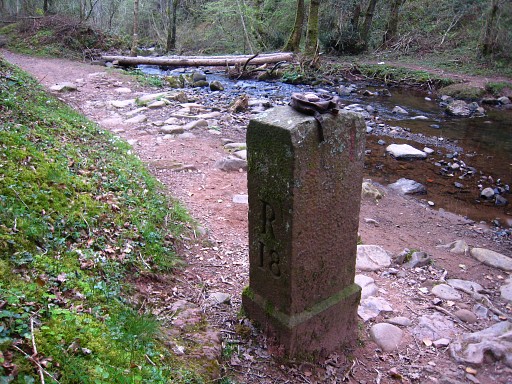 |
This small variant however continues on the path along the river for 150m to reach bm018 | ||||||||||||||||||||||||||||||||||||||||||||||||||||||||||||||||||||||||||||||||||||
 |
Bm019 is on the other side of the stream. This picture shows them both: to the right bm018, to the left bm019. So: cross the stream to get to |
||||||||||||||||||||||||||||||||||||||||||||||||||||||||||||||||||||||||||||||||||||
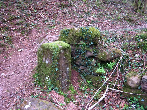 |
bm019. Now return on this side of the river to the small bridge. There's an unnumbered marker ± 50m uphill from bm019, amidst nasty blackberry marker. If you are interested: See this page for a picture and directions. |
||||||||||||||||||||||||||||||||||||||||||||||||||||||||||||||||||||||||||||||||||||
| End of variant 1 |
|||||||||||||||||||||||||||||||||||||||||||||||||||||||||||||||||||||||||||||||||||||
 |
From the footbridge: continue on the GR10-trail. After ± 300m, bm020 is located about 50m uphill, E of the path. |
||||||||||||||||||||||||||||||||||||||||||||||||||||||||||||||||||||||||||||||||||||
 |
Continue on the GR10 until a
crossing of paths. The GR10 continues NE. Now follow the branch to the south, climbing to the hillridge and a cabin at the other side, called Yasolo. |
||||||||||||||||||||||||||||||||||||||||||||||||||||||||||||||||||||||||||||||||||||
 |
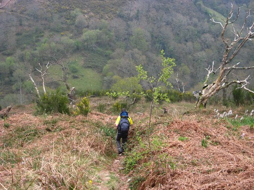
At the other side of the ridge, there is bm021, left of the path. It's the first of a couple of renewed bordermarkers (until bm032) with drilled holes right through them. These holes were drilled to use a metal pole to facilitate the placement of the markers. From this bm, continue SEE along a path underneath (=S of) the rocky ridge. Keep above the forest-road to the right. After ± 500m, you're back on the ridge. The main route continues on the other side of the ridge (the north-side) and passes underneath the summit of La Petit Rhûne. |
||||||||||||||||||||||||||||||||||||||||||||||||||||||||||||||||||||||||||||||||||||
| Variant 2 via bm022 |
|||||||||||||||||||||||||||||||||||||||||||||||||||||||||||||||||||||||||||||||||||||
 |
The variant via bm022 however keeps to the ridge and climbs to La Petite Rhûne. On the Petite Rhûne, there's a very large cairn. |
||||||||||||||||||||||||||||||||||||||||||||||||||||||||||||||||||||||||||||||||||||
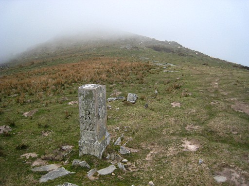 |
Then - after 350m - you will find bm022. From bm022, descend NEE along the hillside to rejoin the main route. |
||||||||||||||||||||||||||||||||||||||||||||||||||||||||||||||||||||||||||||||||||||
| End of variant 2 |
|||||||||||||||||||||||||||||||||||||||||||||||||||||||||||||||||||||||||||||||||||||
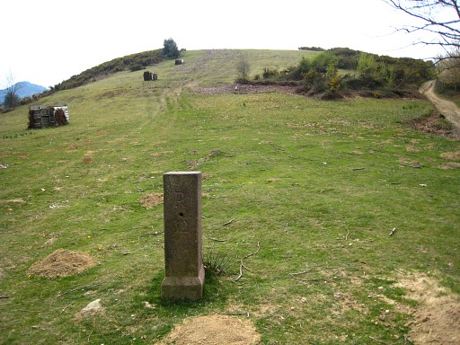
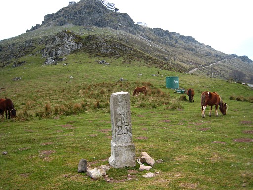 |
The trail brings you to a col with bm023 at the foot of La Rhûne. The main route takes the road further on, visible on this picture. It will bring you via a curve to the E-side of La Rhûne to bm025. |
||||||||||||||||||||||||||||||||||||||||||||||||||||||||||||||||||||||||||||||||||||
| Variant 3 via bm024 |
|||||||||||||||||||||||||||||||||||||||||||||||||||||||||||||||||||||||||||||||||||||
|
This variant climbs first directly towards La Rhûne. | ||||||||||||||||||||||||||||||||||||||||||||||||||||||||||||||||||||||||||||||||||||
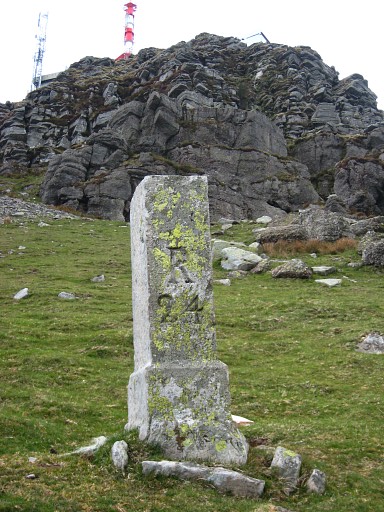 |
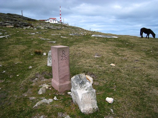
Bm024 is about half way up the mountain. Then - by semi- encircling La Rhûne underneath the summit to the left - you will reach a path that ends uphill up at the little train-station of La Rhûne. La Rhûne is a popular daytrip-destination. There are restaurants and shops. On the summit of La Rhune there are several unnumbered bordermarkers. If you are interested: See this page for pictures and directions. From the summit, continue SE for 350m along the dirtroad. There - near bm025 - you will join the main route again. |
||||||||||||||||||||||||||||||||||||||||||||||||||||||||||||||||||||||||||||||||||||
| End of variant 3 |
|||||||||||||||||||||||||||||||||||||||||||||||||||||||||||||||||||||||||||||||||||||
 |
Between bm027 and 030, navigation requires some caution. The rest - until bm035 - is easy along the hillridge. |
||||||||||||||||||||||||||||||||||||||||||||||||||||||||||||||||||||||||||||||||||||
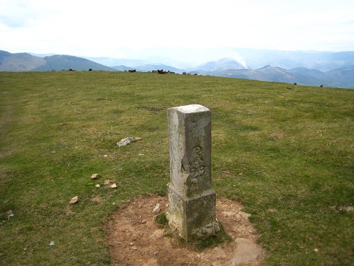
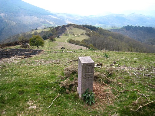
 |
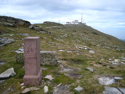
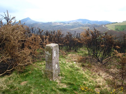
Bm025, looking back to la Rhûne. Wat strikes: usually the number on the esfr-borderstones is placed in the direction of the next marker. But now we are looking back. |
||||||||||||||||||||||||||||||||||||||||||||||||||||||||||||||||||||||||||||||||||||
 |
Bm026, the venta's of La Rhûne still in the background. | ||||||||||||||||||||||||||||||||||||||||||||||||||||||||||||||||||||||||||||||||||||
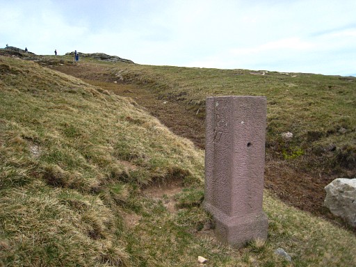 |
Bm027, also placed 'wrongly' A little stream is starting here, leading SE to bm028. The trail to it is yellow-white waymarked. |
||||||||||||||||||||||||||||||||||||||||||||||||||||||||||||||||||||||||||||||||||||
 |
Bm028 Close to bm028 there's a cross engraved in a rock. And between bm028 and 029, there's an unnumbered bm. If you are interested: See this page for pictures and directions. |
||||||||||||||||||||||||||||||||||||||||||||||||||||||||||||||||||||||||||||||||||||
 |
Descending along the yellow-white trail will bring you to a hill-'saddle' with bm029. From here, go SSW and not SE on what seems the obvious borderridge. Between bm029 and bm030, there are two unnumbered bordermarkers. If you are interested: See this page for pictures and directions. |
||||||||||||||||||||||||||||||||||||||||||||||||||||||||||||||||||||||||||||||||||||
 |
Descend to bm030, having picked up the yellow-white trail again. There's a new marker - split in two - and an old one. You will see this more: a new bm with an old one lying besides it. |
||||||||||||||||||||||||||||||||||||||||||||||||||||||||||||||||||||||||||||||||||||
 |
Following the path downwards to bm031. |
||||||||||||||||||||||||||||||||||||||||||||||||||||||||||||||||||||||||||||||||||||
 |
Then you will arrive at a pass with bm032. Now continue over the hillridge to the S. There's a distinct trail and later dirtroad over the ridge until ± bm035. The bordermarkers are either to the left or right from the trail/dirtroad. |
||||||||||||||||||||||||||||||||||||||||||||||||||||||||||||||||||||||||||||||||||||
 |
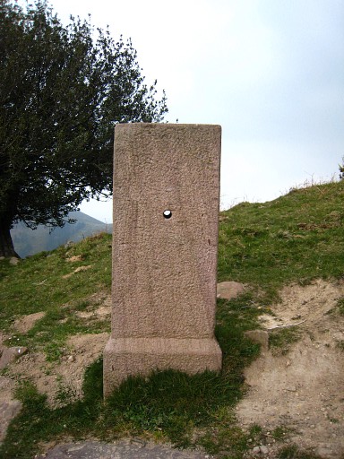
Bm033 Same type of reddish stone but a different typography of the number and no hole. |
||||||||||||||||||||||||||||||||||||||||||||||||||||||||||||||||||||||||||||||||||||
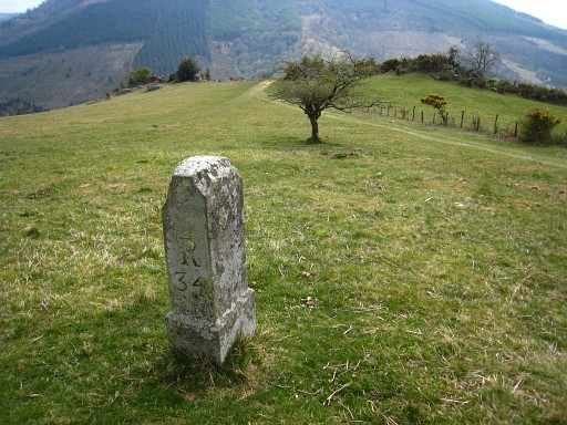 |
Bm034 Between bm034 and 035 there's another unnumbered bm. If you are interested: See this page for pictures and directions. |
||||||||||||||||||||||||||||||||||||||||||||||||||||||||||||||||||||||||||||||||||||
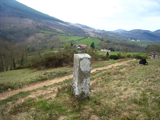 |
Bm035 You now leave the borderline to wind on Spanish roads to Col de Lizuniaga. |
||||||||||||||||||||||||||||||||||||||||||||||||||||||||||||||||||||||||||||||||||||
 |
Directions: take from bm035 the (dirt)road SSW and then turn left & left after 200m. After 100m turn right and you will reach the main road after 200m. Go left and proceed in 600m to the col. |
||||||||||||||||||||||||||||||||||||||||||||||||||||||||||||||||||||||||||||||||||||
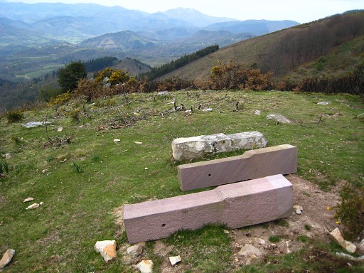
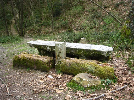 |
At Col de Lizuniaga on the right side of the road this stone table with bm036. The mediaval bordermarker on the other side of the table has disappeared in 2013. Now take the trail starting in the background of this picture. It bends to the right higher on and a short while later passes a fence. |
||||||||||||||||||||||||||||||||||||||||||||||||||||||||||||||||||||||||||||||||||||
 |
Beyond the fence, there's bm037. Close to bm037 in the direction of bm036, there's an unnumbered intermediate marker. Also between bm037 and 038. If you are interested: See this page for pictures and directions. Continue SSW uphill on the trail. After 300m - from the left - a path/dirtroad is joining the trail uphill. |
||||||||||||||||||||||||||||||||||||||||||||||||||||||||||||||||||||||||||||||||||||
 |
A little bit further, there's bm038. Continue straight on. After 150m, the trail enters the forest and start to climb steeply on a wide and straight corridor in the forest. |
||||||||||||||||||||||||||||||||||||||||||||||||||||||||||||||||||||||||||||||||||||
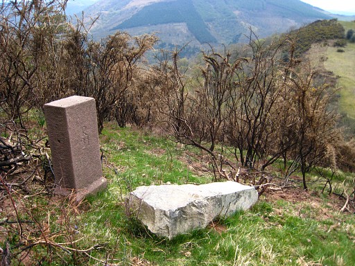
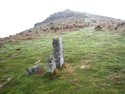 |
After leaving the forest, you will arrive at this pass with bm039. The borderline makes a rectangular angle at this point to the rocky hill in the background where bm040 is located (= variant 4). The main route continues S on a dirtroad wich will bring you easily to Col de Lizarrieta |
||||||||||||||||||||||||||||||||||||||||||||||||||||||||||||||||||||||||||||||||||||
| Variant 4 via bm040-041 |
|||||||||||||||||||||||||||||||||||||||||||||||||||||||||||||||||||||||||||||||||||||
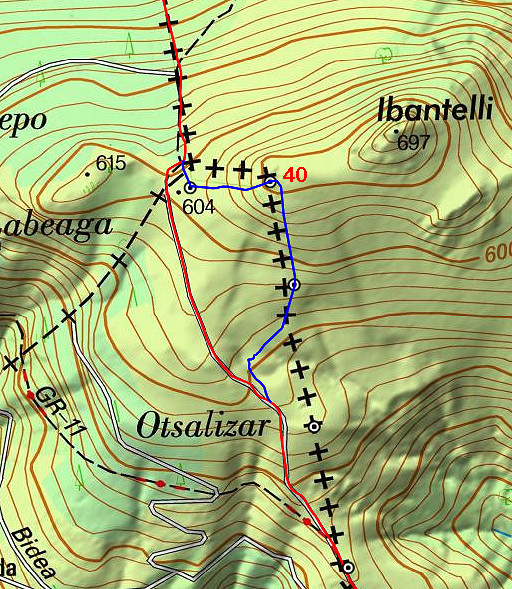 |
It's a bit of climbing E to bm04o. |
||||||||||||||||||||||||||||||||||||||||||||||||||||||||||||||||||||||||||||||||||||
 |
Bm040, looking back at the pass with bm039. This marker also has a rectangular groove on top, showing the next angle in the borderline at this spot. Near bm040 there are two unnumbered crosses and between bm040 and 041 three unnumbered borderstones. If you are interested: See this page for pictures and directions. |
||||||||||||||||||||||||||||||||||||||||||||||||||||||||||||||||||||||||||||||||||||
 |
There's no direct path to bm041 but by using your compass (going 200m S), it's easy to find him. Note: the Col de Lizarrieta in the distance. From bm041, descend the terrain SSW for 200m and climb via a groove to the dirtroad = the main route. |
||||||||||||||||||||||||||||||||||||||||||||||||||||||||||||||||||||||||||||||||||||
| End of variant 4 |
|||||||||||||||||||||||||||||||||||||||||||||||||||||||||||||||||||||||||||||||||||||
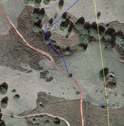 |
Bm042 is 75m E of the dirtroad on the hillridge and might not be visible from the dirtroad. This Google Earth-capture might help you. |
||||||||||||||||||||||||||||||||||||||||||||||||||||||||||||||||||||||||||||||||||||
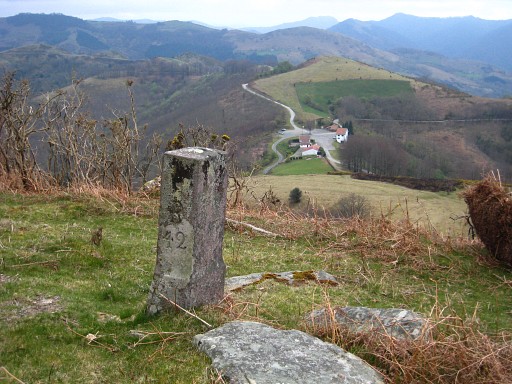 |
Bm042 On the flat stones besides bm042 there are crosses engraved. If you are interested: See this page for pictures and directions. |
||||||||||||||||||||||||||||||||||||||||||||||||||||||||||||||||||||||||||||||||||||
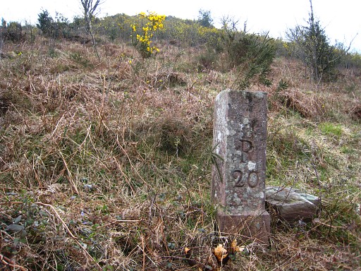
 |
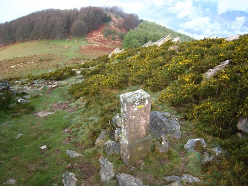
Bm043 stands ± 5m left along the dirtroad where a field of broom starts. It might be hidden by the broom. |
||||||||||||||||||||||||||||||||||||||||||||||||||||||||||||||||||||||||||||||||||||
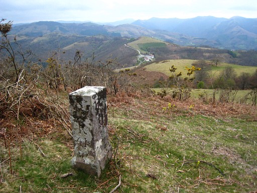
 |
Bm044 close to the venta/bar. End of this stage. |
||||||||||||||||||||||||||||||||||||||||||||||||||||||||||||||||||||||||||||||||||||