|
The
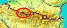
bordermarkers of the Pyrenees : the GRPdesBF
 |
||||||||||||||||||||||||||||||||||||||||||||||||||||||||||
| - stage 17 - Col de Somport - Col de Pourtalet (bm305-310) |
 |
|||||||||||||||||||||||||||||||||||||||||||||||||||||||||
 |
||||||||||||||||||||||||||||||||||||||||||||||||||||||||||
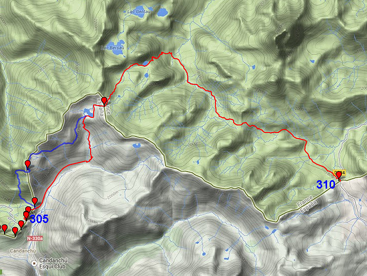
| Only
the bordermarkers along this stage are shown (and some adjoining ones).
The main route is red,
the variants have other colors. The main route provides a smooth
on-going route along most bordermarkers, the variants give access to
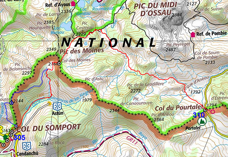
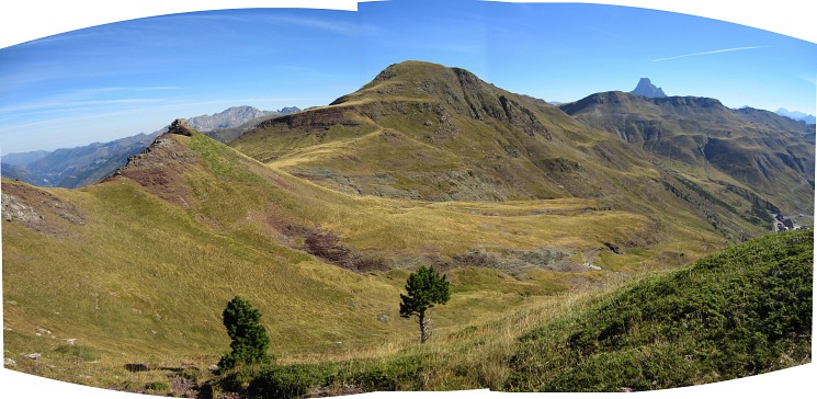
the remaining bordermarkers. See the GRPdesBF-principles. Click here for an fullscreen interactive map. In short The main route is for a large part valley-walking with the climb to Col des Moines (bm509) in between. As soon as you get higher and past the Col des Moines, the magnificent Pic du Midi d'Ossau comes in sight. In the second part - after the descent from Pic des Moines - there's no waymarking but navigating is easy and the terrain not difficult. The variant - doing bm408 - implies a steep but not difficult climb to Col Mayou and then traversing - via bm408 - along the mountainside using cattle tracks to the lake of Ibon de Escalar. Considerations All along the trail there are enough spots for a bivouac and enough water sources. At the end - at Col du Pourtalet there are plenty of restaurants and shops. But there's no natural water source at the Col itself so you have to collect it before you get there. For a quiet bivouac you might continue (next stage) to the nice & flat area around Col de Peyrelue (1h walking) but water might be scarce here as well. The "cabane dous bouès de peyrelue" is closeby but probably not accessible for hikers but one would expect some water source there. Factsheet
Gps-files needed
Version 02 July 2014. If you have any correction, suggestion etcetera -> please email me: eefberns@grenspalen.nl MAPS AND DIRECTIONS You might check the relevant webpages in the 'All markers'-section and 'All my trips'-section for more pictures of the bordermarkers and wayfinding-issues. Print your own maps It's easy to print your own - custom made - maps with the GRPdesBF-route and the bordermarkers on them. See: Print your own maps |
||||||||||||||||||||||||||||||||||||||||||||||||||||||||||
 |
||||||||||||||||||||||||||||||||||||||||||||||||||||||||||
 |
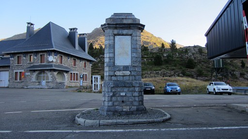
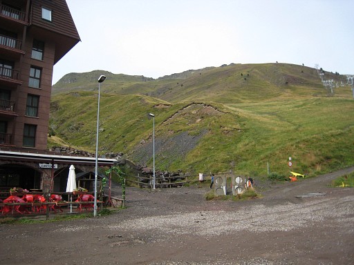
On the Col du Somport, bm305 and 305bis are easy to localize. |
|||||||||||||||||||||||||||||||||||||||||||||||||||||||||
 |
Bm305 |
|||||||||||||||||||||||||||||||||||||||||||||||||||||||||
 |
Bm305bis |
|||||||||||||||||||||||||||||||||||||||||||||||||||||||||
|
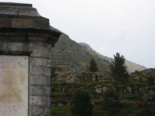
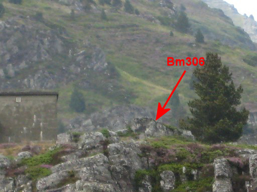
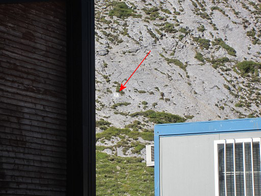
Bm305bis, zooming in to bm306 with that building nearby. That building is useful in locating bm306. |
|||||||||||||||||||||||||||||||||||||||||||||||||||||||||
|
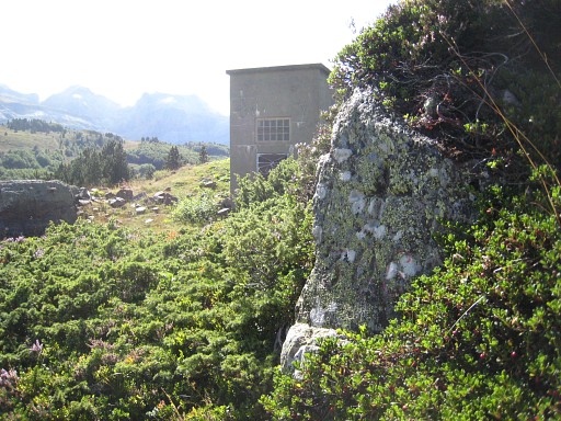
Zoom-in Behind the large building NW of bm305, a trail will bring |
|||||||||||||||||||||||||||||||||||||||||||||||||||||||||
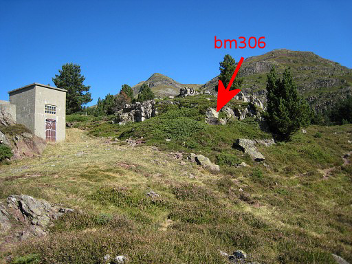 |
in a few minutes to bm306 |
|||||||||||||||||||||||||||||||||||||||||||||||||||||||||
 |
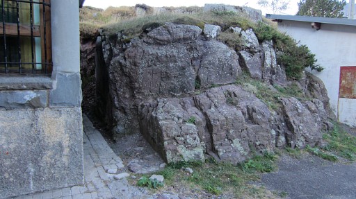
Bm306 |
|||||||||||||||||||||||||||||||||||||||||||||||||||||||||
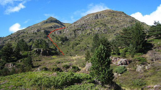 |
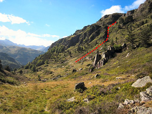
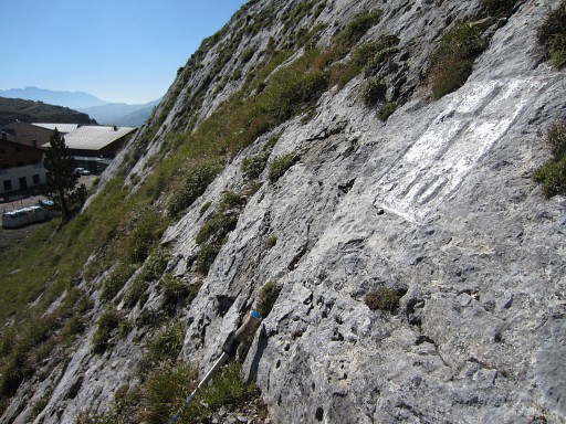
From bm306 continue on the trail. This picture: looking ahead and showing the access to Col Mayou (when doing the variant) -> it's a climb through the bed of a stream, arriving at a flatter part which is followed by the final climb N to Col Mayou. From the Col you can proceed eastwards to bm308. But first towards bm307. |
|||||||||||||||||||||||||||||||||||||||||||||||||||||||||
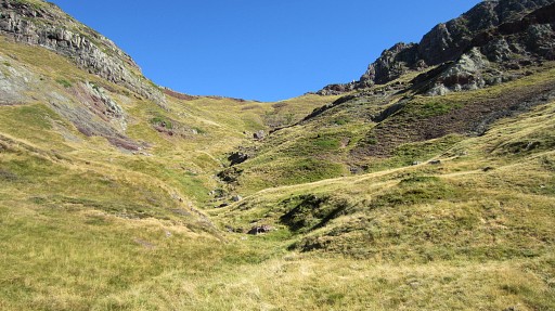
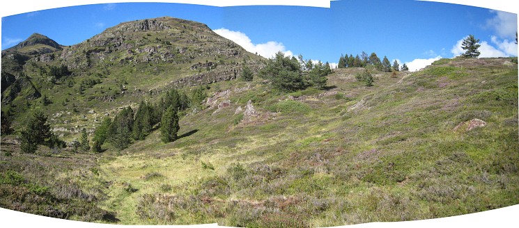 After bm306, there are three successive ‘valleys’ at your right hand. Enter the third one and go through |
||||||||||||||||||||||||||||||||||||||||||||||||||||||||||
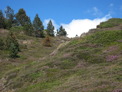 |
this
corridor between two hillridges. |
|||||||||||||||||||||||||||||||||||||||||||||||||||||||||
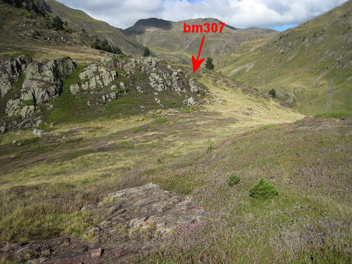 |
At the end you’ll see to the NE a next
valley (this is in fact Col d'Astun) with at the NE-edge a rocky outcrop. There you will find - with a few meters climbing - bm307. |
|||||||||||||||||||||||||||||||||||||||||||||||||||||||||
 |
||||||||||||||||||||||||||||||||||||||||||||||||||||||||||
 |
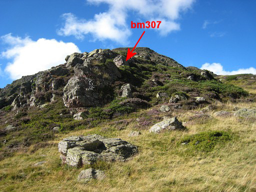
Bm307 Here the main route and the variant part. The main route descends NE through the gras to the road which brings you to |
|||||||||||||||||||||||||||||||||||||||||||||||||||||||||
 |
the Astun ski resor. Here you have to start climbing to Col des Moines. But where? The beginning is behind the last building on the upper row of buildings at the east-side of a stream). You will climb to |
|||||||||||||||||||||||||||||||||||||||||||||||||||||||||
 |
Ibon del Escalar at the foot of Col des Moines. At this point, the variant has already merged with the main route. |
|||||||||||||||||||||||||||||||||||||||||||||||||||||||||
| Variant 1 via bm408 |
||||||||||||||||||||||||||||||||||||||||||||||||||||||||||
 |
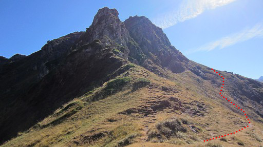
Semicircle the rocky outcrops of bm307 and then go left (=W) until you spot the steep streambed/ravine on the mountainside. |
|||||||||||||||||||||||||||||||||||||||||||||||||||||||||
 |
Climb up the ravine, there’s a kind of trail and you’ll get to an upper valley. Now, go N towards |
|||||||||||||||||||||||||||||||||||||||||||||||||||||||||
 |
Col Mayou, visible on this picture. There's no trail anymore but you can’t miss this col. Interesting: the Procès-Verbal locates bordercross 308 on Col Mayou but that Col is on French territory. Bm308 isn't at a col but on the end of the ridge to the E. |
|||||||||||||||||||||||||||||||||||||||||||||||||||||||||
 |
At the col: go right (=E), approximately as the red line shows. | |||||||||||||||||||||||||||||||||||||||||||||||||||||||||
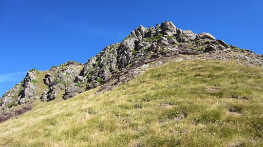 |
Curve around the rocky summit, don't descend too much. At the other side, you can climb through the grass to the ridge |
|||||||||||||||||||||||||||||||||||||||||||||||||||||||||
 |
where bm308 is located at the end. You can see the ski resort of Astun in the valley. |
|||||||||||||||||||||||||||||||||||||||||||||||||||||||||
 |
Bm308 |
|||||||||||||||||||||||||||||||||||||||||||||||||||||||||
 Then: this where to go-> along the hillside to the lake of Ibon del Escalar. |
||||||||||||||||||||||||||||||||||||||||||||||||||||||||||
 |
There's no real trail but often cattle tracks ease your way. | |||||||||||||||||||||||||||||||||||||||||||||||||||||||||
|
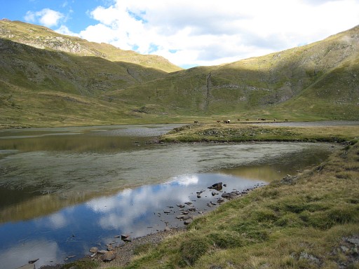
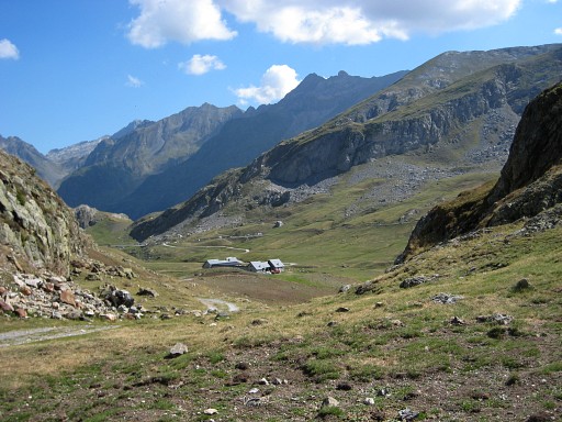
And after merging with the main route: Ibon del Escalar. Go around the lake at its right side and climb to |
|||||||||||||||||||||||||||||||||||||||||||||||||||||||||
 |
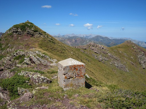
bm309. We are on Col de Moines with this view of the Pic du Midi d'Ossau. Descend on a distinct trail and further on in the direction of Lac Castérau on a trail with an abundance of cairns. |
|||||||||||||||||||||||||||||||||||||||||||||||||||||||||
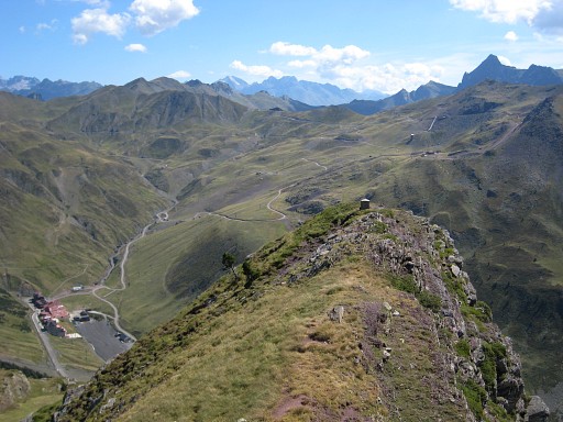
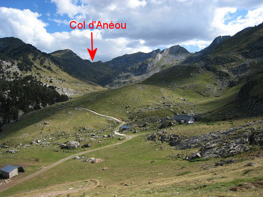 |
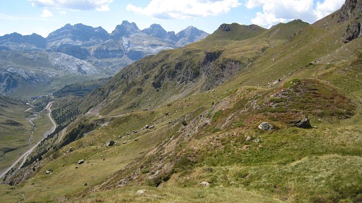
At the cabanes de la Hosse, you have to take the dirtroad to the SE. The Col d'Anéou - giving access to Cirque d'Anéou and Col de Pourtalet - already visible. |
|||||||||||||||||||||||||||||||||||||||||||||||||||||||||
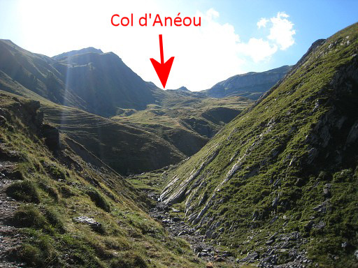 |
Keep following the dirtroad SE until the last cabane. Beyond the cabin, continue on the N-bank of the stream. When the bed of the stream becomes a small canyon, a clear path appears on that N-side. Beyond the canyon you have this clear view ahed of the Col d'Anéaou and the slopes leading to it. Actually you see two passes divided by a small summit in the middle. The left one is Col d'Anéou. |
|||||||||||||||||||||||||||||||||||||||||||||||||||||||||
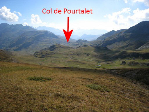 |
The trail disappears but the direction to Col d'Ainéou is obvious. Close to the Col, the trail reappears. On the Col this view ahead to Col de Pourtalet. |
|||||||||||||||||||||||||||||||||||||||||||||||||||||||||
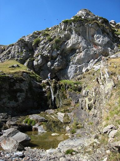 |
Then to Col de Pourtalet: here are no clear and connected paths but it's not difficult. Our route: descend to the little streams down below, following them until the stream disappears in the ground. Then descending with a curve on the left side and curving back to where the stream reappears. This picture: this is where the stream reappears. |
|||||||||||||||||||||||||||||||||||||||||||||||||||||||||
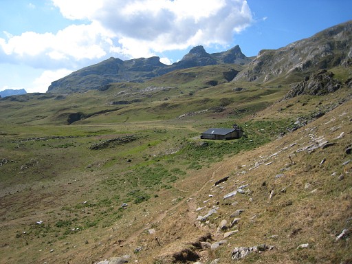 |
Then: on a trail you will reach this barn, from there continue on the dirtroad |
|||||||||||||||||||||||||||||||||||||||||||||||||||||||||
 |
until it descends - left of a rocky outcrop - to other cabanes (this picture). At this point, leave the dirtroad and go along the right side of the rocky outcrop in the direction of Col de Pourtalet. Cross a stream to remain at the same elevation as the Col. Close to the col you have to tackle a small rocky hill. |
|||||||||||||||||||||||||||||||||||||||||||||||||||||||||
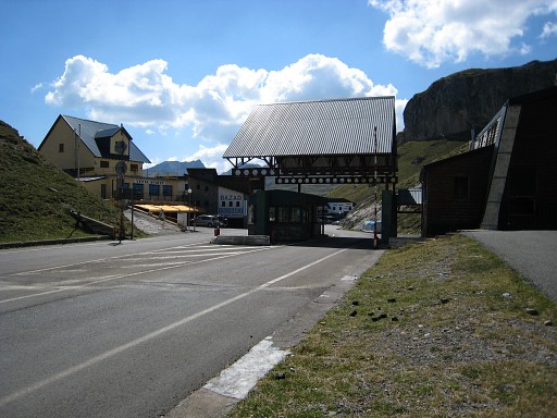 |
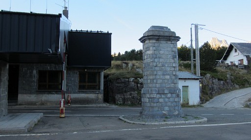
Col du Pourtalet |
|||||||||||||||||||||||||||||||||||||||||||||||||||||||||
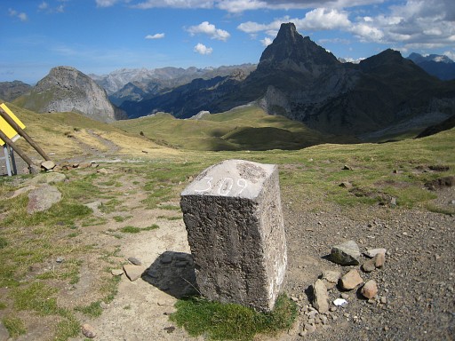
 |
A bit to the right, bm310 is against a rockwall, west of the bordercrossing. | |||||||||||||||||||||||||||||||||||||||||||||||||||||||||
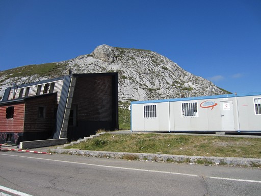
 |
Bm310 |
|||||||||||||||||||||||||||||||||||||||||||||||||||||||||
 |
It requires a small climb to get close to bm310 | |||||||||||||||||||||||||||||||||||||||||||||||||||||||||